SlideShare a Scribd company logo
1 of 24
Download to read offline
Navigating Recreation Technology:
20 Tools in 20 Minutes.
Duane Wilkins
Geospatial Team
Department of Conservation
duwilkins@doc.govt.nz
You have arrived at your destination
goo.gl/qKNstX
GeoCaching.com
● Join the world’s largest treasure hunt!
● Offline Lists – Download geocaches,
maps and more for a completely offline
geocaching experience.
● Field Notes and Offline Logging – Record
your geocaching finds from the field.
● Pocket Queries – Geocaching Premium
members can create custom,
downloadable searches.
● Trackables – Log trackables you find
while geocaching.
2GeoCaching.com
goo.gl/qKNstX
GPS Test
● Displays GPS and sensor data: position
and signal strength of satellites, accuracy,
speed, acceleration, altitude, bearing,
pitch, roll and battery state.
● Tools included: compass with magnetic
and true north, leveling tool, mark or share
your location and navigate back later
using the Radar.
● Keep your GPS fast: reset it or download
A-GPS data regularly for faster fixes.
3
goo.gl/qKNstX
GPS Status Toolbox
● Displays GPS and sensor data: position
and signal strength of satellites, accuracy,
speed, acceleration, altitude, bearing,
pitch, roll and battery state.
● Tools included: compass with magnetic
and true north, leveling tool, mark or share
your location and navigate back later
using the Radar.
● Keep your GPS fast: reset it or download
A-GPS data regularly for faster fixes.
4
goo.gl/qKNstX
● Google Earth Pro is now free for all.
● Create your own Point, Line and Polygons
in 3D, including streetview.
● Create flythroughs, export to video, share
tours with others.
● Works offline using Cached imagery and
on mobile
● Search for locations
● Visualize your GPS tracks and share
● Go back in time with historical imagery
● Tutorials: https://www.google.
com/earth/learn/
Google Earth Pro 5google.com/earth
goo.gl/qKNstX
Google Maps
● Offline, Streetview, Directions, the most
detailed map content on the planet.
● Provides directions, interactive maps, and
satellite/aerial imagery of many countries.
● The most advanced consumer mapping
site available today, integrated search,
directions, places of interest,
photographs, streetview, and 3D views
including 3D buildings and landscapes.
● Mobile version provides spoken
navigation, traffic, shortest route,
roadworks etc.
google.com/maps 6
goo.gl/qKNstX
● Add and update map information for millions of
users to see in Google Maps and all apps that use
the Google Basemap.
● You can add and edit many different things on the
map, including:
● Places, like businesses, addresses, and other
locations, Natural features, like beaches.
New! - Local Guides.
● Local Guides is a global community of explorers
sharing their discoveries on Google Maps.
● Earn 200 points (~50 “reviews”) , and you’ll get
2 Terabytes of Google Drive storage for 2 years.
MapMaker + Guides 7google.com/mapmaker
goo.gl/qKNstX
MyMaps
● You can create custom maps
collaboratively to share online with
Google My Maps - can be nicely
embedded within a website.
● Works on Desktop and Mobile
seamlessly, with user/role based privacy -
Private, editor's, view with link only, and
public.
● Export to KML for Google Earth 3D
● Import from Excel and KML
● Tutorial http://www.google.co.
nz/earth/outreach/tutorials/mapseng_lite
.html
8google.com/mymaps
goo.gl/qKNstX
MyTracks
● My Tracks lets you record your path,
speed, distance, and elevation.
● View live GPS capture data.
● Annotate your path with text and photos
while you record.
● Photographs include direction and
bearing placement.
● Export your tracks to Google Drive, Google
Spreadsheets, or external storage.
● Works Offline
● Track Example
9
goo.gl/qKNstX
TourBuilder 10tourbuilder.withgoogle.com
● TourBuilder helps you craft and share a
story including text, maps, photos and
videos.
● Tour Builder is a new way to show people
the places you've visited and the
experiences you had along the way using
Google Earth. It lets you pick the locations
right on the map, add in photos, text, and
video, and then share your creation.
● https://www.google.
com/earth/outreach/tutorials/tourbuilder.
html
goo.gl/qKNstX
● Explore all of Street View (including
contributions from others)
● Manage your private photo spheres
● Immerse yourself in photo spheres with
Cardboard mode
● Use your phone’s camera (no camera
accessories required)
● Connect to a spherical camera
● Share to Google Maps as immersive
photo spheres
●
Streetview 11google.com/photos
goo.gl/qKNstX
PhotoSpheres
● 3D PhotoSpheres, up down, all around,
just like Street View
● Can be made public, or kept private or
even just offline storage.
● The photo sphere camera mode on your
Android phone makes it easy to capture a
series of photos and automatically turn
them into a seamless 360º experience.
● You can also turn your DSLR camera
panoramas into photo spheres.
● Share and embed via Google+ posts.
12google.com/photos
goo.gl/qKNstX
StorySpheres
● Story Spheres is a way to add stories to
panoramic photographs.
● First upload a PhotoSphere, a 360-degree
photo you can take on your phone.
● Then add dialogue, sound effects and
even a music track.
● Whoever opens the scene will get a
panoramic photo with sound and stories
baked in. Better still, on a phone the photo
wraps right around the viewer … so now
you can tell stories that truly revolve
around your audience
● Example
13storyspheres.com
goo.gl/qKNstX
Picasa
● One of the best image managers available
including location, editing,
synchronisation, and adding descriptions
to photos.
● Locate, move and plot photos on a map,
then view in other apps like Google Earth
● Puts a GPS XY into the photo itself.
● Manage your photos in albums, upload
and host by Google Photos.
● Private, Shared with friends or Public.
● Dowload: https://picasa.google.com/
14picasa.google.com
goo.gl/qKNstX
● Nest Finder provides comprehensive
information about all published DOC huts,
camp sites and visitor centres, as well as
i-SITEs, BBH hostels, YHA hostels, Holiday
Parks of NZ and Forest and Bird lodges
across New Zealand.
● More than 1600 places to stay, including
more than 1000 huts, 350 camp sites, 280
BBH hostels, 280 Holiday Parks, 50 YHA
hostels and all Forest and Bird lodges
● Tight DOC and YHA booking system
integration:
Nest Finder 15www.nestfinder.co.nz
goo.gl/qKNstX
PDF Maps
● Show GPS position over a map
● Measure distances and areas
● Overlay search engine results on any map
for offline use
● Handy map searching tools to find the
map you need
● Load your own Geospatial PDF, GeoPDF®,
GeoTIFF and JPG maps from the file
system, Dropbox, a URL, or email
● Enables data capture offline
● Full LINZ Topo 50k maps available for
free online!
16http://www.avenza.com/pdf-maps
goo.gl/qKNstX
Strava
TRACK YOUR RUNS AND RIDES WITH GPS
● Follow routes you’ve created or found and
view your activity map as you record
● Get key stats like distance, pace, speed,
elevation gained and calories burned
● Collect heart rate data from Bluetooth
Low Energy sensors
● Follow friends
● Find places to run and ride throughout NZ
● Compete with others
17http://strava.com/
goo.gl/qKNstX
Ricoh Theta 360
● Full 360 x 360 degrees
Photo and HD Video
● Instant photo, 8 seconds to
transfer.
● The only affordable camera
that Connects and posts
immediately within
Streetview
● Remote preview and
adjustment from any
Smartphone
● Can be attached to drones
with kindling and sellotape
upside down
18google.com/get/cardboard/
goo.gl/qKNstX
NZ Topo Maps
● Easy to use outdoor navigation app with
most recent topographic maps of New
Zealand, Cook Islands and Tokelau.
● This app gives you similar mapping
options as you might know from Garmin
or Magellan GPS handhelds.
19storyspheres.com
goo.gl/qKNstX
Nikon P900
● Onboard GPS that works
● 16mpx
● Long lasting battery
● Aimed at advanced Snap and Shooters
with a wide range of useful shooting
modes
● Stereo video
● Fast focus
● 24 - 2000 mm 35m Equivalent.
20google.com/get/cardboard/
goo.gl/qKNstX
21
goo.gl/qKNstX
22
goo.gl/qKNstX
Cardboard
● 3D Earth: Fly where your fancy takes you
on Google Earth.
● Tour Guide: Visit Versailles with a local
guide.
● My Videos: Watch your videos on a
massive screen.
● Exhibit: Examine cultural artifacts from
every angle.
● Streetview: explore the world in 3D
● Youtube - View an increasing range of
surround 360 Video.
23google.com/get/cardboard/
Navigating Recreation Technology: 20 Tools in 20 Minutes.
Duane Wilkins
Geospatial Team
Department of Conservation
duwilkins@doc.govt.nz
maps.doc.govt.nz
goo.gl/qKNstX

More Related Content

Similar to NZRA D Wilkins Thursday Morning DOC

Science Maths Ict Tools
Science Maths Ict Tools Science Maths Ict Tools
Science Maths Ict Tools Gosia Garkowska
 
Geo-ing Global TeachMeet BETT 2011
Geo-ing Global TeachMeet BETT 2011Geo-ing Global TeachMeet BETT 2011
Geo-ing Global TeachMeet BETT 2011Dom Breadmore
 
How Does GPS Work? And Why Do You Need To Understand It?
How Does GPS Work? And Why Do You Need To Understand It? How Does GPS Work? And Why Do You Need To Understand It?
How Does GPS Work? And Why Do You Need To Understand It? Bob Mayer
 
Science IST tools Warsaw October 2018
Science IST tools Warsaw October 2018Science IST tools Warsaw October 2018
Science IST tools Warsaw October 2018Gosia Garkowska
 
Introduction to OpenStreetMap and Humanitarian OSM Team for Plan Internationa...
Introduction to OpenStreetMap and Humanitarian OSM Team for Plan Internationa...Introduction to OpenStreetMap and Humanitarian OSM Team for Plan Internationa...
Introduction to OpenStreetMap and Humanitarian OSM Team for Plan Internationa...chippy
 
Google [x] ongoing projects
Google [x] ongoing projectsGoogle [x] ongoing projects
Google [x] ongoing projectsAkash Rai
 
OSGeo Live - DokuTech
OSGeo Live - DokuTechOSGeo Live - DokuTech
OSGeo Live - DokuTechBesfort Guri
 
MapUp Resources- Map Maker Intro Presentation-Edit 001
MapUp Resources- Map Maker Intro Presentation-Edit 001MapUp Resources- Map Maker Intro Presentation-Edit 001
MapUp Resources- Map Maker Intro Presentation-Edit 001Asith Wijenayake
 
The essentials for life at cogs
The essentials for life at cogsThe essentials for life at cogs
The essentials for life at cogsCOGS Presentations
 
Free GIS Resources
Free GIS ResourcesFree GIS Resources
Free GIS Resourcesrutlandrpc
 
Geo mapfish 2_foss4g-eu_2017
Geo mapfish 2_foss4g-eu_2017Geo mapfish 2_foss4g-eu_2017
Geo mapfish 2_foss4g-eu_2017Camptocamp
 
Google Earth
Google EarthGoogle Earth
Google Earthtracyl
 
Google Earth
Google EarthGoogle Earth
Google Earthtracyl
 
AGIT 2017: Cesium 1.35, WebGL Virtual Globe and Map Engine
AGIT 2017: Cesium 1.35, WebGL Virtual Globe and Map EngineAGIT 2017: Cesium 1.35, WebGL Virtual Globe and Map Engine
AGIT 2017: Cesium 1.35, WebGL Virtual Globe and Map EngineCamptocamp
 
Bath: Hacked Learning Night: Introduction to CartoDB
Bath: Hacked Learning Night: Introduction to CartoDBBath: Hacked Learning Night: Introduction to CartoDB
Bath: Hacked Learning Night: Introduction to CartoDBLeigh Dodds
 

Similar to NZRA D Wilkins Thursday Morning DOC (20)

IMW2014 Tools Scan
IMW2014 Tools ScanIMW2014 Tools Scan
IMW2014 Tools Scan
 
Science Maths Ict Tools
Science Maths Ict Tools Science Maths Ict Tools
Science Maths Ict Tools
 
Simple Aerial Photomapping - Engineers Without Borders West Coast Regional Wo...
Simple Aerial Photomapping - Engineers Without Borders West Coast Regional Wo...Simple Aerial Photomapping - Engineers Without Borders West Coast Regional Wo...
Simple Aerial Photomapping - Engineers Without Borders West Coast Regional Wo...
 
Geo-ing Global TeachMeet BETT 2011
Geo-ing Global TeachMeet BETT 2011Geo-ing Global TeachMeet BETT 2011
Geo-ing Global TeachMeet BETT 2011
 
How Does GPS Work? And Why Do You Need To Understand It?
How Does GPS Work? And Why Do You Need To Understand It? How Does GPS Work? And Why Do You Need To Understand It?
How Does GPS Work? And Why Do You Need To Understand It?
 
Science IST tools Warsaw October 2018
Science IST tools Warsaw October 2018Science IST tools Warsaw October 2018
Science IST tools Warsaw October 2018
 
Google Next
Google NextGoogle Next
Google Next
 
Introduction to OpenStreetMap and Humanitarian OSM Team for Plan Internationa...
Introduction to OpenStreetMap and Humanitarian OSM Team for Plan Internationa...Introduction to OpenStreetMap and Humanitarian OSM Team for Plan Internationa...
Introduction to OpenStreetMap and Humanitarian OSM Team for Plan Internationa...
 
Google [x] ongoing projects
Google [x] ongoing projectsGoogle [x] ongoing projects
Google [x] ongoing projects
 
OSGeo Live - DokuTech
OSGeo Live - DokuTechOSGeo Live - DokuTech
OSGeo Live - DokuTech
 
Google Earth
Google EarthGoogle Earth
Google Earth
 
MapUp Resources- Map Maker Intro Presentation-Edit 001
MapUp Resources- Map Maker Intro Presentation-Edit 001MapUp Resources- Map Maker Intro Presentation-Edit 001
MapUp Resources- Map Maker Intro Presentation-Edit 001
 
Presentation1
Presentation1Presentation1
Presentation1
 
The essentials for life at cogs
The essentials for life at cogsThe essentials for life at cogs
The essentials for life at cogs
 
Free GIS Resources
Free GIS ResourcesFree GIS Resources
Free GIS Resources
 
Geo mapfish 2_foss4g-eu_2017
Geo mapfish 2_foss4g-eu_2017Geo mapfish 2_foss4g-eu_2017
Geo mapfish 2_foss4g-eu_2017
 
Google Earth
Google EarthGoogle Earth
Google Earth
 
Google Earth
Google EarthGoogle Earth
Google Earth
 
AGIT 2017: Cesium 1.35, WebGL Virtual Globe and Map Engine
AGIT 2017: Cesium 1.35, WebGL Virtual Globe and Map EngineAGIT 2017: Cesium 1.35, WebGL Virtual Globe and Map Engine
AGIT 2017: Cesium 1.35, WebGL Virtual Globe and Map Engine
 
Bath: Hacked Learning Night: Introduction to CartoDB
Bath: Hacked Learning Night: Introduction to CartoDBBath: Hacked Learning Night: Introduction to CartoDB
Bath: Hacked Learning Night: Introduction to CartoDB
 

NZRA D Wilkins Thursday Morning DOC

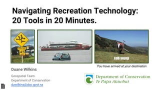
  • 1. Navigating Recreation Technology: 20 Tools in 20 Minutes. Duane Wilkins Geospatial Team Department of Conservation duwilkins@doc.govt.nz You have arrived at your destination
  • 2. goo.gl/qKNstX GeoCaching.com ● Join the world’s largest treasure hunt! ● Offline Lists – Download geocaches, maps and more for a completely offline geocaching experience. ● Field Notes and Offline Logging – Record your geocaching finds from the field. ● Pocket Queries – Geocaching Premium members can create custom, downloadable searches. ● Trackables – Log trackables you find while geocaching. 2GeoCaching.com
  • 3. goo.gl/qKNstX GPS Test ● Displays GPS and sensor data: position and signal strength of satellites, accuracy, speed, acceleration, altitude, bearing, pitch, roll and battery state. ● Tools included: compass with magnetic and true north, leveling tool, mark or share your location and navigate back later using the Radar. ● Keep your GPS fast: reset it or download A-GPS data regularly for faster fixes. 3
  • 4. goo.gl/qKNstX GPS Status Toolbox ● Displays GPS and sensor data: position and signal strength of satellites, accuracy, speed, acceleration, altitude, bearing, pitch, roll and battery state. ● Tools included: compass with magnetic and true north, leveling tool, mark or share your location and navigate back later using the Radar. ● Keep your GPS fast: reset it or download A-GPS data regularly for faster fixes. 4
  • 5. goo.gl/qKNstX ● Google Earth Pro is now free for all. ● Create your own Point, Line and Polygons in 3D, including streetview. ● Create flythroughs, export to video, share tours with others. ● Works offline using Cached imagery and on mobile ● Search for locations ● Visualize your GPS tracks and share ● Go back in time with historical imagery ● Tutorials: https://www.google. com/earth/learn/ Google Earth Pro 5google.com/earth
  • 6. goo.gl/qKNstX Google Maps ● Offline, Streetview, Directions, the most detailed map content on the planet. ● Provides directions, interactive maps, and satellite/aerial imagery of many countries. ● The most advanced consumer mapping site available today, integrated search, directions, places of interest, photographs, streetview, and 3D views including 3D buildings and landscapes. ● Mobile version provides spoken navigation, traffic, shortest route, roadworks etc. google.com/maps 6
  • 7. goo.gl/qKNstX ● Add and update map information for millions of users to see in Google Maps and all apps that use the Google Basemap. ● You can add and edit many different things on the map, including: ● Places, like businesses, addresses, and other locations, Natural features, like beaches. New! - Local Guides. ● Local Guides is a global community of explorers sharing their discoveries on Google Maps. ● Earn 200 points (~50 “reviews”) , and you’ll get 2 Terabytes of Google Drive storage for 2 years. MapMaker + Guides 7google.com/mapmaker
  • 8. goo.gl/qKNstX MyMaps ● You can create custom maps collaboratively to share online with Google My Maps - can be nicely embedded within a website. ● Works on Desktop and Mobile seamlessly, with user/role based privacy - Private, editor's, view with link only, and public. ● Export to KML for Google Earth 3D ● Import from Excel and KML ● Tutorial http://www.google.co. nz/earth/outreach/tutorials/mapseng_lite .html 8google.com/mymaps
  • 9. goo.gl/qKNstX MyTracks ● My Tracks lets you record your path, speed, distance, and elevation. ● View live GPS capture data. ● Annotate your path with text and photos while you record. ● Photographs include direction and bearing placement. ● Export your tracks to Google Drive, Google Spreadsheets, or external storage. ● Works Offline ● Track Example 9
  • 10. goo.gl/qKNstX TourBuilder 10tourbuilder.withgoogle.com ● TourBuilder helps you craft and share a story including text, maps, photos and videos. ● Tour Builder is a new way to show people the places you've visited and the experiences you had along the way using Google Earth. It lets you pick the locations right on the map, add in photos, text, and video, and then share your creation. ● https://www.google. com/earth/outreach/tutorials/tourbuilder. html
  • 11. goo.gl/qKNstX ● Explore all of Street View (including contributions from others) ● Manage your private photo spheres ● Immerse yourself in photo spheres with Cardboard mode ● Use your phone’s camera (no camera accessories required) ● Connect to a spherical camera ● Share to Google Maps as immersive photo spheres ● Streetview 11google.com/photos
  • 12. goo.gl/qKNstX PhotoSpheres ● 3D PhotoSpheres, up down, all around, just like Street View ● Can be made public, or kept private or even just offline storage. ● The photo sphere camera mode on your Android phone makes it easy to capture a series of photos and automatically turn them into a seamless 360º experience. ● You can also turn your DSLR camera panoramas into photo spheres. ● Share and embed via Google+ posts. 12google.com/photos
  • 13. goo.gl/qKNstX StorySpheres ● Story Spheres is a way to add stories to panoramic photographs. ● First upload a PhotoSphere, a 360-degree photo you can take on your phone. ● Then add dialogue, sound effects and even a music track. ● Whoever opens the scene will get a panoramic photo with sound and stories baked in. Better still, on a phone the photo wraps right around the viewer … so now you can tell stories that truly revolve around your audience ● Example 13storyspheres.com
  • 14. goo.gl/qKNstX Picasa ● One of the best image managers available including location, editing, synchronisation, and adding descriptions to photos. ● Locate, move and plot photos on a map, then view in other apps like Google Earth ● Puts a GPS XY into the photo itself. ● Manage your photos in albums, upload and host by Google Photos. ● Private, Shared with friends or Public. ● Dowload: https://picasa.google.com/ 14picasa.google.com
  • 15. goo.gl/qKNstX ● Nest Finder provides comprehensive information about all published DOC huts, camp sites and visitor centres, as well as i-SITEs, BBH hostels, YHA hostels, Holiday Parks of NZ and Forest and Bird lodges across New Zealand. ● More than 1600 places to stay, including more than 1000 huts, 350 camp sites, 280 BBH hostels, 280 Holiday Parks, 50 YHA hostels and all Forest and Bird lodges ● Tight DOC and YHA booking system integration: Nest Finder 15www.nestfinder.co.nz
  • 16. goo.gl/qKNstX PDF Maps ● Show GPS position over a map ● Measure distances and areas ● Overlay search engine results on any map for offline use ● Handy map searching tools to find the map you need ● Load your own Geospatial PDF, GeoPDF®, GeoTIFF and JPG maps from the file system, Dropbox, a URL, or email ● Enables data capture offline ● Full LINZ Topo 50k maps available for free online! 16http://www.avenza.com/pdf-maps
  • 17. goo.gl/qKNstX Strava TRACK YOUR RUNS AND RIDES WITH GPS ● Follow routes you’ve created or found and view your activity map as you record ● Get key stats like distance, pace, speed, elevation gained and calories burned ● Collect heart rate data from Bluetooth Low Energy sensors ● Follow friends ● Find places to run and ride throughout NZ ● Compete with others 17http://strava.com/
  • 18. goo.gl/qKNstX Ricoh Theta 360 ● Full 360 x 360 degrees Photo and HD Video ● Instant photo, 8 seconds to transfer. ● The only affordable camera that Connects and posts immediately within Streetview ● Remote preview and adjustment from any Smartphone ● Can be attached to drones with kindling and sellotape upside down 18google.com/get/cardboard/
  • 19. goo.gl/qKNstX NZ Topo Maps ● Easy to use outdoor navigation app with most recent topographic maps of New Zealand, Cook Islands and Tokelau. ● This app gives you similar mapping options as you might know from Garmin or Magellan GPS handhelds. 19storyspheres.com
  • 20. goo.gl/qKNstX Nikon P900 ● Onboard GPS that works ● 16mpx ● Long lasting battery ● Aimed at advanced Snap and Shooters with a wide range of useful shooting modes ● Stereo video ● Fast focus ● 24 - 2000 mm 35m Equivalent. 20google.com/get/cardboard/
  • 23. goo.gl/qKNstX Cardboard ● 3D Earth: Fly where your fancy takes you on Google Earth. ● Tour Guide: Visit Versailles with a local guide. ● My Videos: Watch your videos on a massive screen. ● Exhibit: Examine cultural artifacts from every angle. ● Streetview: explore the world in 3D ● Youtube - View an increasing range of surround 360 Video. 23google.com/get/cardboard/
  • 24. Navigating Recreation Technology: 20 Tools in 20 Minutes. Duane Wilkins Geospatial Team Department of Conservation duwilkins@doc.govt.nz maps.doc.govt.nz goo.gl/qKNstX