Gis for Oilspill Response Model
•Download as PPTX, PDF•
1 like•1,189 views

Kuwaiti oil spill model demo using NOAA software and ROPME data

Recommended
Recommended
More Related Content
What's hot
What's hot (20)
Viewers also liked
Viewers also liked (20)
Similar to Gis for Oilspill Response Model
Similar to Gis for Oilspill Response Model (20)
More from Andrew Zolnai
More from Andrew Zolnai (20)
Recently uploaded
Recently uploaded (20)
Gis for Oilspill Response Model
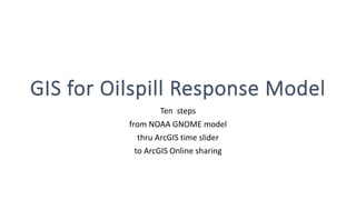
- 1. GIS for Oilspill Response Model Ten steps from NOAA GNOME model thru ArcGIS time slider to ArcGIS Online sharing
- 2. 2010: GNOME Oil Spill Model Output Input into ArcMap Prepare the data Time slider 2015: ArcGIS Online Presentation Outline
- 3. http://response.restoration.noaa.gov/software/gnome/gnomeftp.html • GNOME is a publicly available oil spill trajectory model that simulates oil movement due to winds, currents, tides, and spreading. • GNOME was developed by the Hazardous Materials Response Division (HAZMAT) of the National Oceanic and Atmospheric Administration Office of Response and Restoration (NOAA OR&R). • HAZMAT will use this model during spill response to calculate a “best guess” of a spill’s trajectory and the associated uncertainty in that trajectory.
- 4. (continued from NOAA website) GNOME is used to: • Predict how winds, currents, and other processes might move and spread oil spilled on the water. • Learn how predicted oil trajectories are affected by inexactness ("uncertainty") in current and wind observations and forecasts. • See how spilled oil is predicted to change chemically and physically ("weather") during the time that it remains on the water surface.
- 5. Start GNOME with local ropme.org file
- 6. Apply oil spill model and locale parameters
- 7. Model is run on NOAA application Basic Inputs Initial location and shape of Oil spill (Spill Map) Date, time & volume of Oil disposed in the sea Wind speed and direction Data for currents & waves Main Output Volume of Oil that reaches / remains the beaches Affected habitats, beds, anchorages etc Locations for Mitigation and Remediation Note that ONBEACH / INWATER limit differs from map coastline
- 8. Display is shown in ArcMap Basic Output (cont.) GNOME output data Time series Main Input Gnome.dll from NOAA Import file series Each time-step a separate feature in separate geodatabase WARNING Very laborious
- 10. Prepare data Create File Geodatabase Features in separate Personal Geodatabase outputs all have the same name File Geodatabase allows to rename them sequentially And time stamp is preserved Later note: time stamp field [Age] is Double format Time Slider accepted it as-is in ArcMap To be converted to Date format in ArcGIS Online
- 11. Format the Time Attributes
- 12. Add the Time Slider
- 13. Enjoy the Movie! (hover mouse over map)
- 14. Extra: Prepare for ArcGIS Online Time stamp (Age) is Double format AGOL will not post it as Time Aware Need to add Field (Days) as Date format
- 15. Convert to Date / Time Disable Time in the Feature Add Field ArcToolbox > Data Management > Fields > Add Field Input Table: select Feature Field Type: Date Copy field Field Calculator: Days = [Age] Notice it’s ~ 1900 Set date to when Model is run for Days = #dd/mm/yyyy# + [Age] Re-enable Time in the Feature
- 16. For ArcGIS Online Add basemap: Dark grey canvas Make feature symbol: INWATER a white circle ONBEACH a white cross Size: 10.0 Mimic oilspill dispersion: size inverse proportion to Age Symbology > Advanced > Size > Expression: 50/[Age] Publish File > Share As > Map Package In ArcMap Make feature symbol: INWATER an orange circle ONBEACH a red circle Size: 10.0 Publish File > Share As > Service Add basemap: Dark grey canvas Notice: limit of the two symbols doesn’t match the coastline NOAA model used ROMPE dataset likely had a coastline of different vintage, scale or projection
- 17. or the webmap!Enjoy the video…
- 18. Thank You OpenWare (Esri agents in Kuwait for original presentation) Esri (Dawn Wright for encouraging story maps & web apps) Esri(UK) (Esri agents in UK for ongoing technical support)