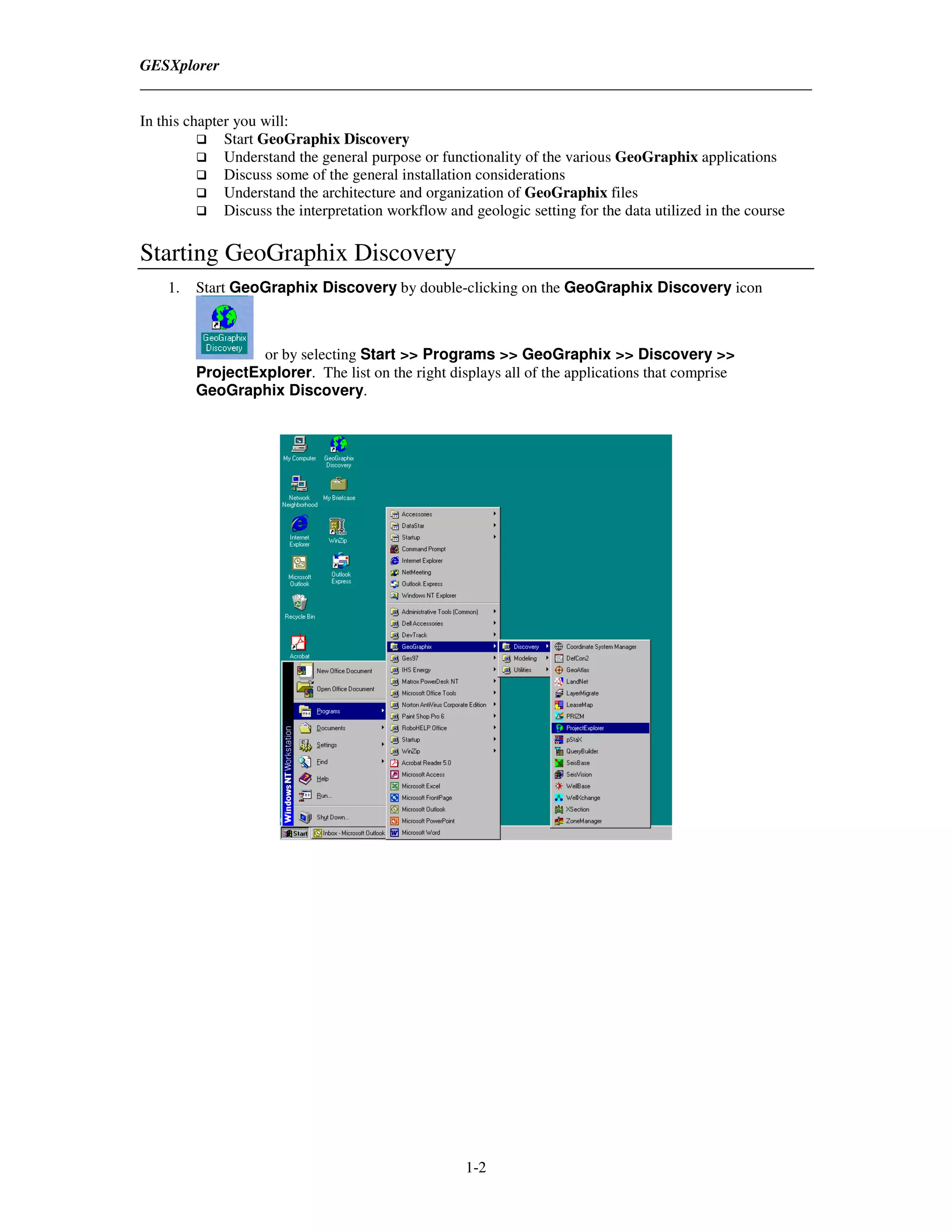
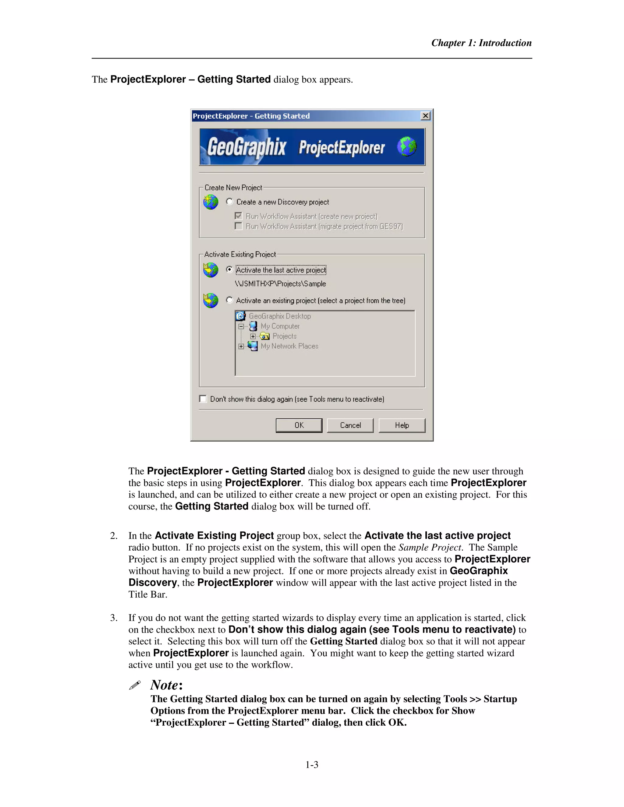
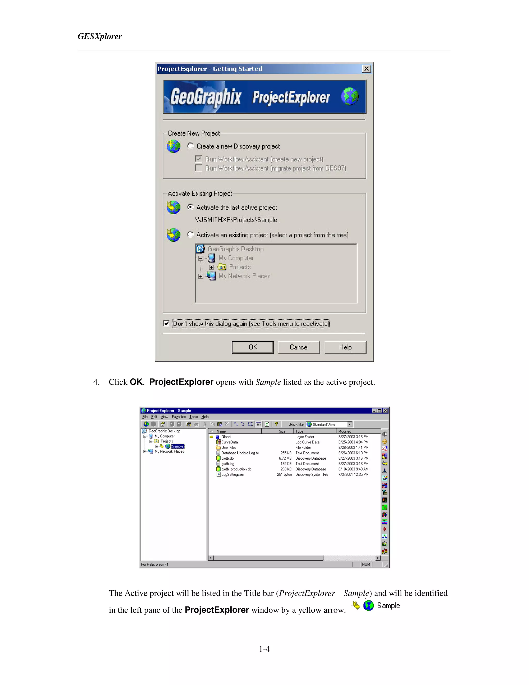
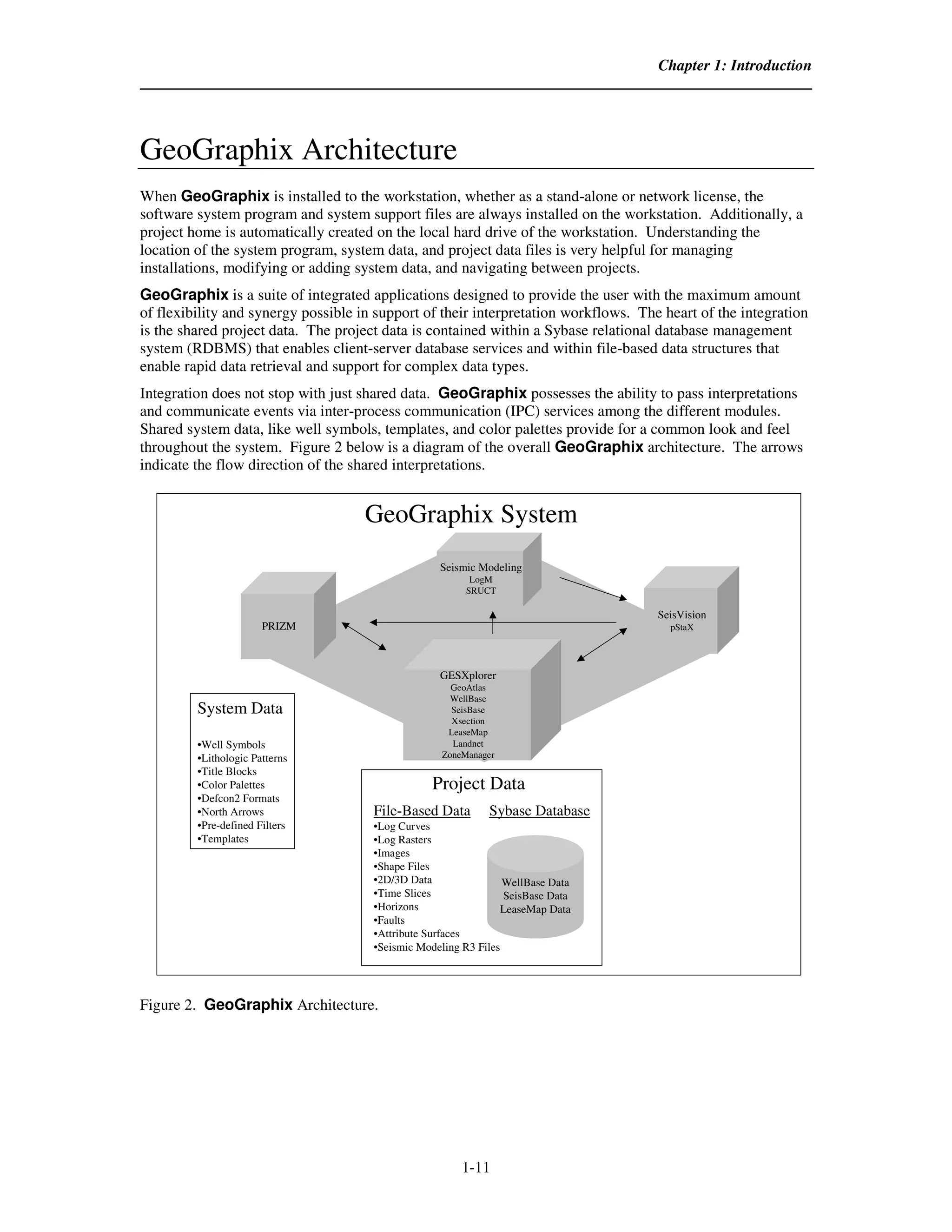
GeoGraphix provides a complete system for interpreting land, seismic, production, and well data through integrated modules. The modules include DataManager for data management, GESXplorer for geological mapping and interpretation, PRIZM for petrophysical analysis, SeisVision for seismic interpretation, and connectivity tools. ProjectExplorer is used to create and organize projects containing data to be analyzed using these interpretation modules.


![Vibe Coding vs. Spec-Driven Development [Free Meetup]](https://cdn.slidesharecdn.com/ss_thumbnails/vibecodingvsspecdrivendevelopment-251209105622-43f455e7-thumbnail.jpg?width=640&height=640&fit=bounds)


