Download to read offline
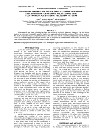
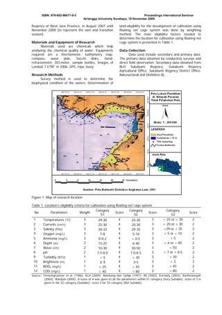
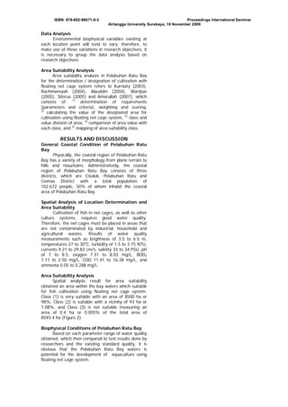
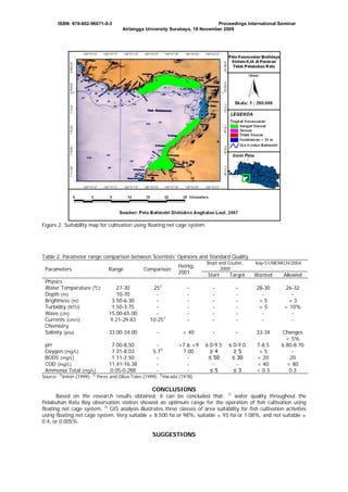

This document summarizes a study that used geographic information systems (GIS) to determine suitable areas for floating net cage aquaculture in Pelabuhan Ratu Bay, Indonesia. Spatial analysis of environmental and water quality parameters identified approximately 8,500 hectares, or 98% of the study area, as very suitable for net cage aquaculture. The analysis incorporated 12 biophysical variables and assigned scores to classify suitability. The results can help optimize sustainable aquaculture development and fishery production in the region.


