Download as PPSX, PPTX

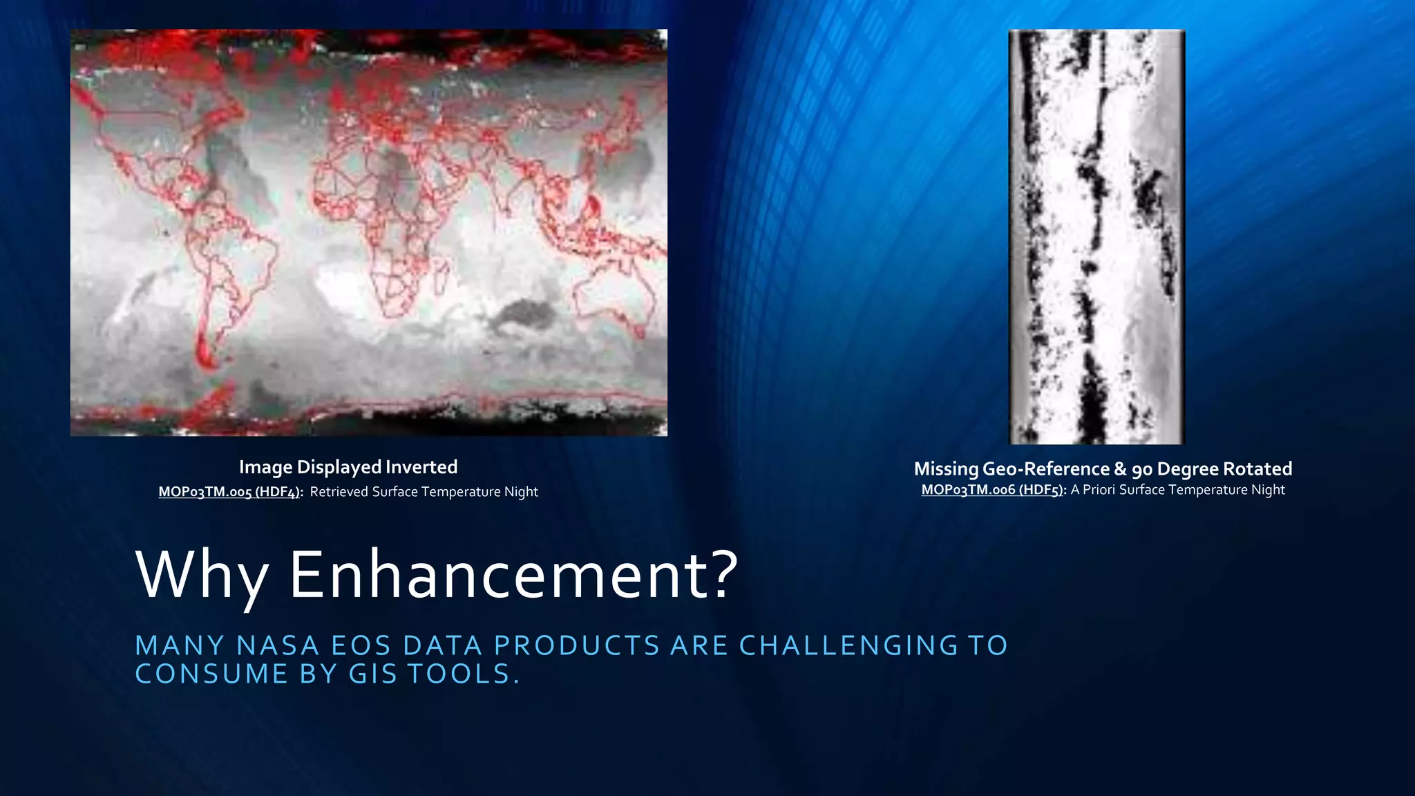
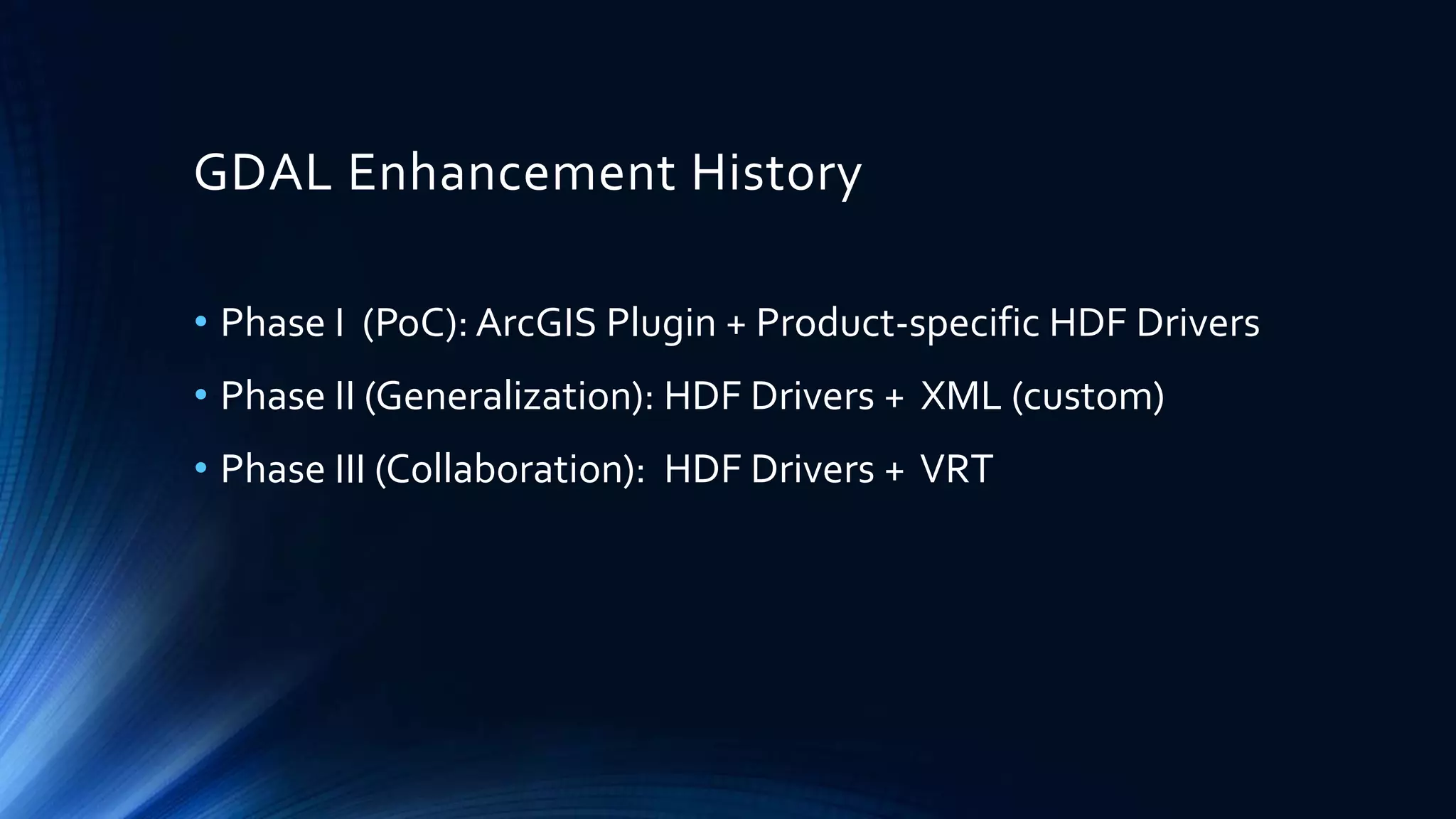
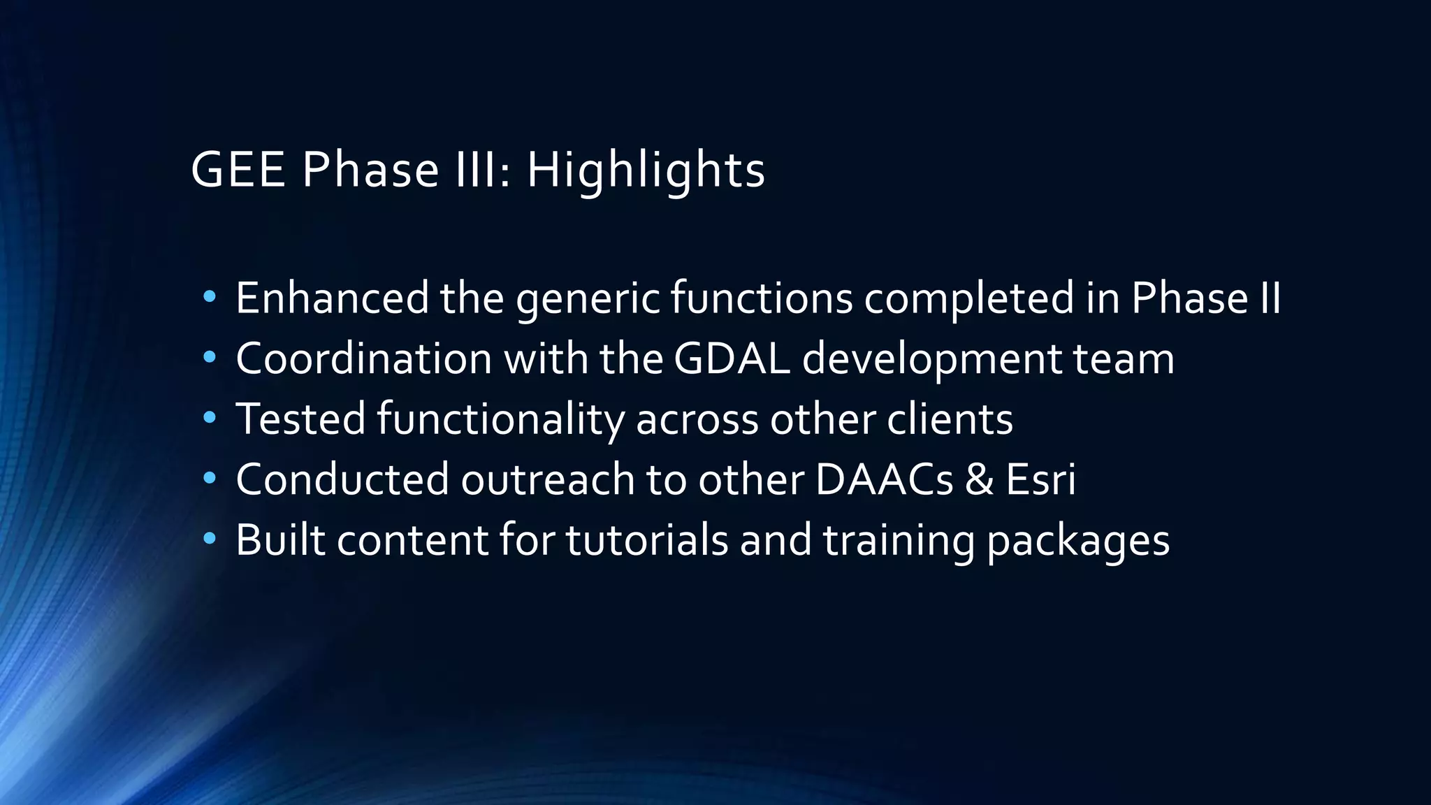


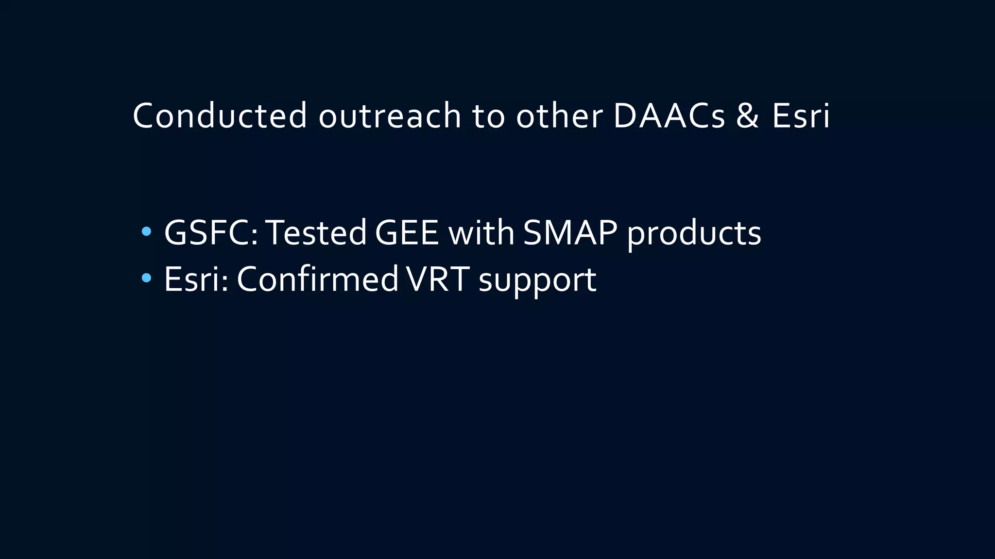
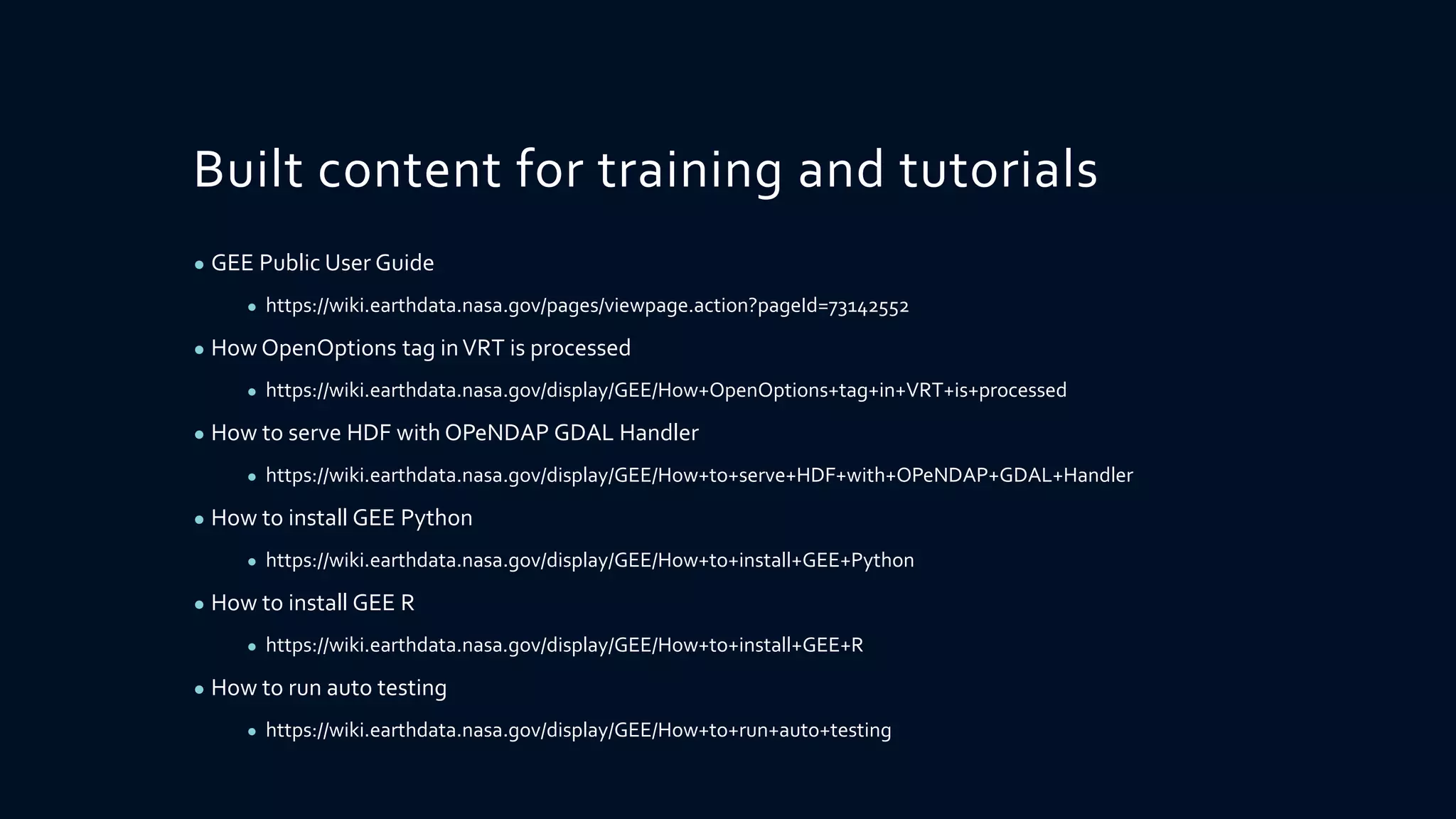
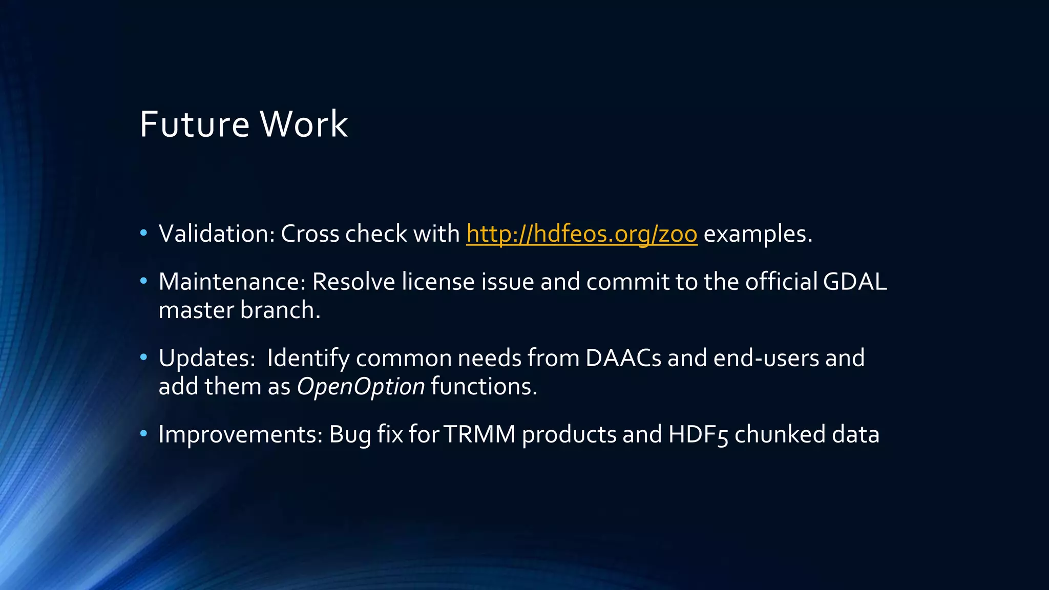

This document summarizes the work done to enhance the Geospatial Data Abstraction Library (GDAL) to better support NASA Earth Observing System (EOS) data products. It describes three phases of work: 1) a proof-of-concept ArcGIS plugin for product-specific HDF drivers, 2) generalized HDF drivers and an XML format, and 3) collaboration with GDAL developers utilizing HDF drivers and a Virtual Format (VRT) specification. The third phase highlights include enhanced generic functions, coordination with GDAL developers, testing across GIS clients, outreach to other data centers, and building tutorials. Future work areas are also outlined.


![Coded Agents – with UiPath SDK + LangGraph [Virtual Hands-on Workshop]](https://cdn.slidesharecdn.com/ss_thumbnails/codedagentsdeck-251215155422-5497c599-thumbnail.jpg?width=640&height=640&fit=bounds)
![Vibe Coding vs. Spec-Driven Development [Free Meetup]](https://cdn.slidesharecdn.com/ss_thumbnails/vibecodingvsspecdrivendevelopment-251209105622-43f455e7-thumbnail.jpg?width=640&height=640&fit=bounds)


