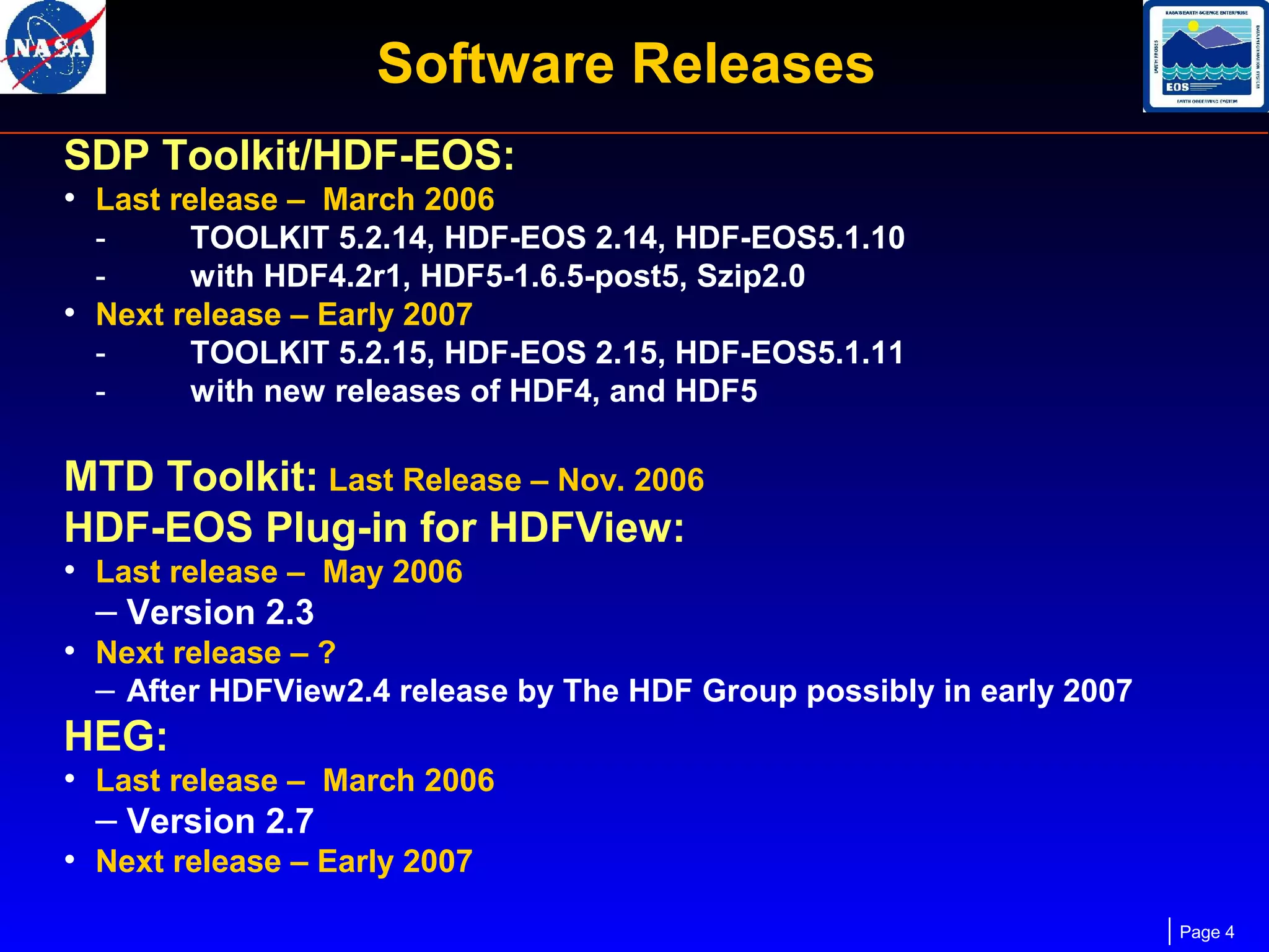
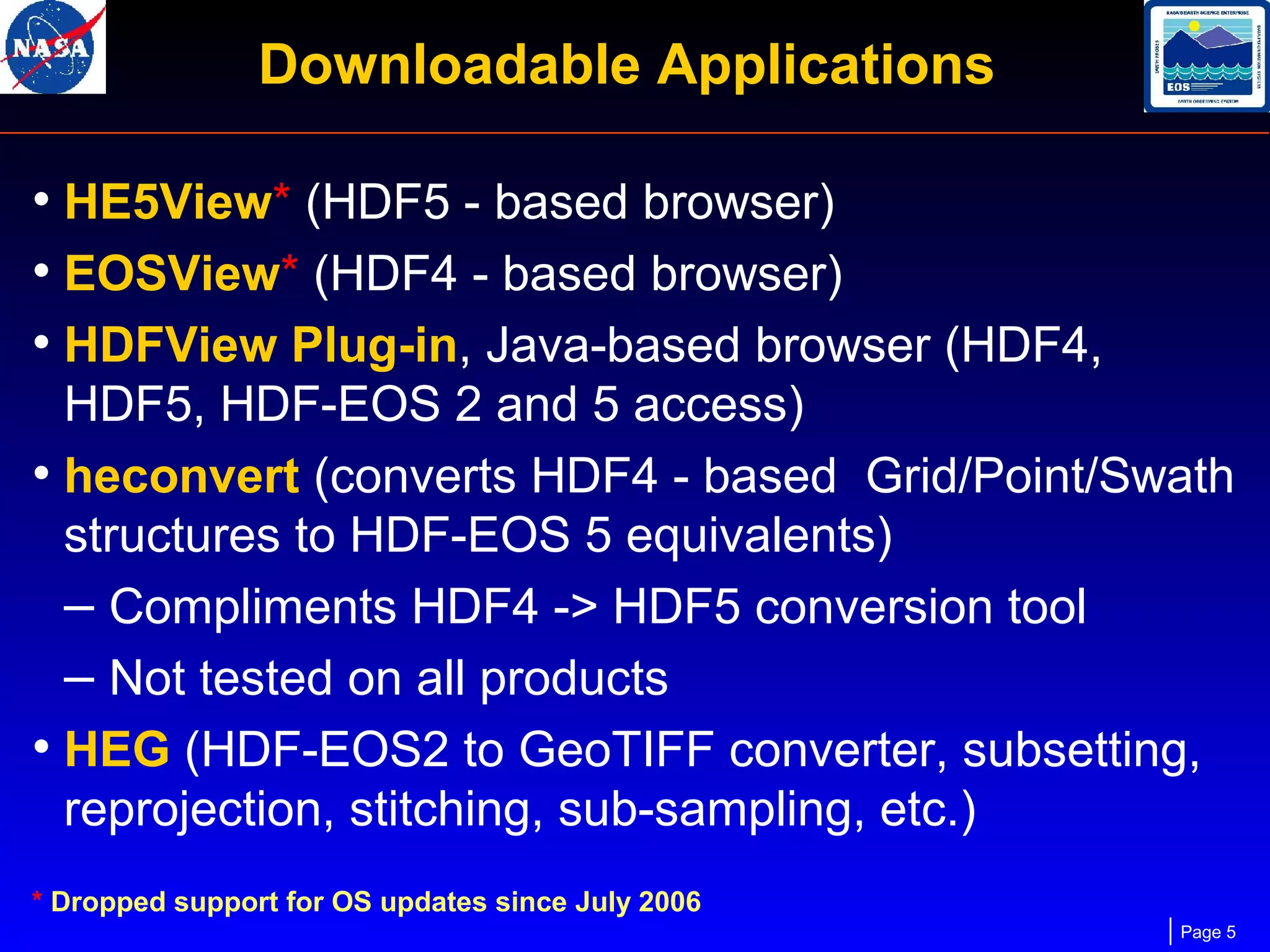
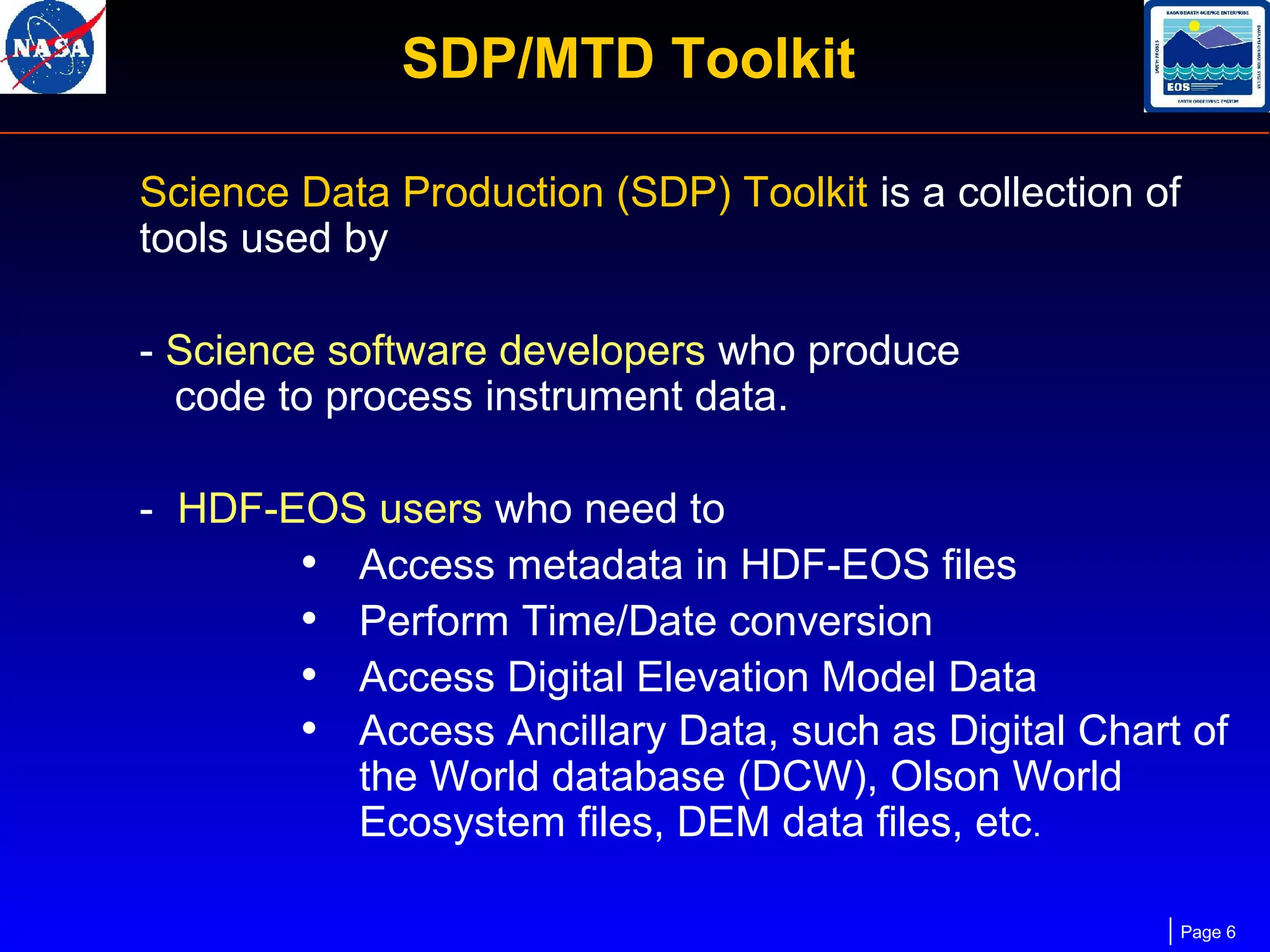
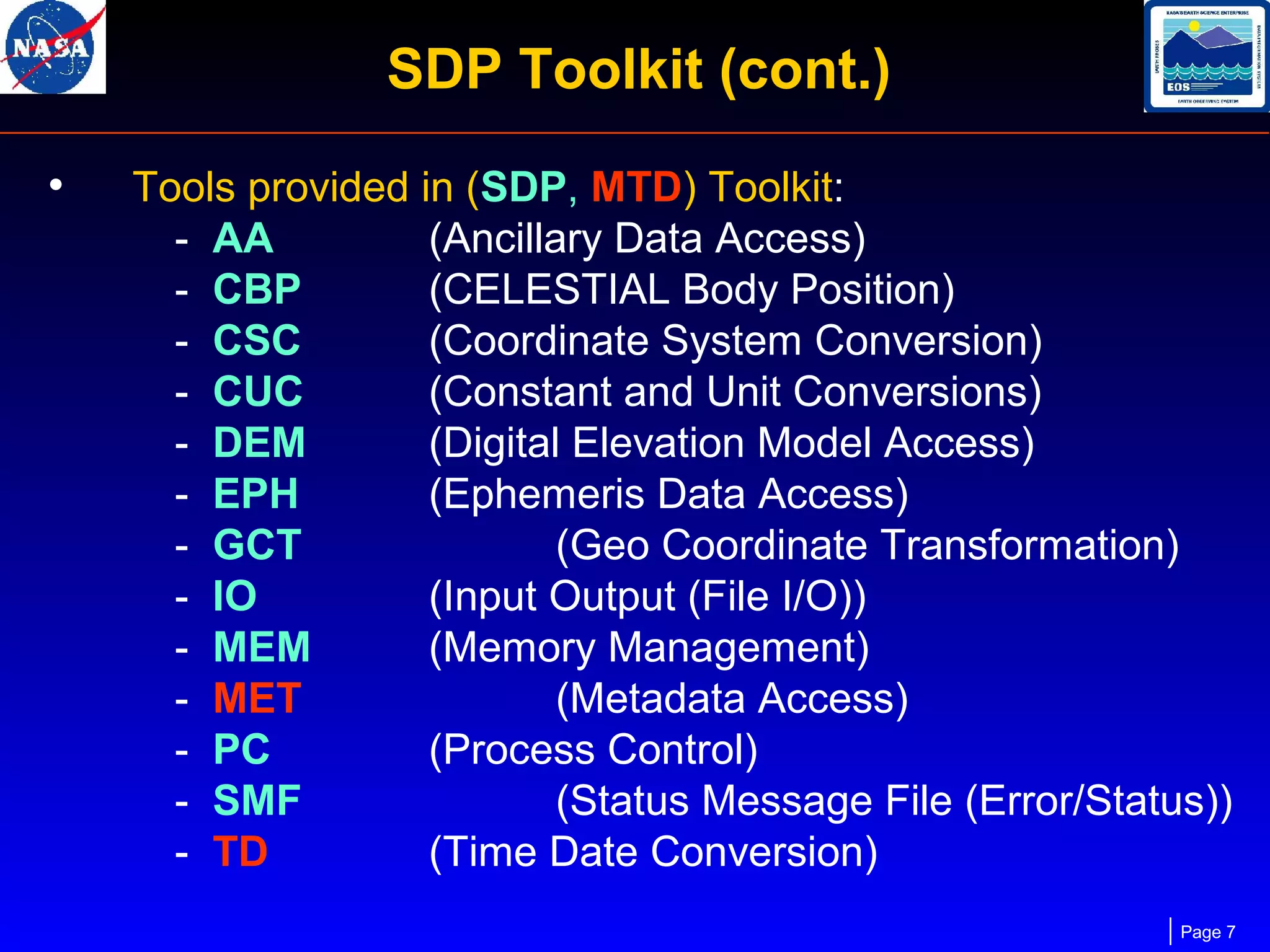
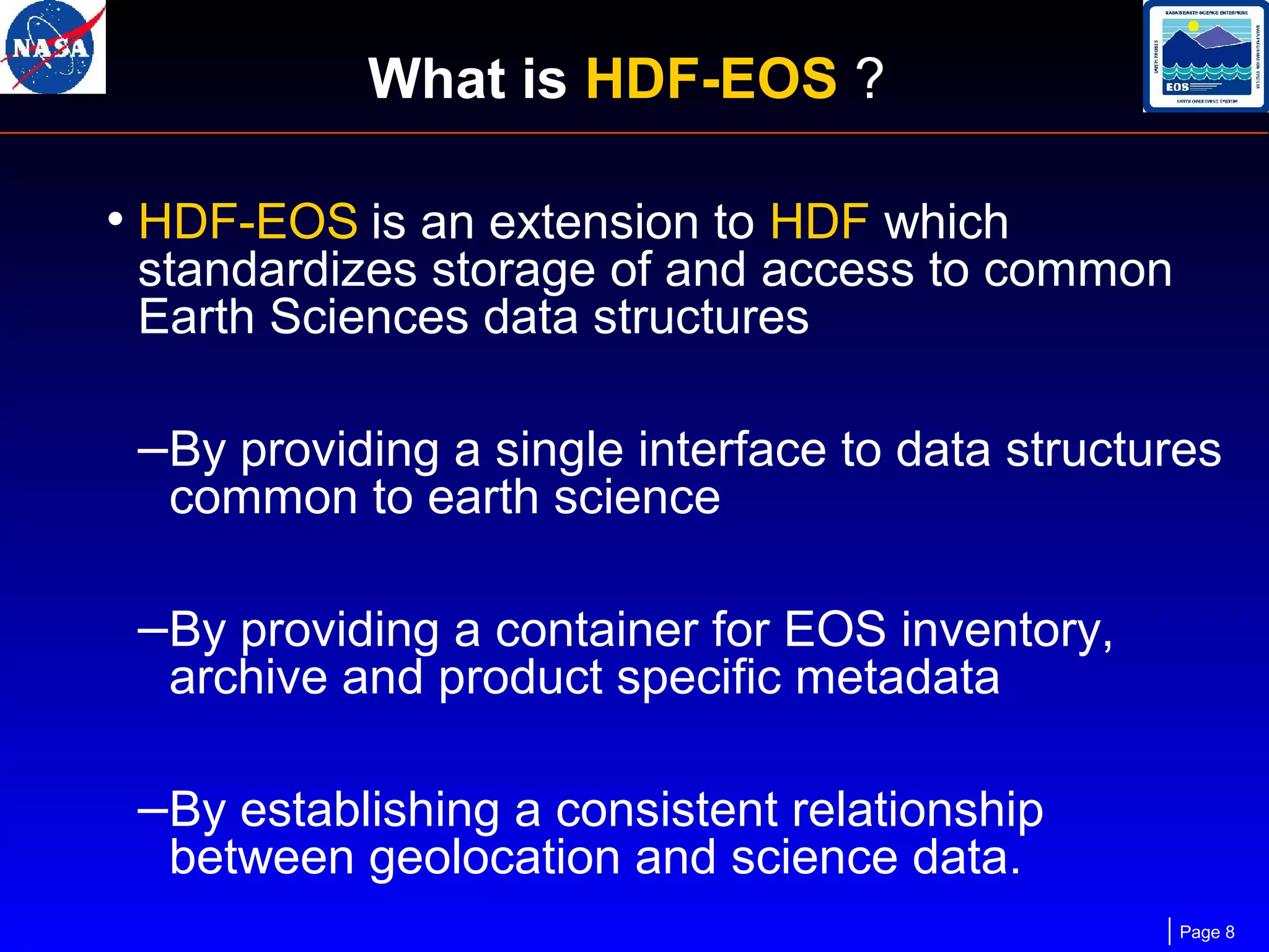
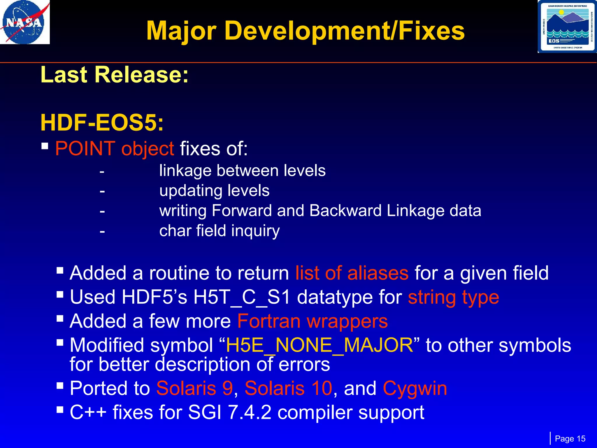
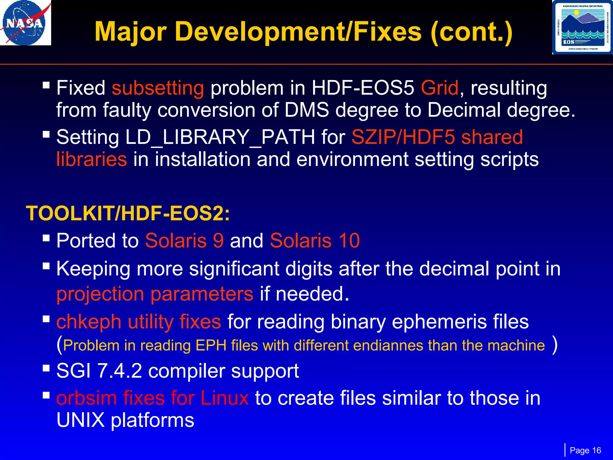
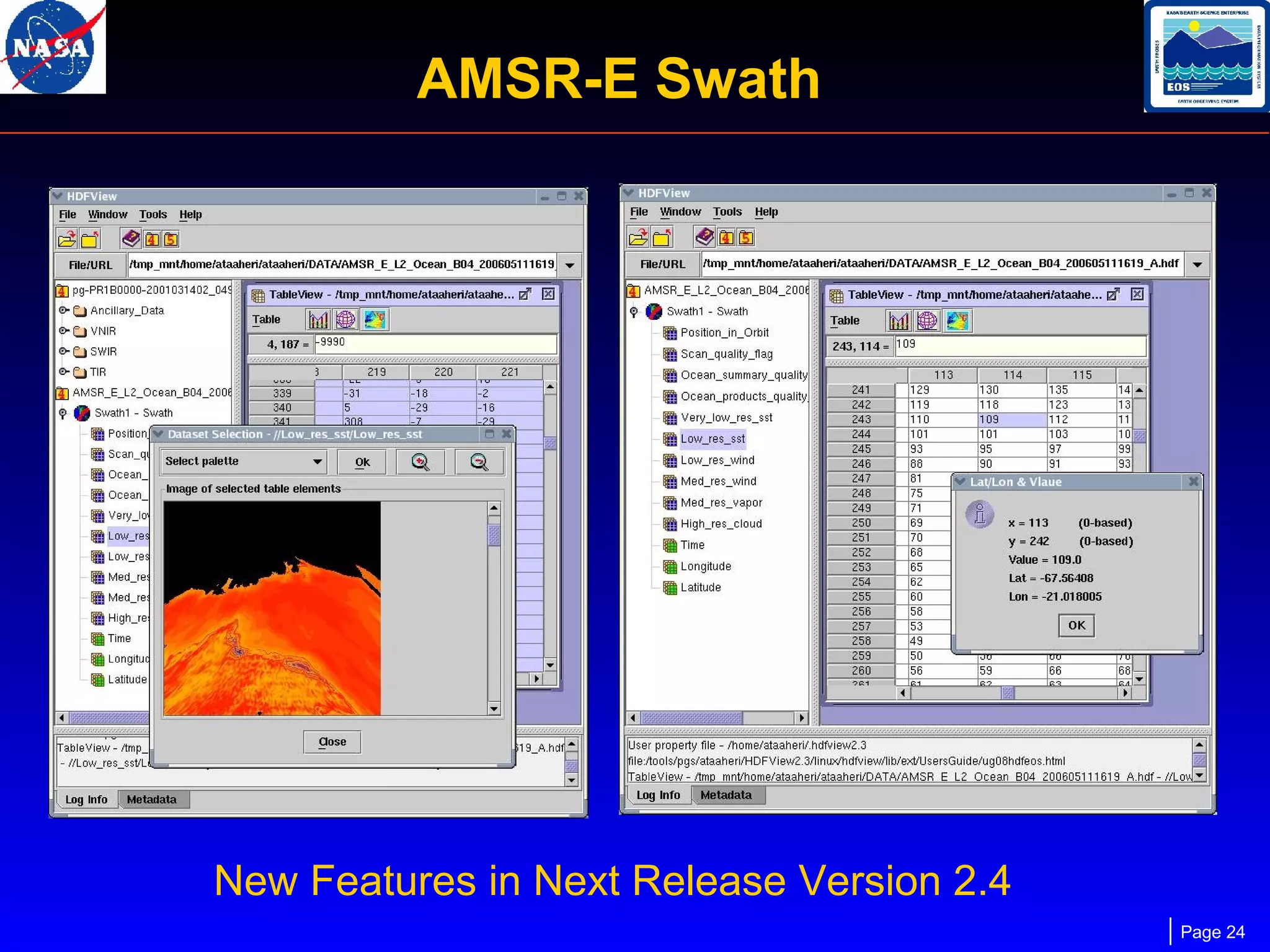
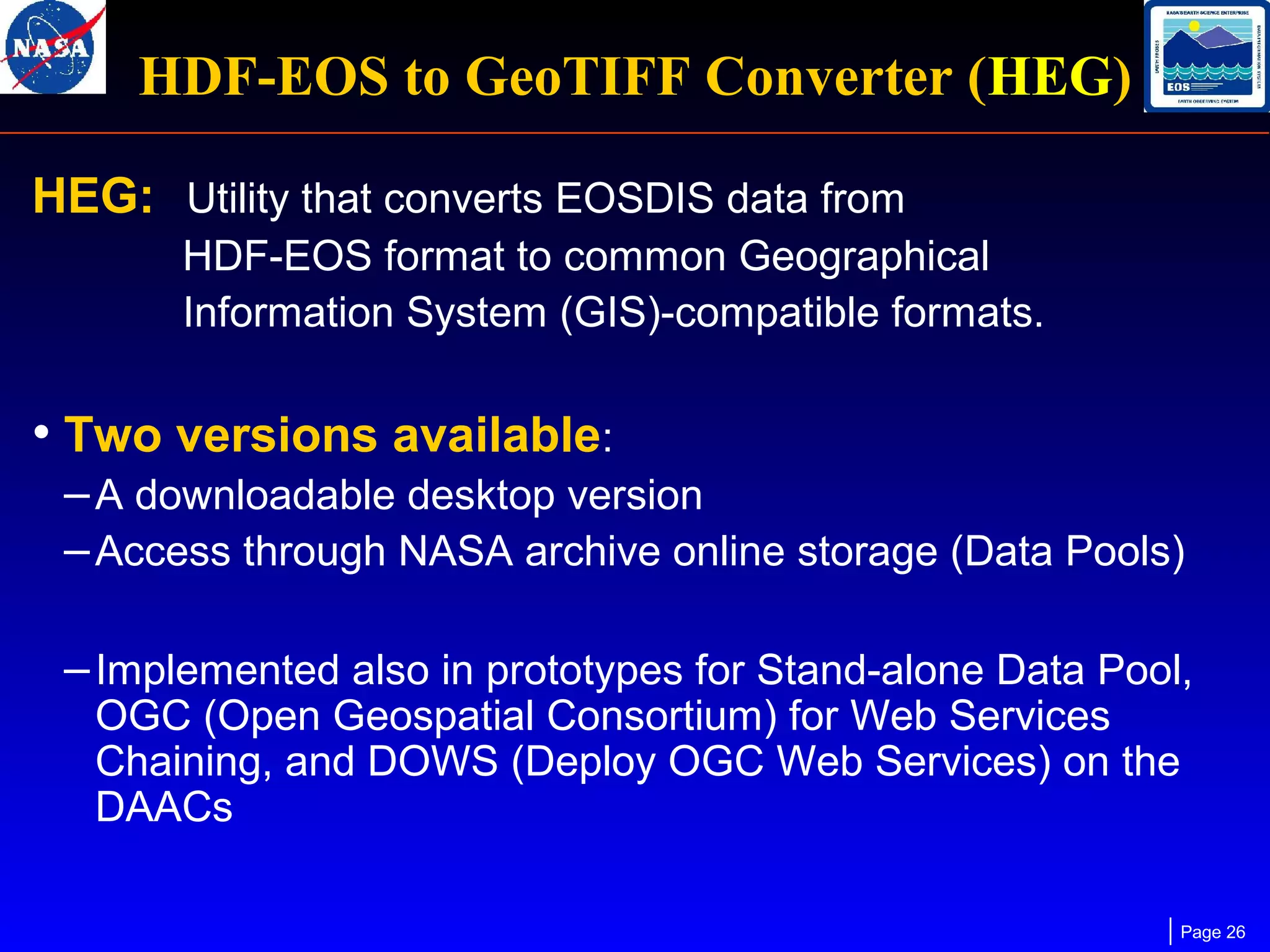
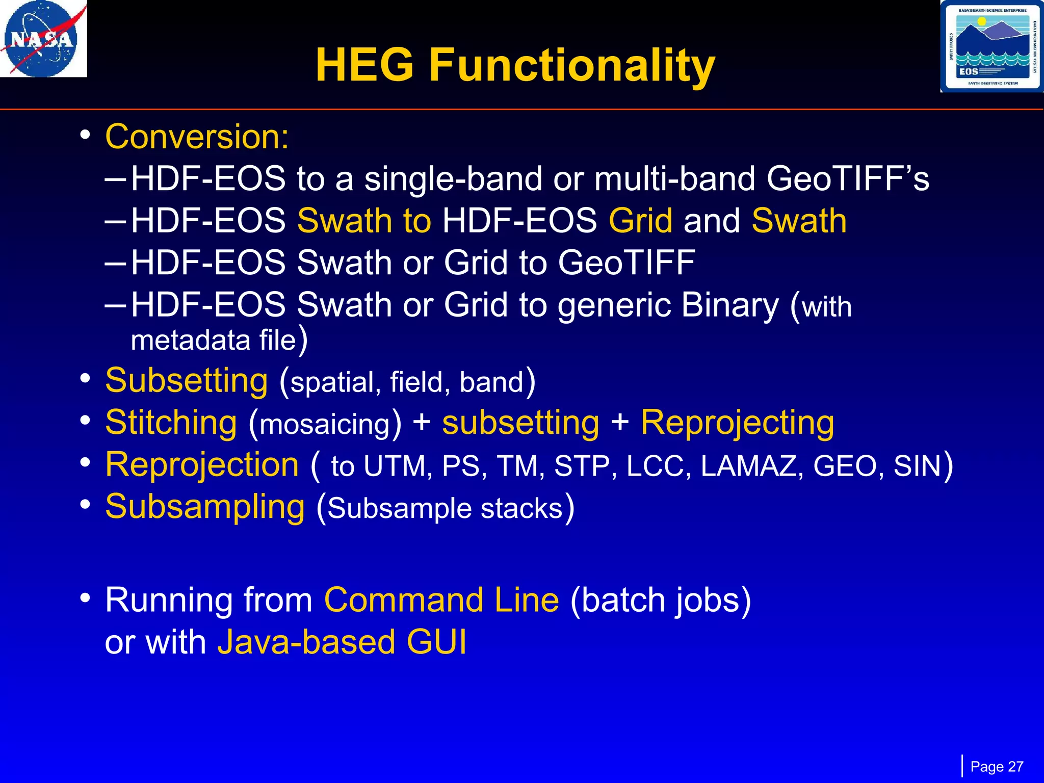
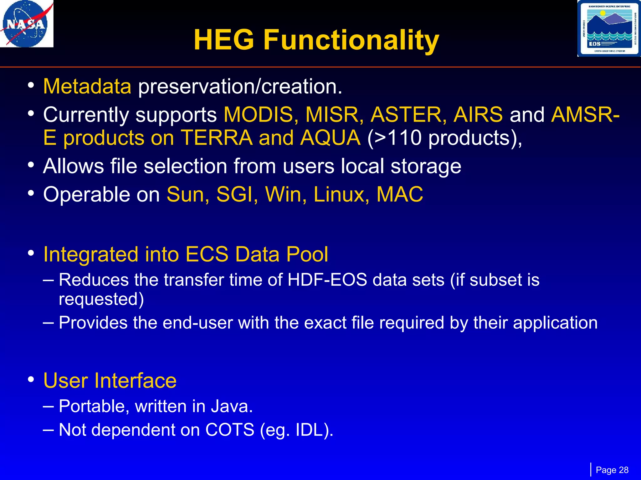
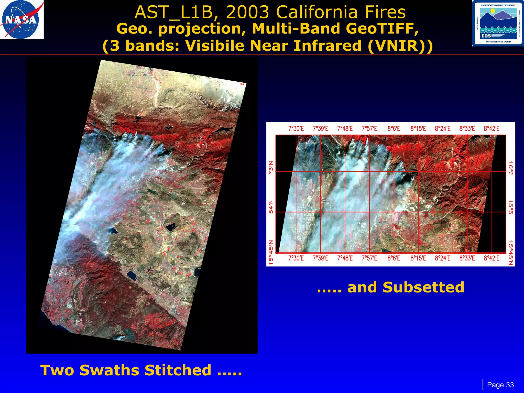
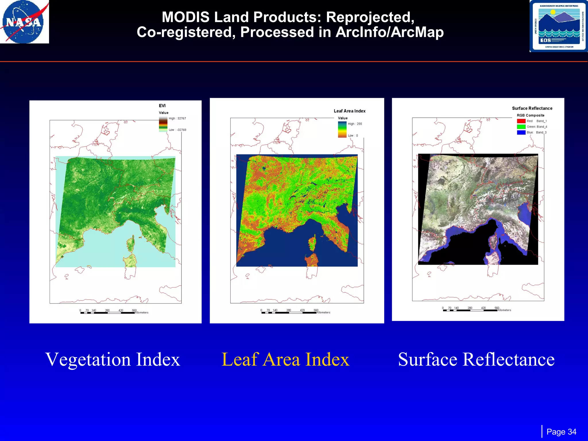
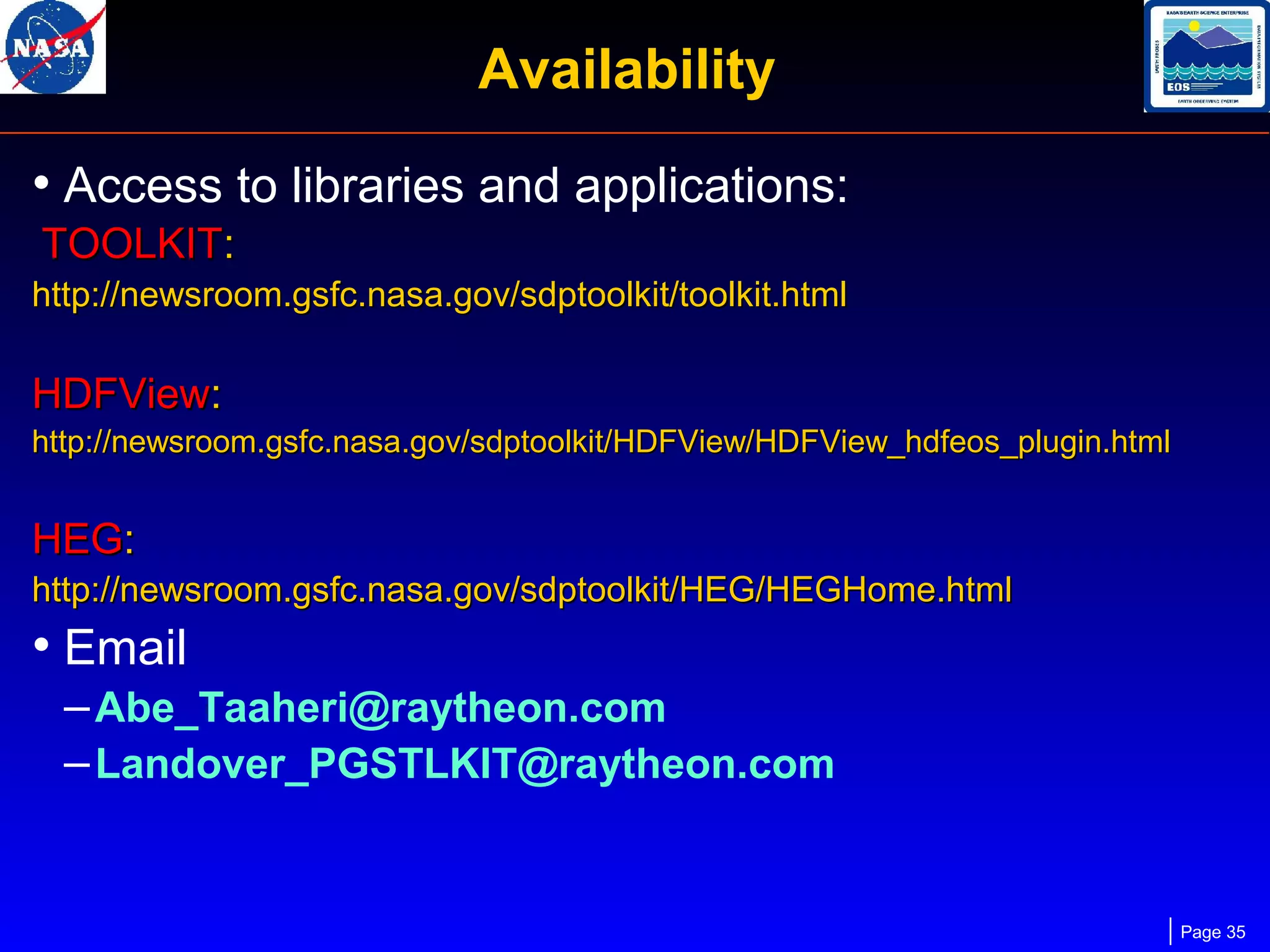
HDF-EOS Maintenance,
Current Development
and Tools
Abe Taaheri, Raytheon Information Systems
Larry Klein, RS Information Systems
HDF-EOS Workshop X, November 2006
HDF-EOS Support
• Maintenance support is funded on EMD Evolution
through May 2008

• Current staff
- One full time developer for maintaining:
SDP/MTD Toolkit,
HDF-EOS2 & 5,
HDF-EOS plug-in for HDFView,
HEG,
other Toolkit/HDF-EOS related software/maintenance:
- Users Guides
- Web sites
- User help
- Training another developer for HEG maintenance
Page 2
ECS Support of HDF-EOS
• Both HDF4 and HDF5 based flavors of HDF-EOS are part
of ECS baseline.

• OS's: Solaris (8, 9, 10), Irix6.5, HP 11, AIX, DEC,
Windows NT/2000/XP, Linux (including 64-bit Opteron
and Itanium), Mac OS X, Cygwin (MTD Toolkit, HDF-EOS2 & 5)
• Adding Cygwin support for SDP Toolkit
• Possibly supporting Intel based Mac for next release

• Compilers: Fortran 77/90 & g77/pgf90 , C, C++, gcc, g++
• Support for SGI 7.4.2 besides SGI 7.3.1
Page 3
Software Releases
SDP Toolkit/HDF-EOS:
• Last release – March 2006

TOOLKIT 5.2.14, HDF-EOS 2.14, HDF-EOS5.1.10
with HDF4.2r1, HDF5-1.6.5-post5, Szip2.0
• Next release – Early 2007
TOOLKIT 5.2.15, HDF-EOS 2.15, HDF-EOS5.1.11
with new releases of HDF4, and HDF5

MTD Toolkit: Last Release – Nov. 2006
HDF-EOS Plug-in for HDFView:

• Last release – May 2006
– Version 2.3
• Next release – ?
– After HDFView2.4 release by The HDF Group possibly in early 2007

HEG:

• Last release – March 2006
– Version 2.7
• Next release – Early 2007
Page 4
Downloadable Applications
• HE5View* (HDF5 - based browser)
• EOSView* (HDF4 - based browser)
• HDFView Plug-in, Java-based browser (HDF4,
HDF5, HDF-EOS 2 and 5 access)
• heconvert (converts HDF4 - based Grid/Point/Swath
structures to HDF-EOS 5 equivalents)
– Compliments HDF4 -> HDF5 conversion tool
– Not tested on all products
• HEG (HDF-EOS2 to GeoTIFF converter, subsetting,
reprojection, stitching, sub-sampling, etc.)
* Dropped support for OS updates since July 2006
Page 5
SDP/MTD Toolkit
Science Data Production (SDP) Toolkit is a collection of
tools used by
- Science software developers who produce
code to process instrument data.
- HDF-EOS users who need to
• Access metadata in HDF-EOS files
• Perform Time/Date conversion
• Access Digital Elevation Model Data
• Access Ancillary Data, such as Digital Chart of
the World database (DCW), Olson World
Ecosystem files, DEM data files, etc.
Page 6
SDP Toolkit (cont.)
•

Tools provided in (SDP, MTD) Toolkit:
- AA
(Ancillary Data Access)
- CBP
(CELESTIAL Body Position)
- CSC
(Coordinate System Conversion)
- CUC
(Constant and Unit Conversions)
- DEM
(Digital Elevation Model Access)
- EPH
(Ephemeris Data Access)
- GCT
(Geo Coordinate Transformation)
- IO
(Input Output (File I/O))
- MEM
(Memory Management)
- MET
(Metadata Access)
- PC
(Process Control)
- SMF
(Status Message File (Error/Status))
- TD
(Time Date Conversion)
Page 7
What is HDF-EOS ?
• HDF-EOS is an extension to HDF which

standardizes storage of and access to common
Earth Sciences data structures

–By providing a single interface to data structures
common to earth science

–By providing a container for EOS inventory,
archive and product specific metadata

–By establishing a consistent relationship
between geolocation and science data.

Page 8
HDF-EOS 2
• HDF4 - based, storage format for EOS standard
products.
• Used operationally by MODIS, MISR, ASTER,
Landsat, AIRS and other EOS instruments
• Support for Grid/Point/Swath structures

• HDF4 and HDF-EOS 2 will be supported by
THG/NASA for the fore-seeable future.

Page 9
HDF-EOS 5
• Based on HDF5, a complete rewrite of HDF-EOS2
with a different user interface.
–First released in 2000.
–Format used by EOS Aura instruments

• Designed to ‘resemble’ HDF-EOS 2 to the
maximum extent possible.
–Supports same data structures
–Added prefix ‘HE5_’ to HDF-EOS 2 functions.

Page 10
HDF-EOS Grid Structure
• Usage - Data which is organized
by regular geographic spacing,
specified by projection parameters.

• Structure
– Any number of 2-D to 8-D data arrays per structure
– Geolocation information contained in projection formula,
coupled by structural metadata.
– Any number of Grid structures per file allowed.

Page 11
HDF-EOS Swath Structure
• Data which is organized by time, or
other track parameter.
• Spacing can be irregular.

• Structure
– Geolocation information stored
explicitly in Geolocation
Field (2-D array)
– Data stored in 2-D or 3-D arrays
– Time stored in 1-D or 2-D array,
TAI is standard.
– Geolocation/science data
connected by structural metadata
Page 12
HDF-EOS Point Structure
• Data is specified temporally and/or spatially, but
with no particular organization

• Structure
–Tables used to store science
data at a particular
Lat/Long/Height

– Up to eight levels of

Station
Chicago
Los Angeles
Washington
Miami

data allowed. Structural
metadata specifies
relationship between levels.

Lat
Lon
41.49 -87.37
34.03 -118.14
38.50 -77.00
25.45 -80.11

Time
0800
0900
1000
0800
0900
1000
1100
1000
1100
1200
1300
1400
0600
0700

Temp(C)
-3
-2
-1
20
21
22
24
6
8
9
11
12
15
16

Page 13
Zonal Average Structure
• Generalized array structure with no geolocation
linkage
• Data can be organized by time or track
parameter
• Data spacing can be irregular
• Structure
– Data stored in multidimensional arrays
– Time stored in 1-D or 2-D array

Page 14
Major Development/Fixes
Last Release:
HDF-EOS5:
 POINT object fixes of:
-

-

linkage between levels
updating levels
writing Forward and Backward Linkage data
char field inquiry

 Added a routine to return list of aliases for a given field
 Used HDF5’s H5T_C_S1 datatype for string type
 Added a few more Fortran wrappers
 Modified symbol “H5E_NONE_MAJOR” to other symbols
for better description of errors
 Ported to Solaris 9, Solaris 10, and Cygwin
 C++ fixes for SGI 7.4.2 compiler support

Page 15
Major Development/Fixes (cont.)
 Fixed subsetting problem in HDF-EOS5 Grid, resulting

from faulty conversion of DMS degree to Decimal degree.
 Setting LD_LIBRARY_PATH for SZIP/HDF5 shared
libraries in installation and environment setting scripts
TOOLKIT/HDF-EOS2:
 Ported to Solaris 9 and Solaris 10
 Keeping more significant digits after the decimal point in
projection parameters if needed.
 chkeph utility fixes for reading binary ephemeris files
(Problem in reading EPH files with different endiannes than the machine )
 SGI 7.4.2 compiler support
 orbsim fixes for Linux to create files similar to those in
UNIX platforms
Page 16
Future Development/Fixes
Next Release:
 Default installation of SZIP
 Choice for installing Toolkit/HDF-EOS in 32 or 64 bit

modes in 64-bit Linux platforms
 New HDF4/HDF5 Release support
 Lat/Lon conversions to pixel number in DEM tools in
Linux for getting results similar to those in Unix platforms

Future Plans:

− Support for Cygwin
− Support for HDF4.2r2 and HDF5-1.8
− Performance improvement, if possible, for reading HDF

format ephemeris/attitude files in Toolkit
− Performance improvement in HDF-EOS5 by redesigning
some functions
Page 17
HDFView
•
•
•

•
•
•

HDFView: A Java-based browser from THG for HDF4
and HDF5 – based data.
HDF-EOS plug-in extends HDFView to browse HDFEOS data in both versions.
The extension is a plug-in module and does not
change THG HDFView functionality. All copy, save,
editing, image display, etc. for HDF4 and 5 objects
remains.
Identical look and feel when displaying HDF and
HDF-EOS objects.
Users can access a complete breakdown of HDFEOS objects. e.g. grid information, projection info.,
dimensions, datafields, and attributes are displayed.
Current Support: SUN, SGI, LINUX, WINDOWS
platforms
Page 18
HDFView (Cont.)
• Release 2.2 October 2005
- A separate HDF-EOS plug-in: Users install HDFView 2.2 and
integrates HDF-EOS plug-in into it.
- Ability to do "Save as" for HDF-EOS5:
modify individual values in grid or swath data.
Delete entire grids or swaths.
Save the result.
- Separate help window for HDF-EOS objects

• Release 2.3 January 2006
− Display Point Objects
− Scientific notation in Table data
− Geolocating pixels for swath and grid images
Page 19
HDFView (Cont.)
• Next Release: Version 2.4
– Automatic installation of plug-in into HDFView running selfextracting archives.
– Display image for selected pixels in the viewed tables
– Geolocating cells in the data field tables for swath and grid
– Mac OSX porting
– Better display of Plug-in User’s Guide
– New icons for activating Lat/Lon display for Swath & Grid
- Future Plans:
- Ability to modify input HDF-EOS2 granules.
- Ability to cut/paste objects, modify/delete attributes.
- Ability to convert HDF-EOS2 to HDF-EOS5
- Ability to create new grids/swaths

Page 20
Swath, Grid, and Point Objects

Page 21
AMSR-E Grid, Northern Hemisphere,
with selected palette

Page 22
AMSR-E and OMI Point objects

Page 23
AMSR-E Swath

New Features in Next Release Version 2.4
Page 24
Aster Swath, with Image menu

Page 25
HDF-EOS to GeoTIFF Converter (HEG)
HEG: Utility that converts EOSDIS data from
HDF-EOS format to common Geographical
Information System (GIS)-compatible formats.

• Two versions available:
– A downloadable desktop version
– Access through NASA archive online storage (Data Pools)
– Implemented also in prototypes for Stand-alone Data Pool,
OGC (Open Geospatial Consortium) for Web Services
Chaining, and DOWS (Deploy OGC Web Services) on the
DAACs

Page 26
HEG Functionality
• Conversion:
– HDF-EOS to a single-band or multi-band GeoTIFF’s
– HDF-EOS Swath to HDF-EOS Grid and Swath
– HDF-EOS Swath or Grid to GeoTIFF
– HDF-EOS Swath or Grid to generic Binary (with
•
•
•
•

metadata file)
Subsetting (spatial, field, band)
Stitching (mosaicing) + subsetting + Reprojecting
Reprojection ( to UTM, PS, TM, STP, LCC, LAMAZ, GEO, SIN)
Subsampling (Subsample stacks)

• Running from Command Line (batch jobs)
or with Java-based GUI

Page 27
HEG Functionality
• Metadata preservation/creation.
• Currently supports MODIS, MISR, ASTER, AIRS and AMSRE products on TERRA and AQUA (>110 products),
• Allows file selection from users local storage
• Operable on Sun, SGI, Win, Linux, MAC

• Integrated into ECS Data Pool
– Reduces the transfer time of HDF-EOS data sets (if subset is

requested)
– Provides the end-user with the exact file required by their application

• User Interface
– Portable, written in Java.
– Not dependent on COTS (eg. IDL).
Page 28
HEG Releases
– Support for:
AMSR-E L3 GRID products (in Polar Stereographic and EASE-Grid)
AMSR-E L3 GRID products (in Geographic projection)
MISR L3 products (in Geographic projection).
AMSR-E L2 SWATH products
AIRS L3 products (in Geographic projection)
ASTER DEM products: Correction for missing data in the internal
geolocation fields of the ASTER DEMs.
MOD43C1, MOD43C2, MOD43C3, MCD43C1, MCD43C2, MCD43C3,
MOD12C1, MYD12C1: Corner points of GRID in DD instead of DMS units.
MOD11_L2: fillvalues (-999.0) in the Lat/Lon geolocations while (-999.9) in
internal metadata.

– Added Albers Projection
– New "Subsetter" functionality for Parameters (aka Fields). This results in:
• Output to HDF-EOS SWATH from input HDF-EOS SWATH
• No alteration of input data because of projection operation.
Page 29
Mt. Etna Eruption: MISR L1B
Swaths: Stitched

Page 30
MODIS L1B: La Plata Tornado

Reprojected, Co-Registered with ASTER
Page 31
2004 Hurricane Francis, MODIS

MOD021KM, Multi-Band GeoTIFF, 3 bands:
EV_1KM_RefSB, Bands 1,2,5
Page 32
AST_L1B, 2003 California Fires

Geo. projection, Multi-Band GeoTIFF,
(3 bands: Visibile Near Infrared (VNIR))

….. and Subsetted

Two Swaths Stitched …..
Page 33
MODIS Land Products: Reprojected,
Co-registered, Processed in ArcInfo/ArcMap

Vegetation Index

Leaf Area Index

Surface Reflectance

Page 34
Availability
• Access to libraries and applications:
TOOLKIT:
http://newsroom.gsfc.nasa.gov/sdptoolkit/toolkit.html

HDFView:
http://newsroom.gsfc.nasa.gov/sdptoolkit/HDFView/HDFView_hdfeos_plugin.html

HEG:
http://newsroom.gsfc.nasa.gov/sdptoolkit/HEG/HEGHome.html

• Email
– Abe_Taaheri@raytheon.com
– Landover_PGSTLKIT@raytheon.com

Page 35

HDF-EOS Maintenance, Current Development and Tools

  • 1.
    HDF-EOS Maintenance, Current Development andTools Abe Taaheri, Raytheon Information Systems Larry Klein, RS Information Systems HDF-EOS Workshop X, November 2006
  • 2.
    HDF-EOS Support • Maintenancesupport is funded on EMD Evolution through May 2008 • Current staff - One full time developer for maintaining: SDP/MTD Toolkit, HDF-EOS2 & 5, HDF-EOS plug-in for HDFView, HEG, other Toolkit/HDF-EOS related software/maintenance: - Users Guides - Web sites - User help - Training another developer for HEG maintenance Page 2
  • 3.
    ECS Support ofHDF-EOS • Both HDF4 and HDF5 based flavors of HDF-EOS are part of ECS baseline. • OS's: Solaris (8, 9, 10), Irix6.5, HP 11, AIX, DEC, Windows NT/2000/XP, Linux (including 64-bit Opteron and Itanium), Mac OS X, Cygwin (MTD Toolkit, HDF-EOS2 & 5) • Adding Cygwin support for SDP Toolkit • Possibly supporting Intel based Mac for next release • Compilers: Fortran 77/90 & g77/pgf90 , C, C++, gcc, g++ • Support for SGI 7.4.2 besides SGI 7.3.1 Page 3
  • 4.
    Software Releases SDP Toolkit/HDF-EOS: •Last release – March 2006 TOOLKIT 5.2.14, HDF-EOS 2.14, HDF-EOS5.1.10 with HDF4.2r1, HDF5-1.6.5-post5, Szip2.0 • Next release – Early 2007 TOOLKIT 5.2.15, HDF-EOS 2.15, HDF-EOS5.1.11 with new releases of HDF4, and HDF5 MTD Toolkit: Last Release – Nov. 2006 HDF-EOS Plug-in for HDFView: • Last release – May 2006 – Version 2.3 • Next release – ? – After HDFView2.4 release by The HDF Group possibly in early 2007 HEG: • Last release – March 2006 – Version 2.7 • Next release – Early 2007 Page 4
  • 5.
    Downloadable Applications • HE5View*(HDF5 - based browser) • EOSView* (HDF4 - based browser) • HDFView Plug-in, Java-based browser (HDF4, HDF5, HDF-EOS 2 and 5 access) • heconvert (converts HDF4 - based Grid/Point/Swath structures to HDF-EOS 5 equivalents) – Compliments HDF4 -> HDF5 conversion tool – Not tested on all products • HEG (HDF-EOS2 to GeoTIFF converter, subsetting, reprojection, stitching, sub-sampling, etc.) * Dropped support for OS updates since July 2006 Page 5
  • 6.
    SDP/MTD Toolkit Science DataProduction (SDP) Toolkit is a collection of tools used by - Science software developers who produce code to process instrument data. - HDF-EOS users who need to • Access metadata in HDF-EOS files • Perform Time/Date conversion • Access Digital Elevation Model Data • Access Ancillary Data, such as Digital Chart of the World database (DCW), Olson World Ecosystem files, DEM data files, etc. Page 6
  • 7.
    SDP Toolkit (cont.) • Toolsprovided in (SDP, MTD) Toolkit: - AA (Ancillary Data Access) - CBP (CELESTIAL Body Position) - CSC (Coordinate System Conversion) - CUC (Constant and Unit Conversions) - DEM (Digital Elevation Model Access) - EPH (Ephemeris Data Access) - GCT (Geo Coordinate Transformation) - IO (Input Output (File I/O)) - MEM (Memory Management) - MET (Metadata Access) - PC (Process Control) - SMF (Status Message File (Error/Status)) - TD (Time Date Conversion) Page 7
  • 8.
    What is HDF-EOS? • HDF-EOS is an extension to HDF which standardizes storage of and access to common Earth Sciences data structures –By providing a single interface to data structures common to earth science –By providing a container for EOS inventory, archive and product specific metadata –By establishing a consistent relationship between geolocation and science data. Page 8
  • 9.
    HDF-EOS 2 • HDF4- based, storage format for EOS standard products. • Used operationally by MODIS, MISR, ASTER, Landsat, AIRS and other EOS instruments • Support for Grid/Point/Swath structures • HDF4 and HDF-EOS 2 will be supported by THG/NASA for the fore-seeable future. Page 9
  • 10.
    HDF-EOS 5 • Basedon HDF5, a complete rewrite of HDF-EOS2 with a different user interface. –First released in 2000. –Format used by EOS Aura instruments • Designed to ‘resemble’ HDF-EOS 2 to the maximum extent possible. –Supports same data structures –Added prefix ‘HE5_’ to HDF-EOS 2 functions. Page 10
  • 11.
    HDF-EOS Grid Structure •Usage - Data which is organized by regular geographic spacing, specified by projection parameters. • Structure – Any number of 2-D to 8-D data arrays per structure – Geolocation information contained in projection formula, coupled by structural metadata. – Any number of Grid structures per file allowed. Page 11
  • 12.
    HDF-EOS Swath Structure •Data which is organized by time, or other track parameter. • Spacing can be irregular. • Structure – Geolocation information stored explicitly in Geolocation Field (2-D array) – Data stored in 2-D or 3-D arrays – Time stored in 1-D or 2-D array, TAI is standard. – Geolocation/science data connected by structural metadata Page 12
  • 13.
    HDF-EOS Point Structure •Data is specified temporally and/or spatially, but with no particular organization • Structure –Tables used to store science data at a particular Lat/Long/Height – Up to eight levels of Station Chicago Los Angeles Washington Miami data allowed. Structural metadata specifies relationship between levels. Lat Lon 41.49 -87.37 34.03 -118.14 38.50 -77.00 25.45 -80.11 Time 0800 0900 1000 0800 0900 1000 1100 1000 1100 1200 1300 1400 0600 0700 Temp(C) -3 -2 -1 20 21 22 24 6 8 9 11 12 15 16 Page 13
  • 14.
    Zonal Average Structure •Generalized array structure with no geolocation linkage • Data can be organized by time or track parameter • Data spacing can be irregular • Structure – Data stored in multidimensional arrays – Time stored in 1-D or 2-D array Page 14
  • 15.
    Major Development/Fixes Last Release: HDF-EOS5: POINT object fixes of: - - linkage between levels updating levels writing Forward and Backward Linkage data char field inquiry  Added a routine to return list of aliases for a given field  Used HDF5’s H5T_C_S1 datatype for string type  Added a few more Fortran wrappers  Modified symbol “H5E_NONE_MAJOR” to other symbols for better description of errors  Ported to Solaris 9, Solaris 10, and Cygwin  C++ fixes for SGI 7.4.2 compiler support Page 15
  • 16.
    Major Development/Fixes (cont.) Fixed subsetting problem in HDF-EOS5 Grid, resulting from faulty conversion of DMS degree to Decimal degree.  Setting LD_LIBRARY_PATH for SZIP/HDF5 shared libraries in installation and environment setting scripts TOOLKIT/HDF-EOS2:  Ported to Solaris 9 and Solaris 10  Keeping more significant digits after the decimal point in projection parameters if needed.  chkeph utility fixes for reading binary ephemeris files (Problem in reading EPH files with different endiannes than the machine )  SGI 7.4.2 compiler support  orbsim fixes for Linux to create files similar to those in UNIX platforms Page 16
  • 17.
    Future Development/Fixes Next Release: Default installation of SZIP  Choice for installing Toolkit/HDF-EOS in 32 or 64 bit modes in 64-bit Linux platforms  New HDF4/HDF5 Release support  Lat/Lon conversions to pixel number in DEM tools in Linux for getting results similar to those in Unix platforms Future Plans: − Support for Cygwin − Support for HDF4.2r2 and HDF5-1.8 − Performance improvement, if possible, for reading HDF format ephemeris/attitude files in Toolkit − Performance improvement in HDF-EOS5 by redesigning some functions Page 17
  • 18.
    HDFView • • • • • • HDFView: A Java-basedbrowser from THG for HDF4 and HDF5 – based data. HDF-EOS plug-in extends HDFView to browse HDFEOS data in both versions. The extension is a plug-in module and does not change THG HDFView functionality. All copy, save, editing, image display, etc. for HDF4 and 5 objects remains. Identical look and feel when displaying HDF and HDF-EOS objects. Users can access a complete breakdown of HDFEOS objects. e.g. grid information, projection info., dimensions, datafields, and attributes are displayed. Current Support: SUN, SGI, LINUX, WINDOWS platforms Page 18
  • 19.
    HDFView (Cont.) • Release2.2 October 2005 - A separate HDF-EOS plug-in: Users install HDFView 2.2 and integrates HDF-EOS plug-in into it. - Ability to do "Save as" for HDF-EOS5: modify individual values in grid or swath data. Delete entire grids or swaths. Save the result. - Separate help window for HDF-EOS objects • Release 2.3 January 2006 − Display Point Objects − Scientific notation in Table data − Geolocating pixels for swath and grid images Page 19
  • 20.
    HDFView (Cont.) • NextRelease: Version 2.4 – Automatic installation of plug-in into HDFView running selfextracting archives. – Display image for selected pixels in the viewed tables – Geolocating cells in the data field tables for swath and grid – Mac OSX porting – Better display of Plug-in User’s Guide – New icons for activating Lat/Lon display for Swath & Grid - Future Plans: - Ability to modify input HDF-EOS2 granules. - Ability to cut/paste objects, modify/delete attributes. - Ability to convert HDF-EOS2 to HDF-EOS5 - Ability to create new grids/swaths Page 20
  • 21.
    Swath, Grid, andPoint Objects Page 21
  • 22.
    AMSR-E Grid, NorthernHemisphere, with selected palette Page 22
  • 23.
    AMSR-E and OMIPoint objects Page 23
  • 24.
    AMSR-E Swath New Featuresin Next Release Version 2.4 Page 24
  • 25.
    Aster Swath, withImage menu Page 25
  • 26.
    HDF-EOS to GeoTIFFConverter (HEG) HEG: Utility that converts EOSDIS data from HDF-EOS format to common Geographical Information System (GIS)-compatible formats. • Two versions available: – A downloadable desktop version – Access through NASA archive online storage (Data Pools) – Implemented also in prototypes for Stand-alone Data Pool, OGC (Open Geospatial Consortium) for Web Services Chaining, and DOWS (Deploy OGC Web Services) on the DAACs Page 26
  • 27.
    HEG Functionality • Conversion: –HDF-EOS to a single-band or multi-band GeoTIFF’s – HDF-EOS Swath to HDF-EOS Grid and Swath – HDF-EOS Swath or Grid to GeoTIFF – HDF-EOS Swath or Grid to generic Binary (with • • • • metadata file) Subsetting (spatial, field, band) Stitching (mosaicing) + subsetting + Reprojecting Reprojection ( to UTM, PS, TM, STP, LCC, LAMAZ, GEO, SIN) Subsampling (Subsample stacks) • Running from Command Line (batch jobs) or with Java-based GUI Page 27
  • 28.
    HEG Functionality • Metadatapreservation/creation. • Currently supports MODIS, MISR, ASTER, AIRS and AMSRE products on TERRA and AQUA (>110 products), • Allows file selection from users local storage • Operable on Sun, SGI, Win, Linux, MAC • Integrated into ECS Data Pool – Reduces the transfer time of HDF-EOS data sets (if subset is requested) – Provides the end-user with the exact file required by their application • User Interface – Portable, written in Java. – Not dependent on COTS (eg. IDL). Page 28
  • 29.
    HEG Releases – Supportfor: AMSR-E L3 GRID products (in Polar Stereographic and EASE-Grid) AMSR-E L3 GRID products (in Geographic projection) MISR L3 products (in Geographic projection). AMSR-E L2 SWATH products AIRS L3 products (in Geographic projection) ASTER DEM products: Correction for missing data in the internal geolocation fields of the ASTER DEMs. MOD43C1, MOD43C2, MOD43C3, MCD43C1, MCD43C2, MCD43C3, MOD12C1, MYD12C1: Corner points of GRID in DD instead of DMS units. MOD11_L2: fillvalues (-999.0) in the Lat/Lon geolocations while (-999.9) in internal metadata. – Added Albers Projection – New "Subsetter" functionality for Parameters (aka Fields). This results in: • Output to HDF-EOS SWATH from input HDF-EOS SWATH • No alteration of input data because of projection operation. Page 29
  • 30.
    Mt. Etna Eruption:MISR L1B Swaths: Stitched Page 30
  • 31.
    MODIS L1B: LaPlata Tornado Reprojected, Co-Registered with ASTER Page 31
  • 32.
    2004 Hurricane Francis,MODIS MOD021KM, Multi-Band GeoTIFF, 3 bands: EV_1KM_RefSB, Bands 1,2,5 Page 32
  • 33.
    AST_L1B, 2003 CaliforniaFires Geo. projection, Multi-Band GeoTIFF, (3 bands: Visibile Near Infrared (VNIR)) ….. and Subsetted Two Swaths Stitched ….. Page 33
  • 34.
    MODIS Land Products:Reprojected, Co-registered, Processed in ArcInfo/ArcMap Vegetation Index Leaf Area Index Surface Reflectance Page 34
  • 35.
    Availability • Access tolibraries and applications: TOOLKIT: http://newsroom.gsfc.nasa.gov/sdptoolkit/toolkit.html HDFView: http://newsroom.gsfc.nasa.gov/sdptoolkit/HDFView/HDFView_hdfeos_plugin.html HEG: http://newsroom.gsfc.nasa.gov/sdptoolkit/HEG/HEGHome.html • Email – Abe_Taaheri@raytheon.com – Landover_PGSTLKIT@raytheon.com Page 35