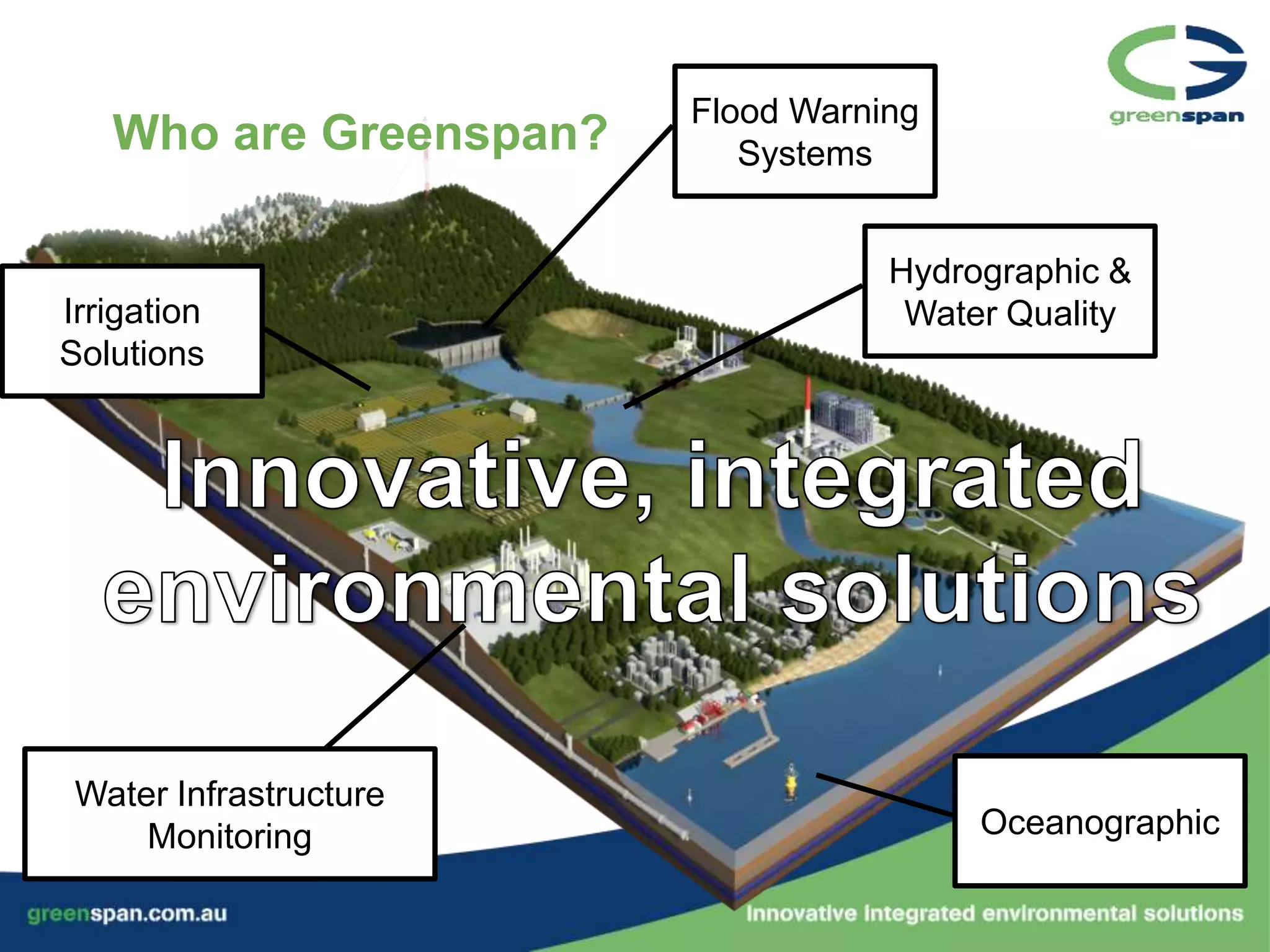
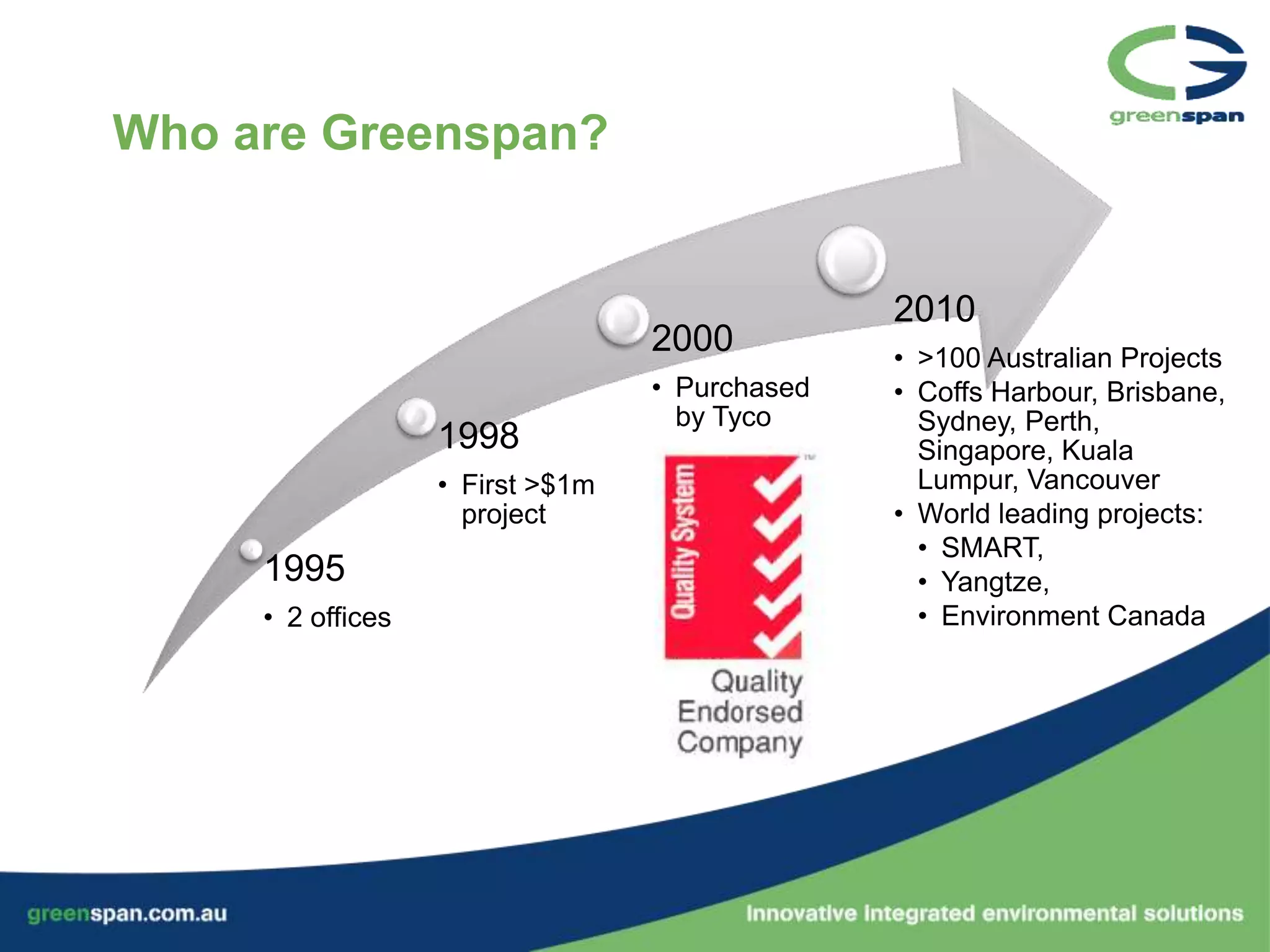
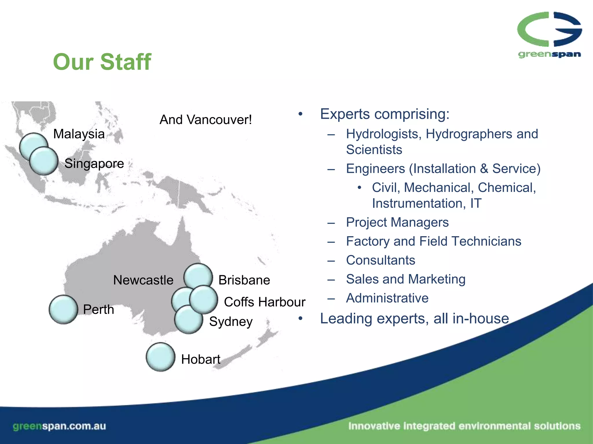
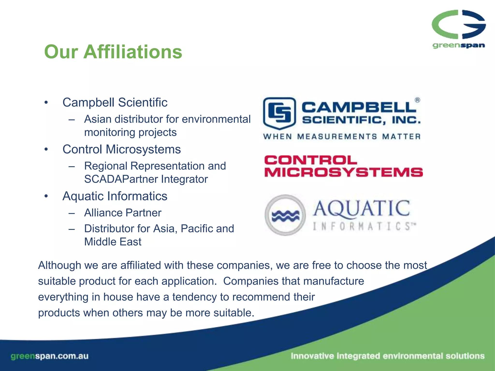
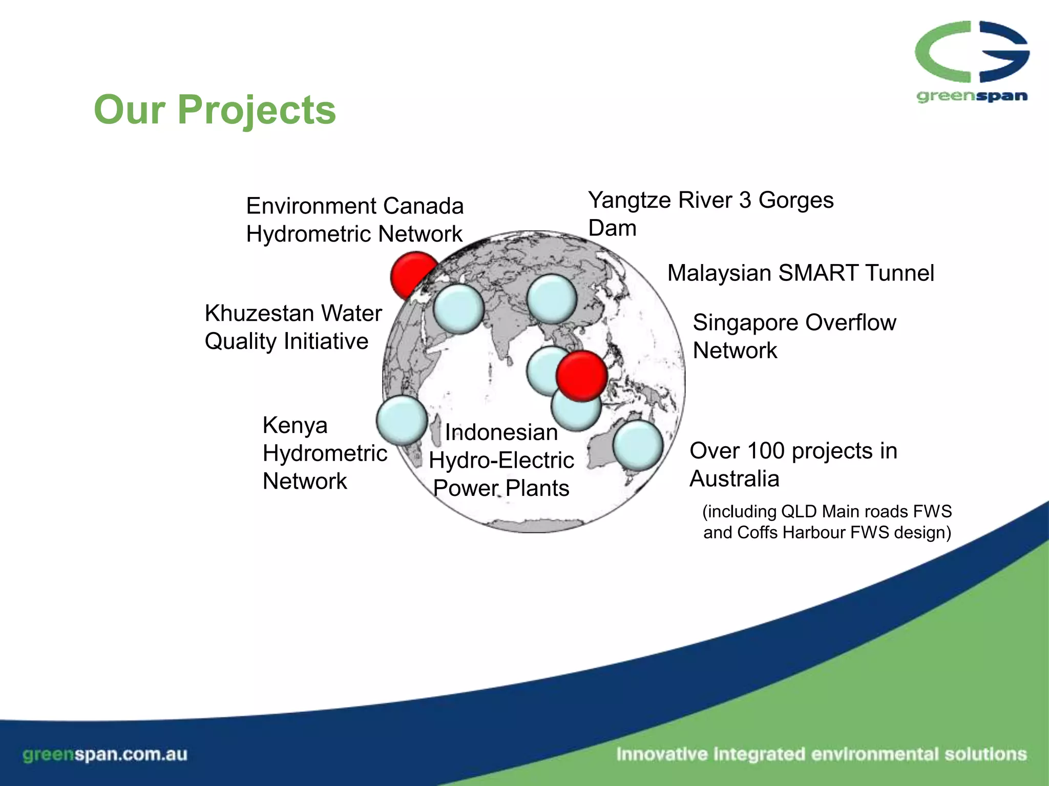
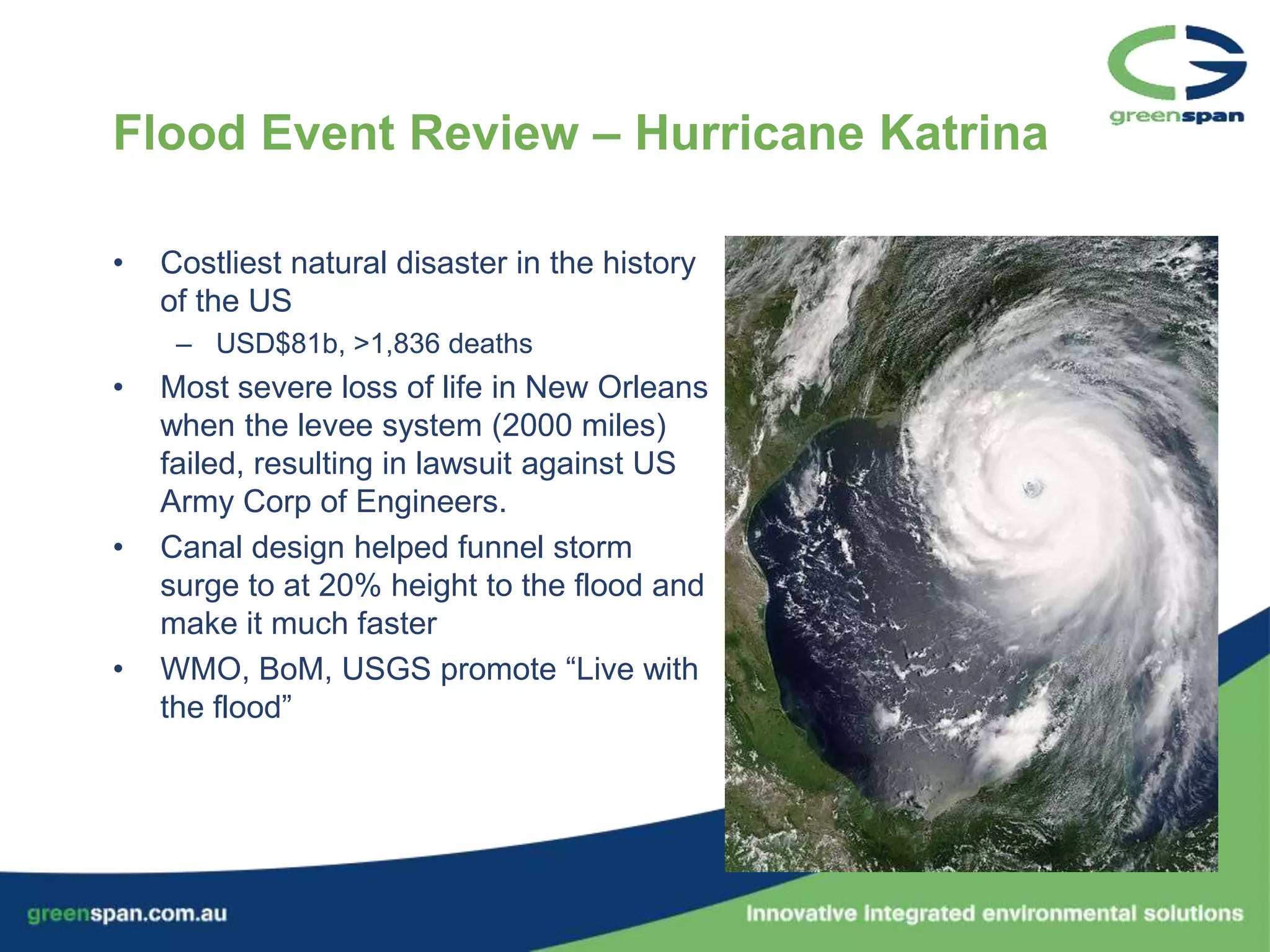
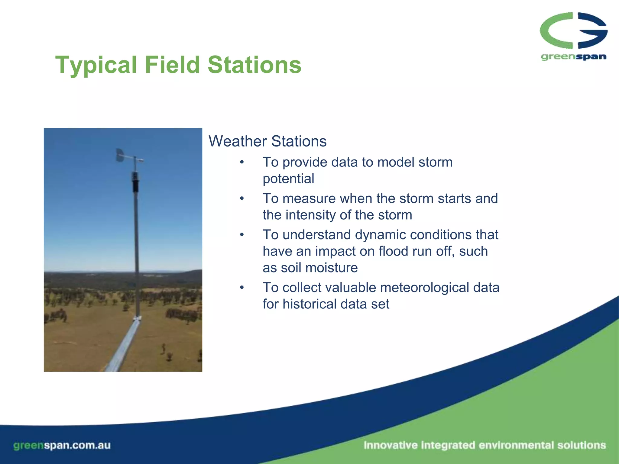
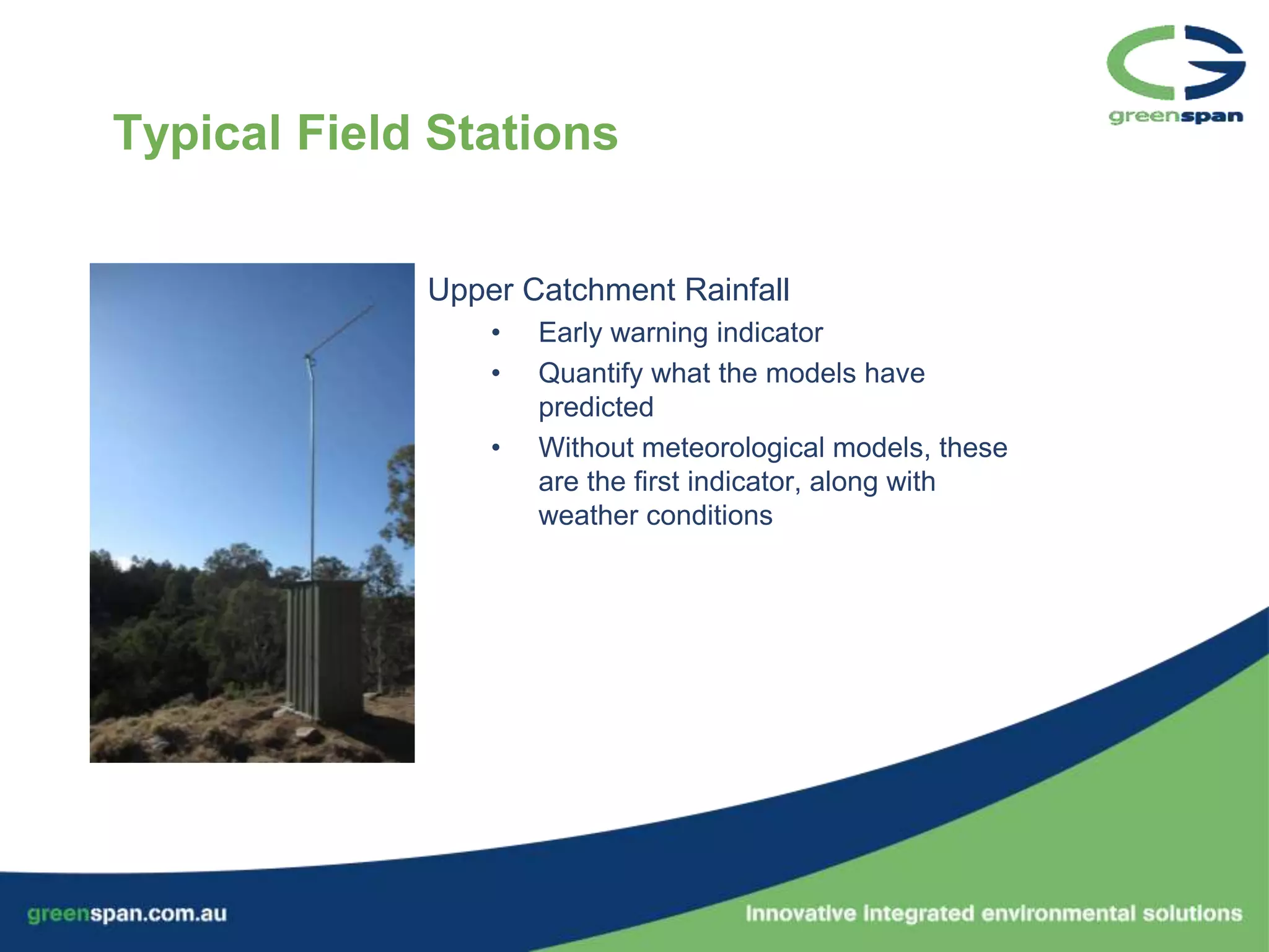
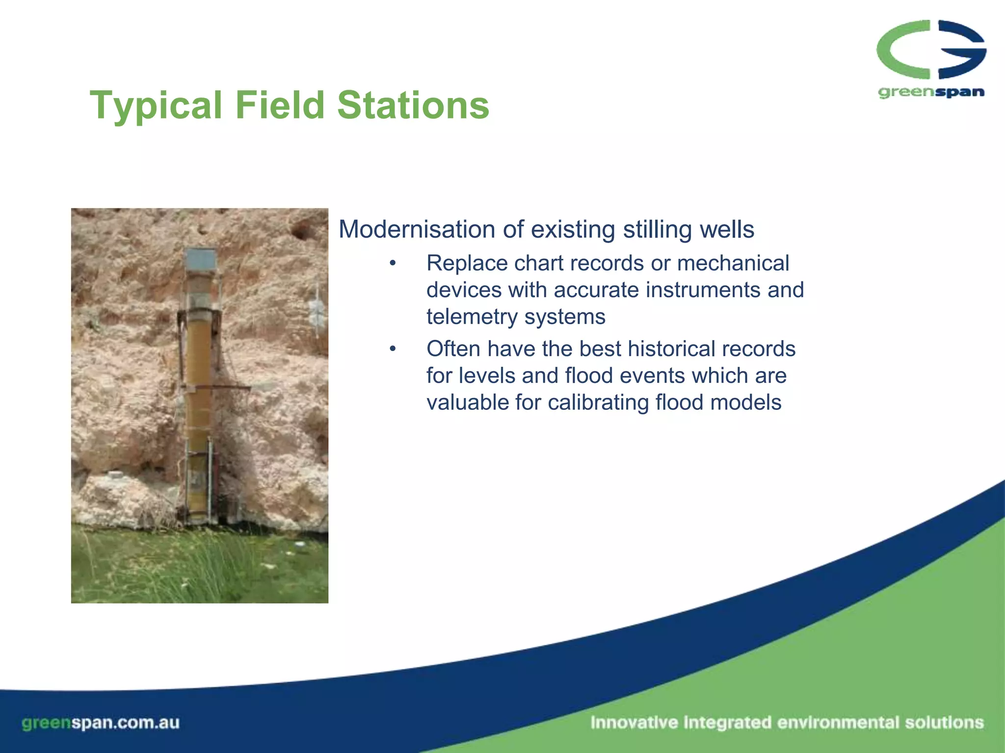
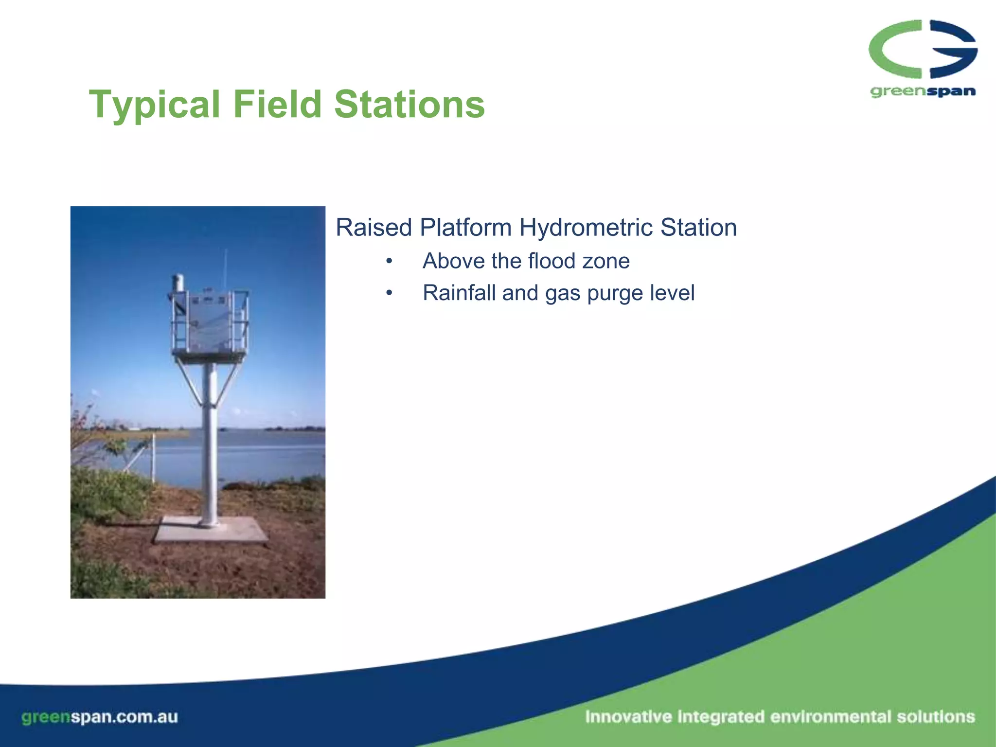
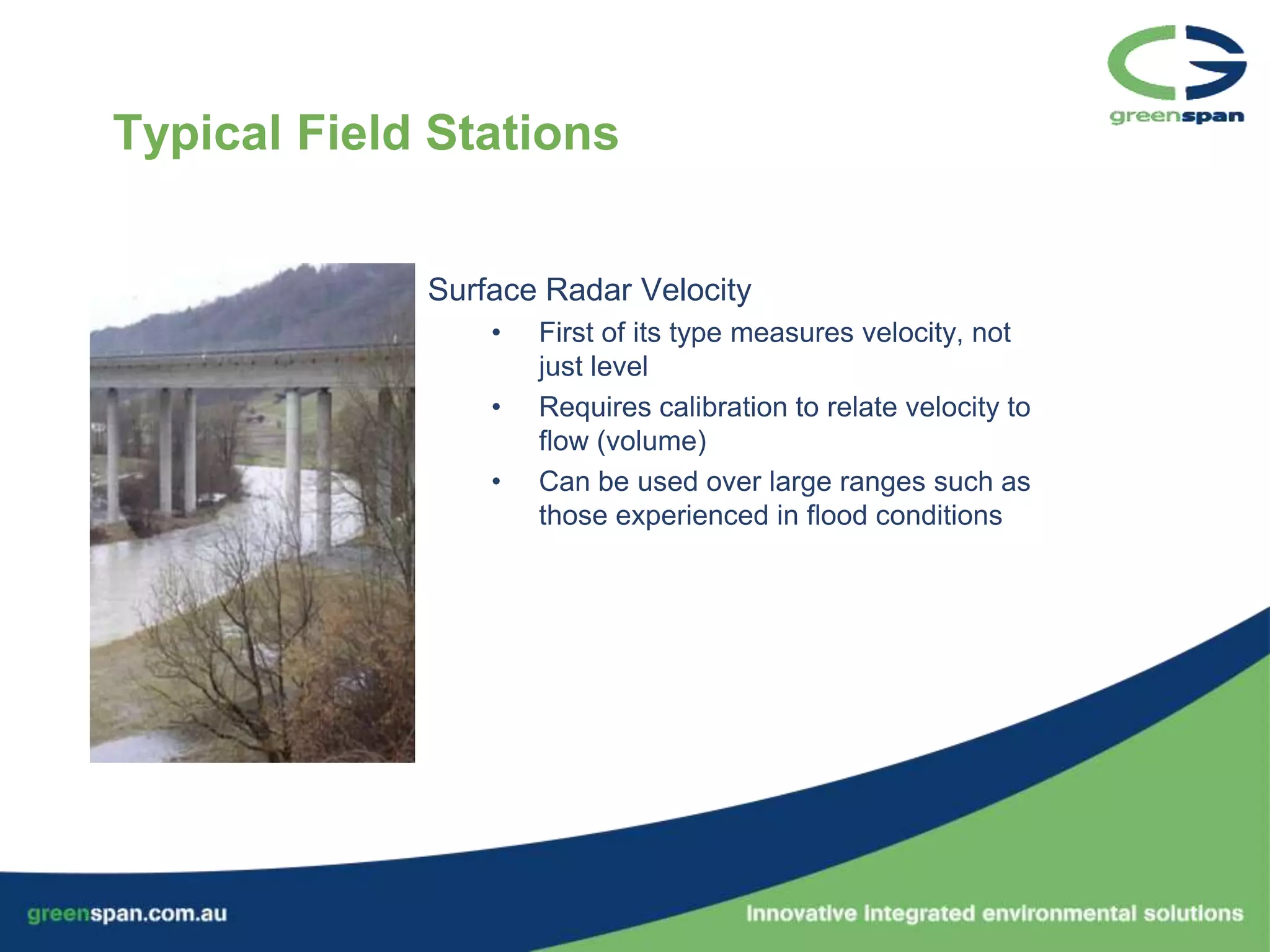
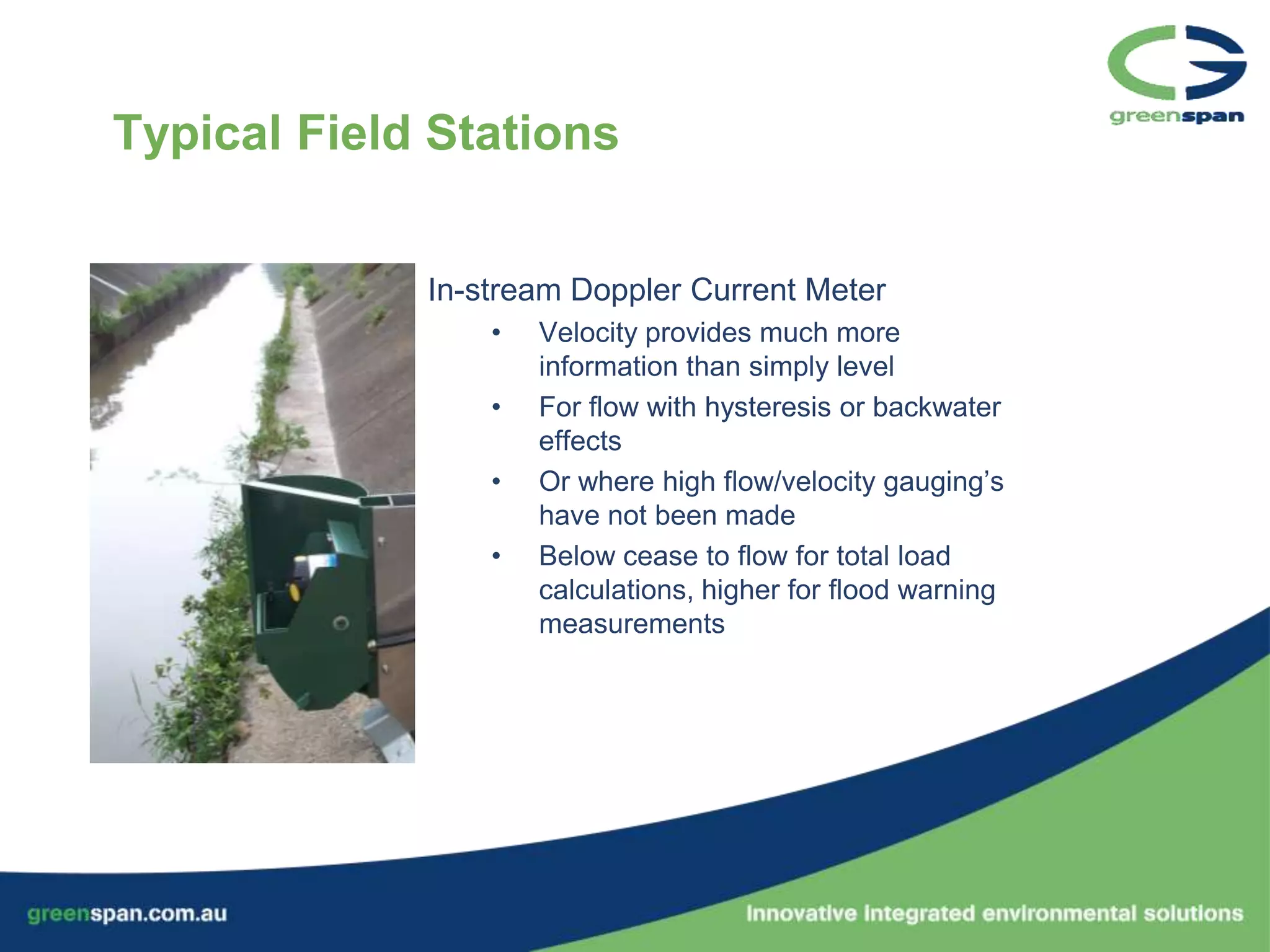
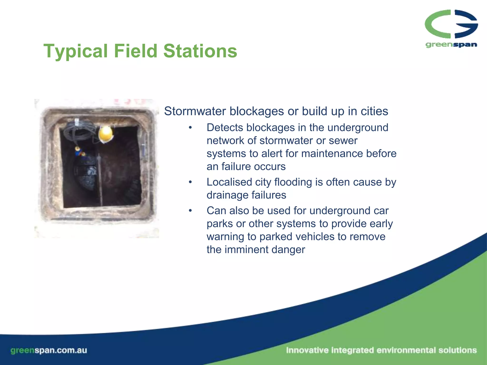
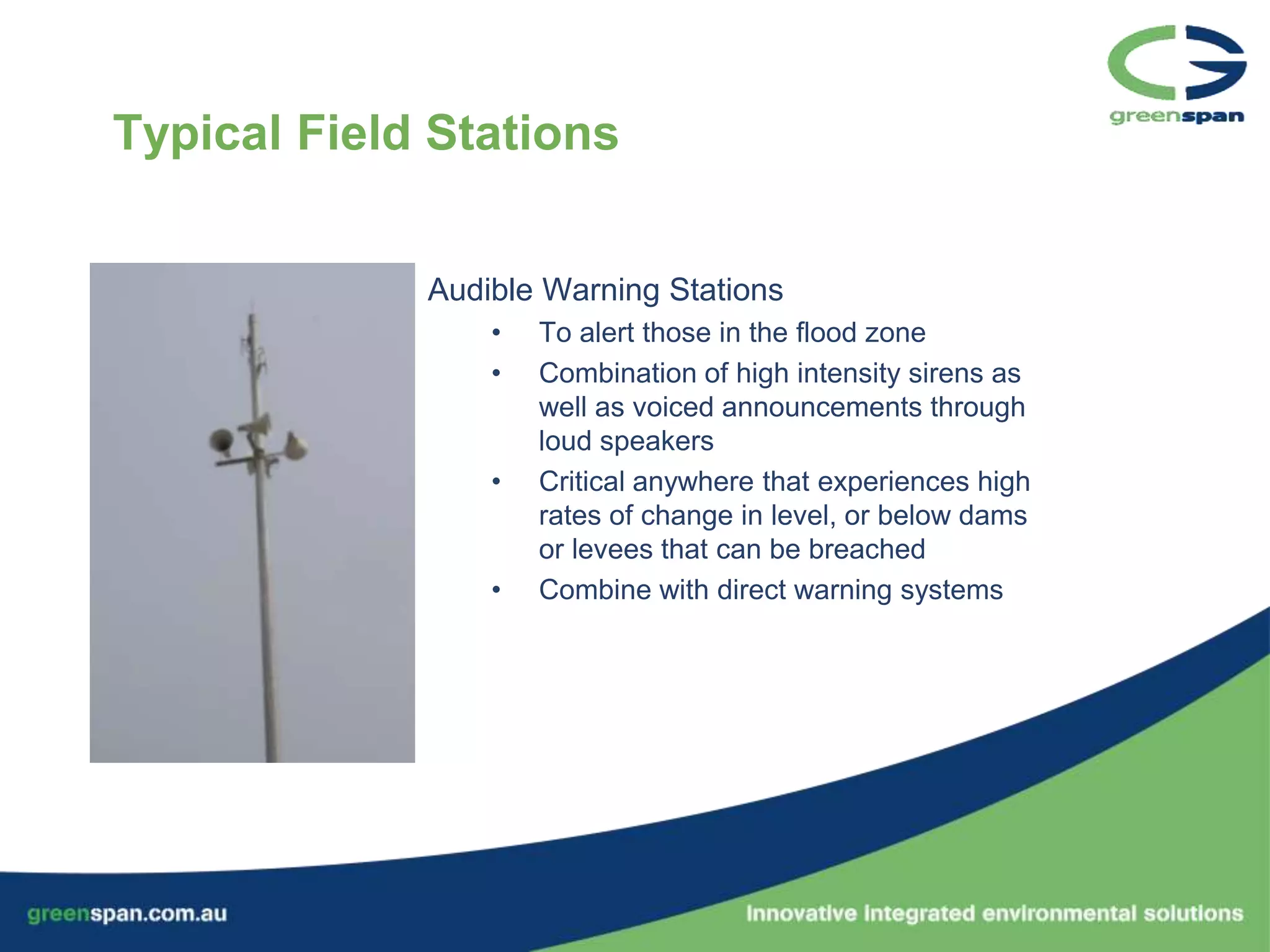
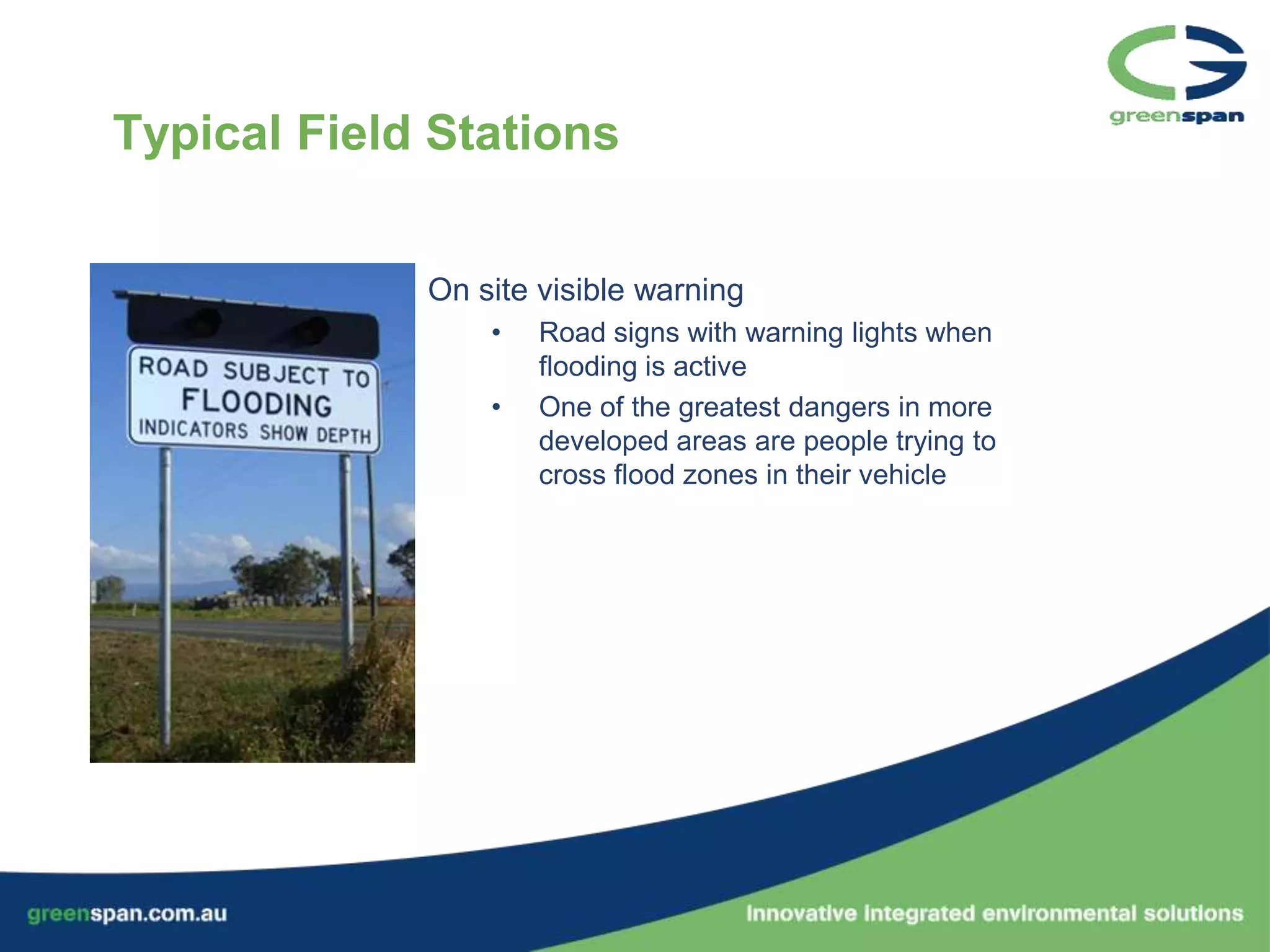
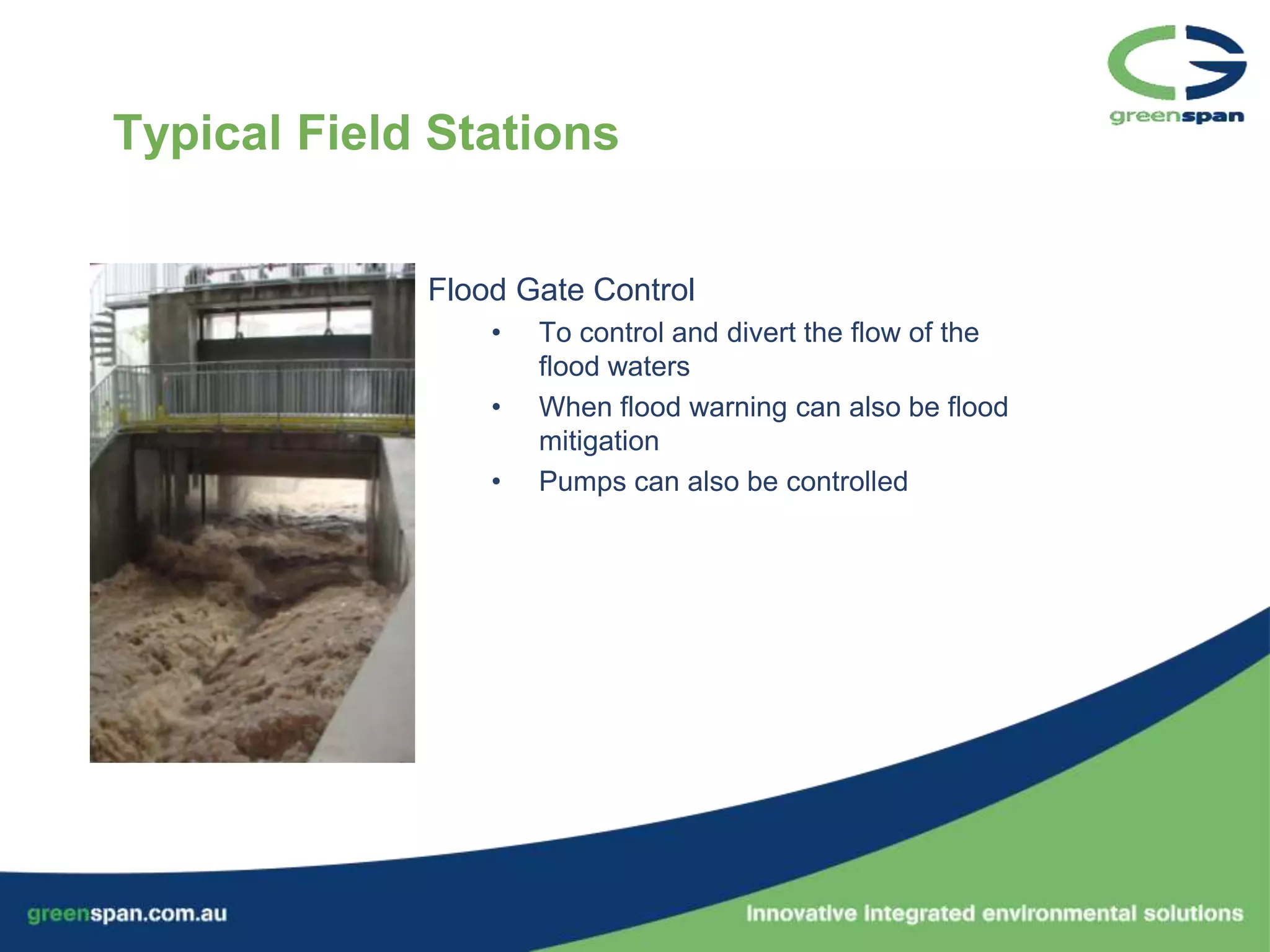
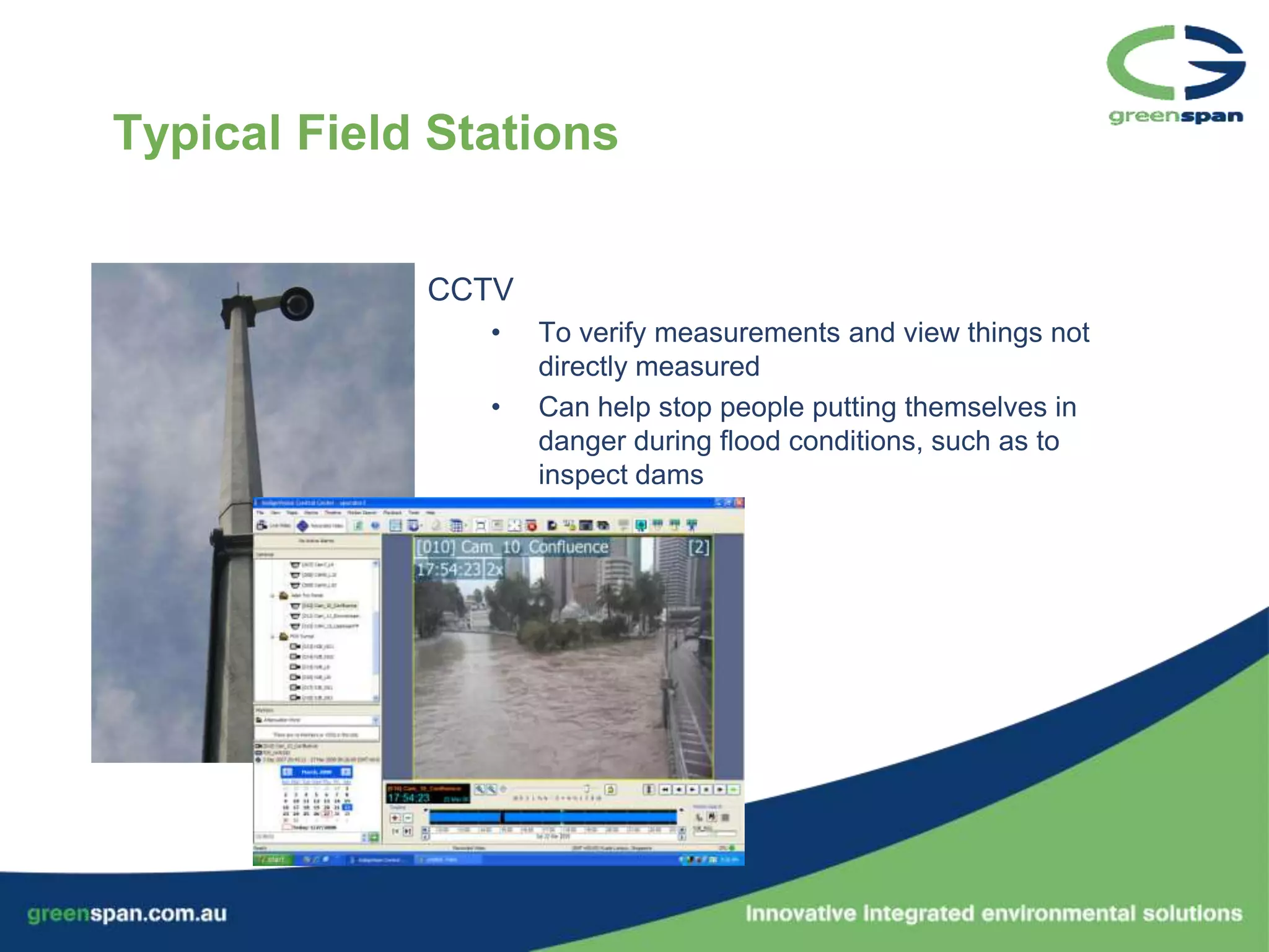
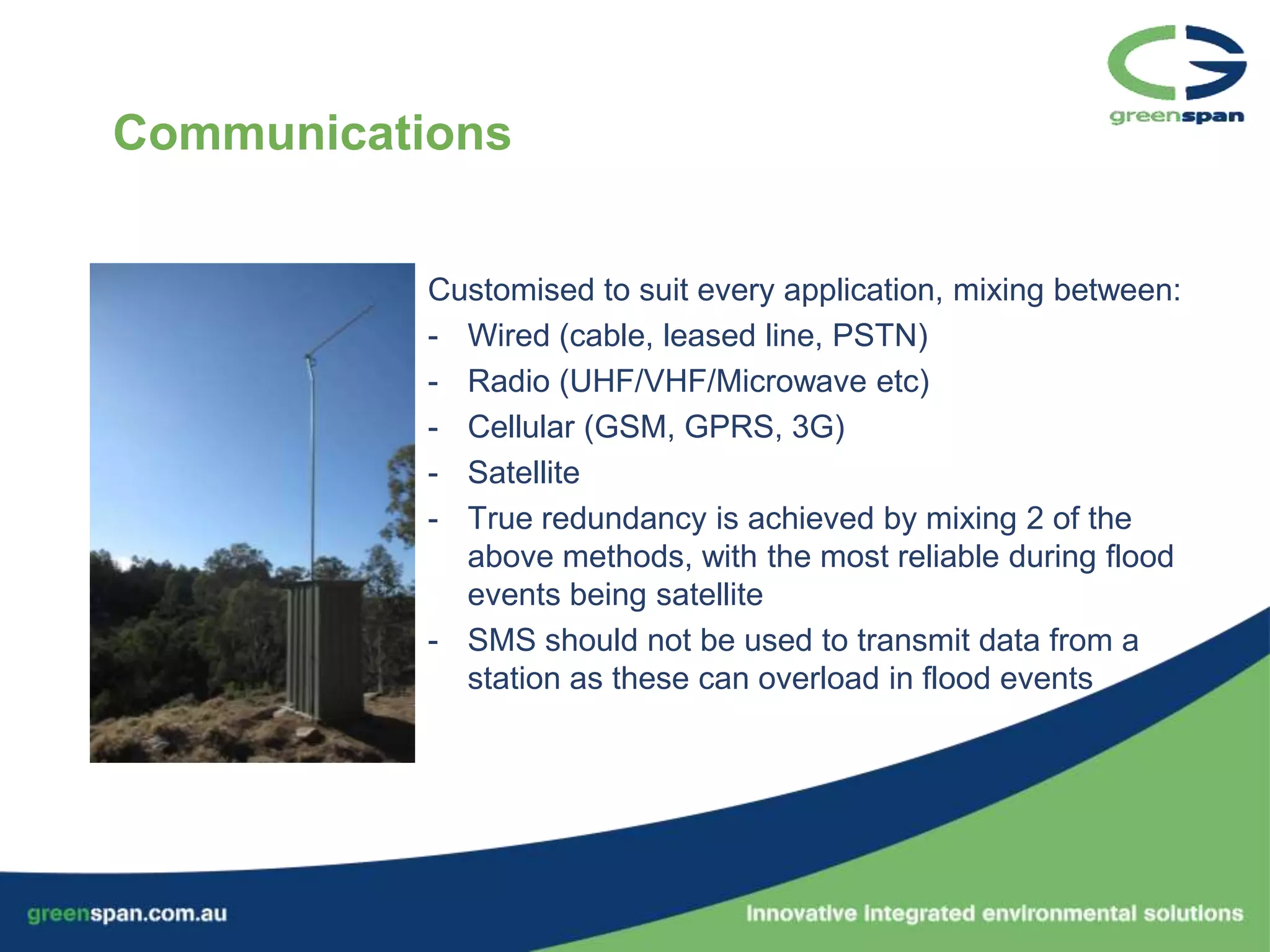
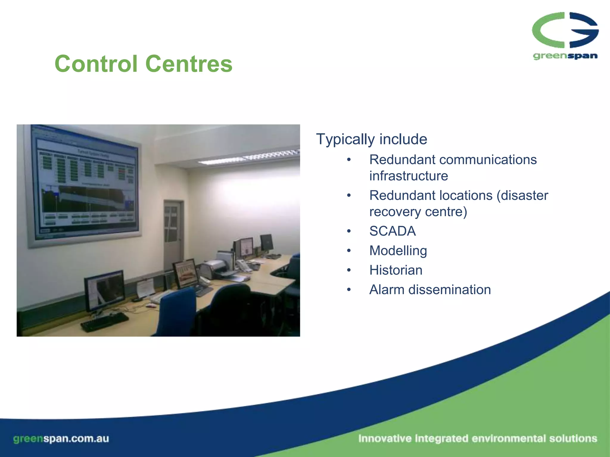
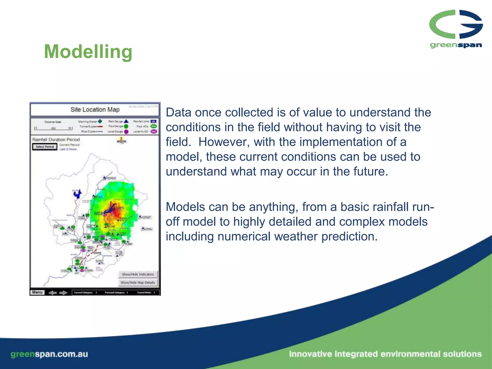
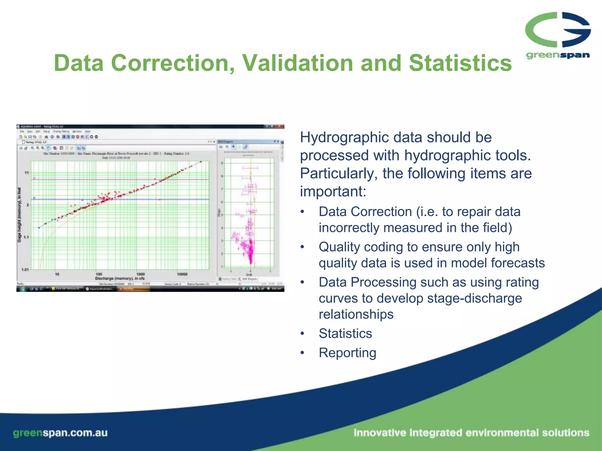
A reputation for delivering innovative,
  integrated environmental systems
               globally
Presentation Outline

•   Who are Greenspan?
•   What projects have we completed?
•   Flood Warning Systems
     –   What is a typical flood warning system
     –   Field Stations
     –   Communications
     –   Base Stations
     –   The path forward
Flood Warning
   Who are Greenspan?      Systems


                                   Hydrographic &
Irrigation                          Water Quality
Solutions


 Water Infrastructure
     Monitoring                         Oceanographic
Who are Greenspan?


                                                2010
                                  2000          • >100 Australian Projects
                                  • Purchased   • Coffs Harbour, Brisbane,
                                    by Tyco       Sydney, Perth,
                   1998                           Singapore, Kuala
                   • First >$1m                   Lumpur, Vancouver
                     project                    • World leading projects:
                                                  • SMART,
     1995                                         • Yangtze,
     • 2 offices                                  • Environment Canada
Our Staff

                 And Vancouver!         •    Experts comprising:
Malaysia                                      – Hydrologists, Hydrographers and
                                                Scientists
 Singapore                                    – Engineers (Installation & Service)
                                                  • Civil, Mechanical, Chemical,
                                                    Instrumentation, IT
                                              – Project Managers
                                              – Factory and Field Technicians
                                              – Consultants
           Newcastle        Brisbane          – Sales and Marketing
                             Coffs Harbour    – Administrative
    Perth
                           Sydney        •   Leading experts, all in-house

                       Hobart
Our Affiliations

 •   Campbell Scientific
      – Asian distributor for environmental
        monitoring projects
 •   Control Microsystems
      – Regional Representation and
        SCADAPartner Integrator
 •   Aquatic Informatics
      – Alliance Partner
      – Distributor for Asia, Pacific and
        Middle East

Although we are affiliated with these companies, we are free to choose the most
suitable product for each application. Companies that manufacture
everything in house have a tendency to recommend their
products when others may be more suitable.
Our Projects

         Environment Canada                Yangtze River 3 Gorges
         Hydrometric Network               Dam
                                                  Malaysian SMART Tunnel
     Khuzestan Water                                Singapore Overflow
     Quality Initiative                             Network


          Kenya            Indonesian
          Hydrometric     Hydro-Electric            Over 100 projects in
          Network         Power Plants              Australia
                                                     (including QLD Main roads FWS
                                                     and Coffs Harbour FWS design)
Flood Event Review – Hurricane Katrina

•   Costliest natural disaster in the history
    of the US
     – USD$81b, >1,836 deaths
•   Most severe loss of life in New Orleans
    when the levee system (2000 miles)
    failed, resulting in lawsuit against US
    Army Corp of Engineers.
•   Canal design helped funnel storm
    surge to at 20% height to the flood and
    make it much faster
•   WMO, BoM, USGS promote “Live with
    the flood”
The goal of a flood warning system

• To provide timely measurement and modelling of
  flood potential to areas at risk
• Engineer a system that will not fail during flood
  conditions
• Maximise the ability of those who are charged
  with the responsibility for preserving life to have
  sufficient warning of impending danger.
Typical Field Stations


             Weather Stations
                 •   To provide data to model storm
                     potential
                 •   To measure when the storm starts and
                     the intensity of the storm
                 •   To understand dynamic conditions that
                     have an impact on flood run off, such
                     as soil moisture
                 •   To collect valuable meteorological data
                     for historical data set
Typical Field Stations


             Upper Catchment Rainfall
                 •   Early warning indicator
                 •   Quantify what the models have
                     predicted
                 •   Without meteorological models, these
                     are the first indicator, along with
                     weather conditions
Typical Field Stations


             Modernisation of existing stilling wells
                 •   Replace chart records or mechanical
                     devices with accurate instruments and
                     telemetry systems
                 •   Often have the best historical records
                     for levels and flood events which are
                     valuable for calibrating flood models
Typical Field Stations


             Raised Platform Hydrometric Station
                 •   Above the flood zone
                 •   Rainfall and gas purge level
Typical Field Stations


             Surface Radar Velocity
                 •   First of its type measures velocity, not
                     just level
                 •   Requires calibration to relate velocity to
                     flow (volume)
                 •   Can be used over large ranges such as
                     those experienced in flood conditions
Typical Field Stations


             In-stream Doppler Current Meter
                 •   Velocity provides much more
                     information than simply level
                 •   For flow with hysteresis or backwater
                     effects
                 •   Or where high flow/velocity gauging’s
                     have not been made
                 •   Below cease to flow for total load
                     calculations, higher for flood warning
                     measurements
Typical Field Stations


             Stormwater blockages or build up in cities
                 •   Detects blockages in the underground
                     network of stormwater or sewer
                     systems to alert for maintenance before
                     an failure occurs
                 •   Localised city flooding is often cause by
                     drainage failures
                 •   Can also be used for underground car
                     parks or other systems to provide early
                     warning to parked vehicles to remove
                     the imminent danger
Typical Field Stations


             Audible Warning Stations
                 •   To alert those in the flood zone
                 •   Combination of high intensity sirens as
                     well as voiced announcements through
                     loud speakers
                 •   Critical anywhere that experiences high
                     rates of change in level, or below dams
                     or levees that can be breached
                 •   Combine with direct warning systems
Typical Field Stations


             On site visible warning
                 •   Road signs with warning lights when
                     flooding is active
                 •   One of the greatest dangers in more
                     developed areas are people trying to
                     cross flood zones in their vehicle
Typical Field Stations


             Flood Gate Control
                 •   To control and divert the flow of the
                     flood waters
                 •   When flood warning can also be flood
                     mitigation
                 •   Pumps can also be controlled
Typical Field Stations


             CCTV
                •   To verify measurements and view things not
                    directly measured
                •   Can help stop people putting themselves in
                    danger during flood conditions, such as to
                    inspect dams
Communications


           Customised to suit every application, mixing between:
           - Wired (cable, leased line, PSTN)
           - Radio (UHF/VHF/Microwave etc)
           - Cellular (GSM, GPRS, 3G)
           - Satellite
           - True redundancy is achieved by mixing 2 of the
             above methods, with the most reliable during flood
             events being satellite
           - SMS should not be used to transmit data from a
             station as these can overload in flood events
Control Centres


                  Typically include
                      •   Redundant communications
                          infrastructure
                      •   Redundant locations (disaster
                          recovery centre)
                      •   SCADA
                      •   Modelling
                      •   Historian
                      •   Alarm dissemination
Modelling


            Data once collected is of value to understand the
            conditions in the field without having to visit the
            field. However, with the implementation of a
            model, these current conditions can be used to
            understand what may occur in the future.

            Models can be anything, from a basic rainfall run-
            off model to highly detailed and complex models
            including numerical weather prediction.
Data Correction, Validation and Statistics


                      Hydrographic data should be
                      processed with hydrographic tools.
                      Particularly, the following items are
                      important:
                      •   Data Correction (i.e. to repair data
                          incorrectly measured in the field)
                      •   Quality coding to ensure only high
                          quality data is used in model forecasts
                      •   Data Processing such as using rating
                          curves to develop stage-discharge
                          relationships
                      •   Statistics
                      •   Reporting
RECAP:
The goal of a flood warning system

• To provide timely measurement and modelling of
  flood potential to areas at risk
• Engineer a system that will not fail during flood
  conditions
• Maximise the ability of those who are charged
  with the responsibility for preserving life to have
  sufficient warning of impending danger.
Where to from here?

•   Make sure that there is a commitment to save lives and property
    through the investment required to engineer a suitable solution
•   Develop a scope of works and specification through expert
    consultancy
•   Manage the project implementation

•   We highly recommend a visit to the Stormwater Management And
    Road Tunnel (SMART) in Kuala Lumpur if at all possible as it is
    an excellent example of the topics discussed here today.

Flood Warning Systems - A practical approach

  • 1.
    A reputation fordelivering innovative, integrated environmental systems globally
  • 2.
    Presentation Outline • Who are Greenspan? • What projects have we completed? • Flood Warning Systems – What is a typical flood warning system – Field Stations – Communications – Base Stations – The path forward
  • 3.
    Flood Warning Who are Greenspan? Systems Hydrographic & Irrigation Water Quality Solutions Water Infrastructure Monitoring Oceanographic
  • 4.
    Who are Greenspan? 2010 2000 • >100 Australian Projects • Purchased • Coffs Harbour, Brisbane, by Tyco Sydney, Perth, 1998 Singapore, Kuala • First >$1m Lumpur, Vancouver project • World leading projects: • SMART, 1995 • Yangtze, • 2 offices • Environment Canada
  • 5.
    Our Staff And Vancouver! • Experts comprising: Malaysia – Hydrologists, Hydrographers and Scientists Singapore – Engineers (Installation & Service) • Civil, Mechanical, Chemical, Instrumentation, IT – Project Managers – Factory and Field Technicians – Consultants Newcastle Brisbane – Sales and Marketing Coffs Harbour – Administrative Perth Sydney • Leading experts, all in-house Hobart
  • 6.
    Our Affiliations • Campbell Scientific – Asian distributor for environmental monitoring projects • Control Microsystems – Regional Representation and SCADAPartner Integrator • Aquatic Informatics – Alliance Partner – Distributor for Asia, Pacific and Middle East Although we are affiliated with these companies, we are free to choose the most suitable product for each application. Companies that manufacture everything in house have a tendency to recommend their products when others may be more suitable.
  • 7.
    Our Projects Environment Canada Yangtze River 3 Gorges Hydrometric Network Dam Malaysian SMART Tunnel Khuzestan Water Singapore Overflow Quality Initiative Network Kenya Indonesian Hydrometric Hydro-Electric Over 100 projects in Network Power Plants Australia (including QLD Main roads FWS and Coffs Harbour FWS design)
  • 8.
    Flood Event Review– Hurricane Katrina • Costliest natural disaster in the history of the US – USD$81b, >1,836 deaths • Most severe loss of life in New Orleans when the levee system (2000 miles) failed, resulting in lawsuit against US Army Corp of Engineers. • Canal design helped funnel storm surge to at 20% height to the flood and make it much faster • WMO, BoM, USGS promote “Live with the flood”
  • 9.
    The goal ofa flood warning system • To provide timely measurement and modelling of flood potential to areas at risk • Engineer a system that will not fail during flood conditions • Maximise the ability of those who are charged with the responsibility for preserving life to have sufficient warning of impending danger.
  • 10.
    Typical Field Stations Weather Stations • To provide data to model storm potential • To measure when the storm starts and the intensity of the storm • To understand dynamic conditions that have an impact on flood run off, such as soil moisture • To collect valuable meteorological data for historical data set
  • 11.
    Typical Field Stations Upper Catchment Rainfall • Early warning indicator • Quantify what the models have predicted • Without meteorological models, these are the first indicator, along with weather conditions
  • 12.
    Typical Field Stations Modernisation of existing stilling wells • Replace chart records or mechanical devices with accurate instruments and telemetry systems • Often have the best historical records for levels and flood events which are valuable for calibrating flood models
  • 13.
    Typical Field Stations Raised Platform Hydrometric Station • Above the flood zone • Rainfall and gas purge level
  • 14.
    Typical Field Stations Surface Radar Velocity • First of its type measures velocity, not just level • Requires calibration to relate velocity to flow (volume) • Can be used over large ranges such as those experienced in flood conditions
  • 15.
    Typical Field Stations In-stream Doppler Current Meter • Velocity provides much more information than simply level • For flow with hysteresis or backwater effects • Or where high flow/velocity gauging’s have not been made • Below cease to flow for total load calculations, higher for flood warning measurements
  • 16.
    Typical Field Stations Stormwater blockages or build up in cities • Detects blockages in the underground network of stormwater or sewer systems to alert for maintenance before an failure occurs • Localised city flooding is often cause by drainage failures • Can also be used for underground car parks or other systems to provide early warning to parked vehicles to remove the imminent danger
  • 17.
    Typical Field Stations Audible Warning Stations • To alert those in the flood zone • Combination of high intensity sirens as well as voiced announcements through loud speakers • Critical anywhere that experiences high rates of change in level, or below dams or levees that can be breached • Combine with direct warning systems
  • 18.
    Typical Field Stations On site visible warning • Road signs with warning lights when flooding is active • One of the greatest dangers in more developed areas are people trying to cross flood zones in their vehicle
  • 19.
    Typical Field Stations Flood Gate Control • To control and divert the flow of the flood waters • When flood warning can also be flood mitigation • Pumps can also be controlled
  • 20.
    Typical Field Stations CCTV • To verify measurements and view things not directly measured • Can help stop people putting themselves in danger during flood conditions, such as to inspect dams
  • 21.
    Communications Customised to suit every application, mixing between: - Wired (cable, leased line, PSTN) - Radio (UHF/VHF/Microwave etc) - Cellular (GSM, GPRS, 3G) - Satellite - True redundancy is achieved by mixing 2 of the above methods, with the most reliable during flood events being satellite - SMS should not be used to transmit data from a station as these can overload in flood events
  • 22.
    Control Centres Typically include • Redundant communications infrastructure • Redundant locations (disaster recovery centre) • SCADA • Modelling • Historian • Alarm dissemination
  • 23.
    Modelling Data once collected is of value to understand the conditions in the field without having to visit the field. However, with the implementation of a model, these current conditions can be used to understand what may occur in the future. Models can be anything, from a basic rainfall run- off model to highly detailed and complex models including numerical weather prediction.
  • 24.
    Data Correction, Validationand Statistics Hydrographic data should be processed with hydrographic tools. Particularly, the following items are important: • Data Correction (i.e. to repair data incorrectly measured in the field) • Quality coding to ensure only high quality data is used in model forecasts • Data Processing such as using rating curves to develop stage-discharge relationships • Statistics • Reporting
  • 25.
    RECAP: The goal ofa flood warning system • To provide timely measurement and modelling of flood potential to areas at risk • Engineer a system that will not fail during flood conditions • Maximise the ability of those who are charged with the responsibility for preserving life to have sufficient warning of impending danger.
  • 26.
    Where to fromhere? • Make sure that there is a commitment to save lives and property through the investment required to engineer a suitable solution • Develop a scope of works and specification through expert consultancy • Manage the project implementation • We highly recommend a visit to the Stormwater Management And Road Tunnel (SMART) in Kuala Lumpur if at all possible as it is an excellent example of the topics discussed here today.