Morphometric Analysis to Identify Erosion Prone Areas on the Upper Blue Nile ...IRJET Journal
This document presents a morphometric analysis of the Didessa and Jema sub-basins in Ethiopia using GIS to identify erosion prone areas. Digital elevation data was analyzed to delineate the sub-watershed boundaries and stream networks. Various linear, areal, and relief morphometric parameters were computed, including stream order, bifurcation ratio, drainage density, stream frequency, circularity ratio, and relief ratio. These parameters were used to rank the sub-watersheds based on their erosion potential. The results showed that the Jema sub-watershed covers a larger area (49.45%) of high priority erosion prone land compared to the Didessa sub-watershed (29.85%). This indicates
IJERA (International journal of Engineering Research and Applications) is International online, ... peer reviewed journal. For more detail or submit your article, please visit www.ijera.com
IRJET- Preparation of Flood Model and Hazard Estimation on Yamuna River (...IRJET Journal
1. The document describes a study that used GIS and remote sensing techniques to create flood models and estimate flood hazards along the Yamuna River in Delhi, India.
2. The study analyzed satellite imagery to identify flood-prone areas, calculate the extent of flooded areas during extreme events, and assess flood risks to infrastructure, agriculture lands, and urban areas.
3. The results indicated approximately 19.5 square kilometers of land within 500 meters of the Yamuna River boundary is affected by floods, including over 2.8 square kilometers of urban settlements and 2.1 square kilometers of forest area. Thematic maps were generated to visualize the flood risk to different geographical features.
IRJET- Rainfall-Runoff Analysis of the Watershed for River AIEIRJET Journal
This document summarizes a study analyzing the rainfall-runoff relationship of the Aie River watershed in Bhutan using the Soil and Water Assessment Tool (SWAT) model. Key steps included delineating the watershed boundaries using ASTER DEM data, defining land use and soil types, acquiring meteorological data, running hydrologic simulations from 1995-2014, and analyzing the water balance. The SWAT model effectively simulated the rainfall-runoff dynamics in the ungauged watershed and provided insights into its hydrologic response to precipitation patterns.
A Holistic Approach for Determining the Characteristic Flow on Kangsabati Cat...ijceronline
Kangsabati river rises from the Chotanagpur plateau in the state of West Bengal, India and passes through the districts of Purulia, Bankura and Paschim Medinipur in West Bengal before joining into river Rupnarayan. It is life of these three districts of West Bengal situated in the western part of the state. The river has ephemeral characteristics i.e. it has low flow in the year round and have a high peak on a certain time basis. In the Kangasabati catchment hydrological study gives an evident that during the period every two years there is a chance of drought condition and consecutively after that there is a high flow year. In our study period from 1991 to 2010 there are six low streamflow year i.e. in that year there is less rainfall than the average rainfall on that area. The year 1991, 2002 and 2009 are the drought prone year and above that in 2010 the severe drought condition was seen and this is the lowest rainfall year among the last 20 years and the rainfall on this year is only 766 mm which is in an about 38% less rainfall than the average rainfall of the catchment. And the highest flood peak in the last twenty year is noted on 19th Aug 2007 as 377107.8 Mm3
The document provides background on assessing the surface water potential of the Omo-Gibe River Basin in Ethiopia. It discusses:
1) Ethiopia has significant water resources but little has been developed for agriculture, industry, and hydropower due to lack of research and management. The Omo-Gibe Basin faces water scarcity and competition between sectors.
2) Accurate assessment of surface water potential and demands is needed to address water problems. Previous studies of the basin were limited.
3) The study aims to assess the basin's surface water potential by dividing it into watersheds and using the SWAT model, in order to inform management of water resources for development.
DSD-SEA 2019 Seasonal drought forecasting using state-of-the-art hydro softwa...Deltares
Presentation by Mr. Irfan Sudono, MT Research Center for Water Resources – Ministry of Public Works and Housing (Indonesia) at the Seminar Hydro Software to support policy development and real-time decision making, during the Deltares Software Days South-East Asia 2019. Wednesday, 27 November 2019, Bangkok.
Evaluations of Stream Flow Response to Land use and Land Cover Changes in Wab...IJCMESJOURNAL
Land Use and Land Cover Change (LU/LC) is one of the notable human induced worldwide changes. Hence, understanding the stream flow responses of a watershed to this dynamic change is becoming fundamental for water resources management planning. The study was conducted with the objective to analyses the impact of Land use and Land cover changes on stream flow response of Wabe watershed, in Omo-Gibe basin. Land use and land cover maps were developed using satellite image of Landsat5 TM 1988, Landsat7 ETM+ 2001 and Landsat8 OLI/TIRS 2018 through maximum likelihood algorithm of supervised classification using ERDAS Imagine 2014 and ArcGIS software for satellite image processing and map preparation. A physical based, semi-distributed hydrological model SWAT was used to simulate LU/LC change effects on the stream flow responses of watershed. During the study period the land use and land cover has changed due to natural and anthropogenic activity. The results depicted that there was an incessant expansion of agricultural land, built-up area and forest cover, on the other hand declining of agroforestry; grassland and woodland were happened during from the 1988 to 2018 periods. Due to the occurred LU/LC changes, the mean monthly stream flow were increased by 5.97m3/s for wet season and similarly the dry season flow showed increasing by 0.96m3/s during the study periods from 1988 up to 2018. Generally the result indicated that large changes of the stream flow in the watershed. Hence result notified an urgent intervention, so as to regulate the LU/LC change and to reduce its strong impacts on the stream flow of the Wabe watershed.
This document discusses the use of Geographic Information Systems (GIS) in disaster management. It begins with introductions to disaster management and GIS. It then reviews literature on previous applications of GIS to flood risk management and urbanization. The document presents two case studies, one on using GIS to manage flood risk in Allahabad, India, and another on tsunami risk analysis and evacuation planning in Gocek, Turkey. Both cases demonstrate how GIS can be used to map hazardous areas, infrastructure, and plan emergency responses. The document concludes that GIS is a valuable tool for disaster managers to obtain spatial data and visualize information needed for planning and response.
Since the recent development of UAVs(Unmanned Aerial Vehicles) and digital sensors technology has enabled the acquisition of high-resolution image data, it is considered that the image data of riverside can be analysed. Therefore, this study analyses the applicability of remote sensing techniques through image analysis in river systems and habitats. The target stream in this study was the Cheongmi stream and the applicability of the river environmental evaluation technique was analysed through image analysis. The satellite images used for the analysis of river topography and environments were compared with the aerial images taken by a micro UAV), and the river environmental evaluation was carried out with the field research at the same time. The data acquisition range and application limit by river environmental evaluation technique proposed previously were evaluated, and as a result, it was found that it was possible to draw various evaluation parameters using a drone that could take an image at a low altitude in comparison to satellite images.
This document provides an overview of water harvesting techniques presented by Mengistu Zantet, a lecturer in hydraulic and water resources engineering at Mizan Tepi University. It defines water harvesting, outlines its principles and design considerations, and describes various techniques including micro catchments, external catchment systems, and floodwater farming. Key points covered include catchment types, design criteria, and categories of water harvesting systems for plant production.
Feasibility of direct pumping for irrigation improvement projectsIAEME Publication
This document summarizes a study on replacing head tanks with air valves at irrigation pumping stations to reduce costs. Field measurements were taken at 3 pumping stations and numerical simulations were performed. The simulations matched field measurements well. The study found that replacing head tanks with air valves would not negatively impact pipeline safety during power failures and could save about 606 Egyptian pounds per feddan irrigated. Therefore, using air valves is a feasible way to lower the costs of irrigation improvement projects.
IDENTIFICATION OF GROUNDWATER POTENTIAL ZONES USING REMOTE SENSING AND GEOGRA...IAEME Publication
The document describes a study that used remote sensing and GIS techniques to identify groundwater potential zones in the Konakaluva sub-basin of India. Various thematic maps were generated from satellite imagery and other data sources. These maps were overlaid and assigned weights based on their influence on groundwater occurrence. Soil data was given the highest weight of 40%, while land use/cover and drainage density were also significant at 25% and 10%, respectively. An integrated groundwater potential zones map was produced that classified areas as very good, good, fair, moderate or poor potential zones based on the overlay analysis. The results can help with better planning and management of groundwater resources in the study area.
Application of Swat Model for Generating Surface Runoff and Estimation of Wat...IRJET Journal
This document describes using the SWAT hydrological model to simulate rainfall-runoff and estimate water availability in the 800 sqkm Balehonnur catchment of the Badra River basin in India. Various data inputs were used, including DEM, land use, soil, and temperature and precipitation. The model was calibrated for 1995-2010 and validated for 2011-2015, achieving R2 and NSE values of 0.878 and 0.78 for calibration and 0.869 and 0.75 for validation. Future water availability from 2021-2050 was estimated using climate change scenario data, though overestimation requires bias correction. The study aims to evaluate climate change impacts on water resources for planning.
Time Series Analysis of Rainfall in North Bangalore Metropolitan Region using...Dr Ramesh Dikpal
Rainfall studies are of utmost utility for understanding nature & hence the behaviour of climate changes. Time series is a set of observations taken at specified times usually at equal interval. The inherent variability displayed by many hydrological time series usually mask trends and periodic patterns. This situation has often led to “something” the original time series so that the effects of random variations are reduced and trends or cyclical patterns enhanced. Thus a set of data depending on time is called a Time series. Here, Rainfall series represent the time series. The time series analysis is helpful to compare the actual performance and analyse the cause of variations. By comparing different time series we can draw important conclusion. Graphical method implies in increasing trend for pre-monsoon, south-west monsoon, north-east monsoon and annually.Geo- informatics module consists of GIS mapping for Location map, Geomorphology map and Season wise Rainfall maps are generated. Autocorrelation indicates the periodicity observed as 37,16 & 6 years (PM), 12, 37 & 16 years (SWM), 8, 18 & 6 years (NEM) and 16, 22 & 8 years (Annual) respectively. Power spectral depicts the cyclicity of 37, 4 & 3 years (PM), 2, 4& 2 years (SWM), 3, 7 & 2 years (NEM) and 2, 4 & 2 years (Annual) respectively. Moving average displays prominent positive correlation coefficients at lags of 18 to 42 years in PM & SWM and 12 to 24 years in NEM & Annual. The southwest and southeast parts of the study area experience the heavy rainfall whereas the least rainfall areas are the northern parts of the study area.The short term and long term cyclicity observed in Autocorrelation, power spectrum and Moving Average. Spatial variation of rainfall for the three seasons and annual has been studied
23 - NRSC - Remote Satellite Imgae - Hydrology and Water Management-Sep-17indiawrm
This document discusses the use of satellite remote sensing for hydrology and water management applications. It provides examples of how satellite data can be used to monitor surface water bodies, snow cover, soil moisture, precipitation and other variables. It also describes how satellite data has been used to assess irrigation potential, monitor irrigation tanks and reservoirs, model hydrology and forecast flooding. The satellite data provides valuable information to support water resources management.
Delineation of irrigation infrastructural, potential and land useIAEME Publication
This study assessed irrigation infrastructure in Muzaffarnagar district, India using satellite imagery. The main canals are Tikri Branch, Nirpura Branch, and Kurthal Branch, with several minor canals branching off. Satellite imagery was used to measure canal lengths and compare to official data. Most canal lengths matched well, but Gadidbra minor was found to be shorter than officially reported. Irrigation potentials were also estimated and found to match closely with official data, except for Gadidbra minor which had lower potential than expected due to its shorter length. Land use/land cover of the study area was classified, finding agricultural land covers 48.64% of the total area.
This document presents a methodology for improved groundwater monitoring and management in Saudi Arabia. The methodology involves:
1. Frequently monitoring groundwater wells to determine optimal sampling frequencies for different water quality parameters.
2. Analyzing parameter changes using geostatistics techniques to generate predictive 3D models and contour maps.
3. Developing a virtual instrument using data fusion techniques to predict levels of sensitive parameters and future variations.
4. Proposing a nanotechnology treatment using titanium photocatalysis to degrade toxic contaminants and heavy metals in groundwater.
The goal is to develop an advanced monitoring program that implements new modeling techniques to better monitor, analyze, predict, and treat groundwater resources in the
Sachpazis: ewra2005, A Hydrogeotechnical Integrated SystemDr.Costas Sachpazis
«A Hydrogeotechnical Integrated System for Water Resources Management of Attica – Greece». Presented in the 6th International Conference of the European Water Resources Association (EWRA2005), held in Menton (France) on 7-10 September 2005. Cooperation with Manoliadis Odysseus, Baronos Athina, and Tsapraili Chrysanthy. 2005
Assessment of climate change impact on water availability of bilate watershed...Alexander Decker
This document assesses the impact of climate change on water availability in the Bilate watershed in Ethiopia. It uses the HadCM3 climate model and Statistical Downscaling Model (SDSM) to develop climate change scenarios for precipitation and temperature. These scenarios are input into the Soil and Water Assessment Tool (SWAT) hydrological model to simulate future streamflow. SWAT simulations indicate streamflow may decrease slightly by 3.7% for the 2011-2040 period under an A2a emissions scenario but increase up to 3.7% for the 2041-2070 period under a B2a scenario. Adopting water storage options could help address potential future water demand and flow issues.
SWaRMA_IRBM_Module2_#5, Role of hydrometeorological monitoring for IRBM in Ne...ICIMOD
This presentation is the part of 12-day (28 January–8 February 2019) training workshop on “Multi-scale Integrated River Basin Management (IRBM) from the Hindu Kush Himalayan Perspective” organized by the Strengthening Water Resources Management in Afghanistan (SWaRMA) Initiative of the International Centre for Integrated Mountain Development (ICIMOD), and targeted at participants from Afghanistan.
Capitalising on river flow data to meet changing national needs a uk perspe...hydrologywebsite1
This document discusses initiatives in the United Kingdom to maximize the strategic utility of nationally archived river flow data. It examines the need for evolution of the UK gauging station network to meet both operational and strategic information needs. Emphasis is placed on the importance of continued dialogue between data users and those responsible for data collection to fully capitalize on existing network infrastructure and data processing capabilities. Key points discussed include categorizing stations to identify those most useful for benchmarking, monitoring impacts, regionalization studies, and integrated monitoring efforts. The creation of a national benchmark network of about 100 relatively undisturbed stations is also described.
A MODEL OF (P-GIS) FOR HYDRAULIC PROTECTION DAMS IN NORTHERN MOROCCOijait
To strengthen the quality of information, inclusion and implementation of continuous link between different categories of actors by mobilizing P-GIS as tools for participation and methodological aid to decision-making, and help to better understanding of environmental issues and challenges related
to climate change, allowing regional authorities to better analyze and process. So what we've seen, that the conventional GIS does not include certain information such as social exclusion, displacement, narrative conflicts of use of land and water, cultural stories, local politics. Hence the need to find an effective method to circumvent these problems.
So this study is based on a software solution that is supported on the geographic information system (GIS) coupled with the participatory model to give the (P-GIS). By manipulating various GIS software el descriptive data collected directly from the study area of the dam Ibn Battouta. A Data Type Model was generated to model the flow of data and related information. The delineation of protection zones will then contribute to the superposition, by adding each of the identified factors. The result of this study has created a multi-source spatial data management. This produces what is appalled the demonstration model GIS-remote sensing.'' It is based on certain factors that use parameters observed in the field and the information collected from censuses.
APPLICABILITY OF WEAP AS WATER MANAGEMENT DECISIONMarwan Haddad
This document describes using the Water Evaluation and Planning (WEAP) model as a decision support system (DSS) tool to evaluate water management options for the Tulkarem district in Palestine under different scenarios. Key points:
- WEAP was used to model the Tulkarem district water resources system, which includes municipal, agricultural, and other water demands and supplies.
- Stakeholder surveys identified the most important water management issues as agricultural management and physical/political water constraints.
- The model results can help water managers evaluate options to improve sustainable water resources development and management in the district.
Optimal operation of a multi reservoir system and performance evaluationIAEME Publication
This document summarizes an article from the International Journal of Advanced Research in Engineering and Technology that discusses optimal operation of a multi-reservoir system in India. The article develops an efficient algorithm using Discrete Differential Dynamic Programming to determine optimal policies for reservoir release from the Damodar Valley reservoir system, which consists of 4 reservoirs. The objective is to minimize deficits in water supply for irrigation, municipal, and industrial use. Two types of objective functions are used and evaluated: one that penalizes only deficits, and one that penalizes both deficits and surpluses. Performance is evaluated using reliability parameters to analyze the initial and optimal solutions.
This document summarizes a study that used geo-informatics techniques to assess river basin buffers in the Ghataprabha catchment area for engineering restoration purposes. Land cover classification of satellite imagery identified agriculture, forest, shrubs and other land uses. Digital elevation data was used to generate water bodies and buffer zones of 25-200m around streams. Buffers were divided among 3 sub-basins. Cropland areas were inventoried in buffers by sub-basin. Results showed the Ghataprabha river sub-basin had the most cropland in buffers, indicating a high priority for restoration. The study demonstrated how geo-informatics can effectively evaluate farming intensities in basin buffers to inform catchment management
This document presents a small hydro CDM project in Bosnia and Herzegovina called Jabusnica 3 for sale. It provides details about the project such as its installed power of 2.124 MW, anticipated annual production of 10,350 MWh, and preliminary calculations showing it would save 1,091 tons of CO2 per MWh produced. Financial calculations are given both without and with revenue from Certified Emission Reduction credits, showing improved returns when including this income stream. Thorough planning and understanding of local regulations is emphasized for successful small hydro projects.
Suweco Mini Hydro Development Projectsirisnicole13
The document discusses two mini-hydro plant projects in the Philippines: the 1.5 MW Solong Mini-Hydro Plant Project and the 2.1 MW Hitoma 01 Mini-Hydro Plant Project. It provides a summary of accomplishments for each project as of March 1-7, 2010, including the completion of dam/weir structures, headrace pipes, forebay structures, penstock lines, powerhouse buildings, and the installation of water turbines and sub-stations.
Given by Ir. Dr. Abang Hatta bin Abang Taha
The second in our series of workshops designed to gather input from stakeholders involved in existing off-grid projects in Africa, Asia and Latin America. This event is workshop scheduled to be held in Malaysia for the ASEAN countries will be organised by the Academy of Sciences Malaysia (ASM) in collaboration with Universiti Malaysia Sarawak (UNIMAS).
This document is a Quality Function Deployment (QFD) House of Quality document for designing a micro hydro turbine for a sewage treatment plant. It lists 10 functional requirements for the turbine and compares them to 5 explicit and implicit customer requirements. A weight chart shows the importance of each requirement to customers and technicians. Correlations between requirements and competitors are also assessed to ensure the new design meets customer needs better than other options.
This document contains the analysis of a student group for their client on the potential of a micro-hydro system on a stream in Verona. The group measured the instantaneous power of the stream to be 7.37 kW during their site visit in October. They developed a method to estimate the annual energy output using representative historical stream data. The group determined that a vertical Kaplan turbine with a 4 kW capacity would be the best design. They created an Excel spreadsheet to analyze the financial return based on the estimated annual energy and equipment costs.
Given by Chen Shiun, PhD
The second in our series of workshops designed to gather input from stakeholders involved in existing off-grid projects in Africa, Asia and Latin America. This event is workshop scheduled to be held in Malaysia for the ASEAN countries will be organised by the Academy of Sciences Malaysia (ASM) in collaboration with Universiti Malaysia Sarawak (UNIMAS).
O documento fornece informações sobre as soluções integradas da SEMI para pequenas centrais hidrelétricas, incluindo a oferta de turbinas, equipamentos hidromecânicos, penstocks, equipamentos elétricos, automação de plantas, montagem e inicialização, além de pacotes chave-na-mão. A empresa também discute sua capacidade de projeto, fabricação e instalação.
Developing and Sustaining Hydro Integrated Renewable Energy Power System (Hyd...Sammy S. Aiau
The document discusses developing and sustaining integrated renewable energy power systems for rural areas in Papua New Guinea. It provides background on PNG's energy sector, which is dominated by electricity, oil, and gas. PNG Power Limited is responsible for generation and distribution but only 7% of the population has access to electricity. The presentation outlines PNG's renewable energy resources including hydro, solar, and wind. It also discusses a case study of the Wantun micro-hydro project and proposes micro-grid systems and various business models to power rural micro-grids, emphasizing private sector participation and subsidies.
The document discusses Flygt hydro turbines produced by Xylem. It provides an overview of Flygt's history in developing submersible pumps and turbines since 1947. Flygt offers a range of submersible hydro turbines that are reliable, efficient, and easy to install. Their turbines can be used across a variety of site conditions and applications. The document provides specifications for Flygt's turbine models and details their design features. It also discusses Xylem's aftermarket support services to optimize turbine performance.
Coanda Power Systems aims to simplify small hydroelectric power development through innovative equipment. Their modular and pre-engineered solutions can lower costs and simplify the permitting, design, installation, and operation of micro, mini, and small hydro plants. Their equipment includes Coanda intake screens, turbines optimized for low heads, modular powerhouses, and switchgear components. Their goal is to make small hydro power simple and cost-effective to help meet global energy needs.
This document provides a guide to developing mini-hydroelectric schemes in the UK. It covers the basics of hydropower generation, the key steps and considerations in developing a project, including assessing site characteristics, commissioning feasibility studies, obtaining necessary planning and licenses, evaluating costs and economics, contracting construction, and the various technology components. The guide is intended to support those interested in developing small-scale hydropower generation systems.
Two leg three-phase inverters (FSTPIs) have been proposed to be used in low-power; low-cost applications because of the reduced number of semiconductor devices, and space vector pulse width modulation (SVPWM) techniques have also been introduced to control FSTPIs. However, high-performance controllers are needed to implement complicated SVPWM algorithms, which limit their low-cost applications. To simplify algorithms and reduce the cost of implementation, an equivalent scalar method for SVPWM of FSTPIs is proposed. SVPWM for FSTPIs is actually a sine PWM by modulating two sine waves of 600 phase difference with a triangle wave, but in this method third harmonics doesn’t eliminated. So as to eliminate the third harmonics we have to compose a high frequency sine wave to on existing sine waves. So such a special sine PWM can be used to control FSTPIs. The Mathematical and simulation results demonstrate the validity of the proposed method.
http://www.mathworks.com/matlabcentral/fileexchange/authors/126814
Kuching | Jan-15 | Research & Development Projects for Rural Community Develo...Smart Villages
Given by Assoc. Prof. Dr. Al-Khalid Haji Othman
The second in our series of workshops designed to gather input from stakeholders involved in existing off-grid projects in Africa, Asia and Latin America. This event is workshop scheduled to be held in Malaysia for the ASEAN countries will be organised by the Academy of Sciences Malaysia (ASM) in collaboration with Universiti Malaysia Sarawak (UNIMAS).
This document discusses the design and development of an ultra low head simple reaction water turbine. It begins by outlining the growing global energy demand and potential for hydropower. The aim of the research project is then introduced - to develop a low-cost water turbine that can produce electricity from very low head water sources. Two prototypes of a split reaction water turbine are designed and tested. The testing unit measures the turbine's performance by monitoring input hydraulic power versus electrical power output. In summary, the document outlines the need for low-cost hydropower solutions and introduces the design of a split reaction water turbine as a potential option for generating energy from ultra low head water sources.
This document discusses hydroelectric power plants. It begins by defining hydroelectricity as electricity generated through the use of falling or flowing water. It then provides background on the sources of power generation and the concept of hydroelectric power plants. The document goes on to describe the major components of hydroelectric power plants including the reservoir, dam, turbines, and generators. It also discusses the working, sizes, history and advantages of hydroelectric power plants, as well as examples in Pakistan.
Kuching | Jan-15 | Micro Grid - Renewable Energy TNB Experiences Towards Rura...Smart Villages
The keynote speech discusses Malaysia's rural electrification efforts through renewable micro grids. It provides background on Malaysia's rural development journey since independence, outlining various national policies to improve rural infrastructure including electrification. TNB's perspective is presented, highlighting its extensive experience providing renewable micro grids using solar hybrid, mini hydro and biomass systems across rural and island communities in Malaysia since the 1970s. Challenges and the benefits of micro grids for reliable and cost-effective rural electrification are discussed.
IRJET- Assessment the Harm from the Grand Ethiopian Renaissance Dam on the Wa...IRJET Journal
This document discusses the potential impacts of filling and operating the Grand Ethiopian Renaissance Dam (GERD) on water inflows to the High Aswan Dam (HAD) in Egypt. It uses the Eastern Nile Model within the RiverWare software to simulate GERD filling and operation over 115 hydrological scenarios from 2017-2060 under three different initial HAD water level scenarios. The results show that GERD filling, which is assumed to take six years, could significantly reduce HAD inflows and water levels, with probabilities of HAD levels dropping below critical thresholds of 159m and 147m increasing substantially during the filling period. Specifically, the probability of inflows to HAD falling below 55.5 billion
Development of a Modified Rational Model for Flood Risk Assessment of Imo Sta...theijes
The document describes a study that used GIS and remote sensing techniques to develop a modified rational model to assess flood risk in Imo State, Nigeria. Key findings included:
- Areas nearest streams in northwest Oguta LGA and northwest Ohaji/Egbema LGA have very high flood risk (7.32% of study area).
- Southeast Oguta LGA, south Ohaji/Egbema LGA, and Otamiri area of Owerri Municipal have high flood risk (34.08% of study area).
- Moderate risk zones include parts of 7 LGAs making up 29.41% of the study area.
- Low risk and risk-
This study aimed to identify suitable areas for surface irrigation along the Erer Watershed in Eastern Hararghe Zone, Ethiopia using GIS-based multi-criteria analysis. Fifteen factors were considered in the analysis including soil properties, land use/cover, slope, and distance to river outlets. Soil data were obtained from the Harmonized World Soil Database and land cover data were extracted from a Landsat 8 image. The factors were standardized and weighted based on their importance for irrigation suitability. A weighted overlay analysis was performed to determine areas highly, moderately, marginally, and not suitable for surface irrigation. The results identified 386,731ha as highly suitable, 151,120ha as marginally suitable, 50
Impact of Climate Change on Water Resources in SomaliaIRJET Journal
This document summarizes a research paper on the impacts of climate change on water resources in Somalia. It finds that climate change is causing rising temperatures, variations in precipitation patterns, and an increase in floods and droughts in Somalia. Drought has been a long-standing problem in Somalia and has worsened in recent decades. Precipitation levels and river flows are becoming more erratic due to climate change. The research uses the Standardized Precipitation Index to analyze drought conditions from 2009-2017 and finds varying levels of drought across different cities in Somalia during this period. Climate change is exacerbating water scarcity issues in Somalia and disrupting agricultural and economic activities that rely on consistent water availability. The research aims to increase awareness
Remote sensing and Geographical Information System using for Water Resources ...AI Publications
Nowadays, studies on water resources management are quite important. This study on a subwatershed of the Bandama River in Côte d’Ivoire got a better understanding of the geomorphological characteristics of the study area. The use of satellite images and geographic information systems tools allowed to respond appropriately the management of water resources. The Digital Elevation Model (DEM) of the Farandougou subwatershed, the Bandama river hydrographic network and the geostatistical analysis of this subwatershed have been shown and interpreted in this study. The area’s elevation is between 0 and 700 meters approximatively. The value of river length minimum is around 11273.091 meters and the value of river length maximum is around 44415.180 meters, the coefficient of variation is around 0.462 for example. The geostatistic of Kohoua at Farandougou has given also mean of 449.621 meters, mediane of 441 meters, variance of 3040.996 meters and standard deviation of 55.145 meters. The majority of the Kohoua subwatershed area has an elevation around 410 meters versus the minority around 715 meters.
This document assesses the economic viability of furrow (surface) irrigation and sprinkler irrigation in Chaar-Ghare, Nepal. It finds that sprinkler irrigation requires less water than furrow irrigation but results in higher crop yields. Specifically:
- A study was conducted of different irrigation methods used to grow crops like tomatoes, onions, garlic, and corn in Chaar-Ghare.
- Furrow irrigation is currently most common but uses more water than sprinkler irrigation due to lower efficiency.
- The study calculated water requirements under different scenarios and found sprinkler irrigation requires around 1.5 times less water than furrow irrigation to grow the same crops.
- Based on the water usage and
Inundation and Hazard Mapping on River Asa, using GISOyeniyi Samuel
This document discusses using GIS to create inundation and hazard maps of River Asa in Ilorin, Nigeria. Land use maps from 1976-2004 were digitized and analyzed, showing increases in built up area and cultivation over time. A digital elevation model was generated from contour lines. Rainfall data from 1984-2013 showed more years exceeding 100mm annually in later periods. Floodplains were mapped based on land use, rainfall, elevation, and slope data. Discharge values were calculated for return periods up to 200 years. The 50-year discharge value was used with GIS, HEC-RAS, and HEC-GeoRAS to produce an inundation map of areas at risk of flooding
- The document analyzes the hydrological impacts of land-use and land-cover changes in the Ketar watershed in Ethiopia between 1986 and 2010.
- Land-use classifications using satellite images from 1986 and 2010 showed an expansion of agricultural land and settlements, and a reduction of forest and grassland areas.
- Hydrological modeling with SWAT found that mean monthly wet season flow increased 3.8% from 1986 to 2010, while mean monthly dry season flow decreased 12.3%, indicating changes to the watershed's hydrological processes due to land conversion.
- Continued conversion of marginal lands to agriculture as the population grows could further impact the watershed's hydrology and threaten livelihoods.
Egypt is one of the biggest and affected country in Africa and Middle East, which
affected by increasing population and many developing projects. The Nile is the artery
of life to Egypt as it shares with other ten countries as it considered the longest river
by adding its tributaries which reach 6,850 km. Egypt is suffering from deficit of water
resources at the present and in the future. Modeling may be helpful in solving water
shortage problems in the Nile valley with successful future planning. Many previous
studies had applied mathematical, physical and mechanical models on Nile river basin
and studying the impact of climate change and new strategies in water resources
management and using the GIS and share decisions with al participates. In the present
research, we apply WEAP program on east Nile delta and study Sharkia Governorate
as case study as it is the third big governorate in population and it is expected to
suffering from water deficit problem, so to achieve this deficit place and amount. We
feed the program with total resources of main canals (Ismailia and Bahr Mowais) and
total demand of water from different sectors; irrigation, domestic, and industrial
water demands. then the program determines the deficit area and redistributes the
water according to demand node priorities. We concluded that the water deficit value
=11.6MCM/year occur at the end of irrigation network (San Al Hagar & Al Salheya
region) where some illegal actions done by the farmers to overcome this water
shortage.
IRJET- Flood Frequency Analysis of Flood Flow in Periyar River BasinIRJET Journal
This document analyzes flood frequency in the Periyar River Basin in Kerala, India from 1968-1979. It finds that the Log Pearson Type III distribution best fits the maximum monthly flood data, based on goodness-of-fit tests. The study aims to identify the optimal probability distribution to model floods and enable design of hydraulic structures like dams and bridges. Key results showed the Log Pearson Type III distribution fitted the data better than Normal, Lognormal, or Gumbel distributions.
The International Journal of Engineering and Science (The IJES)theijes
The International Journal of Engineering & Science is aimed at providing a platform for researchers, engineers, scientists, or educators to publish their original research results, to exchange new ideas, to disseminate information in innovative designs, engineering experiences and technological skills. It is also the Journal's objective to promote engineering and technology education. All papers submitted to the Journal will be blind peer-reviewed. Only original articles will be published.
To prevent losing water resources and wetlands, and conserve existing wetlands
ecosystem for ecosystem and biodiversity services, good, wetlands habitats forstart
any sustainable development programs, it is necessary to detect, monitor and
inventory water resources and their surround uplands. Recently, AL-Razaza Lake
suffer from a critical situation because of the decreasing in the water level and
increase a salinity. We have propose a method to monitor and model the spatial and
multi-temporal changes of AL-Razaza Lake in the period 1992–2018. This study
includes pre-processing, processing and post-processing stages. In Addition, a
supervised classification was used to classify the satellite images. Validation result
reveals that the overall accuracies and kappa coefficients of the supervised
classifications were 88, 90.79, 95.94 and 87.67 respectively, and 82%, 86%, 93% and
79% respectively. The results showed that the percentage change was significant
during this period, such that the decreased surface area was from 1313.87 km2 in
1992 to 224.85 km2 in 201.The noticeable results show the rapidly decreasing in the
Lake area by 82.8% with area about 1089.02 km2 over the last three decades. All the
dehydration extended area of the Lake was replaced by soil.
Modeling the hydrological regime of Turkana Lake (Kenya, Ethiopia) by combini...DAFNE project
The document describes a study that used a hydrological model combined with remote sensing data to understand the hydrological processes in the poorly gauged Lake Turkana catchment in Kenya and Ethiopia. The model was able to represent observed streamflow and lake level time series. It also showed similar fluctuations to GRACE satellite estimates of total water storage. The lake water budget is near equilibrium, but changes to inflows from planned hydropower reservoirs could significantly affect lake dynamics. The study aims to understand how water, energy, and food development projects in the catchment may impact the lake.
The document summarizes a study on variations in groundwater flow potential in parts of Imo State, Nigeria. Ten boreholes across the study area underlain by the Benin Formation were investigated. Transmissivity values, which indicate groundwater flow potential, ranged from 311.04 to 388,800 m2/day. The highest potential was at Futo borehole, while the lowest was at Uratta. The study area was segmented into areas of moderate and high potential. Areas with lower hydraulic conductivity and transmissivity values generally had moderate potential, while others with higher values had high potential. The groundwater flow potential model shows potential increases from north to south. The transmissivity values obtained can support sustainable groundwater
This document discusses a geo-electrical investigation of groundwater potential in Kuje Area Council, FCT, Abuja, Nigeria. It was conducted by Adeeko Tajudeen Olugbenga, a master's student at the University of Abuja, in partial fulfillment of the requirements for a master's degree in applied geophysics. The study aimed to demonstrate the application of the vertical electrical sounding (VES) method to explore for groundwater for irrigation and domestic use in three areas of Kuje. ABEM Terrameter SAS 300C was used to carry out 25 VES measurements using the Schlumberger profiling method. The results identified 4-5 geoelectric layers and showed that one area has potential
This document summarizes a study that used GIS techniques to model spatial variation in rainfall runoff erosivity (R-factor) in the Nzoia River basin in Western Kenya. Rainfall and erosion data were collected from 14 stations in the basin. R-factor values, which represent the ability of rainfall to cause soil erosion, ranged from 339.39 to 855.00 MJ mmha-1year-1. Higher R-factor values occurred in the middle to lower basin, likely due to relief rainfall from nearby hills and mountains. The study found significant spatial variation in R-factor across the basin and concluded that accounting for this variation is important to understand soil erosion risk.
International Journal of Engineering and Science Invention (IJESI) is an international journal intended for professionals and researchers in all fields of computer science and electronics. IJESI publishes research articles and reviews within the whole field Engineering Science and Technology, new teaching methods, assessment, validation and the impact of new technologies and it will continue to provide information on the latest trends and developments in this ever-expanding subject. The publications of papers are selected through double peer reviewed to ensure originality, relevance, and readability. The articles published in our journal can be accessed online.
This document summarizes a study that used integrated hydrological modeling tools to assess water availability and identify vulnerable areas in the complex Lake Kinneret Watershed in Israel under future climate change scenarios. The watershed spans multiple countries and hydrogeological units. The study used the Water Evaluation and Planning tool along with other hydrological models to simulate the watershed and separate regions impacted by climate change from those impacted by operational decisions. The watershed faces challenges of increasing water demand, limited supply, and an expected reduction in available water due to climate change impacts like decreased rainfall and groundwater recharge.
Water hyacinth (Eichhornia crassipes (Mart.): Land use/land cover changes and...Agriculture Journal IJOEAR
Water hyacinth was officially reported in Ethiopia in 1956 at Koka Dam and Awash River and it is considered as a constraint to the development of the country. Thus, this study was undertaken to determine Water hyacinth and associated land cover/use changes, and capture perceptions regarding community-based management to enhance its proper control/eradication in Lume and Boa districts, east Shoa zone, Ethiopia using integrated approach. The method of study included Water hyacinth and associated land use/cover change analyses, focus group discussions, discussions with experts at the district, zone and region levels and undertaking consultative workshop. The land use/land cover change analyses revealed increased area coverage by Water hyacinth from about 145.53 ha in 1986 to 2319.48 ha in 2015 with decline in the area of water bodies and wetlands. The annual rate of increase in the area of the weed was about 51.51% while water bodies and wetlands declined by about 0.49% and 1.16%, respectively. Of the 10 group discussions undertaken in the study districts with the communities, 9 of them reported water hyacinth to increase in terms of area coverage since its appearance in their areas which concurs the results obtained from satellite image analyses and they reported the weed to be very harmful to their livelihood. Furthermore, the nine group discussants disclosed water hyacinth to be of no use to them. Recommendations included developing comprehensive management strategies and action plans, analysis and defining roles of each stakeholder, awareness creation, training, institutional linkages, co-management and reduction of nutrient load in water bodies.
Similar to Feasibility study of small hydropower schemes in giba and (20)
Abnormalities of hormones and inflammatory cytokines in women affected with p...Alexander Decker
Women with polycystic ovary syndrome (PCOS) have elevated levels of hormones like luteinizing hormone and testosterone, as well as higher levels of insulin and insulin resistance compared to healthy women. They also have increased levels of inflammatory markers like C-reactive protein, interleukin-6, and leptin. This study found these abnormalities in the hormones and inflammatory cytokines of women with PCOS ages 23-40, indicating that hormone imbalances associated with insulin resistance and elevated inflammatory markers may worsen infertility in women with PCOS.
A usability evaluation framework for b2 c e commerce websitesAlexander Decker
This document presents a framework for evaluating the usability of B2C e-commerce websites. It involves user testing methods like usability testing and interviews to identify usability problems in areas like navigation, design, purchasing processes, and customer service. The framework specifies goals for the evaluation, determines which website aspects to evaluate, and identifies target users. It then describes collecting data through user testing and analyzing the results to identify usability problems and suggest improvements.
A universal model for managing the marketing executives in nigerian banksAlexander Decker
This document discusses a study that aimed to synthesize motivation theories into a universal model for managing marketing executives in Nigerian banks. The study was guided by Maslow and McGregor's theories. A sample of 303 marketing executives was used. The results showed that managers will be most effective at motivating marketing executives if they consider individual needs and create challenging but attainable goals. The emerged model suggests managers should provide job satisfaction by tailoring assignments to abilities and monitoring performance with feedback. This addresses confusion faced by Nigerian bank managers in determining effective motivation strategies.
A unique common fixed point theorems in generalized dAlexander Decker
This document presents definitions and properties related to generalized D*-metric spaces and establishes some common fixed point theorems for contractive type mappings in these spaces. It begins by introducing D*-metric spaces and generalized D*-metric spaces, defines concepts like convergence and Cauchy sequences. It presents lemmas showing the uniqueness of limits in these spaces and the equivalence of different definitions of convergence. The goal of the paper is then stated as obtaining a unique common fixed point theorem for generalized D*-metric spaces.
A trends of salmonella and antibiotic resistanceAlexander Decker
This document provides a review of trends in Salmonella and antibiotic resistance. It begins with an introduction to Salmonella as a facultative anaerobe that causes nontyphoidal salmonellosis. The emergence of antimicrobial-resistant Salmonella is then discussed. The document proceeds to cover the historical perspective and classification of Salmonella, definitions of antimicrobials and antibiotic resistance, and mechanisms of antibiotic resistance in Salmonella including modification or destruction of antimicrobial agents, efflux pumps, modification of antibiotic targets, and decreased membrane permeability. Specific resistance mechanisms are discussed for several classes of antimicrobials.
A transformational generative approach towards understanding al-istifhamAlexander Decker
This document discusses a transformational-generative approach to understanding Al-Istifham, which refers to interrogative sentences in Arabic. It begins with an introduction to the origin and development of Arabic grammar. The paper then explains the theoretical framework of transformational-generative grammar that is used. Basic linguistic concepts and terms related to Arabic grammar are defined. The document analyzes how interrogative sentences in Arabic can be derived and transformed via tools from transformational-generative grammar, categorizing Al-Istifham into linguistic and literary questions.
A time series analysis of the determinants of savings in namibiaAlexander Decker
This document summarizes a study on the determinants of savings in Namibia from 1991 to 2012. It reviews previous literature on savings determinants in developing countries. The study uses time series analysis including unit root tests, cointegration, and error correction models to analyze the relationship between savings and variables like income, inflation, population growth, deposit rates, and financial deepening in Namibia. The results found inflation and income have a positive impact on savings, while population growth negatively impacts savings. Deposit rates and financial deepening were found to have no significant impact. The study reinforces previous work and emphasizes the importance of improving income levels to achieve higher savings rates in Namibia.
A therapy for physical and mental fitness of school childrenAlexander Decker
This document summarizes a study on the importance of exercise in maintaining physical and mental fitness for school children. It discusses how physical and mental fitness are developed through participation in regular physical exercises and cannot be achieved solely through classroom learning. The document outlines different types and components of fitness and argues that developing fitness should be a key objective of education systems. It recommends that schools ensure pupils engage in graded physical activities and exercises to support their overall development.
A theory of efficiency for managing the marketing executives in nigerian banksAlexander Decker
This document summarizes a study examining efficiency in managing marketing executives in Nigerian banks. The study was examined through the lenses of Kaizen theory (continuous improvement) and efficiency theory. A survey of 303 marketing executives from Nigerian banks found that management plays a key role in identifying and implementing efficiency improvements. The document recommends adopting a "3H grand strategy" to improve the heads, hearts, and hands of management and marketing executives by enhancing their knowledge, attitudes, and tools.
This document discusses evaluating the link budget for effective 900MHz GSM communication. It describes the basic parameters needed for a high-level link budget calculation, including transmitter power, antenna gains, path loss, and propagation models. Common propagation models for 900MHz that are described include Okumura model for urban areas and Hata model for urban, suburban, and open areas. Rain attenuation is also incorporated using the updated ITU model to improve communication during rainfall.
A synthetic review of contraceptive supplies in punjabAlexander Decker
This document discusses contraceptive use in Punjab, Pakistan. It begins by providing background on the benefits of family planning and contraceptive use for maternal and child health. It then analyzes contraceptive commodity data from Punjab, finding that use is still low despite efforts to improve access. The document concludes by emphasizing the need for strategies to bridge gaps and meet the unmet need for effective and affordable contraceptive methods and supplies in Punjab in order to improve health outcomes.
A synthesis of taylor’s and fayol’s management approaches for managing market...Alexander Decker
1) The document discusses synthesizing Taylor's scientific management approach and Fayol's process management approach to identify an effective way to manage marketing executives in Nigerian banks.
2) It reviews Taylor's emphasis on efficiency and breaking tasks into small parts, and Fayol's focus on developing general management principles.
3) The study administered a survey to 303 marketing executives in Nigerian banks to test if combining elements of Taylor and Fayol's approaches would help manage their performance through clear roles, accountability, and motivation. Statistical analysis supported combining the two approaches.
A survey paper on sequence pattern mining with incrementalAlexander Decker
This document summarizes four algorithms for sequential pattern mining: GSP, ISM, FreeSpan, and PrefixSpan. GSP is an Apriori-based algorithm that incorporates time constraints. ISM extends SPADE to incrementally update patterns after database changes. FreeSpan uses frequent items to recursively project databases and grow subsequences. PrefixSpan also uses projection but claims to not require candidate generation. It recursively projects databases based on short prefix patterns. The document concludes by stating the goal was to find an efficient scheme for extracting sequential patterns from transactional datasets.
A survey on live virtual machine migrations and its techniquesAlexander Decker
This document summarizes several techniques for live virtual machine migration in cloud computing. It discusses works that have proposed affinity-aware migration models to improve resource utilization, energy efficient migration approaches using storage migration and live VM migration, and a dynamic consolidation technique using migration control to avoid unnecessary migrations. The document also summarizes works that have designed methods to minimize migration downtime and network traffic, proposed a resource reservation framework for efficient migration of multiple VMs, and addressed real-time issues in live migration. Finally, it provides a table summarizing the techniques, tools used, and potential future work or gaps identified for each discussed work.
A survey on data mining and analysis in hadoop and mongo dbAlexander Decker
This document discusses data mining of big data using Hadoop and MongoDB. It provides an overview of Hadoop and MongoDB and their uses in big data analysis. Specifically, it proposes using Hadoop for distributed processing and MongoDB for data storage and input. The document reviews several related works that discuss big data analysis using these tools, as well as their capabilities for scalable data storage and mining. It aims to improve computational time and fault tolerance for big data analysis by mining data stored in Hadoop using MongoDB and MapReduce.
1. The document discusses several challenges for integrating media with cloud computing including media content convergence, scalability and expandability, finding appropriate applications, and reliability.
2. Media content convergence challenges include dealing with the heterogeneity of media types, services, networks, devices, and quality of service requirements as well as integrating technologies used by media providers and consumers.
3. Scalability and expandability challenges involve adapting to the increasing volume of media content and being able to support new media formats and outlets over time.
This document surveys trust architectures that leverage provenance in wireless sensor networks. It begins with background on provenance, which refers to the documented history or derivation of data. Provenance can be used to assess trust by providing metadata about how data was processed. The document then discusses challenges for using provenance to establish trust in wireless sensor networks, which have constraints on energy and computation. Finally, it provides background on trust, which is the subjective probability that a node will behave dependably. Trust architectures need to be lightweight to account for the constraints of wireless sensor networks.
This document discusses private equity investments in Kenya. It provides background on private equity and discusses trends in various regions. The objectives of the study discussed are to establish the extent of private equity adoption in Kenya, identify common forms of private equity utilized, and determine typical exit strategies. Private equity can involve venture capital, leveraged buyouts, or mezzanine financing. Exits allow recycling of capital into new opportunities. The document provides context on private equity globally and in developing markets like Africa to frame the goals of the study.
This document discusses a study that analyzes the financial health of the Indian logistics industry from 2005-2012 using Altman's Z-score model. The study finds that the average Z-score for selected logistics firms was in the healthy to very healthy range during the study period. The average Z-score increased from 2006 to 2010 when the Indian economy was hit by the global recession, indicating the overall performance of the Indian logistics industry was good. The document reviews previous literature on measuring financial performance and distress using ratios and Z-scores, and outlines the objectives and methodology used in the current study.
AI Transformation Playbook: Thinking AI-First for Your BusinessArijit Dutta
I dive into how businesses can stay competitive by integrating AI into their core processes. From identifying the right approach to building collaborative teams and recognizing common pitfalls, this guide has got you covered. AI transformation is a journey, and this playbook is here to help you navigate it successfully.
SATTA MATKA DPBOSS KALYAN MATKA RESULTS KALYAN CHART KALYAN MATKA MATKA RESULT KALYAN MATKA TIPS SATTA MATKA MATKA COM MATKA PANA JODI TODAY BATTA SATKA MATKA PATTI JODI NUMBER MATKA RESULTS MATKA CHART MATKA JODI SATTA COM INDIA SATTA MATKA MATKA TIPS MATKA WAPKA ALL MATKA RESULT LIVE ONLINE MATKA RESULT KALYAN MATKA RESULT DPBOSS MATKA 143 MAIN MATKA KALYAN MATKA RESULTS KALYAN CHART
Best Competitive Marble Pricing in Dubai - ☎ 9928909666Stone Art Hub
Stone Art Hub offers the best competitive Marble Pricing in Dubai, ensuring affordability without compromising quality. With a wide range of exquisite marble options to choose from, you can enhance your spaces with elegance and sophistication. For inquiries or orders, contact us at ☎ 9928909666. Experience luxury at unbeatable prices.
Enhancing Adoption of AI in Agri-food: IntroductionCor Verdouw
Introduction to the Panel on: Pathways and Challenges: AI-Driven Technology in Agri-Food, AI4Food, University of Guelph
“Enhancing Adoption of AI in Agri-food: a Path Forward”, 18 June 2024
Ellen Burstyn: From Detroit Dreamer to Hollywood Legend | CIO Women MagazineCIOWomenMagazine
In this article, we will dive into the extraordinary life of Ellen Burstyn, where the curtains rise on a story that's far more attractive than any script.
SATTA MATKA DPBOSS KALYAN MATKA RESULTS KALYAN CHART KALYAN MATKA MATKA RESULT KALYAN MATKA TIPS SATTA MATKA MATKA COM MATKA PANA JODI TODAY BATTA SATKA MATKA PATTI JODI NUMBER MATKA RESULTS MATKA CHART MATKA JODI SATTA COM INDIA SATTA MATKA MATKA TIPS MATKA WAPKA ALL MATKA RESULT LIVE ONLINE MATKA RESULT KALYAN MATKA RESULT DPBOSS MATKA 143 MAIN MATKA KALYAN MATKA RESULTS KALYAN CHART
Discover the Beauty and Functionality of The Expert Remodeling Serviceobriengroupinc04
Unlock your kitchen's true potential with expert remodeling services from O'Brien Group Inc. Transform your space into a functional, modern, and luxurious haven with their experienced professionals. From layout reconfiguration to high-end upgrades, they deliver stunning results tailored to your style and needs. Visit obriengroupinc.com to elevate your kitchen's beauty and functionality today.
Cover Story - China's Investment Leader - Dr. Alyce SUmsthrill
In World Expo 2010 Shanghai – the most visited Expo in the World History
https://www.britannica.com/event/Expo-Shanghai-2010
China’s official organizer of the Expo, CCPIT (China Council for the Promotion of International Trade https://en.ccpit.org/) has chosen Dr. Alyce Su as the Cover Person with Cover Story, in the Expo’s official magazine distributed throughout the Expo, showcasing China’s New Generation of Leaders to the World.
High-Quality IPTV Monthly Subscription for $15advik4387
Experience high-quality entertainment with our IPTV monthly subscription for just $15. Access a vast array of live TV channels, movies, and on-demand shows with crystal-clear streaming. Our reliable service ensures smooth, uninterrupted viewing at an unbeatable price. Perfect for those seeking premium content without breaking the bank. Start streaming today!
https://rb.gy/f409dk
KALYAN CHART SATTA MATKA DPBOSS KALYAN MATKA RESULTS KALYAN MATKA MATKA RESULT KALYAN MATKA TIPS SATTA MATKA MATKA COM MATKA PANA JODI TODAY BATTA SATKA MATKA PATTI JODI NUMBER MATKA RESULTS MATKA CHART MATKA JODI SATTA COM INDIA SATTA MATKA MATKA TIPS MATKA WAPKA ALL MATKA RESULT LIVE ONLINE MATKA RESULT KALYAN MATKA RESULT DPBOSS MATKA 143 MAIN MATKA KALYAN MATKA RESULTS KALYAN CHART
SATTA MATKA DPBOSS KALYAN MATKA RESULTS KALYAN CHART KALYAN MATKA MATKA RESULT KALYAN MATKA TIPS SATTA MATKA MATKA COM MATKA PANA JODI TODAY BATTA SATKA MATKA PATTI JODI NUMBER MATKA RESULTS MATKA CHART MATKA JODI SATTA COM INDIA SATTA MATKA MATKA TIPS MATKA WAPKA ALL MATKA RESULT LIVE ONLINE MATKA RESULT KALYAN MATKA RESULT DPBOSS MATKA 143 MAIN MATKA KALYAN MATKA RESULTS KALYAN CHART
Satta Matka Dpboss Kalyan Matka Results Kalyan Chart
Feasibility study of small hydropower schemes in giba and
1. Journal of Energy Technologies and Policy www.iiste.org
ISSN 2224-3232 (Paper) ISSN 2225-0573 (Online)
Vol.4, No.8, 2014
Feasibility Study of Small Hydropower Schemes in Giba and
Worie Subbasins of Tekeze River, Ethiopia
Niguse Abebe*
Department of Water Resources and Irrigation Engineering, Aksum University, Ethiopia
* E-mail of the corresponding author: nigus.abebe@gmail.com
8
Abstract
The untapped small hydropower potential of Ethiopia has not been given much attention yet that can contribute
for green power development in poverty reduction and sustainable development. The main objective of this
research work is to evaluate the technical and economic feasibility of small hydropower potential sites of Giba
and Worie subbasins which are part of the Tekeze River Basin, Northern Ethiopia. Ten (10) small hydropower
potential sites were verified for economic/financial feasibility analysis from Giba and Worie subbasins (20
potential sites). Rainfall records from ten stations in the Giba and six stations in the Worie catchments were used
to compute the areal rainfall over the two catchments. Stream flow records from seven gauging stations in Giba
and one gauging station in Worie catchments were used for hydrological analysis. The discharge for ungauged
hydropower potential sites was transferred/estimated using the runoff coefficient method. Topographic map and
Digital Elevation Models were used for analyzing watershed delineation, river networks, location of the potential
sites and gauging stations, Thiessen Polygon network construction, area of contributing catchments and
measuring civil work components using GIS and Global Mapper. The viability of the hydropower potential sites
was analysed using RETScreen software. Based on the RETScreen generated results Meskila-1, Meskila-2,
Meskila-3, Genfel-1, Genfel-2 and Suluh were feasible with total power of 3591kW, but Genfel-3, Genfel-4,
Agulae and Giba dam site are not viable from Giba subbasin. All except site W-7 (783kW) are not viable in
Worie subbasin. In general, most of the run-of-river plants are not feasible; though there is suitable gross heads
for small hydropower development, there is high variability of stream flows.
Keywords: Small Hydropower, Financial Parameters, RETScreen, Feasibility/viability
1. Introduction
Ethiopia is fortunate to be blessed with abundant water resources that can be tapped to meet its growing energy
needs, despite being landlocked and non-oil producing country. Hydropower is one of the main energy sources
that is recognized and given priority for poverty reduction and sustainable development in Ethiopia.
According Solomon (1998), regardless of its great economic advantages, large scale hydropower projects need
considerably large amount of investment, face strong opposition of environmental civil organizations, and take
relatively longer gestation period than small hydropower schemes. Therefore, Small (Scale) Hydropower (SHP)
schemes have emerged as an alternative energy sources since they are renewable, easily developed, relatively
inexpensive, and it has low impact on the environment. SHP systems can play an important role in the
electrification of rural areas and towns in Ethiopia that are far from the national electricity grid, or to contribute
to the national grid. It is also desirable not only to meet an ever growing energy demand, but also to reduce bio-fuels
use related health risks like respiratory illnesses, cancer, carbon monoxide poisoning, and the causes for the
environment pollution.
Feasibility study is a comprehensive analysis and detailed study of the proposed project. It is carried out
in order to determine whether the potential development is technically, economically and environmentally
feasible and justifiable under anticipated economic conditions (Ravn, 1992).
Feasibility studies include estimation of diversion, design and probable maximum floods, determination of
power potential for a range of dam heights and installed capacities for project optimization, preliminary
design of main structures, earthquake effect analysis, optimization of the project layout, water levels and
components, detailed cost estimates, development of cash flow tables, production of implementation schedule
and development plans, economic and financial analyses and environmental impact assessment (Ravn,1992).
The feasibility assessment of SHP sites is a relatively high proportion of overall project costs (Petras, 2011). It is
absolutely clear that a reliable assessment of real SHP site feasibility implies some “on the ground” surveying
and investigation, but software tools (like RETScreen) for SHP assessment are helpful to assess the technical and
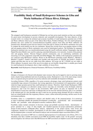
2. Journal of Energy Technologies and Policy www.iiste.org
ISSN 2224-3232 (Paper) ISSN 2225-0573 (Online)
Vol.4, No.8, 2014
economic feasibility of a SHP projects before spending substantial sums of money and time (Wilson, 2000 and
Petras, 2011). In this study, therefore, the technical and economic feasibility evaluation of SHP potential sites in
Giba and Worie catchments using RETScreen was carried out.
2. Materials and Methods
2.1. Description of the Study Area
The Tekeze River Basin is located in the northern part of Ethiopia (Figure 2.1). The basin has an average
elevation of 1850m above sea level (asl) and average annual rainfall ranges from 1200mm to 600mm. A
catchment area of about 63,000km2 (excluding tributaries like Angereb and Goang which join the basin
beyond the Ethio-Sudanese border). The total area of the basin with Angereb and Goang is 86491km2
(NEDECO, 1998).
The main tributaries of Tekeze in Ethiopia are: on the right bank Tahali, Meri, Tellare, Sullo, Arekwa, Giba,
Worie, Firafira, Tocoro and Gumalo Rivers; on the left bank Nili, Balagas, Saha, Bemba, Ataba, Zarima, and
Kwalema Rivers. The average annual precipitation decreases from south to north from 1200mm to 600mm,
(NEDECO, 1998).
Figure 2.1: Study Area Delineation: Giba and Worie Sub-basins
9
a) Giba Subbasin
The Giba sub basin lies between latitudes 13017’46” and 14015’00” N and longitudes 38037’37”and 39047’47’’E.
The total drainage area of the Giba up to the junction to Tekeze is about 5163 km2; the length of the main
watercourse is 236.4km. The principal tributaries of this river are: Suluh, Genfel, Agulae, Illala, and Meskilla.
This Giba river is one of the main tributaries of Tekeze river located in the northern part of Ethiopia; it joins the
Tekeze river 34km (along the watercourse) downstream of the Tekeze Hydropower project at an elevation of less
than 1000 ( about 975)m .a.s.l.
The Giba river originates at Gasat (Latitude13038’50”N, Longitude 39024’42”E and Altitude1762m.a.s.l), the
junction of Suluh and Genfel, and is 143km long. The Suluh river originates from Keshehat in the Dendera ridge
at an elevation of 3323m a.s.l. (for the Suluh River) and Ayfela in the Ayfela ridge at an elevation of more than
2740m.a.s.l.
3. Journal of Energy Technologies and Policy www.iiste.org
ISSN 2224-3232 (Paper) ISSN 2225-0573 (Online)
Vol.4, No.8, 2014
The elevation of the study basin varies from about 1000 m to 3333 m a.s.l. (Dendera ridge), average elevation is
about 2150 m. The topographic setting (feature) and availability of abundant water provides great potential for
hydropower development.
Rainfall of the Giba basin is highly seasonal with an annual rainfall ranging from over 500mm in the northern
part to about 700mm in the central and west of the basin. The average over the whole basin is about 666mm,
with more than 60% of the rainfall occurring between July and August, is unimodal pattern. The distribution of
rainfall indicates that the rainfall is concentrated in the central part of the basin.
10
b) Worie Subbasin
Worie is also one of the tributaries of Tekeze basin; lies between latitudes 13036’27” and 14o16’7.5”N and
longitudes 38034’2.5” and 39029’18.5”E. it has drainage area about 5379 km2 and annual rainfall around 730mm.
The major tributaries of Worie are: Teway Ruba, Asem, Kinetal, Tsedia, Ruba Seguh, Yerbay, Gedgeda, Tsalet.
2.2. Data Collection Techniques and Analysis
Quantitative and qualitative of primary and secondary data were collected from different sources and analyzed
using GIS, Global Mapper, Spread Sheet Excel and RETScreen. In the RETScreen models; analyzing the energy
output generation with the costs under the consideration of the financial parameters of the project life; the
savings, income summary, cash flow, and financial viability information has been generated. The general
procedure of the data analysis is structured in flowchart (Figure 2.2).
2.2.1. Topographic Data Analysis
For this particular study the topographic data with scale of 1:50,000 which was collected from Ethiopia Mapping
Agency and shape files of the Tekeze River basin generated from Shuttle Radar Topographic Mission Digital
Elevation Mode (SRTM DEM) resolution of 90mx90m obtained from Ministry of Water, Irrigation and Energy
department of GIS, mainly used to describe the streams, main roads and grid center using Global Mapper 10.
The SRTM DEM of 30mx30m spatial resolution is helpful for visualizing and delineating basin area, contour
line generations, hydrological parameters computations and analysis (flow direction & flow accumulation, slope,
etc...) using ArcHydro Tools 9 of ArcGIS 9.3 extension. The civil work components were measured from the
10m contour interval of SRTM DEM of 30mx30m spatial resolution. The contour lines overlay can be
visualized by zooming in and out. ArcGIS 9.3 gives the power to visualize, explore, query and analyze data
geographically.
2.2.2. Meteorological Data Analysis
There are ten (10) and six (6) rainfall gauging stations used for Giba and Worie in or near subbasins, respectively.
These gauging stations have poor matching recorded periods and missing of months and years. Moreover, for
some stations the total number of years of records is too small for analysis. The missing rainfall data were filled;
the homogeneity and consistency of the rainfall data were checked. The average watershed rainfalls at the sites
of interest were estimated by constructing Thessien polygon network.
2.2.3. Hydrological Data Analysis
To estimate water resources as well as hydropower potentials at the sites, hydrologic study was carried out using
existing discharge and rainfall data recorded at the gauging stations available for the subbasin in or nearby the
area. Even though there is significant missing data in rainfall and runoff, as well as poor matching of recorded
periods, monthly rainfall and concurrent runoff data were used.
For this study purpose, stream flow discharges of seven (7) gauge stations for Giba and one (1) station for Worie
subbasins was obtained from Ministry of Water Resources, Hydrology Department. Stream flow data should be
carefully checked and adjusted for errors resulting from instrumental and observational deficiencies. Double
mass curve is employed to evaluate consistency. In double mass curve, accumulated runoff of a station is plotted
against accumulated specific runoff a group of nearby stations to evaluate consistency. If the consistency of a
station has undergone changes, it can be noticed from the slope of the mass curve. Unless the change is
significant exceeding 10% of the original slope, it should be confirmed whether the deviation is not part of the
usual scatter.
In this study, filling of the missed data was conducted by use of runoff coefficient and developing rainfall-runoff
regression model. The monthly areal rainfall by employing the Thiessen polygon method, and the concurrent
runoff data, the monthly runoff coefficient was estimated. This runoff coefficient was used to fill missing runoff
data and to estimate runoff data at the hydro sites upstream or downstream of the respective rainfall gauging
4. Journal of Energy Technologies and Policy www.iiste.org
ISSN 2224-3232 (Paper) ISSN 2225-0573 (Online)
Vol.4, No.8, 2014
station.
The regression relation model of rainfall-runoff for Giba subbasin was developed as Q= 0.4105P - 44.829,
where Q= mean annual runoff (Mm3) or (mm) and P= Mean annual watershed rainfall in millions m3 or mm. The
runoff coefficient at Worie stream gauge station is assumed to represent the whole Worie subbasin.
2.2.4. Transformation of Stream Flow Data for Ungauged Hydropower Potential Sites
The sites of the study area are far away from the gauging station of stream flow data historical recorded which
are used to transfer the stream flow and rainfall of the gauged stations to the ungauged sites of hydro potential.
Thus based on the above situation the data analysis, stream flow generation/transfer should be performed to the
hydro sites using runoff coefficient- discussed in section 2.2.3. To estimate the hydropower potential sites of the
study area, discharge at ungauged sites (hydro sites) are estimated by using the runoff coefficients obtained from
simultaneous data of rainfall and runoff at the gauged sites of the same time, which is given by:
site
A
Q = ( ) •
site P
Where: ASite = Drainage area of site of interest (km2), Agauge = drainage area at the gauge site
site
(km2), QSite = Discharge at the site of interest (m3/s), Qgauge = Discharge at the gauge site (m3/s), Psite = areal
rainfall at the site of interest (mm), Pgauge = areal rainfall at the gauge site (mm).
2.2.5. Small Hydropower Project Model Analysis using RETScreen
The model addresses both run-of-river and reservoir developments and it incorporates sophisticated formulae for
calculating efficiencies of a wide variety of hydro turbines. The Small Hydro Project Model has been developed
primarily to determine whether work on the small hydro project should proceed further or be dropped in favour
of other alternatives. Only about 25% of the cost is relatively fixed, being the cost of manufacturing the
electromechanical equipment (RETScreen, 2004-a, 2005 and 2010).
The model has seven worksheets: Energy Model (Hydrology Analysis and Load Calculation, and Equipment
Data), Cost Analysis and formula tools, Greenhouse Gas Emission Reduction Analysis (GHG Analysis),
Financial Analysis (financial Summary), and Sensitivity and Risk Analysis (Sensitivity) are provided in the
Small Hydro Project Workbook file. The GHG Analysis and Sensitivity worksheets are optional analysis. Each
worksheet in the models must be completed by row from the top to bottom by entering values of the required
data. First, the Energy Model worksheet is completed, and then the Cost Analysis worksheet and finally the
Financial Summary worksheet should be completed. This step can be repeated several times in order to optimize
the design of the small hydro project from an energy production and cost standpoint.
11
gauge
gauge
gauge
P
Q
A
5. Journal of Energy Technologies and Policy www.iiste.org
ISSN 2224-3232 (Paper) ISSN 2225-0573 (Online)
Vol.4, No.8, 2014
Data
Spatial data
Civil works
• Hydrological data
• Gross head
• Hydraulic loses
• Turbine
Energy Cost Analysis Model Analysis Model
Financial Analysis Model Annual Energy Production
12
• Financial parameters
Initial Cost
Annual Cost
Total Cost
No No
Yes
• Global Mapper
• GIS
• Field survey
RETScreen
Financial
viability
Viable site
Figure 2.2: Economic feasibility study of SHP flowchart
• Tuning cost ratios
• Coefficient factors
• Electromechanical
3. Results and Discussion
3.1. Small Hydropower Potential Sites of the Study Area
Based on the ranking of small hydropower potential sites in the study area ten (10) top ranked SHP potential
sites were verified for financial feasibility analysis from Giba and Worie subbasins (total of twenty potential
sites). Only two remaining parameters were used to determine the hydropower potential sites, discharge and head.
The gross head of hydroelectric power may be constant, but the flow varies over the year. The head was
measured from digital elevation model (DEM). Discharge is dependent on a number of processes taking place in
the catchment. The main influence is runoff from rainfall, stream flow, drainage basins, catchment areas,
evapotranspiration, surface geology, groundwater, etc. For this study, the first four parameters were considered.
The discharge at the interest point was estimated by transforming of the stream flow data to ungauged potential
sites. The transformation was carried out by estimating the point and areal rainfall data, catchments areas of the
gauge stations and potential sites, and monthly runoff coefficient of the catchments. The rainfall data at the point
of interest was determined based on the contributing confluence areas visualized on the Thiessen polygon
network. Drainage areas of gauge stations was already available, the total drainage area supplying runoff to
reach outlet (hydro site) was obtained by summing area of upstream catchments (water contributing area
6. Journal of Energy Technologies and Policy www.iiste.org
ISSN 2224-3232 (Paper) ISSN 2225-0573 (Online)
Vol.4, No.8, 2014
above the outlet point).
In order to obtain the optimum design discharge for a given project, various design discharges are selected and
change of the net income with respect to the selected discharge is evaluated. The discharge resulting in the
maximum annual net benefit (i.e. annual income-annual cost) is selected as the design discharge for that project
for a given electricity export rate.
3.2. Small Hydropower Project Formulation Results Using RETScreen
RETScreen runs on Microsoft Excel platform and uses empirical equations to calculate the energy output and
costs of the projects. RETScreen software determines the main financial viability of the project to compare the
possible project alternatives. RETScreen software gives more accurate results for small hydropower projects
especially run-of-river type than reservoir storage. Moreover, when the input parameters of the program are
changed, the results are updated automatically. The software uses colored cells to guide the user when entering
data. As can be seen in the general layout of the program (Figure 3.1) it has "Start Energy Model, Cost Analysis,
Emission Analysis, Financial Analysis, Risk Analysis and Tools" sheets͘. In this study, emission and risk analysis
sheets were not used.
In the evaluation of the alternatives, first Start and Energy Model sheets are completed with the required data͘
after that the "Hydro Formula Costing Method" given in the Tools sheet is used to calculate the total initial costs
of the project. In the next step the Cost Analysis sheet is completed. Finally, Financial Analysis sheet is filled
and as a result the financial viability of the project is obtained (Table 3.5). Evaluation of a small hydropower
scheme in RETScreen involves completion of many input data provided in each worksheets. Within the
scope of this research, these sheets are completed for various alternatives of the potential sites.
Table 3.2: Data required for RETScreen- SHP analysis of the sites in Giba & Worie subbasins
13
1 CF=Cross flow
Giba
Giba-Site Name Suluh Genfel-1 Genfel-2 Genfel-3 Genfel-
4
Agulae Meskila-1 Meskila-2 Meskila-3 Ghiba
Coordinate (x,y) (UTM, WGS84)
555000 570400 573500 572500 553600 556400 543000 533000 531300 537300
1535700 1543000 1544400 1433400 1515200 1510400 1486300 1487700 1487350 1494350
Catchment Area (km2) Giba Area ( 5113 km2) 617.31 173.395 21.673 133.035 687 493.903 160.374 508.777 134.647 3112
Gross Head (m) 40 87 380 480 96 177 45 45 80 94
Design flow(m3/s) 1.619 1.316 0.102 1.018 3.733 1.657 0.342 2.078 2.274 24.502
Turbine type CF1 Turgo Pelton Pelton Turgo Turgo CF CF Turgo Francis
Dam crest length (m) 25 18 23 30 32 28 22 31 34 64
Road Length (km) 5.08 6.16 5.65 5.25 8.80 4.77 6.34 14.74 15.27 1.886
Canal length in rock (m) 1100 2250 1400 1800 1858 1280 160 1500 240 19200
Penstock length (m) 120 100 900 1000 1762 555 340 200 130 1300
Grid Center Negash Wukro Wukro Wukro Mekelle Mekelle Mekelle Mekelle Mekelle Mekelle
Transmission line (km) 9.8 19.08 15.08 12.60 14 15.30 7.81 17.18 18.60 12.64
Worie
Worie-Site Name W-1 W-2 W-3 W-4 W-5 W-6 W-7 W-8 W-9 W-10
Coordinate (x,y) (UTM, WGS84) 459120.5 462272 485156.5 473729.33 466998 491090.5 510161.33 470660.75 488043 498996.8
1512381 1517303 1524893 1522271 1519833 1527699 1531977 1520017 1536623 1529493
Catchment Area (km2) Worie area (5379 km2) 3212 2972 1904 2487 2954 1890 777 2503 430 1677
Gross head (m) 96 71 83 94 55 33 27 25 167 27
Design flow (m3/s) 20.512 18.980 11.860 15.882 18.864 11.772 4.277 15.984 2.273 9.231
Turbine type Turgo Turgo Turgo Turgo Turgo Francis CF Francis Turgo CF
Dam crest length (m) 128 120 68 84 104 54 32 98 45 48
Road length (km) 2.111 3.532 0.564 2.106 1.049 0.601 1.585 1.324 2.854 2.135
Canal length in rock (m) 305 630 445 365 587 290 500 445 730 480
Penstock length (m) 110 260 200 140 420 100 265 350 500 340
Grid Center Abi-adi Abi-adi Maykinetal Abi-adi Abi-adi Maykinetal Maykinetal Maykinetal Maykinetal Maykinetal
Transmission line (km) 41.98 40.01 21.54 31.52 36.41 16.07 15.40 31.14 12.12 12.02
7. Journal of Energy Technologies and Policy www.iiste.org
ISSN 2224-3232 (Paper) ISSN 2225-0573 (Online)
Vol.4, No.8, 2014
3.2.1. The Start Sheet and the Energy Model Sheet
General information about the project is entered to the Start Sheet (Figure 3.1).
Figure 3.1: General layout of RETScreen and the Start Sheet
Grid type can be central grid, from the two analysis types Method 2 are selected. Heating value is a measure of
energy released when fuel is completely burned. For hydropower projects, this value is important only if
emission analysis will be carried out. In this study, emission analysis was not carried out.
The flow duration curve entered to the energy model sheet is used to calculate the energy output of the project.
Taking this data as input to the Energy mode sheer, the installed capacity and annual energy production is
estimated.
3.2.2. Cost Analysis Sheet and Hydro Formula Costing Method Tool
After filling the energy model sheet, the software directs the user to complete the cost analysis sheet.
Since RETScreen is developed in Canada, the formula method uses Canadian projects as a baseline and then
allows the user to adjust the results for local conditions. There are tuning factors to the local area (Ethiopia), the
costs between Ethiopia and Canada is tuned by the cost ratios of labour, equipment, fuel, equipment manufacture
coefficient and exchange rates. The civil works measured from a 10 m contour interval DEM generated were
used for cost analysis of the project.
The hydro formula costing method tool estimates the project costs using the empirical formulae derived from the
costs of numerous completed small hydro projects. Since costs associated with various construction items,
engineering and development works are not available for this project, hydro formula costing method is used to
estimate total initial costs. However, RETScreen cannot automatically use this calculated total initial costs
in financial analysis and requires the user to externally input this value into the cost analysis worksheet. Thus,
the total initial costs calculated by hydro formula costing method should be entered into one of the cost item
listed in the cost analysis sheet.
Assume 0.2% of the total investment cost can be allocated as operation and maintenance costs. Considering
the other sources of annual costs such as labor cost or insurance premium, 0.4% of the total investment cost
was used for total annual costs in this study. It should be noted that interest and depreciation costs are not
14
8. Journal of Energy Technologies and Policy www.iiste.org
ISSN 2224-3232 (Paper) ISSN 2225-0573 (Online)
Vol.4, No.8, 2014
accepted as annual costs by RETScreen. RETScreen suggests a value between 4 -7% for allowable tunnel head
loss factor. If the allowable tunnel head loss factor is chosen as 5% as suggested by RETScreen (2004), the
tunnel diameter and the tunnel cost is automatically calculated. Allowable penstock head loss factor is 1-4% is
suggested by RETScreen (2004).
3.2.3. Financial Viability Analysis Sheet and Results
The financial parameters entered to the software are given in Table 3.5. Inflation rate, discount rate, project life,
effective income tax rate, and more over the following information were used:
• Fuel cost escalation rate was taken as 0% since hydropower plants do not consume fuel to generate
electricity. Fuel is used only in the construction period to run the construction machinery. Therefore, the
effect of this rate can be assumed to be negligible.
• Depreciation period is equal to the project life which was taken as 30 years. The percentage of total costs
to be depreciated (depreciated tax basis) is 95%. The remaining 5% accounts for the cost items that
cannot be depreciated. Depreciation method is selected as straight line.
After analyzing the annual energy production with the selling price as benefit vis-à-vis the costs estimated,
RETScreen displays outputs of the financial analysis: total initial and annual costs (same as displayed in cost
analysis model), the savings, income summary, financial viability parameters, yearly cash flow table and
cumulative cash flow graph. The financial viability information generated from the RETScreen decision support
tool are equity, assets, payback periods, net present value (NPV), internal return rate (IRR) and Benefit-Cost
ratio. The financial viability of the SHP potential sites are decided based on the Benefit-Cost ratio, net present
value (NPV), internal return rate (IRR) and simple payback period.
Projects are called feasible when benefit-cost ratio is greater than one, positive net present value(NPV) and
Internal Return Rate (IRR) greater than 5% (National Bank of Ethiopia fixed interest rate), and short period of
payback, i.e. the time taken to return the expenditure for the project. However, if the value of benefit-cost ratio is
approximately rounded off to unity, it can be taken as feasible. The financial analysis of the project indicates that
whether the project is profitable. Benefit-Cost Ratio is greater than one whereas the Benefit-Cost Ratio of
Genfel-1 is 0.78 (Table 3.5), it can be rounded off to one and it is considered as feasible.
Therefore, Meskila-1 SHP project is worth investing. Cumulative cash flow is negative until the 2 year. After
the 2 year it turns positive meaning that the project starts making profit.
Based on the RETScreen generated results Meskila-1, Meskila-2, Meskila-3, Genfel-1, Genfel-2, and Suluh are
feasible from Giba Subbasin, but Genfel-3, Genfel-4, Agulae and Giba dam site in Giba subbasin and except W-
7 in Worie subbasin are not viable. The annual energy generation, costs, financial viability parameters and
feasibility of the hydro sites are summarized in Table 3.5.
Since the hydropower potential sites of Giba subbasin were selected from the tributaries with hills/waterfalls,
most of the hydro sites are feasible where as in Worie the hydro potential sites were selected from DEM derived
head and specific yield discharge. All of potential sites were laid on the main stream and the head is found after
going very long distance from the intake site to the power house, this was made very expensive and difficult for
run-of-river plants; consequently, almost all of the hydro sites were not feasible. From this more detailed study,
the potential sites top-ranked and arranged orderly in the previous studies of the same hydro sites were found
with different results in this study.
15
9. Journal of Energy Technologies and Policy www.iiste.org
ISSN 2224-3232 (Paper) ISSN 2225-0573 (Online)
Vol.4, No.8, 2014
Table 3.5: Financial analysis results and viability of the sites
Conclusion
Based on the research findings the technical and economic feasibility of SHP potential sites of Giba and Worie
subbasins of Tekeze River were obtained. For analysis ten potential sites were verified for each catchment. The
discharge for the ungauged hydro sites was estimated using the runoff coefficients and area ratios of the stream
gauging stations and ungauged potential sites. Based on the available gross head, estimated discharge, and by
determining hydraulic losses and turbine characteristics; the amount of annual energy generation was produced
from the selected hydro sites.
2 Simple payback period > project life, i.e. Deficit not viable
16
Site
Power
capacity
(kW)
Electricity
exported
to grid
(MWh)
Total initial
costs (ETB)
Annual
costs (ETB)
Energy
production
costs(ETB/MWh)
Annual
savings
and income
(ETB)
Simple
payback
(yr)
Benefit-
Cost
Ratio
NPV
(ETB)
IRR
(%)
Viability
Site
Name
Giba
Suluh 439 2,044 13,581,831 193,375 791.25 2,942,777 4.6 1.84 10,248,337 17.3 Feasible
Genfel-1 821 3,177 48,829,728 695,225 1,829.97 4,574,628 10.7 0.78 Negative 6.4 Feasible
Genfel-2 273 1,113 3,325,687 47,350 355.68 1,602,992 2.1 4.12 9,330,567 39.1 Feasible
Genfel-3 3,610
14,025
432,909,843 6,163,662 3,675.00 20,195,535 21.4 0.38 Negative 1.1 Not
feasible
Genfel-4 2,627
10,577
453,784,076 6,460,864 5,107.94 15,230,650 29.8 0.25 Negative -0.8 Not
feasible
Agulae 2188
9,327
233,513,937 3,324,713 2,980.64 13,431,294 17.4 0.47 Negative 2.5 Not
feasible
Meskila-
1
104
351
817,178 11,635 277.24 505,334 1.6 5.29 3,154,208 50.3 Feasible
Meskila-
2
634
2,017
24,455,758 348,195 1,443.40 2,904,758 8.4 1.00 Negative 8.8 Feasible
Meskila-
3
1,320
11,076
130,722,379 1,861,193 1,405.10 15,949,922 8.2 1.03 2,988,481 9.1 Feasible
Giba
dam site
17,748
76,825
8,590,302,241 122,306,578 12,930.08 110,627,412 >proj.life2 0.04 Negative -2.1 Not
feasible
Site No. Worie
W-1 14,798
46,530
6,267,137,494 89,229,939 16,035.76 67,003,019 >proj.life 0.01 Negative -7.1 Not
feasible
W-2 10,135
34,803
4,292,468,987 61,115,101 14,683.75 50,116,994 >proj.life 0.03 Negative -6.7 Not
feasible
W-3 7,332
29,554
2,468,059,700 35,139,618 9,942.44 42,557,615 >proj.life 0.08 Negative -4.7 Not
feasible
W-4 11,187
38,415
5,156,273,410 73,413,733 15,980.55 55,317,034 >proj.life 0.02 Negative -7.1 Not
feasible
W-5 7,802
26,792
3,064,112,472 43,626,068 13,615.84 38,581,139 >proj.life 0.03 Negative -6.3 Not
feasible
W-6 2,835
8,544
477,178,577 6,793,949 6,649.50 12,302,875 >proj.life 0.17 Negative -2.5 Not
feasible
W-7 783 2,702 44,872,339 638,881 1,977.54 3,890,162 11.5 0.72 Negative 5.7 Feasible
W-8 2,833
8,294
529,847,907 7,543,842 7,605.26 11,944,057 >proj.life 0.14 Negative -3.2 Not
feasible
W-9 2,754
9,472
396,800,976 5,649,553 5,015.72 13,562,954 29.3 0.26 Negative -0.7 Not
feasible
W-10 1,691
5,830
210,218,733 2,993,042 4,292.69 8,395,695 >proj.life 0.32 Negative 0.2 Not
feasible
10. Journal of Energy Technologies and Policy www.iiste.org
ISSN 2224-3232 (Paper) ISSN 2225-0573 (Online)
Vol.4, No.8, 2014
Having the civil works with the consideration of terrain conditions, electromechanical equipment and financial
parameters of the project life; using RETScreen analyzing the energy output generation with the initial, annual
and total costs; as a result, the savings, income summary, cash flow, and financial viability was generated. The
financial viability of the SHP potential sites was decided based on the Benefit-Cost ratio, net present value
(NPV), Internal Return Rate (IRR) and simple payback period.
Results of the RETScreen analyses revealed that Meskila-1, Meskila-2, Meskila-3, Genfel-1, Genfel-2, and
Suluh are feasible with total power of 3591kW from Giba subbasin, but Genfel-3, Genfel-4, Agulae and Giba
dam site in Giba subbasin and except site W-7 (783kW) in Worie subbasin are not viable.
In general, most of the rivers in the study area are intermittent and it has been observed that dependable flow in
the basin without storage is low. Therefore, run-of-river plants are not feasible. This is because, though there is
suitable gross heads for SHP development, there is high variability of stream flows.
References
Canada labor cost, [Online] Available at: http://www.tradingeconomics.com [Accessed 20 November 2013].
Central Statistics Agency of Ethiopia, CSA, [Online] Available at: http://www.csa.gov.et [Accessed 20
17
November 2013].
Diesel Prices, [Online] Available at: http://www.mytravelcost.com/petrol-prices/ [Accessed 20 November 2013].
EEPCo, 2009/2010. Facts in berief. Ethiopian Electric Power Corporation Corporate Relations, Addis Ababa.
Maidment, D.R, 1993. Handbook of Hydrology, McGraw-Hill Inc., USA
National Bank of Ethiopia, NBE, [Online] Available at: http://www.nbe.gov.et [Accessed 20 November 2013].
NEDECO, 1998. Tekeze River Basin Integrated Development Master Plan Project, Vol 5 & 6. Ministry of water
resources, Addis Ababa.
Petras. P., Dumbrauskas A., Kvaraciejus A., Vyciene G . , 2011. Tools for Small Hydropower Plant Resource Planning
and Development: A Review of Technology and Applications. Water and Land Management Faculty of the
Lithuanian University of Agriculture, Kaunas, Akademija, 10 Universiteto Str, LT-53361. Lithuania.
Ravn, J., 1992. Planning and Implementation of Hydropower Projects. Norwegian Institute of Technology,
Division of Hydraulic Engineering.
RETScreen, [Online] Available at: http://www.retscreen.net/ang/home.php [Accessed 26 May 2013].
RETScreen, 2004. Clean Energy Decision Support Centre. Clean Energy Project Analysis: RETSCREEN®
Engineering & Cases Textbook. Small Hydro Project Analysis Chapter. Natural Resources Canada,
Ottawa, Canada.
RETScreen, 2005. Clean Energy Project Analysis, “RETScreen® Engineering and Cases Textbook” Third
Edition, Minister of Natural Resources Canada.
RETScreen, 2010. “RETScreen Software Help,” Integrated to the software.
Solomon, S., 1998. Hydropower of Ethiopia; status potential and prospects, EACE, bulletinVol.1, no.1. [Online]
Available at: http://www.ethiopians.com/engineering/hydropower_of_ethiopia.htm [Accessed 15 June
2013].
Wilson, E. M., 2000. Assessment Methods for Small-Hydro Projects; Technical Report; the International Energy
Agency: Paris, France.
11. The IISTE is a pioneer in the Open-Access hosting service and academic event
management. The aim of the firm is Accelerating Global Knowledge Sharing.
More information about the firm can be found on the homepage:
http://www.iiste.org
CALL FOR JOURNAL PAPERS
There are more than 30 peer-reviewed academic journals hosted under the hosting
platform.
Prospective authors of journals can find the submission instruction on the
following page: http://www.iiste.org/journals/ All the journals articles are available
online to the readers all over the world without financial, legal, or technical barriers
other than those inseparable from gaining access to the internet itself. Paper version
of the journals is also available upon request of readers and authors.
MORE RESOURCES
Book publication information: http://www.iiste.org/book/
IISTE Knowledge Sharing Partners
EBSCO, Index Copernicus, Ulrich's Periodicals Directory, JournalTOCS, PKP Open
Archives Harvester, Bielefeld Academic Search Engine, Elektronische
Zeitschriftenbibliothek EZB, Open J-Gate, OCLC WorldCat, Universe Digtial
Library , NewJour, Google Scholar