SlideShare a Scribd company logo
1 of 80
Download to read offline
→ Sentinel-2
	ESA’s Optical High-Resolution Mission for GMES Operational Services
→ Sentinel-2
	ESA’s Optical High-Resolution Mission for GMES Operational Services
SP-1322/2
March 2012
Acknowledgements
In the preparation of this publication, ESA acknowledges the contributions
of the following organisations and individuals:
GMES programme, ESA Sentinel-2 Project and Science Division Teams at
ESTEC, Noordwijk, the Netherlands: F. Bertini, O. Brand, S. Carlier, U. Del Bello,
M. Drusch, R. Duca, V. Fernandez, C. Ferrario, M.H. Ferreira, C. Isola,
V. Kirschner, P. Laberinti, M. Lambert, G. Mandorlo, P. Marcos, P. Martimort,
S. Moon, P. Oldeman, M. Palomba, J. Patterson, M. Prochazka, M.H. Schricke-
Didot, C. Schwieso, J. Skoog, F. Spoto, J. Stjernevi, O. Sy, B. Teianu and C. Wildner
ESA Sentinel-2 Payload Data Ground Segment and Mission Management
Team at ESRIN, Frascati, Italy: O. Arino, P. Bargellini, M. Berger, E. Cadau,
O. Colin, F. Gascon, B. Hoersch, H. Laur, B. Lopez Fernandez and E. Monjoux
ESA Sentinel-2 Flight Operations Segment Team at ESOC, Darmstadt,
Germany: M. Collins, F. Marchese and J. Piñeiro
National space agencies working in partnership with ESA:
—— CNES, Toulouse, France: S. Ballarin, C. Dechoz, P. Henry, S.  Lachérade,
A. Meygret, B. Petrucci, S. Sylvander and T. Trémas.
CNES is in charge of Sentinel-2 image quality activities, including monitoring
mission performance and assisting ESA with the prototyping, development
and verification of payload data processing and product quality monitoring.
—— DLR, Bonn, Germany: H. Hauschildt, R. Meyer and S. Phillip-May.
DLR is responsible for providing the Optical Communication Payload (OCP),
developed by Tesat (Germany), which is expected to enhance the distribution
of mission data to receiving and processing stations in real time through
Alphasat and later on EDRS.
Members of the industrial consortium led by Astrium GmbH (platform and
satellite system) and Astrium SAS (MultiSpectral Instrument), in particular
the project managers H. Sontag and V. Cazaubiel and their teams for their
significant contributions to the design, development, integration, testing and
verification of the Sentinel-2 satellite system.
Cover: Artist’s impression of one Sentinel-2 satellite operating in orbit.
An ESA Communications Production
Publication Sentinel-2: ESA’s Optical High-Resolution Mission for GMES Operational Services
(ESA SP-1322/2 March 2012)
Production Editor K. Fletcher
Editing/Layout Contactivity bv, Leiden, the Netherlands
Publisher ESA Communications
ESTEC, PO Box 299, 2200 AG Noordwijk, The Netherlands
Tel: +31 71 565 3408 Fax: +31 71 565 5433 www.esa.int
ISBN 978-92-9221-419-7
ISSN 0379-6566
Copyright © 2012 European Space Agency
iii
Foreword
Foreword
As part of the Global Monitoring for Environment and Security (GMES) Space
Component programme, ESA is undertaking the development of an operational
optical high-resolution Earth observation mission. Sentinel-2 is a system of two
polar-orbiting satellites that will contribute to the continuity and improvement
of the SPOT and Landsat series of multispectral missions, and ensure the
delivery of high-quality data and applications for operational land monitoring,
emergency response and security services.
v
Contents
Contents
Foreword  .   .   .   .   .   .   .   .   .   .   .   .   .   .   .   .   .   .   .   .   .   .   .   .   .   .   .   .   .   .   .   .  iii
1	 Introduction  .   .   .   .   .   .   .   .   .   .   .   .   .   .   .   .   .   .   .   .   .   .   .   .   .   .   .   .   .   . 3
2	 GMES Programme Context  .   .   .   .   .   .   .   .   .   .   .   .   .   .   .   .   .   .   .   .   .   .   .   .   . 5
2.1	 GMES Sentinel Missions  .   .   .   .   .   .   .   .   .   .   .   .   .   .   .   .   .   .   .   .   .   .   .   .   . 5
2.2	 GMES Space Component Ground Segment   .   .   .   .   .   .   .   .   .   .   .   .   .   .   .   .   .   . 7
2.3	 GMES Initiative and Data Access  .   .   .   .   .   .   .   .   .   .   .   .   .   .   .   .   .   .   .   .   .   . 7
3	 Sentinel-2 Mission Overview  .  .  .  .  .  .  .  .  .  .  .  .  .  .  .  .  .  .  .  .  .  .  .  . 9
4	 Sentinel-2 System Concept Overview  .   .   .   .   .   .   .   .   .   .   .   .   .   .   .   .   .   .   .   .  15
4.1	 Sentinel-2 Space Segment  .  .  .  .  .  .  .  .  .  .  .  .  .  .  .  .  .  .  .  .  .  .  .  . 15
4.1.1	 Satellite and Platform Design  .   .   .   .   .   .   .   .   .   .   .   .   .   .   .   .   .   .   .   .  15
4.1.2	 The MultiSpectral Instrument Design  .   .   .   .   .   .   .   .   .   .   .   .   .   .   .   .   .  25
4.1.3	 Assembly, Integration and Test Programmes  .   .   .   .   .   .   .   .   .   .   .   .   .   .   . 28
4.1.4	 Satellite System Verification  .   .   .   .   .   .   .   .   .   .   .   .   .   .   .   .   .   .   .   .   . 31
4.2	 Sentinel-2 Ground Segment  .   .   .   .   .   .   .   .   .   .   .   .   .   .   .   .   .   .   .   .   .   .   .  32
4.2.1	 Flight Operations Segment .   .   .   .   .   .   .   .   .   .   .   .   .   .   .   .   .   .   .   .   .  32
4.2.2	 Payload Data Ground Segment  .   .   .   .   .   .   .   .   .   .   .   .   .   .   .   .   .   .   .   . 33
5	 Sentinel-2 Launch Campaign and Early In-Orbit Operations  .  .  .  .  .  .  .  .  .  .  . 37
5.1	 Launch Campaign  .  .  .  .  .  .  .  .  .  .  .  .  .  .  .  .  .  .  .  .  .  .  .  .  .  . 37
5.2	 Early Orbit Phase  .  .  .  .  .  .  .  .  .  .  .  .  .  .  .  .  .  .  .  .  .  .  .  .  .  .  . 37
5.3	 Switch-on and Verification  .  .  .  .  .  .  .  .  .  .  .  .  .  .  .  .  .  .  .  .  .  .  . 38
6	 Sentinel-2 Image Quality .   .   .   .   .   .   .   .   .   .   .   .   .   .   .   .   .   .   .   .   .   .   .   .   .  39
7	 Sentinel-2 Level-1 Processing  .   .   .   .   .   .   .   .   .   .   .   .   .   .   .   .   .   .   .   .   .   .   .  43
8	 Prototyping of Level-2 Products: Cloud Screening and Atmospheric Corrections  .  .  . 45
9	 Sentinel-2 Applications and Products .   .   .   .   .   .   .   .   .   .   .   .   .   .   .   .   .   .   .   .  47
9.1	 Geoland-2  .  .  .  .  .  .  .  .  .  .  .  .  .  .  .  .  .  .  .  .  .  .  .  .  .  .  .  .  . 47
9.2	 SAFER, RISK-EOS and Respond  .   .   .   .   .   .   .   .   .   .   .   .   .   .   .   .   .   .   .   .   .   . 49
9.3	 G-MOSAIC  .   .   .   .   .   .   .   .   .   .   .   .   .   .   .   .   .   .   .   .   .   .   .   .   .   .   .   .   .  50
9.4	 Sentinel-2 Data Contributions  .  .  .  .  .  .  .  .  .  .  .  .  .  .  .  .  .  .  .  .  .  . 51
10	 Sentinel-2 Calibration and Validation .   .   .   .   .   .   .   .   .   .   .   .   .   .   .   .   .   .   .   .  53
10.1	Radiometric Calibration  .  .  .  .  .  .  .  .  .  .  .  .  .  .  .  .  .  .  .  .  .  .  .  . 53
10.2	Geometric Calibration .   .   .   .   .   .   .   .   .   .   .   .   .   .   .   .   .   .   .   .   .   .   .   .   .  54
10.2	Atmospheric Corrections .   .   .   .   .   .   .   .   .   .   .   .   .   .   .   .   .   .   .   .   .   .   .   .  54
11	 Sentinel-2 Pre-flight Campaigns  .   .   .   .   .   .   .   .   .   .   .   .   .   .   .   .   .   .   .   .   .   .  55
SP-1322/2
vi
12	 Conclusions  .  .  .  .  .  .  .  .  .  .  .  .  .  .  .  .  .  .  .  .  .  .  .  .  .  .  .  .  .  . 57
Appendices  .   .   .   .   .   .   .   .   .   .   .   .   .   .   .   .   .   .   .   .   .   .   .   .   .   .   .   .   .   .   .  59
Appendix A: Members of the Sentinel-2 Industrial Consortium  .  .  .  .  .  .  .  .  .  .  . 61
Appendix B: Associated Industrial Partners  .  .  .  .  .  .  .  .  .  .  .  .  .  .  .  .  .  .  . 63
Appendix C: The Sentinel-2 system  .   .   .   .   .   .   .   .   .   .   .   .   .   .   .   .   .   .   .   .   .   .  65
References  .  .  .  .  .  .  .  .  .  .  .  .  .  .  .  .  .  .  .  .  .  .  .  .  .  .  .  .  .  .  . 67
Acronyms and Abbreviations  .  .  .  .  .  .  .  .  .  .  .  .  .  .  .  .  .  .  .  .  .  .  .  . 69
→→ Sentinel-2
Introduction
3
1. Introduction
The Global Monitoring for Environment and Security (GMES) programme is
a joint initiative of the European Commission (EC) and the European Space
Agency (ESA) to establish a European capacity for the provision and use of
monitoring information for environmental and security applications. ESA’s
role in GMES is to provide the definition and the development of the space- and
ground-based system elements.
The GMES Sentinel-2 mission will ensure the continuity of services that rely
on multispectral high-resolution optical observations over global terrestrial
surfaces. The mission objectives are to provide systematic acquisitions of high-
resolution multispectral imagery with a high revisit frequency, to ensure the
continuity of multispectral imagery provided by the SPOT series of satellites,
and to provide observations for the next generation of operational products
such as land-cover maps, land-use change detection maps and geophysical
variables. Consequently, Sentinel-2 will contribute directly to land monitoring,
emergency response and security services.
The corresponding user requirements have driven the design towards a
dependable multispectral Earth observation system featuring a MultiSpectral
Instrument (MSI) with 13 spectral bands ranging from the visible and near-
infrared to the short-wave infrared. The spatial resolution varies from 10 m to
60 m, depending on the spectral band, with a 290 km field of view. This unique
combination of high spatial resolution, wide field of view and broad spectral
coverage represents a major step forward compared with other multispectral
missions.
The mission foresees a series of satellites, each with a lifetime of 7.25 years,
over a 20-year period. During full operation, two identical satellites will be
maintained in the same orbit with a phase delay of 180°, providing a revisit
time of five days at the equator.
The first satellite, Sentinel-2A, is expected to be launched in late 2013, and
Sentinel‑2B, about two years later.
The Contributors
The report is based on inputs from all the ESA Sentinel-2 teams involved in
space, ground and mission development activities. Major contributions have
also been received from national space agencies working in partnership with
ESA, especially the Centre National d’Etudes Spatiales (CNES, France) and
the Deutsches Zentrum für Luft und Raumfart (DLR, Germany), as well as
from Astrium GmbH and Astrium SAS, the Prime Contractors responsible for
developing the satellite system and the MultiSpectral Instrument, respectively.
The contributors to this report are listed on page ii of this report.
Structure of this Report
This report provides an overview of the GMES Sentinel-2 mission, including
the technical system concept, image quality, Level-1 data processing and
operational applications. The report describes all of the system elements on
which the Sentinel-2 mission is built.
Chapter 2, ‘GMES Programme Context’ provides general information on this
European flagship operational space programme.
Chapter 3, ‘Sentinel-2 Mission Overview’, provides an overview of the
mission, including products, user services and precursor missions.
Chapter 4, ‘Sentinel-2 System Concept Overview’, introduces the Sentinel-2
Space Segment – the satellite design, including the platform and payload
SP-1322/2
4
instrument, predicted performance and Assembly Integration Test and
verification programmes – and the Flight Operations and Payload Data Ground
Segments.
Chapter 5, ‘Sentinel-2 Launch Campaign and Early In-Orbit Operations’,
addresses the critical phase following the separation of the satellite from the
launcher until the performance of time-critical activities in orbit.
Chapter 6, ‘Sentinel-2 Image Quality’, depicts the main payload instrument
performance that will determine the quality of the mission products and user
services.
Chapter 7, ‘Sentinel-2 Level-1 Processing’, describes how Sentinel-2 mission
products are produced, archived and made available to users.
Chapter 8, ‘Prototyping of Level-2 Products: Cloud Screening and Atmosphere
Corrections’, underlines the innovative capabilities of Sentinel-2 for automatic
data product correction using specific instrument spectral channels.
Chapter 9, ‘Sentinel-2 Applications and Products’, describes the main data
products and their applications for land and security services promoted by ESA
and the European Commission.
Chapter 10, ‘Sentinel-2 Calibration and Validation’, describes the approach
that will be used during the in-orbit commissioning phase to ensure optimal
mission performance and the delivery of reliable data to user communities.
Chapter 11, ‘Sentinel-2 Pre-Flight Campaign’, presents the planned activities
to generate validation data that will be used to optimise data products during
the routine operation phase.
Finally, Chapter 12 presents some conclusions.
GMES Programme Context
5
2. GMES Programme Context
The GMES programme is a European initiative to ensure the availability of
information and data products for environmental and security services. It is
based on data received from Earth observation satellites and ground-based
networks.
Within the GMES programme, the GMES Space Component (GSC) is
responsible for delivering the necessary Earth observation data to the GMES
Service Component, which in turn is responsible for providing the Earth
observation data and value-added products to users.
As part of the GMES Space Component programme, ESA is responsible for
developing a fully operational space-based capability to feed the GMES Service
Component with satellite data. This capability will be achieved by facilitating
access to data from GMES Contributing Missions as well as by developing
new GMES dedicated Earth observation missions, the Sentinel missions. The
satellite data will be stored in a long-term archive to enable repeated use of
long time series (Fig. 2.1).
The Sentinel missions have been designed in accordance with the
individual Mission Requirement Documents (e.g. ESA, 2010) with a view to
satisfying the evolving requirements of GMES user communities, in particular
those identified in the strategic implementation plans prepared by the EC’s
GMES Core Services implementation groups in 2007, and in the GMES Space
Component Programme Declaration approved by the participating ESA
Member States.
2.1	 GMES Sentinel Missions
The ESA Sentinels constitute the first series of operational satellites that will
respond to the Earth observation needs of the GMES initiative. The GMES
Space Component relies strongly on complementary developments within ESA,
as well as on the existing and planned space assets of the various national
space agencies.
As part of the GMES Space Component, ESA is developing five Sentinels
mission families. Each Sentinel-1, Sentinel-2, Sentinel-3 and Jason-CS mission
Figure 2.1. The GMES end-to-end system.
SP-1322/2
6
is based on a constellation of two satellites in the same orbital plane. With this
configuration it will be possible to fulfil the revisit and coverage requirements
and provide robust and affordable operational services. Sentinel-5P is
conceived as a gap-filler satellite. Sentinel-4 covers the development of two
payload instruments to be carried on Meteosat Third Generation. Sentinel-5
covers the development of two instrument payloads to be carried on MetOp
Second Generation. The lifetime of the individual satellites is specified as 7.25
years (5 years for Jason-CS), with consumables onboard each satellite allowing
for mission extensions of up to 12 years (2 years for Jason-CS). The life cycle of
each generation of satellites is planned to be on the order of 15–20 years. The
strategy for the procurement and replacement of Sentinel satellites over this
period is being elaborated.
The current phase of the GMES Space Component includes the following
missions and satellites:
Sentinel-1 – Synthetic Aperture Radar (SAR) imaging for (Davidson et al., 2011):
—— monitoring sea-ice zones and the Arctic and Antarctic environment;
—— surveillance of marine environments;
—— monitoring land surface motion risks;
—— mapping of land surfaces: forests, water and soils, agriculture;
—— mapping in support of humanitarian aid in crisis situations.
Sentinel-2 – Multispectral imaging for (Drusch et al., 2012):
—— land cover, land use and land-use change detection maps;
—— maps of biogeophysical variables such as leaf chlorophyll content, leaf water
content, leaf area index (LAI);
—— risk mapping;
—— acquisition and rapid delivery of images to support disaster relief efforts.
Sentinel-3 – Multispectral imaging, radiometry and altimetry for (Donlon et
al., 2012):
—— sea and land colour data;
—— sea and land surface temperatures;
—— sea-surface and land-ice topography;
—— high-resolution altimetry for synthetic aperture processing;
—— land synergy products from optical instrument data.
Sentinel-4, Sentinel-5P and Sentinel-5 – Multispectral imaging and profiling
for (Ingman et al., 2011):
—— monitoring changes in atmospheric composition at high spatial resolution;
—— daily global and regional mapping of ozone, NO2, SO2, formaldehyde and
aerosols at high temporal resolution;
—— daily global mapping of CO and CH4.
Sentinel-4 is an atmospheric chemistry instrument operating in geostationary
orbit, to be flown on the Meteosat Third Generation (MTG) satellites. Sentinel-5P
is a precursor atmospheric chemistry mission to be flown in a polar Sun-
synchronous orbit (filling the gap between Envisat and MetOp second-
generation satellites). Sentinel-5 is an operational atmospheric chemistry
instrument to be flown on MetOp second-generation satellites to be operated in
a Sun-synchronous polar orbit.
Jason CS – Operational altimetry for monitoring sea-surface height (under
Phases A−B1).
GMES Programme Context
7
2.2	 GMES Space Component Ground Segment
The GSC Ground Segment is composed of three segments: the GSC Core Ground
Segment, the GSC Collaborative Ground Segment and the GMES Contributing
Missions ground segments.
First, the GSC Core Ground Segment, with GSC-funded functions and
elements, provides primary access to Sentinel data and coordinates access to
GMES Contributing Mission data. The GSC Core Ground Segment consists of the
Sentinel Core Ground Segment and the GMES Data Access Layer.
The Sentinel Core Ground Segment comprises:
—— TheSentinelFlightOperationsSegment(FOS),whichprovides,forallSentinels:
–– satellite monitoring and control during all mission phases (i.e. launch
and early orbit phases, commissioning, routine and deorbiting);
–– satellite orbit determination and maintenance; and
–– the network of tracking, telemetry and command S-band ground stations.
—— The Sentinel Payload Data Ground Segment (PDGS), which provides, for all
Sentinel missions:
–– planning, acquisition, processing and dissemination of data products;
–– calibration and validation of the Sentinel missions;
–– user services including cataloguing, data selection, metadata access, user
help and documentation;
–– systematic reprocessing of historical Sentinel mission data; and
–– algorithm and product maintenance and upgrading.
The GMES Data Access Layer provides harmonised access to data from the
Sentinel missions and the GMES Contributing Missions.
Second, the GSC Collaborative Ground Segment, with non-GSC-funded
functions and elements, provides supplementary access to Sentinel mission data,
i.e. either through specific data acquisition services, or specific data products.
Finally, the GMES Contributing Mission ground segments allow the acquisition
of useful operational data guaranteed by relevant space missions.
2.3	 GMES Initiative and Data Access
GMES is a joint initiative of the EC and ESA to establish a European capacity for
the provision and use of operational monitoring information for environmental
and security applications. This capacity is envisaged to consist of three
modules, which together constitute the functional GMES system:
—— the production and dissemination of information in support of European
Union (EU) policies related to the environment and security;
—— the mechanisms needed to ensure permanent dialogue between all
stakeholders, and in particular between providers and users; and
—— the legal, financial, organisational and institutional frameworks necessary to
ensure the functioning of the GMES system and its evolution.
Although elements of these three modules already exist, many have
been conceived, designed and managed in isolation, thus limiting their
interoperability and the production of relevant information. GMES will
provide added value by ensuring the coherence, efficiency and sustainability
of a shared information system for Europe. Achieving this goal will involve
improving the compatibility of the existing elements, establishing cooperation
between the relevant organisations and filling the gaps where necessary.
Within the GMES programme, ESA is responsible for the development of the
GMES Space Component, a fully operational space-based capability to supply
Earth observation data to support environmental information services across
SP-1322/2
8
Europe. These services, implemented in parallel by the European Commission,
will then be able to offer added value in terms of the data and services available
to users.
The Sentinels are dedicated Earth observation missions that are the
essential elements of the GMES Space Component. In the global GMES
framework, these missions will complement other satellites made available
by third parties or by ESA, and will be coordinated in a synergistic system
through the GSC Data Access system (see http://gmesdata.esa.int).
In the GMES programme context, the Sentinel-2 mission will ensure
the continuity of services that rely on multispectral high-resolution optical
observations over global terrestrial surfaces (Martimort et al., 2007a, 2007b).
The key objectives of the mission are to:
—— provide systematic global acquisitions of high-resolution multispectral
imagery with a high revisit frequency;
—— ensure the continuity of multispectral imagery provided by the SPOT (Satellite
pour l’Observation de la Terre) series of satellites; and
—— deliver observations for the next generation of operational products such
as land-cover maps, land-cover change detection maps and geophysical
variables.
Sentinel-2 will capitalise on the technology and the vast experience acquired
in Europe and the United States to maintain the supply of data for operational
services such as:
—— risk management (floods and forest fires, subsidence and landslides);
—— European land use and land cover state and changes;
—— forest monitoring;
—— food security/early warning systems;
—— water management and soil protection;
—— urban mapping;
—— natural hazards; and
—— terrestrial mapping for humanitarian aid and development.
The EC and ESA have agreed to ensure free and open access to all GMES
Sentinel data. Conditions of access to and use of data from GMES Contributing
Missions will be determined by the respective mission owners, in consultation
with ESA.
Sentinel-2 Mission Overview
9
3. Sentinel-2 Mission Overview
The GMES Sentinel-2 mission will contribute to a variety of services that
rely on multispectral high-spatial-resolution optical observations over
global terrestrial surfaces. The mission has been designed as a dependable
multispectral Earth observation system that will ensure the continuity of
Landsat and SPOT observations and improve the availability of data for users
(see Fig. 3.1).
The SPOT remote-sensing programme was set up in 1978 by CNES in France,
in partnership with Belgium and Sweden. The first satellite, SPOT-1, was
launched in 1986, SPOT-2 in 1990, SPOT-3 in 1993, SPOT-4 in 1998 and SPOT-5
in 2002.
Each SPOT payload includes two identical High-Resolution Visible (HRV)
imaging instruments that are able to operate in two modes, either simultaneously
or individually. The two spectral modes are panchromatic and multispectral.
The panchromatic band has a resolution of 10 m on SPOT-4, down to 2.5 m
on SPOT-5, and the four multispectral bands − three in the Visible and Near
Infrared (VNIR) and one in Short Wave Infrared (SWIR) − have a resolution of
20 m, except for the three VNIR bands with a resolution of 10 m on SPOT-5.
The revisit period is 26 days and the coverage is not systematic, but is based on
imaging requests received from users. Since the deorbitation of SPOT-2 in 2009,
after almost 20 years of service, the SPOT-4 and SPOT-5 satellites together have
continued to provide high-resolution SPOT images and global images with the
Vegetation instrument.
In a privately financed initiative, Astrium is continuing the SPOT programme
with the development of SPOT-6 and SPOT-7 (also called AstroTerra), focusing
on commercial applications based on even higher spatial resolution. These
satellites are expected to offer 1.5 m resolution in the panchromatic band and
6 m resolution in four VNIR multispectral bands within a 60 km swath. SPOT-6
and SPOT-7 are scheduled for launch in late 2012 and 2014, respectively (http://
eoedu.belspo.be/en/satellites/spot.htm). The data from the SPOT series of
satellites have been used primarily for land-cover classification (Kanellopoulos
et al., 1992; Gong et al., 1992) and for detecting changes in land use (e.g. Lu et
al., 2004; Jensen et al., 1995).
The Landsat programme started with the launch of the first of six satellites
in 1972. Landsat observations have provided key data for monitoring global
change and have been a primary source of medium spatial resolution Earth
observation data for a wide range of applications (see the special issues of
various journals on Landsat published in 1984, 1985, 1997, 2001, 2003, 2004
and 2006).
The Landsat satellites can be classified into three groups, based on their sensor
and platform characteristics (Chander et al., 2009). The first group consists of
Landsat-1, Landsat-2 and Landsat-3, each of which carries a MultiSpectral Scanner
(MSS) sensor and a Return Beam Vidicon (RBV) camera. The second group,
comprising Landsat-4 and Landsat-5, carry the MSS and the Thematic Mapper I.
The third group, Landsat-6 and Landsat-7, carry the Enhanced Thematic Mapper
(ETM) and the Enhanced Thematic Mapper Plus (ETM+).
Currently, Landsat data acquisition is assured by two in-orbit operational
satellites, Landsat-5 and Landsat-7. A new satellite, called the Landsat Data
Continuity Mission (LDCM), is scheduled for launch in early 2013 and will
incorporate some improvements in terms of spatial resolution and spectral
coverage. Landsat-5, with the MSS instrument, features six multispectral
bands at 30 m resolution − four bands in the VNIR, and one in SWIR. Landsat-7,
with the ETM+ instrument, features in addition to Landsat-5 one panchromatic
band at 15 m resolution. The LDCM, with the Operational Land Imager (OLI)
instrument, features in addition to Landsat-7 a further spectral band in the
blue region. Both Landsat-5 and Landsat-7 also feature a thermal infrared spectral
SP-1322/2
10
band for which continuity will be assured with the Thermal Infrared Sensor
(TIRS) instrument on the LDCM.
The US Geological Survey (USGS) currently distributes Landsat data at no
charge to users via the Internet. The demand for data seems to be increasing
exponentially, with 200 TBytes of data requested by users in 2009. The Landsat
data are systematically terrain corrected. Based on the Landsat experience,
it is anticipated that users will request a comparable, if not greater volume of
Sentinel-2 data under the open access policy.
In comparison with the SPOT and Landsat precursor series of satellites, the
Sentinel-2 mission will offer an unprecedented combination of the following
capabilities (Figs. 3.1 and 3.2):
—— systematic global coverage of land surfaces from 56°S to 84°N, including
coastal waters, the Mediterranean and selected calibration sites, e.g. over
Antarctica;
—— high revisit frequency: every five days at the equator under the same viewing
conditions;
—— high spatial resolution: 10 m, 20 m and 60 m;
—— multispectral information with 13 bands in the VNIR and SWIR parts of the
spectrum; and
—— a wide field of view: 290 km.
Arising from the need for high revisit frequency and high mission availability,
two identical Sentinel-2 satellites will operate simultaneously (Fig. 3.3). Their
orbit is Sun-synchronous at an altitude of 786 km (14 + 3/10 revolutions per day)
with 10:30 as the local time of the descending node (LTDN). This local time was
selected as the best compromise between the need for minimal cloud cover
and to ensure suitable solar illumination. It is also close to the Landsat and
SPOT local times, allowing the seamless combination of Sentinel-2 data with
historical images and the building of long time series. The two satellites will
be phased at 180° on opposite sides of the orbit (Fig. 3.4). The first Sentinel-2
satellite is expected to be launched in late 2013.
Sentinel-2’s 13 spectral bands extend from the VNIR to the SWIR (Fig. 3.5),
featuring:
—— four bands at 10 m: the classical blue (490 nm), green (560 nm), red (665 nm)
and near-infrared (842 nm);
—— six bands at 20 m: four narrow bands in the vegetation red-edge spectral
domain (705 nm, 740 nm, 783 nm and 865 nm) and two large SWIR bands
(1610 nm and 2190 nm); and
Figure 3.1. Comparison of the capabilities
of Landsat, SPOT and Sentinel-2.
(Astrium GmbH, Germany)
Landsat SPOT Sentinel-2
Number in series 7+1* 5** starting with 2
Launch 1972 to 1999* 1986 to 2002 S2-A launch end 2013
Measurement principle scanner pushbroom pushbroom
Earth coverage 16 26 5 days
Swath 185 2 × 60 290 km
Multispectral bands 7(8*) 4+1 (panchromatic) 13
Spatial sampling
distance
30, 60 10, 20, (2.5) 10, 20, 60 m
* LCDM mission
targeted early 2013
** SPOT-6 targeted
end 2012
Sentinel-2 Mission Overview
11
Figure 3.3. Sentinel-2 satellite. (Astrium GmbH, Germany)
500	 1000	 1500	 2000
Wavelength (nm)
Sentinel-2 MSI
LDCM OLI
SPOT 6/7
Spatialresolution(m)
60
30
20
15
10
6
1.5
Figure 3.2. Key characteristics of Landsat,
SPOT and Sentinel-2 (main panel), and
the spectral resolution and band settings
of the MultiSpectral Instrument (MSI),
Operational Land Imager (OLI) and SPOT
instruments (inset, bottom right).
SP-1322/2
12
—— three bands at 60 m, which are mainly dedicated to atmospheric corrections
and cloud screening (443 nm for aerosol retrieval, 945 nm for water vapour
retrieval and 1375 nm for cirrus cloud detection).
The average observation time per orbit is 17 min, while the peak value is 32 min.
The combination of the large swath and broad spectral range, coupled with
the requirement for global and continuous acquisition with a high revisit
frequency, will lead to the generation of about 1.6 TBytes of compressed raw
image data each day from the constellation of satellites. This corresponds to an
average continuous raw-data supply rate of 160 Mbit/s.
The key features of the Sentinel-2 mission are summarised in Table 3.1.
Figure 3.4. Sentinel-2 satellite orbital
configuration. (Astrium GmbH, Germany)
Table 3.1. Key features of the Sentinel-2
mission.
Mission features Data
Mission lifetime 15 years
Number of satellites 2
Nominal in-orbit satellite lifetime 7.25 years with consumables for an additional 5 years
Nominal orbit Sun-synchronous at 786 km (mean altitude),
10:30 LTDN
Land coverage −56° to +84°
Global revisit time 5 days
Global accessibility 2 days; 1 day above 45° latitude
Global Near-Real Time
(NRT) latency
2 h to reception on ground
Mission phases LEOP, commissioning, operational, deorbiting phases
Sentinel-2 Mission Overview
13
Figure 3.5. Spectral bands versus spatial resolution (upper panel), and MSI normalised filter transmission functions and the modelled top-
of-atmosphere (TOA) radiance spectrum of deciduous forest (bottom panel).
Sentinel-2 System Concept Overview
15
4. Sentinel-2 System Concept Overview
The Sentinel-2 end-to-end system will comprise two segments:
—— the Sentinel-2 Space Segment, i.e. the two orbiting satellites including their
payload instruments; and
—— the Sentinel-2 Ground Segment, which will acquire the data transmitted by
the Space Segment, perform data processing (Level-0 to -1c; -2a), archiving
and dissemination, control the mission as a whole, and command and
control the satellites in orbit.
The main features of the Sentinel-2 system are summarised in Appendix C.
4.1	 Sentinel-2 Space Segment
4.1.1	Satellite and Platform Design
The Sentinel-2 satellite system is being developed by an industrial consortium
led by Astrium GmbH (Germany) as the Prime Contractor, while Astrium SAS
(France) is responsible for the MultiSpectral Instrument. The satellite is based on
a new platform developed for Sentinel-2 that is conceived as a generic product
that will be compatible with the pointing accuracy and stability requirements
of some very demanding Earth observation missions. The design of the satellite
has benefited from the experience gained by EADS-Astrium on previous ESA
missions such as the European Remote Sensing (ERS) satellites, Envisat, MetOp,
CryoSat and the Earth Explorer Atmospheric Dynamics Mission (ADM-Aeolus),
as well as national missions such as the German TerraSAR-X.
Each Sentinel-2 satellite weighs about 1.2 tonnes and features a rather
compact design that ensures compatibility with small launchers like Vega and
Rockot (Fig.  4.1). The satellite lifetime is specified as 7.25 years, including a
three-month in-orbit commissioning phase. Batteries and propellants are sized
for 12 years, including provision for deorbiting manoeuvres at end-of-life.
Each satellite is 3-axis stabilised and will be placed directly in circular
polar orbit by the launcher. The satellite attitude is measured by an advanced
multihead startracker and an Inertial Measurement Unit (IMU) using a
fibre-optic gyroscope (Fig.  4.2) and controlled by a set of four reaction
wheels (Fig.  4.3) and three magnetic torque rods. The startracker heads
and the fibre-optic gyro unit are mounted on the MultiSpectral Instrument
structure for better pointing accuracy and stability. The reaction wheels are
damper-mounted and the Solar Array Drive Mechanism (SADM) employs a
microstepping motor in order to reduce microvibrations that could adversely
affect image quality and performance (Fig. 4.4).
The position of each Sentinel-2 satellite in orbit will be measured by a dual-
frequency GNSS (Global Navigation Satellite System) receiver and its orbit
is accurately maintained by a dedicated propulsion system using hydrazine
propellant and catalytic reaction thrusters. Coarse Earth and Sun Sensors
(CESS) are used to maintain a coarse pointing in the event that an anomaly
affects the fine pointing system (Fig. 4.5). The power subsystem relies on highly
efficient solar cells (GaAs triple junction) and lithium ion batteries.
The Sentinel-2 satellite design is characterised by a modular configuration
enabling parallel development and integration of its main assemblies for
schedule optimisation (Fig. 4.6). Its main components are as follows:
—— An aluminium frame divides the satellite into a lower propulsion module
and platform equipment compartment, and an upper instrument and sensor
compartment (Fig. 4.7). This frame interfaces with a cylindrical launcher
Figure 4.1. The Sentinel-2 satellite enclosed
within the launcher fairing. (Astrium GmbH,
Germany)
SP-1322/2
16
Figure 4.2. Inertial Measurement Unit.
(Astrium SAS, France)
adapter. The instrument and sensor plate compartment is stiffened by an
aluminium frame and closed by four access and radiator panels and a top
floor. The top floor provides accommodation for the MultiSpectral Instrument
optical assembly in SiC technology mounted isostatically through six
Carbon-fibre Reinforced Polymer (CFRP) struts on top of a CFRP panel. The
critical Attitude and Orbit Control System (AOCS) sensor assembly carrying
the three startrackers and the fibre-optic gyroscope package is isostatically
accommodated directly on the instrument’s telescope structure (Fig. 4.8).
—— The satellite configuration provides nadir pointing to the instrument
and unobstructed fields of view for the startracker optical heads and
for the X‑band/S‑band communication and GNSS antennas. The Optical
Communication Payload (Fig. 4.9) is located on the side of the satellite facing
away from Earth in order to ensure optimal visibility to a geostationary data
relay satellite (Alphasat, and later EDRS). The Coarse Earth and Sun Sensors
are positioned such that there is an unobstructed field of view of a deployed
and rotating solar array.
—— The platform equipment compartment accommodates all the electronic
equipment on four sandwich panels and an intermediate floor. The batteries
are mounted outside the compartment for late integration.
—— The various units have been located so as to optimise thermal heat dissipation
and to maintain the satellite’s centre of gravity. Optical alignment cubes
are integrated into all sensitive equipment for the derivation of accurate
alignment vectors and transfer matrices with the satellite reference frame.
—— The single-wing solar array has been designed so as to limit in-orbit
mechanical disturbances in its deployed and rotating configuration.
—— The propulsion system has been designed as an independent module that can
be tested prior to its integration within the platform compartment. Thruster
plume impingement and thruster obstruction are avoided by a mechanical
accommodation within the launcher adapter ring.
The satellite has been designed to operate autonomously in the event of a
nominal or single failure without updating its mission commands for up to
15 days. Retrieval and analysis of the satellite housekeeping telemetry data are,
however, scheduled to take place twice a day. Satellite command and control
Sentinel-2 System Concept Overview
17
Figure 4.3. Reaction wheels. (Bradford
Engineering, the Netherlands)
Figure 4.4. Qualification model of the
Sentinel-2 Solar Array Drive Mechanism.
(RUAG, Switzerland)
SP-1322/2
18
Figure 4.6. Sentinel-2 configuration with the solar array deployed. (Astrium GmbH, Germany)
Figure 4.5. Coarse Earth and Sun Sensors.
(Astrium GmbH, Germany)
and thermal control functions are implemented by the satellite Onboard
Computer (OBC). The Atmel ERC-32 processing module performs the core
processing of the unit via patchable software. The computer also drives two
redundant MIL-STD-1553B buses (one for the payload, one for the platform).
The payload data handling is based on a 2.4  Tbit solid state mass memory
based on NAND flash technology, and the payload data downlink is performed
at a rate of 560 Mbit/s in the X-band with 8-PSK modulation and an isoflux
antenna (Fig. 4.10) compliant with the spectrum bandwidth allocated by the
International Telecommunication Union (ITU).
The OCP complements the payload data handling and telecommunication
system for optical data transmission of mission data through a geostationary
satellite (e.g. Alphasat, a forerunner of the European Data Relay System,
Sentinel-2 System Concept Overview
19
EDRS). Redundant S-band telemetry/telecommand (TM/TC) chains, compliant
with ECSS/CCSDS communications standards, provide authenticated
command and secure satellite telemetry links with the Ground Control segment
(Fig. 4.11). Most satellite functions are redundant and can be autonomously
reconfigured by the OBC to maximise the reliability and availability of the
system. Furthermore, extensive internal cross-coupling within the OBC permits
maximum operational flexibility during the mission.
Figure 4.12 provides an overview of the satellite’s operational modes, while
Fig. 4.13 sketches the Sentinel-2 data communication system. Figure 4.14 shows
the system and equipment-level onboard software functions embedded in the
satellite design.
The main platform functions are as follows:
—— attitude and orbit control, including precise attitude measurements, stable
and precise 3-axis pointing and precise orbit determination;
—— propulsion, including correction of orbit injection errors, orbit maintenance
and attitude control during ultimate safe mode and end-of-life disposal
(Fig. 4.15);
—— satellite data handling, including telecommand reception, deciphering,
handlinganddistribution,telemetrycollection,packetisationandforwarding
to ground by telemetry, tracking and command (TTC) communication
equipment, and time and synchronisation signals management also in
support of the payload;
—— satelliteautonomyandfailuredetectionidentificationandrecovery,including
payload and satellite status monitoring, management and recovery, satellite
operations planning support (mission timeline and sub-schedules);
—— power generation (Fig.  4.16) and energy balance management, including
power generation and energy storage, power conditioning, protection,
distribution and switching, and pyrotechnic device actuation;
—— thermal control, including temperature monitoring, heat generation and
dissipation;
—— structure, including primary structural support and interface with the launch
vehicle, and appendage tie-down points and release mechanisms; and
—— telemetry data communication with the ground, with satellite telemetry
transmission and telecommand reception via the S-band transponder,
instrument telemetry downlink via the X-band transmitter or via the OCP
using an intermediate geostationary data relay satellite.
Figure 4.7. Sentinel-2 Protoflight Model
(PFM) platform integrating the structure,
propulsion module, thermal hardware and
harness. (CASA, Spain, and Astrium GmbH,
Germany)
SP-1322/2
20
Figure 4.8. Sentinel-2 satellite architecture. (Astrium GmbH, Germany)
Sentinel-2 System Concept Overview
21
Figure 4.9. Left: OCP integration rehearsal on the PFM satellite. (Astrium GmbH, Germany) Right: Sentinel-2 Optical Communication Payload
(DLR and Tesat GmbH, Germany).
Figure 4.10. X-band antenna. (Thales, Italy)
SP-1322/2
22
Figure 4.11. S-band transponder.
(Thales Spain)
Figure 4.12. Sentinel-2 operational modes. (Astrium GmbH, Germany)
Sentinel-2 System Concept Overview
23
Figure 4.13. Sentinel-2 data communication system. HK – housekeeping; TM/TC – telemetry/telecommand; FOS, Darmstadt, Germany; PDGS,
Frascati, Italy.
Figure 4.14. Sentinel-2 software. (Astrium
GmbH, Germany)
SP-1322/2
24
Figure 4.15. The propulsion module.
(Astrium GmbH, Germany)
Figure 4.16. Qualification model of the
Sentinel-2 solar array. (Dutch Space, the
Netherlands)
Sentinel-2 System Concept Overview
25
The main characteristics of the Sentinel-2 satellite system are presented in
Table 4.1.
4.1.2	The MultiSpectral Instrument Design
The MultiSpectral Instrument has a mass of 290 kg (Fig. 4.17) and is based
on the push-broom concept. It features a Three-Mirror Anastigmatic (TMA)
telescope with a pupil diameter equivalent to 150 mm, which is isostatically
mounted on the platform in order to minimise thermoelastic distortions. The
optical design has been optimised to achieve state-of-the-art imaging quality
across its very wide field of view: its 290 km swath width is significantly larger
than the 120 km swath of SPOT-5 (using two instruments), or the 185 km of the
OLI included in the Landsat Continuity Mission. The telescope structure and
the mirrors are made of silicon carbide, which provides a very high optical
stability to mass ratio and minimises the thermoelastic deformation (Fig. 4.18).
System features Data
Evolution Four satellites needed for 15 years of operation
Ground station scenario
(for payload data recovery via the X-band)
Matera (Italy), Svalbard (Norway), Maspalomas (Spain),
Prudhoe Bay (Alaska, USA), plus local user stations
Security Authentication of commands
Reliability 0.7
Availability 97%
Geolocation (2σ) without ground control points (GCPs) 20 m
Swath 290 km
Modes of operation Nominal mode, extended mode, support modes, safe mode
Maximum imaging 32 min per 100 min orbit
Launcher for Sentinel-2A Rockot (Eurockot, Germany)
Launcher for Sentinel-2B Vega (Arianespace, France)
Satellite launch mass 1225 kg (with 70 kg margin included)
Satellite dimensions (stowed) 3390 × 1630 × 2350 mm
Table 4.1. Sentinel-2 system characteristics.
Figure 4.17. The MultiSpectral Instrument. (Astrium SAS, France)
SP-1322/2
26
The VNIR focal plane is based on monolithic complementary metal oxide
semiconductor (CMOS) detectors, while the SWIR focal plane (see Fig. 4.19) is
based on mercury−cadmium−telluride (MCT) detectors hybridised on a CMOS
readout circuit. Twelve VNIR and SWIR detectors are employed in a staggered
configuration to cover the field of view. The SWIR focal plane is passively
thermo-controlled at temperatures below 195K. A dichroic beam splitter
provides the spectral separation of the VNIR and SWIR channels. Spectral
separation in the various bands is provided by stripe filters (see Fig. 4.20)
mounted on top of the detectors.
Figure 4.18. Sentinel-2 MultiSpectral
Instrument SiC mirrors after polishing and
coating (AMOS, Belgium) and the monolithic
telescope base plate (Boostec, France).
Sentinel-2 System Concept Overview
27
Figure 4.19. Two views of the Engineering Model (EM) of the SWIR focal plane, equipped with detectors and thermal hardware. (Astrium
SAS, France)
Figure 4.20. VNIR filter assemblies
positioned on top of the detectors on the
FPA. The assembly design and materials
have been optimised to minimise straylight.
(Jena-Optronik, Germany)
SP-1322/2
28
A full-field and full-pupil onboard diffuser will be employed for radiometric
calibration to guarantee high-quality radiometric performance. The observation
data are digitised into 12 bits. State-of-the-art lossy compression based on
a wavelet transform is applied to reduce the data volume. The compression
ratio of between 2 and 3 has been fine-tuned for each spectral band to ensure
that there is no significant impact on image quality. A shutter mechanism is
implemented to prevent the instrument from direct illumination by the Sun
in orbit and to avoid contamination during launch. The same mechanism will
also function as a calibration device by collecting the sunlight after reflection
by a diffuser (Fig. 4.21).
4.1.3	Assembly, Integration and Test Programmes
Platform and Satellite AIT programme
The Sentinel-2 satellite Assembly, Integration and Test (AIT) programme
encompasses:
—— functional test activities;
—— integration and qualification of the Sentinel-2A satellite; and
—— integration and acceptance of the Sentinel-2B satellite.
In line with the Sentinel-2 development model philosophy, three test facilities
are used to support the functional tests on the development models and on the
Sentinel-2 satellites: the Software Test Bench (STB); the Electrical Functional
Model (EFM) and the Protoflight Model (PFM).
The STB includes an Elegant Breadboard of the Onboard Computer
(Fig. 4.22) and is dedicated to executing the satellite Central Software (CSW)
in representative target hardware and to simulate in real time its command
and control interfaces with the other platform and payload units. The STB
constitutes an operational facility capable of supporting the development of
the different CSW versions in synergy with the other CSW verification facilities
and performance analysis benches. This allows the preparation and debugging
of automated test sequences that can be reused on the other development
models and to prepare the flight operation sequences.
The EFM includes the engineering qualification model of the OBC and
engineering models of the main platform and payload units, complemented
by a simulation of the remaining units. It constitutes an electrical model
representative of the whole satellite, including fully representative hardware
and software of all the critical units operating on the MIL-bus and with high-
fidelity electrical and functional simulation models of the missing units.
The EFM provides all the features needed to perform early validation of the
electrical interfaces, verification of the AOCS functionalities by real-time
closed-loop testing, including failure detection, isolation and recovery, and the
development of the flight operational procedures. It allows also early electrical
and functional verification of the interfaces between the platform and all
payload units.
The PFM test environment is designed to support the functional verification
of the Sentinel-2 satellites throughout their assembly and integration phases
and during the respective environmental qualification and acceptance test
campaigns. The design of the satellite and of the PFM Electrical Ground Support
Equipment (EGSE) has been conceived to provide the capability to stimulate
and test in closed-loop the AOCS sensors and actuators. This encompasses the
utilisation of sophisticated external optical and electrical real-time stimuli to
the sensors, including the simulation of the GNSS constellation of satellites
(Fig. 4.23). It also includes the capability to fully stimulate and monitor the
power subsystem, S-band and X-band subsystems, and allows the execution of
System Functional Tests (SFTs) and Operations System Tests (OSTs) using the
Figure 4.21. Calibration and shutter
mechanism showing the fixation points for
the Sun calibration diffuser. (SENER, Spain)
Figure 4.22. Sentinel-2 Software Test
Bench with the OBC Elegant Breadboard
and simulation front-end. (Astrium GmbH,
Germany)
Sentinel-2 System Concept Overview
29
same TM/TC command and control databases used for the flight operations.
The above features allow the execution of functional tests of the satellite with
its hardware and software in flight configuration until the late stages of the AIT
programme.
The EFM and PFM test environments support the preparation and execution
of the System Validation Tests (SVTs). During these tests, executed in four
sessions during the satellite AIT programme, the control of the satellite is
transferred to the Flight Operations Segment at ESA’s ESOC (European Space
Operations Centre), and the S-band TM/TC and X-band downlink data are
exchanged and acquired by dedicated EGSE.
It is planned to conduct environmental tests of the Sentinel-2 satellites at
the ESTEC Test Centre over a period of about six months. For the PFM satellite,
the following tests are foreseen:
—— mass property measurements;
—— sine and acoustic vibration tests;
—— adapter fit check and separation shock tests, with the Vega and Rockot
1194 mm launcher adapters;
—— thermal vacuum and thermal balance, including solar simulation;
—— electromagnetic compatibility tests;
—— operations system tests; and
—— functional, alignment tests, including payload end-to-end optical stability
checks, propulsion leak and solar array deployment tests, which will be
executed at the beginning and the end of the environmental test campaign.
For the second and recurring models of the satellite, a standard environmental
acceptance test sequence is foreseen, allowing the duration of the test to be
reduced to 8 weeks.
Figure 4.24 shows the arrival of the first Sentinel-2 protoflight platform at
Astrium within its transport container.
MultiSpectral Instrument AIT Programme
The Sentinel-2 MultiSpectral Instrument is undergoing a thorough integration
and test programme based on a two-step approach. The MSI verification
programme starts with an EM programme dedicated to the early verification of
the VNIR and SWIR focal plane opto-mechanical integration, and an electrical
coupling allowing a first end-to-end characterisation of the performance of the
MSI detection chains. To complete the MSI verification, the flight hardware
will undergo a protoflight (PFM) qualification programme, including a
full characterisation of geometric, optical and radiometric performance at
instrument level.
The instrument EM AIT programme uses sophisticated test and verification
techniques specific to each focal plane. For the VNIR Focal Plane Assembly
(FPA), composed of ten bands with strip filters mounted on top of the detectors,
the alignment procedure requires fine-tuned positioning with micrometre
accuracy in order to achieve planarity without vignetting and to minimise
straylight parasitic effects. For the SWIR FPA, the challenge lies in achieving
accurate control of the detectors and strip filter alignment under flight-
representative thermal conditions (195K) in order to reach the specified signal-
to-noise ratio (SNR) performance. The alignment and radiometric performance
will be characterised during a dedicated thermal balance test.
The EM test programme also couples the detectors to the front-end
electronics module (Fig. 4.25) and to the Video and Compression Unit (VCU),
allowing the verification of the instrument data sequencing of the onboard
data compression performance and of the data handling for the VNIR and
SWIR detection chains.
The instrument EM test programme is completed by a performance
characterisation of all the detection chains, including optical Modulation
Figure 4.23. Sentinel-2 GPS constellation
simulator. (Astrium GmbH, Germany)
Figure 4.24. The Sentinel-2 protoflight
platform arriving at Astrium in
Friedrichshafen. (Astrium GmbH, Germany)
SP-1322/2
30
Transfer Function (MTF, for stray light effects) and radiometric performance
such as cross-talk, SNR and linearity.
The instrument PFM test programme is based on a sequential integration
approach. In particular, geometric, radiometric and optical tests will be run
at Focal Plane Assembly level with additional geometric and optical tests
done after alignment with the telescope structure and before the complete
set of performance tests run at instrument level. Following the instrument
equipment integration, a qualification programme is conducted including
vibration, electromagnetic compatibility (EMC), and thermal vacuum tests
completed by initial and final functional and performance tests. Note that
the SWIR detections chains have been designed to allow functional and
radiometric health checks at ambient by specific adjustment of integration time
under controlled ambient conditions.
The MSI qualification programme will be run at Intespace in Toulouse,
France, for the vibration and EMC tests, while the thermal tests will be
conducted in the Focal‑5 vacuum chamber at the Centre Spatial de Liège (CSL),
Belgium. The PFM instrument test sequence includes a complete calibration
test sequence and verification of all nominal and redundant instrument
functions, telecommands, all mission and ancillary data, and verification of
the housekeeping telemetry content.
The calibration test is based on an end-to-end verification using a fully
characterised onboard diffuser. A determination of on-ground coefficients
will be performed and further computed to define calibration laws to be used
during the Sentinel-2 mission. Based on these laws, a table of non-uniformity
coefficients (NUCs) will be determined and uploaded to perform the onboard
correction prior to data compression. The first cross-validation of the calibrated
data will be done during the in-orbit commissioning phase to validate or
update the onboard NUC table. During the lifetime of the MSI, the NUC table
will be cross-checked on a monthly calibration basis.
Figure 4.25. Front-end electronics module. (CRISA, Spain)
Sentinel-2 System Concept Overview
31
4.1.4	Satellite System Verification
ESA’s technical requirements are expressed in the System Requirements
Document that specifies the satellites’ functions, performance and external
interfaces, and in the Operational Interface Requirements Document specifying
satellite operability. These system level requirements have been broken down
into a consistent tree of specifications, interface control documents and test
and verification plans.
At all levels of the satellite, product requirement verification methods have
been defined with the relevant industries and ESA teams (i.e. tests, analyses
and design reviews, and combinations of all three methods), and each
verification process is tracked throughout the development phase to certify
its adequate close-out. The Satellite Flight Acceptance Review will check the
adequate completion of the verification process, including the acceptability
of requests for deviations or waivers agreed between ESA and the relevant
industries.
The satellite system verification is configured and controlled using
the DOORS software tool. The definition of a structured and complete
verification process has in turn allowed the definition of a sound analysis
campaign completed at the Satellite Critical Design Review by an optimised
AIT programme that permits the derivation of a consistent schedule for all
activities. Figure 4.26 illustrates the tight links maintained between the system
requirements, AIT programme definition, verification methods and close-out,
and finally the Sentinel-2 programme schedule (see Fig. 4.27).
Figure 4.26. Sentinel-2 requirements verification logic.
SP-1322/2
32
4.2	 Sentinel-2 Ground Segment
The Sentinel-2 Ground Segment is composed of the Flight Operations Segment
and the Payload Data Ground Segment.
4.2.1	Flight Operations Segment
The FOS is responsible for all flight operations of the Sentinel-2 satellites,
including monitoring and control, the execution of all platform activities and
commanding of the payload schedules. Based at ESOC in Darmstadt, Germany,
the principal components of the FOS are as follows (see Fig. 4.28):
—— The Ground Station and Communications Network, which will perform
telemetry, tracking and command operations using the S-band
telecommunication subsystem of the satellites. The S-band ground
station used throughout all mission phases will be ESA’s Kiruna station
(complemented by Svalbard and Troll as backup stations).
—— The Flight Operations Control Centre (FOCC) at ESOC, including:
–– the Sentinel Mission Control System, which will support hardware and
software telecommand coding and transfer, housekeeping telemetry
(HKTM) data archiving, and processing tasks essential for controlling the
mission, as well as all FOCC external interfaces;
–– the Sentinel Mission Scheduling System (part of the Mission Control
system), which will support command request handling and the planning
and scheduling of satellite/payload operations;
–– specific Sentinel-1/-2/-3 satellite simulators, which will support procedure
validation, operator training and simulation campaigns before each
major phase of the mission; and
–– the Sentinel Flight Dynamics System (FDS), which will support all
activities related to attitude and orbit determination and prediction,
Figure 4.27. Sentinel-2 programme schedule.
Sentinel-2 System Concept Overview
33
preparation of slew and orbit manoeuvres, evaluation of satellite
dynamics and navigation.
—— A general purpose communication network, which will provide services for
exchanging data with any other external system during all phases of the mission.
In order to improve the cost effectiveness of running routine operations, a
single satellite operator for the three Sentinels will be on shift during working
hours, seven days a week. Also, the number of TTC ground station passes
scheduled for each satellite will be minimised to only two per day thanks to the
high autonomy of the satellites.
The housekeeping telemetry from the satellites will be downlinked
every orbit using dedicated X-band stations and retrieved by the FOS for
offline processing. Once a day and during special operations (e.g. LEOP,
commissioning activities) the data will also be retrieved at the S-band via a
2 Mbit/s link.
The satellite design foresees not only traditional onboard scheduling based
on time-tag commands, but also another one based on orbit position tags (a
combination of orbit number and angle from the ascending node). The FOS
Mission Planning System supports both schedules, allowing the different
activities to be planned either by time (e.g. platform maintenance) or by orbit
position (e.g. payload operations). The system also supports re-planning based
on plan increments starting from synchronisation points identified in advance.
4.2.2	Payload Data Ground Segment
The Sentinel-2 Payload Data Ground Segment (see Fig. 4.29) is responsible for
payload and downlink planning, data acquisition, processing, archiving and
Figure 4.28. Sentinel-2 Flight Operations Segment.
Operations preparation tools
—— Satellite and ground segment constraint checker
—— Flight operations procedure generation tool
Mission Control System
—— Database editors
—— Security key management
—— Mission command scheduler
—— Telemetry handler
—— Telecommand handler
Management  control of ground
stations for satellite tracking
External
data
server
Master key
management facility
Satellite
mission plans
Flight Dynamics System
—— Orbit determination  prediction
—— Satellite attitude control
—— AOCS command generation
—— Orbit manoeuvres
External
data
server
Collision avoidance service
Communication Network
Ground Station command schedules Satellite command schedules
Satellite simulator Network Data Interface Unit ESA S-band TTC ground stations Non-ESA S-band TTC ground stations
Satellites during AIT phase
SP-1322/2
34
downstream distribution of satellite data, while contributing to the overall
monitoring of the payload and platform in coordination with the FOS.
The systematic activities of the PDGS include the coordinated planning of
the mission subsystems and all processes cascading from the data acquired
from the Sentinel-2 constellation, including:
—— the automated and recurrent planning of satellite observations and their
transmission to a network of distributed X-band ground stations;
—— the systematic acquisition and safeguarding of all satellite-acquired data,
and their processing to higher-level products ensuring quality and timeliness
targets;
—— the recurrent calibration of the instrument as triggered by quality control
processes;
—— the automated circulation of data products across the PDGS distributed
archives to ensure the required reliability of the data and their availability to
users; and
—— the long-term archiving of all mission data with embedded redundancy over
the mission lifetime and beyond.
Vis-à-vis its users, the PDGS features:
—— a scalable data access and distribution system to cope with the large volumes
of data and the anticipated high level of demand from users; and
—— user services, including providing automated user-registration facilities,
online access to data, tools, user manuals, and up-to-date news on the main
events of the mission and performance.
Figure 4.29. Sentinel-2 Payload Data
Ground Segment architecture.
Sentinel-2 System Concept Overview
35
The PDGS has been designed as a distributed ground system that includes ground
stations, processing and archiving centres, and a control centre. The PDGS links
all remote archives, although physically located at various sites, offering users a
single virtual access point for locating and downloading products.
All Sentinel-2 data will be processed by the Sentinel-2 PDGS, which will
offer users three levels of data product timeliness:
—— Real Time (RT), corresponding to product availability online not later than
100 min after data sensing;
—— Near-Real Time (NRT), corresponding to product availability online between
100 min and 3 h after data sensing; and
—— Non-Time-Critical (NTC) for all other data products, available within 3−24 h
following data take.
Considering the very high data generation profile of the Sentinel-2 mission,
and depending on the product type and age of the data, different data
dissemination and archiving strategies will be followed. Two complementary
means of archiving are foreseen:
—— arollingmedium-termarchivewillprovideoptimisedaccesstothelatestproducts
generated for a period of up to typically four months following data take; and
—— along-termarchivewillprovideaccesstoolderdata,withretrievalcapabilities
covering the entire historical archive.
An analysis of the Sentinel-2 data supply has concluded that about a quarter of
the overall data will be required by users under RT or NRT constraints, leaving
the remaining data as NTC. Table 4.2 shows the dissemination strategies for
each of these product types.
Sentinel-2 product type Online product retention Offline product retention Product storage strategy
Housekeeping telemetry
data
1 week Mission lifetime Data available online at the station for 1 week, then
stored in the long-term archive
Level-0 data products 3 months Mission lifetime Data available online at the station for 1 week, and
stored in the medium-term archive for 3 months
(swift data reprocessing, e.g. during commissioning),
in parallel storage in the long-term archive
Level-1a data products 1 month No Products available online from the medium-term
archive for 1 month
Level-1b data products 1 month Mission lifetime Products maintained online for 1 month, then
accessible from the long-term archive
Level-1c data products 1 month global
1 year global cloud free
1 year over Europe
Mission lifetime All products with cloudiness below a threshold (e.g.
80%) archived offline for 1 year. Over Europe, all
products are archived regardless of cloud cover. All
data are kept online for at least 1 month, after which
all products can be retrieved from the long-term
archive offline
Table 4.2. Sentinel-2 data product dissemination strategies.
Sentinel-2 Launch Campaign and Early In-Orbit Operations
37
5. Sentinel-2 Launch Campaign and Early In-Orbit
Operations
5.1	 Launch Campaign
Following a successful Flight Acceptance Review, and pending the readiness
of the Ground Segment to conduct system operations and mission exploitation,
each Sentinel-2 satellite will be transported to the launch site for final
integration, validation and preparations for launch, including fuelling.
These activities will be performed by a joint team led by ESA and involving
the industrial Prime Contractor and core team partners and will last about
two months. Following lift-off, the launcher will inject the satellite into its
operational orbit.
5.2	 Early Orbit Phase
Following separation of the satellite from the launcher upper stage, an
automatic sequence piloted by the onboard software will deploy the three
panels of the solar array, initiate the rotation of the solar array drive
mechanism, and initialise the acquisition of the satellite local normal pointing
so that the satellite can be operated by the Flight Operations Segment at ESOC.
The S-band transponder will also implement a ranging function to determine
the satellite orbit precisely prior to the full operation of the onboard GPS
receiver. This critical phase will only last a few orbits prior to initiating the
satellite switch-on and in-orbit verification phase.
Figure 5.1 provides a timeline for the Launch and Early Orbit Phase (LEOP).
Figure 5.1. Sentinel-2 satellite LEOP timeline.
SP-1322/2
38
5.3	 Switch-on and Verification
Following a successful LEOP, the satellite functions will be incrementally
switched on and functionally verified. The satellite attitude and orbit
control, telecommunication links, and the thermal equilibrium of the
satellite will be characterised. After the payload instrument switch-on and
health characterisation, the first images will be acquired and processed
simultaneously by the Level-1c Ground Prototype Processor (GPP) and by the
PDGS Operational Processor. Data performance and quality indicators will be
derived from these measurements and performance comparisons between the
PDGS and the GPP will be carried out to confirm their compliance with mission
requirements and to derive a strategy for periodic instrument in-orbit and
ground processing characterisation.
Following the satellite and ground segment functional verification,
calibration and performance characterisation, the In-orbit Commissioning
Review will decide whether to release operationally the Sentinel-2 system.
From that moment, the Sentinel-2 Mission Manager will be responsible for the
operational phase of the mission.
Sentinel-2 Image Quality
39
6. Sentinel-2 Image Quality
The Sentinel-2 products will take advantage of the stringent radiometric and
geometric image quality requirements. These requirements constrain the
stability of the platform and the instrument, the ground processing and the
in-orbit calibration. Table 6.1 shows the spectral band characteristics and the
required signal-to-noise ratios for the reference radiances (Lref) defined for
the mission. An accurate knowledge of the band equivalent wavelength is
very important as an error of 1 nm can induce errors of several percent on the
reflectance, especially in the blue part (atmospheric scattering) and the near-
infrared part of the spectrum (vegetation red edge). The equivalent wavelength
therefore needs to be known with an uncertainty below 1 nm.
Obtaining a physical value (radiance or reflectance) from the numerical
output provided by the instrument requires knowledge of the instrument
sensitivity. Any error on the absolute calibration measurement will directly
affect the accuracy of this physical value. This is why a maximum 5% absolute
calibration knowledge uncertainty was required for the mission, with an
objective of 3%. In the same way, the cross-band and multitemporal calibration
knowledge accuracies were set to 3% as an objective and 1%, respectively.
Moreover, the nonlinearity of the instrument response will be known with an
accuracy of better than 1% and will have to be stable enough that the detector
non-uniformity can be calibrated at two radiance levels in flight.
The system MTF is specified to be higher than 0.15 and lower than 0.3 at
the Nyquist frequency for the 10 m and 20 m bands, and lower than 0.45 for the
60 m bands.
The geometric image quality requirements are summarised in Table  6.2.
The accuracy of the image location, 20 m without ground control points (GCPs),
is very good with regard to the pixel size and should be sufficient for most
applications. However, from the Level-1 processing description, most of the
Sentinel-2 images will benefit from GCPs and will satisfy the 12.5 m maximum
geolocation accuracy.
The main instrument performance specifications are recalled in Table 6.3,
with an example representing the spectral performance measured using the
EM filter programme shown in Fig.  6.1, and the MultiSpectral Instrument
spectral requirements in Table 6.4.
Band number Central wavelength
(nm)
Bandwidth (nm) Spatial resolution (m) Lref
(W m−2 sr−1 μm−1)
SNR @ Lref
1 443 20 60 129 129
2 490 65 10 128 154
3 560 35 10 128 168
4 665 30 10 108 142
5 705 15 20 74.5 117
6 740 15 20 68 89
7 783 20 20 67 105
8 842 115 10 103 174
8b 865 20 20 52.5 72
9 945 20 60 9 114
10 1380 30 60 6 50
11 1610 90 20 4 100
12 2190 180 20 1.5 100
Table 6.1. Spectral bands and signal-to-noise ratio requirements for the Sentinel-2 mission.
SP-1322/2
40
Figure 6.1. Filter transmission of the flight
model for Sentinel-2 MSI bands.
Geometric image quality requirements Ground processing hypothesis
A priori accuracy of image location:
2 km max (3σ)
No processing
Accuracy of image location:
20 m (3σ)
After image processing without GCPs
Accuracy of image location:
12.5 m (3σ)
After image processing with GCPs
Multitemporal registration:
3 m (2σ) for 10 m bands
6 m (2σ) for 20 m bands
18 m (2σ) for 60 m bands
After image processing with GCPs
Multispectral registration for any pair of
spectral bands:
3 m (3σ) for 10 m bands
6 m (3σ) for 20 m bands
18 m (3σ) for 60 m bands
After image processing with GCPs
Table 6.2. Sentinel-2 geometric image
quality requirements.
Sentinel-2 Image Quality
41
Specifications
SNR See Table 6.1
Spectral performance See Fig. 6.1
Rejection For any spectral channel and at any radiance level between Lmin and Lmax, the out-of-band
integrated energy, as defined by the following equation, shall be less than 1% and 5% at the
wavelengths indicated as λmin1% , λmax1%, and λmin5%, λmax5%, respectively, specified in
Table 6.4:
1
( ) ( )
( ) ( )
0.01
L R d
L R d
0.3
20
m
m
min1%
max1%
− 1
m m m
m m m
n
n
m
m
#
#
and 1
( ) ( )
( ) ( )
0.05
L R d
L R d
0.3
20
m
m
min5%
max5%
− 1
m m m
m m m
n
n
m
m
#
#
Cross-talk The channel-to-channel cross-talk shall be less than 0.5%.
MTF The system MTF, at the Nyquist frequency, shall be higher than 0.15 and lower than 0.30,
both across-track and along-track, for the spectral bands at 10 m and 20 m SSD (smoothing
by spectral dispersion), and not higher than 0.45 for the spectral channels at 60 m SSD. MTF
curves over the entire frequency range shall be calculated.
Absolute radiometric accuracy The absolute radiometric accuracy should be 3% (goal)/5% (threshold).
Inter-band calibration accuracy The inter-band calibration accuracy shall be 3%.
Geolocation The geolocation accuracy of Level-1c data with reference to a reference map shall be ≥20 m at
2σ confidence levels without the need for any ground control points.
Table 6.3. MultiSpectral Instrument performance specifications.
Band Centre
λcentre
(nm)
Spectral
width, Δλ
(nm)
Stability of
λcentre
(± nm)
Stability
of spectral
width
(± nm)
Knowledge
of λcentre
(± nm)
Knowledge
of spectral
width
(± nm)
Min 5%
λmin5%
(nm)
Max 5%
λmin5%
(nm)
Min 1%
λmin5%
(nm)
Max 1%
λmin5%
(nm)
B 1 443 20 3.0 2.0 0.2 0.2 418.7 467.3 413.7 472.3
B 2 490 65 5.0 2.5 0.5 0.5 430.1 549.9 425.1 554.9
B 3 560 35 5.0 2.0 0.5 0.5 515.2 604.8 510.2 609.8
B 4 665 30 5.0 1.5 0.5 0.5 622.8 702.2 617.7 707.2
B 5 705 15 3.0 1.5 0.2 0.2 680.0 717.0 675.0 722.0
B 6 740 15 3.0 1.5 0.2 0.2 725.0 758.0 720.0 760.0
B 7 783 20 5.0 2.0 0.5 0.5 745.7 807.3 740.7 812.3
B 8 842 115 5.0 5.0 0.5 0.5 764.5 919.5 752.2 926.8
B 8a 865 20 5.0 2.0 0.2 0.2 835.0 895.0 822.7 902.3
B 9 945 20 5.0 2.0 0.2 0.2 907.7 977.3 902.7 982.3
B 10 1375 30 5.0 5.0 0.5 0.5 1342.6 1407.5 1337.6 1412.5
B 11 1610 90 10.0 10.0 1.0 1.0 1546.0 1685.0 1532.0 1704.0
B 12 2190 180 10.0 10.0 1.0 1.0 2045.0 2301.0 2035.0 2311.0
Table 6.4. MultiSpectral Instrument spectral requirements.
Sentinel-2 Level-1 Processing
43
7. Sentinel-2 Level-1 Processing
As the Sentinel-2 mission objectives emphasise the potential of data time
series, the basic Level-1 products must be geometrically registered and
radiometrically calibrated. This has led to the following product definitions:
Level-0 and Level-1a products provide raw compressed and uncompressed
data, respectively. Level-1b data are radiometrically corrected radiances. The
physical geometric model is refined using available ground control points and
appended to the product but not applied.
The Level-1c product provides geocoded top-of-atmosphere TOA reflectance
with sub-pixel multispectral and multi-date registration. Cloud and land/water
masks are associated with the product. The cloud mask also provides an indication
of the presence of cirrus clouds. These masks are based on threshold tests using
the spectral information obtained from the MultiSpectral Instrument. The ground
sampling distance of Level-1c products is 10 m, 20 m or 60 m, depending on the
band (see Table 6.1). The Level-1c unitary product is a tile of 100 × 100 km. Users
will receive as many tiles as necessary to cover their requested area.
Figure 7.1 presents the data processing workflow up to and including Level-1C.
Sentinel-2 data products will follow the recommendations of Quality
Assurance Framework for Earth Observation (QA4EO) agreed by the Committee
on Earth Observation Satellites (CEOS, 2010). Performance traceability and
radiometric and geometric quality indices will be provided with the ancillary
product data. A schematic overview of Level-1 processing is shown in Fig. 7.1.
For the SWIR bands, the detector module is made up of three lines for band
B10 and four lines for bands B11 and B12. In order to make optimal use of the
pixels with the best SNR for the acquisition, for each column we select one pixel
over three lines for B10 and two successive pixels over four lines for B11 and B12
as these bands work in Time Delay Integration (TDI) mode. At ground level, a
rearrangementof the SWIR pixels is performed by shifting the columns of the
Level-0 Level-0
Consolidated
Level-1a Level-1b Level-1c
TELEMETRY ANALYSIS
PRELIMINARY QUICK-
LOOK AND CLOUD MASK
GENERATION
DECOMPRESSION
SWIR PIXELS
REARRANGEMENT
RADIOMETRIC
CORRECTIONS
- Inv. onboard equalisation
- Dark signal correction
- Blind pixels removal
- Cross-talk correction
- Relative response correction
- Defective/no-data correction
- Deconvolution/Denoising
- Binning of 60 m bands
GEOMETRIC VIEWING MODEL
REFINEMENT
- Refining of the viewing
model using a global set of
reference images
- Registration between VNIR
and SWIR focal planes
(optional)
RESAMPLING
- Geometry interpolation
grid computation
- Resampling (B-splines)
CONVERSION TO
REFLECTANCES
PREVIEW IMAGE AND
MASKS GENERATION
(defective pixels, cloud 
land/water)
Figure 7.1. Level-1 data processing chart.
SP-1322/2
44
image according to the relative position of the selected pixels. A simple pixel
rearrangement along columns in the image is performed thanks to Earth rotation
compensation by the satellite yaw steering. For the normalisation a dark signal
and photo-response non-uniformity correction is applied, including a dynamic
offset correction for each detector module thanks to blind pixels.
Despite a very demanding cross-talk specification, the high radiance
dynamics specified for Sentinel-2 may induce defects that need to be corrected.
This phenomenon, mainly driven by the electronics, will be completely
characterised and modelled before launch. For defective pixels (specified
as less than 0.1% of pixels) a correction may have to be applied. The image
restoration combines deconvolution to correct the instrument MTF (frequency-
domain processing) and denoising based on a wavelet processing. When the
denoising is not necessary, it is automatically deactivated through a noise
level threshold. For the 60 m bands data are binned as the spatial resolution
acquired across the track is 20 m because of the pixel size.
The goal of the geometric correction is to perform the temporal and spectral
registration of all the images taken over any target. To achieve this objective,
the physical geometric model, which associates a viewing direction to any
pixel, has to be refined. This physical geometric model combines position,
attitude and date information, transformation matrices between different
reference frames – satellite, instrument, focal planes and detectors – and for
each pixel of each elementary detector of each band a viewing direction is
defined. An automatic correlation processing between a reference band of
the image to be refined and a reference image provides ground control points,
allowing the calibration online of the viewing model and correcting for
variations in attitude or position or thermoelastic deformation. This refined
geometrical model is then applied to all the bands and is used to project them
onto a cartographic reference frame.
The reference image will be part of a worldwide georeferenced database of
Sentinel-2 mono-spectral images that will be gradually built up from cloud-
free scenes. The georeferencing of all the images is performed through a global
space-triangulation process using tie points between the different images and
GCPs. Because of the parallax between odd and even detector modules, and
between bands, the registration is sensitive to the Digital Elevation Model
(DEM) used for the processing. A Shuttle Radar Topography Mission (SRTM;
Farr et al., 2007) class DEM is necessary to reach the required performance. It
is planned to use the SRTM DEM, complemented at higher and lower latitudes
with DEMs such as the Canadian National DEM, the Greenland Geoscience
Laser Altimeter System (GLAS) DEM (Di Marzio et al., 2007), the National
Elevation Dataset (NED; Gesch et al., 2009), and corrected in specific areas
where the SRTM presents artefacts (e.g. over the Himalayas).
For the resampling two steps are combined. First, a geometric process
computes the grid that gives for each point of the output image its location in
the focal plane, and second, a radiometric process computes for each point of
the grid its radiometry using spline interpolation functions. The inversion of
the radiometric model provides the TOA reflectance taking into account the
camera sensitivity. Finally, cloud (opaque/cirrus) and land/water masks are
computed based on spectral criteria.
Prototyping of Level-2 Products: Cloud Screening and Atmospheric Corrections
45
8. Prototyping of Level-2 Products: Cloud
Screening and Atmospheric Corrections
The Sentinel-2 Payload Data Ground Segment will offer additional data
processing options, through a software toolbox to be made available to users,
to derive bottom-of-atmosphere (BOA) reflectance (Level-2a) and enhanced
cloud masks from the top-of-atmosphere reflectance (Level-1c). The Sentinel-2
atmospheric correction is being developed based on algorithm proposed in the
Atmospheric/Topographic Correction for Satellite Imagery (ATCOR; Richter and
Schlaepfer, 2011).
The method performs atmospheric correction based on the libRadtran
radiative transfer model (Mayer and Kylling, 2005). The model is run once
to generate a large look-up table (LUT) that accounts for a wide variety of
atmospheric conditions, solar geometries and ground elevations. This LUT is
used as a simplified model (running faster than the full model) to invert the
radiative transfer equation, and to calculate BOA reflectance. All gaseous and
aerosol properties of the atmosphere are either derived by the algorithm itself
or fixed to an a priori value. The aerosol optical thickness and water vapour
content are derived from the images themselves.
The algorithm also generates an enhanced cloud mask and scene
classification compared with the one generated through the Level-1c
processing. Figure 9.1 provides an example of simulated Sentinel-2 data before
and after atmospheric correction.
Sentinel-2 Applications and Products
47
9. Sentinel-2 Applications and Products
Observations from the Sentinel-2 mission will be used by three GMES service
elements, namely Geoland-2, Services and Applications for Emergency
Response (SAFER) and GMES services for Management of Operations, Situation
Awareness and Intelligence for regional Crises (G-MOSAIC). The mission has
been designed to fulfil their user requirements for a number of operational
applications summarised in this chapter. Figure 9.1 visualises a cloud
correction process on simulated Sentinel-2 data.
9.1	 Geoland-2
The pre-operational land service of GMES is currently provided through the EU
FP7 project Geoland-2 (www.gmes-geoland.info). The Geoland-2 project aims
to provide geoinformation data at regional, European and global scales, and
covers a wide range of thematic domains organised into three core mapping
services and seven core information services:
—— The European Land Monitoring Service (Euroland) addresses the local
(Urban Atlas) and continental components (high spatial resolution land-
cover parameters and land-cover change) of the Land Monitoring Core
Service (LMCS).
—— The Biogeophysical Parameter (BioPar) service has established pre-
operational infrastructures for providing an extensive range of parameters
characterising Europe’s vegetation, energy budget and water cycle.
—— The Seasonal and Annual Change Monitoring (SATChMo) service aims to
close the gap between low- and high-resolution global coverage by providing
seasonal to annual Europe-wide coverage of physical properties describing
biogeophysical information parameters such as land cover (LC) and land-
cover change (LCC). Products will be delivered in the form of indicators,
maps and statistics. SATChMo will deliver products less frequently but with
more spatial detail than BioPar, and more frequently but with less spatial and
thematic detail than Euroland.
Figure 9.1. Simulated Sentinel-2 scene
containing cirrus clouds. True colour
coding: red/green/blue = bands 4/3/1 (665,
560 and 443 nm). Left: Original scene;
centre: cirrus band (1.375 μm); right:
after cirrus detection and atmospheric
correction. (Data simulation, DLR Germany;
Aviris data supply, NASA/JPL, USA)
SP-1322/2
48
—— Thesevencoreinformationservicesare:spatialplanning,agro-environmental
monitoring, water monitoring, forest monitoring, land carbon, natural
resource monitoring in Africa and global crop monitoring.
The first results from the Geoland2 BioPar core mapping service have been
obtained using SPOT/Vegetation and Envisat/MERIS (Medium-Resolution
Imaging Spectrometer) Full Resolution (FR) data (Lacaze et al., 2010).
One prototype algorithm for Leaf Area Index (LAI), Fraction of Absorbed
Photosynthetically Active Radiation (fAPAR) and Fraction of Vegetation Cover
(fCover) data is based on observations from the Vegetation sensors that have
been atmospherically corrected using the SMAC code (Baret et al., 2007).
The resulting nadir view top-of-canopy reflectance data are used in a neural
network to retrieve geophysical products. The neural network has been trained
using data produced with the SAIL+PROSPECT radiative transfer models. This
methodology is very similar to the Level-2 processing envisaged for Sentinel-2.
A full processing line for LAI products has been established at CNES within
the framework of the Cyclopes project (FP7). Figure 9.2 shows a global map of
LAI for July 2002, which was produced by CNES as part of a two-year global
data set (Lacaze et al., 2010).
Infoterra France has developed a processing line to produce biophysical
variables from MERIS FR data. Again, the core component of the algorithm
is based on the SAIL+ PROSPECT model (Verhoef, 1984). The processing chain
has been operated in offline mode and the existing MERIS FR (300 m spatial
resolution) products now cover several European river basins (Rhine, Seine−
Normandie, Guadalquivir, Adour−Garonne, Nemunas, Moselle−Sarre, Motala−
Ström, Sventoji and Strymonas−Struma) for years of major interest to final users.
As an example, Fig. 9.3 (from Lacaze et al., 2010) shows fAPAR over Europe as
derived from MERIS FR data. The values vary from 0 (white) to 1 (red).
Sentinel-2 will make a significant contribution to land monitoring services
by providing both land-cover/land-cover change maps and estimates of
biogeophysical parameters based on frequent and systematic coverage.
Figure 9.2. Leaf Area Index map derived from SPOT/Vegetation data for July 2002. (CNES France, Lacaze et al., 2010)
Sentinel-2 Applications and Products
49
9.2	 SAFER, RISK-EOS and Respond
The GMES SAFER project addresses potentially all types of disasters or
crises: natural disasters (floods, fires, landslides, storms, earthquakes, etc.),
technological accidents, humanitarian crises (for instance after a period of
severe drought), and civil or military crises.
In recent years European institutions have funded numerous projects in the
domain of emergency management, paving the way towards a pre-operational
GMES service. These include projects such as RISK-EOS (www.riskeos.com) and
Respond. Started in 2003, RISK-EOS aims to deliver operational geoinformation
services to support the management of meteorological hazards such as floods,
Figure 9.3. Map of Fraction of Absorbed Photosynthetically Active Radiation (fAPAR), July 2011, as derived from MERIS FR data. The values
vary from 0 (white) to 1 (red). (Astrium GmbH, Germany)
SP-1322/2
50
forest fires and, to a lesser extent, other natural hazards throughout all
phases of disaster reduction, including prevention, early warning, crisis and
post-crisis. The RISK-EOS services combine the use of satellite observation
data (some provided in near-real time) with exogenous data and modelling
techniques. The services are targeted to meet the needs of risk management
agencies (for civil protection, firefighting and rescue services, land planning
and risk prevention) at European, national and regional levels.
Another objective related to crisis management is to increase the efficiency
and effectiveness of the European and international humanitarian community
through the appropriate and reliable application of geographic information.
The main target users of the GMES Services Element (GSE) project Respond are:
—— the European Commission, in particular the European Community
Humanitarian Office (ECHO), the DG for External Relations (RELEX) and the
DG Environment Monitoring Information Centre (ENV/MIC);
—— the United Nations, e.g. the UN Office for Coordination of Humanitarian
Affairs (OCHA), the UN High Commissioner for Refugees (UNHCR), and the
UN Department of Peacekeeping Operations (UNDPKO); and
—— the International Committee of the Red Cross and other non-governmental
organisations.
Respond will provide information for preparedness (pro-active) and for relief
activities (reactive), and will support both slow and fast onset crises (e.g. famine
– slow, and earthquake – fast). Geographic information has proven useful to
organisations working in this arena for a large variety of purposes, from ensuring
the rapid deployment of relief services following a disaster, to the planning of
reconstruction and development activities for long-term recovery.
Sentinel-2 will make a significant contribution to disaster management
services by providing recent synoptic views of an area affected by a disaster
before it occurred and updated synoptic views to support disaster relief activities.
9.3	 G-MOSAIC
The pre-operational security service of GMES is currently provided through the
FP7 project G-MOSAIC (GMES Services for Management of Operations, Situation
Awareness and Intelligence for Regional Crises; www.gmes-gmosaic.eu) and the
FP6 project LIMES (Land and Sea Integrated Monitoring for European Security;
www.fp6-limes.eu). These two projects, which combine Earth observation with
communication and positioning technologies, address the following services:
—— maritime surveillance (e.g. sea border surveillance within and outside
Europe, illegal immigration and trafficking surveillance, sea lane safety/
piracy/ sensitive cargoes);
—— infrastructure surveillance (e.g. land border surveillance, critical infrastructure);
and
—— support to peacekeeping, intelligence and early warning, and crisis
management operations.
Before G-MOSAIC and LIMES, European institutions funded several projects
dealing with different aspects of security, such as the Global Monitoring for
Food Security project (GMFS; www.gmfs.info). GMFS services are tailored to
meet the information requirements of specific core users and currently include
two applications: continental-scale continuous monitoring of the status of
vegetation in Africa by analysing long-term Earth observation time series
data (usually on a 10‑day basis); national monitoring, supplying detailed
information on major food crops, such as planting dates and the extent of
cultivation. These products are delivered once or twice per growing season.
Sentinel-2 Applications and Products
51
Another important aspect of the service is in-situ data collection, including
field data used for validation purposes and as inputs for agro-meteorological
modelling. With its frequent and systematic coverage, Sentinel-2 will make a
significant contribution to food security services.
9.4	 Sentinel-2 Data Contributions
For the applications outlined above, a number of data sets will be produced
on an operational basis either by ESA or the service elements. The baseline
for the geophysical parameters is the bottom-of-atmosphere reflectance Level-
2a product, corrected for atmospheric, adjacency and slope effects. Potential
Level-2b products include generic maps of land cover, fraction of absorbed
photosynthetically active radiation, leaf area index, fraction of vegetation
cover, leaf chlorophyll content and leaf water content.
Additional Level-2b products that may be considered include maps of the
fraction of non-photosynthetically active vegetation, surface albedo, burn
scars, fuel load, structural fire risk indices, crown density, forest age, flood
monitoring data, land-cover change detection and snow cover maps.
Sentinel-2 Calibration and Validation
53
10. Sentinel-2 Calibration and Validation
The Sentinel-2 Calibration and Validation (Cal/Val) phase corresponds to the
process of updating and validating onboard and on-ground configuration
parameters and algorithms to ensure that the data product quality requirements
are met. To meet the baseline product quality requirements, a well-defined Cal/
Val plan will be systematically applied.
Cal/Val activities will be carried out in coordination and cooperation with
other CEOS partners and, in line with the quality assurance guidelines endorsed
by CEOS, the Quality Assurance Framework for Earth Observation (QA4EO).
Further information about CEOS and QA4EO can be found at www.ceos.org and
http://qa4eo.org, respectively.
10.1	Radiometric Calibration
This section outlines the operations applicable to the radiometric Cal/Val.
First, dark-signal assessment will be performed using images acquired over
oceans at night. This will allow determination of the radiometric calibration
parameters for removing the offset due to dark current. This operation will be
automatic and data-driven based on the reception of the dark-signal calibration
data that will be commanded every two weeks during the operational phase. Such
acquisitions will be optimised so as to cover areas without luminescent plankton
(such as the South Pacific CEOS test site) and to avoid full Moon conditions.
Second, detector relative sensitivities will be determined through the
following operations:
—— Onboard Sun-diffuser images acquired by the instrument will be used to
determine the radiometric equalisation parameters for inter-pixel calibration
(onboard and on the ground). This operation will be data-driven on reception
of absolute calibration data with the Calibration and Shutter Mechanism
(CSM) in the Sun-diffuser position that will be commanded every four weeks
(Fig. 10.1).
—— Images acquired over ground uniform areas (e.g. Greenland, Dome-C in
Antarctica). In principle, this calibration operation will be triggered only
during Phase-E1 (commissioning phase) for onboard diffuser validation, and
on a contingency basis during Phase-E2 (operational phase). It will not be
automated, but will be carried out when required by an expert Cal/Val team
after appropriate commanding of specific image acquisitions in nominal mode.
Figure 10.1. MSI Calibration and Shutter
Mechanism showing the Sun calibration
diffuser. (Sener, Spain and CSL, Belgium)
SP-1322/2
54
Third, the absolute radiometric calibration parameters will be determined
through the following operations:
—— Calibration using onboard Sun-diffuser images will be data-driven on
reception of absolute calibration data that will be performed every four
weeks reusing the predefined planning outlined for the detector relative
sensitivities determination.
—— Various Cal/Val based on image acquisitions over specific areas such as
snow-covered sites (e.g. Dome-C in Antarctica), instrumented Cal/Val sites
from the CEOS network (e.g. Tuz Gölü in Turkey or La Crau in France), and
desert sites (e.g. the Libyan desert) for cross-calibration with other sensors
and for monitoring temporal stability.
—— Inter-band calibration through the processing of Sun-glint measurements.
During operations, this will only be done to consolidate and monitor the
calibration performed during the commissioning phase.
—— Refocusing of the instrument by varying the M3 mirror temperature. During
commissioning or operations, this calibration will be performed only in case
of contingency.
10.2	Geometric Calibration
During operations, geometric calibration will mainly involve updating the Global
Reference Images (GRIs) used to meet multitemporal registration requirements.
Calibration will be complemented with a set of activities that will be triggered in
case of contingency, and a validation plan to check that user requirements are
being met. Contingency geometric calibration will include corrections:
—— between reference frames (steered/camera), to be performed during
operations only in case of contingency; and
—— between detector reference frames, to be done only during the commissioning
phase and only in case of contingency during operations.
The validation of the geometric performance will be performed during
commissioning and subsequently on a yearly basis, and will include:
—— geolocation accuracy assessment using reference sites with geometric
patterns and for which geometry is mastered;
—— multitemporal registration assessment using image correlation techniques;
and
—— multispectral registration assessment using correlations between images of
different bands.
10.3	Atmospheric Corrections
For atmospheric correction and cloud screening algorithms, the calibration
of the algorithms and the validation of the obtained products (bottom-of-
atmosphere reflectance, aerosol optical thickness and water vapour content)
will be performed using a series of test sites that are representative of main
surface−atmosphere types.
For a quantitative validation, these sites will include the Landnet sites – the
set of Land Equipped Sites (LES) endorsed by CEOS as standard reference sites
for the calibration of space-based optical imaging sensors. In addition, ad hoc
validation campaigns involving airborne, balloon and ground measurements
will be organised.
Further information about the test sites mentioned above, and the CEOS
Cal/Val activities, can be found at http://calvalportal.ceos.org.
eSA’s Optical High-Resolution Mission for GMeS Operational Services

More Related Content

What's hot

Implementation of a Localization System for Sensor Networks-berkley
Implementation of a Localization System for Sensor Networks-berkleyImplementation of a Localization System for Sensor Networks-berkley
Implementation of a Localization System for Sensor Networks-berkleyFarhad Gholami
 
Au anthea-ws-201011-ma sc-thesis
Au anthea-ws-201011-ma sc-thesisAu anthea-ws-201011-ma sc-thesis
Au anthea-ws-201011-ma sc-thesisevegod
 
Maxim_Clarke_Thesis_Submission
Maxim_Clarke_Thesis_SubmissionMaxim_Clarke_Thesis_Submission
Maxim_Clarke_Thesis_SubmissionMaxim Clarke
 
Evaluation of tdoa techniques for position
Evaluation of tdoa techniques for positionEvaluation of tdoa techniques for position
Evaluation of tdoa techniques for positionChau Tran
 
Quantum Cryptography and Possible Attacks
Quantum Cryptography and Possible AttacksQuantum Cryptography and Possible Attacks
Quantum Cryptography and Possible AttacksArinto Murdopo
 
RMD RadCam Thesis Report - [ver.3.0]
RMD RadCam Thesis Report - [ver.3.0]RMD RadCam Thesis Report - [ver.3.0]
RMD RadCam Thesis Report - [ver.3.0]Michael Kim
 

What's hot (15)

Implementation of a Localization System for Sensor Networks-berkley
Implementation of a Localization System for Sensor Networks-berkleyImplementation of a Localization System for Sensor Networks-berkley
Implementation of a Localization System for Sensor Networks-berkley
 
Au anthea-ws-201011-ma sc-thesis
Au anthea-ws-201011-ma sc-thesisAu anthea-ws-201011-ma sc-thesis
Au anthea-ws-201011-ma sc-thesis
 
Maxim_Clarke_Thesis_Submission
Maxim_Clarke_Thesis_SubmissionMaxim_Clarke_Thesis_Submission
Maxim_Clarke_Thesis_Submission
 
Matconvnet manual
Matconvnet manualMatconvnet manual
Matconvnet manual
 
Evaluation of tdoa techniques for position
Evaluation of tdoa techniques for positionEvaluation of tdoa techniques for position
Evaluation of tdoa techniques for position
 
Quantum Cryptography and Possible Attacks
Quantum Cryptography and Possible AttacksQuantum Cryptography and Possible Attacks
Quantum Cryptography and Possible Attacks
 
RMD RadCam Thesis Report - [ver.3.0]
RMD RadCam Thesis Report - [ver.3.0]RMD RadCam Thesis Report - [ver.3.0]
RMD RadCam Thesis Report - [ver.3.0]
 
Titletoc
TitletocTitletoc
Titletoc
 
document
documentdocument
document
 
MSc_Thesis
MSc_ThesisMSc_Thesis
MSc_Thesis
 
NMT Senior Design
NMT Senior DesignNMT Senior Design
NMT Senior Design
 
master thesis
master thesismaster thesis
master thesis
 
Master thesis
Master thesisMaster thesis
Master thesis
 
Textbook retscreen pv
Textbook retscreen pvTextbook retscreen pv
Textbook retscreen pv
 
THESIS
THESISTHESIS
THESIS
 

Viewers also liked

yonezawa.pptx
yonezawa.pptxyonezawa.pptx
yonezawa.pptxgrssieee
 
Efacec transportes 2010 pt
Efacec transportes 2010 ptEfacec transportes 2010 pt
Efacec transportes 2010 ptpaulocustodia
 
Bogotá 2012 Encuentro BiblioRed
Bogotá 2012 Encuentro BiblioRedBogotá 2012 Encuentro BiblioRed
Bogotá 2012 Encuentro BiblioRedMaria Jose Vitorino
 
Secret website tweaks 26 june2 upload
Secret website tweaks 26 june2 uploadSecret website tweaks 26 june2 upload
Secret website tweaks 26 june2 uploadJenny Spring
 
Artes mediales en mexico hoy
Artes mediales en mexico hoyArtes mediales en mexico hoy
Artes mediales en mexico hoyWilly Chilombiano
 
Introdución - Comunicación Publicitaria 2012_02
Introdución - Comunicación Publicitaria 2012_02Introdución - Comunicación Publicitaria 2012_02
Introdución - Comunicación Publicitaria 2012_02Rodolfo Olmedo
 
Scientific Computing in the Cloud: Speeding Access for Drug Discovery
Scientific Computing in the Cloud: Speeding Access for Drug DiscoveryScientific Computing in the Cloud: Speeding Access for Drug Discovery
Scientific Computing in the Cloud: Speeding Access for Drug DiscoveryAvere Systems
 
Gloria anzaldua borderlands-la frontera
Gloria anzaldua   borderlands-la fronteraGloria anzaldua   borderlands-la frontera
Gloria anzaldua borderlands-la fronteraFabiana Carvalho
 
Nemetschek Scia, Enabling Innovation in Construction
Nemetschek Scia, Enabling Innovation in ConstructionNemetschek Scia, Enabling Innovation in Construction
Nemetschek Scia, Enabling Innovation in ConstructionNemetschek Scia
 
Tratado de libre comercio plan puebla panama
Tratado de libre comercio plan puebla panamaTratado de libre comercio plan puebla panama
Tratado de libre comercio plan puebla panamaDavid Mejia
 
Industry's first ICT Converged Agile gateway for Enterprises
Industry's first ICT Converged Agile gateway for EnterprisesIndustry's first ICT Converged Agile gateway for Enterprises
Industry's first ICT Converged Agile gateway for EnterprisesHuawei Enterprise
 
NewLaw Paradigm: Contract Management for LPO and Law Firms
NewLaw Paradigm: Contract Management for LPO and Law FirmsNewLaw Paradigm: Contract Management for LPO and Law Firms
NewLaw Paradigm: Contract Management for LPO and Law FirmsMike Evans
 
Introduccion a la logistica formato sena
Introduccion a la logistica formato senaIntroduccion a la logistica formato sena
Introduccion a la logistica formato senafdopuerta
 

Viewers also liked (20)

yonezawa.pptx
yonezawa.pptxyonezawa.pptx
yonezawa.pptx
 
Rossy de palma
Rossy de palmaRossy de palma
Rossy de palma
 
Efacec transportes 2010 pt
Efacec transportes 2010 ptEfacec transportes 2010 pt
Efacec transportes 2010 pt
 
Bogotá 2012 Encuentro BiblioRed
Bogotá 2012 Encuentro BiblioRedBogotá 2012 Encuentro BiblioRed
Bogotá 2012 Encuentro BiblioRed
 
Secret website tweaks 26 june2 upload
Secret website tweaks 26 june2 uploadSecret website tweaks 26 june2 upload
Secret website tweaks 26 june2 upload
 
Memoria1112
Memoria1112Memoria1112
Memoria1112
 
Rae, Moral Choices: Euthanasia1
Rae, Moral Choices: Euthanasia1Rae, Moral Choices: Euthanasia1
Rae, Moral Choices: Euthanasia1
 
Artes mediales en mexico hoy
Artes mediales en mexico hoyArtes mediales en mexico hoy
Artes mediales en mexico hoy
 
Introdución - Comunicación Publicitaria 2012_02
Introdución - Comunicación Publicitaria 2012_02Introdución - Comunicación Publicitaria 2012_02
Introdución - Comunicación Publicitaria 2012_02
 
Treuhänderanlass 20.09.2016: AHV Dividenden Lohn
Treuhänderanlass 20.09.2016: AHV Dividenden LohnTreuhänderanlass 20.09.2016: AHV Dividenden Lohn
Treuhänderanlass 20.09.2016: AHV Dividenden Lohn
 
Scientific Computing in the Cloud: Speeding Access for Drug Discovery
Scientific Computing in the Cloud: Speeding Access for Drug DiscoveryScientific Computing in the Cloud: Speeding Access for Drug Discovery
Scientific Computing in the Cloud: Speeding Access for Drug Discovery
 
Gloria anzaldua borderlands-la frontera
Gloria anzaldua   borderlands-la fronteraGloria anzaldua   borderlands-la frontera
Gloria anzaldua borderlands-la frontera
 
Nemetschek Scia, Enabling Innovation in Construction
Nemetschek Scia, Enabling Innovation in ConstructionNemetschek Scia, Enabling Innovation in Construction
Nemetschek Scia, Enabling Innovation in Construction
 
Tratado de libre comercio plan puebla panama
Tratado de libre comercio plan puebla panamaTratado de libre comercio plan puebla panama
Tratado de libre comercio plan puebla panama
 
Industry's first ICT Converged Agile gateway for Enterprises
Industry's first ICT Converged Agile gateway for EnterprisesIndustry's first ICT Converged Agile gateway for Enterprises
Industry's first ICT Converged Agile gateway for Enterprises
 
NewLaw Paradigm: Contract Management for LPO and Law Firms
NewLaw Paradigm: Contract Management for LPO and Law FirmsNewLaw Paradigm: Contract Management for LPO and Law Firms
NewLaw Paradigm: Contract Management for LPO and Law Firms
 
Modulo iv unidad i
Modulo iv unidad iModulo iv unidad i
Modulo iv unidad i
 
Mayas
MayasMayas
Mayas
 
Introduccion a la logistica formato sena
Introduccion a la logistica formato senaIntroduccion a la logistica formato sena
Introduccion a la logistica formato sena
 
Facto rh
Facto rhFacto rh
Facto rh
 

Similar to eSA’s Optical High-Resolution Mission for GMeS Operational Services

AUGUMENTED REALITY FOR SPACE.pdf
AUGUMENTED REALITY FOR SPACE.pdfAUGUMENTED REALITY FOR SPACE.pdf
AUGUMENTED REALITY FOR SPACE.pdfjeevanbasnyat1
 
TFG_Cristobal_Cuevas_Garcia_2018.pdf
TFG_Cristobal_Cuevas_Garcia_2018.pdfTFG_Cristobal_Cuevas_Garcia_2018.pdf
TFG_Cristobal_Cuevas_Garcia_2018.pdfGerard Labernia
 
Comparison of Different Control Strategies for Rotary Flexible Arm Joint
Comparison of Different Control Strategies for Rotary Flexible Arm JointComparison of Different Control Strategies for Rotary Flexible Arm Joint
Comparison of Different Control Strategies for Rotary Flexible Arm Jointomkarharshe
 
Master_Thesis_Jiaqi_Liu
Master_Thesis_Jiaqi_LiuMaster_Thesis_Jiaqi_Liu
Master_Thesis_Jiaqi_LiuJiaqi Liu
 
Distributed Mobile Graphics
Distributed Mobile GraphicsDistributed Mobile Graphics
Distributed Mobile GraphicsJiri Danihelka
 
Im-ception - An exploration into facial PAD through the use of fine tuning de...
Im-ception - An exploration into facial PAD through the use of fine tuning de...Im-ception - An exploration into facial PAD through the use of fine tuning de...
Im-ception - An exploration into facial PAD through the use of fine tuning de...Cooper Wakefield
 
Robust link adaptation in HSPA Evolved
Robust link adaptation in HSPA EvolvedRobust link adaptation in HSPA Evolved
Robust link adaptation in HSPA EvolvedDaniel Göker
 
nasa-safer-using-b-method
nasa-safer-using-b-methodnasa-safer-using-b-method
nasa-safer-using-b-methodSylvain Verly
 
Smart Street System
Smart Street SystemSmart Street System
Smart Street SystemLibin Thomas
 
FYP_enerScope_Final_v4
FYP_enerScope_Final_v4FYP_enerScope_Final_v4
FYP_enerScope_Final_v4Hafiiz Osman
 

Similar to eSA’s Optical High-Resolution Mission for GMeS Operational Services (20)

AUGUMENTED REALITY FOR SPACE.pdf
AUGUMENTED REALITY FOR SPACE.pdfAUGUMENTED REALITY FOR SPACE.pdf
AUGUMENTED REALITY FOR SPACE.pdf
 
Calmet users guide
Calmet users guideCalmet users guide
Calmet users guide
 
Sdr
SdrSdr
Sdr
 
eur22904en.pdf
eur22904en.pdfeur22904en.pdf
eur22904en.pdf
 
TFG_Cristobal_Cuevas_Garcia_2018.pdf
TFG_Cristobal_Cuevas_Garcia_2018.pdfTFG_Cristobal_Cuevas_Garcia_2018.pdf
TFG_Cristobal_Cuevas_Garcia_2018.pdf
 
Comparison of Different Control Strategies for Rotary Flexible Arm Joint
Comparison of Different Control Strategies for Rotary Flexible Arm JointComparison of Different Control Strategies for Rotary Flexible Arm Joint
Comparison of Different Control Strategies for Rotary Flexible Arm Joint
 
report
reportreport
report
 
Intro photo
Intro photoIntro photo
Intro photo
 
Master_Thesis_Jiaqi_Liu
Master_Thesis_Jiaqi_LiuMaster_Thesis_Jiaqi_Liu
Master_Thesis_Jiaqi_Liu
 
Distributed Mobile Graphics
Distributed Mobile GraphicsDistributed Mobile Graphics
Distributed Mobile Graphics
 
Im-ception - An exploration into facial PAD through the use of fine tuning de...
Im-ception - An exploration into facial PAD through the use of fine tuning de...Im-ception - An exploration into facial PAD through the use of fine tuning de...
Im-ception - An exploration into facial PAD through the use of fine tuning de...
 
thesis
thesisthesis
thesis
 
AAPM-2005-TG18.pdf
AAPM-2005-TG18.pdfAAPM-2005-TG18.pdf
AAPM-2005-TG18.pdf
 
Robust link adaptation in HSPA Evolved
Robust link adaptation in HSPA EvolvedRobust link adaptation in HSPA Evolved
Robust link adaptation in HSPA Evolved
 
Xray 1
Xray 1Xray 1
Xray 1
 
Xray 1
Xray 1Xray 1
Xray 1
 
nasa-safer-using-b-method
nasa-safer-using-b-methodnasa-safer-using-b-method
nasa-safer-using-b-method
 
main
mainmain
main
 
Smart Street System
Smart Street SystemSmart Street System
Smart Street System
 
FYP_enerScope_Final_v4
FYP_enerScope_Final_v4FYP_enerScope_Final_v4
FYP_enerScope_Final_v4
 

More from Cláudio Carneiro

Inovações e velhas aspirações no “modelo” para o sector portuário
Inovações e velhas aspirações no “modelo” para o sector portuárioInovações e velhas aspirações no “modelo” para o sector portuário
Inovações e velhas aspirações no “modelo” para o sector portuárioCláudio Carneiro
 
Sines no clube dos 14 mil - Cargo
Sines no clube dos 14 mil - CargoSines no clube dos 14 mil - Cargo
Sines no clube dos 14 mil - CargoCláudio Carneiro
 
O Investimento Directo Português no Estrangeiro (IDPE) na China
O Investimento Directo Português no Estrangeiro (IDPE) na ChinaO Investimento Directo Português no Estrangeiro (IDPE) na China
O Investimento Directo Português no Estrangeiro (IDPE) na ChinaCláudio Carneiro
 
Linha Ferroviária Sines-Caia isoladamente não serve o país exportador
Linha Ferroviária Sines-Caia isoladamente não serve o país exportadorLinha Ferroviária Sines-Caia isoladamente não serve o país exportador
Linha Ferroviária Sines-Caia isoladamente não serve o país exportadorCláudio Carneiro
 
Plano de Infraestruturas do Governo: erro histórico para a Economia
Plano de Infraestruturas do Governo:  erro histórico para a Economia Plano de Infraestruturas do Governo:  erro histórico para a Economia
Plano de Infraestruturas do Governo: erro histórico para a Economia Cláudio Carneiro
 
Economia Portuguesa em Risco de Isolamento
Economia Portuguesa em Risco de IsolamentoEconomia Portuguesa em Risco de Isolamento
Economia Portuguesa em Risco de IsolamentoCláudio Carneiro
 
Portugal: Consolidação da reforma estrutural para o apoio ao crescimento e à ...
Portugal: Consolidação da reforma estrutural para o apoio ao crescimento e à ...Portugal: Consolidação da reforma estrutural para o apoio ao crescimento e à ...
Portugal: Consolidação da reforma estrutural para o apoio ao crescimento e à ...Cláudio Carneiro
 
Actividades Portuárias no nível nacional para o Futuro 2011
Actividades Portuárias no nível nacional para o Futuro 2011Actividades Portuárias no nível nacional para o Futuro 2011
Actividades Portuárias no nível nacional para o Futuro 2011Cláudio Carneiro
 
PSA Internacional PTE LTD ANUAL REPORTE 2013
PSA Internacional PTE LTD ANUAL REPORTE 2013PSA Internacional PTE LTD ANUAL REPORTE 2013
PSA Internacional PTE LTD ANUAL REPORTE 2013Cláudio Carneiro
 
APS edita publicação "Porto de Sines - Uma história em números"
   APS edita publicação "Porto de Sines - Uma história em números"   APS edita publicação "Porto de Sines - Uma história em números"
APS edita publicação "Porto de Sines - Uma história em números"Cláudio Carneiro
 
Sines prepara salto de gigante para a globalização
Sines prepara salto de gigante para a globalizaçãoSines prepara salto de gigante para a globalização
Sines prepara salto de gigante para a globalizaçãoCláudio Carneiro
 
Port of-sines-terminal-xxi--wh
Port of-sines-terminal-xxi--whPort of-sines-terminal-xxi--wh
Port of-sines-terminal-xxi--whCláudio Carneiro
 
LIVRO BRANCO - A Política Europeia de Transportes no Horizonte 2010: a Hora d...
LIVRO BRANCO - A Política Europeia de Transportes no Horizonte 2010: a Hora d...LIVRO BRANCO - A Política Europeia de Transportes no Horizonte 2010: a Hora d...
LIVRO BRANCO - A Política Europeia de Transportes no Horizonte 2010: a Hora d...Cláudio Carneiro
 
Roteiro do espaço único europeu dos transportes – Rumo a um sistema de transp...
Roteiro do espaço único europeu dos transportes – Rumo a um sistema de transp...Roteiro do espaço único europeu dos transportes – Rumo a um sistema de transp...
Roteiro do espaço único europeu dos transportes – Rumo a um sistema de transp...Cláudio Carneiro
 
Sobre a interpretação do Regulamento (CEE) n.º 3577/92 do Conselho relativo ...
Sobre a interpretação do Regulamento (CEE) n.º 3577/92 do Conselho  relativo ...Sobre a interpretação do Regulamento (CEE) n.º 3577/92 do Conselho  relativo ...
Sobre a interpretação do Regulamento (CEE) n.º 3577/92 do Conselho relativo ...Cláudio Carneiro
 
Nova ligação ferroviária de mercadorias vai impulsionar exportações
Nova ligação ferroviária de mercadorias vai impulsionar exportaçõesNova ligação ferroviária de mercadorias vai impulsionar exportações
Nova ligação ferroviária de mercadorias vai impulsionar exportaçõesCláudio Carneiro
 
25 anos de fundos estruturais e fundos
25 anos de fundos estruturais e fundos25 anos de fundos estruturais e fundos
25 anos de fundos estruturais e fundosCláudio Carneiro
 
Anexos: Estratégia Europa 2020 Ponto de Situação das Metas em Portugal
Anexos: Estratégia Europa 2020 Ponto de Situação das Metas em PortugalAnexos: Estratégia Europa 2020 Ponto de Situação das Metas em Portugal
Anexos: Estratégia Europa 2020 Ponto de Situação das Metas em PortugalCláudio Carneiro
 

More from Cláudio Carneiro (20)

Inovações e velhas aspirações no “modelo” para o sector portuário
Inovações e velhas aspirações no “modelo” para o sector portuárioInovações e velhas aspirações no “modelo” para o sector portuário
Inovações e velhas aspirações no “modelo” para o sector portuário
 
Relatrio final - IEVA
Relatrio final - IEVARelatrio final - IEVA
Relatrio final - IEVA
 
Sines no clube dos 14 mil - Cargo
Sines no clube dos 14 mil - CargoSines no clube dos 14 mil - Cargo
Sines no clube dos 14 mil - Cargo
 
O Investimento Directo Português no Estrangeiro (IDPE) na China
O Investimento Directo Português no Estrangeiro (IDPE) na ChinaO Investimento Directo Português no Estrangeiro (IDPE) na China
O Investimento Directo Português no Estrangeiro (IDPE) na China
 
Transportes
TransportesTransportes
Transportes
 
Linha Ferroviária Sines-Caia isoladamente não serve o país exportador
Linha Ferroviária Sines-Caia isoladamente não serve o país exportadorLinha Ferroviária Sines-Caia isoladamente não serve o país exportador
Linha Ferroviária Sines-Caia isoladamente não serve o país exportador
 
Plano de Infraestruturas do Governo: erro histórico para a Economia
Plano de Infraestruturas do Governo:  erro histórico para a Economia Plano de Infraestruturas do Governo:  erro histórico para a Economia
Plano de Infraestruturas do Governo: erro histórico para a Economia
 
Economia Portuguesa em Risco de Isolamento
Economia Portuguesa em Risco de IsolamentoEconomia Portuguesa em Risco de Isolamento
Economia Portuguesa em Risco de Isolamento
 
Portugal: Consolidação da reforma estrutural para o apoio ao crescimento e à ...
Portugal: Consolidação da reforma estrutural para o apoio ao crescimento e à ...Portugal: Consolidação da reforma estrutural para o apoio ao crescimento e à ...
Portugal: Consolidação da reforma estrutural para o apoio ao crescimento e à ...
 
Actividades Portuárias no nível nacional para o Futuro 2011
Actividades Portuárias no nível nacional para o Futuro 2011Actividades Portuárias no nível nacional para o Futuro 2011
Actividades Portuárias no nível nacional para o Futuro 2011
 
PSA Internacional PTE LTD ANUAL REPORTE 2013
PSA Internacional PTE LTD ANUAL REPORTE 2013PSA Internacional PTE LTD ANUAL REPORTE 2013
PSA Internacional PTE LTD ANUAL REPORTE 2013
 
APS edita publicação "Porto de Sines - Uma história em números"
   APS edita publicação "Porto de Sines - Uma história em números"   APS edita publicação "Porto de Sines - Uma história em números"
APS edita publicação "Porto de Sines - Uma história em números"
 
Sines prepara salto de gigante para a globalização
Sines prepara salto de gigante para a globalizaçãoSines prepara salto de gigante para a globalização
Sines prepara salto de gigante para a globalização
 
Port of-sines-terminal-xxi--wh
Port of-sines-terminal-xxi--whPort of-sines-terminal-xxi--wh
Port of-sines-terminal-xxi--wh
 
LIVRO BRANCO - A Política Europeia de Transportes no Horizonte 2010: a Hora d...
LIVRO BRANCO - A Política Europeia de Transportes no Horizonte 2010: a Hora d...LIVRO BRANCO - A Política Europeia de Transportes no Horizonte 2010: a Hora d...
LIVRO BRANCO - A Política Europeia de Transportes no Horizonte 2010: a Hora d...
 
Roteiro do espaço único europeu dos transportes – Rumo a um sistema de transp...
Roteiro do espaço único europeu dos transportes – Rumo a um sistema de transp...Roteiro do espaço único europeu dos transportes – Rumo a um sistema de transp...
Roteiro do espaço único europeu dos transportes – Rumo a um sistema de transp...
 
Sobre a interpretação do Regulamento (CEE) n.º 3577/92 do Conselho relativo ...
Sobre a interpretação do Regulamento (CEE) n.º 3577/92 do Conselho  relativo ...Sobre a interpretação do Regulamento (CEE) n.º 3577/92 do Conselho  relativo ...
Sobre a interpretação do Regulamento (CEE) n.º 3577/92 do Conselho relativo ...
 
Nova ligação ferroviária de mercadorias vai impulsionar exportações
Nova ligação ferroviária de mercadorias vai impulsionar exportaçõesNova ligação ferroviária de mercadorias vai impulsionar exportações
Nova ligação ferroviária de mercadorias vai impulsionar exportações
 
25 anos de fundos estruturais e fundos
25 anos de fundos estruturais e fundos25 anos de fundos estruturais e fundos
25 anos de fundos estruturais e fundos
 
Anexos: Estratégia Europa 2020 Ponto de Situação das Metas em Portugal
Anexos: Estratégia Europa 2020 Ponto de Situação das Metas em PortugalAnexos: Estratégia Europa 2020 Ponto de Situação das Metas em Portugal
Anexos: Estratégia Europa 2020 Ponto de Situação das Metas em Portugal
 

Recently uploaded

Lucknow 💋 Russian Call Girls Lucknow Finest Escorts Service 8923113531 Availa...
Lucknow 💋 Russian Call Girls Lucknow Finest Escorts Service 8923113531 Availa...Lucknow 💋 Russian Call Girls Lucknow Finest Escorts Service 8923113531 Availa...
Lucknow 💋 Russian Call Girls Lucknow Finest Escorts Service 8923113531 Availa...anilsa9823
 
Is RISC-V ready for HPC workload? Maybe?
Is RISC-V ready for HPC workload? Maybe?Is RISC-V ready for HPC workload? Maybe?
Is RISC-V ready for HPC workload? Maybe?Patrick Diehl
 
Animal Communication- Auditory and Visual.pptx
Animal Communication- Auditory and Visual.pptxAnimal Communication- Auditory and Visual.pptx
Animal Communication- Auditory and Visual.pptxUmerFayaz5
 
Artificial Intelligence In Microbiology by Dr. Prince C P
Artificial Intelligence In Microbiology by Dr. Prince C PArtificial Intelligence In Microbiology by Dr. Prince C P
Artificial Intelligence In Microbiology by Dr. Prince C PPRINCE C P
 
Nightside clouds and disequilibrium chemistry on the hot Jupiter WASP-43b
Nightside clouds and disequilibrium chemistry on the hot Jupiter WASP-43bNightside clouds and disequilibrium chemistry on the hot Jupiter WASP-43b
Nightside clouds and disequilibrium chemistry on the hot Jupiter WASP-43bSérgio Sacani
 
Call Girls in Mayapuri Delhi 💯Call Us 🔝9953322196🔝 💯Escort.
Call Girls in Mayapuri Delhi 💯Call Us 🔝9953322196🔝 💯Escort.Call Girls in Mayapuri Delhi 💯Call Us 🔝9953322196🔝 💯Escort.
Call Girls in Mayapuri Delhi 💯Call Us 🔝9953322196🔝 💯Escort.aasikanpl
 
G9 Science Q4- Week 1-2 Projectile Motion.ppt
G9 Science Q4- Week 1-2 Projectile Motion.pptG9 Science Q4- Week 1-2 Projectile Motion.ppt
G9 Science Q4- Week 1-2 Projectile Motion.pptMAESTRELLAMesa2
 
Call Us ≽ 9953322196 ≼ Call Girls In Mukherjee Nagar(Delhi) |
Call Us ≽ 9953322196 ≼ Call Girls In Mukherjee Nagar(Delhi) |Call Us ≽ 9953322196 ≼ Call Girls In Mukherjee Nagar(Delhi) |
Call Us ≽ 9953322196 ≼ Call Girls In Mukherjee Nagar(Delhi) |aasikanpl
 
Physiochemical properties of nanomaterials and its nanotoxicity.pptx
Physiochemical properties of nanomaterials and its nanotoxicity.pptxPhysiochemical properties of nanomaterials and its nanotoxicity.pptx
Physiochemical properties of nanomaterials and its nanotoxicity.pptxAArockiyaNisha
 
Traditional Agroforestry System in India- Shifting Cultivation, Taungya, Home...
Traditional Agroforestry System in India- Shifting Cultivation, Taungya, Home...Traditional Agroforestry System in India- Shifting Cultivation, Taungya, Home...
Traditional Agroforestry System in India- Shifting Cultivation, Taungya, Home...jana861314
 
SOLUBLE PATTERN RECOGNITION RECEPTORS.pptx
SOLUBLE PATTERN RECOGNITION RECEPTORS.pptxSOLUBLE PATTERN RECOGNITION RECEPTORS.pptx
SOLUBLE PATTERN RECOGNITION RECEPTORS.pptxkessiyaTpeter
 
All-domain Anomaly Resolution Office U.S. Department of Defense (U) Case: “Eg...
All-domain Anomaly Resolution Office U.S. Department of Defense (U) Case: “Eg...All-domain Anomaly Resolution Office U.S. Department of Defense (U) Case: “Eg...
All-domain Anomaly Resolution Office U.S. Department of Defense (U) Case: “Eg...Sérgio Sacani
 
Boyles law module in the grade 10 science
Boyles law module in the grade 10 scienceBoyles law module in the grade 10 science
Boyles law module in the grade 10 sciencefloriejanemacaya1
 
Call Girls in Munirka Delhi 💯Call Us 🔝8264348440🔝
Call Girls in Munirka Delhi 💯Call Us 🔝8264348440🔝Call Girls in Munirka Delhi 💯Call Us 🔝8264348440🔝
Call Girls in Munirka Delhi 💯Call Us 🔝8264348440🔝soniya singh
 
Spermiogenesis or Spermateleosis or metamorphosis of spermatid
Spermiogenesis or Spermateleosis or metamorphosis of spermatidSpermiogenesis or Spermateleosis or metamorphosis of spermatid
Spermiogenesis or Spermateleosis or metamorphosis of spermatidSarthak Sekhar Mondal
 
Biopesticide (2).pptx .This slides helps to know the different types of biop...
Biopesticide (2).pptx  .This slides helps to know the different types of biop...Biopesticide (2).pptx  .This slides helps to know the different types of biop...
Biopesticide (2).pptx .This slides helps to know the different types of biop...RohitNehra6
 
Work, Energy and Power for class 10 ICSE Physics
Work, Energy and Power for class 10 ICSE PhysicsWork, Energy and Power for class 10 ICSE Physics
Work, Energy and Power for class 10 ICSE Physicsvishikhakeshava1
 
Recombinant DNA technology (Immunological screening)
Recombinant DNA technology (Immunological screening)Recombinant DNA technology (Immunological screening)
Recombinant DNA technology (Immunological screening)PraveenaKalaiselvan1
 

Recently uploaded (20)

Lucknow 💋 Russian Call Girls Lucknow Finest Escorts Service 8923113531 Availa...
Lucknow 💋 Russian Call Girls Lucknow Finest Escorts Service 8923113531 Availa...Lucknow 💋 Russian Call Girls Lucknow Finest Escorts Service 8923113531 Availa...
Lucknow 💋 Russian Call Girls Lucknow Finest Escorts Service 8923113531 Availa...
 
The Philosophy of Science
The Philosophy of ScienceThe Philosophy of Science
The Philosophy of Science
 
Is RISC-V ready for HPC workload? Maybe?
Is RISC-V ready for HPC workload? Maybe?Is RISC-V ready for HPC workload? Maybe?
Is RISC-V ready for HPC workload? Maybe?
 
Animal Communication- Auditory and Visual.pptx
Animal Communication- Auditory and Visual.pptxAnimal Communication- Auditory and Visual.pptx
Animal Communication- Auditory and Visual.pptx
 
Artificial Intelligence In Microbiology by Dr. Prince C P
Artificial Intelligence In Microbiology by Dr. Prince C PArtificial Intelligence In Microbiology by Dr. Prince C P
Artificial Intelligence In Microbiology by Dr. Prince C P
 
Nightside clouds and disequilibrium chemistry on the hot Jupiter WASP-43b
Nightside clouds and disequilibrium chemistry on the hot Jupiter WASP-43bNightside clouds and disequilibrium chemistry on the hot Jupiter WASP-43b
Nightside clouds and disequilibrium chemistry on the hot Jupiter WASP-43b
 
Call Girls in Mayapuri Delhi 💯Call Us 🔝9953322196🔝 💯Escort.
Call Girls in Mayapuri Delhi 💯Call Us 🔝9953322196🔝 💯Escort.Call Girls in Mayapuri Delhi 💯Call Us 🔝9953322196🔝 💯Escort.
Call Girls in Mayapuri Delhi 💯Call Us 🔝9953322196🔝 💯Escort.
 
G9 Science Q4- Week 1-2 Projectile Motion.ppt
G9 Science Q4- Week 1-2 Projectile Motion.pptG9 Science Q4- Week 1-2 Projectile Motion.ppt
G9 Science Q4- Week 1-2 Projectile Motion.ppt
 
Engler and Prantl system of classification in plant taxonomy
Engler and Prantl system of classification in plant taxonomyEngler and Prantl system of classification in plant taxonomy
Engler and Prantl system of classification in plant taxonomy
 
Call Us ≽ 9953322196 ≼ Call Girls In Mukherjee Nagar(Delhi) |
Call Us ≽ 9953322196 ≼ Call Girls In Mukherjee Nagar(Delhi) |Call Us ≽ 9953322196 ≼ Call Girls In Mukherjee Nagar(Delhi) |
Call Us ≽ 9953322196 ≼ Call Girls In Mukherjee Nagar(Delhi) |
 
Physiochemical properties of nanomaterials and its nanotoxicity.pptx
Physiochemical properties of nanomaterials and its nanotoxicity.pptxPhysiochemical properties of nanomaterials and its nanotoxicity.pptx
Physiochemical properties of nanomaterials and its nanotoxicity.pptx
 
Traditional Agroforestry System in India- Shifting Cultivation, Taungya, Home...
Traditional Agroforestry System in India- Shifting Cultivation, Taungya, Home...Traditional Agroforestry System in India- Shifting Cultivation, Taungya, Home...
Traditional Agroforestry System in India- Shifting Cultivation, Taungya, Home...
 
SOLUBLE PATTERN RECOGNITION RECEPTORS.pptx
SOLUBLE PATTERN RECOGNITION RECEPTORS.pptxSOLUBLE PATTERN RECOGNITION RECEPTORS.pptx
SOLUBLE PATTERN RECOGNITION RECEPTORS.pptx
 
All-domain Anomaly Resolution Office U.S. Department of Defense (U) Case: “Eg...
All-domain Anomaly Resolution Office U.S. Department of Defense (U) Case: “Eg...All-domain Anomaly Resolution Office U.S. Department of Defense (U) Case: “Eg...
All-domain Anomaly Resolution Office U.S. Department of Defense (U) Case: “Eg...
 
Boyles law module in the grade 10 science
Boyles law module in the grade 10 scienceBoyles law module in the grade 10 science
Boyles law module in the grade 10 science
 
Call Girls in Munirka Delhi 💯Call Us 🔝8264348440🔝
Call Girls in Munirka Delhi 💯Call Us 🔝8264348440🔝Call Girls in Munirka Delhi 💯Call Us 🔝8264348440🔝
Call Girls in Munirka Delhi 💯Call Us 🔝8264348440🔝
 
Spermiogenesis or Spermateleosis or metamorphosis of spermatid
Spermiogenesis or Spermateleosis or metamorphosis of spermatidSpermiogenesis or Spermateleosis or metamorphosis of spermatid
Spermiogenesis or Spermateleosis or metamorphosis of spermatid
 
Biopesticide (2).pptx .This slides helps to know the different types of biop...
Biopesticide (2).pptx  .This slides helps to know the different types of biop...Biopesticide (2).pptx  .This slides helps to know the different types of biop...
Biopesticide (2).pptx .This slides helps to know the different types of biop...
 
Work, Energy and Power for class 10 ICSE Physics
Work, Energy and Power for class 10 ICSE PhysicsWork, Energy and Power for class 10 ICSE Physics
Work, Energy and Power for class 10 ICSE Physics
 
Recombinant DNA technology (Immunological screening)
Recombinant DNA technology (Immunological screening)Recombinant DNA technology (Immunological screening)
Recombinant DNA technology (Immunological screening)
 

eSA’s Optical High-Resolution Mission for GMeS Operational Services

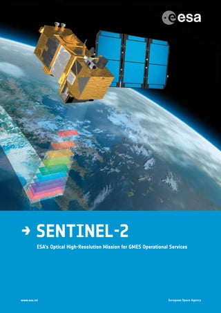
  • 1. → Sentinel-2 ESA’s Optical High-Resolution Mission for GMES Operational Services
  • 2.
  • 3. → Sentinel-2 ESA’s Optical High-Resolution Mission for GMES Operational Services SP-1322/2 March 2012
  • 4. Acknowledgements In the preparation of this publication, ESA acknowledges the contributions of the following organisations and individuals: GMES programme, ESA Sentinel-2 Project and Science Division Teams at ESTEC, Noordwijk, the Netherlands: F. Bertini, O. Brand, S. Carlier, U. Del Bello, M. Drusch, R. Duca, V. Fernandez, C. Ferrario, M.H. Ferreira, C. Isola, V. Kirschner, P. Laberinti, M. Lambert, G. Mandorlo, P. Marcos, P. Martimort, S. Moon, P. Oldeman, M. Palomba, J. Patterson, M. Prochazka, M.H. Schricke- Didot, C. Schwieso, J. Skoog, F. Spoto, J. Stjernevi, O. Sy, B. Teianu and C. Wildner ESA Sentinel-2 Payload Data Ground Segment and Mission Management Team at ESRIN, Frascati, Italy: O. Arino, P. Bargellini, M. Berger, E. Cadau, O. Colin, F. Gascon, B. Hoersch, H. Laur, B. Lopez Fernandez and E. Monjoux ESA Sentinel-2 Flight Operations Segment Team at ESOC, Darmstadt, Germany: M. Collins, F. Marchese and J. Piñeiro National space agencies working in partnership with ESA: —— CNES, Toulouse, France: S. Ballarin, C. Dechoz, P. Henry, S.  Lachérade, A. Meygret, B. Petrucci, S. Sylvander and T. Trémas. CNES is in charge of Sentinel-2 image quality activities, including monitoring mission performance and assisting ESA with the prototyping, development and verification of payload data processing and product quality monitoring. —— DLR, Bonn, Germany: H. Hauschildt, R. Meyer and S. Phillip-May. DLR is responsible for providing the Optical Communication Payload (OCP), developed by Tesat (Germany), which is expected to enhance the distribution of mission data to receiving and processing stations in real time through Alphasat and later on EDRS. Members of the industrial consortium led by Astrium GmbH (platform and satellite system) and Astrium SAS (MultiSpectral Instrument), in particular the project managers H. Sontag and V. Cazaubiel and their teams for their significant contributions to the design, development, integration, testing and verification of the Sentinel-2 satellite system. Cover: Artist’s impression of one Sentinel-2 satellite operating in orbit. An ESA Communications Production Publication Sentinel-2: ESA’s Optical High-Resolution Mission for GMES Operational Services (ESA SP-1322/2 March 2012) Production Editor K. Fletcher Editing/Layout Contactivity bv, Leiden, the Netherlands Publisher ESA Communications ESTEC, PO Box 299, 2200 AG Noordwijk, The Netherlands Tel: +31 71 565 3408 Fax: +31 71 565 5433 www.esa.int ISBN 978-92-9221-419-7 ISSN 0379-6566 Copyright © 2012 European Space Agency
  • 5. iii Foreword Foreword As part of the Global Monitoring for Environment and Security (GMES) Space Component programme, ESA is undertaking the development of an operational optical high-resolution Earth observation mission. Sentinel-2 is a system of two polar-orbiting satellites that will contribute to the continuity and improvement of the SPOT and Landsat series of multispectral missions, and ensure the delivery of high-quality data and applications for operational land monitoring, emergency response and security services.
  • 6.
  • 7. v Contents Contents Foreword . . . . . . . . . . . . . . . . . . . . . . . . . . . . . . . . iii 1 Introduction . . . . . . . . . . . . . . . . . . . . . . . . . . . . . . 3 2 GMES Programme Context . . . . . . . . . . . . . . . . . . . . . . . . . 5 2.1 GMES Sentinel Missions . . . . . . . . . . . . . . . . . . . . . . . . . 5 2.2 GMES Space Component Ground Segment . . . . . . . . . . . . . . . . . . 7 2.3 GMES Initiative and Data Access . . . . . . . . . . . . . . . . . . . . . . 7 3 Sentinel-2 Mission Overview . . . . . . . . . . . . . . . . . . . . . . . . 9 4 Sentinel-2 System Concept Overview . . . . . . . . . . . . . . . . . . . . 15 4.1 Sentinel-2 Space Segment . . . . . . . . . . . . . . . . . . . . . . . . 15 4.1.1 Satellite and Platform Design . . . . . . . . . . . . . . . . . . . . 15 4.1.2 The MultiSpectral Instrument Design . . . . . . . . . . . . . . . . . 25 4.1.3 Assembly, Integration and Test Programmes . . . . . . . . . . . . . . . 28 4.1.4 Satellite System Verification . . . . . . . . . . . . . . . . . . . . . 31 4.2 Sentinel-2 Ground Segment . . . . . . . . . . . . . . . . . . . . . . . 32 4.2.1 Flight Operations Segment . . . . . . . . . . . . . . . . . . . . . 32 4.2.2 Payload Data Ground Segment . . . . . . . . . . . . . . . . . . . . 33 5 Sentinel-2 Launch Campaign and Early In-Orbit Operations . . . . . . . . . . . 37 5.1 Launch Campaign . . . . . . . . . . . . . . . . . . . . . . . . . . 37 5.2 Early Orbit Phase . . . . . . . . . . . . . . . . . . . . . . . . . . . 37 5.3 Switch-on and Verification . . . . . . . . . . . . . . . . . . . . . . . 38 6 Sentinel-2 Image Quality . . . . . . . . . . . . . . . . . . . . . . . . . 39 7 Sentinel-2 Level-1 Processing . . . . . . . . . . . . . . . . . . . . . . . 43 8 Prototyping of Level-2 Products: Cloud Screening and Atmospheric Corrections . . . 45 9 Sentinel-2 Applications and Products . . . . . . . . . . . . . . . . . . . . 47 9.1 Geoland-2 . . . . . . . . . . . . . . . . . . . . . . . . . . . . . 47 9.2 SAFER, RISK-EOS and Respond . . . . . . . . . . . . . . . . . . . . . . 49 9.3 G-MOSAIC . . . . . . . . . . . . . . . . . . . . . . . . . . . . . 50 9.4 Sentinel-2 Data Contributions . . . . . . . . . . . . . . . . . . . . . . 51 10 Sentinel-2 Calibration and Validation . . . . . . . . . . . . . . . . . . . . 53 10.1 Radiometric Calibration . . . . . . . . . . . . . . . . . . . . . . . . 53 10.2 Geometric Calibration . . . . . . . . . . . . . . . . . . . . . . . . . 54 10.2 Atmospheric Corrections . . . . . . . . . . . . . . . . . . . . . . . . 54 11 Sentinel-2 Pre-flight Campaigns . . . . . . . . . . . . . . . . . . . . . . 55
  • 8. SP-1322/2 vi 12 Conclusions . . . . . . . . . . . . . . . . . . . . . . . . . . . . . . 57 Appendices . . . . . . . . . . . . . . . . . . . . . . . . . . . . . . . 59 Appendix A: Members of the Sentinel-2 Industrial Consortium . . . . . . . . . . . 61 Appendix B: Associated Industrial Partners . . . . . . . . . . . . . . . . . . . 63 Appendix C: The Sentinel-2 system . . . . . . . . . . . . . . . . . . . . . . 65 References . . . . . . . . . . . . . . . . . . . . . . . . . . . . . . . 67 Acronyms and Abbreviations . . . . . . . . . . . . . . . . . . . . . . . . 69
  • 10.
  • 11. Introduction 3 1. Introduction The Global Monitoring for Environment and Security (GMES) programme is a joint initiative of the European Commission (EC) and the European Space Agency (ESA) to establish a European capacity for the provision and use of monitoring information for environmental and security applications. ESA’s role in GMES is to provide the definition and the development of the space- and ground-based system elements. The GMES Sentinel-2 mission will ensure the continuity of services that rely on multispectral high-resolution optical observations over global terrestrial surfaces. The mission objectives are to provide systematic acquisitions of high- resolution multispectral imagery with a high revisit frequency, to ensure the continuity of multispectral imagery provided by the SPOT series of satellites, and to provide observations for the next generation of operational products such as land-cover maps, land-use change detection maps and geophysical variables. Consequently, Sentinel-2 will contribute directly to land monitoring, emergency response and security services. The corresponding user requirements have driven the design towards a dependable multispectral Earth observation system featuring a MultiSpectral Instrument (MSI) with 13 spectral bands ranging from the visible and near- infrared to the short-wave infrared. The spatial resolution varies from 10 m to 60 m, depending on the spectral band, with a 290 km field of view. This unique combination of high spatial resolution, wide field of view and broad spectral coverage represents a major step forward compared with other multispectral missions. The mission foresees a series of satellites, each with a lifetime of 7.25 years, over a 20-year period. During full operation, two identical satellites will be maintained in the same orbit with a phase delay of 180°, providing a revisit time of five days at the equator. The first satellite, Sentinel-2A, is expected to be launched in late 2013, and Sentinel‑2B, about two years later. The Contributors The report is based on inputs from all the ESA Sentinel-2 teams involved in space, ground and mission development activities. Major contributions have also been received from national space agencies working in partnership with ESA, especially the Centre National d’Etudes Spatiales (CNES, France) and the Deutsches Zentrum für Luft und Raumfart (DLR, Germany), as well as from Astrium GmbH and Astrium SAS, the Prime Contractors responsible for developing the satellite system and the MultiSpectral Instrument, respectively. The contributors to this report are listed on page ii of this report. Structure of this Report This report provides an overview of the GMES Sentinel-2 mission, including the technical system concept, image quality, Level-1 data processing and operational applications. The report describes all of the system elements on which the Sentinel-2 mission is built. Chapter 2, ‘GMES Programme Context’ provides general information on this European flagship operational space programme. Chapter 3, ‘Sentinel-2 Mission Overview’, provides an overview of the mission, including products, user services and precursor missions. Chapter 4, ‘Sentinel-2 System Concept Overview’, introduces the Sentinel-2 Space Segment – the satellite design, including the platform and payload
  • 12. SP-1322/2 4 instrument, predicted performance and Assembly Integration Test and verification programmes – and the Flight Operations and Payload Data Ground Segments. Chapter 5, ‘Sentinel-2 Launch Campaign and Early In-Orbit Operations’, addresses the critical phase following the separation of the satellite from the launcher until the performance of time-critical activities in orbit. Chapter 6, ‘Sentinel-2 Image Quality’, depicts the main payload instrument performance that will determine the quality of the mission products and user services. Chapter 7, ‘Sentinel-2 Level-1 Processing’, describes how Sentinel-2 mission products are produced, archived and made available to users. Chapter 8, ‘Prototyping of Level-2 Products: Cloud Screening and Atmosphere Corrections’, underlines the innovative capabilities of Sentinel-2 for automatic data product correction using specific instrument spectral channels. Chapter 9, ‘Sentinel-2 Applications and Products’, describes the main data products and their applications for land and security services promoted by ESA and the European Commission. Chapter 10, ‘Sentinel-2 Calibration and Validation’, describes the approach that will be used during the in-orbit commissioning phase to ensure optimal mission performance and the delivery of reliable data to user communities. Chapter 11, ‘Sentinel-2 Pre-Flight Campaign’, presents the planned activities to generate validation data that will be used to optimise data products during the routine operation phase. Finally, Chapter 12 presents some conclusions.
  • 13. GMES Programme Context 5 2. GMES Programme Context The GMES programme is a European initiative to ensure the availability of information and data products for environmental and security services. It is based on data received from Earth observation satellites and ground-based networks. Within the GMES programme, the GMES Space Component (GSC) is responsible for delivering the necessary Earth observation data to the GMES Service Component, which in turn is responsible for providing the Earth observation data and value-added products to users. As part of the GMES Space Component programme, ESA is responsible for developing a fully operational space-based capability to feed the GMES Service Component with satellite data. This capability will be achieved by facilitating access to data from GMES Contributing Missions as well as by developing new GMES dedicated Earth observation missions, the Sentinel missions. The satellite data will be stored in a long-term archive to enable repeated use of long time series (Fig. 2.1). The Sentinel missions have been designed in accordance with the individual Mission Requirement Documents (e.g. ESA, 2010) with a view to satisfying the evolving requirements of GMES user communities, in particular those identified in the strategic implementation plans prepared by the EC’s GMES Core Services implementation groups in 2007, and in the GMES Space Component Programme Declaration approved by the participating ESA Member States. 2.1 GMES Sentinel Missions The ESA Sentinels constitute the first series of operational satellites that will respond to the Earth observation needs of the GMES initiative. The GMES Space Component relies strongly on complementary developments within ESA, as well as on the existing and planned space assets of the various national space agencies. As part of the GMES Space Component, ESA is developing five Sentinels mission families. Each Sentinel-1, Sentinel-2, Sentinel-3 and Jason-CS mission Figure 2.1. The GMES end-to-end system.
  • 14. SP-1322/2 6 is based on a constellation of two satellites in the same orbital plane. With this configuration it will be possible to fulfil the revisit and coverage requirements and provide robust and affordable operational services. Sentinel-5P is conceived as a gap-filler satellite. Sentinel-4 covers the development of two payload instruments to be carried on Meteosat Third Generation. Sentinel-5 covers the development of two instrument payloads to be carried on MetOp Second Generation. The lifetime of the individual satellites is specified as 7.25 years (5 years for Jason-CS), with consumables onboard each satellite allowing for mission extensions of up to 12 years (2 years for Jason-CS). The life cycle of each generation of satellites is planned to be on the order of 15–20 years. The strategy for the procurement and replacement of Sentinel satellites over this period is being elaborated. The current phase of the GMES Space Component includes the following missions and satellites: Sentinel-1 – Synthetic Aperture Radar (SAR) imaging for (Davidson et al., 2011): —— monitoring sea-ice zones and the Arctic and Antarctic environment; —— surveillance of marine environments; —— monitoring land surface motion risks; —— mapping of land surfaces: forests, water and soils, agriculture; —— mapping in support of humanitarian aid in crisis situations. Sentinel-2 – Multispectral imaging for (Drusch et al., 2012): —— land cover, land use and land-use change detection maps; —— maps of biogeophysical variables such as leaf chlorophyll content, leaf water content, leaf area index (LAI); —— risk mapping; —— acquisition and rapid delivery of images to support disaster relief efforts. Sentinel-3 – Multispectral imaging, radiometry and altimetry for (Donlon et al., 2012): —— sea and land colour data; —— sea and land surface temperatures; —— sea-surface and land-ice topography; —— high-resolution altimetry for synthetic aperture processing; —— land synergy products from optical instrument data. Sentinel-4, Sentinel-5P and Sentinel-5 – Multispectral imaging and profiling for (Ingman et al., 2011): —— monitoring changes in atmospheric composition at high spatial resolution; —— daily global and regional mapping of ozone, NO2, SO2, formaldehyde and aerosols at high temporal resolution; —— daily global mapping of CO and CH4. Sentinel-4 is an atmospheric chemistry instrument operating in geostationary orbit, to be flown on the Meteosat Third Generation (MTG) satellites. Sentinel-5P is a precursor atmospheric chemistry mission to be flown in a polar Sun- synchronous orbit (filling the gap between Envisat and MetOp second- generation satellites). Sentinel-5 is an operational atmospheric chemistry instrument to be flown on MetOp second-generation satellites to be operated in a Sun-synchronous polar orbit. Jason CS – Operational altimetry for monitoring sea-surface height (under Phases A−B1).
  • 15. GMES Programme Context 7 2.2 GMES Space Component Ground Segment The GSC Ground Segment is composed of three segments: the GSC Core Ground Segment, the GSC Collaborative Ground Segment and the GMES Contributing Missions ground segments. First, the GSC Core Ground Segment, with GSC-funded functions and elements, provides primary access to Sentinel data and coordinates access to GMES Contributing Mission data. The GSC Core Ground Segment consists of the Sentinel Core Ground Segment and the GMES Data Access Layer. The Sentinel Core Ground Segment comprises: —— TheSentinelFlightOperationsSegment(FOS),whichprovides,forallSentinels: –– satellite monitoring and control during all mission phases (i.e. launch and early orbit phases, commissioning, routine and deorbiting); –– satellite orbit determination and maintenance; and –– the network of tracking, telemetry and command S-band ground stations. —— The Sentinel Payload Data Ground Segment (PDGS), which provides, for all Sentinel missions: –– planning, acquisition, processing and dissemination of data products; –– calibration and validation of the Sentinel missions; –– user services including cataloguing, data selection, metadata access, user help and documentation; –– systematic reprocessing of historical Sentinel mission data; and –– algorithm and product maintenance and upgrading. The GMES Data Access Layer provides harmonised access to data from the Sentinel missions and the GMES Contributing Missions. Second, the GSC Collaborative Ground Segment, with non-GSC-funded functions and elements, provides supplementary access to Sentinel mission data, i.e. either through specific data acquisition services, or specific data products. Finally, the GMES Contributing Mission ground segments allow the acquisition of useful operational data guaranteed by relevant space missions. 2.3 GMES Initiative and Data Access GMES is a joint initiative of the EC and ESA to establish a European capacity for the provision and use of operational monitoring information for environmental and security applications. This capacity is envisaged to consist of three modules, which together constitute the functional GMES system: —— the production and dissemination of information in support of European Union (EU) policies related to the environment and security; —— the mechanisms needed to ensure permanent dialogue between all stakeholders, and in particular between providers and users; and —— the legal, financial, organisational and institutional frameworks necessary to ensure the functioning of the GMES system and its evolution. Although elements of these three modules already exist, many have been conceived, designed and managed in isolation, thus limiting their interoperability and the production of relevant information. GMES will provide added value by ensuring the coherence, efficiency and sustainability of a shared information system for Europe. Achieving this goal will involve improving the compatibility of the existing elements, establishing cooperation between the relevant organisations and filling the gaps where necessary. Within the GMES programme, ESA is responsible for the development of the GMES Space Component, a fully operational space-based capability to supply Earth observation data to support environmental information services across
  • 16. SP-1322/2 8 Europe. These services, implemented in parallel by the European Commission, will then be able to offer added value in terms of the data and services available to users. The Sentinels are dedicated Earth observation missions that are the essential elements of the GMES Space Component. In the global GMES framework, these missions will complement other satellites made available by third parties or by ESA, and will be coordinated in a synergistic system through the GSC Data Access system (see http://gmesdata.esa.int). In the GMES programme context, the Sentinel-2 mission will ensure the continuity of services that rely on multispectral high-resolution optical observations over global terrestrial surfaces (Martimort et al., 2007a, 2007b). The key objectives of the mission are to: —— provide systematic global acquisitions of high-resolution multispectral imagery with a high revisit frequency; —— ensure the continuity of multispectral imagery provided by the SPOT (Satellite pour l’Observation de la Terre) series of satellites; and —— deliver observations for the next generation of operational products such as land-cover maps, land-cover change detection maps and geophysical variables. Sentinel-2 will capitalise on the technology and the vast experience acquired in Europe and the United States to maintain the supply of data for operational services such as: —— risk management (floods and forest fires, subsidence and landslides); —— European land use and land cover state and changes; —— forest monitoring; —— food security/early warning systems; —— water management and soil protection; —— urban mapping; —— natural hazards; and —— terrestrial mapping for humanitarian aid and development. The EC and ESA have agreed to ensure free and open access to all GMES Sentinel data. Conditions of access to and use of data from GMES Contributing Missions will be determined by the respective mission owners, in consultation with ESA.
  • 17. Sentinel-2 Mission Overview 9 3. Sentinel-2 Mission Overview The GMES Sentinel-2 mission will contribute to a variety of services that rely on multispectral high-spatial-resolution optical observations over global terrestrial surfaces. The mission has been designed as a dependable multispectral Earth observation system that will ensure the continuity of Landsat and SPOT observations and improve the availability of data for users (see Fig. 3.1). The SPOT remote-sensing programme was set up in 1978 by CNES in France, in partnership with Belgium and Sweden. The first satellite, SPOT-1, was launched in 1986, SPOT-2 in 1990, SPOT-3 in 1993, SPOT-4 in 1998 and SPOT-5 in 2002. Each SPOT payload includes two identical High-Resolution Visible (HRV) imaging instruments that are able to operate in two modes, either simultaneously or individually. The two spectral modes are panchromatic and multispectral. The panchromatic band has a resolution of 10 m on SPOT-4, down to 2.5 m on SPOT-5, and the four multispectral bands − three in the Visible and Near Infrared (VNIR) and one in Short Wave Infrared (SWIR) − have a resolution of 20 m, except for the three VNIR bands with a resolution of 10 m on SPOT-5. The revisit period is 26 days and the coverage is not systematic, but is based on imaging requests received from users. Since the deorbitation of SPOT-2 in 2009, after almost 20 years of service, the SPOT-4 and SPOT-5 satellites together have continued to provide high-resolution SPOT images and global images with the Vegetation instrument. In a privately financed initiative, Astrium is continuing the SPOT programme with the development of SPOT-6 and SPOT-7 (also called AstroTerra), focusing on commercial applications based on even higher spatial resolution. These satellites are expected to offer 1.5 m resolution in the panchromatic band and 6 m resolution in four VNIR multispectral bands within a 60 km swath. SPOT-6 and SPOT-7 are scheduled for launch in late 2012 and 2014, respectively (http:// eoedu.belspo.be/en/satellites/spot.htm). The data from the SPOT series of satellites have been used primarily for land-cover classification (Kanellopoulos et al., 1992; Gong et al., 1992) and for detecting changes in land use (e.g. Lu et al., 2004; Jensen et al., 1995). The Landsat programme started with the launch of the first of six satellites in 1972. Landsat observations have provided key data for monitoring global change and have been a primary source of medium spatial resolution Earth observation data for a wide range of applications (see the special issues of various journals on Landsat published in 1984, 1985, 1997, 2001, 2003, 2004 and 2006). The Landsat satellites can be classified into three groups, based on their sensor and platform characteristics (Chander et al., 2009). The first group consists of Landsat-1, Landsat-2 and Landsat-3, each of which carries a MultiSpectral Scanner (MSS) sensor and a Return Beam Vidicon (RBV) camera. The second group, comprising Landsat-4 and Landsat-5, carry the MSS and the Thematic Mapper I. The third group, Landsat-6 and Landsat-7, carry the Enhanced Thematic Mapper (ETM) and the Enhanced Thematic Mapper Plus (ETM+). Currently, Landsat data acquisition is assured by two in-orbit operational satellites, Landsat-5 and Landsat-7. A new satellite, called the Landsat Data Continuity Mission (LDCM), is scheduled for launch in early 2013 and will incorporate some improvements in terms of spatial resolution and spectral coverage. Landsat-5, with the MSS instrument, features six multispectral bands at 30 m resolution − four bands in the VNIR, and one in SWIR. Landsat-7, with the ETM+ instrument, features in addition to Landsat-5 one panchromatic band at 15 m resolution. The LDCM, with the Operational Land Imager (OLI) instrument, features in addition to Landsat-7 a further spectral band in the blue region. Both Landsat-5 and Landsat-7 also feature a thermal infrared spectral
  • 18. SP-1322/2 10 band for which continuity will be assured with the Thermal Infrared Sensor (TIRS) instrument on the LDCM. The US Geological Survey (USGS) currently distributes Landsat data at no charge to users via the Internet. The demand for data seems to be increasing exponentially, with 200 TBytes of data requested by users in 2009. The Landsat data are systematically terrain corrected. Based on the Landsat experience, it is anticipated that users will request a comparable, if not greater volume of Sentinel-2 data under the open access policy. In comparison with the SPOT and Landsat precursor series of satellites, the Sentinel-2 mission will offer an unprecedented combination of the following capabilities (Figs. 3.1 and 3.2): —— systematic global coverage of land surfaces from 56°S to 84°N, including coastal waters, the Mediterranean and selected calibration sites, e.g. over Antarctica; —— high revisit frequency: every five days at the equator under the same viewing conditions; —— high spatial resolution: 10 m, 20 m and 60 m; —— multispectral information with 13 bands in the VNIR and SWIR parts of the spectrum; and —— a wide field of view: 290 km. Arising from the need for high revisit frequency and high mission availability, two identical Sentinel-2 satellites will operate simultaneously (Fig. 3.3). Their orbit is Sun-synchronous at an altitude of 786 km (14 + 3/10 revolutions per day) with 10:30 as the local time of the descending node (LTDN). This local time was selected as the best compromise between the need for minimal cloud cover and to ensure suitable solar illumination. It is also close to the Landsat and SPOT local times, allowing the seamless combination of Sentinel-2 data with historical images and the building of long time series. The two satellites will be phased at 180° on opposite sides of the orbit (Fig. 3.4). The first Sentinel-2 satellite is expected to be launched in late 2013. Sentinel-2’s 13 spectral bands extend from the VNIR to the SWIR (Fig. 3.5), featuring: —— four bands at 10 m: the classical blue (490 nm), green (560 nm), red (665 nm) and near-infrared (842 nm); —— six bands at 20 m: four narrow bands in the vegetation red-edge spectral domain (705 nm, 740 nm, 783 nm and 865 nm) and two large SWIR bands (1610 nm and 2190 nm); and Figure 3.1. Comparison of the capabilities of Landsat, SPOT and Sentinel-2. (Astrium GmbH, Germany) Landsat SPOT Sentinel-2 Number in series 7+1* 5** starting with 2 Launch 1972 to 1999* 1986 to 2002 S2-A launch end 2013 Measurement principle scanner pushbroom pushbroom Earth coverage 16 26 5 days Swath 185 2 × 60 290 km Multispectral bands 7(8*) 4+1 (panchromatic) 13 Spatial sampling distance 30, 60 10, 20, (2.5) 10, 20, 60 m * LCDM mission targeted early 2013 ** SPOT-6 targeted end 2012
  • 19. Sentinel-2 Mission Overview 11 Figure 3.3. Sentinel-2 satellite. (Astrium GmbH, Germany) 500 1000 1500 2000 Wavelength (nm) Sentinel-2 MSI LDCM OLI SPOT 6/7 Spatialresolution(m) 60 30 20 15 10 6 1.5 Figure 3.2. Key characteristics of Landsat, SPOT and Sentinel-2 (main panel), and the spectral resolution and band settings of the MultiSpectral Instrument (MSI), Operational Land Imager (OLI) and SPOT instruments (inset, bottom right).
  • 20. SP-1322/2 12 —— three bands at 60 m, which are mainly dedicated to atmospheric corrections and cloud screening (443 nm for aerosol retrieval, 945 nm for water vapour retrieval and 1375 nm for cirrus cloud detection). The average observation time per orbit is 17 min, while the peak value is 32 min. The combination of the large swath and broad spectral range, coupled with the requirement for global and continuous acquisition with a high revisit frequency, will lead to the generation of about 1.6 TBytes of compressed raw image data each day from the constellation of satellites. This corresponds to an average continuous raw-data supply rate of 160 Mbit/s. The key features of the Sentinel-2 mission are summarised in Table 3.1. Figure 3.4. Sentinel-2 satellite orbital configuration. (Astrium GmbH, Germany) Table 3.1. Key features of the Sentinel-2 mission. Mission features Data Mission lifetime 15 years Number of satellites 2 Nominal in-orbit satellite lifetime 7.25 years with consumables for an additional 5 years Nominal orbit Sun-synchronous at 786 km (mean altitude), 10:30 LTDN Land coverage −56° to +84° Global revisit time 5 days Global accessibility 2 days; 1 day above 45° latitude Global Near-Real Time (NRT) latency 2 h to reception on ground Mission phases LEOP, commissioning, operational, deorbiting phases
  • 21. Sentinel-2 Mission Overview 13 Figure 3.5. Spectral bands versus spatial resolution (upper panel), and MSI normalised filter transmission functions and the modelled top- of-atmosphere (TOA) radiance spectrum of deciduous forest (bottom panel).
  • 22.
  • 23. Sentinel-2 System Concept Overview 15 4. Sentinel-2 System Concept Overview The Sentinel-2 end-to-end system will comprise two segments: —— the Sentinel-2 Space Segment, i.e. the two orbiting satellites including their payload instruments; and —— the Sentinel-2 Ground Segment, which will acquire the data transmitted by the Space Segment, perform data processing (Level-0 to -1c; -2a), archiving and dissemination, control the mission as a whole, and command and control the satellites in orbit. The main features of the Sentinel-2 system are summarised in Appendix C. 4.1 Sentinel-2 Space Segment 4.1.1 Satellite and Platform Design The Sentinel-2 satellite system is being developed by an industrial consortium led by Astrium GmbH (Germany) as the Prime Contractor, while Astrium SAS (France) is responsible for the MultiSpectral Instrument. The satellite is based on a new platform developed for Sentinel-2 that is conceived as a generic product that will be compatible with the pointing accuracy and stability requirements of some very demanding Earth observation missions. The design of the satellite has benefited from the experience gained by EADS-Astrium on previous ESA missions such as the European Remote Sensing (ERS) satellites, Envisat, MetOp, CryoSat and the Earth Explorer Atmospheric Dynamics Mission (ADM-Aeolus), as well as national missions such as the German TerraSAR-X. Each Sentinel-2 satellite weighs about 1.2 tonnes and features a rather compact design that ensures compatibility with small launchers like Vega and Rockot (Fig.  4.1). The satellite lifetime is specified as 7.25 years, including a three-month in-orbit commissioning phase. Batteries and propellants are sized for 12 years, including provision for deorbiting manoeuvres at end-of-life. Each satellite is 3-axis stabilised and will be placed directly in circular polar orbit by the launcher. The satellite attitude is measured by an advanced multihead startracker and an Inertial Measurement Unit (IMU) using a fibre-optic gyroscope (Fig.  4.2) and controlled by a set of four reaction wheels (Fig.  4.3) and three magnetic torque rods. The startracker heads and the fibre-optic gyro unit are mounted on the MultiSpectral Instrument structure for better pointing accuracy and stability. The reaction wheels are damper-mounted and the Solar Array Drive Mechanism (SADM) employs a microstepping motor in order to reduce microvibrations that could adversely affect image quality and performance (Fig. 4.4). The position of each Sentinel-2 satellite in orbit will be measured by a dual- frequency GNSS (Global Navigation Satellite System) receiver and its orbit is accurately maintained by a dedicated propulsion system using hydrazine propellant and catalytic reaction thrusters. Coarse Earth and Sun Sensors (CESS) are used to maintain a coarse pointing in the event that an anomaly affects the fine pointing system (Fig. 4.5). The power subsystem relies on highly efficient solar cells (GaAs triple junction) and lithium ion batteries. The Sentinel-2 satellite design is characterised by a modular configuration enabling parallel development and integration of its main assemblies for schedule optimisation (Fig. 4.6). Its main components are as follows: —— An aluminium frame divides the satellite into a lower propulsion module and platform equipment compartment, and an upper instrument and sensor compartment (Fig. 4.7). This frame interfaces with a cylindrical launcher Figure 4.1. The Sentinel-2 satellite enclosed within the launcher fairing. (Astrium GmbH, Germany)
  • 24. SP-1322/2 16 Figure 4.2. Inertial Measurement Unit. (Astrium SAS, France) adapter. The instrument and sensor plate compartment is stiffened by an aluminium frame and closed by four access and radiator panels and a top floor. The top floor provides accommodation for the MultiSpectral Instrument optical assembly in SiC technology mounted isostatically through six Carbon-fibre Reinforced Polymer (CFRP) struts on top of a CFRP panel. The critical Attitude and Orbit Control System (AOCS) sensor assembly carrying the three startrackers and the fibre-optic gyroscope package is isostatically accommodated directly on the instrument’s telescope structure (Fig. 4.8). —— The satellite configuration provides nadir pointing to the instrument and unobstructed fields of view for the startracker optical heads and for the X‑band/S‑band communication and GNSS antennas. The Optical Communication Payload (Fig. 4.9) is located on the side of the satellite facing away from Earth in order to ensure optimal visibility to a geostationary data relay satellite (Alphasat, and later EDRS). The Coarse Earth and Sun Sensors are positioned such that there is an unobstructed field of view of a deployed and rotating solar array. —— The platform equipment compartment accommodates all the electronic equipment on four sandwich panels and an intermediate floor. The batteries are mounted outside the compartment for late integration. —— The various units have been located so as to optimise thermal heat dissipation and to maintain the satellite’s centre of gravity. Optical alignment cubes are integrated into all sensitive equipment for the derivation of accurate alignment vectors and transfer matrices with the satellite reference frame. —— The single-wing solar array has been designed so as to limit in-orbit mechanical disturbances in its deployed and rotating configuration. —— The propulsion system has been designed as an independent module that can be tested prior to its integration within the platform compartment. Thruster plume impingement and thruster obstruction are avoided by a mechanical accommodation within the launcher adapter ring. The satellite has been designed to operate autonomously in the event of a nominal or single failure without updating its mission commands for up to 15 days. Retrieval and analysis of the satellite housekeeping telemetry data are, however, scheduled to take place twice a day. Satellite command and control
  • 25. Sentinel-2 System Concept Overview 17 Figure 4.3. Reaction wheels. (Bradford Engineering, the Netherlands) Figure 4.4. Qualification model of the Sentinel-2 Solar Array Drive Mechanism. (RUAG, Switzerland)
  • 26. SP-1322/2 18 Figure 4.6. Sentinel-2 configuration with the solar array deployed. (Astrium GmbH, Germany) Figure 4.5. Coarse Earth and Sun Sensors. (Astrium GmbH, Germany) and thermal control functions are implemented by the satellite Onboard Computer (OBC). The Atmel ERC-32 processing module performs the core processing of the unit via patchable software. The computer also drives two redundant MIL-STD-1553B buses (one for the payload, one for the platform). The payload data handling is based on a 2.4  Tbit solid state mass memory based on NAND flash technology, and the payload data downlink is performed at a rate of 560 Mbit/s in the X-band with 8-PSK modulation and an isoflux antenna (Fig. 4.10) compliant with the spectrum bandwidth allocated by the International Telecommunication Union (ITU). The OCP complements the payload data handling and telecommunication system for optical data transmission of mission data through a geostationary satellite (e.g. Alphasat, a forerunner of the European Data Relay System,
  • 27. Sentinel-2 System Concept Overview 19 EDRS). Redundant S-band telemetry/telecommand (TM/TC) chains, compliant with ECSS/CCSDS communications standards, provide authenticated command and secure satellite telemetry links with the Ground Control segment (Fig. 4.11). Most satellite functions are redundant and can be autonomously reconfigured by the OBC to maximise the reliability and availability of the system. Furthermore, extensive internal cross-coupling within the OBC permits maximum operational flexibility during the mission. Figure 4.12 provides an overview of the satellite’s operational modes, while Fig. 4.13 sketches the Sentinel-2 data communication system. Figure 4.14 shows the system and equipment-level onboard software functions embedded in the satellite design. The main platform functions are as follows: —— attitude and orbit control, including precise attitude measurements, stable and precise 3-axis pointing and precise orbit determination; —— propulsion, including correction of orbit injection errors, orbit maintenance and attitude control during ultimate safe mode and end-of-life disposal (Fig. 4.15); —— satellite data handling, including telecommand reception, deciphering, handlinganddistribution,telemetrycollection,packetisationandforwarding to ground by telemetry, tracking and command (TTC) communication equipment, and time and synchronisation signals management also in support of the payload; —— satelliteautonomyandfailuredetectionidentificationandrecovery,including payload and satellite status monitoring, management and recovery, satellite operations planning support (mission timeline and sub-schedules); —— power generation (Fig.  4.16) and energy balance management, including power generation and energy storage, power conditioning, protection, distribution and switching, and pyrotechnic device actuation; —— thermal control, including temperature monitoring, heat generation and dissipation; —— structure, including primary structural support and interface with the launch vehicle, and appendage tie-down points and release mechanisms; and —— telemetry data communication with the ground, with satellite telemetry transmission and telecommand reception via the S-band transponder, instrument telemetry downlink via the X-band transmitter or via the OCP using an intermediate geostationary data relay satellite. Figure 4.7. Sentinel-2 Protoflight Model (PFM) platform integrating the structure, propulsion module, thermal hardware and harness. (CASA, Spain, and Astrium GmbH, Germany)
  • 28. SP-1322/2 20 Figure 4.8. Sentinel-2 satellite architecture. (Astrium GmbH, Germany)
  • 29. Sentinel-2 System Concept Overview 21 Figure 4.9. Left: OCP integration rehearsal on the PFM satellite. (Astrium GmbH, Germany) Right: Sentinel-2 Optical Communication Payload (DLR and Tesat GmbH, Germany). Figure 4.10. X-band antenna. (Thales, Italy)
  • 30. SP-1322/2 22 Figure 4.11. S-band transponder. (Thales Spain) Figure 4.12. Sentinel-2 operational modes. (Astrium GmbH, Germany)
  • 31. Sentinel-2 System Concept Overview 23 Figure 4.13. Sentinel-2 data communication system. HK – housekeeping; TM/TC – telemetry/telecommand; FOS, Darmstadt, Germany; PDGS, Frascati, Italy. Figure 4.14. Sentinel-2 software. (Astrium GmbH, Germany)
  • 32. SP-1322/2 24 Figure 4.15. The propulsion module. (Astrium GmbH, Germany) Figure 4.16. Qualification model of the Sentinel-2 solar array. (Dutch Space, the Netherlands)
  • 33. Sentinel-2 System Concept Overview 25 The main characteristics of the Sentinel-2 satellite system are presented in Table 4.1. 4.1.2 The MultiSpectral Instrument Design The MultiSpectral Instrument has a mass of 290 kg (Fig. 4.17) and is based on the push-broom concept. It features a Three-Mirror Anastigmatic (TMA) telescope with a pupil diameter equivalent to 150 mm, which is isostatically mounted on the platform in order to minimise thermoelastic distortions. The optical design has been optimised to achieve state-of-the-art imaging quality across its very wide field of view: its 290 km swath width is significantly larger than the 120 km swath of SPOT-5 (using two instruments), or the 185 km of the OLI included in the Landsat Continuity Mission. The telescope structure and the mirrors are made of silicon carbide, which provides a very high optical stability to mass ratio and minimises the thermoelastic deformation (Fig. 4.18). System features Data Evolution Four satellites needed for 15 years of operation Ground station scenario (for payload data recovery via the X-band) Matera (Italy), Svalbard (Norway), Maspalomas (Spain), Prudhoe Bay (Alaska, USA), plus local user stations Security Authentication of commands Reliability 0.7 Availability 97% Geolocation (2σ) without ground control points (GCPs) 20 m Swath 290 km Modes of operation Nominal mode, extended mode, support modes, safe mode Maximum imaging 32 min per 100 min orbit Launcher for Sentinel-2A Rockot (Eurockot, Germany) Launcher for Sentinel-2B Vega (Arianespace, France) Satellite launch mass 1225 kg (with 70 kg margin included) Satellite dimensions (stowed) 3390 × 1630 × 2350 mm Table 4.1. Sentinel-2 system characteristics. Figure 4.17. The MultiSpectral Instrument. (Astrium SAS, France)
  • 34. SP-1322/2 26 The VNIR focal plane is based on monolithic complementary metal oxide semiconductor (CMOS) detectors, while the SWIR focal plane (see Fig. 4.19) is based on mercury−cadmium−telluride (MCT) detectors hybridised on a CMOS readout circuit. Twelve VNIR and SWIR detectors are employed in a staggered configuration to cover the field of view. The SWIR focal plane is passively thermo-controlled at temperatures below 195K. A dichroic beam splitter provides the spectral separation of the VNIR and SWIR channels. Spectral separation in the various bands is provided by stripe filters (see Fig. 4.20) mounted on top of the detectors. Figure 4.18. Sentinel-2 MultiSpectral Instrument SiC mirrors after polishing and coating (AMOS, Belgium) and the monolithic telescope base plate (Boostec, France).
  • 35. Sentinel-2 System Concept Overview 27 Figure 4.19. Two views of the Engineering Model (EM) of the SWIR focal plane, equipped with detectors and thermal hardware. (Astrium SAS, France) Figure 4.20. VNIR filter assemblies positioned on top of the detectors on the FPA. The assembly design and materials have been optimised to minimise straylight. (Jena-Optronik, Germany)
  • 36. SP-1322/2 28 A full-field and full-pupil onboard diffuser will be employed for radiometric calibration to guarantee high-quality radiometric performance. The observation data are digitised into 12 bits. State-of-the-art lossy compression based on a wavelet transform is applied to reduce the data volume. The compression ratio of between 2 and 3 has been fine-tuned for each spectral band to ensure that there is no significant impact on image quality. A shutter mechanism is implemented to prevent the instrument from direct illumination by the Sun in orbit and to avoid contamination during launch. The same mechanism will also function as a calibration device by collecting the sunlight after reflection by a diffuser (Fig. 4.21). 4.1.3 Assembly, Integration and Test Programmes Platform and Satellite AIT programme The Sentinel-2 satellite Assembly, Integration and Test (AIT) programme encompasses: —— functional test activities; —— integration and qualification of the Sentinel-2A satellite; and —— integration and acceptance of the Sentinel-2B satellite. In line with the Sentinel-2 development model philosophy, three test facilities are used to support the functional tests on the development models and on the Sentinel-2 satellites: the Software Test Bench (STB); the Electrical Functional Model (EFM) and the Protoflight Model (PFM). The STB includes an Elegant Breadboard of the Onboard Computer (Fig. 4.22) and is dedicated to executing the satellite Central Software (CSW) in representative target hardware and to simulate in real time its command and control interfaces with the other platform and payload units. The STB constitutes an operational facility capable of supporting the development of the different CSW versions in synergy with the other CSW verification facilities and performance analysis benches. This allows the preparation and debugging of automated test sequences that can be reused on the other development models and to prepare the flight operation sequences. The EFM includes the engineering qualification model of the OBC and engineering models of the main platform and payload units, complemented by a simulation of the remaining units. It constitutes an electrical model representative of the whole satellite, including fully representative hardware and software of all the critical units operating on the MIL-bus and with high- fidelity electrical and functional simulation models of the missing units. The EFM provides all the features needed to perform early validation of the electrical interfaces, verification of the AOCS functionalities by real-time closed-loop testing, including failure detection, isolation and recovery, and the development of the flight operational procedures. It allows also early electrical and functional verification of the interfaces between the platform and all payload units. The PFM test environment is designed to support the functional verification of the Sentinel-2 satellites throughout their assembly and integration phases and during the respective environmental qualification and acceptance test campaigns. The design of the satellite and of the PFM Electrical Ground Support Equipment (EGSE) has been conceived to provide the capability to stimulate and test in closed-loop the AOCS sensors and actuators. This encompasses the utilisation of sophisticated external optical and electrical real-time stimuli to the sensors, including the simulation of the GNSS constellation of satellites (Fig. 4.23). It also includes the capability to fully stimulate and monitor the power subsystem, S-band and X-band subsystems, and allows the execution of System Functional Tests (SFTs) and Operations System Tests (OSTs) using the Figure 4.21. Calibration and shutter mechanism showing the fixation points for the Sun calibration diffuser. (SENER, Spain) Figure 4.22. Sentinel-2 Software Test Bench with the OBC Elegant Breadboard and simulation front-end. (Astrium GmbH, Germany)
  • 37. Sentinel-2 System Concept Overview 29 same TM/TC command and control databases used for the flight operations. The above features allow the execution of functional tests of the satellite with its hardware and software in flight configuration until the late stages of the AIT programme. The EFM and PFM test environments support the preparation and execution of the System Validation Tests (SVTs). During these tests, executed in four sessions during the satellite AIT programme, the control of the satellite is transferred to the Flight Operations Segment at ESA’s ESOC (European Space Operations Centre), and the S-band TM/TC and X-band downlink data are exchanged and acquired by dedicated EGSE. It is planned to conduct environmental tests of the Sentinel-2 satellites at the ESTEC Test Centre over a period of about six months. For the PFM satellite, the following tests are foreseen: —— mass property measurements; —— sine and acoustic vibration tests; —— adapter fit check and separation shock tests, with the Vega and Rockot 1194 mm launcher adapters; —— thermal vacuum and thermal balance, including solar simulation; —— electromagnetic compatibility tests; —— operations system tests; and —— functional, alignment tests, including payload end-to-end optical stability checks, propulsion leak and solar array deployment tests, which will be executed at the beginning and the end of the environmental test campaign. For the second and recurring models of the satellite, a standard environmental acceptance test sequence is foreseen, allowing the duration of the test to be reduced to 8 weeks. Figure 4.24 shows the arrival of the first Sentinel-2 protoflight platform at Astrium within its transport container. MultiSpectral Instrument AIT Programme The Sentinel-2 MultiSpectral Instrument is undergoing a thorough integration and test programme based on a two-step approach. The MSI verification programme starts with an EM programme dedicated to the early verification of the VNIR and SWIR focal plane opto-mechanical integration, and an electrical coupling allowing a first end-to-end characterisation of the performance of the MSI detection chains. To complete the MSI verification, the flight hardware will undergo a protoflight (PFM) qualification programme, including a full characterisation of geometric, optical and radiometric performance at instrument level. The instrument EM AIT programme uses sophisticated test and verification techniques specific to each focal plane. For the VNIR Focal Plane Assembly (FPA), composed of ten bands with strip filters mounted on top of the detectors, the alignment procedure requires fine-tuned positioning with micrometre accuracy in order to achieve planarity without vignetting and to minimise straylight parasitic effects. For the SWIR FPA, the challenge lies in achieving accurate control of the detectors and strip filter alignment under flight- representative thermal conditions (195K) in order to reach the specified signal- to-noise ratio (SNR) performance. The alignment and radiometric performance will be characterised during a dedicated thermal balance test. The EM test programme also couples the detectors to the front-end electronics module (Fig. 4.25) and to the Video and Compression Unit (VCU), allowing the verification of the instrument data sequencing of the onboard data compression performance and of the data handling for the VNIR and SWIR detection chains. The instrument EM test programme is completed by a performance characterisation of all the detection chains, including optical Modulation Figure 4.23. Sentinel-2 GPS constellation simulator. (Astrium GmbH, Germany) Figure 4.24. The Sentinel-2 protoflight platform arriving at Astrium in Friedrichshafen. (Astrium GmbH, Germany)
  • 38. SP-1322/2 30 Transfer Function (MTF, for stray light effects) and radiometric performance such as cross-talk, SNR and linearity. The instrument PFM test programme is based on a sequential integration approach. In particular, geometric, radiometric and optical tests will be run at Focal Plane Assembly level with additional geometric and optical tests done after alignment with the telescope structure and before the complete set of performance tests run at instrument level. Following the instrument equipment integration, a qualification programme is conducted including vibration, electromagnetic compatibility (EMC), and thermal vacuum tests completed by initial and final functional and performance tests. Note that the SWIR detections chains have been designed to allow functional and radiometric health checks at ambient by specific adjustment of integration time under controlled ambient conditions. The MSI qualification programme will be run at Intespace in Toulouse, France, for the vibration and EMC tests, while the thermal tests will be conducted in the Focal‑5 vacuum chamber at the Centre Spatial de Liège (CSL), Belgium. The PFM instrument test sequence includes a complete calibration test sequence and verification of all nominal and redundant instrument functions, telecommands, all mission and ancillary data, and verification of the housekeeping telemetry content. The calibration test is based on an end-to-end verification using a fully characterised onboard diffuser. A determination of on-ground coefficients will be performed and further computed to define calibration laws to be used during the Sentinel-2 mission. Based on these laws, a table of non-uniformity coefficients (NUCs) will be determined and uploaded to perform the onboard correction prior to data compression. The first cross-validation of the calibrated data will be done during the in-orbit commissioning phase to validate or update the onboard NUC table. During the lifetime of the MSI, the NUC table will be cross-checked on a monthly calibration basis. Figure 4.25. Front-end electronics module. (CRISA, Spain)
  • 39. Sentinel-2 System Concept Overview 31 4.1.4 Satellite System Verification ESA’s technical requirements are expressed in the System Requirements Document that specifies the satellites’ functions, performance and external interfaces, and in the Operational Interface Requirements Document specifying satellite operability. These system level requirements have been broken down into a consistent tree of specifications, interface control documents and test and verification plans. At all levels of the satellite, product requirement verification methods have been defined with the relevant industries and ESA teams (i.e. tests, analyses and design reviews, and combinations of all three methods), and each verification process is tracked throughout the development phase to certify its adequate close-out. The Satellite Flight Acceptance Review will check the adequate completion of the verification process, including the acceptability of requests for deviations or waivers agreed between ESA and the relevant industries. The satellite system verification is configured and controlled using the DOORS software tool. The definition of a structured and complete verification process has in turn allowed the definition of a sound analysis campaign completed at the Satellite Critical Design Review by an optimised AIT programme that permits the derivation of a consistent schedule for all activities. Figure 4.26 illustrates the tight links maintained between the system requirements, AIT programme definition, verification methods and close-out, and finally the Sentinel-2 programme schedule (see Fig. 4.27). Figure 4.26. Sentinel-2 requirements verification logic.
  • 40. SP-1322/2 32 4.2 Sentinel-2 Ground Segment The Sentinel-2 Ground Segment is composed of the Flight Operations Segment and the Payload Data Ground Segment. 4.2.1 Flight Operations Segment The FOS is responsible for all flight operations of the Sentinel-2 satellites, including monitoring and control, the execution of all platform activities and commanding of the payload schedules. Based at ESOC in Darmstadt, Germany, the principal components of the FOS are as follows (see Fig. 4.28): —— The Ground Station and Communications Network, which will perform telemetry, tracking and command operations using the S-band telecommunication subsystem of the satellites. The S-band ground station used throughout all mission phases will be ESA’s Kiruna station (complemented by Svalbard and Troll as backup stations). —— The Flight Operations Control Centre (FOCC) at ESOC, including: –– the Sentinel Mission Control System, which will support hardware and software telecommand coding and transfer, housekeeping telemetry (HKTM) data archiving, and processing tasks essential for controlling the mission, as well as all FOCC external interfaces; –– the Sentinel Mission Scheduling System (part of the Mission Control system), which will support command request handling and the planning and scheduling of satellite/payload operations; –– specific Sentinel-1/-2/-3 satellite simulators, which will support procedure validation, operator training and simulation campaigns before each major phase of the mission; and –– the Sentinel Flight Dynamics System (FDS), which will support all activities related to attitude and orbit determination and prediction, Figure 4.27. Sentinel-2 programme schedule.
  • 41. Sentinel-2 System Concept Overview 33 preparation of slew and orbit manoeuvres, evaluation of satellite dynamics and navigation. —— A general purpose communication network, which will provide services for exchanging data with any other external system during all phases of the mission. In order to improve the cost effectiveness of running routine operations, a single satellite operator for the three Sentinels will be on shift during working hours, seven days a week. Also, the number of TTC ground station passes scheduled for each satellite will be minimised to only two per day thanks to the high autonomy of the satellites. The housekeeping telemetry from the satellites will be downlinked every orbit using dedicated X-band stations and retrieved by the FOS for offline processing. Once a day and during special operations (e.g. LEOP, commissioning activities) the data will also be retrieved at the S-band via a 2 Mbit/s link. The satellite design foresees not only traditional onboard scheduling based on time-tag commands, but also another one based on orbit position tags (a combination of orbit number and angle from the ascending node). The FOS Mission Planning System supports both schedules, allowing the different activities to be planned either by time (e.g. platform maintenance) or by orbit position (e.g. payload operations). The system also supports re-planning based on plan increments starting from synchronisation points identified in advance. 4.2.2 Payload Data Ground Segment The Sentinel-2 Payload Data Ground Segment (see Fig. 4.29) is responsible for payload and downlink planning, data acquisition, processing, archiving and Figure 4.28. Sentinel-2 Flight Operations Segment. Operations preparation tools —— Satellite and ground segment constraint checker —— Flight operations procedure generation tool Mission Control System —— Database editors —— Security key management —— Mission command scheduler —— Telemetry handler —— Telecommand handler Management control of ground stations for satellite tracking External data server Master key management facility Satellite mission plans Flight Dynamics System —— Orbit determination prediction —— Satellite attitude control —— AOCS command generation —— Orbit manoeuvres External data server Collision avoidance service Communication Network Ground Station command schedules Satellite command schedules Satellite simulator Network Data Interface Unit ESA S-band TTC ground stations Non-ESA S-band TTC ground stations Satellites during AIT phase
  • 42. SP-1322/2 34 downstream distribution of satellite data, while contributing to the overall monitoring of the payload and platform in coordination with the FOS. The systematic activities of the PDGS include the coordinated planning of the mission subsystems and all processes cascading from the data acquired from the Sentinel-2 constellation, including: —— the automated and recurrent planning of satellite observations and their transmission to a network of distributed X-band ground stations; —— the systematic acquisition and safeguarding of all satellite-acquired data, and their processing to higher-level products ensuring quality and timeliness targets; —— the recurrent calibration of the instrument as triggered by quality control processes; —— the automated circulation of data products across the PDGS distributed archives to ensure the required reliability of the data and their availability to users; and —— the long-term archiving of all mission data with embedded redundancy over the mission lifetime and beyond. Vis-à-vis its users, the PDGS features: —— a scalable data access and distribution system to cope with the large volumes of data and the anticipated high level of demand from users; and —— user services, including providing automated user-registration facilities, online access to data, tools, user manuals, and up-to-date news on the main events of the mission and performance. Figure 4.29. Sentinel-2 Payload Data Ground Segment architecture.
  • 43. Sentinel-2 System Concept Overview 35 The PDGS has been designed as a distributed ground system that includes ground stations, processing and archiving centres, and a control centre. The PDGS links all remote archives, although physically located at various sites, offering users a single virtual access point for locating and downloading products. All Sentinel-2 data will be processed by the Sentinel-2 PDGS, which will offer users three levels of data product timeliness: —— Real Time (RT), corresponding to product availability online not later than 100 min after data sensing; —— Near-Real Time (NRT), corresponding to product availability online between 100 min and 3 h after data sensing; and —— Non-Time-Critical (NTC) for all other data products, available within 3−24 h following data take. Considering the very high data generation profile of the Sentinel-2 mission, and depending on the product type and age of the data, different data dissemination and archiving strategies will be followed. Two complementary means of archiving are foreseen: —— arollingmedium-termarchivewillprovideoptimisedaccesstothelatestproducts generated for a period of up to typically four months following data take; and —— along-termarchivewillprovideaccesstoolderdata,withretrievalcapabilities covering the entire historical archive. An analysis of the Sentinel-2 data supply has concluded that about a quarter of the overall data will be required by users under RT or NRT constraints, leaving the remaining data as NTC. Table 4.2 shows the dissemination strategies for each of these product types. Sentinel-2 product type Online product retention Offline product retention Product storage strategy Housekeeping telemetry data 1 week Mission lifetime Data available online at the station for 1 week, then stored in the long-term archive Level-0 data products 3 months Mission lifetime Data available online at the station for 1 week, and stored in the medium-term archive for 3 months (swift data reprocessing, e.g. during commissioning), in parallel storage in the long-term archive Level-1a data products 1 month No Products available online from the medium-term archive for 1 month Level-1b data products 1 month Mission lifetime Products maintained online for 1 month, then accessible from the long-term archive Level-1c data products 1 month global 1 year global cloud free 1 year over Europe Mission lifetime All products with cloudiness below a threshold (e.g. 80%) archived offline for 1 year. Over Europe, all products are archived regardless of cloud cover. All data are kept online for at least 1 month, after which all products can be retrieved from the long-term archive offline Table 4.2. Sentinel-2 data product dissemination strategies.
  • 44.
  • 45. Sentinel-2 Launch Campaign and Early In-Orbit Operations 37 5. Sentinel-2 Launch Campaign and Early In-Orbit Operations 5.1 Launch Campaign Following a successful Flight Acceptance Review, and pending the readiness of the Ground Segment to conduct system operations and mission exploitation, each Sentinel-2 satellite will be transported to the launch site for final integration, validation and preparations for launch, including fuelling. These activities will be performed by a joint team led by ESA and involving the industrial Prime Contractor and core team partners and will last about two months. Following lift-off, the launcher will inject the satellite into its operational orbit. 5.2 Early Orbit Phase Following separation of the satellite from the launcher upper stage, an automatic sequence piloted by the onboard software will deploy the three panels of the solar array, initiate the rotation of the solar array drive mechanism, and initialise the acquisition of the satellite local normal pointing so that the satellite can be operated by the Flight Operations Segment at ESOC. The S-band transponder will also implement a ranging function to determine the satellite orbit precisely prior to the full operation of the onboard GPS receiver. This critical phase will only last a few orbits prior to initiating the satellite switch-on and in-orbit verification phase. Figure 5.1 provides a timeline for the Launch and Early Orbit Phase (LEOP). Figure 5.1. Sentinel-2 satellite LEOP timeline.
  • 46. SP-1322/2 38 5.3 Switch-on and Verification Following a successful LEOP, the satellite functions will be incrementally switched on and functionally verified. The satellite attitude and orbit control, telecommunication links, and the thermal equilibrium of the satellite will be characterised. After the payload instrument switch-on and health characterisation, the first images will be acquired and processed simultaneously by the Level-1c Ground Prototype Processor (GPP) and by the PDGS Operational Processor. Data performance and quality indicators will be derived from these measurements and performance comparisons between the PDGS and the GPP will be carried out to confirm their compliance with mission requirements and to derive a strategy for periodic instrument in-orbit and ground processing characterisation. Following the satellite and ground segment functional verification, calibration and performance characterisation, the In-orbit Commissioning Review will decide whether to release operationally the Sentinel-2 system. From that moment, the Sentinel-2 Mission Manager will be responsible for the operational phase of the mission.
  • 47. Sentinel-2 Image Quality 39 6. Sentinel-2 Image Quality The Sentinel-2 products will take advantage of the stringent radiometric and geometric image quality requirements. These requirements constrain the stability of the platform and the instrument, the ground processing and the in-orbit calibration. Table 6.1 shows the spectral band characteristics and the required signal-to-noise ratios for the reference radiances (Lref) defined for the mission. An accurate knowledge of the band equivalent wavelength is very important as an error of 1 nm can induce errors of several percent on the reflectance, especially in the blue part (atmospheric scattering) and the near- infrared part of the spectrum (vegetation red edge). The equivalent wavelength therefore needs to be known with an uncertainty below 1 nm. Obtaining a physical value (radiance or reflectance) from the numerical output provided by the instrument requires knowledge of the instrument sensitivity. Any error on the absolute calibration measurement will directly affect the accuracy of this physical value. This is why a maximum 5% absolute calibration knowledge uncertainty was required for the mission, with an objective of 3%. In the same way, the cross-band and multitemporal calibration knowledge accuracies were set to 3% as an objective and 1%, respectively. Moreover, the nonlinearity of the instrument response will be known with an accuracy of better than 1% and will have to be stable enough that the detector non-uniformity can be calibrated at two radiance levels in flight. The system MTF is specified to be higher than 0.15 and lower than 0.3 at the Nyquist frequency for the 10 m and 20 m bands, and lower than 0.45 for the 60 m bands. The geometric image quality requirements are summarised in Table  6.2. The accuracy of the image location, 20 m without ground control points (GCPs), is very good with regard to the pixel size and should be sufficient for most applications. However, from the Level-1 processing description, most of the Sentinel-2 images will benefit from GCPs and will satisfy the 12.5 m maximum geolocation accuracy. The main instrument performance specifications are recalled in Table 6.3, with an example representing the spectral performance measured using the EM filter programme shown in Fig.  6.1, and the MultiSpectral Instrument spectral requirements in Table 6.4. Band number Central wavelength (nm) Bandwidth (nm) Spatial resolution (m) Lref (W m−2 sr−1 μm−1) SNR @ Lref 1 443 20 60 129 129 2 490 65 10 128 154 3 560 35 10 128 168 4 665 30 10 108 142 5 705 15 20 74.5 117 6 740 15 20 68 89 7 783 20 20 67 105 8 842 115 10 103 174 8b 865 20 20 52.5 72 9 945 20 60 9 114 10 1380 30 60 6 50 11 1610 90 20 4 100 12 2190 180 20 1.5 100 Table 6.1. Spectral bands and signal-to-noise ratio requirements for the Sentinel-2 mission.
  • 48. SP-1322/2 40 Figure 6.1. Filter transmission of the flight model for Sentinel-2 MSI bands. Geometric image quality requirements Ground processing hypothesis A priori accuracy of image location: 2 km max (3σ) No processing Accuracy of image location: 20 m (3σ) After image processing without GCPs Accuracy of image location: 12.5 m (3σ) After image processing with GCPs Multitemporal registration: 3 m (2σ) for 10 m bands 6 m (2σ) for 20 m bands 18 m (2σ) for 60 m bands After image processing with GCPs Multispectral registration for any pair of spectral bands: 3 m (3σ) for 10 m bands 6 m (3σ) for 20 m bands 18 m (3σ) for 60 m bands After image processing with GCPs Table 6.2. Sentinel-2 geometric image quality requirements.
  • 49. Sentinel-2 Image Quality 41 Specifications SNR See Table 6.1 Spectral performance See Fig. 6.1 Rejection For any spectral channel and at any radiance level between Lmin and Lmax, the out-of-band integrated energy, as defined by the following equation, shall be less than 1% and 5% at the wavelengths indicated as λmin1% , λmax1%, and λmin5%, λmax5%, respectively, specified in Table 6.4: 1 ( ) ( ) ( ) ( ) 0.01 L R d L R d 0.3 20 m m min1% max1% − 1 m m m m m m n n m m # # and 1 ( ) ( ) ( ) ( ) 0.05 L R d L R d 0.3 20 m m min5% max5% − 1 m m m m m m n n m m # # Cross-talk The channel-to-channel cross-talk shall be less than 0.5%. MTF The system MTF, at the Nyquist frequency, shall be higher than 0.15 and lower than 0.30, both across-track and along-track, for the spectral bands at 10 m and 20 m SSD (smoothing by spectral dispersion), and not higher than 0.45 for the spectral channels at 60 m SSD. MTF curves over the entire frequency range shall be calculated. Absolute radiometric accuracy The absolute radiometric accuracy should be 3% (goal)/5% (threshold). Inter-band calibration accuracy The inter-band calibration accuracy shall be 3%. Geolocation The geolocation accuracy of Level-1c data with reference to a reference map shall be ≥20 m at 2σ confidence levels without the need for any ground control points. Table 6.3. MultiSpectral Instrument performance specifications. Band Centre λcentre (nm) Spectral width, Δλ (nm) Stability of λcentre (± nm) Stability of spectral width (± nm) Knowledge of λcentre (± nm) Knowledge of spectral width (± nm) Min 5% λmin5% (nm) Max 5% λmin5% (nm) Min 1% λmin5% (nm) Max 1% λmin5% (nm) B 1 443 20 3.0 2.0 0.2 0.2 418.7 467.3 413.7 472.3 B 2 490 65 5.0 2.5 0.5 0.5 430.1 549.9 425.1 554.9 B 3 560 35 5.0 2.0 0.5 0.5 515.2 604.8 510.2 609.8 B 4 665 30 5.0 1.5 0.5 0.5 622.8 702.2 617.7 707.2 B 5 705 15 3.0 1.5 0.2 0.2 680.0 717.0 675.0 722.0 B 6 740 15 3.0 1.5 0.2 0.2 725.0 758.0 720.0 760.0 B 7 783 20 5.0 2.0 0.5 0.5 745.7 807.3 740.7 812.3 B 8 842 115 5.0 5.0 0.5 0.5 764.5 919.5 752.2 926.8 B 8a 865 20 5.0 2.0 0.2 0.2 835.0 895.0 822.7 902.3 B 9 945 20 5.0 2.0 0.2 0.2 907.7 977.3 902.7 982.3 B 10 1375 30 5.0 5.0 0.5 0.5 1342.6 1407.5 1337.6 1412.5 B 11 1610 90 10.0 10.0 1.0 1.0 1546.0 1685.0 1532.0 1704.0 B 12 2190 180 10.0 10.0 1.0 1.0 2045.0 2301.0 2035.0 2311.0 Table 6.4. MultiSpectral Instrument spectral requirements.
  • 50.
  • 51. Sentinel-2 Level-1 Processing 43 7. Sentinel-2 Level-1 Processing As the Sentinel-2 mission objectives emphasise the potential of data time series, the basic Level-1 products must be geometrically registered and radiometrically calibrated. This has led to the following product definitions: Level-0 and Level-1a products provide raw compressed and uncompressed data, respectively. Level-1b data are radiometrically corrected radiances. The physical geometric model is refined using available ground control points and appended to the product but not applied. The Level-1c product provides geocoded top-of-atmosphere TOA reflectance with sub-pixel multispectral and multi-date registration. Cloud and land/water masks are associated with the product. The cloud mask also provides an indication of the presence of cirrus clouds. These masks are based on threshold tests using the spectral information obtained from the MultiSpectral Instrument. The ground sampling distance of Level-1c products is 10 m, 20 m or 60 m, depending on the band (see Table 6.1). The Level-1c unitary product is a tile of 100 × 100 km. Users will receive as many tiles as necessary to cover their requested area. Figure 7.1 presents the data processing workflow up to and including Level-1C. Sentinel-2 data products will follow the recommendations of Quality Assurance Framework for Earth Observation (QA4EO) agreed by the Committee on Earth Observation Satellites (CEOS, 2010). Performance traceability and radiometric and geometric quality indices will be provided with the ancillary product data. A schematic overview of Level-1 processing is shown in Fig. 7.1. For the SWIR bands, the detector module is made up of three lines for band B10 and four lines for bands B11 and B12. In order to make optimal use of the pixels with the best SNR for the acquisition, for each column we select one pixel over three lines for B10 and two successive pixels over four lines for B11 and B12 as these bands work in Time Delay Integration (TDI) mode. At ground level, a rearrangementof the SWIR pixels is performed by shifting the columns of the Level-0 Level-0 Consolidated Level-1a Level-1b Level-1c TELEMETRY ANALYSIS PRELIMINARY QUICK- LOOK AND CLOUD MASK GENERATION DECOMPRESSION SWIR PIXELS REARRANGEMENT RADIOMETRIC CORRECTIONS - Inv. onboard equalisation - Dark signal correction - Blind pixels removal - Cross-talk correction - Relative response correction - Defective/no-data correction - Deconvolution/Denoising - Binning of 60 m bands GEOMETRIC VIEWING MODEL REFINEMENT - Refining of the viewing model using a global set of reference images - Registration between VNIR and SWIR focal planes (optional) RESAMPLING - Geometry interpolation grid computation - Resampling (B-splines) CONVERSION TO REFLECTANCES PREVIEW IMAGE AND MASKS GENERATION (defective pixels, cloud land/water) Figure 7.1. Level-1 data processing chart.
  • 52. SP-1322/2 44 image according to the relative position of the selected pixels. A simple pixel rearrangement along columns in the image is performed thanks to Earth rotation compensation by the satellite yaw steering. For the normalisation a dark signal and photo-response non-uniformity correction is applied, including a dynamic offset correction for each detector module thanks to blind pixels. Despite a very demanding cross-talk specification, the high radiance dynamics specified for Sentinel-2 may induce defects that need to be corrected. This phenomenon, mainly driven by the electronics, will be completely characterised and modelled before launch. For defective pixels (specified as less than 0.1% of pixels) a correction may have to be applied. The image restoration combines deconvolution to correct the instrument MTF (frequency- domain processing) and denoising based on a wavelet processing. When the denoising is not necessary, it is automatically deactivated through a noise level threshold. For the 60 m bands data are binned as the spatial resolution acquired across the track is 20 m because of the pixel size. The goal of the geometric correction is to perform the temporal and spectral registration of all the images taken over any target. To achieve this objective, the physical geometric model, which associates a viewing direction to any pixel, has to be refined. This physical geometric model combines position, attitude and date information, transformation matrices between different reference frames – satellite, instrument, focal planes and detectors – and for each pixel of each elementary detector of each band a viewing direction is defined. An automatic correlation processing between a reference band of the image to be refined and a reference image provides ground control points, allowing the calibration online of the viewing model and correcting for variations in attitude or position or thermoelastic deformation. This refined geometrical model is then applied to all the bands and is used to project them onto a cartographic reference frame. The reference image will be part of a worldwide georeferenced database of Sentinel-2 mono-spectral images that will be gradually built up from cloud- free scenes. The georeferencing of all the images is performed through a global space-triangulation process using tie points between the different images and GCPs. Because of the parallax between odd and even detector modules, and between bands, the registration is sensitive to the Digital Elevation Model (DEM) used for the processing. A Shuttle Radar Topography Mission (SRTM; Farr et al., 2007) class DEM is necessary to reach the required performance. It is planned to use the SRTM DEM, complemented at higher and lower latitudes with DEMs such as the Canadian National DEM, the Greenland Geoscience Laser Altimeter System (GLAS) DEM (Di Marzio et al., 2007), the National Elevation Dataset (NED; Gesch et al., 2009), and corrected in specific areas where the SRTM presents artefacts (e.g. over the Himalayas). For the resampling two steps are combined. First, a geometric process computes the grid that gives for each point of the output image its location in the focal plane, and second, a radiometric process computes for each point of the grid its radiometry using spline interpolation functions. The inversion of the radiometric model provides the TOA reflectance taking into account the camera sensitivity. Finally, cloud (opaque/cirrus) and land/water masks are computed based on spectral criteria.
  • 53. Prototyping of Level-2 Products: Cloud Screening and Atmospheric Corrections 45 8. Prototyping of Level-2 Products: Cloud Screening and Atmospheric Corrections The Sentinel-2 Payload Data Ground Segment will offer additional data processing options, through a software toolbox to be made available to users, to derive bottom-of-atmosphere (BOA) reflectance (Level-2a) and enhanced cloud masks from the top-of-atmosphere reflectance (Level-1c). The Sentinel-2 atmospheric correction is being developed based on algorithm proposed in the Atmospheric/Topographic Correction for Satellite Imagery (ATCOR; Richter and Schlaepfer, 2011). The method performs atmospheric correction based on the libRadtran radiative transfer model (Mayer and Kylling, 2005). The model is run once to generate a large look-up table (LUT) that accounts for a wide variety of atmospheric conditions, solar geometries and ground elevations. This LUT is used as a simplified model (running faster than the full model) to invert the radiative transfer equation, and to calculate BOA reflectance. All gaseous and aerosol properties of the atmosphere are either derived by the algorithm itself or fixed to an a priori value. The aerosol optical thickness and water vapour content are derived from the images themselves. The algorithm also generates an enhanced cloud mask and scene classification compared with the one generated through the Level-1c processing. Figure 9.1 provides an example of simulated Sentinel-2 data before and after atmospheric correction.
  • 54.
  • 55. Sentinel-2 Applications and Products 47 9. Sentinel-2 Applications and Products Observations from the Sentinel-2 mission will be used by three GMES service elements, namely Geoland-2, Services and Applications for Emergency Response (SAFER) and GMES services for Management of Operations, Situation Awareness and Intelligence for regional Crises (G-MOSAIC). The mission has been designed to fulfil their user requirements for a number of operational applications summarised in this chapter. Figure 9.1 visualises a cloud correction process on simulated Sentinel-2 data. 9.1 Geoland-2 The pre-operational land service of GMES is currently provided through the EU FP7 project Geoland-2 (www.gmes-geoland.info). The Geoland-2 project aims to provide geoinformation data at regional, European and global scales, and covers a wide range of thematic domains organised into three core mapping services and seven core information services: —— The European Land Monitoring Service (Euroland) addresses the local (Urban Atlas) and continental components (high spatial resolution land- cover parameters and land-cover change) of the Land Monitoring Core Service (LMCS). —— The Biogeophysical Parameter (BioPar) service has established pre- operational infrastructures for providing an extensive range of parameters characterising Europe’s vegetation, energy budget and water cycle. —— The Seasonal and Annual Change Monitoring (SATChMo) service aims to close the gap between low- and high-resolution global coverage by providing seasonal to annual Europe-wide coverage of physical properties describing biogeophysical information parameters such as land cover (LC) and land- cover change (LCC). Products will be delivered in the form of indicators, maps and statistics. SATChMo will deliver products less frequently but with more spatial detail than BioPar, and more frequently but with less spatial and thematic detail than Euroland. Figure 9.1. Simulated Sentinel-2 scene containing cirrus clouds. True colour coding: red/green/blue = bands 4/3/1 (665, 560 and 443 nm). Left: Original scene; centre: cirrus band (1.375 μm); right: after cirrus detection and atmospheric correction. (Data simulation, DLR Germany; Aviris data supply, NASA/JPL, USA)
  • 56. SP-1322/2 48 —— Thesevencoreinformationservicesare:spatialplanning,agro-environmental monitoring, water monitoring, forest monitoring, land carbon, natural resource monitoring in Africa and global crop monitoring. The first results from the Geoland2 BioPar core mapping service have been obtained using SPOT/Vegetation and Envisat/MERIS (Medium-Resolution Imaging Spectrometer) Full Resolution (FR) data (Lacaze et al., 2010). One prototype algorithm for Leaf Area Index (LAI), Fraction of Absorbed Photosynthetically Active Radiation (fAPAR) and Fraction of Vegetation Cover (fCover) data is based on observations from the Vegetation sensors that have been atmospherically corrected using the SMAC code (Baret et al., 2007). The resulting nadir view top-of-canopy reflectance data are used in a neural network to retrieve geophysical products. The neural network has been trained using data produced with the SAIL+PROSPECT radiative transfer models. This methodology is very similar to the Level-2 processing envisaged for Sentinel-2. A full processing line for LAI products has been established at CNES within the framework of the Cyclopes project (FP7). Figure 9.2 shows a global map of LAI for July 2002, which was produced by CNES as part of a two-year global data set (Lacaze et al., 2010). Infoterra France has developed a processing line to produce biophysical variables from MERIS FR data. Again, the core component of the algorithm is based on the SAIL+ PROSPECT model (Verhoef, 1984). The processing chain has been operated in offline mode and the existing MERIS FR (300 m spatial resolution) products now cover several European river basins (Rhine, Seine− Normandie, Guadalquivir, Adour−Garonne, Nemunas, Moselle−Sarre, Motala− Ström, Sventoji and Strymonas−Struma) for years of major interest to final users. As an example, Fig. 9.3 (from Lacaze et al., 2010) shows fAPAR over Europe as derived from MERIS FR data. The values vary from 0 (white) to 1 (red). Sentinel-2 will make a significant contribution to land monitoring services by providing both land-cover/land-cover change maps and estimates of biogeophysical parameters based on frequent and systematic coverage. Figure 9.2. Leaf Area Index map derived from SPOT/Vegetation data for July 2002. (CNES France, Lacaze et al., 2010)
  • 57. Sentinel-2 Applications and Products 49 9.2 SAFER, RISK-EOS and Respond The GMES SAFER project addresses potentially all types of disasters or crises: natural disasters (floods, fires, landslides, storms, earthquakes, etc.), technological accidents, humanitarian crises (for instance after a period of severe drought), and civil or military crises. In recent years European institutions have funded numerous projects in the domain of emergency management, paving the way towards a pre-operational GMES service. These include projects such as RISK-EOS (www.riskeos.com) and Respond. Started in 2003, RISK-EOS aims to deliver operational geoinformation services to support the management of meteorological hazards such as floods, Figure 9.3. Map of Fraction of Absorbed Photosynthetically Active Radiation (fAPAR), July 2011, as derived from MERIS FR data. The values vary from 0 (white) to 1 (red). (Astrium GmbH, Germany)
  • 58. SP-1322/2 50 forest fires and, to a lesser extent, other natural hazards throughout all phases of disaster reduction, including prevention, early warning, crisis and post-crisis. The RISK-EOS services combine the use of satellite observation data (some provided in near-real time) with exogenous data and modelling techniques. The services are targeted to meet the needs of risk management agencies (for civil protection, firefighting and rescue services, land planning and risk prevention) at European, national and regional levels. Another objective related to crisis management is to increase the efficiency and effectiveness of the European and international humanitarian community through the appropriate and reliable application of geographic information. The main target users of the GMES Services Element (GSE) project Respond are: —— the European Commission, in particular the European Community Humanitarian Office (ECHO), the DG for External Relations (RELEX) and the DG Environment Monitoring Information Centre (ENV/MIC); —— the United Nations, e.g. the UN Office for Coordination of Humanitarian Affairs (OCHA), the UN High Commissioner for Refugees (UNHCR), and the UN Department of Peacekeeping Operations (UNDPKO); and —— the International Committee of the Red Cross and other non-governmental organisations. Respond will provide information for preparedness (pro-active) and for relief activities (reactive), and will support both slow and fast onset crises (e.g. famine – slow, and earthquake – fast). Geographic information has proven useful to organisations working in this arena for a large variety of purposes, from ensuring the rapid deployment of relief services following a disaster, to the planning of reconstruction and development activities for long-term recovery. Sentinel-2 will make a significant contribution to disaster management services by providing recent synoptic views of an area affected by a disaster before it occurred and updated synoptic views to support disaster relief activities. 9.3 G-MOSAIC The pre-operational security service of GMES is currently provided through the FP7 project G-MOSAIC (GMES Services for Management of Operations, Situation Awareness and Intelligence for Regional Crises; www.gmes-gmosaic.eu) and the FP6 project LIMES (Land and Sea Integrated Monitoring for European Security; www.fp6-limes.eu). These two projects, which combine Earth observation with communication and positioning technologies, address the following services: —— maritime surveillance (e.g. sea border surveillance within and outside Europe, illegal immigration and trafficking surveillance, sea lane safety/ piracy/ sensitive cargoes); —— infrastructure surveillance (e.g. land border surveillance, critical infrastructure); and —— support to peacekeeping, intelligence and early warning, and crisis management operations. Before G-MOSAIC and LIMES, European institutions funded several projects dealing with different aspects of security, such as the Global Monitoring for Food Security project (GMFS; www.gmfs.info). GMFS services are tailored to meet the information requirements of specific core users and currently include two applications: continental-scale continuous monitoring of the status of vegetation in Africa by analysing long-term Earth observation time series data (usually on a 10‑day basis); national monitoring, supplying detailed information on major food crops, such as planting dates and the extent of cultivation. These products are delivered once or twice per growing season.
  • 59. Sentinel-2 Applications and Products 51 Another important aspect of the service is in-situ data collection, including field data used for validation purposes and as inputs for agro-meteorological modelling. With its frequent and systematic coverage, Sentinel-2 will make a significant contribution to food security services. 9.4 Sentinel-2 Data Contributions For the applications outlined above, a number of data sets will be produced on an operational basis either by ESA or the service elements. The baseline for the geophysical parameters is the bottom-of-atmosphere reflectance Level- 2a product, corrected for atmospheric, adjacency and slope effects. Potential Level-2b products include generic maps of land cover, fraction of absorbed photosynthetically active radiation, leaf area index, fraction of vegetation cover, leaf chlorophyll content and leaf water content. Additional Level-2b products that may be considered include maps of the fraction of non-photosynthetically active vegetation, surface albedo, burn scars, fuel load, structural fire risk indices, crown density, forest age, flood monitoring data, land-cover change detection and snow cover maps.
  • 60.
  • 61. Sentinel-2 Calibration and Validation 53 10. Sentinel-2 Calibration and Validation The Sentinel-2 Calibration and Validation (Cal/Val) phase corresponds to the process of updating and validating onboard and on-ground configuration parameters and algorithms to ensure that the data product quality requirements are met. To meet the baseline product quality requirements, a well-defined Cal/ Val plan will be systematically applied. Cal/Val activities will be carried out in coordination and cooperation with other CEOS partners and, in line with the quality assurance guidelines endorsed by CEOS, the Quality Assurance Framework for Earth Observation (QA4EO). Further information about CEOS and QA4EO can be found at www.ceos.org and http://qa4eo.org, respectively. 10.1 Radiometric Calibration This section outlines the operations applicable to the radiometric Cal/Val. First, dark-signal assessment will be performed using images acquired over oceans at night. This will allow determination of the radiometric calibration parameters for removing the offset due to dark current. This operation will be automatic and data-driven based on the reception of the dark-signal calibration data that will be commanded every two weeks during the operational phase. Such acquisitions will be optimised so as to cover areas without luminescent plankton (such as the South Pacific CEOS test site) and to avoid full Moon conditions. Second, detector relative sensitivities will be determined through the following operations: —— Onboard Sun-diffuser images acquired by the instrument will be used to determine the radiometric equalisation parameters for inter-pixel calibration (onboard and on the ground). This operation will be data-driven on reception of absolute calibration data with the Calibration and Shutter Mechanism (CSM) in the Sun-diffuser position that will be commanded every four weeks (Fig. 10.1). —— Images acquired over ground uniform areas (e.g. Greenland, Dome-C in Antarctica). In principle, this calibration operation will be triggered only during Phase-E1 (commissioning phase) for onboard diffuser validation, and on a contingency basis during Phase-E2 (operational phase). It will not be automated, but will be carried out when required by an expert Cal/Val team after appropriate commanding of specific image acquisitions in nominal mode. Figure 10.1. MSI Calibration and Shutter Mechanism showing the Sun calibration diffuser. (Sener, Spain and CSL, Belgium)
  • 62. SP-1322/2 54 Third, the absolute radiometric calibration parameters will be determined through the following operations: —— Calibration using onboard Sun-diffuser images will be data-driven on reception of absolute calibration data that will be performed every four weeks reusing the predefined planning outlined for the detector relative sensitivities determination. —— Various Cal/Val based on image acquisitions over specific areas such as snow-covered sites (e.g. Dome-C in Antarctica), instrumented Cal/Val sites from the CEOS network (e.g. Tuz Gölü in Turkey or La Crau in France), and desert sites (e.g. the Libyan desert) for cross-calibration with other sensors and for monitoring temporal stability. —— Inter-band calibration through the processing of Sun-glint measurements. During operations, this will only be done to consolidate and monitor the calibration performed during the commissioning phase. —— Refocusing of the instrument by varying the M3 mirror temperature. During commissioning or operations, this calibration will be performed only in case of contingency. 10.2 Geometric Calibration During operations, geometric calibration will mainly involve updating the Global Reference Images (GRIs) used to meet multitemporal registration requirements. Calibration will be complemented with a set of activities that will be triggered in case of contingency, and a validation plan to check that user requirements are being met. Contingency geometric calibration will include corrections: —— between reference frames (steered/camera), to be performed during operations only in case of contingency; and —— between detector reference frames, to be done only during the commissioning phase and only in case of contingency during operations. The validation of the geometric performance will be performed during commissioning and subsequently on a yearly basis, and will include: —— geolocation accuracy assessment using reference sites with geometric patterns and for which geometry is mastered; —— multitemporal registration assessment using image correlation techniques; and —— multispectral registration assessment using correlations between images of different bands. 10.3 Atmospheric Corrections For atmospheric correction and cloud screening algorithms, the calibration of the algorithms and the validation of the obtained products (bottom-of- atmosphere reflectance, aerosol optical thickness and water vapour content) will be performed using a series of test sites that are representative of main surface−atmosphere types. For a quantitative validation, these sites will include the Landnet sites – the set of Land Equipped Sites (LES) endorsed by CEOS as standard reference sites for the calibration of space-based optical imaging sensors. In addition, ad hoc validation campaigns involving airborne, balloon and ground measurements will be organised. Further information about the test sites mentioned above, and the CEOS Cal/Val activities, can be found at http://calvalportal.ceos.org.