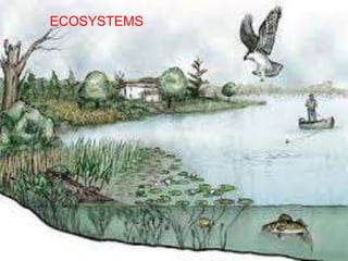
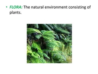
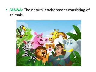
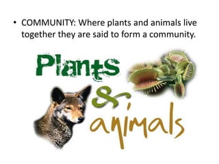
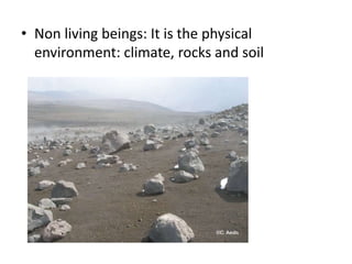
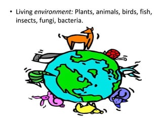
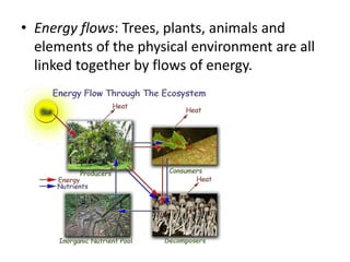
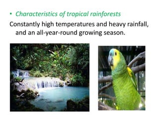
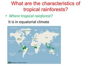
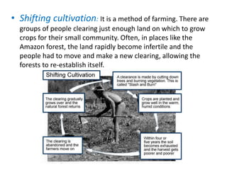
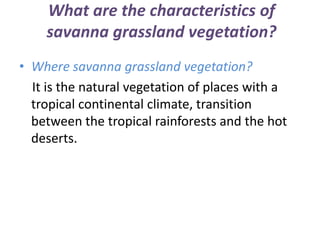
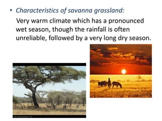
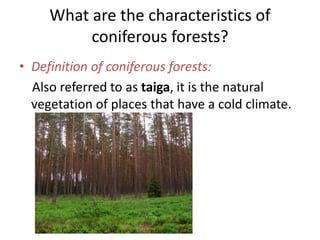
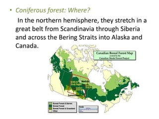
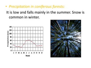
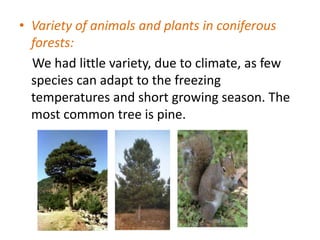
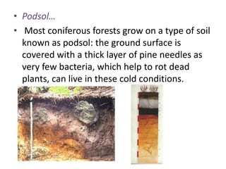
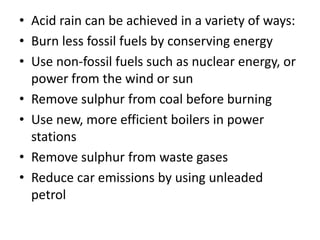
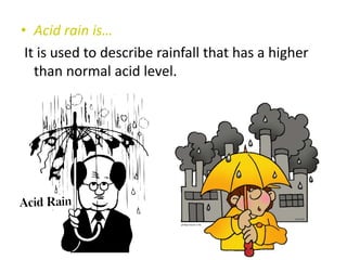
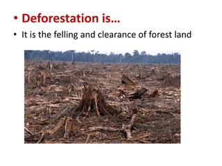
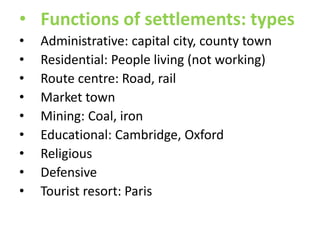
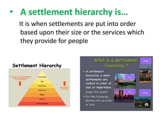
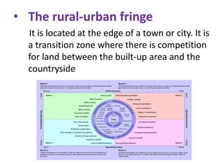
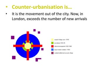
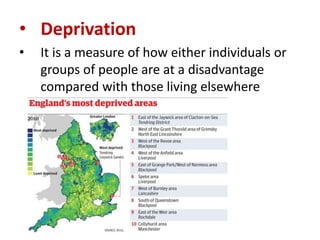
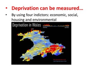
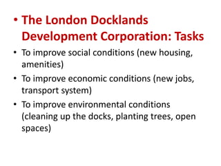
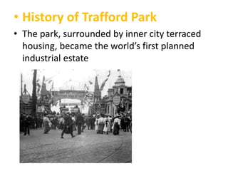
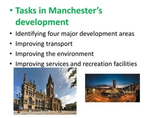
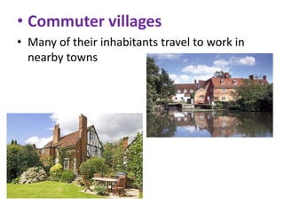
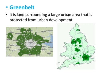
SlideShare a Scribd company logo
1 of 99
ECOSYSTEMS
• FLORA: The natural environment consisting of
plants.
• FAUNA: The natural environment consisting of
animals
• COMMUNITY: Where plants and animals live
together they are said to form a community.
• Non living beings: It is the physical
environment: climate, rocks and soil
• Living environment: Plants, animals, birds, fish,
insects, fungi, bacteria.
• Energy flows: Trees, plants, animals and
elements of the physical environment are all
linked together by flows of energy.
• Characteristics of tropical rainforests
Constantly high temperatures and heavy rainfall,
and an all-year-round growing season.
What are the characteristics of
tropical rainforests?
• Where tropical rainforest?
It is in equatorial climate
• Shifting cultivation: It is a method of farming. There are
groups of people clearing just enough land on which to grow
crops for their small community. Often, in places like the
Amazon forest, the land rapidly become infertile and the
people had to move and make a new clearing, allowing the
forests to re-establish itself.
What are the characteristics of
savanna grassland vegetation?
• Where savanna grassland vegetation?
It is the natural vegetation of places with a
tropical continental climate, transition
between the tropical rainforests and the hot
deserts.
• Characteristics of savanna grassland:
Very warm climate which has a pronounced
wet season, though the rainfall is often
unreliable, followed by a very long dry season.
What are the characteristics of
coniferous forests?
• Definition of coniferous forests:
Also referred to as taiga, it is the natural
vegetation of places that have a cold climate.
• Coniferous forest: Where?
In the northern hemisphere, they stretch in a
great belt from Scandinavia through Siberia
and across the Bering Straits into Alaska and
Canada.
• Precipitation in coniferous forests:
It is low and falls mainly in the summer. Snow is
common in winter.
• Variety of animals and plants in coniferous
forests:
We had little variety, due to climate, as few
species can adapt to the freezing
temperatures and short growing season. The
most common tree is pine.
• Podsol…
• Most coniferous forests grow on a type of soil
known as podsol: the ground surface is
covered with a thick layer of pine needles as
very few bacteria, which help to rot dead
plants, can live in these cold conditions.
• Acid rain can be achieved in a variety of ways:
• Burn less fossil fuels by conserving energy
• Use non-fossil fuels such as nuclear energy, or
power from the wind or sun
• Remove sulphur from coal before burning
• Use new, more efficient boilers in power
stations
• Remove sulphur from waste gases
• Reduce car emissions by using unleaded
petrol
• Acid rain is…
It is used to describe rainfall that has a higher
than normal acid level.
• Deforestation is…
• It is the felling and clearance of forest land
Settlement
and urban
growth
• How were sites for early
settlements chosen?
The location and growth of an individual
settlement depend upon its site and
situation.
• Settlement of situation in
relation to…
It is in relation to natural resources: Physical
features, and other settlements (human
features).+
• Location factors
•
•
•
•
•
•
•
•

Water
Away from flooded
Able to defend in case of attack
Near to materials for building homes
Able to feed themselves
Access to other places
Shelter from bad weather
Supply of fuel for cooking and heating
• Functions of settlements: types
•
•
•
•
•
•
•
•
•

Administrative: capital city, county town
Residential: People living (not working)
Route centre: Road, rail
Market town
Mining: Coal, iron
Educational: Cambridge, Oxford
Religious
Defensive
Tourist resort: Paris
• A settlement hierarchy is…
It is when settlements are put into order
based upon their size or the services which
they provide for people
• A settlement hierarchy can be
produced using three different
methods
•

•
•

Population size: the larger the settlement the fewer
there will be of them
Distance apart: the larger the settlement the
further it will be from other large settlements
Range and number of services: the larger the
settlement the more services it will provide
• Is there a hierarchy of shopping
centres of different sizes?
•
•

•

Population size: the larger the settlement the
greater the number of high order shops
Distance apart: the larger the shopping centre the
further it will be to other large centres
Range of services: the larger the shopping centre
the more services it will provide
• Urban land use models are…
•

These are theories by several geographers to
show how the characteristic patterns and
shapes develop
• The Burgess model
He claimed that the focal point of a town
was the CBD (Central Business District)
• Functional zones in a city
As towns grew, each of the zones developed
its own special type of land use or function
• The major types of land use in a
town are
They are shops and offices, industry, and
housing. Other significant types of land use
include open space, transport and services
(schools, hospitals and shops.
• Compare the Burgess model
and the Hoyt model
•

As each city develops its own pattern of land
use, that pattern is likely to be more complex
than the one shown in the Burgess model.
The Hoyt model is a more realistic map
showing land use and functional zones in a
city.
• The CBD is…
It is the commercial and business centre of a
town or city: Central Business District
• The CBD is so for two reasons
•
•

Accessibility
Land values
• The suburbs
•

This outward growth, known as urban
sprawl, led to the construction of numerous
private housing estates in car-based suburbs.
These corresponded with Burgess’s zone of
medium-cost housing
• The rural-urban fringe
It is located at the edge of a town or city. It is
a transition zone where there is competition
for land between the built-up area and the
countryside
• Counter-urbanisation is…
•

It is the movement out of the city. Now, in
London, exceeds the number of new arrivals
• Deprivation
•

It is a measure of how either individuals or
groups of people are at a disadvantage
compared with those living elsewhere
• Deprivation can be measured…
•

By using four indictors: economic, social,
housing and environmental
• Factors of deprivation
•
•
•

Live in decent housing
Earn an adequate wage
Have access to various amenities
• Cycle of poverty
•

Poverty is transmitted from one generation
to the next, making escape from deprivation
very difficult
• Make a summary of a city /
town parts
•

CBD – Inner city – Suburbs – Rural-urban
fringe
Urban planning
and change
• Nowadays, cities grown…
No change is meant to take place unless
planning permission has been given
• Why have CBDs changed?
• The increase in traffic congestion led to several shops moving
to out-of-town locations
• Hypermarkets and out-of-town shopping centre led to a
decline in the number of shoppers visiting the city centre
• The decline in the number of shoppers has continued with the
increase of internet shopping
• People visiting the city centre wanted a safer environment
• Increasing demand for leisure amenities (entertainment)
• Many taller buildings were built in order to offset the costly
rates and rent resulting from the high land values
• The Port of London
• During the nineteenth century the port of
London was the busiest in the world.
Surrounding the dock were:
• Numerous industries using imported goods
• High-density, poor quality housing typical of
old inner city areas
• The London Docklands
Development Corporation
• The London Docklands Development
Corporation (LDDC, 1981) was set up to try to
improve the social, economic and
environmental conditions of the area
• The London Docklands
Development Corporation: Tasks
• To improve social conditions (new housing,
amenities)
• To improve economic conditions (new jobs,
transport system)
• To improve environmental conditions
(cleaning up the docks, planting trees, open
spaces)
• History of Trafford Park
• The park, surrounded by inner city terraced
housing, became the world’s first planned
industrial estate
• Tasks in Manchester’s
development
•
•
•
•

Identifying four major development areas
Improving transport
Improving the environment
Improving services and recreation facilities
• Advantages of the rural-urban
fringe
• A pleasant environment with more open
space
• Less traffic congestion and pollution (air and
noise)
• Cheaper land
• Easier access and a better road infrastructure
• Greenfield sites
• They are at the rural-urban fringe, and they
have not been built
• Greenfield sites are under
constant threat for:
•
•
•
•
•
•
•

Housing development
Science and business parks
Hypermarkets, superstores
Firms
Hotels and conference centres
Road development
Recreational areas such as country parks and new sports
stadiums
• Counter-urbanization is…
• Places that have attracted wealthy urban
workers and retired people: this process is
called counter-urbanization
• The result of the counterurbanization village is known
as…, because…
• It is known as suburbanized village because
they increasingly begin to look like an
extension to the suburbs of adjacent towns
• Commuter villages
• Many of their inhabitants travel to work in
nearby towns
• Assuming Britain will need 4
million new homes by 2016:
Where?
• 60 per cent on Brownfield sites (disused land
within existing urban areas)
• 40 per cent on Greenfield sites (countryside
and green belts)
• Greenbelt
• It is land surrounding a large urban area that is
protected from urban development
• The National Database shows a
mismatch
• The South-East of England: most houses are
needed but where Brownfield sites are limited
• The Midlands and North, where most
Brownfield sites are available but where
demand for new homes is less
• A commuter is…
• It is a person who lives:
• Either in the suburbs of a large city
• Or in a village or small town close to a larger
town or city
• What are the damaging effects
of traffic?
• Economic: Cost of petrol or diesel
• Environmental: Air pollution, noise pollution,
visual pollution
• Social: Respiratory illnesses caused by car
fumes
• How can we make urban traffic
sustainable?
• Cycle tracks
• Park and ride schemes
• Traffic in residential areas: It has to be controlled, avoiding its
use by drivers from other sites to make an easier pass
• Super trams: its operability, better than buses on the road,
and underground under the road, getting all places, in the
centre and suburbs at the same level
• Congestion charges: you must pay if you want enter the
centre
• Deforestation can be the result
of several types of activity:
• Government policies
• Transnational companies
• Local people
• Deforestation is not only losing
resources, it is also changing world
climates:
• The burning of the rainforests, and the release of
carbon dioxide is a major cause of global warming
• A greatly reduced number of trees will mean a
decrease in evapotranspiration. Some scientists believe
this could eventually turn places like the Amazon Basin
into desert
• Nearly one-half of the world’s supply of oxygen comes
from trees in the Amazon Basin. It takes one large tree
to provide enough oxygen for two people for one day,
and 150 large trees to absorb the carbon dioxide
produced by one small car
• Soil erosion is…
• It is a process by which soil is removed by the
wind and running water
• Soil erosion is a problem when…
• It is a problem when human activity removes
the protective vegetation cover either to
plough the land or through deforestation
• What can be done to prevent or
reduce soil erosion?
•
•
•
•

Indonesia: Terracing
USA: Contour ploughing and strip cropping
Kenya: animal welfare
Burkina Faso: stone lines (‘magic stones’)
• Causes of desertification
• They result from a combination of climatic
changes (decreased rainfall and global
warming), and increased human activity and
pressure upon the land (overgrazing,
overcultivation and deforestation)
• Population density
• It describes the number of people living in a
given area, usually a square kilometer, and is a
measure of how crowded a place is
• Population of the UK / Area of the UK (km2) =
60.272.000/244.880 = 246 per km2
• What are the present and
predicted trends in population
growth?
• The fastest growth has been in the world’s
poorer, less economically developed countries
• Very slow growth rate in the world’s richer,
more economically developed countries
• Population change
• It depends mainly upon the balance between
the birth rate and the death rate. It can also
be affected by migration
• Birth rate
• It is the average number of live births in a year
for every 1000 people
• Death rate
• It is the average number of deaths in a year
for every 1000 people
• Infant mortality
• It is the number of children out of every 1000
that are born alive but who die before they
reach the age of one year
• Life expectancy
• It is the average number of years that a person
born in a country can expect to live
• Places overpopulated are…
• Places where the number of people living
there outweigh the availability of resources
are said to be overpopulated
• Overpopulation can result from:
• An increase in population (high birth rate or
people moving into this area)
• A decrease in resources, perhaps resulting
from soil erosion or the exhaustion of a
mineral, or disasters (flood, drought)
• Population structure
• The population structure shows the number
of males and females within different age
groups in the population
• Population pyramid show
• population divided into five-year age groups
• percentage of people in each age group
• percentage of males and females in each age
group
• trends in the birth rate, death rate, infant
mortality rate and life expectancy
• proportion of elderly and young people who are
dependent upon those of working age
• results of people migrating into or out of the
region or country
• The population of the United
Kingdom seems to have a true
pyramidal shape?
• No, because its population structure is typical
of a country that is more economically
developed (stage 4 of the demographic
transition model)
• The population of India seems to
have a true pyramidal shape?
• Yes, because its population structure is typical
less economically developed country (stage 2
of the demographic transition model)
• The problem in China was…
• Due to patriotic reasons, Chinese had as many
children as possible: population growth of
over 55 million (about the same size as the
UK’s total population) every three years
• After the problem, the solution
proposed was
• 1979, ‘one child per family’ policy and set the
marriageable age for men at 22 and women at
20
• Effects of ‘one child’ policy
• By the late 1990s, the birth rate had fallen
from 31 to 19 in 20 years. The size of the
overall population estimated to be 230 million
less than it would have been had the one-child
policy not been introduced
• Relaxation of the one-child
policy
• 1999, then if two married they could have two
children. Allowing women, for the first time,
an informed choice between different kinds of
contraception
• Ageism is…
• It is the increase of the life expectancy,
together with a falling birth rate, with higher
proportion of the population beyond the age
of 65, and even beyond 80
• There are three main effects of an increase in
life expectancy:
• An increase in the old age dependency ratio
• Changes in the population structure,
especially in the MEDCs: population aged over
65 is more and more (Italy)
• The UN predict that by 2025 there will be
more elderly people in the world than there
will be children aged under 15
• Migration is…
• It is the movement of people from one place
to another to live or to work, or both
• Types of migration
• Permanent, temporary, seasonal and daily
• Migration balance:
• It is the difference between the number of
emigrants and the number of immigrants
• Migration in Britain
• People are descended from either
• Early Roman, Viking, Angle, Saxon and Norman
invaders.
• Later movements from Ireland, Eastern Europe.
• Former British colonies such as India, Bangladesh,
Pakistan and the West Indies
• So, this is a multicultural society, with ethnic
groups, whose descendents were born in Britain
• Internal migration
• This is when people move within a country
usually in order to find a better home or job or
to live in a more pleasant
• Types of internal migration
• Regional migration
• Rural-urban migration, from smaller rural
settlements to large urban areas
• Counter-urbanization, leaving the large urban
areas to settle in smaller towns and villages
• Rural-urban migration is due to
two factors:
• Rural push factors: In the hope of improving
their living conditions and quality of life
• Urban pull factors: They are attracted by their
perception of what they think: better schools,
hospitals, or even their existence…
• If we make a comparison between
a losing population country and a
gaining country:
• More males than females –this is because males are
usually the first to travel abroad to seek work, with the
intention later of either returning home or being joined
by their families
• More aged between 20 and 34 years, the younger
levels of the economically active age group
• A relatively large number of children, because the
economically active groups coincide with the
reproductively active age groups
• Few elderly people, as they are least likely to migrate
• Refugees are…
• They are people who have been forced to
leave their homes for war, for environmental
disasters, or persecution (race, religion)
• Economic migrants
• They move hoping to find better jobs which
will give them a higher standard of living and a
better quality of life
• Illegal immigrants
• They are who arrived in a country without
permission and identification. They can be
exploited and work as slave labor
(prostitution)

More Related Content

What's hot

Settlement Revision Pack
Settlement Revision PackSettlement Revision Pack
Settlement Revision Packigrant
 
L3 ap medc 2013 urban issues
L3 ap medc 2013 urban issuesL3 ap medc 2013 urban issues
L3 ap medc 2013 urban issuesSHS Geog
 
Teori Zon Berpusat (Concenteric Zone Theory)
Teori Zon Berpusat (Concenteric Zone Theory)Teori Zon Berpusat (Concenteric Zone Theory)
Teori Zon Berpusat (Concenteric Zone Theory)Muslim Sejati
 
Models of Urban Growth
Models of Urban GrowthModels of Urban Growth
Models of Urban GrowthKhandace Davis
 
L3 land use in urban areas website
L3 land use in urban areas websiteL3 land use in urban areas website
L3 land use in urban areas websitemrabski
 
Neighbourhood development strategy
Neighbourhood development strategyNeighbourhood development strategy
Neighbourhood development strategySatyam Rai
 
Mumbai – Redevelopment of Dharavi RA.ppt
Mumbai – Redevelopment of Dharavi RA.pptMumbai – Redevelopment of Dharavi RA.ppt
Mumbai – Redevelopment of Dharavi RA.ppttonybattista
 
Burgess and Hoyt Land Use Models
Burgess and Hoyt Land Use ModelsBurgess and Hoyt Land Use Models
Burgess and Hoyt Land Use Modelsthomasdr
 
Clarence perry faheem atif
Clarence perry faheem  atifClarence perry faheem  atif
Clarence perry faheem atifMariyam Zakiah
 
Sustainable Urban Spaces - Nairobi
Sustainable Urban Spaces - NairobiSustainable Urban Spaces - Nairobi
Sustainable Urban Spaces - NairobiConstant Cap
 
Sec 2 Unit 4 rural and urban settlements
Sec 2 Unit 4 rural and urban settlementsSec 2 Unit 4 rural and urban settlements
Sec 2 Unit 4 rural and urban settlementscritter33
 
GEOGRAPHY IGCSE: SETTLEMENTS
GEOGRAPHY IGCSE: SETTLEMENTSGEOGRAPHY IGCSE: SETTLEMENTS
GEOGRAPHY IGCSE: SETTLEMENTSGeorge Dumitrache
 
The Burgess Model
The Burgess ModelThe Burgess Model
The Burgess Modelcheergalsal
 

What's hot (15)

Settlement Revision Pack
Settlement Revision PackSettlement Revision Pack
Settlement Revision Pack
 
L3 ap medc 2013 urban issues
L3 ap medc 2013 urban issuesL3 ap medc 2013 urban issues
L3 ap medc 2013 urban issues
 
Teori Zon Berpusat (Concenteric Zone Theory)
Teori Zon Berpusat (Concenteric Zone Theory)Teori Zon Berpusat (Concenteric Zone Theory)
Teori Zon Berpusat (Concenteric Zone Theory)
 
Models of Urban Growth
Models of Urban GrowthModels of Urban Growth
Models of Urban Growth
 
Sector theory
Sector theorySector theory
Sector theory
 
L3 land use in urban areas website
L3 land use in urban areas websiteL3 land use in urban areas website
L3 land use in urban areas website
 
Neighbourhood development strategy
Neighbourhood development strategyNeighbourhood development strategy
Neighbourhood development strategy
 
Mumbai – Redevelopment of Dharavi RA.ppt
Mumbai – Redevelopment of Dharavi RA.pptMumbai – Redevelopment of Dharavi RA.ppt
Mumbai – Redevelopment of Dharavi RA.ppt
 
Burgess and Hoyt Land Use Models
Burgess and Hoyt Land Use ModelsBurgess and Hoyt Land Use Models
Burgess and Hoyt Land Use Models
 
Clarence perry faheem atif
Clarence perry faheem  atifClarence perry faheem  atif
Clarence perry faheem atif
 
Sustainable Urban Spaces - Nairobi
Sustainable Urban Spaces - NairobiSustainable Urban Spaces - Nairobi
Sustainable Urban Spaces - Nairobi
 
Sec 2 Unit 4 rural and urban settlements
Sec 2 Unit 4 rural and urban settlementsSec 2 Unit 4 rural and urban settlements
Sec 2 Unit 4 rural and urban settlements
 
GEOGRAPHY IGCSE: SETTLEMENTS
GEOGRAPHY IGCSE: SETTLEMENTSGEOGRAPHY IGCSE: SETTLEMENTS
GEOGRAPHY IGCSE: SETTLEMENTS
 
CONCENTRIC ZONE MODEL THEORY
CONCENTRIC ZONE MODEL THEORYCONCENTRIC ZONE MODEL THEORY
CONCENTRIC ZONE MODEL THEORY
 
The Burgess Model
The Burgess ModelThe Burgess Model
The Burgess Model
 

Viewers also liked

Detail Urban Zones
Detail Urban ZonesDetail Urban Zones
Detail Urban Zoneswhiskeyhj
 
Functional zones in cities
Functional zones in citiesFunctional zones in cities
Functional zones in citiesNoel Hogan
 
Urban planning: zoning
Urban planning: zoningUrban planning: zoning
Urban planning: zoningMark M. Miller
 
Integrated Urban Water Management, by Kala Vairavamoorthy
Integrated Urban Water Management, by Kala VairavamoorthyIntegrated Urban Water Management, by Kala Vairavamoorthy
Integrated Urban Water Management, by Kala VairavamoorthyGlobal Water Partnership
 
Rural urban fringe
Rural urban fringeRural urban fringe
Rural urban fringestudent
 
Spatial planning india
Spatial planning indiaSpatial planning india
Spatial planning indiaDelhi2050
 
Ajit katari book review
Ajit katari book reviewAjit katari book review
Ajit katari book reviewAjit Katari
 
Elements of city plan 3 unit
Elements of city plan 3 unitElements of city plan 3 unit
Elements of city plan 3 unitSumanta Das
 
Water distribution planning in urban area
Water distribution planning in urban areaWater distribution planning in urban area
Water distribution planning in urban areaPiyush Verma
 
Neighbourhood planning - learning from the pioneers
Neighbourhood planning - learning from the pioneersNeighbourhood planning - learning from the pioneers
Neighbourhood planning - learning from the pioneersLocality
 
PPT on Mini Water Supply Scheme
PPT on Mini Water Supply SchemePPT on Mini Water Supply Scheme
PPT on Mini Water Supply SchemeArvind kumar
 
Rural Urban Fringe
Rural Urban FringeRural Urban Fringe
Rural Urban Fringeclemaitre
 
Concentric zone theory
Concentric zone theoryConcentric zone theory
Concentric zone theorymorgannnx38
 
Copy of sustainable urban development ppt presentation
Copy of sustainable urban development   ppt presentationCopy of sustainable urban development   ppt presentation
Copy of sustainable urban development ppt presentationAr. Mukunda K.S
 
Zoning and Land Use Planning
Zoning and Land Use PlanningZoning and Land Use Planning
Zoning and Land Use PlanningRavi Varma reddy
 

Viewers also liked (20)

Detail Urban Zones
Detail Urban ZonesDetail Urban Zones
Detail Urban Zones
 
Functional zones in cities
Functional zones in citiesFunctional zones in cities
Functional zones in cities
 
Assessment of performance of selected Small-scale Water Infrastructure (SWI) ...
Assessment of performance of selected Small-scale Water Infrastructure (SWI) ...Assessment of performance of selected Small-scale Water Infrastructure (SWI) ...
Assessment of performance of selected Small-scale Water Infrastructure (SWI) ...
 
Urban planning: zoning
Urban planning: zoningUrban planning: zoning
Urban planning: zoning
 
urban fringes
urban fringesurban fringes
urban fringes
 
Integrated Urban Water Management, by Kala Vairavamoorthy
Integrated Urban Water Management, by Kala VairavamoorthyIntegrated Urban Water Management, by Kala Vairavamoorthy
Integrated Urban Water Management, by Kala Vairavamoorthy
 
Rural urban fringe
Rural urban fringeRural urban fringe
Rural urban fringe
 
Spatial planning india
Spatial planning indiaSpatial planning india
Spatial planning india
 
Ajit katari book review
Ajit katari book reviewAjit katari book review
Ajit katari book review
 
Elements of city plan 3 unit
Elements of city plan 3 unitElements of city plan 3 unit
Elements of city plan 3 unit
 
L 2 sources and water supply schemes
L 2 sources and water supply schemesL 2 sources and water supply schemes
L 2 sources and water supply schemes
 
Water distribution planning in urban area
Water distribution planning in urban areaWater distribution planning in urban area
Water distribution planning in urban area
 
Neighbourhood planning - learning from the pioneers
Neighbourhood planning - learning from the pioneersNeighbourhood planning - learning from the pioneers
Neighbourhood planning - learning from the pioneers
 
PPT on Mini Water Supply Scheme
PPT on Mini Water Supply SchemePPT on Mini Water Supply Scheme
PPT on Mini Water Supply Scheme
 
Rural Urban Fringe
Rural Urban FringeRural Urban Fringe
Rural Urban Fringe
 
SustSan workshop: Integrated Urban Water Management by Ankur Gupta
SustSan workshop:  Integrated Urban Water Management by Ankur GuptaSustSan workshop:  Integrated Urban Water Management by Ankur Gupta
SustSan workshop: Integrated Urban Water Management by Ankur Gupta
 
Concentric zone theory
Concentric zone theoryConcentric zone theory
Concentric zone theory
 
Udpfistandards
UdpfistandardsUdpfistandards
Udpfistandards
 
Copy of sustainable urban development ppt presentation
Copy of sustainable urban development   ppt presentationCopy of sustainable urban development   ppt presentation
Copy of sustainable urban development ppt presentation
 
Zoning and Land Use Planning
Zoning and Land Use PlanningZoning and Land Use Planning
Zoning and Land Use Planning
 

Similar to Ecosystems.pptx222

Urban settlements
Urban settlementsUrban settlements
Urban settlementsMarissia226
 
Settlement - Introduction for the topic
Settlement - Introduction for the topicSettlement - Introduction for the topic
Settlement - Introduction for the topicErnesto Correa Gómez
 
Trabajo sociales
Trabajo socialesTrabajo sociales
Trabajo socialessergiales98
 
human settlement (1).pptx
human settlement (1).pptxhuman settlement (1).pptx
human settlement (1).pptxCharuNangia
 
SETTLEMENT AND SERVICE PROVISION YEAR 10 GEO 1.pptx
SETTLEMENT AND SERVICE PROVISION YEAR 10 GEO 1.pptxSETTLEMENT AND SERVICE PROVISION YEAR 10 GEO 1.pptx
SETTLEMENT AND SERVICE PROVISION YEAR 10 GEO 1.pptxpraisechi81
 
Garden Cities of Tommorow by Sir Ebenezer Howard
Garden Cities of Tommorow by Sir Ebenezer HowardGarden Cities of Tommorow by Sir Ebenezer Howard
Garden Cities of Tommorow by Sir Ebenezer Howardsdeepanshu
 
Edexcel GCSE Geography Unit 3 Economic change
Edexcel GCSE Geography Unit 3 Economic changeEdexcel GCSE Geography Unit 3 Economic change
Edexcel GCSE Geography Unit 3 Economic changePerrymanGeography
 
EBENEZER HOWARD - GARDEN CITY REPORT
EBENEZER HOWARD - GARDEN CITY REPORTEBENEZER HOWARD - GARDEN CITY REPORT
EBENEZER HOWARD - GARDEN CITY REPORTShamali Kather
 
The organization of urban space
The organization of urban spaceThe organization of urban space
The organization of urban spacesluguard
 
Urban planning theories
Urban planning theoriesUrban planning theories
Urban planning theoriesAkanksha Modi
 
urbanization_part_1.pptx
urbanization_part_1.pptxurbanization_part_1.pptx
urbanization_part_1.pptxEliasAsaye
 
How we organize ourselves
How we organize ourselvesHow we organize ourselves
How we organize ourselvescastillosekel
 
MODULE 1 - Part I - SETTLEMENTS, HOUSING TYPOLOGIES.pdf
MODULE 1 - Part I - SETTLEMENTS, HOUSING TYPOLOGIES.pdfMODULE 1 - Part I - SETTLEMENTS, HOUSING TYPOLOGIES.pdf
MODULE 1 - Part I - SETTLEMENTS, HOUSING TYPOLOGIES.pdfThirumeni Madavan
 
Urban land use
Urban land useUrban land use
Urban land useNoel Hogan
 
Sir ebenezer howard
Sir ebenezer howardSir ebenezer howard
Sir ebenezer howardAyaz Khan
 
Ebenzer Howard, palak, anmol , harsh.pptx
Ebenzer Howard, palak, anmol , harsh.pptxEbenzer Howard, palak, anmol , harsh.pptx
Ebenzer Howard, palak, anmol , harsh.pptxCharuNangia
 

Similar to Ecosystems.pptx222 (20)

Urban settlements
Urban settlementsUrban settlements
Urban settlements
 
Settlement - Introduction for the topic
Settlement - Introduction for the topicSettlement - Introduction for the topic
Settlement - Introduction for the topic
 
Settlement Change
Settlement ChangeSettlement Change
Settlement Change
 
GEOGRAPHY
GEOGRAPHYGEOGRAPHY
GEOGRAPHY
 
Trabajo sociales
Trabajo socialesTrabajo sociales
Trabajo sociales
 
human settlement (1).pptx
human settlement (1).pptxhuman settlement (1).pptx
human settlement (1).pptx
 
SETTLEMENT AND SERVICE PROVISION YEAR 10 GEO 1.pptx
SETTLEMENT AND SERVICE PROVISION YEAR 10 GEO 1.pptxSETTLEMENT AND SERVICE PROVISION YEAR 10 GEO 1.pptx
SETTLEMENT AND SERVICE PROVISION YEAR 10 GEO 1.pptx
 
Garden Cities of Tommorow by Sir Ebenezer Howard
Garden Cities of Tommorow by Sir Ebenezer HowardGarden Cities of Tommorow by Sir Ebenezer Howard
Garden Cities of Tommorow by Sir Ebenezer Howard
 
Edexcel GCSE Geography Unit 3 Economic change
Edexcel GCSE Geography Unit 3 Economic changeEdexcel GCSE Geography Unit 3 Economic change
Edexcel GCSE Geography Unit 3 Economic change
 
Zero Carbon Cities-
Zero Carbon Cities-Zero Carbon Cities-
Zero Carbon Cities-
 
EBENEZER HOWARD - GARDEN CITY REPORT
EBENEZER HOWARD - GARDEN CITY REPORTEBENEZER HOWARD - GARDEN CITY REPORT
EBENEZER HOWARD - GARDEN CITY REPORT
 
Radburn City
Radburn CityRadburn City
Radburn City
 
The organization of urban space
The organization of urban spaceThe organization of urban space
The organization of urban space
 
Urban planning theories
Urban planning theoriesUrban planning theories
Urban planning theories
 
urbanization_part_1.pptx
urbanization_part_1.pptxurbanization_part_1.pptx
urbanization_part_1.pptx
 
How we organize ourselves
How we organize ourselvesHow we organize ourselves
How we organize ourselves
 
MODULE 1 - Part I - SETTLEMENTS, HOUSING TYPOLOGIES.pdf
MODULE 1 - Part I - SETTLEMENTS, HOUSING TYPOLOGIES.pdfMODULE 1 - Part I - SETTLEMENTS, HOUSING TYPOLOGIES.pdf
MODULE 1 - Part I - SETTLEMENTS, HOUSING TYPOLOGIES.pdf
 
Urban land use
Urban land useUrban land use
Urban land use
 
Sir ebenezer howard
Sir ebenezer howardSir ebenezer howard
Sir ebenezer howard
 
Ebenzer Howard, palak, anmol , harsh.pptx
Ebenzer Howard, palak, anmol , harsh.pptxEbenzer Howard, palak, anmol , harsh.pptx
Ebenzer Howard, palak, anmol , harsh.pptx
 

Ecosystems.pptx222

  • 2. • FLORA: The natural environment consisting of plants.
  • 3. • FAUNA: The natural environment consisting of animals
  • 4. • COMMUNITY: Where plants and animals live together they are said to form a community.
  • 5. • Non living beings: It is the physical environment: climate, rocks and soil
  • 6. • Living environment: Plants, animals, birds, fish, insects, fungi, bacteria.
  • 7. • Energy flows: Trees, plants, animals and elements of the physical environment are all linked together by flows of energy.
  • 8. • Characteristics of tropical rainforests Constantly high temperatures and heavy rainfall, and an all-year-round growing season.
  • 9. What are the characteristics of tropical rainforests? • Where tropical rainforest? It is in equatorial climate
  • 10. • Shifting cultivation: It is a method of farming. There are groups of people clearing just enough land on which to grow crops for their small community. Often, in places like the Amazon forest, the land rapidly become infertile and the people had to move and make a new clearing, allowing the forests to re-establish itself.
  • 11. What are the characteristics of savanna grassland vegetation? • Where savanna grassland vegetation? It is the natural vegetation of places with a tropical continental climate, transition between the tropical rainforests and the hot deserts.
  • 12. • Characteristics of savanna grassland: Very warm climate which has a pronounced wet season, though the rainfall is often unreliable, followed by a very long dry season.
  • 13. What are the characteristics of coniferous forests? • Definition of coniferous forests: Also referred to as taiga, it is the natural vegetation of places that have a cold climate.
  • 14. • Coniferous forest: Where? In the northern hemisphere, they stretch in a great belt from Scandinavia through Siberia and across the Bering Straits into Alaska and Canada.
  • 15. • Precipitation in coniferous forests: It is low and falls mainly in the summer. Snow is common in winter.
  • 16. • Variety of animals and plants in coniferous forests: We had little variety, due to climate, as few species can adapt to the freezing temperatures and short growing season. The most common tree is pine.
  • 17. • Podsol… • Most coniferous forests grow on a type of soil known as podsol: the ground surface is covered with a thick layer of pine needles as very few bacteria, which help to rot dead plants, can live in these cold conditions.
  • 18. • Acid rain can be achieved in a variety of ways: • Burn less fossil fuels by conserving energy • Use non-fossil fuels such as nuclear energy, or power from the wind or sun • Remove sulphur from coal before burning • Use new, more efficient boilers in power stations • Remove sulphur from waste gases • Reduce car emissions by using unleaded petrol
  • 19. • Acid rain is… It is used to describe rainfall that has a higher than normal acid level.
  • 20. • Deforestation is… • It is the felling and clearance of forest land
  • 22. • How were sites for early settlements chosen? The location and growth of an individual settlement depend upon its site and situation.
  • 23. • Settlement of situation in relation to… It is in relation to natural resources: Physical features, and other settlements (human features).+
  • 24. • Location factors • • • • • • • • Water Away from flooded Able to defend in case of attack Near to materials for building homes Able to feed themselves Access to other places Shelter from bad weather Supply of fuel for cooking and heating
  • 25. • Functions of settlements: types • • • • • • • • • Administrative: capital city, county town Residential: People living (not working) Route centre: Road, rail Market town Mining: Coal, iron Educational: Cambridge, Oxford Religious Defensive Tourist resort: Paris
  • 26. • A settlement hierarchy is… It is when settlements are put into order based upon their size or the services which they provide for people
  • 27. • A settlement hierarchy can be produced using three different methods • • • Population size: the larger the settlement the fewer there will be of them Distance apart: the larger the settlement the further it will be from other large settlements Range and number of services: the larger the settlement the more services it will provide
  • 28. • Is there a hierarchy of shopping centres of different sizes? • • • Population size: the larger the settlement the greater the number of high order shops Distance apart: the larger the shopping centre the further it will be to other large centres Range of services: the larger the shopping centre the more services it will provide
  • 29. • Urban land use models are… • These are theories by several geographers to show how the characteristic patterns and shapes develop
  • 30. • The Burgess model He claimed that the focal point of a town was the CBD (Central Business District)
  • 31. • Functional zones in a city As towns grew, each of the zones developed its own special type of land use or function
  • 32. • The major types of land use in a town are They are shops and offices, industry, and housing. Other significant types of land use include open space, transport and services (schools, hospitals and shops.
  • 33. • Compare the Burgess model and the Hoyt model • As each city develops its own pattern of land use, that pattern is likely to be more complex than the one shown in the Burgess model. The Hoyt model is a more realistic map showing land use and functional zones in a city.
  • 34. • The CBD is… It is the commercial and business centre of a town or city: Central Business District
  • 35. • The CBD is so for two reasons • • Accessibility Land values
  • 36. • The suburbs • This outward growth, known as urban sprawl, led to the construction of numerous private housing estates in car-based suburbs. These corresponded with Burgess’s zone of medium-cost housing
  • 37. • The rural-urban fringe It is located at the edge of a town or city. It is a transition zone where there is competition for land between the built-up area and the countryside
  • 38. • Counter-urbanisation is… • It is the movement out of the city. Now, in London, exceeds the number of new arrivals
  • 39. • Deprivation • It is a measure of how either individuals or groups of people are at a disadvantage compared with those living elsewhere
  • 40. • Deprivation can be measured… • By using four indictors: economic, social, housing and environmental
  • 41. • Factors of deprivation • • • Live in decent housing Earn an adequate wage Have access to various amenities
  • 42. • Cycle of poverty • Poverty is transmitted from one generation to the next, making escape from deprivation very difficult
  • 43. • Make a summary of a city / town parts • CBD – Inner city – Suburbs – Rural-urban fringe
  • 45. • Nowadays, cities grown… No change is meant to take place unless planning permission has been given
  • 46. • Why have CBDs changed? • The increase in traffic congestion led to several shops moving to out-of-town locations • Hypermarkets and out-of-town shopping centre led to a decline in the number of shoppers visiting the city centre • The decline in the number of shoppers has continued with the increase of internet shopping • People visiting the city centre wanted a safer environment • Increasing demand for leisure amenities (entertainment) • Many taller buildings were built in order to offset the costly rates and rent resulting from the high land values
  • 47. • The Port of London • During the nineteenth century the port of London was the busiest in the world. Surrounding the dock were: • Numerous industries using imported goods • High-density, poor quality housing typical of old inner city areas
  • 48. • The London Docklands Development Corporation • The London Docklands Development Corporation (LDDC, 1981) was set up to try to improve the social, economic and environmental conditions of the area
  • 49. • The London Docklands Development Corporation: Tasks • To improve social conditions (new housing, amenities) • To improve economic conditions (new jobs, transport system) • To improve environmental conditions (cleaning up the docks, planting trees, open spaces)
  • 50. • History of Trafford Park • The park, surrounded by inner city terraced housing, became the world’s first planned industrial estate
  • 51. • Tasks in Manchester’s development • • • • Identifying four major development areas Improving transport Improving the environment Improving services and recreation facilities
  • 52. • Advantages of the rural-urban fringe • A pleasant environment with more open space • Less traffic congestion and pollution (air and noise) • Cheaper land • Easier access and a better road infrastructure
  • 53. • Greenfield sites • They are at the rural-urban fringe, and they have not been built
  • 54. • Greenfield sites are under constant threat for: • • • • • • • Housing development Science and business parks Hypermarkets, superstores Firms Hotels and conference centres Road development Recreational areas such as country parks and new sports stadiums
  • 55. • Counter-urbanization is… • Places that have attracted wealthy urban workers and retired people: this process is called counter-urbanization
  • 56. • The result of the counterurbanization village is known as…, because… • It is known as suburbanized village because they increasingly begin to look like an extension to the suburbs of adjacent towns
  • 57. • Commuter villages • Many of their inhabitants travel to work in nearby towns
  • 58. • Assuming Britain will need 4 million new homes by 2016: Where? • 60 per cent on Brownfield sites (disused land within existing urban areas) • 40 per cent on Greenfield sites (countryside and green belts)
  • 59. • Greenbelt • It is land surrounding a large urban area that is protected from urban development
  • 60. • The National Database shows a mismatch • The South-East of England: most houses are needed but where Brownfield sites are limited • The Midlands and North, where most Brownfield sites are available but where demand for new homes is less
  • 61. • A commuter is… • It is a person who lives: • Either in the suburbs of a large city • Or in a village or small town close to a larger town or city
  • 62. • What are the damaging effects of traffic? • Economic: Cost of petrol or diesel • Environmental: Air pollution, noise pollution, visual pollution • Social: Respiratory illnesses caused by car fumes
  • 63. • How can we make urban traffic sustainable? • Cycle tracks • Park and ride schemes • Traffic in residential areas: It has to be controlled, avoiding its use by drivers from other sites to make an easier pass • Super trams: its operability, better than buses on the road, and underground under the road, getting all places, in the centre and suburbs at the same level • Congestion charges: you must pay if you want enter the centre
  • 64. • Deforestation can be the result of several types of activity: • Government policies • Transnational companies • Local people
  • 65. • Deforestation is not only losing resources, it is also changing world climates: • The burning of the rainforests, and the release of carbon dioxide is a major cause of global warming • A greatly reduced number of trees will mean a decrease in evapotranspiration. Some scientists believe this could eventually turn places like the Amazon Basin into desert • Nearly one-half of the world’s supply of oxygen comes from trees in the Amazon Basin. It takes one large tree to provide enough oxygen for two people for one day, and 150 large trees to absorb the carbon dioxide produced by one small car
  • 66. • Soil erosion is… • It is a process by which soil is removed by the wind and running water
  • 67. • Soil erosion is a problem when… • It is a problem when human activity removes the protective vegetation cover either to plough the land or through deforestation
  • 68. • What can be done to prevent or reduce soil erosion? • • • • Indonesia: Terracing USA: Contour ploughing and strip cropping Kenya: animal welfare Burkina Faso: stone lines (‘magic stones’)
  • 69. • Causes of desertification • They result from a combination of climatic changes (decreased rainfall and global warming), and increased human activity and pressure upon the land (overgrazing, overcultivation and deforestation)
  • 70. • Population density • It describes the number of people living in a given area, usually a square kilometer, and is a measure of how crowded a place is • Population of the UK / Area of the UK (km2) = 60.272.000/244.880 = 246 per km2
  • 71. • What are the present and predicted trends in population growth? • The fastest growth has been in the world’s poorer, less economically developed countries • Very slow growth rate in the world’s richer, more economically developed countries
  • 72. • Population change • It depends mainly upon the balance between the birth rate and the death rate. It can also be affected by migration
  • 73. • Birth rate • It is the average number of live births in a year for every 1000 people
  • 74. • Death rate • It is the average number of deaths in a year for every 1000 people
  • 75. • Infant mortality • It is the number of children out of every 1000 that are born alive but who die before they reach the age of one year
  • 76. • Life expectancy • It is the average number of years that a person born in a country can expect to live
  • 77. • Places overpopulated are… • Places where the number of people living there outweigh the availability of resources are said to be overpopulated
  • 78. • Overpopulation can result from: • An increase in population (high birth rate or people moving into this area) • A decrease in resources, perhaps resulting from soil erosion or the exhaustion of a mineral, or disasters (flood, drought)
  • 79. • Population structure • The population structure shows the number of males and females within different age groups in the population
  • 80. • Population pyramid show • population divided into five-year age groups • percentage of people in each age group • percentage of males and females in each age group • trends in the birth rate, death rate, infant mortality rate and life expectancy • proportion of elderly and young people who are dependent upon those of working age • results of people migrating into or out of the region or country
  • 81. • The population of the United Kingdom seems to have a true pyramidal shape? • No, because its population structure is typical of a country that is more economically developed (stage 4 of the demographic transition model)
  • 82. • The population of India seems to have a true pyramidal shape? • Yes, because its population structure is typical less economically developed country (stage 2 of the demographic transition model)
  • 83. • The problem in China was… • Due to patriotic reasons, Chinese had as many children as possible: population growth of over 55 million (about the same size as the UK’s total population) every three years
  • 84. • After the problem, the solution proposed was • 1979, ‘one child per family’ policy and set the marriageable age for men at 22 and women at 20
  • 85. • Effects of ‘one child’ policy • By the late 1990s, the birth rate had fallen from 31 to 19 in 20 years. The size of the overall population estimated to be 230 million less than it would have been had the one-child policy not been introduced
  • 86. • Relaxation of the one-child policy • 1999, then if two married they could have two children. Allowing women, for the first time, an informed choice between different kinds of contraception
  • 87. • Ageism is… • It is the increase of the life expectancy, together with a falling birth rate, with higher proportion of the population beyond the age of 65, and even beyond 80
  • 88. • There are three main effects of an increase in life expectancy: • An increase in the old age dependency ratio • Changes in the population structure, especially in the MEDCs: population aged over 65 is more and more (Italy) • The UN predict that by 2025 there will be more elderly people in the world than there will be children aged under 15
  • 89. • Migration is… • It is the movement of people from one place to another to live or to work, or both
  • 90. • Types of migration • Permanent, temporary, seasonal and daily
  • 91. • Migration balance: • It is the difference between the number of emigrants and the number of immigrants
  • 92. • Migration in Britain • People are descended from either • Early Roman, Viking, Angle, Saxon and Norman invaders. • Later movements from Ireland, Eastern Europe. • Former British colonies such as India, Bangladesh, Pakistan and the West Indies • So, this is a multicultural society, with ethnic groups, whose descendents were born in Britain
  • 93. • Internal migration • This is when people move within a country usually in order to find a better home or job or to live in a more pleasant
  • 94. • Types of internal migration • Regional migration • Rural-urban migration, from smaller rural settlements to large urban areas • Counter-urbanization, leaving the large urban areas to settle in smaller towns and villages
  • 95. • Rural-urban migration is due to two factors: • Rural push factors: In the hope of improving their living conditions and quality of life • Urban pull factors: They are attracted by their perception of what they think: better schools, hospitals, or even their existence…
  • 96. • If we make a comparison between a losing population country and a gaining country: • More males than females –this is because males are usually the first to travel abroad to seek work, with the intention later of either returning home or being joined by their families • More aged between 20 and 34 years, the younger levels of the economically active age group • A relatively large number of children, because the economically active groups coincide with the reproductively active age groups • Few elderly people, as they are least likely to migrate
  • 97. • Refugees are… • They are people who have been forced to leave their homes for war, for environmental disasters, or persecution (race, religion)
  • 98. • Economic migrants • They move hoping to find better jobs which will give them a higher standard of living and a better quality of life
  • 99. • Illegal immigrants • They are who arrived in a country without permission and identification. They can be exploited and work as slave labor (prostitution)