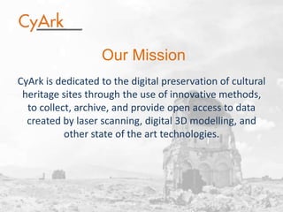
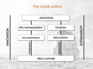
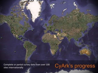
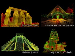
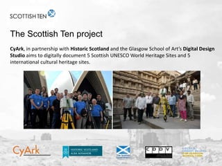
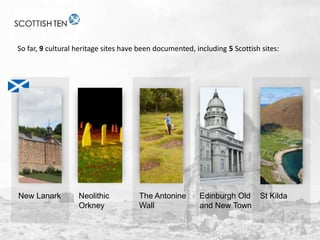
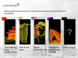
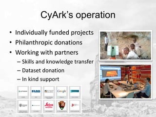
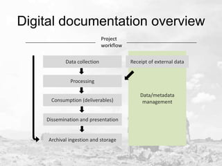
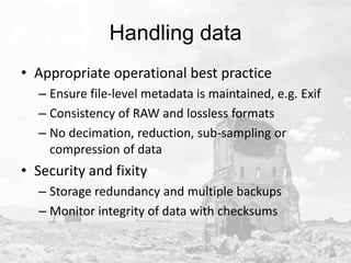
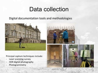
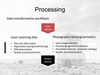
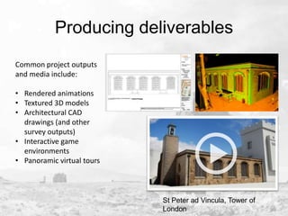
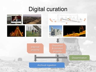
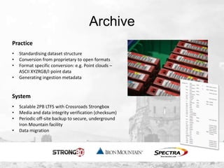
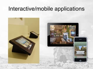
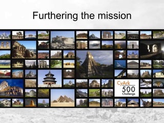
DEDICATE Seminar
21 October 2013
Adam Frost

Introduction and operational framework

CyArk Europe is a registered charity in Scotland, number: SC044310
Our Mission
CyArk is dedicated to the digital preservation of cultural
heritage sites through the use of innovative methods,
to collect, archive, and provide open access to data
created by laser scanning, digital 3D modelling, and
other state of the art technologies.
Natural and anthropogenic threats

Urban Sprawl
Arson
Pyramids at Giza, Egypt Sungnyemun Gate, Seoul, South Korea

Flooding
Piazza San
Marco, Venice, Italy
The CyArk outline
Complete or partial survey data from over 100
sites internationally

CyArk’s progress
The Royal Kasubi Tombs | Uganda
The Scottish Ten project
CyArk, in partnership with Historic Scotland and the Glasgow School of Art’s Digital Design
Studio aims to digitally document 5 Scottish UNESCO World Heritage Sites and 5
international cultural heritage sites.
So far, 9 cultural heritage sites have been documented, including 5 Scottish sites:

New Lanark

Neolithic
Orkney

The Antonine
Wall

Edinburgh Old
and New Town

St Kilda
Working with partner countries to record 5 international sites (field data for 4
completed):
?

?
The Eastern
Qing
Tombs, China

Rani Ki Vav,
India

Mount
The Sydney
Rushmore, US Opera House,
Australia

Unannounced
CyArk’s operation
• Individually funded projects
• Philanthropic donations
• Working with partners
– Skills and knowledge transfer
– Dataset donation
– In kind support
Digital documentation overview
Project
workflow
Data collection

Receipt of external data

Processing
Consumption (deliverables)

Dissemination and presentation

Archival ingestion and storage

Data/metadata
management
Handling data
• Appropriate operational best practice
– Ensure file-level metadata is maintained, e.g. Exif
– Consistency of RAW and lossless formats
– No decimation, reduction, sub-sampling or
compression of data

• Security and fixity
– Storage redundancy and multiple backups
– Monitor integrity of data with checksums
Data collection
Digital documentation tools and methodologies

Principal capture techniques include:
- Laser scanning survey
- HDR digital photography
- Photogrammetry
Processing
Data-transformative workflows
Field
capture

Laser scanning data

Photographic/photogrammetric

•
•
•
•

•
•
•
•

Raw scan data import
Registration (and georeferencing)
RGB colourisation
Quality assurance/control
Output
dataset

Input image selection
Processing algorithms/software
Parameters (texture, resolution settings)
Quality assurance/control
Producing deliverables
Common project outputs
and media include:

• Rendered animations
• Textured 3D models
• Architectural CAD
drawings (and other
survey outputs)
• Interactive game
environments
• Panoramic virtual tours

St Peter ad Vincula, Tower of
London
Digital curation

Internal
projects

Deposited
& donated
projects

Dissemination
Archival ingestion
Archive
Practice
•
•
•
•

Standardising dataset structure
Conversion from proprietary to open formats
Format specific conversion: e.g. Point clouds –
ASCII XYZRGB/I point data
Generating ingestion metadata

System
•
•
•
•

Scalable 2PB LTFS with Crossroads Strongbox
Media and data integrity verification (checksum)
Periodic off-site backup to secure, underground
Iron Mountain facility
Data migration
Dissemination
• Database driven website
• Embracing open access
– Site multimedia released
under Creative Commons
license
– Free access to 3D viewer for
point cloud data and 3D
models
– Lesson plans (K-12
education)

• Developed own tools…
Web
• Project/site information
and historical context
• Links to interactive
educational content,
lesson plans
• Designed to be socialmedia friendly, e.g.
unique content URLs
and comment system
SiteManager
• Bespoke web based
GIS
• Embedded
multimedia content
with metadata from
datasets
• Management with
content type filters,
layers, hierarchies
and sub-areas
3D viewing tools
Church of St. Trophime, France

3D model & point cloud
viewer
• Measurable
• Perspective /
orthographic
• RGB/Intensity
• Clipping box

1.9m pts

338k pts
Interactive/mobile applications
Furthering the mission

CyArc Europe - Introduction and operational framework

  • 1.
    DEDICATE Seminar 21 October2013 Adam Frost Introduction and operational framework CyArk Europe is a registered charity in Scotland, number: SC044310
  • 2.
    Our Mission CyArk isdedicated to the digital preservation of cultural heritage sites through the use of innovative methods, to collect, archive, and provide open access to data created by laser scanning, digital 3D modelling, and other state of the art technologies.
  • 3.
    Natural and anthropogenicthreats Urban Sprawl Arson Pyramids at Giza, Egypt Sungnyemun Gate, Seoul, South Korea Flooding Piazza San Marco, Venice, Italy
  • 4.
  • 5.
    Complete or partialsurvey data from over 100 sites internationally CyArk’s progress
  • 6.
    The Royal KasubiTombs | Uganda
  • 7.
    The Scottish Tenproject CyArk, in partnership with Historic Scotland and the Glasgow School of Art’s Digital Design Studio aims to digitally document 5 Scottish UNESCO World Heritage Sites and 5 international cultural heritage sites.
  • 8.
    So far, 9cultural heritage sites have been documented, including 5 Scottish sites: New Lanark Neolithic Orkney The Antonine Wall Edinburgh Old and New Town St Kilda
  • 9.
    Working with partnercountries to record 5 international sites (field data for 4 completed): ? ? The Eastern Qing Tombs, China Rani Ki Vav, India Mount The Sydney Rushmore, US Opera House, Australia Unannounced
  • 10.
    CyArk’s operation • Individuallyfunded projects • Philanthropic donations • Working with partners – Skills and knowledge transfer – Dataset donation – In kind support
  • 11.
    Digital documentation overview Project workflow Datacollection Receipt of external data Processing Consumption (deliverables) Dissemination and presentation Archival ingestion and storage Data/metadata management
  • 12.
    Handling data • Appropriateoperational best practice – Ensure file-level metadata is maintained, e.g. Exif – Consistency of RAW and lossless formats – No decimation, reduction, sub-sampling or compression of data • Security and fixity – Storage redundancy and multiple backups – Monitor integrity of data with checksums
  • 13.
    Data collection Digital documentationtools and methodologies Principal capture techniques include: - Laser scanning survey - HDR digital photography - Photogrammetry
  • 14.
    Processing Data-transformative workflows Field capture Laser scanningdata Photographic/photogrammetric • • • • • • • • Raw scan data import Registration (and georeferencing) RGB colourisation Quality assurance/control Output dataset Input image selection Processing algorithms/software Parameters (texture, resolution settings) Quality assurance/control
  • 15.
    Producing deliverables Common projectoutputs and media include: • Rendered animations • Textured 3D models • Architectural CAD drawings (and other survey outputs) • Interactive game environments • Panoramic virtual tours St Peter ad Vincula, Tower of London
  • 16.
  • 17.
    Archive Practice • • • • Standardising dataset structure Conversionfrom proprietary to open formats Format specific conversion: e.g. Point clouds – ASCII XYZRGB/I point data Generating ingestion metadata System • • • • Scalable 2PB LTFS with Crossroads Strongbox Media and data integrity verification (checksum) Periodic off-site backup to secure, underground Iron Mountain facility Data migration
  • 18.
    Dissemination • Database drivenwebsite • Embracing open access – Site multimedia released under Creative Commons license – Free access to 3D viewer for point cloud data and 3D models – Lesson plans (K-12 education) • Developed own tools…
  • 19.
    Web • Project/site information andhistorical context • Links to interactive educational content, lesson plans • Designed to be socialmedia friendly, e.g. unique content URLs and comment system
  • 20.
    SiteManager • Bespoke webbased GIS • Embedded multimedia content with metadata from datasets • Management with content type filters, layers, hierarchies and sub-areas
  • 21.
    3D viewing tools Churchof St. Trophime, France 3D model & point cloud viewer • Measurable • Perspective / orthographic • RGB/Intensity • Clipping box 1.9m pts 338k pts
  • 22.
  • 23.