Fair of European Innovators in Cultural HeritageArchAIDE Project
Archaeologists currently classify pottery finds manually which is time-consuming. A new app called ArchAIDE uses machine learning to automatically classify ceramic artifacts digitally. It develops algorithms to analyze photos of pottery shards and match them to a digital comparative collection, streamlining the identification process. This has the potential to make archaeological knowledge more accessible and help various stakeholders in research, cultural heritage, and technology industries.
A mobile app for the automatic recognition of archaeological potsherds: the A...ArchAIDE Project
Gabriele Gattiglia, Francesca Anichini, Michael Remmy, Holly Wright, Massimo Zallocco
A mobile app for the automatic recognition of archaeological potsherds: the ArchAIDE project
Virtual Heritage, Wien - November 12th, 2018
ArchAIDE aims to support archaeologists' work of classifying and interpreting pottery sherds through innovative computer tools. The tools will match discovered sherds to huge existing ceramic catalogs. Key concepts include using deep learning for automatic pottery recognition, digitizing texts manually and automatically, and developing multilingual vocabularies to conceptually and linguistically map pottery. The project involves various partners and faces open challenges regarding user experience evaluation, engaging users for data and testing, addressing technology issues like deep learning techniques, and ensuring business sustainability and handling intellectual property issues after the project lifetime.
Navigating a new digital interface: using automated image recognition to iden...ArchAIDE Project
Navigating a new digital interface: using automated image recognition to identify pottery in the ArchAIDE project
Gabriele Gattiglia, Francesca Anichini, Holly Wright
EAA Barcelona, September 6, 2018
Presentation to Digital Humanities class at Pratt Institute on the history of computing in the field of archaeology and current digital humanities projects.
The document outlines an agenda for a training session on Scratchpads, a website platform for taxonomists. The agenda includes introductions, an overview presentation of Scratchpads and its features, and training course options on basic and advanced use of the platform. The document also provides background on the goals of Scratchpads to enable taxonomy research and publication and to help inventory the world's species.
Is micro-computed tomography a suitable tool for the modern taxonomist? An example using polychaetes. Presented by Christos Arvanitidis at the 13th International Polychaete Conference, August 2013, Sydney
This document discusses Scratchpad virtual research environments for sharing, linking, and publishing biodiversity data. It notes that most biodiversity data is currently not in digital, openly accessible, or linked formats. Scratchpads are introduced as hosted websites for biodiversity data, which allow researchers to create virtual research platforms, publish data openly and flexibly. The document outlines the types of biodiversity data that can be incorporated into Scratchpads, including taxon pages, maps, images, literature, and matrices. It also summarizes the goals and funding of the ViBRANT project, which aims to develop a federated network of biodiversity informatics infrastructures through Scratchpads and other virtual research environments.
Italian training day. Pisa, 23 Marzo 2018 Il progettoArchAIDE Project
1. The ArchAIDE project aims to develop algorithms and databases to aid in the digitalization, identification, and analysis of ceramic artifacts.
2. Key aspects of the project include developing algorithms for the automatic recognition of ceramic decorations and shapes through neural networks trained on thousands of images.
3. The project seeks to make all analyzed data openly available online for reuse, in line with the Open Research Data Pilot.
A Cultural Heritage Repository as Source for Learning MaterialsManjulaPatel
A presentation given by Manjula Patel (UKOLN) at VAST 2004: The 5th International Symposium on Virtual Reality, Archaeology and Intelligent Cultural Heritage (http://www.informatik.uni-trier.de/~ley/db/conf/vast/vast2004.html)
Joseph Padfield and Rupert Shepherd, The National Gallery, and Rob Tice, Knowledge Integration
How can information be opened up within an organisation? The National Gallery was faced with a series of different systems, all holding data related to the collection - but speaking to each other only intermittently. This issue was solved with the installation of a middleware system to combine and deliver data from these eight different data sources as a seamless whole.
Our paper will look at the implications this has had for how we work with our data, and as an organisation. We will also touch upon the benefits of opening information up within our organisation, and some projects that are currently using - or are planning to use - our data, which will be delivered using established, open standards.
The document discusses the project "re:DDS" which aims to preserve the digital heritage of "De Digitale Stad" (The Digital City), the first virtual city in the Netherlands from 1994-2001. It outlines the challenges of preserving "born-digital" content due to issues like link rot, missing software and hardware. The project seeks to reconstruct the virtual city through techniques like web archiving, crowdsourcing and emulation to make it accessible again.
This document provides an overview of the International Image Interoperability Framework (IIIF). It discusses IIIF as a standard for presenting and annotating digital cultural heritage objects. Key points include:
- IIIF allows for interoperability across institutions through shared APIs.
- It provides features like deep zoom, annotation, and searching within large image collections.
- IIIF is implemented through its Image API and Presentation API and has led to many applications and open source projects.
This document summarizes Mozaika, a research center focused on humanizing technologies. It discusses technologies that make emerging technologies more understandable and give people more control, including reducing data complexity through semantic technologies. It provides examples of Mozaika's projects involving skills matching, city experience summarization, satellite communications, linked open data, and e-publishing. The goal is for technology to better support and enhance humanity.
ALIAOnline Practical Linked (Open) Data for Libraries, Archives & MuseumsJon Voss
This document discusses practical applications of Linked Open Data (LOD) for libraries, archives, and museums. It describes how LOD allows these institutions to publish structured data on the web in ways that are interoperable and can be connected to other open datasets. Examples are given of how LOD is being used by various institutions to share metadata, images, and other cultural heritage assets on the web in open, machine-readable formats. The presenter argues that LOD represents a new paradigm that these cultural organizations should embrace to make their collections more accessible and useful on the web.
FOCUS K3D is a Coordination Action (CA) of the European Union's 7th Framework Programme which aims at promoting the adoption of best-practices for the use of semantics in 3D content modelling and processing. This slide set gives an overview of the whole project.
You can download these slides at
http://www.focusk3d.eu/downloads
IIIF for CNI Spring 2014 Membership MeetingTom-Cramer
An overview of the International Image Interoperability Framework (IIIF) at the Coalition for Networked Information (CNI) Spring 2014 Meeting in St. Louis, MO.
29 March 2019 Presentation on the relation of digital and virtual heritage to digital humanities, issues, some projects..at Curtin University Perth Australia
This document discusses the use of e-science, or collaborative science using advanced computing and networking infrastructure, in archaeology. It describes how e-science allows for global collaboration, sharing of resources securely over networks, and new forms of collaboration. Examples provided include projects linking digital archives and publications, using geospatial modeling to simulate ancient battles, and constructing geodatabases of archaeological evidence like tephra deposits. E-science provides opportunities to better analyze and understand large, heterogeneous archaeological data sources.
#DHNord2019 : Pour un regard à 360 degrés des corpus visuels : pratiques de m...Antoine Courtin
This document outlines topics that will be covered in a presentation about digital image collections and their reuse. Some of the key topics mentioned include: an overview of existing platforms for hosting image collections; blurring boundaries between data providers, service providers, and end users; tools and workflows for managing image collections; standards like IIIF for sharing collection data; metadata issues; and machine learning applications. The presentation will provide examples of current projects and discuss challenges around topics like ensuring proper understanding of object scale in digital interfaces.
Presented at the 2013 Annual Conference of the Council of American Jewish Museums (http://www.cajm.net/annual-conference). Based on the research exhibition "Case Study No. 3 | Sound Objects," created at The Magnes Collection of Jewish Art and Life, University of California, Berkeley, in 2012-2013 (http://bit.ly/sound-objects).
The document discusses scratchpads, which are websites for taxonomists to publish and share their research. It describes how scratchpads allow taxonomists to manage taxonomic data, reference bibliographies, images, phylogenies, character matrices, distribution maps, and specimen records. Over 200 scratchpad communities have been created, with over 2,500 users publishing over 300,000 pages of content. The ViBRANT project aims to further develop and support scratchpads as a virtual research environment for taxonomists.
Semantic Web special interest group meeting - IFLA WLIC 2012Figoblog
The document discusses the 2nd open session of the IFLA Semantic Web Special Interest Group (SWSIG) being held in Helsinki. It provides an introduction to semantic web concepts including the semantic web, linked data, RDF triples, and ontologies. It also discusses applications of semantic web standards and namespaces from organizations like IFLA, W3C, and FRBR in areas such as library linked open data projects, element sets, value vocabularies, and dataset applications. Presentations will be given on topics like the Bibliographic Framework Update, licensing issues in linked data projects, and practical linked library data applications.
The document provides an overview of the history of data from ancient times to modern technologies and the challenges of harnessing big data. It discusses how data is generated from a variety of sources at different frequencies and velocities and not all data is useful or accurate, highlighting issues of veracity. It then presents solutions for storing, processing, analyzing and visualizing large datasets including MapReduce, high-scale databases, distributed processing, data visualization tools, and end-to-end platforms.
xDams and the Reload Project at "Italian lectures on semantic web and linked ...regesta_com
Le slide di Silvia Mazzini di regesta.exe sui Linked Data in ambito archivistico. Intervento sul progetto Reload e xDams alla giornata di lavoro organizzata dall' American University of Rome il 7maggio 2014. Regesta speech by Silvia Mazzini at American University of Rome workshop: "archival resources into the web of data"
This document discusses the convergence of digitization and measurement approaches for documenting tangible cultural heritage. It notes that digitization aims to provide qualitative digital representations through mass production, while measurement produces quantitative data using scientific protocols. Both aim to enhance access and preservation. As technologies improve, the boundaries between the two approaches are blurring. The document calls for new tools and infrastructure to support low-cost, standardized digitization and long-term management of complex, interrelated cultural heritage datasets.
Digital Scholarship Intersection Scale Social MachinesDavid De Roure
This document discusses digital scholarship and social machines. It begins with an overview of digital humanities and social machines. It then provides examples of digital scholarship projects that utilize large datasets, citizen science, and social annotation. These examples demonstrate how digital methods can facilitate collaboration at scale. The document argues that a digital strategy is needed to guide investment and support for research using digital infrastructure and methods at universities.
Similar to CLIR3DVR Presentation 2018-03-08, University of Oklahoma, Will Rourk (20)
How to Make a Field Mandatory in Odoo 17Celine George
In Odoo, making a field required can be done through both Python code and XML views. When you set the required attribute to True in Python code, it makes the field required across all views where it's used. Conversely, when you set the required attribute in XML views, it makes the field required only in the context of that particular view.
Leveraging Generative AI to Drive Nonprofit InnovationTechSoup
In this webinar, participants learned how to utilize Generative AI to streamline operations and elevate member engagement. Amazon Web Service experts provided a customer specific use cases and dived into low/no-code tools that are quick and easy to deploy through Amazon Web Service (AWS.)
Main Java[All of the Base Concepts}.docxadhitya5119
This is part 1 of my Java Learning Journey. This Contains Custom methods, classes, constructors, packages, multithreading , try- catch block, finally block and more.
Communicating effectively and consistently with students can help them feel at ease during their learning experience and provide the instructor with a communication trail to track the course's progress. This workshop will take you through constructing an engaging course container to facilitate effective communication.
Chapter wise All Notes of First year Basic Civil Engineering.pptxDenish Jangid
Chapter wise All Notes of First year Basic Civil Engineering
Syllabus
Chapter-1
Introduction to objective, scope and outcome the subject
Chapter 2
Introduction: Scope and Specialization of Civil Engineering, Role of civil Engineer in Society, Impact of infrastructural development on economy of country.
Chapter 3
Surveying: Object Principles & Types of Surveying; Site Plans, Plans & Maps; Scales & Unit of different Measurements.
Linear Measurements: Instruments used. Linear Measurement by Tape, Ranging out Survey Lines and overcoming Obstructions; Measurements on sloping ground; Tape corrections, conventional symbols. Angular Measurements: Instruments used; Introduction to Compass Surveying, Bearings and Longitude & Latitude of a Line, Introduction to total station.
Levelling: Instrument used Object of levelling, Methods of levelling in brief, and Contour maps.
Chapter 4
Buildings: Selection of site for Buildings, Layout of Building Plan, Types of buildings, Plinth area, carpet area, floor space index, Introduction to building byelaws, concept of sun light & ventilation. Components of Buildings & their functions, Basic concept of R.C.C., Introduction to types of foundation
Chapter 5
Transportation: Introduction to Transportation Engineering; Traffic and Road Safety: Types and Characteristics of Various Modes of Transportation; Various Road Traffic Signs, Causes of Accidents and Road Safety Measures.
Chapter 6
Environmental Engineering: Environmental Pollution, Environmental Acts and Regulations, Functional Concepts of Ecology, Basics of Species, Biodiversity, Ecosystem, Hydrological Cycle; Chemical Cycles: Carbon, Nitrogen & Phosphorus; Energy Flow in Ecosystems.
Water Pollution: Water Quality standards, Introduction to Treatment & Disposal of Waste Water. Reuse and Saving of Water, Rain Water Harvesting. Solid Waste Management: Classification of Solid Waste, Collection, Transportation and Disposal of Solid. Recycling of Solid Waste: Energy Recovery, Sanitary Landfill, On-Site Sanitation. Air & Noise Pollution: Primary and Secondary air pollutants, Harmful effects of Air Pollution, Control of Air Pollution. . Noise Pollution Harmful Effects of noise pollution, control of noise pollution, Global warming & Climate Change, Ozone depletion, Greenhouse effect
Text Books:
1. Palancharmy, Basic Civil Engineering, McGraw Hill publishers.
2. Satheesh Gopi, Basic Civil Engineering, Pearson Publishers.
3. Ketki Rangwala Dalal, Essentials of Civil Engineering, Charotar Publishing House.
4. BCP, Surveying volume 1
Philippine Edukasyong Pantahanan at Pangkabuhayan (EPP) CurriculumMJDuyan
(𝐓𝐋𝐄 𝟏𝟎𝟎) (𝐋𝐞𝐬𝐬𝐨𝐧 𝟏)-𝐏𝐫𝐞𝐥𝐢𝐦𝐬
𝐃𝐢𝐬𝐜𝐮𝐬𝐬 𝐭𝐡𝐞 𝐄𝐏𝐏 𝐂𝐮𝐫𝐫𝐢𝐜𝐮𝐥𝐮𝐦 𝐢𝐧 𝐭𝐡𝐞 𝐏𝐡𝐢𝐥𝐢𝐩𝐩𝐢𝐧𝐞𝐬:
- Understand the goals and objectives of the Edukasyong Pantahanan at Pangkabuhayan (EPP) curriculum, recognizing its importance in fostering practical life skills and values among students. Students will also be able to identify the key components and subjects covered, such as agriculture, home economics, industrial arts, and information and communication technology.
𝐄𝐱𝐩𝐥𝐚𝐢𝐧 𝐭𝐡𝐞 𝐍𝐚𝐭𝐮𝐫𝐞 𝐚𝐧𝐝 𝐒𝐜𝐨𝐩𝐞 𝐨𝐟 𝐚𝐧 𝐄𝐧𝐭𝐫𝐞𝐩𝐫𝐞𝐧𝐞𝐮𝐫:
-Define entrepreneurship, distinguishing it from general business activities by emphasizing its focus on innovation, risk-taking, and value creation. Students will describe the characteristics and traits of successful entrepreneurs, including their roles and responsibilities, and discuss the broader economic and social impacts of entrepreneurial activities on both local and global scales.
বাংলাদেশের অর্থনৈতিক সমীক্ষা ২০২৪ [Bangladesh Economic Review 2024 Bangla.pdf] কম্পিউটার , ট্যাব ও স্মার্ট ফোন ভার্সন সহ সম্পূর্ণ বাংলা ই-বুক বা pdf বই " সুচিপত্র ...বুকমার্ক মেনু 🔖 ও হাইপার লিংক মেনু 📝👆 যুক্ত ..
আমাদের সবার জন্য খুব খুব গুরুত্বপূর্ণ একটি বই ..বিসিএস, ব্যাংক, ইউনিভার্সিটি ভর্তি ও যে কোন প্রতিযোগিতা মূলক পরীক্ষার জন্য এর খুব ইম্পরট্যান্ট একটি বিষয় ...তাছাড়া বাংলাদেশের সাম্প্রতিক যে কোন ডাটা বা তথ্য এই বইতে পাবেন ...
তাই একজন নাগরিক হিসাবে এই তথ্য গুলো আপনার জানা প্রয়োজন ...।
বিসিএস ও ব্যাংক এর লিখিত পরীক্ষা ...+এছাড়া মাধ্যমিক ও উচ্চমাধ্যমিকের স্টুডেন্টদের জন্য অনেক কাজে আসবে ...
LAND USE LAND COVER AND NDVI OF MIRZAPUR DISTRICT, UPRAHUL
This Dissertation explores the particular circumstances of Mirzapur, a region located in the
core of India. Mirzapur, with its varied terrains and abundant biodiversity, offers an optimal
environment for investigating the changes in vegetation cover dynamics. Our study utilizes
advanced technologies such as GIS (Geographic Information Systems) and Remote sensing to
analyze the transformations that have taken place over the course of a decade.
The complex relationship between human activities and the environment has been the focus
of extensive research and worry. As the global community grapples with swift urbanization,
population expansion, and economic progress, the effects on natural ecosystems are becoming
more evident. A crucial element of this impact is the alteration of vegetation cover, which plays a
significant role in maintaining the ecological equilibrium of our planet.Land serves as the foundation for all human activities and provides the necessary materials for
these activities. As the most crucial natural resource, its utilization by humans results in different
'Land uses,' which are determined by both human activities and the physical characteristics of the
land.
The utilization of land is impacted by human needs and environmental factors. In countries
like India, rapid population growth and the emphasis on extensive resource exploitation can lead
to significant land degradation, adversely affecting the region's land cover.
Therefore, human intervention has significantly influenced land use patterns over many
centuries, evolving its structure over time and space. In the present era, these changes have
accelerated due to factors such as agriculture and urbanization. Information regarding land use and
cover is essential for various planning and management tasks related to the Earth's surface,
providing crucial environmental data for scientific, resource management, policy purposes, and
diverse human activities.
Accurate understanding of land use and cover is imperative for the development planning
of any area. Consequently, a wide range of professionals, including earth system scientists, land
and water managers, and urban planners, are interested in obtaining data on land use and cover
changes, conversion trends, and other related patterns. The spatial dimensions of land use and
cover support policymakers and scientists in making well-informed decisions, as alterations in
these patterns indicate shifts in economic and social conditions. Monitoring such changes with the
help of Advanced technologies like Remote Sensing and Geographic Information Systems is
crucial for coordinated efforts across different administrative levels. Advanced technologies like
Remote Sensing and Geographic Information Systems
9
Changes in vegetation cover refer to variations in the distribution, composition, and overall
structure of plant communities across different temporal and spatial scales. These changes can
occur natural.
LAND USE LAND COVER AND NDVI OF MIRZAPUR DISTRICT, UP
CLIR3DVR Presentation 2018-03-08, University of Oklahoma, Will Rourk
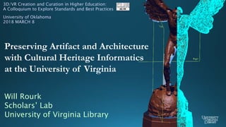
1. Will Rourk
Scholars’ Lab
University of Virginia Library
Preserving Artifact and Architecture
with Cultural Heritage Informatics
at the University of Virginia
3D/VR Creation and Curation in Higher Education:
A Colloquium to Explore Standards and Best Practices
University of Oklahoma
2018 MARCH 8
2. Cultural Heritage Informatics
http://bit.ly/UVA3D
COLLABORATORS
The Fralin Museum of Art
Monticello
Home of Thomas Jefferson
Montpelier
Home of James Madison
The Kluge-Ruhe
Aboriginal Art Collection
UVA Library
Special Collections
Rivanna Archaeological
Services
The Tibetan and
Himalayan Library
At UVA
AGENTS
Institute for
Advanced Technology
in the Humanities
UVA Library
Scholars’ Lab
Spatial Technologies
UVA Library
Content Stewardship
UVA
Facilities Management
3. artifact
(Fralin 3DGV)
architecture
Cultural Heritage Data : Laser Scanning / LIDAR
archaeology
Zscanner 700 CX
scanner accuracy
= approx .2mm
scanner effective range
= approx .3m
24 bit color texture capture
creates mesh models
FARO Focus 3D
scanner accuracy
= approx 2mm
scanner effective range
= approx 60m
integrated color texture capture
captures point cloud data
4. Cultural Heritage Data : Photogrammetry
terrestrial
DSLR with prime lens
(Canon 7D with 50 mm prime)
Point & Shoot
(Olympus TG-4 w/ remote app)
aerial
DJI Inspire
Max Flight Time
= approx. 18 mins
Max Flight Alt
= 4500 m
Camera Model
= X3 FC350
Max Image Resolution
= 12.4 MP
Lens
= 20mm ; f/2.8
Video Recording
= 4K, FullHD, HD
18. Drupal UI The Fralin Museum
EmbARK DB
http://vcg.isti.cnr.it/3dhop
http://bit.ly/Fralin3DKotyle
Archives : THE LIBRARY
19. 3D Geographic
Information System
- 3DGIS -
Historic Building
Information Model
- HBIM -
vs
ArcGIS Pro
City Engine
Arc Scene
ESRI ArcGIS Suite
(Environmental Systems Research Institute)
QGIS / GRASS* / etc …
Autodesk
Revit
IFC* / Open BIM / etc …
vs
Cultural Heritage Informatics – Directions : Spatial Data Platforms
*Industry Foundation Classes*Geographic Resources Analysis Support System
20. Cultural Heritage Informatics Virtual Reality Platform
(CHIVR)
Cultural Heritage Informatics – Directions
University of Mary Washington
Center for Historic Preservation
James Madison University Library
Innovation Services
University of Virginia Library
Scholars’ Lab
Health Sciences Library
University of Virginia
Immersive VR Student SIG
University of Virginia
Institute for Advanced
Technology in the Humanities
(IATH)
21. Pedagogy - #CHIintern
Cultural Heritage Informatics – Directions
#AdrianaTheIntern
#AndrewTheIntern
#BaxterTheIntern
#ElizaTheIntern
#LaureyTheIntern
… revolutionizing the field …
http://bit.ly/UVACHIpedagogy