
More Related Content
What's hot
What's hot (20)
Viewers also liked
Viewers also liked (8)
Similar to Continents
Similar to Continents (20)
Recently uploaded
Recently uploaded (20)
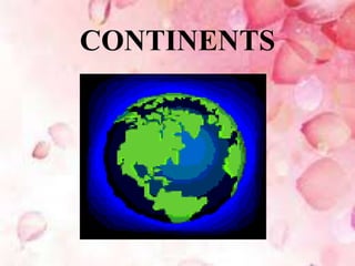
Continents
- 1. CONTINENTS
- 2. CONTINENTS • The seven continents are the seven main land areas on the Earth. Some are joined to each other, and some are completely surrounded by water. Some continents have a lot of countries, but others only a few.
- 3. CONTINENTS • It is believed that in past ,all continents were joined, this land area was called Pangaea .This area started to break up & got divided into 7 parts ,so today we have 7 continents .These continents are still moving away or moving close to each other. This is called continental drift or plate tectonics theory. For example Europe & North America are said to be moving 7 cm apart every year.
- 4. What is a continent? • A continent is one of several large landmasses on Earth.
- 5. What is a land mass? • Land mass refers to the total area of a country or geographical region (which may include discontinuous pieces of land such as islands). • A continent is one of several large landmasses on Earth.
- 6. • There are seven continents – they are (from largest in size to smallest): Asia, Africa, North America, South America, Antarctica, Europe, and Australia
- 8. What continent do we live on?
- 9. ASIA
- 11. ASIA • Asia is the continent that has one third of the total land area of the world.
- 12. LOCATION ASIA Latitude Longitude 10°11′ South 81°12′ North 26°2′ East 169°40′ West
- 13. PHYSIOGRAPHIC DIVISIONS • Asia is divided into the following physiographic divisions. • The Northern Lowlands • The Central Mountain Chains • Old Plateaus of the South
- 15. Northern lowlands • This is the region found to the south of the Arctic Ocean covering the majority of Siberia. Even though they are lowlands they are not plains. They have mountains and plateaus. • The Ural Mountains found on the western side of the northern lowlands separate Asia from Europe.
- 16. The Central Mountain Chains • This physiographic division is found onthe southern side of the northern lowlands. • The mountain ranges of Asia are extendedfrom the Pamir Knot which is located almost at the centre of Asia. • The Pamir Knot is known as the 'Roof of the World'.
- 17. The Central Mountain Chains • The Hindukush and the Sulaiman are the two mountain ranges that extend towardsthe west of the Pamir Knot. Four mountain ranges are seen towards the east of the Pamir Knot. • The most important among them is the Himalayas. The Kunlun and the Altin are the mountain ranges situated on the north of the Himalayas. • Arakanyoma is a large mountain range that runs first towards the southwest from the eastern tip of the Himalayas and then turns towards the south. • The central mountain chain contains many peaks including the highest peak in the world the Mt. Everest.
- 18. Old Plateaus of the South • This physiographic division includes three major plateaus, Arabia, Deccan and Indo-China. • They are formed of relatively old and hard rocks. • Though it has some rivers, this is mostly a dry region and lies between the Red Sea and the River Tigris with a west to east slope.
- 19. THE GREAT RIVER VALLEYS • These are fertile alluvial lowlands. • This region comprises eight valleys namely, the Tigris- Euphrates valleys, the Indus valley, the Ganga- Brahmaputra valleys, the Menam valley, the Iravathi valley, the Mekong valley, the Yangtze valley and the Hwanho valley. This highly fertile region is one of the most thickly populated regions of the world.
- 20. THE ISLAND GROUPS • Most of the islands are the elevated portions of mountain ranges found in the oceans which are the continuation of mountain ranges of the mainland. Some island groups have many volcanoes. Japan, Philippines, Indonesia, KurileIslands and Formosa are the major island groups.
- 21. Climatic Regions and Natural Vegetation Following are the important factors that influence the climate of Asia. Location of the continent Area Altitude above mean sea level Nearness to ocean Location of mountains The course of the monsoon
- 22. Asia: Resources and Distribution of Population
- 23. FOREST RESOURCES • Tall and large trees grow densely in the equatorial regions of Asia. • The type of vegetation varies depending upon the variations in rainfall. • Evergreen and semi evergreen forests grow in regions which have the influence of monsoons and cactus type of vegetation grows in the desert regions.
- 24. AGRICULTURE • This continent having mountains, plateaus, deserts and dense forests experiences water scarcity in many regions. • Most of the people of Asia depend on agriculture for livelihood. China, the largest producer of rice in the world is in the continent of Asia. • Various crops like wheat, pulses, oil seeds, cotton, jute, rubber, tea, coffee etc. are cultivated in different parts of Asia.
- 25. Mineral Resources • Asia is a storehouse of various minerals. • Hence mining is a major occupation in Asia. • About 90% of mica produced in the world is mined from Asia. In addition to this, minerals such as monazite, tin, tungsten, iron ore, manganese, bauxite, gold, silver etc. are also mined in Asia. • Asia also has large deposits of coal and petroleum.
- 26. DISTRIBUTION OF POPULATION • Asia, the largest continent in the world is also the continent with the highest population. • About 60% of the world's population lives in Asia. It is also a continent with diverse distribution of population. • The Ganga Valley, the Yangtze -Tsikiang Valley, Java Island of Indonesia, Singapore,Japan etc. are regions with a high density of population. • Moderate population is found in the coastal regions of Turkey, Southeast Asia and in some Arabian countries. But population is sparse in the central Asian deserts, southwest Asia and northern Russia.
- 27. EUROPE
- 29. EUROPE • It is believed that Europe is named originally after ‘Europa’ who was a Phoenician Princess from Greek Mythology.. • In Europe , there are no deserts.It is the only continent without deserts. • Venice, the world’s smallest country is in Europe . • Most of the countries of Europe use a single currency called the Euro. • Germany is the most populous country in Europe, • Industrial revolution is said to have originated in Europe only & from there it spread to whole world.
- 30. Location • Europe is a continent located fully in the northern hemisphere. It is situated between 34°51' N and 81°47' N latitudes and 24°33'W and 69°03' E longitudes. • The total area of Europe, which is surrounded by oceans on three sides, is 10,49,8000 sq.km. • As a common region Europe and Asia are together known as 'Eurasia'.
- 31. PHYSIOGRAPHY • Europe is a continent with many mountains and vast plains. More than half of Europe lies at an average height of 200m above the sea level.
- 32. Europe has been divided into the following physiographic divisions. The North Western Mountain Region The North European Plains The Central Uplands The Alpine System
- 34. The North Western Mountain Region • The region extends from Finland to Sweden, Norway, the British Isles comprising Britain and Ireland and Iceland. • The topography of this region asseen today is the result of the process of weathering and erosion by glaciers over a long period of time. • The oldest mountains of Europe are found in this region. • The north western mountain region which is rich in mineral resources has limited deposits of coal and petroleum.
- 35. The North European Plains • This is a vast plain which covers almost half of Europe. • It extends from the Atlantic coast in the west to Ural Mountains in the east. • These plains are formed by the deposits of rivers. • Holland, Belgium, Denmark, western France, northern Germany and Poland are the major countries situated in the Northern European Plains.
- 36. The Central Uplands • This region includes the mountains, hills and plains lying between the North European Plains and the Alps Mountain ranges. • The mountains in this region have an average altitude of 1600 m above the sea level. • The Central Uplands include the Ural Mountains and the Black Forest of Germany.
- 37. The Alpine System • The Alpine System includes mountain ranges extending from the Atlantic Ocean in the west to the Caspian Sea in the east. • Parallel fold mountains are the peculiarities of this region.
- 38. CLIMATE • The following are the major factors controlling the climate of Europe. • Physiography • Nearness to oceans • Planetary winds • Ocean Currents
- 39. CLIMATE • Europe has been classified into the following five climatic divisions. • West European Type • Continental Type • Mediterranean Type • Taiga Type • Tundra Type
- 41. AGRICULTURE • Only one third of the total geographical area is used for cultivation. • A small portion of the people of Europe are engaged directly or indirectly in agriculture. • Different types of food crops, fruits and flowers are cultivated here. • Many crops like wheat, barley, oats, sugarcane etc. are grown here. • Cattle rearing is one of the main occupations of the people in different parts of Europe.
- 42. FISHING • Europe is a continent which has the most favourable geographical conditions for fishing. • The following are the some of them. • A lot of bays • Confluence of ocean currents • Presence of planktons • All these help in fishing. One fourth of the fish produced in the world is from Europe. • Fishing is done using modern machinery. • Dogger Bank, Norway, Sweden, Denmark, France, Britain, Germany, Holland etc. are the major fishing centres of Europe.
- 43. Mineral Resources • Europe has a diverse collection of mineral and energy resources. The major resources found in Europe are iron ore, zinc, lead, platinum, copper, bauxite etc. • In addition to conventional energy sources like coal, petroleum and natural gas, nonconventional energy sources like atomic and hydel energy are also used here. • Europe is far ahead in terms of the production of non-conventional energy.
- 44. Industries • Europe has many industries. Iron and steel industry, wool industry, technological industries like automobile manufacturing, ship building, chemical industries, paper manufacturing etc. are widespread in Europe. • Ruhr Basin in Germany, which has the fifth position in the world in the production of iron and steel, is in Europe.
- 45. Human Life • Europe has the third position in the world in terms of total population and the first position in terms of population density. • Rhine Valley, Holland, Belgium, Britain etc. are densely populated regions. • Norway, Sweden etc. are countries with very low density of population.
- 46. AFRICA
- 48. AFRICA • Africa has the second position in the world in terms of its area. Almost all the sides of Africa are covered with oceans and seas. • Africa is the continent having the largest number of countries, with about 59 countries including the Madagascar Island. • Till the end of last century the interior of the African continent was a mystery to the outside world. • Hence Africa is known as the 'Dark Continent'.
- 49. Location • Africa spreads on both the hemispheres. It is located between 34°52' S to 37°31' N latitude and 25°11 W to 51°24' E longitude. • The equator divides this continent into two equal halves. The area of African continent is 3033500 sq. km.
- 50. PHYSIOGRAPHY • The physiography of Africa is classified as follows. • Plateaus • Mountains • Deserts • Rift Valleys
- 52. PLATEAUS • Generally Africa consists of plateaus made up of hard rocks and narrow coastal plains. • The average height of the plateaus is over 600 m above the sea level. • It can be seen that the altitude of the plateaus decreases from south to north.
- 53. MOUNTAINS • Mountains are relatively few in the continent of Africa. • Some importantmountains are found in the plateaus and deserts. The highest peak in Africa is Mt. Kilimanjaro. This is situated in Tanzania of East Africa. • In addition to this, Atlas, Kenya, Ruwanzari etc. are other major mountain ranges of Africa. • Ruwanzari is also the source of the Nile River.
- 54. DESERTS • Deserts are seen on the northern and southern sides of Africa. One third of Africa is covered with deserts.
- 55. RIFT VALLEYS • Another major landform in Africa is theRift Valleys. • Rift valleys are formed when the region in between two fault zones subsides. • The Great Rift Valley is a major rift valley in Africa.
- 56. RIVERS • The longest river in the world, River Nile originates from the tropical rainforests of Africa. • In addition to the River Nile, the River Congo which has many tributaries flows through the middle of Africa.
- 57. CLIMATE AND NATURAL VEGETATION • Hot climate is generaly experienced in the continent except in its north and south ends. • When the countries in the northern hemisphere of the African continent experience a cold climate, most of the countries of Africa in the southern hemisphere experience a hot climate.
- 58. Africa is divided into the following climatic regions. • Equatorial Climate • Savanna Climate • Desert Climate • Midlatitude Temperate Grassland Climate • Mediterranean Climate • Mountain or Highland Climate • China Type Climate
- 59. RESOURCES
- 60. FOREST RESOURCES • One fourth area of the African continent is dense forest. • Dense forests containing many types of trees and wild animals are the peculiarity of Africa.
- 61. Agriculture • Since most of the places in Africa are deserts or dense forests, areas suitable for agriculture are very less here. • But available agricultural land is utilized to the maximum. • Old agricultural practices are followed mostly. • Agriculture using modern machinery is practiced in SouthAfrica, the Nile Delta of Egypt and in the coastal areas. • Africa produces many crops like rice, wheat, cotton, coffee, tea etc. • Fruits like pineapple, lemon, orange, grapes and olive are cultivated in the regions where Mediterranean type of climate is experienced.
- 62. MINERALS • Africa is blessed with many types of minerals. The major minerals mined in • Africa are copper, gold, platinum, iron ore, lead and manganese. About 25% of the uranium and copper produced in the world is from African countries like Zambia, Zimbabwe and Zaire. • The African continent is the leading mining centre of diamonds in the world. • The Kimberly region of Africa has the first position in diamond mining.
- 63. POPULATION DISTRIBUTION • Even though Africa has one fifth of the total geographical area of the world, its population is comparatively less. • One tenth of the world's population live in Africa. • Since most of the places in Africa are deserts or thick forests, the population here is less. • Population is more in the coastal areas, river valleys, mining centres and the elevated regions of east Africa
- 64. ANTARCTICA
- 66. ANTARCTICA • Antarctica known as the 'White Continent‘ is the only continent in the world where there are no permanent inhabitants. • The area of Antarctica, which has the fifth position in terms of its size, is about 14000000 km. • The highest peak in this continent is the 'Vinson Massif'.
- 67. PHYSICAL CHARACTERISTICS • Most of Antarctica lies 2100-2400 m above the sea level. Antarctica is divided into two East Antarctica and West Antarctica. • East Antarctica is a snow covered plateau. But the comparatively small West Antarctica is seen as broken up into thousands of snow covered islands. East and West parts of Antarctica are covered with ice slabs of about 2000 m thickness. • Even though they are snow covered, active volcanoes are found in the Scotia Islands of Antarctica.
- 68. CLIMATE • Temperature in Antarctica falls as low as -85°C during winter seasons. • This has given Antarctica the, title, 'the coldest continent of the earth'. • The temperature of -89.2°C, recorded at the Russian observation centre Vostok on 21st July 1983, remains the lowest ever recorded temperature on the surface of the earth. • Only the observation centres of various countries working in Antarctica record temperature continuously on all seasons. • Antarctica experiences long days and nights. • The average temperature of Antarctica is -49°C
- 69. RESOURCES • The presence of abundant ocean resources is the reason for drawing human attention to Antarctica. • Seals were hunted for leather and whales for oil. • Now whale hunting has been banned in all the oceans south of Australia. • Fishing has been increasing in the oceans around Antarctica for the past thirty years. • Besides marine resources mineral deposits are also found in Antarctica. • Deposits of iron ore, chromium, copper, gold, nickel, coal etc. are found here.
- 70. AUSTRALIA
- 72. AUSTRALIA • Australia as a continent includes the mainland of Australia along with Tasmania and many of the Islands throughout the Pacific Ocean.
- 73. AUSTRALIA • Australia is the largest island (island is a place which is surrounded by water from all sides).It is also the smallest continent in the world. It is also known as “island continent”. • Australia continent has only one country ,which is Australia itself.It lies entirely south of the equator and is called land down under. • Australia is home of three unique animals: platypus ,mammal that lays eggs, the kangaroo,which carries its young in a pouch,the emu ,a large bird that does not fly.
- 74. AUSTRALIA • Australia is also known for its various type of Eucalyptus trees. There are over 500 varieties. • Australia ‘s sheep population is more than its human population. Its sheep population is 14 times more than its human population. This is why Australia stands first in the production & export of wool in the world.
- 75. NORTHAMERICA
- 77. NORTHAMERICA • North America was named after the explorer Americo Vespucci. • North America is the only continent that has every kind of climate • The population density is approximately 22.9 per square kilometer, which is the largest for any continent in the world. • North America is around twice the size of Europe. • Lake Superior is the largest fresh water lake in the world. It is located on the border between the United States and Canada.
- 78. NORTHAMERICA • North America is made up of four countries: Canada is the furthest North, The United States is in the middle, and Mexico is the furthest south. Greenland is an Island of North America, lying Northeast of Canada. • There are three Oceans that touch North America, The Arctic to the North, The Pacific to the West, and the Atlantic to the East.
- 79. SOUTH AMERICA
- 81. SOUTH AMERICA • Andes form the Second Highest Mountain System in the World next to the Himalayas. They are Young Fold Mountains. Mt. Aconcagua is the Highest Peak (7,021 m) of The Andes. • The Angel Falls is the Highest Waterfall in the World • It also has the world’s largest river –Amazon (by volume of water) • Predominant languages spoken in South America are Spanish and Portuguese • Largest salt lake in the world: Salar de Uyuni(Uyuni salt flats) • Soccer is the dominant game in this continent
- 82. SOUTH AMERICA • South America is made up of twelve countries. • The Pacific Ocean borders South America to the West, and the Atlantic to the East. • South America is a warm continent • People there speak mostly Spanish • The biggest country is Brazil, where people love to play soccer • The Amazon rainforest is in South America
- 83. Can you name the continents on this map?
- 84. THANK YOU….. SUBMITTED BY Athira.M.R Dept.of SoialScience St.Xaviers Training College,Thottakkattukara,Aluva- 683108