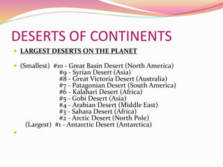
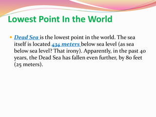
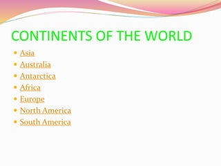
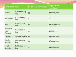
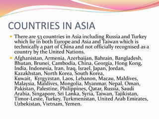
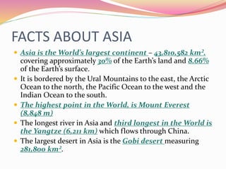
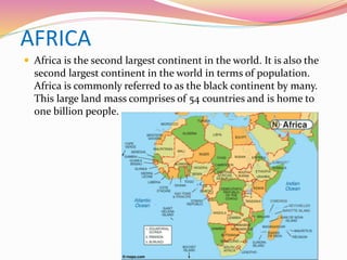
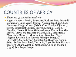
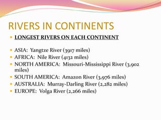
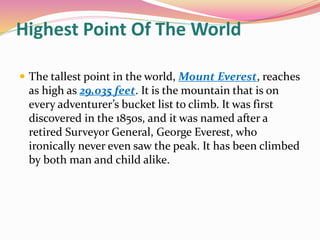
The document provides information about the seven major continents of the world: Asia, Africa, Europe, North America, South America, Antarctica, and Australia/Oceania. It includes brief descriptions of each continent, lists of countries within each continent, and lists of key facts about the physical geography and population of each continent.
There are seven continents in the world: Asia, Africa, North and South America, Antarctica, Europe, and Australia/Oceania. The key characteristics that define a continent are that it is a very large landmass usually separated by water or other natural features. Continents only cover 29% of the Earth's surface, with the rest being water. Each continent is then described in 1-2 sentences highlighting some of its defining physical or cultural features.
The document summarizes the seven continents of the world: Asia, Africa, North America, South America, Antarctica, Europe, and Oceania/Australia. It provides key details about each continent, including their size, population, largest countries, and most populous cities. The continents are ordered from largest to smallest by land area.
The document summarizes the continents and oceans of the world. It states that Asia is the largest continent, home to 60% of the world's population. Australia is the smallest continent, known for its deadly snakes. Africa has the most countries with 53 and is home to lions, viruses, and bugs. Antarctica is entirely made up of desert and has a population of zero aside from some penguins. Europe has the highest population density and was home to historical events like plagues and wars, as well as Speedos. South America has the largest rainforest and river system and is home to isolated tribes. The four oceans named are the Atlantic, Pacific, Arctic, and Indian.
This is a PowerPoint Presentation by my second class at the Cape Fear Center for Inquiry in Wilmington, North Carolina. . This presentation reflects an inquiry continuum within the thematic unit of geography. The students began by recalling what they already knew about the seven continents and then asked questions to shape their research. Students also discussed what research sources would most helpful to answer their questions. After two sessions of small group work in the computer lab, students created PowerPoint slides to synthesize their findings. This was a challenging but age-appropriate project because students had to also work cooperatively in collaborative groups, use technology responsibly and implement design ideas to support their final product
Note: Some fonts have been altered since uploaded onto slideshare.
Todd Latham joined Robert Swan and an international group of people on an expedition to Antarctica in March 2011. Part of the 2041.com effort to educate the world about climate change, renewable energy and the future of the planet's last untouched wilderness - Antarctica.
The document is a summary of the planets and moons in our solar system. It provides details on each planet's orbit around the sun, distance from the sun, gravity, atmosphere and notable features. It also describes Earth's moon and its formation from asteroid impacts over time.
This document provides an overview of the physical geography and human geography of Europe. It describes the various peninsulas that extend from Europe, including the Scandinavian, Jutland, Iberian, Apennine, and Balkan peninsulas. It discusses the mountain ranges, plains, rivers, climate zones, natural resources, and vegetation regions of Europe. It also summarizes the population patterns, urbanization trends, ethnic groups, and historical developments that have shaped the human geography and development of different regions in Europe.
North America is the third largest continent, spanning over 24 million square km between latitudes of 7-85 degrees north and longitudes of 20-179 degrees west. Its major physical features include the Canadian Shield of old rocky areas, the Eastern Highlands including the Appalachian Mountains, the vast Central Lowlands agricultural region, and the Western Cordilleras mountain range extending from Alaska to Panama. The climate varies significantly from tundra and taiga in the north to grasslands, Mediterranean, desert, and tropical rainforest zones in the south, influenced by proximity to oceans and mountain ranges. The continent's economy is based around agriculture in the central plains, dairy farming, fishing, and major industries like mining, manufacturing,
The document summarizes the seven continents of Earth. It describes the key facts about each continent, such as their relative sizes, countries they contain, and notable geographic features. The seven continents are North America, South America, Europe, Asia, Africa, Australia, and Antarctica.
There are four main types of landforms: mountains, plateaus, and plains. Mountains form through volcanism or faults in the earth's crust and are categorized as block, fold, residual, or volcanic mountains based on their formation. Plateaus are high plains that can be intermontane, piedmont, or continental based on their surrounding terrain. Plains form through deposition by rivers (alluvial), glaciers (glacial), seas (coastal), or uplift of continental shelves (structural).
There are 5 oceans in the world: the Pacific, Atlantic, Indian, Antarctic, and Arctic oceans. The document provides brief descriptions of each ocean, noting key features like their locations and surrounding regions. It also explains that oceans are incredibly important as they cover most of the Earth's surface, support a vast diversity of life, produce oxygen, and provide food for many species including humans.
The document discusses key facts about our planet Earth. It begins by providing context about our solar system and universe. It then explains that Earth is the third planet from the sun and the only planet that supports life. The document goes on to describe how Earth formed from a hot cloud of gases and cooled over millions of years, developing a crust, mantle and core similar to an egg. Volcanoes are mentioned as openings where molten material from the core is forced out of the crust.
The document provides information about the planets in our solar system as well as other celestial bodies such as comets, asteroids, meteors, and meteorites. It details facts about each planet such as their size, composition, orbital period, temperature, and other characteristics. It also describes comets as icy bodies that develop tails when near the sun, asteroids as rocky fragments in the asteroid belt, meteors as space rocks that burn up in the atmosphere appearing as shooting stars, and meteorites as chunks of rock or metal that reach the ground.
This document provides information about the seven continents and five oceans. It describes the location and key details of each continent, such as the countries it contains and surrounding bodies of water. It also provides facts about each of the five oceans, including their sizes and average depths. The objectives are to name and locate the continents and oceans on a map. Comprehension activities are suggested at the end to reinforce learning about the continents and oceans.
South Africa is located at the southern tip of Africa, bordered by several countries and two oceans. It has nine provinces and over 44 million people. The main languages include Afrikaans, English, Zulu, Xhosa, and Tswana. The climate is moderate with warm summers and mild winters. South Africa is a democracy with Jacob Zuma as President and has a diverse economy focused on industries like mining, farming, and automotive. Tourism also contributes significantly to the economy.
South America was named after Amerigo Vespucci, an Italian explorer. It is the fourth largest continent located primarily in the southern hemisphere, bordered by the Atlantic Ocean and Pacific Ocean. Some key features include the Andes Mountains, Amazon River, diverse climate and cultures influenced by European colonization. The continent has experienced rapid economic development in recent decades driven by industries like agriculture, mining, and manufacturing.
Captain James Cook was the first to enter the Antarctic circle in 1774. In 1840, Jules Dumont d'Urville became the first person to set foot on Antarctica. The four most important Antarctic explorers were Roald Amundsen, Ernest Shackleton, Robert Falcon Scott, and Richard E. Byrd. The Greeks were among the first to believe that another land could exist in the southern hemisphere opposite their known world.
South America is the 4th largest continent, located mostly in the tropics, with coastlines along the Atlantic, Pacific, and Caribbean Seas. It contains three main physical regions - the Andes Mountains, plains, and the lowlands and plateaus of Brazil. The continent was dominated by indigenous civilizations like the Inca prior to European colonization starting in the 15th century. Today, most countries in South America have left-leaning governments, Spanish and Portuguese are the dominant languages, and the economies rely heavily on natural resource extraction and agriculture.
This is a presentation designed for 3rd graders. There were many videos embedded in this PPT, which you will not be able to view. It was also designed in kiosk mode which allows students to view a section at a time.
Interesting facts about continents in the worldUsama Jawed
The document discusses the seven continents of the world. It provides 3-4 facts about each continent, such as Asia being the largest continent and home to many ancient civilizations, Africa being rich in minerals and the origin of humans, and Australia having more sheep than people. It also notes interesting details about Antarctica being the coldest, driest, and windiest place on Earth and its size fluctuating with the seasons.
Canada is located in northern North America, bordered by three oceans (the Arctic, Atlantic, and Pacific) and one country (the United States) to the south. While Canada has a large land area, most of its population lives near the southern border due to the harsh climate further north. The country's location and natural resources have contributed to its development and trade.
Europe has diverse geography due to its location between Asia and Africa. It contains many peninsulas and mountain ranges that divide the continent. The Alps and Pyrenees form natural borders, while rivers like the Danube flow through many countries. Europe's climate varies significantly from polar in the north to Mediterranean in the south. Overall, Europe's unique geography and location have shaped its development over the past 200 million years.
This document provides an overview of the geography of Asia. It begins with an introduction to Asia's size and diversity. It then describes Asia's major physical divisions, including the northern lowlands, central mountains, southern plateaus, great river valleys, and island groups. The document also discusses the key climate factors of Asia and how they contribute to its various climate regions and rainfall patterns. It concludes that Asia's diverse physical geography results in a wide variety of climates and landscapes across the continent.
Earth is a planet that formed around 4.6 billion years ago from a cloud of gas and dust. It is the only planet known to support life. Earth is spherical in shape but slightly oblate, meaning it bulges at the equator. It rotates on its axis once every 24 hours and revolves around the sun once every 365 days. Earth has four major interior layers - crust, mantle, outer core, and inner core. NASA studies Earth using satellites to monitor changes to its land, oceans, atmosphere, and climate in order to better understand and predict environmental changes.
The document discusses different types of plains, including coastal plains which are flat, low-lying landforms near oceans or large lakes that are home to natural resources. It also describes the Northern Fertile Plain/Gangetic Plain of India, which is one of the largest and most fertile plains in the world, densely populated and an important agricultural region. The Great Plains of North America are also mentioned as a broad expanse of flat land covered in prairie and grasslands west of the Mississippi River and east of the Rocky Mountains.
The document discusses the seven continents of the world: Asia, Africa, North America, South America, Europe, Antarctica, and Australia. It provides key facts about each continent, including their sizes, locations, geographic features, climates, animals, and populations. Asia is the largest continent covering one-third of the world's land. The continents vary greatly from densely populated places to icy Antarctica which is covered in ice year-round.
The document discusses the seven continents and Europe in particular, mentioning Spain and its Andalusian region, as well as the cities of Seville and Santiponce within that region.
The document summarizes the 7 continents - North America, South America, Europe, Asia, Antarctica, Australia, and Africa. It provides key details about each continent, including their size, population, countries, surrounding bodies of water, climate, and notable geographic or demographic features. For example, it notes that Asia is the largest continent and has the highest mountains and lowest points, while Africa is the second largest and home to many wild animals.
The document summarizes the seven continents: North America is the third largest continent with diverse climates and a triangular shape. South America is the largest forested continent connected to North America. Europe is the second smallest continent with more people than any other except Asia. Asia covers more land than North America, Europe, and Australia combined and is the most populated. Australia is the smallest, flattest continent located in the Southern Hemisphere. Antarctica is very icy and home to many types of penguins. Africa is mostly desert land, is the second largest continent, and is known for its wild animals.
All countries of world along with their official language and capital and also their currency, I would strongly suggest you all to go through it. In the end don't forget to like it.
The document contains a quiz about countries, continents, rivers, and cities around the world. It asks 10 multiple choice questions with increasing cash prizes for each correct answer, starting at £100 and culminating in a £1,000,000 prize for the final question. The questions cover topics like the largest country, longest river, capital cities, locations of natural landmarks, and more.
South American countries and their language, capital & currencysTvNNa
This document lists key information about 14 countries in South America - their flags, capital cities, currencies, and official languages. It provides an overview of South American nations, including Argentina, Bolivia, Brazil, Chile, Colombia, Ecuador, Falkland Islands, French Guiana, Guyana, Paraguay, Peru, Suriname, Uruguay, and Venezuela.
Countries And Nationalities Slideshow 5º 6Ana Trigueiros
The document lists the countries of the European Union and their capitals and nationalities. It then lists several countries outside of the European Union and their capitals and nationalities. The countries included Portugal, Spain, France, Italy, Ireland, Germany, Slovenia, the United Kingdom, Poland, Sweden, Romania, Slovakia, Finland, the Netherlands, Belgium, Denmark, Latvia, Hungary, Malta, the Czech Republic, Estonia, Cyprus, Luxembourg, Greece, Lithuania, and Austria within the EU. Outside the EU it lists countries such as Iraq, Jamaica, Egypt, Turkey, India, Japan, Brazil, Switzerland, China, Australia, Ukraine, Russia, Angola, the United States, South Africa,
South east asia editable continent map with countriesSlideTeam.net
The document is a map of Southeast Asia that depicts the countries of the region. It includes labels for each country and surrounding bodies of water. Text on the slides promotes using the map template for presentations and provides instructions on customizing it. The key details are the map of Southeast Asia showing the countries of the region and text encouraging use of the template.
Lesson 10: Continents and Countries of the WorldJamaica Olazo
This document provides information about the seven continents of the world:
- It describes the location and key physical features of each continent, including major mountain ranges, rivers, deserts, and lakes.
- It also lists some of the most populous countries and major cities found within Asia, Europe, North America, South America, Africa, Australia, and Antarctica.
- The document aims to teach about the geographical makeup and notable characteristics of each continent.
North American countries and their language, capital & currencysTvNNa
This document lists 45 countries and territories in the Americas and their basic information including name, capital, currency, and official language. The list includes independent countries, overseas territories of European nations like the UK and France, and insular areas of the United States. Most use US dollars, East Caribbean dollars, or euros and have English, Spanish, Dutch, or French as their official language.
7 continents of the world and the 5 Oceans By Mr.Allah Dad Khan Visiting Prof...Mr.Allah Dad Khan
The document provides information about the 7 continents and 5 oceans of the world. It discusses each of the 7 continents, including their location, key facts about area and population, and brief descriptions. The continents covered are Africa, Antarctica, Asia, Australia, Europe, North America, and South America.
The document provides information on several topics related to Earth:
1) Earth is often called the "blue planet" because it appears blue from space and 70% of its surface is covered in water.
2) Earth has four main layers from the center out - the inner core, outer core, mantle, and crust. The mantle makes up 85% of Earth's mass.
3) The seven continents formed from the breaking apart of the supercontinent Pangaea, ranging in size from largest Asia to smallest Australia.
4) The two main movements of Earth are its rotation on its axis, which causes day and night, and its revolution around the sun, which causes the seasons.
The document describes the seven continents and five oceans of the world. It provides details on the location and key facts about each continent. Asia is the largest continent and most populous. It is home to China, Mt. Everest, Burj Khalifa, Lake Baikal, and the Caspian Sea. Africa is the second largest continent and home to the Sahara desert, the Nile River, African elephants, giraffes, cheetahs, Nile crocodiles, and gorillas. North America is made up of 23 countries and includes Lake Superior and lion's mane jellyfish.
Earth is the third planet from the sun and the only known planet to support life. It has large land areas and oceans, with the land containing seven continents - Africa, Antarctica, Asia, Europe, North America, Oceania, and South America. The document also provides brief descriptions of each continent and mentions that water is a major component of the planet, existing in different states including liquid, solid, and gas.
GEOGRAPHY YEAR 9 - CONTINENTS AND OCEANS. Contains: what is a continent, Asia, Africa, North America, South America, Antarctica, Europe, Australia, what is a ocean, Pacific, Atlantic, Indian, Southern, Arctic.
The document summarizes the seven continents of the world: Africa, Americas, Antarctica, Asia, Australia/Oceania, and Europe. It provides key details about each continent's area, population, highest point, largest lake, and longest river. The continents are differentiated as large, continuous land masses on Earth, with two-thirds of the continental land located in the Northern Hemisphere.
The document discusses the seven continents of the world: North America, South America, Europe, Asia, Africa, Australia, and Antarctica. It provides 1-2 brief facts or details about each continent, such as common animals, languages spoken, countries, or geographical features. It also includes diagrams labeling each continent and a poem summarizing the seven continents.
The document summarizes the five major oceans of the world and their geographical boundaries. The five oceans are the Pacific, Atlantic, Indian, Southern, and Arctic Oceans. It provides the locations and key defining features of each ocean, including their percentages of Earth's surface area and water volume. It also lists some of the major seas and their locations.
The document discusses the seven continents of the world:
1) Europe, Asia, Africa, North America, South America, Antarctica, and Australia are the seven continents identified based on convention rather than strict criteria.
2) Each continent is described in terms of its boundaries, population, etymology of the name, and a brief overview of its economy.
3) Key facts are provided about the total population and land area of the continents, with Asia and Africa having the largest populations while Asia and North America have the largest total land areas.
Asia is the largest and most populous continent in the world. It covers about 30% of Earth's total land area and has over 4.4 billion people. Asia contains 48 countries and is very diverse, with various subregions including Central, North, East, West, South, and Southeast Asia. Some of Asia's notable physical features include the Himalayan mountain range, the Arabian Peninsula, and the Pacific Ocean bordering its east side. Asia is home to many "superlative" geographic locations, such as Mount Everest being the highest point on Earth and the Yangtze River being the longest river.
Here you will find information about the second largest continent in the world. It includes its geographical features too! Even amazing facts at the end. It can be used in schools too, as it improvises better understanding in students.
The document discusses the major features of the Earth's surface, including the distribution and sizes of the seven continents. It provides details on the sizes and locations of Asia, Africa, North America, South America, Antarctica, Europe, and Australia. It also describes the major relief features found on continents, such as mountains, plains, and plateaus. It identifies four types of mountains - volcanic, block, fold, and residual - and gives examples of each type. Rift valleys are described as long, deep valleys formed when continental plates separate.
The document describes the seven continents and five major oceans of the world. It provides details about the location and key features of each continent, including their highest mountains, longest rivers, largest deserts, and prominent countries. It also describes the five oceans - the Pacific, Atlantic, Indian, Southern, and Arctic oceans - and highlights their sizes, depths, and notable underwater geographic features.
The document provides a brief overview of the seven continents:
North America is the third largest continent and fourth most populated, including countries like Canada, United States, and Mexico. South America is the largest forest and home to most of the world's forests, connecting to North America and covering 12% of the world's land. Europe occupies one-fifth of Earth's greatest landmass and has more people than any continent except Asia. Asia is home to Earth's highest mountains and lowest lands and has more people living there than any other continent. Australia is the smallest and flattest continent and only continent that is also a country. Africa is the second largest continent, covering one-fifth of the world's land area and home to
Asia is the world's largest continent, covering about 30% of the world's land area. It includes Eastern Asia, dominated by China; Southern Asia, which includes India and Pakistan; Southeast Asia, consisting of peninsulas and thousands of islands; and Southwest Asia, also known as the Middle East. Asia contains many different climate zones from deserts to rainforests and is home to over 4 billion people of diverse cultures and religions. While many Asians were traditionally farmers, in the last 50 years some countries have industrialized rapidly and seen rising living standards.
Europe is a continent located in the Northern Hemisphere, mostly in the Eastern Hemisphere. It covers around 10.18 million square kilometers, making it the second smallest continent. Politically, Europe is divided into about fifty sovereign states, with Russia being the largest by area and population. The European climate is influenced by warm Atlantic currents, resulting in milder weather than areas in Asia and North America at similar latitudes.
The document provides an overview of the geography of Asia. It notes that Asia is the world's largest and most populous continent, with over 4 billion people. Asia has tremendous geographic diversity, containing the highest and lowest points on Earth and a wide variety of climates and landscapes, including deserts, forests, mountains, and grasslands. It discusses some of Asia's key physical features, such as major mountain ranges like the Himalayas and Tien Shan, plateaus like the Tibetan Plateau and Deccan Plateau, and rivers like the Yangtze and Mekong. The document also highlights Asia's significant influence on the global economy and culture.
Presentation contains up dated world map from continent wise to country wise at a glance (for beginners).along with Pakistan provincial and cities map.
Data taken from world atlas.
This document provides information about the seven continents and five oceans of the world. It begins by describing the basic structure of the globe and how the continents were originally joined together in a supercontinent called Pangaea before drifting apart. Each continent is then detailed in terms of their location, notable geographic features, surrounding bodies of water, and other facts. The document also discusses oceans, noting the five oceans and providing key details about each. It concludes with multiple choice questions to test comprehension.
Optimizing Post Remediation Groundwater Performance with Enhanced Microbiolog...Joshua Orris
Results of geophysics and pneumatic injection pilot tests during 2003 – 2007 yielded significant positive results for injection delivery design and contaminant mass treatment, resulting in permanent shut-down of an existing groundwater Pump & Treat system.
Accessible source areas were subsequently removed (2011) by soil excavation and treated with the placement of Emulsified Vegetable Oil EVO and zero-valent iron ZVI to accelerate treatment of impacted groundwater in overburden and weathered fractured bedrock. Post pilot test and post remediation groundwater monitoring has included analyses of CVOCs, organic fatty acids, dissolved gases and QuantArray® -Chlor to quantify key microorganisms (e.g., Dehalococcoides, Dehalobacter, etc.) and functional genes (e.g., vinyl chloride reductase, methane monooxygenase, etc.) to assess potential for reductive dechlorination and aerobic cometabolism of CVOCs.
In 2022, the first commercial application of MetaArray™ was performed at the site. MetaArray™ utilizes statistical analysis, such as principal component analysis and multivariate analysis to provide evidence that reductive dechlorination is active or even that it is slowing. This creates actionable data allowing users to save money by making important site management decisions earlier.
The results of the MetaArray™ analysis’ support vector machine (SVM) identified groundwater monitoring wells with a 80% confidence that were characterized as either Limited for Reductive Decholorination or had a High Reductive Reduction Dechlorination potential. The results of MetaArray™ will be used to further optimize the site’s post remediation monitoring program for monitored natural attenuation.
Evolving Lifecycles with High Resolution Site Characterization (HRSC) and 3-D...Joshua Orris
The incorporation of a 3DCSM and completion of HRSC provided a tool for enhanced, data-driven, decisions to support a change in remediation closure strategies. Currently, an approved pilot study has been obtained to shut-down the remediation systems (ISCO, P&T) and conduct a hydraulic study under non-pumping conditions. A separate micro-biological bench scale treatability study was competed that yielded positive results for an emerging innovative technology. As a result, a field pilot study has commenced with results expected in nine-twelve months. With the results of the hydraulic study, field pilot studies and an updated risk assessment leading site monitoring optimization cost lifecycle savings upwards of $15MM towards an alternatively evolved best available technology remediation closure strategy.
ENVIRONMENT~ Renewable Energy Sources and their future prospects.tiwarimanvi3129
This presentation is for us to know that how our Environment need Attention for protection of our natural resources which are depleted day by day that's why we need to take time and shift our attention to renewable energy sources instead of non-renewable sources which are better and Eco-friendly for our environment. these renewable energy sources are so helpful for our planet and for every living organism which depends on environment.
Microbial characterisation and identification, and potability of River Kuywa ...Open Access Research Paper
Water contamination is one of the major causes of water borne diseases worldwide. In Kenya, approximately 43% of people lack access to potable water due to human contamination. River Kuywa water is currently experiencing contamination due to human activities. Its water is widely used for domestic, agricultural, industrial and recreational purposes. This study aimed at characterizing bacteria and fungi in river Kuywa water. Water samples were randomly collected from four sites of the river: site A (Matisi), site B (Ngwelo), site C (Nzoia water pump) and site D (Chalicha), during the dry season (January-March 2018) and wet season (April-July 2018) and were transported to Maseno University Microbiology and plant pathology laboratory for analysis. The characterization and identification of bacteria and fungi were carried out using standard microbiological techniques. Nine bacterial genera and three fungi were identified from Kuywa river water. Clostridium spp., Staphylococcus spp., Enterobacter spp., Streptococcus spp., E. coli, Klebsiella spp., Shigella spp., Proteus spp. and Salmonella spp. Fungi were Fusarium oxysporum, Aspergillus flavus complex and Penicillium species. Wet season recorded highest bacterial and fungal counts (6.61-7.66 and 3.83-6.75cfu/ml) respectively. The results indicated that the river Kuywa water is polluted and therefore unsafe for human consumption before treatment. It is therefore recommended that the communities to ensure that they boil water especially for drinking.
Presented by The Global Peatlands Assessment: Mapping, Policy, and Action at GLF Peatlands 2024 - The Global Peatlands Assessment: Mapping, Policy, and Action
Climate Change All over the World .pptxsairaanwer024
Climate change refers to significant and lasting changes in the average weather patterns over periods ranging from decades to millions of years. It encompasses both global warming driven by human emissions of greenhouse gases and the resulting large-scale shifts in weather patterns. While climate change is a natural phenomenon, human activities, particularly since the Industrial Revolution, have accelerated its pace and intensity
Improving the viability of probiotics by encapsulation methods for developmen...Open Access Research Paper
The popularity of functional foods among scientists and common people has been increasing day by day. Awareness and modernization make the consumer think better regarding food and nutrition. Now a day’s individual knows very well about the relation between food consumption and disease prevalence. Humans have a diversity of microbes in the gut that together form the gut microflora. Probiotics are the health-promoting live microbial cells improve host health through gut and brain connection and fighting against harmful bacteria. Bifidobacterium and Lactobacillus are the two bacterial genera which are considered to be probiotic. These good bacteria are facing challenges of viability. There are so many factors such as sensitivity to heat, pH, acidity, osmotic effect, mechanical shear, chemical components, freezing and storage time as well which affects the viability of probiotics in the dairy food matrix as well as in the gut. Multiple efforts have been done in the past and ongoing in present for these beneficial microbial population stability until their destination in the gut. One of a useful technique known as microencapsulation makes the probiotic effective in the diversified conditions and maintain these microbe’s community to the optimum level for achieving targeted benefits. Dairy products are found to be an ideal vehicle for probiotic incorporation. It has been seen that the encapsulated microbial cells show higher viability than the free cells in different processing and storage conditions as well as against bile salts in the gut. They make the food functional when incorporated, without affecting the product sensory characteristics.
Kinetic studies on malachite green dye adsorption from aqueous solutions by A...Open Access Research Paper
Water polluted by dyestuffs compounds is a global threat to health and the environment; accordingly, we prepared a green novel sorbent chemical and Physical system from an algae, chitosan and chitosan nanoparticle and impregnated with algae with chitosan nanocomposite for the sorption of Malachite green dye from water. The algae with chitosan nanocomposite by a simple method and used as a recyclable and effective adsorbent for the removal of malachite green dye from aqueous solutions. Algae, chitosan, chitosan nanoparticle and algae with chitosan nanocomposite were characterized using different physicochemical methods. The functional groups and chemical compounds found in algae, chitosan, chitosan algae, chitosan nanoparticle, and chitosan nanoparticle with algae were identified using FTIR, SEM, and TGADTA/DTG techniques. The optimal adsorption conditions, different dosages, pH and Temperature the amount of algae with chitosan nanocomposite were determined. At optimized conditions and the batch equilibrium studies more than 99% of the dye was removed. The adsorption process data matched well kinetics showed that the reaction order for dye varied with pseudo-first order and pseudo-second order. Furthermore, the maximum adsorption capacity of the algae with chitosan nanocomposite toward malachite green dye reached as high as 15.5mg/g, respectively. Finally, multiple times reusing of algae with chitosan nanocomposite and removing dye from a real wastewater has made it a promising and attractive option for further practical applications.
Kinetic studies on malachite green dye adsorption from aqueous solutions by A...
Presentation on world
1. The world is the planet Earth and all life upon it,
including human civilization.[1] In a philosophical
context, the world is the whole of the
physical Universe, or an ontological world. In a
theological context, the world is the material or the
profane sphere, as opposed to the celestial, spiritual,
transcendent or sacred. The "end of the world" refers
to scenarios of the final end of human history, often
in religious contexts.
2. CONTINENTS
A continent is one of several very large landmasses on
Earth. Generally identified by convention rather than
any strict criteria, up to seven regions are commonly
regarded as continents.
3. CONTINENTS OF THE WORLD
Asia
Australia
Antarctica
Africa
Europe
North America
South America
5. Continent Area Number of Countries
Population
(as of 2011)
Africa
11,608,000 sq
km
54 778,000,000
Antarctica
5,100,000 sq
km
0 0
Asia
17,212,000 sq
km
47 3,674,000,000
Australia
plus
Oceania
2,968,000 sq
km
14 31,000,000
Europe 837,000 sq km 43 342,000,000
North
America
9,365,000 sq
km
23 483,000,000
South
America
6,880,000 sq
km
12 342,000,000
6. ASIA
Asia is the largest continent on earth covering about 9
percent of the earth’s surface. It is also the most populated
continent on earth, home to an estimated population of
around 4.3 billion people. This large population makes it
an important part of the world economy.
7. COUNTRIES IN ASIA
There are 53 countries in Asia including Russia and Turkey
which lie in both Europe and Asia and Taiwan which is
technically a part of China and not officially recognised as a
country by the United Nations.
Afghanistan, Armenia, Azerbaijan, Bahrain, Bangladesh,
Bhutan, Brunei, Cambodia, China, Georgia, Hong Kong,
India, Indonesia, Iran, Iraq, Israel, Japan, Jordan,
Kazakhstan, North Korea, South Korea,
Kuwait, Kyrgyzstan, Laos, Lebanon, Macau, Maldives,
Malaysia, Maldives, Mongolia, Myanmar, Nepal, Oman,
Pakistan, Palestine, Philippines, Qatar, Russia, Saudi
Arabia, Singapore, Sri Lanka, Syria, Taiwan, Tajikistan,
Timor-Leste, Turkey, Turkmenistan, United Arab Emirates,
Uzbekistan, Vietnam, Yemen.
8. FACTS ABOUT ASIA
Asia is the World’s largest continent – 43,810,582 km².
covering approximately 30% of the Earth’s land and 8.66%
of the Earth’s surface.
It is bordered by the Ural Mountains to the east, the Arctic
Ocean to the north, the Pacific Ocean to the west and the
Indian Ocean to the south.
The highest point in the World, is Mount Everest
(8,848 m)
The longest river in Asia and third longest in the World is
the Yangtze (6,211 km) which flows through China.
The largest desert in Asia is the Gobi desert measuring
281,800 km².
9. AFRICA
Africa is the second largest continent in the world. It is also the
second largest continent in the world in terms of population.
Africa is commonly referred to as the black continent by many.
This large land mass comprises of 54 countries and is home to
one billion people.
10. COUNTRIES OF AFRICA
There are 53 countries in Africa.
Algeria, Angola, Benin, Botswana, Burkina Faso, Burundi,
Cameroon, Cape Verde, Central African Republic, Chad,
Comoros, Congo, Congo (DRC), Cote d’Ivoire, Djibouti,
Egypt, Equatorial Guinea, Eritrea, Ethiopia, Gabon,
Gambia, Ghana, Guinea, Guinea-Bissau, Kenya, Lesotho,
Liberia, Libya, Madagascar, Malawi, Mali, Mauritania,
Mauritius, Morocco, Mozambique, Namibia, Niger,
Nigeria, Rwanda, Sao Tome & Principe, Senegal,
Seychelles, Sierra Leone, Somalia, South Africa, Sudan,
South Sudan, Swaziland, Tanzania, Togo, Tunisia, Uganda,
Western Sahara, Zambia, Zimbabwe. Click on the map
(right) for a larger image.
11. FACTS ABOUT AFRICA
Africa is the World’s second-largest continent – 30,065,000
km² covering approximately 20% of the Earth’s land and 6% of
the Earth’s surface .
It is bordered by the Atlantic Ocean to the east, the Indian
Ocean to the west and the Mediterranean Sea to the north. The
Red Sea and Suez Canal lie to the north-east and separate Africa
from Asia.
The longest river in the World, The Nile, measuring 6,695 km
– flows north ending in a delta that empties into the
Mediterranean Sea.
The World’s largest desert, The Sahara, measuring 9,000,000
km², covers much of north Africa. The Kalahari desert in south-
west Africa measures 259,000 km².
The Atlas mountain range lies in the north-west of Africa and
the highest mountain, Kilimanjaro, 5895 m, is in Tanzania.
12. EUROPE Europe is the second smallest continent in the world. It comprises
the westernmost peninsula of the giant Eurasian landmass.
Covering almost 2 percent of the earth’s surface Europe takes 6.8
percent of the world’s total land area. Europe is home to almost 50
countries and is the third most populated continent in the world
after Asia and Africa.
13. COUNTRIES OF EUROPE
There are 47 countries in Europe including Turkey and
Russia which lie in both Europe and Asia.
Albania, Andorra, Austria, Belarus, Belgium, Bosnia and
Herzegovina, Bulgaria, Croatia, Cyprus, Czech Republic,
Denmark, Estonia, Finland, France, Germany, Greece,
Hungary, Iceland, Ireland, Italy, Latvia, Liechtenstein,
Lithuania, Luxembourg, Macedonia, Malta, Moldova,
Monaco, Montenegro, Netherlands, Norway, Poland,
Portugal, Romania, Russia, San Marino, Serbia, Slovakia,
Slovenia, Spain, Sweden, Switzerland, Turkey, Ukraine,
United Kingdom, Vatican City.
14. FACTS ABOUT EUROPE
Europe is the World’s second-smallest continent –
10,180,000 km² covering approximately 6.7% of the Earth’s
land and 2% of the Earth’s surface .
It is bordered by the Atlantic Ocean to the west, the Arctic
Ocean to the north and the Mediterranean Sea to the
south. The Ural mountains in Russia mark the eastern
extreme.
The southern regions are higher and include the Pyrenees,
the Alps and the Carpathian mountain ranges.
The longest river in Europe is the Volga (2,850 km) in
Russia.
The highest mountain is Elbrus (5,642 m) in Russia.
15. AUSTRALIA
The continent of Australia is a single country continent. It
is the sixth largest country by total area, and is also the
smallest of all the seven continents. Because of its size, and
isolated location, it is also called as island continent.
Covering an area of 7617930 square kilometres, Australia
lies in the Indo- Australian Plate.
16. COUNTRIES IN AUSTRALIA
There are 28 countries and Island groups in
Australia/Oceania.
Australia, Christmas Island, Cocos Islands, Cook
Islands, Fiji, Guam, Kiribati, Marshall Islands,
Federated States of Micronesia, Nauru, New
Caledonia, New Zealand, Niue, Norfolk Island,
Northern Mariana Islands, Palau, Papua New Guinea,
Pitcairn Islands, French Polynesia, American Samoa,
Samoa, Solomon Islands, Tokelau, Tonga, Tuvalu,
Vanuatu, Wallis and Futuna
17. FACTS ABOUT AUSTRALIA
Australia, also called Oceania or Australia/Oceania, is the
World’s smallest continent – 8,112,000 km² covering
approximately 5.3% of the Earth’s land and 1.5% of the
Earth’s surface.
It is situated partly in the Pacific ocean, bordered by the
Indian Ocean to the west and the Southern ocean to the
south.
The highest point is Mount Wilhelm (4509 m) in Papua
New Guinea.
The longest river is the Darling river (2,739 km) which is a
tributary of the Murray river in Australia.
Australia is the flattest continent with much of Australia
being desert.
18. ANTARCTICA
Antarctica is the southernmost continent of all. The geographic
south pole of the earth is contained in this continent. It is made
of large permanent glaciers that surround the South Pole. This is
one of the most uninhabitable places on earth. With a very small
population of less than 5000 residents, Antarctica is the least
populated continent on earth.
20. FACTS ABOUT ANTARCTICA
Antarctica is the World’s fifth-largest continent
measuring approximately 14 million km², covering
approximately 8.9% of the Earth’s land and 2.7% of the
Earth’s surface.
It is surrounded by the Southern Ocean and lies almost
entirely within the Antarctic circle.
98% of the land area is permanently covered with ice
The Eastern side of Antarctica is higher than the West. The
highest point is Vinson Massif measuring 4,897 m.
Antarctica is the coldest place on Earth. The higher,
eastern side of Antarctica is colder than the lower west and
the peninsula of Graham Land is the warmest region.
21. NORTH AMERICA North America is a continent which lies wholly in the northern
hemisphere. It is bordered by Arctic Ocean in the north, Atlantic
Ocean in the east, Pacific Ocean in the south and west, and South
America and Caribbean Sea in the south east. North America lies
almost wholly in the western hemisphere. North America covers
almost 4.8 percent of the earth’s surface.
22. COUNRIES IN NORTH AMERICA
There are 38 countries and Islands in North America.
Anguilla, Antigua and Barbuda, Aruba, The Bahamas,
Barbados, Belize, Bermuda, British Virgin Islands, Canada,
Cayman Islands, Costa Rica, Cuba, Dominica, Dominican
Republic, El Salvador, Greenland, Grenada, Guadeloupe,
Guatemala, Haiti, Honduras, Jamaica, Martinique, Mexico,
Montserrat, Navassa Islands, Netherlands Antilles,
Nicaragua, Panama, Puerto Rico, Saint Kitts and Nevis,
Saint Lucia, Saint-Pierre and Miquelon, Saint Vincent and
the Grenadines, Trinidad and Tobago, United States of
America, US Virgin Islands.
23. FACTS ABOUT NORTH AMERICA
North America is the World’s third-largest continent –
24,474,000 km² covering approximately 16.5% of the
Earth’s land and 5% of the Earth’s surface.
It is bordered by the Atlantic Ocean to the east, the Arctic
Ocean to the north and the Pacific Ocean to the west.
The eastern side of the continent is generally lower than
the west which contains the Rocky mountains. The five
Great Lakes lie on the United States Canadian border.
The highest mountain is Mt McKinley in Alaska (6,194
m) and the longest river is the Mississippi (3,765 km).
24. SOUTH AMERICA
South America is a continent located in the western hemisphere
with most of its land area lying in the southern hemisphere and a
relatively small portion in the northern hemisphere. It has Pacific
Ocean to its western side, Atlantic Ocean in the north and eastern
side, and North America and Caribbean Sea in the North West side.
25. COUNTRIES IN SOUTH AMERICA
There are 16 countries and Islands in South America.
Argentina, Bolivia, Brazil, Chile, Colombia, Ecuador,
Falkland Islands, French Guiana, Guyana, Paraguay,
Peru, South Georgia and South Sandwich Islands,
Suriname, Uruguay, Venezuela.
26. FACTS ABOUT SOUTH AMERICA
South America is the World’s fourth-largest continent –
17,840,000 km² covering approximately 12% of the Earth’s
land and 3.5% of the Earth’s surface.
It is bordered by the Atlantic Ocean to the east and the
Pacific Ocean to the west.
The eastern side of the continent is generally lower than
the west which contains the Andes mountain range.
The second-longest river in the World, the Amazon (6,400
km) flows across the top of the continent.
Argentina is home to the highest mountain
Aconcagua (6960 m) and the World’s highest waterfall
– Angel Falls (979 m).
27. HIGHEST MOUNTAINS IN EACH
CONTINENT
HIGHEST MOUNTAINS ON EACH CONTINENT
ASIA: MT EVEREST (29,035 FT)
AFRICA: MT KILIMANJARO (19,340 FT)
NORTH AMERICA: MT MCKINLEY (20,320 FT)
SOUTH AMERICA: MT ACONCAGUA (22,834 FT)
AUSTRALIA: MT KOSCIUSKO (7,310 FT)
ANTARCTICA: VINSON MASSIF (16,066 FT)
EUROPE: MT ELBRUS (18,510 FT)
28. DESERTS OF CONTINENTS
LARGEST DESERTS ON THE PLANET
(Smallest) #10 - Great Basin Desert (North America)
#9 - Syrian Desert (Asia)
#8 - Great Victoria Desert (Australia)
#7 - Patagonian Desert (South America)
#6 - Kalahari Desert (Africa)
#5 - Gobi Desert (Asia)
#4 - Arabian Desert (Middle East)
#3 - Sahara Desert (Africa)
#2 - Arctic Desert (North Pole)
(Largest) #1 - Antarctic Desert (Antarctica)
29. RIVERS IN CONTINENTS
LONGEST RIVERS ON EACH CONTINENT
ASIA: Yangtze River (3917 miles)
AFRICA: Nile River (4132 miles)
NORTH AMERICA: Missouri-Mississippi River (3,902
miles)
SOUTH AMERICA: Amazon River (3,976 miles)
AUSTRALIA: Murray-Darling River (2,282 miles)
EUROPE: Volga River (2,266 miles)
30. Highest Point Of The World
The tallest point in the world, Mount Everest, reaches
as high as 29,035 feet. It is the mountain that is on
every adventurer’s bucket list to climb. It was first
discovered in the 1850s, and it was named after a
retired Surveyor General, George Everest, who
ironically never even saw the peak. It has been climbed
by both man and child alike.
31.
32. Lowest Point In the World
Dead Sea is the lowest point in the world. The sea
itself is located 434 meters below sea level (as sea
below sea level? That irony). Apparently, in the past 40
years, the Dead Sea has fallen even further, by 80 feet
(25 meters).
33.
34. Northernmost Point Of Land
It might be the northernmost point on earth, but the
northernmost point of land is Kaffeklubben Island,
which is located in the Arctic Ocean, Greenland.
However, this island is located 713.5 kilometers (443.3
miles) away from the North Pole, so maybe a visit to
Santa is not an impossibility after all. It was first
discovered in 1900 by Robert E. Peary, who was an
American Arctic explorer.
35.
36. Southernmost Point Of Land
It is located in Antarctica ,Once in the South Pole, all
the directions from there are north, because it is in a
location where all the lines of longitude converge
(including the North Pole) and the latitude is 90
degrees south.
The land is only about a 100 meters above sea level,
and the ice is about 2,700 meters (9,000 feet) thick,
making the South Pole even colder than the North
Pole.