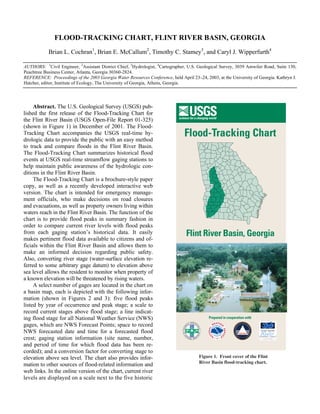
The document describes a flood-tracking chart created by the U.S. Geological Survey for the Flint River Basin in Georgia. The chart summarizes historical flood events at streamflow gauging stations to help maintain public awareness of flood conditions. It is intended for emergency officials and property owners to compare current river levels to past flood peaks and determine flood risk. The chart is available both in print and interactive web versions, with the web version providing updated current river stage data. The goal is to easily provide pertinent flood data and information to citizens and officials in the basin.