This document summarizes a program to restore fish passage in the Milwaukee River watershed. The program removed barriers like dams to reconnect over 37 river miles and 33 tributary miles of habitat. Barriers ranged from large mainstem dams to small debris jams. Removal projects included dam removals and construction of nature-like fishways. Monitoring found increased presence of target species like northern pike in reconnected areas. The program enhanced ecological connectivity while creating jobs and stakeholder partnerships across the watershed.
The SCIF report summarizes 15 student sustainability projects funded by the Sustainable Campus Initiative Fund (SCIF) at the University of Utah between Fall 2009 and Spring 2010. Some of the projects profiled include creating campus gardens to grow organic produce, greening chemistry labs by installing more efficient water-saving equipment, implementing sustainable irrigation practices, and conducting an energy efficiency study of lighting in a campus plaza. The report shows how SCIF has supported innovative student ideas to improve the university's environmental performance and make the campus more sustainable through hands-on learning experiences.
Salt River Bay Marine Research and Education Centermichaelsbayer
The document provides an overview of the Salt River Bay Marine Research and Education Center (MREC) project. The MREC will be a world-class, sustainable facility serving partners through marine research and Caribbean studies programs. It will demonstrate green building and sustainable energy technologies while showcasing "research in a park" and environmental education programs. The MREC brings together the Department of the Interior, National Park Service, Government of the Virgin Islands, and four university partners through the Joint Institute for Caribbean Marine Studies to establish a marine research lab and further understanding of tropical marine ecosystems.
The LakeSmart program aims to educate shoreline residents around Beaver Lake, which serves as the drinking water source for over 350,000 people, on how to reduce pollution from their properties. Through a series of workshops led by trained volunteers, residents are guided through an environmental self-assessment to identify potential pollution risks from their homes and properties. Follow-up evaluations have found the program is effective at increasing knowledge of best practices and documenting behavioral changes among participants to help protect water quality, such as improved septic system maintenance and reduced fertilizer and pet waste runoff. Plans are underway to expand the program's reach within the watershed.
BC Hydro Experience with Environmental Management: British Colombia, CanadaCPWF Mekong
By Sokhem Pech, Hatfield Consultant and M-Power
Presented at the Mekong Forum on Water, Food and Energy
Phnom Penh, Cambodia
December 7-9, 2011
Session 1: Managing water resources development within a water-food-energy nexus
This document presents a senior capstone project that proposes a new master plan for John Muir Memorial County Park in Marquette County, Wisconsin. The plan aims to preserve the landscape and legacy of John Muir by incorporating recreation and ecological restoration. Key points:
- The plan will identify how an "E-Way" (environmental corridor connecting people with land and history) can inform the park's design and guide future development and acquisitions.
- As the core of the proposed E-Way, a new master plan is needed to organize recreation, restoration, and management across the park's properties as currently separated.
- The plan aims to accommodate visitors while avoiding degradation of natural areas through sustainable recreation integrated
Roger Goulding has extensive experience managing environmental programs and initiatives in the UK. He currently works as a National Advisor for the Environment Agency, managing a £1.6 million budget for bathing water projects. Previously he served as a committee member for the Heritage Lottery Fund and as a Green Flag and Blue Flag judge. He has held several leadership roles with the Environment Agency focused on recreation, navigation, and biodiversity.
Australian Showcase:Theme 1:Australia and Waterined_v3icidciid
The document discusses water management in Australia, focusing on the Water Act of 2007 and the Murray-Darling Basin Plan. It provides background on Australia's climate and history of water management agreements. It describes the objectives of the Water Act to manage basin water resources through plans and environmental flows. It also discusses government investment programs aimed at improving irrigation efficiency and balancing environmental and consumptive water needs.
The annual report summarizes Devens' activities in fiscal year 2008. It discusses the opening of a new recycling center, progress on Bristol-Myers Squibb and Evergreen Solar facilities, and the retirement of two long-time MassDevelopment employees. It also provides details on community events, education programs, engineering projects, environmental work, public works initiatives, and public safety services in Devens during the fiscal year.
Ecological Enhancement of Coastal and Marine InfrastructuresStephanie Camay
This document discusses strategies for decreasing the ecological footprint of coastal and marine infrastructures. It provides an overview of the environmental impacts of coastal development such as habitat loss, pollution, and invasive species. The strategies presented include environmental compensation, ecological engineering, and designing infrastructures to be ecologically active. Ecologically active infrastructures use texture, composition, and macro-design elements to support biological productivity while meeting construction requirements. This enhances biodiversity and ecosystem services without compromising structural integrity. The document advocates for scientists, engineers, and policymakers to collaborate on more sustainable coastal infrastructure design and enhancement.
The document summarizes assessments of stream restoration and stormwater projects funded by the CWMTF. It discusses the types of restoration and stormwater projects funded, methods used to assess the projects, findings from site visits by field representatives, and presentations made on various project types including stream restoration, wetland restoration, agricultural BMPs, and stormwater BMPs. Key highlights include that most funded projects showed water quality benefits and compliance with goals, though some required maintenance and repairs, and presentations provided examples and findings on different best management practices.
The document summarizes collaborative fisheries management in Baler Bay, Philippines. It describes the geographical location and municipalities within the project site. It identifies issues like overfishing, illegal fishing practices, and coastal habitat destruction. It then outlines interventions like limiting access and stopping illegal practices. The key intervention discussed is an Inter-LGU Fisheries Management Plan to improve management between municipalities through committees, ordinances, budgets, and other active efforts like establishing marine protected areas. The plan aims to transition to more sustainable management through inter-municipal collaboration, political will, and public awareness.
http://www.limitlessvistas.org Limitless Vistas, INC. (LVI) is a 501(c)(3) non-profit organization devoted to creating opportunity for disconnected youth. We are dedicated to 1) helping disadvantaged young people reconnect to society through education and job training;
2) Imparting job skills and behaviors to help facilitate gainful employment, build hope, families, communities and foster economic growth;
3) helping young people become stewards of their environment while introducing them to entry level career opportunities in the environmental field and green jobs.
This presentation will help you learn more about LVI and our Green jobs training programs in New Orleans, LA
The communication strategy for the Citarum River restoration program in Indonesia aims to enhance information sharing and raise awareness among stakeholders and the public. It seeks to support the roadmap's vision of improving the river's health through partnership between government and communities. The strategy uses various approaches like media campaigns, coordination meetings, and tailored messaging for different groups to promote participation and contributions towards achieving the common goal of a healthier Citarum River. It also recognizes the need for paradigm shifts and evolving strategies as the restoration program progresses through different stages.
WRT and PennPraxis received the Honor Award for Excellence on the Waterfront from the DC-based Waterfront Center for the Civic Vision for the Central Delaware and the accompanying Action Plan for the Central Delaware: 2008-2018. WRT Principal Nando Micale and PennPraxis' Harris Steinberg attended the award ceremony in Chicago's Drake Hotel on November 21st.
The document discusses North Fort Bend Water Authority's considerations around direct water reuse and conservation efforts. It outlines a multi-pronged approach including water conservation programs, incentives for water reuse for irrigation, and increasing the credit provided for metered reuse. It also summarizes current conservation efforts, the potential for earning additional conversion credits through conservation, and other efforts being explored like irrigation studies. The document analyzes the potential costs and benefits of implementing water reuse projects compared to continuing groundwater use. It notes that pursuing reuse now will maximize opportunities and have less cost than retrofitting existing developments.
Water Wednesday - Murray Darling Basin Plan: Striking the right balance
The Water Research Centre in conjunction with Australian Water Association SA Branch presented Water Wednesday on 29 February 2012.
This special joint Water Wednesday forum featured a presentation from Professor Barry Hart, an independent member of the Murray Darling Basin Authority, on the Draft Basin Plan which is currently out for public review.
The document discusses a proposed project to manage flood risk in the Eddleston Water catchment area on the border of Scotland and England. It summarizes the current issues, including poor river habitat, a history of channelization, and flood risks. Proposed measures are outlined to restore river habitats while reducing flood risk through natural flood management techniques. These include interventions in the upper catchment and floodplain. Key opportunities and challenges are identified, such as working with farmers and overcoming institutional barriers. The Managing Borderlands project aims to facilitate knowledge sharing across the border to develop resilient land management strategies through stakeholder engagement.
The document discusses the Murray-Darling Basin Plan, which aims to balance environmental and consumptive water needs in the basin. It notes that significant development has led to overallocation of water, degrading the environment. The Basin Plan seeks to set sustainable diversion limits and return more water to the environment through investments while minimizing socioeconomic impacts. It describes the process of determining environmental water needs based on key assets and functions. Opportunities and constraints to implementation are also discussed.
The document summarizes the status of environmental flows (E-flows) in India and a study conducted by WWF-India to assess E-flows in the upper stretch of the River Ganga. It provides background on the concept of E-flows and highlights key initiatives in India. It then describes the building block methodology used in the Ganga study, conducted in partnership with hydrology, geomorphology, and other experts. The study identified four zones and representative sites to recommend maintenance flows based on filling out flow motivation forms. Results presented flows for zones 1 and 3 as a percentage of mean annual runoff to meet ecological needs.
Nebraska Agricultural Water Management Demonstration Network: Integrating Res...nacaa
The Nebraska Agricultural Water Management Demonstration Network was formed in 2005 as a collaboration between UNL Extension, local natural resources districts, producers, and crop consultants. The network utilizes research-based tools like ET gages and soil moisture sensors in producers' fields to demonstrate water and energy conservation practices. Network members work with producers to install the equipment and determine proper irrigation management. Educational meetings are held before, during and after the growing season. Over 8,650 agricultural professionals have participated in the network's 231 meetings. Surveys found the network helped save an average of 2.6 inches of water per acre for corn and 2.1 inches for soybeans, equivalent to $2.8 million and $2.3 million in fuel
This document is Andrew Cunningham's design portfolio from Ball State University. It summarizes various landscape architecture projects he worked on from his second through fourth years of study as well as internships. The portfolio includes projects ranging from recreational parks and greenways to residential developments, gardens, and streetscapes. It demonstrates Cunningham's skills in designing for different contexts and users while preserving natural features and increasing recreational and environmental benefits.
This document provides an agenda and details for a water-wise showcase event being held by Friends of Balboa Park. The event will include presentations from 5-6 PM on projects that have optimized water usage in Balboa Park, including smart irrigation controls, water infrastructure mapping, and specific project areas like Plaza de Balboa and Bird Park. There will also be exhibits showcasing additional projects from 4:30-7 PM. The goal of Friends of Balboa Park's water-wise initiative is to optimize water usage in the park by 2020 and serve as an internationally recognized model for sustainable water practices through applied research projects.
The document is Tony Chevalier's portfolio, which includes:
- A list of over 30 landscape architecture and planning projects he has worked on across several states.
- Details of his educational background and professional licenses.
- Samples of project work showing landscape designs, plans, and construction documents for streetscapes, parks, redevelopments, and natural areas.
- Statements about his approach to landscape architecture and integrating ecological functions into designs.
This document summarizes the methodology used in a study analyzing the effects of land use change on sediment accumulation in lakes in West Central Alberta, Canada. Sediment cores from 13 lakes were analyzed to develop sedimentation profiles and determine accumulation rates. Watershed characteristics were inventoried using GIS. Statistical analyses examined correlations between landscape/land use factors and sedimentation rates to assess impacts of disturbances like forestry, oil/gas development, and roads. Comparisons identified the most disturbed watersheds and how sediment yields changed over time.
This document discusses experiences from the Australia-China Centre on Water Resources Research's ACEDP Inland River Basin Project. There are natural and institutional similarities between water management in Australia and China that provide opportunities for comparative studies. The project aims to improve river basin management capacity by enforcing the science-policy interface through international collaboration, knowledge co-production, and jointly scoping projects. Expected outcomes include developing an approach for adaptive river basin governance and producing several co-authored journal publications.
The document discusses China's National River Health Monitoring and Restoration Program. It outlines challenges facing China's rivers, including water pollution, soil erosion, and floods. It then describes the national program to regularly assess river health, establish standards and methods, conduct monitoring, and produce biennial reports. The program aims to improve river water quality, hydrology, habitats, ecology, and functions. It will assess pilot rivers from 2010-2013 and establish a framework for defining and measuring healthy rivers.
Community-Based Watershed Management and Wetland Mitigation
Southeast Alaska Watershed Coalition
alaskawatershedcoalition.org
Community Training
October 17, 2011
The document discusses the Healthy Waterways Report Card, which is used in South East Queensland, Australia as an effective tool for public-private partnerships. The report card synthesizes annual monitoring results into ratings for waterways from A to F. It is presented publicly and increases community awareness of waterway health. The report card also tracks the success of management actions in achieving environmental values.
This document discusses frameworks for assessing watershed conditions and prioritizing restoration projects on the Tongass National Forest. It outlines gathering existing information, identifying data gaps, developing watershed assessments to identify restoration projects, implementing those projects, and monitoring them through adaptive management. Key parts of the framework include classifying watershed conditions, conducting landscape and aquatic assessments at multiple tiers, setting habitat management objectives, and leveraging partnerships to fund restoration. The overall goal is to maintain and improve watershed health and aquatic habitat.
The document discusses implementing Stream Management Plans in the Schoharie basin through local leadership. It establishes the Schoharie Watershed Advisory Committee (SWAC) to oversee implementation at the basin scale with input from local, county, state and federal agencies. SWAC evaluates proposals for funding categories like education, infrastructure improvements, habitat restoration and approves projects that meet the criteria of benefiting water quality and stream stability in the basin. Coordinating these programs and funding sources through SWAC allows for integrated management of the streams at a watershed scale.
EPA's Source Water Protection Program aims to protect drinking water sources through a multi-barrier approach including source water protection. Key EPA programs related to source water protection include the Safe Drinking Water Act which requires states to develop Wellhead Protection Programs and Source Water Assessments. Source water protection involves delineating protection areas, inventorying contaminant sources, assessing susceptibility, notifying the public, and developing and implementing protection strategies. EPA supports state and local source water protection efforts through technical assistance, workshops, and coordination across programs. Success stories demonstrate effective multi-stakeholder collaboration on alternative intakes, BMPs with agriculture, monitoring, outreach, and funding from various federal, state, and local sources.
The document discusses the vision and work of the Social Alliance Network founded by Bill Jacobson to build community and promote environmental, economic, social, and spiritual welfare. It outlines Jacobson's background and experience in indigenous spirituality and community development. It then discusses the Network's involvement in a 7-year process with the Federal Energy Regulatory Commission to develop studies on the cultural and environmental impacts of hydroelectric projects and develop a long-term sustainability vision that integrates Native communities.
Muskegon Lake, located in Muskegon, Mich., has been listed as a Great Lakes Area of Concern due to a significant loss of wildlife habitat and degraded water quality. This presentation will discuss how an organized grassroots effort has successfully received state and federal funding to implement large-scale ecological restoration projects throughout the lake.
In April 1998, a small indigenous community began one of the earliest Community-managed Marine Protected Areas (MPA) in Fiji, beginning a decade of commitment to protecting reef life for future generations. The project was a founder member of the Fiji Locally Managed Marine Areas (FLMMA) network, and one of the few FLMMA projects to include an
income-generating community-managed tourism operation.
Annual biological monitoring since the project’s inception, undertaken by a team of scientists and community members,
utilised in-water survey methods, including Catch Per Unit Effort (CPUE) for key invertebrate species, Manta Tows for
broad-scale habitat and invertebrate assessment, Point Intercept Transects for coral cover, and Fish Underwater Visual Census (UVC). These surveys demonstrated increased fish populations within the MPA after 3 years, and increased invertebrate populations after 5 years. Fish and invertebrates important to local subsistence and commerce are harvested in the spill-over area near the MPA. Some poaching occurs inside the MPA, so far not significantly impacting overall populations, suggesting the ecosystem is now adequately robust to withstand some harvesting.
Coral growth was retarded by a bleaching event in 2000, but herbivory has reduced macroalgal cover within the MPA,
creating better coral-growth substrate, accelerating coral settlement and recovery in comparison with heavily fished areas where macroalgae covers most available substrate, preventing new coral settlement. A small coral restoration project is thriving inside the MPA.
Socio-economic surveys have shown the MPA to have economic and social importance to the local inhabitants, and the value of the MPA as a reserve for conservation and future fish stocks has been reinforced by the income-generating potential of eco-tourism activities.
Keywords: Community Managed Marine Areas, Ecotourism, Sustainable development, Long-term biological monitoring, Coral bleaching, Habitat phase shift.
This document discusses the promise of the Clean Water Act to make waters fishable and swimmable. It also discusses sustainability paradigms and moving from a technological to ecological approach in areas like wastewater treatment. Natural systems and watershed approaches are highlighted as are constraints like inconsistent regulations. Case studies show the benefits of natural treatment systems and constructed wetlands in providing ecological functions and multiple community benefits.
The document discusses the development of an Ecosystem Health Monitoring Program (EHMP) for streams and rivers in southeast Queensland, Australia. It outlines the process used to design a cost-effective monitoring program, including developing conceptual models, classifying waterways, pilot testing indicators, and a major field trial to evaluate the response of indicators to disturbance gradients. Key indicators were selected for the EHMP based on their ability to detect various types of disturbance and their association with catchment characteristics.
The document discusses watershed assessments and their importance for effective watershed restoration. It provides a framework for conducting assessments that includes establishing the geographic scope, identifying resources, assessing existing conditions and threats, developing solutions, prioritizing actions, implementing projects, and monitoring. Examples of completed assessments are summarized, including those focusing on Pullen Creek, Auke Lake Watershed, fish passage in Haines, invasive plants in Juneau, and road conditions in Klawock. The role of assessments in identifying restoration opportunities and guiding restoration efforts is highlighted.
SLIPP SC TT PAC meeting with NHC June 2010Erin Vieira
Shuswap Lake Integrated Planning Process: meeting of the Steering Committee, Technical Teams, and Public Advisory Committee on Education, Compliance and Enforcement in June 2010 at Quaaout Lodge. Meeting features presentation by Northwest Hydraulic Consultants Ltd. on their report, Review of Greywater Management Strategies for Shuswap Lake.
03. Carrying Capacity estimation White 1Patrick White
This document discusses aquaculture carrying capacity case studies in the Philippines. It examines three small-scale aquaculture areas: Bolinao and Anda, Dagupan estuary, and Taal Lake. For each area, it provides information on the types and amounts of aquaculture present, as well as any issues with recurring fish kills. It then discusses estimating carrying capacity through modeling nutrient inputs and outputs, and how water exchange rates and precipitation can impact this capacity. The goal is to help sustainably manage cumulative aquaculture impacts on shared water bodies.
The project will increase property values in the surrounding neighborhood and attract new residents and businesses by preserving the natural area and providing public access to trails.
MAXIMUM POINTS - 5 POINTS
John Hankinson, Executive Director, Gulf Coast Ecosystem Restoration Task Force, spoke at the Joint Public Advisory Committee's Resilient Communities in North America workshop in New Orleans on July 9, 2012. More info at http://www.cec.org/Council2012
CaBA Startup Conference 02 - A response to the challenge from the third sectorCaBASupport
Sets the context for the Catchment based Approach, describing the decline in ecosystem functionality and the challenge that still faces the UK in achieving improvements under the Water Framework Directive. Outlines the roles of the new CaBA Partnerships, the National Steering group, and the EA in helping to shape the next round of River Basin Managment Plans, and also in achieving improvements that go beyond WFD.
The document provides information on various federal, state, and local programs that provide funding and technical assistance for watershed restoration projects. It describes programs run by agencies such as the US Fish and Wildlife Service, Natural Resources Conservation Service, and National Marine Fisheries Service. Contact information is provided for representatives from these agencies who can provide more details on available restoration funding and partnership opportunities.
Similar to Clean Rivers, Clean Lake 8 -- Ozaukee County Fishway -- Andrew Struck (20)
The document summarizes a campaign by Sweet Water and Root-Pike WIN to raise awareness about water pollution from stormwater runoff. The campaign includes TV ads featuring a puppet dog named Sparkles, as well as community events. It discusses the development and funding of the campaign, including grants totaling $250,000 over two years. The goal is to educate the public about actions they can take to reduce stormwater pollution and respect local waters.
Clean Rivers, Clean Lake -- Rooftops to Rivers Study-- Karen HobbsSweet Water
This document discusses how green infrastructure can provide smart, green solutions to water pollution challenges from urban stormwater runoff and combined sewer overflows. It defines green infrastructure as systems that use vegetation, soils, and natural processes to manage water and create healthier urban environments, and provides examples such as streetscape planters, permeable pavement, green roofs, and bioretention cells. The document also outlines the multiple non-water benefits of green infrastructure, and reviews how several cities like Philadelphia, Syracuse, Milwaukee and Portland are implementing large-scale green infrastructure plans to improve water quality and achieve co-benefits. It argues that EPA regulatory changes are needed to advance these solutions more broadly.
Clean Rivers, Clean Lake 8 -- Leveraging Resources -- Robert MonnatSweet Water
The document discusses leveraging water and open space resources to create more livable cities. It notes that water is highly valuable real estate that can attract residents and development if integrated well into the urban design. However, modern cities often lack ecological and biophilic design, disconnecting urban planning from natural resources. The document calls for viewing management, sustainable urbanism practices that enhance views and access to water, and cooperative policies around balancing development and water protection to improve cities.
Clean Rivers, Clean Lake 8 -- Restorative Economics -- Matt HowardSweet Water
The document discusses how restoring water resources can drive economic growth in Milwaukee. It outlines Paul Hawken's concept of a restorative economy that aligns environmental and economic interests. Specifically for Milwaukee, improving water quality capitalizes on historical water-dependent industries and assets. Recent projects show the city's focus on redeveloping contaminated land while managing stormwater. The mayor's goal is to strategically link environmental action to new economic opportunities in water technology and making Milwaukee a more livable city.
Clean Rivers, Clean Lake 8 -- Leveraging Resources -- Robert MonnatSweet Water
The document discusses leveraging water and open space resources to create more livable cities. It notes that water is highly valuable real estate that can attract residents and development if integrated well into the urban design. However, modern cities often lack ecological and biophilic design, disconnecting urban planning from natural resources. The document calls for viewing management and using waterfronts to increase property values and quality of life through recreation and views of open spaces.
Clean Rivers, Clean Lake 8 -- Green Infrastructure Vision -- Jeffrey MenglerSweet Water
The document discusses green infrastructure and defines it as an interconnected network of natural areas that sustains ecosystem values. It summarizes a project by Chicago Wilderness to develop a green infrastructure vision for the region. Over 140 resource protection areas were identified totaling over 1.8 million acres. The vision proposes incorporating conservation at regional, community, neighborhood, and site scales. Implementation focuses on developing tools for municipalities and ongoing pilots to refine the vision.
Clean Rivers, Clean Lake 8 -- Water Quality Trading -- Dennis FrameSweet Water
This document discusses water quality trading between point and non-point sources to reduce phosphorus levels. It outlines the challenges in quantifying phosphorus losses from different agricultural settings and sources. Farmers want to see real data on phosphorus levels and be involved in developing solutions. The document evaluates phosphorus losses from different farms and management practices through monitoring and suggests collaboration is needed between all parties to improve water quality.
Clean Rivers, Clean Lake 8 -- Nutrients Discharging from Drain Tiles -- Eric ...Sweet Water
This document summarizes tile drainage research from three farms in eastern Wisconsin. The key findings are:
1) Tile drains can flow year-round, including during frozen conditions, and may transport similar or greater volumes of water compared to surface flows.
2) Tile drains were responsible for transporting 16-24% of total precipitation on the farms as drainage, compared to 6-10% for surface runoff.
3) The majority of nitrogen (43-94%) and a significant portion of phosphorus (46-77%) and sediment (22-37%) left the fields through tile drains rather than surface runoff.
4) Proper manure and fertilizer management is important
Clean Rivers, Clean Lake 8 -- Home BMPs in the KK -- Ben GramlingSweet Water
This document summarizes a project to install residential stormwater best management practices (BMPs) in the Kinnickinnic River watershed in Milwaukee to improve water quality. The project aims to educate local residents, install BMPs like rain gardens on private properties, and monitor the impact on stormwater runoff. It outlines engaging the community, designing and building the BMPs with local involvement, and replicating the project in other neighborhoods. Preliminary results found BMPs installed in the first target area with monitoring ongoing to quantify the water quality benefits.
Clean Rivers, Clean Lake 8 -- New Projects on KK and Menomonee Rivers -- Dave...Sweet Water
The document summarizes projects to improve rivers and streams in the Milwaukee area for cleaner water and flood management. It discusses rehabilitation of the Kinnickinnic and Menomonee Rivers, including removing concrete channels, adding riffles and pools, and repairing walls to improve fish passage and water quality. It also outlines plans to rehabilitate segments of Underwood Creek to sustain water resources in a sustainable watershed approach. The projects aim to reduce flood risks and improve public safety through natural stream restoration.
Clean Rivers, Clean Lake 8 -- River Walk Investment -- Alyssa RemingtonSweet Water
The Milwaukee RiverWalk system was developed incrementally over five years using $500,000 annually from the city, but this slow approach was deemed insufficient. A new organized and comprehensive approach was established, forming a public-private partnership and business improvement district to hire consultants, determine costs, and draft regulations and funding policies. This included a site plan review overlay district and financing policies split between the city and private developers. The system has since expanded, adding amenities like public art and hosting events. It has resulted in economic benefits for surrounding areas like the Third Ward and Beerline B.
Clean Rivers, Clean Lake 8 -- Menomonee Valley 2012 -- Laura BraySweet Water
The document summarizes the revitalization of the Menomonee Valley in Milwaukee over the past 200 years. It describes how the valley transitioned from a vibrant marshland to an economic powerhouse to an underutilized wasteland. Through strategic planning and public-private partnerships over the past decades, the valley has been redeveloped with over 300 acres of brownfields, 4,700 new jobs, 10 million visitors annually, and extensive trails and parks. The revitalization efforts have increased the assessed value by 229% and leveraged $3.75 of private investment for every $1 of public funding.
Clean Rivers, Clean Lake 8 -- Business Successes on the Lower KK River -- Dav...Sweet Water
This document summarizes revitalization efforts along the Kinnickinnic River in Milwaukee, Wisconsin. A coalition of local groups and government agencies came together in the late 1990s to clean up the polluted river through a $24 million remediation project. This has spurred over $12 million in private waterfront redevelopment projects including a new pub, marina, and sports complex that has created new jobs and economic activity for the neighborhood. Ongoing plans aim to continue stimulating investment and improving the area through additional piers, parks, and other public infrastructure projects.
Clean Rivers, Clean Lake 8 -- Green Infrastructure Vision-- Jeffrey MenglerSweet Water
The document discusses green infrastructure and defines it as an interconnected network of natural and open spaces that provides ecosystem benefits and sustains society. It summarizes a Chicago Wilderness project that identified over 140 resource protection areas totaling over 1.8 million acres to develop a green infrastructure vision. The vision focuses on implementing green infrastructure at regional, community, neighborhood, and site scales.
Clean Rivers, Clean Lake 8 -- Smart Snow and Ice Removal -- Connie FortinSweet Water
This document summarizes information on smart snow and ice control techniques. It discusses how road salt pollutes water sources and provides standards for chloride levels. Various snow and ice melting products like salt, magnesium chloride, and calcium chloride are compared. Proper storage, calibration of spreading equipment, and application rates can significantly reduce salt usage. Anti-icing roads before storms is more effective than de-icing after. Mixing salt with liquids helps it work faster while using less overall product. Adopting best practices could save thousands in costs and reduce environmental impacts.
Clean Rivers, Clean Lake 8 -- Milwaukee's New I and I Reduction Project/ Zafa...Sweet Water
The document summarizes a presentation about an I/I reduction project in Milwaukee. The project rehabilitated sanitary sewer laterals in an area experiencing high levels of I/I through root intrusion and other defects. Over 500 homeowners consented to have their laterals lined through a cured-in-place process at a cost of $3.8 million, with most of the funding from the Milwaukee Metropolitan Sewerage District. The goals were to reduce sewer overflows, basement backups, and treatment costs by reducing peak flows from private sources of I/I entering the system.
Clean Rivers, Clean Lake 8 -- Pike River Restoration Success -- Bill SasseSweet Water
The Pike River Improvements Project is a multi-phase project to control flooding, restore habitat, and develop recreational areas along the Pike River in Mount Pleasant, Wisconsin. The project is divided into 9 phases stretching over 5 miles. Construction began in 2001 and phases 1-5 are complete, with phase 6 currently under construction. The primary goals of the project are flood control, restoration of the riverine corridor and aquatic habitat, and development of a multi-use trail for recreation.
Clean Rivers, Clean Lake 8 -- Restoration Issues/Root River Restoration Plan ...Sweet Water
This document provides background information on the development of a watershed restoration plan for the Root River Watershed in southeastern Wisconsin. It discusses the watershed characteristics, key issues identified in prior planning efforts around water quality, habitat and flooding. It outlines the plan's goals to identify focus issues and recommend actions to address them over five years. The plan will characterize the watershed, identify targets, recommend actions and develop an implementation strategy.
Clean Rivers, Clean Lake 8 -- Rainwater Harvesting/Residential - Sharon AdamsSweet Water
The document summarizes the work of Walnut Way Conservation Corps, a community development organization in Milwaukee, Wisconsin. It discusses how the organization formed in 2000 to promote healthy, diverse neighborhoods. It outlines the organization's work restoring housing, engaging neighbors, addressing stormwater issues, supporting youth programs like Gardens to Market, and their holistic approach to community revitalization through urban agriculture and environmental stewardship. The document highlights the organization's goals of establishing sustainable water systems like rainwater harvesting and greywater reuse to support their orchards and commons areas.
Clean Rivers, Clean Lake 8 Rainwater Harvesting/organization - Tim VargoSweet Water
The document discusses rainwater harvesting at the Urban Ecology Center, including collecting rainwater, building cisterns, and using the water collected. It mentions using every drop of rainwater, photos from the Milwaukee Public Museum, the environmental ethic of Aldo Leopold and others, and Rep. Hilda Solis. Guidelines for decision making include program fun, environmental sustainability, aesthetics, money, time, and politics. The center engages in environmental education and citizen science projects. It also discusses the Rotary Club of Milwaukee's centennial arboretum and the EPA's Great Lakes Restoration Initiative.
In the rapidly evolving landscape of technologies, XML continues to play a vital role in structuring, storing, and transporting data across diverse systems. The recent advancements in artificial intelligence (AI) present new methodologies for enhancing XML development workflows, introducing efficiency, automation, and intelligent capabilities. This presentation will outline the scope and perspective of utilizing AI in XML development. The potential benefits and the possible pitfalls will be highlighted, providing a balanced view of the subject.
We will explore the capabilities of AI in understanding XML markup languages and autonomously creating structured XML content. Additionally, we will examine the capacity of AI to enrich plain text with appropriate XML markup. Practical examples and methodological guidelines will be provided to elucidate how AI can be effectively prompted to interpret and generate accurate XML markup.
Further emphasis will be placed on the role of AI in developing XSLT, or schemas such as XSD and Schematron. We will address the techniques and strategies adopted to create prompts for generating code, explaining code, or refactoring the code, and the results achieved.
The discussion will extend to how AI can be used to transform XML content. In particular, the focus will be on the use of AI XPath extension functions in XSLT, Schematron, Schematron Quick Fixes, or for XML content refactoring.
The presentation aims to deliver a comprehensive overview of AI usage in XML development, providing attendees with the necessary knowledge to make informed decisions. Whether you’re at the early stages of adopting AI or considering integrating it in advanced XML development, this presentation will cover all levels of expertise.
By highlighting the potential advantages and challenges of integrating AI with XML development tools and languages, the presentation seeks to inspire thoughtful conversation around the future of XML development. We’ll not only delve into the technical aspects of AI-powered XML development but also discuss practical implications and possible future directions.
GraphSummit Singapore | The Future of Agility: Supercharging Digital Transfor...Neo4j
Leonard Jayamohan, Partner & Generative AI Lead, Deloitte
This keynote will reveal how Deloitte leverages Neo4j’s graph power for groundbreaking digital twin solutions, achieving a staggering 100x performance boost. Discover the essential role knowledge graphs play in successful generative AI implementations. Plus, get an exclusive look at an innovative Neo4j + Generative AI solution Deloitte is developing in-house.
UiPath Test Automation using UiPath Test Suite series, part 5DianaGray10
Welcome to UiPath Test Automation using UiPath Test Suite series part 5. In this session, we will cover CI/CD with devops.
Topics covered:
CI/CD with in UiPath
End-to-end overview of CI/CD pipeline with Azure devops
Speaker:
Lyndsey Byblow, Test Suite Sales Engineer @ UiPath, Inc.
Let's Integrate MuleSoft RPA, COMPOSER, APM with AWS IDP along with Slackshyamraj55
Discover the seamless integration of RPA (Robotic Process Automation), COMPOSER, and APM with AWS IDP enhanced with Slack notifications. Explore how these technologies converge to streamline workflows, optimize performance, and ensure secure access, all while leveraging the power of AWS IDP and real-time communication via Slack notifications.
HCL Notes and Domino License Cost Reduction in the World of DLAUpanagenda
Webinar Recording: https://www.panagenda.com/webinars/hcl-notes-and-domino-license-cost-reduction-in-the-world-of-dlau/
The introduction of DLAU and the CCB & CCX licensing model caused quite a stir in the HCL community. As a Notes and Domino customer, you may have faced challenges with unexpected user counts and license costs. You probably have questions on how this new licensing approach works and how to benefit from it. Most importantly, you likely have budget constraints and want to save money where possible. Don’t worry, we can help with all of this!
We’ll show you how to fix common misconfigurations that cause higher-than-expected user counts, and how to identify accounts which you can deactivate to save money. There are also frequent patterns that can cause unnecessary cost, like using a person document instead of a mail-in for shared mailboxes. We’ll provide examples and solutions for those as well. And naturally we’ll explain the new licensing model.
Join HCL Ambassador Marc Thomas in this webinar with a special guest appearance from Franz Walder. It will give you the tools and know-how to stay on top of what is going on with Domino licensing. You will be able lower your cost through an optimized configuration and keep it low going forward.
These topics will be covered
- Reducing license cost by finding and fixing misconfigurations and superfluous accounts
- How do CCB and CCX licenses really work?
- Understanding the DLAU tool and how to best utilize it
- Tips for common problem areas, like team mailboxes, functional/test users, etc
- Practical examples and best practices to implement right away
Programming Foundation Models with DSPy - Meetup SlidesZilliz
Prompting language models is hard, while programming language models is easy. In this talk, I will discuss the state-of-the-art framework DSPy for programming foundation models with its powerful optimizers and runtime constraint system.
Driving Business Innovation: Latest Generative AI Advancements & Success StorySafe Software
Are you ready to revolutionize how you handle data? Join us for a webinar where we’ll bring you up to speed with the latest advancements in Generative AI technology and discover how leveraging FME with tools from giants like Google Gemini, Amazon, and Microsoft OpenAI can supercharge your workflow efficiency.
During the hour, we’ll take you through:
Guest Speaker Segment with Hannah Barrington: Dive into the world of dynamic real estate marketing with Hannah, the Marketing Manager at Workspace Group. Hear firsthand how their team generates engaging descriptions for thousands of office units by integrating diverse data sources—from PDF floorplans to web pages—using FME transformers, like OpenAIVisionConnector and AnthropicVisionConnector. This use case will show you how GenAI can streamline content creation for marketing across the board.
Ollama Use Case: Learn how Scenario Specialist Dmitri Bagh has utilized Ollama within FME to input data, create custom models, and enhance security protocols. This segment will include demos to illustrate the full capabilities of FME in AI-driven processes.
Custom AI Models: Discover how to leverage FME to build personalized AI models using your data. Whether it’s populating a model with local data for added security or integrating public AI tools, find out how FME facilitates a versatile and secure approach to AI.
We’ll wrap up with a live Q&A session where you can engage with our experts on your specific use cases, and learn more about optimizing your data workflows with AI.
This webinar is ideal for professionals seeking to harness the power of AI within their data management systems while ensuring high levels of customization and security. Whether you're a novice or an expert, gain actionable insights and strategies to elevate your data processes. Join us to see how FME and AI can revolutionize how you work with data!
Best 20 SEO Techniques To Improve Website Visibility In SERPPixlogix Infotech
Boost your website's visibility with proven SEO techniques! Our latest blog dives into essential strategies to enhance your online presence, increase traffic, and rank higher on search engines. From keyword optimization to quality content creation, learn how to make your site stand out in the crowded digital landscape. Discover actionable tips and expert insights to elevate your SEO game.
TrustArc Webinar - 2024 Global Privacy SurveyTrustArc
How does your privacy program stack up against your peers? What challenges are privacy teams tackling and prioritizing in 2024?
In the fifth annual Global Privacy Benchmarks Survey, we asked over 1,800 global privacy professionals and business executives to share their perspectives on the current state of privacy inside and outside of their organizations. This year’s report focused on emerging areas of importance for privacy and compliance professionals, including considerations and implications of Artificial Intelligence (AI) technologies, building brand trust, and different approaches for achieving higher privacy competence scores.
See how organizational priorities and strategic approaches to data security and privacy are evolving around the globe.
This webinar will review:
- The top 10 privacy insights from the fifth annual Global Privacy Benchmarks Survey
- The top challenges for privacy leaders, practitioners, and organizations in 2024
- Key themes to consider in developing and maintaining your privacy program
Sudheer Mechineni, Head of Application Frameworks, Standard Chartered Bank
Discover how Standard Chartered Bank harnessed the power of Neo4j to transform complex data access challenges into a dynamic, scalable graph database solution. This keynote will cover their journey from initial adoption to deploying a fully automated, enterprise-grade causal cluster, highlighting key strategies for modelling organisational changes and ensuring robust disaster recovery. Learn how these innovations have not only enhanced Standard Chartered Bank’s data infrastructure but also positioned them as pioneers in the banking sector’s adoption of graph technology.
Removing Uninteresting Bytes in Software FuzzingAftab Hussain
Imagine a world where software fuzzing, the process of mutating bytes in test seeds to uncover hidden and erroneous program behaviors, becomes faster and more effective. A lot depends on the initial seeds, which can significantly dictate the trajectory of a fuzzing campaign, particularly in terms of how long it takes to uncover interesting behaviour in your code. We introduce DIAR, a technique designed to speedup fuzzing campaigns by pinpointing and eliminating those uninteresting bytes in the seeds. Picture this: instead of wasting valuable resources on meaningless mutations in large, bloated seeds, DIAR removes the unnecessary bytes, streamlining the entire process.
In this work, we equipped AFL, a popular fuzzer, with DIAR and examined two critical Linux libraries -- Libxml's xmllint, a tool for parsing xml documents, and Binutil's readelf, an essential debugging and security analysis command-line tool used to display detailed information about ELF (Executable and Linkable Format). Our preliminary results show that AFL+DIAR does not only discover new paths more quickly but also achieves higher coverage overall. This work thus showcases how starting with lean and optimized seeds can lead to faster, more comprehensive fuzzing campaigns -- and DIAR helps you find such seeds.
- These are slides of the talk given at IEEE International Conference on Software Testing Verification and Validation Workshop, ICSTW 2022.
Observability Concepts EVERY Developer Should Know -- DeveloperWeek Europe.pdfPaige Cruz
Monitoring and observability aren’t traditionally found in software curriculums and many of us cobble this knowledge together from whatever vendor or ecosystem we were first introduced to and whatever is a part of your current company’s observability stack.
While the dev and ops silo continues to crumble….many organizations still relegate monitoring & observability as the purview of ops, infra and SRE teams. This is a mistake - achieving a highly observable system requires collaboration up and down the stack.
I, a former op, would like to extend an invitation to all application developers to join the observability party will share these foundational concepts to build on:
HCL Notes und Domino Lizenzkostenreduzierung in der Welt von DLAUpanagenda
Webinar Recording: https://www.panagenda.com/webinars/hcl-notes-und-domino-lizenzkostenreduzierung-in-der-welt-von-dlau/
DLAU und die Lizenzen nach dem CCB- und CCX-Modell sind für viele in der HCL-Community seit letztem Jahr ein heißes Thema. Als Notes- oder Domino-Kunde haben Sie vielleicht mit unerwartet hohen Benutzerzahlen und Lizenzgebühren zu kämpfen. Sie fragen sich vielleicht, wie diese neue Art der Lizenzierung funktioniert und welchen Nutzen sie Ihnen bringt. Vor allem wollen Sie sicherlich Ihr Budget einhalten und Kosten sparen, wo immer möglich. Das verstehen wir und wir möchten Ihnen dabei helfen!
Wir erklären Ihnen, wie Sie häufige Konfigurationsprobleme lösen können, die dazu führen können, dass mehr Benutzer gezählt werden als nötig, und wie Sie überflüssige oder ungenutzte Konten identifizieren und entfernen können, um Geld zu sparen. Es gibt auch einige Ansätze, die zu unnötigen Ausgaben führen können, z. B. wenn ein Personendokument anstelle eines Mail-Ins für geteilte Mailboxen verwendet wird. Wir zeigen Ihnen solche Fälle und deren Lösungen. Und natürlich erklären wir Ihnen das neue Lizenzmodell.
Nehmen Sie an diesem Webinar teil, bei dem HCL-Ambassador Marc Thomas und Gastredner Franz Walder Ihnen diese neue Welt näherbringen. Es vermittelt Ihnen die Tools und das Know-how, um den Überblick zu bewahren. Sie werden in der Lage sein, Ihre Kosten durch eine optimierte Domino-Konfiguration zu reduzieren und auch in Zukunft gering zu halten.
Diese Themen werden behandelt
- Reduzierung der Lizenzkosten durch Auffinden und Beheben von Fehlkonfigurationen und überflüssigen Konten
- Wie funktionieren CCB- und CCX-Lizenzen wirklich?
- Verstehen des DLAU-Tools und wie man es am besten nutzt
- Tipps für häufige Problembereiche, wie z. B. Team-Postfächer, Funktions-/Testbenutzer usw.
- Praxisbeispiele und Best Practices zum sofortigen Umsetzen
GraphRAG for Life Science to increase LLM accuracyTomaz Bratanic
GraphRAG for life science domain, where you retriever information from biomedical knowledge graphs using LLMs to increase the accuracy and performance of generated answers
Why You Should Replace Windows 11 with Nitrux Linux 3.5.0 for enhanced perfor...SOFTTECHHUB
The choice of an operating system plays a pivotal role in shaping our computing experience. For decades, Microsoft's Windows has dominated the market, offering a familiar and widely adopted platform for personal and professional use. However, as technological advancements continue to push the boundaries of innovation, alternative operating systems have emerged, challenging the status quo and offering users a fresh perspective on computing.
One such alternative that has garnered significant attention and acclaim is Nitrux Linux 3.5.0, a sleek, powerful, and user-friendly Linux distribution that promises to redefine the way we interact with our devices. With its focus on performance, security, and customization, Nitrux Linux presents a compelling case for those seeking to break free from the constraints of proprietary software and embrace the freedom and flexibility of open-source computing.
Mind map of terminologies used in context of Generative AI
Clean Rivers, Clean Lake 8 -- Ozaukee County Fishway -- Andrew Struck
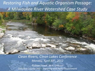
1. Restoring Fish and Aquatic Organism Passage:
A Milwaukee River Watershed Case Study
Clean Rivers, Clean Lakes Conference
Monday, April 30th, 2012
Andrew Struck, M.S., Director
2
Ozaukee County (WI) – Planning and Parks Department
2. Presentation Outline
• Program Background
• Aquatic Connectivity to Existing Habitat
• Target Species - Native / Species of Concern
• Impediment Types
• Watershed-wide Conservation Approach
- Major Mainstem Dams
- Large Scale “Public Works”
- Small Scale “Conservation Corps”
• Environmental Monitoring
• GIS Habitat Tool / Habitat Restoration
• Lessons Learned – Adaptive Management
- Program Accomplishments and Setbacks
- Stakeholder Coordination
- Education and Outreach
3
Ozaukee Fish Passage Program -- Making Connections Across Our Watershed
3. Ecological Division – Fish Passage & Habitat Program
Planning and
Parks
Department
Parks,
Tourism Planning Ecological
Golf Division Trails Division Recreation, and
Division Division Division
Culture Division
Bird Fish Passage Invasive
Conservation Program Species
Fragmentation
Habitat Education and
& Impediment Monitoring Reporting
Restoration Outreach
Remediation
Ozaukee Fish Passage Program -- Making Connections Across Our Watershed
4. Program Location – Ozaukee County, WI
Milwaukee River Basin
Map courtesy of
http://basineducation.uwex.edu/mi
lwaukee/resources/rivers.html
5
Ozaukee Fish Passage Program -- Making Connections Across Our Watershed
5. Fish Passage Program Summary
• $5.24 Million NOAA/ARRA Grant
Awarded (2009 & 2010): Restore
Fish Passage in the Milwaukee
River Watershed
• $1.48 Million USEPA GLRI Grant
Awarded (2010): Enhancing
Ecological Productivity
• $491,000 USEPA GLRI Grant
Awarded (2010): Monitoring to
Address 7 of 11 BUIs
• Program Scope
• 18 tributaries
• 4 main-stem dams
• Develop GIS Model for
Prioritizing Habitat and
Restoration Activities
• Water Quality Monitoring
• Sediment Sampling
• Fisheries Monitoring
Ozaukee Fish Passage Program -- Making Connections Across Our Watershed
6
6. Theme – “Making Connections”
Renewing “Old” Connections….
Milwaukee River Basin
– Lake Michigan
– Milwaukee River
– Tributary Streams
– Spawning and Rearing Habitats
….and Forming “New” Connections (Non-
traditional Stakeholders) through…
Ozaukee County
Elected Officials
Municipalities
Businesses
Schools
NGOs
Citizens / Landowners Map courtesy of
http://basineducation.uwex.edu/mi
Volunteers lwaukee/resources/rivers.html
Collaborative Partnerships
Ozaukee Fish Passage Program -- Making Connections Across Our Watershed
7 7
7. Primary Program Goals – Making Connections
1. Removal of Fish Passage Impediments / Increased
Connectivity to Existing High Quality Habitat
Measures:
– Restored passability at inventoried impediments
– Number of passable stream miles
– Number of impediments removed
– Presence of target species after impediment removal
–Acres of existing wetland habitat made accessible
2. Support Career Development and Job Creation
Measures:
– Labor hours created
– Dollars expended
Ozaukee Fish Passage Program -- Making Connections Across Our Watershed
8
8. Making the Most of What’s Left
• Desirable aquatic habitat has been
lost or significantly altered
• Restored aquatic habitat is expensive
to create and is commonly inferior to
quality natural habitat
• Many pockets of quality natural
aquatic habitat remain and are
protected. However, many, if not
most, are ecologically isolated
• Reconnecting isolated habitat
restores its ecological function to the
watershed and saves resources
Ozaukee Fish Passage Program -- Making Connections Across Our Watershed
9. Fish Life Cycle – Aquatic Connectivity
Develop in
wetlands
and streams
Eggs
Spawning Larvae
Critical Critical
Migrate up from passage Drift downstream
passage
Lake Michigan barrier to Lake Michigan
barrier
Adults Fry
Juveniles
Ozaukee Fish Passage Program -- Making Connections Across Our Watershed
10. Native Fish Swimming Performance
• Good for short distance
“bursts” < 15 sec.
• Fair for “sustained”
movements in velocities
< 2 ft/s
• Poor for “prolonged”
swimming
• Very Poor jumpers
• Require Low velocity
(< 2 - 3 ft/s)
Short jumps < 8 inches
Frequent rest areas
Milwaukee River Watershed Fish Passage Program -- Making Connections Across Our Watershed
11. Aquatic Species Passage
Wisconsin Endangered Species Program Target Species
• Striped Shiner •Northern Pike
Source: pond.dnr.cornell.edu Source: pond.dnr.cornell.edu
Wisconsin Threatened Species •Walleye
Source: utoledo.edu
•Greater Redhorse
Source: pond.dnr.cornell.edu
•Lake Sturgeon (WI Special Concern)
•Longear Sunfish Source: pond.dnr.cornell.edu
Source: library.marist.edu
•Ellipse Mussel
Source: library.marist.edu
12
Ozaukee Fish Passage Program -- Making Connections Across Our Watershed
12. Target Species: Northern Pike
• Valued Species
• Historically Spawned in
Milwaukee River Tributaries
• Require wetland vegetation
to spawn (e.g. sedges)
• “Burst Swimmers” –
Vulnerable to Barriers
• Adults and Larvae Affected
Differently
• Surrogate for a Wide Array
of Organisms
Ozaukee Fish Passage Program -- Making Connections Across Our Watershed
13. Impediment Examples
• Major Dams
• Poorly designed/ installed
culverts
• Excessive water velocities
• Pervious fill deposits
• Channel-constricting bridge
abutments
• Debris jams and channel
aggradation
• Certain log jams
• Sediment deposits
• Invasive vegetation
Ozaukee Fish Passage Program -- Making Connections Across Our Watershed
14. Watershed-wide Conservation Approach
ADAPTIVE PROJECT Example PROGRAM Example
MANAGEMENT
Planning Opportunity Landowner / Measurable Metrics -
Impediment Outcomes Socioeconomic
/ Biological
Research / Design Immediate Permitting / Long term / Level of Effort
Needs Design & Watershed / Priority –
Engineering Scale Inventories /
Criteria GIS modeling
Implementation / Objectives Construct Multiple Dams and
Program Delivery Fish Passage Objectives Other Barriers
/ Remove to Achieve (Public Works /
Impediment Goal Cons. Corps)
Monitoring / Demonstrate Target Identify Next Beneficial Use
Evaluation Success Species Steps Impairments
15
Ozaukee Fish Passage Program -- Making Connections Across Our Watershed
15. Milwaukee River Mainstem Dam Barriers
Newburg Dam Removal, Ongoing
Bridge Street Dam – Passive
Fishway (Proposed)
Lime Kiln Dam Removal, 2010
Mequon-Thiensville Dam Passive
“Nature-like” Fishway, 2010
Ozaukee Fish Passage Program -- Making Connections Across Our Watershed
17. Mequon-Thiensville Dam – Fishway Construction
• Fishway design
– Series of pools and riffles
– Meandering stream channel
– Less than 2% slope
• Entrance near face of the dam, exit
through former millrace entrance
• Program electrofishing and
underwater camera - passage
success
Ozaukee Fish Passage Program -- Making Connections Across Our Watershed
18
18. Mequon Thiensville Dam – Nature-Like Fishway
Ozaukee Fish Passage Program -- Making Connections Across Our Watershed
19. Mequon-Thiensville Dam - Fishway Construction
Ozaukee Fish Passage Program -- Making Connections Across Our Watershed
20. Lime Kiln Dam, Village of Grafton
Map courtesy of Bing Maps
Ozaukee Fish Passage Program -- Making Connections Across Our Watershed
21. Lime Kiln Dam – Removal and Restoration
22
Ozaukee Fish Passage Program -- Making Connections Across Our Watershed
22. Lime Kiln Dam – Removal and Restoration
– Removal incorporated slow draw-
down through historic raceway to
minimize sediment transport
– Used blasting to fracture the dam
structure – three separate blasts
– Long-term restoration strategies
(e.g. seeding and tree planting)
– Planned educational signage and
pedestrian bridge
– Budgeted Costs: $232,000 Photo Credit: Jerry Kiesow
23
Ozaukee Fish Passage Program -- Making Connections Across Our Watershed
23. Lime Kiln Dam – Restoration
11.19.10 – following removal 5.25.11 – 6 months after removal
6.16.11 – 7 months after removal 10.11.11 – 11 months after removal
Ozaukee Fish Passage Program -- Making Connections Across Our Watershed
24. Lime Kiln Dam – Public Access Amenities
Ozaukee Fish Passage Program -- Making Connections Across Our Watershed
25
25. Bridge Street Dam Passive Fishway Design
Ozaukee Fish Passage Program -- Making Connections Across Our Watershed
26
26. Bridge Street Dam, Village of Grafton
Map courtesy of Bing Maps
Ozaukee Fish Passage Program -- Making Connections Across Our Watershed
27. Bridge St. Dam – Potential Removal/Public Input
– NOAA funds allowed option of removal or fishway construction
– Public involvement process and April 2010 referendum – resident
support for keeping the dam
Ozaukee Fish Passage Program -- Making Connections Across Our Watershed
28. Bridge Street Dam Fishway Concept Design
– Design required close
coordination with US Army Corps
of Engineers, Wisconsin DNR,
Ozaukee County, US Fish &
Wildlife Service, Village of
Grafton, Interfluve, Bonestroo,
and local residents
– Design incorporates combination
of “buried box” through dam at
entrance and exposed naturalized
channel daylighting upstream
– AIS, <2% slope, landowner
preferences, upstream AND
downstream considerations
– Budgeted Costs: $1.3 million
Ozaukee Fish Passage Program -- Making Connections Across Our Watershed
29. Bridge Street Dam Fishway Final Design
Ozaukee Fish Passage Program -- Making Connections Across Our Watershed
30. Bridge Street Dam – Fishway Design
Aluminum
Stoplogs for
AIS Control
31
Ozaukee Fish Passage Program -- Making Connections Across Our Watershed
31. AIS – Program Response Summary
• Round goby
• Inconclusive ability to surpass existing
downstream natural Milwaukee River
gradient conditions or navigate fishway
• Predatory control increases as
populations of various species improve
• Tiered Monitoring Approach and Plan
• Sea lamprey
“Given what we know to date, the most likely
• USFWS criteria incorporated into fishway mechanism to infect new waters is through
design human actions that concentrate the virus in
one location. Diffuse movement of the virus
• VHSv by fish movements does not seem to be
• Bridge Street Dam not a full barrier to fish moving the virus significantly."
/ VHSv passage "We also considered closing all of our
• Inconclusive evidence of VHSv prevalence fishways, but decided that the risk was much
lower than human intervention vectors.“
in watershed
• Spread of VHSv by migrating fish far less - Michigan DNR Fisheries and USACE staff
likely than by human introduction
Ozaukee Fish Passage Program -- Making Connections Across Our Watershed
32. Aquatic Invasive Species – Conclusions
• WDNR issued permit for “active” fishway,
requiring:
• Construction of trap and sort facility
• Only passage of lake sturgeon allowed
• Fishway closure if impoundment water levels
rise within .25’ of spilling over western open
channel wall
• V. Grafton (dam owner) rejected permit in 2011
“Take Home Messages”
• Develop, publish and adopt objective, science-based
criteria for defining Great Lakes “boundary dams”
• Recognize demonstrated value of passive fishway
designs for sustainable aquatic connectivity
• Identify and involve regulatory “decision-makers”
early in the process
Ozaukee Fish Passage Program -- Making Connections Across Our Watershed
33. Newburg Dam, Village of Newburg
Ozaukee Fish Passage Program -- Making Connections Across Our Watershed
34. Newburg Dam - Structural Issues
2009 WDNR dam safety inspection identified:
–Right abutment leakage
–Cracking present across
entire crest
–Inoperable gates
–Embankment repairs
–Need for a detailed
engineering study to
determine necessary repairs
Ozaukee Fish Passage Program -- Making Connections Across Our Watershed
35. Newburg Dam – Removal
Village of Newburg voted unanimously to remove the dam on 10/27/11
• Tight timeline – substantial completion by September 30, 2012
• Removal will reconnect 37.25 mainstem river miles (13 from Newburg
Dam to Barton Dam in West Bend, 24.25 from Newburg Dam to Bridge
Street Dam in Grafton), passively reconnect 33 upstream tributary miles
• Sediment characterization
work completed
• Engineering and design ongoing
• Available NOAA funds - up to $650,000
• WDNR Dam Removal Grant $50,000
Ozaukee Fish Passage Program -- Making Connections Across Our Watershed
36. Ozaukee County Road/Stream Crossing Barriers
• 644 Public Road / Stream Crossings
• Even More Private Road Crossings
• Even More Farm / Trail Crossings
Ozaukee Fish Passage Program -- Making Connections Across Our Watershed
37. “Large-Scale” Impediments
Fredonia Creek – Lac Du Cours Creek–
Low-Head Dam Trinity Creek– HWY 57 River Road
Ozaukee Fish Passage Program -- Making Connections Across Our Watershed
38. “Large-Scale” Impediments
Fredonia Creek – Ulao Creek – Stone Riveredge Creek –
Snowmobile Crossing Ford Utility Bridge
Ozaukee Fish Passage Program -- Making Connections Across Our Watershed
39. “Small Scale” Impediments
• 110 NOAA Sites
• Up to 100 EPA Sites
• Impediments Include
– Log Jams/Debris Jams
– Sediment Aggradations
– Invasive Vegetation
– Pervious Fill Deposits
– Railroad Ballast Deposits
Ozaukee Fish Passage Program -- Making Connections Across Our Watershed
40. Unreliable Fish Passage Techniques
Ozaukee Fish Passage Program -- Making Connections Across Our Watershed
41. Fish Passage Program - Monitoring
Monitoring
Sediment
Fish Surveys Water Quality
Contamination
Larval Fishway
Fyke Netting Creel Surveys Visual Surveys Electrofishing eDNA
Trapping Camera
Continuous Discrete
Coring
Monitoring Sampling
Lab Analysis Lab Analysis
Ozaukee Fish Passage Program -- Making Connections Across Our Watershed
42. Fisheries - Fyke Netting and Larval Trapping
• Fyke Netting (2010)
– Four Program streams
– Six locations
– 100 fish from 15 species
• Larval Trapping (2010/2011)
– Nine Program streams and two
“control” streams
– 36 pike larvae from one stream
(2010)
– 34 pike larvae and young-of-year
from three streams (2011)
Ozaukee Fish Passage Program -- Making Connections Across Our Watershed
43. Tributary and Milwaukee River Electrofishing
• Tributary Electrofishing
(2010)
– Five Program streams
and two “control”
streams
– Over 2,800 fish
– Confirmed upstream
passage at four of five
remediation sites
• Milwaukee River E-fishing
(2011)
– Over 4,900 fish from six
sites
– Over 400 fish tagged
Ozaukee Fish Passage Program -- Making Connections Across Our Watershed
44. Mequon-Thiensville Fishway Camera
• Underwater Camera and PIT Tag
Readers
• Since June of 2011:
– Thousands of fish
– 30 species
– 12 PIT-tagged fish
– Other Wildlife (e.g. Beaver)
Beaver
Ozaukee Fish Passage Program -- Making Connections Across Our Watershed
45. Environmental Monitoring – Tagged Fish
46
Ozaukee Fish Passage Program -- Making Connections Across Our Watershed
47. Water Quality and Sediment Contamination
• Water Quality Sampling (2011/2012)
– Three continuous monitoring stations
– 30 discrete sampling locations
• Baseflow and high flows
– Biological Impacts (Fish and Wildlife)
• Sediment Contamination Sampling
(2011/2012)
– Four sampling reaches
• Two impoundments
• Two free-flowing reaches
– Biological Impacts
Ozaukee Fish Passage Program -- Making Connections Across Our Watershed
48. GIS Tool & Habitat Restoration: USEPA & WCMP
• Program staff and partners will
refine existing GIS Tools to:
• Overlap existing and
potentially restorable pike
spawning habitat with
highest value riparian wildlife
habitat to rank and direct
restoration priorities
• Conduct habitat
improvement demonstration
projects (stream
meandering, wetland
restoration)
49
Ozaukee Fish Passage Program -- Making Connections Across Our Watershed
49. Habitat Restoration – Wetland and Floodplain
• GIS Tool Outputs
– Future wetland, in-stream,
and/or floodplain restoration
projects
• Sweet Property (Town of
Fredonia)
– Wetland enhancement and
floodplain connectivity project
on Program stream (Sandhill
Creek)
Ozaukee Fish Passage Program -- Making Connections Across Our Watershed
50. Major Program Successes
• Lime Kiln Dam Removal
• M-T Dam Nature-Like Fishway
• Bridge Street Fishway Engineering & Design
• 35 Road/Stream Crossing Reconstructions,
22 Additional Planned
• 138 Small-Scale Impediment Removals
• Reconnection of 75 stream miles
• 175+ Volunteers = 1,869 Volunteer Hours
• Over 50,000 Labor Hours Created
• Over $1.75 million Invested in Ozaukee
County Infrastructure Improvements
• Info to over 5,251 people at 66 events
• Agreements with 75 Different Landowners
• National Awards & Recognition
Ozaukee Fish Passage Program -- Making Connections Across Our Watershed
51. Lessons Learned -- Stakeholder Buy-In is Crucial
Improve fish passage AND meet infrastructure needs…….
• Program works
closely with nine
Cities, Villages and NOAA/ARRA-Funded Expenditures, by Municipality (4/16/12)
Towns Municipality Conservation Corps*
$26,728
Public Works ** Dam Projects Totals
$83,249
T of Fredonia $56,521
V of Fredonia $6,013 $106,636 $112,649
• 35 road/stream T of Saukville $61,706
$60,739
$519,362
$130,000
$581,068
$643,793
crossings & low- C of Mequon
V of Grafton $13,172
$453,054
$110,273 $123,445
flow dams T of Grafton $6,082 $13,908 $19,990
T of Cedarburg $58,928 $58,928
• Three large dams V of Thiensville $867 $130,000 $130,867
Total $234,233 $1,149,481 $370,273 $1,753,987
Ozaukee Fish Passage Program -- Making Connections Across Our Watershed
52. Lessons Leaned -Stakeholder Support
• NGO’s
– Develop/expand relationships,
utilize mutually-beneficial
efforts
• Landowners
– Program staff working with
over 150 landowners
throughout 2010-11
• Volunteers
– Fulfilled time-intensive
environmental monitoring
activities
• Universities
– Internship opportunities and
student projects
Ozaukee Fish Passage Program -- Making Connections Across Our Watershed
53. Education & Outreach – Awareness/Stewardship
Ozaukee Fish Passage Program -- Making Connections Across Our Watershed
54. Fish Passage Program – Education & Outreach
Ozaukee Fish Passage Program -- Making Connections Across Our Watershed
55. Media Coverage – Fish Passage Program
Lime Kiln Dam removal and Mequon Thiensville Fishway featured in:
fisheries featured in:
• Outdoor Wisconsin
• Outdoor Wisconsin • Discover Wisconsin
• Discover Wisconsin • Milwaukee Journal Sentinel
• On Wisconsin Outdoors • Aqua Kids
• National and International Conferences • 2010 and 2011 Sturgeon Fest
• National and International Conferences
• Underwater camera “live” on web soon
Ozaukee Fish Passage Program -- Making Connections Across Our Watershed
56. Fish Passage Program - Partners
• National Oceanic & Atmospheric Administration • Ozaukee County Tourism Council
• US Environmental Protection Agency • Milwaukee Audubon Society
• WI Department of Natural Resources • Wisconsin Youth Conservation Corps
• Milwaukee Community Service Corps • Community High Schools
• US Geological Survey - Conte Anadromous Fish • River Revitalization Foundation
Laboratory • Treasures of Oz
• US Fish and Wildlife Service • Urban Ecology Center
• Ulao Creek Partnership • Ozaukee Washington Land Trust
• Riveredge Nature Center • Ozaukee County Land Conservation
• Mequon Nature Preserve Partnership
• Carroll University • Ozaukee County (multiple departments)
• Concordia University • Ozaukee County Volunteer Center
• Marquette University • Ozaukee County Master Gardeners
• University of Wisconsin-Milwaukee Field Station • Bonestroo
• University of Wisconsin-Milwaukee • Environmental DNA Solutions
• University of Wisconsin-Stevens Point • City of Mequon
• University of Wisconsin Extension Service • Village of Thiensville
• University of Notre Dame • Village of Grafton
• Milwaukee Area Technical College • Town of Grafton
• Wisconsin Lutheran College • Town of Saukville
• Great Lakes Sport Fisherman • Village of Fredonia
• Trout Unlimited • Town of Fredonia
• Milwaukee Riverkeeper • Town of Cedarburg
• Inter-Fluve • AECOM
• Kapur and Associates • Short Elliott Hendrickson
Ozaukee Fish Passage Program -- Making Connections Across Our Watershed
57. Acknowledgements
2011 Ozaukee Fish Passage Program Staff
Program Officers
Jessica Berrio, NOAA
Terry Heatlie, NOAA
Julie Sims, NOAA Matt Aho, Ozaukee County
Rajen Patel, USEPA Luke Roffler, Ozaukee County
Jennifer Conner, USEPA Ryan McCone, Ozaukee County
Ozaukee Fish Passage Program -- Making Connections Across Our Watershed
58. Acknowledgements - Funding
National Oceanic and Atmospheric Administration –
Great Lakes Program - American Recovery and
Reinvestment Act
US Environmental Protection Agency –
Great Lakes Restoration Initiative
Wisconsin Coastal Management Program
Wisconsin Department of Natural Resources
US Fish and Wildlife Service – Partners for Fish &
Wildlife
Department of Agriculture, Trade and Consumer
Protection – Soil and Water Conservation
Ozaukee Fish Passage Program -- Making Connections Across Our Watershed
59. Making Connections Across Our Watersheds
QUESTIONS ?
Photo Credits: Larry Polenske
60
Ozaukee Fish Passage Program -- Making Connections Across Our Watershed
Editor's Notes
Mention this is the site of a former dam in Grafton- Then ask 2 questions and ask for a show of hands: How many have ever gone fishing on a river or stream? How many have ever worked near or in a waterway?
WCMG: Develop/Evaluate Methodology, Inventory/Prioritize 11 Streams (Milwaukee River & Lake MI Watersheds)2006 grant –Methodology, Inventory, Prioritize2009 grant-Reconnect 158 Miles of Stream, Access Over 119,000 Acres of HabitatNorthern Pike, Lake Sturgeon, Walleye
YOU MAY WANT TO DISCUSS THE SLIDES REGARDING ECOLOGICAL AND SOCIOECONOMIC INDICATORS HERE (NO EXTRA SLIDE NEEDED)
Statewide, about half of wetlands have been lost since settlement.Loss percentage is undoubtedly greater in SE WisconsinHydrology and stream channel changes also compromise habitatGive example of Milwaukee estuary --- upstream areas intact but largely inaccessiblePike are suspected to migrate over 30 miles in Wisconsin streams for spawning. Sturgeon are known to migrate 100’s of miles.