CITRA KOTA
•Download as PPTX, PDF•
5 likes•4,263 views

Mengulang kembali pemikiran Kevin Lynch, serta citra kota di masa kini. disajikan pada Skill Share Studio GS J295 Malang, 25 - 5 - 2015

Recommended
More Related Content
What's hot
What's hot (20)
Viewers also liked
Viewers also liked (20)
Similar to CITRA KOTA
Similar to CITRA KOTA (20)
Recently uploaded
Recently uploaded (20)
CITRA KOTA
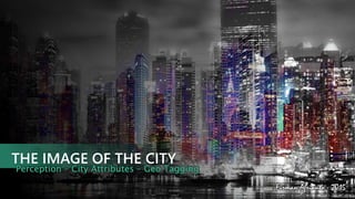
- 1. THE IMAGE OF THE CITY Perception – City Attributes – Geo Tagging Firman Afrianto - 2015
- 2. CHAPTER ONEWhat are in Kevin Lynch’s mind ABOUT KEVIN A. LYNCH (1918-1984) Born in the 20th century. Educated at the Yale university, Rensseleaer Polytechnic Institute and the Massachusetts Institute of Technology. Gained professorship in MIT in the year 1963. Eventually earned professor emeritus status from same. Consulted to the state of Rhode island, new England medical Centre, Boston redevelopment authority, Puerto Rico
- 3. CITY AS A TEMPORAL ART IN VAST SCALE Like a piece of architecture, the city is a construction in space, but one of vast scale, a thing perceived only in the course of long spans of time.
- 4. LEGIBILITY It mean the ease with which its parts can be recognized and can be organized into a coherent pattern/Just as this printed page, if it is legible, can be visually grasped as a related pattern of recognizable symbols.
- 5. IMAGEABILITY Another term introduced by Lynch, is the quality of physical object, which gives a observer a strong vivid image. High imageable city would be well formed, would contain distinct paths. They should be instantly recognizable. Well formed city is highly dependent upon the elements because, that would make the viewers their city imageable. Remembering your city on images is meaningful. Increasing human ability to see and remember patterns, make city easier to learn
- 6. MENTAL MAPPING A person's perception of the world is known as a mental map. A mental map is an individual's own map of their known world. Mental maps of individuals can be investigated . By asking for directions to a landmark or other location. By asking someone to draw a sketch map of an area or describe that area By asking a person to name as many places as possible in a short period of time.
- 7. FIVE ELEMENTS PATHS : Channels by which people move along. Eg: roads, sidewalks, rails, etc EDGES : Dividing lines between 2 phases. Eg: seashores, railway lines, etc.DISTRICTS : Are medium to large sections of the city, characterized by a wealthy neighborhood. Eg: suburbs, college, etc. LANDMARKS : Point of reference. it makes one orient oneself. E.g: signs, buildings, stores, etc. NODES : Area of strategic spots where extra focus is given. E.g: busy intersection, popular city center, etc.
- 8. CHAPTER TWOUnderstanding five elements
- 9. Why paths are important elements in the city image? Concentrati on of uses Containing significant buildings and facades Paths are the most important elements in people’s images Other elements are arranged and along them. Unclear paths = unclear city image PATH
- 10. Edges are linear elements that form boundaries between areas or linear breaks in continuity (e.g. shores, railway cuts, walls). Natural edges, Manmade edges The strongest edges are continuous in form, and often impenetrable to cross movement. Difference between path and edge, Paths Direct the motion to specific direction , Edges Prevent motion in specific direction EDGES
- 11. Districts: are the medium to large parts of the city which share the same characteristics Style - spatial form, topography- colors- texture, urban fabric. Districts : Districts may have Clear edges, or soft uncertain ones gradually fading away into surrounding areas. DISTRICT
- 12. Strategic points in the city the user can enter it be directed to many destinations it can be gathering places or intersection of paths, or places for activities NODE
- 13. A physical element with UNIQUE AND SPECIAL visual features that has a "point-specific” location, and can be identified from the distance Singularity: “one in the context” Clarity of general form LANDMARK
- 14. None of lynch’s elements exits in isolation : all combine to provide the overall image Districts are structures with nodes Edges define Districts Paths introduction to Districts Nodes sprinkled by landmarks Nodes emphasizes the connection between paths
- 15. What creates unclear urban Image ? Unclear urban images Discontinu ous and unclear paths Weak Edges Lacks of character “No identity” “No iconic elements or landmarks Branching in connection s branching Nodes No distinctive districts
- 17. THEE WORKABLE ENVIRONMENTAL IMAGES REQUIRED THREE ATTRIBUTES 1. Identity : an object’s distinction from other things 2. Structure : the object’s spatial relation to the observer and other objects 3. Meaning : the object’s meaning for the observer
- 18. WHAT PURPOSES DOES IT SERVE? Preventing feeling “lost” Helping make the city feel like “home”
- 19. CHAPTER FOURThe New Era of Recognizing The Image of The City
- 20. THE INTERNET ERA Photosharing websites like Instagram, Flickr, and Panoramio have amassed about 4 billion geo- tagged images, with over 2 million new images uploaded every day by users manually. These images contain a huge amount of information about the cities, which are not only used for landmark detection and reconstruction, but are also used to monitor ecological phenomena and human activity occurring in the city
- 21. THE INTERNET ERA City Attributes Green Space Water Coverage Transportation Architecture Vertical Building Social Activity Athlethic Activity
- 22. MENTAL MAPPING THROUGH GEO TAGGING YELLOW dots are locals, CYAN dots tourists, and BLUE dots are those who Fischer couldn't determine
- 23. THE END