
Recommended
More Related Content
What's hot
What's hot (19)
Similar to Chapter12 part2 mass_wasting_2020(1)
Similar to Chapter12 part2 mass_wasting_2020(1) (20)
Recently uploaded
Recently uploaded (20)
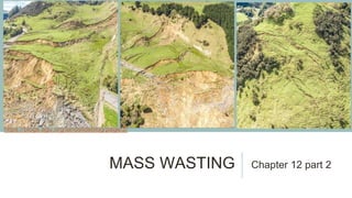
Chapter12 part2 mass_wasting_2020(1)
- 1. MASS WASTING Chapter 12 part 2 https://blogs.agu.org/landslideblog/page/2/
- 2. BREAKING NEWS: HEAVY STUFF FALLS DOWN! Mass wasting: the downslope transport of surface materials in direct response to gravity. Everywhere on earth, gravity pulls objects to earth’s center. We refer to this downward force as weight. Gravity is always helping rock, sediment, and soil to move downhill on sloping surfaces. How heavy an object is (the more it weighs) determines how much gravity is pulling it to the center of the earth. Heavier object = greater downward pull
- 4. GRAVIT Y TUG- OF- WAR G: gravity (weight of the block) F: the weight of the block, pulling perpendicular to the block/earth surface D: downslope component of gravity (shear stress pulling block downhill). f: friction keeping the block from sliding For the block to move downhill, F has to be < D If there is a low slope angle, F > D The steeper the angle, the higher D value F > D F < D
- 5. GRAVITY = GP + GT Remember, gravity (for our purposes) just means weight. Gp: Perpendicular component of gravity The weight of the block being pulled down perpendicular to the ground surface Gt: tangential component of gravity The weight of the block being pulled down the surface of the slope (shear stress-blocks moving past each other) Here, the weight of the block pulling downhill (Gt) is more than the weight of the block being pulled to the tilted hill surface. Since the downhill weight is greater, this block is more likely to slide. Here, more of the weight of the block is perpendicular to the slope, making it unlikely to slide. The weight pulling the block to the hill surface is more than the weight pulling the block downhill. Gt
- 6. WILD CARD: FRICTION Remember, gravity (for our purposes) just means weight. Now we have identical blocks on identical slopes. But the one slope is made up of loose rocks fallen from the mountain already, and the other has trees on it. The small rocks on the left will act as ball bearings and decrease the friction by rolling underneath the rock, making it more likely to slide. The trees on the slope on the right will slow the rock down, creating more friction for the rock to overcome on its way down the mountain.
- 7. MATERIALS AND MOTION Mass wasting events are categorized by: �Kinds of Earth materials involved �Ways the materials move �Terminology (Soil, earth, debris, and mud) �Speed (Slow vs. fast mass wasting)
- 8. Creep: slow migration of particles to successfully lower elevations. Gradual downslope motion usually affects a thin top layer of weathered rock particles. Most widespread and persistent form of mass wasting Heaving process SLOW MASS WASTING: CREEP
- 9. SOIL CREEP: ABOVE GROUND AND BELOW While the mechanism of soil creep happens below the surface and very slowly, the effects of soil creep can be seen in the landscape if you know what you’re looking for.
- 10. SLOW MASS WASTING: SOLIFLUCTION (SOIL FLOW) Solifluction: Slow downslope movement of water-saturated soil or regolith Occurs in high-latitude or high-elevation tundra regions: permafrost conditions Active layer: part of the soil that thaws in summer Because the melted water can’t be absorbed by the frozen ground beneath it, the mass of wet muddy soil slides downhill on top of the permafrost
- 12. ROCKFALLS Earth materials plummeting downward freely through the air (not rolling downhill) �Large slabs break into clasts at the bottom of the slope Triggers: �Steep slopes �Spring thaws/freezes �Earthquakes
- 13. ROCK FALL IN TENNESSEE CAUSED BY UNLOADING/EXFOLIATION OF A GRANITE CLIFF https://www.youtube.com/watch?v=39LCzBS8yOM
- 14. ROCKFALL DURING ROAD CONSTRUCTION https://www.youtube.com/watch?v=8FJwIHdV ue8
- 15. ROCKFALL IN TAROKO GORGE, TAWIAN Taroko Gorge: a dashcam video of a very near-miss with a co-seismic rockfall in Taiwan. This is a still from the AGU landslide blog, written by Dave Petley. “A magnitude 6.1 earthquake struck eastern Taiwan on Thursday 18th April 2019 at at 13:01 local time. This shallow earthquake shook the extraordinarily beautiful Taroko Gorge in eastern Taiwan, a major tourist attraction with very tall, very steep slopes above a major highway. A dashcam video has been posted to Youtube, shot by a motorist on the road at the time of the earthquake. Unsurprisingly, the earthquake triggered large numbers of rockfalls. The dashcam video captures a near-miss event that was extraordinarily close to being a tragedy” https://blogs.agu.org/landslideblog/2019/04/20/taroko-gorge-1/
- 17. BONUS ROCKFALL: NIAGARA FALLS, 1954 https://www.youtube.com/watch?v= SH8lsTO9Lsk&feature=emb_title
- 18. AVALANCHES 3 types: �Snow �Rock—pulverized bedrock �Debris-very poorly sorted mixture of gravel, sand, silt, and clay Avalanches are made up of pulverized material—broken into small, powdery fragments that flows rapidly as an airborne density current
- 19. https://blogs.agu.org/landslideblog/2019/05/15/joffre-peak/ ROCK AVALANCHE ON JOFFRE PEAK, CANADA The source area of the rock avalanche on May 13, 2019 The track of the avalanche that stretched for over 4 kilometers
- 20. https://blogs.agu.org/landslideblog/2019/05/17/another-probably-even-larger- rock-avalanche-on-joffre-peak/ THEN ANOTHER, LARGER AVALANCHE Left: source/scar area where the May 18th avalanche originated
- 21. LANDSLIDES Landslide: Cohesive or semicohesive unit of Earth material that slips downslope in continuous contact with the land surface They are categorized (if possible) by the material or kind of motion involved: Rockslides Debris slides Mudslides Slumps Landslide
- 22. ROCKSLIDE/ AVALANCHE IN NEW ZEALAND, 2013 Top photos are where the rock broke off the cliff face. You can see the extreme weathering in the picture on the right. https://blogs.agu.org/landslideblog/2013/01/23/an-analysis-based-on-images-and-video-of-the-mount-cook-national-park-landslide-on-monday/
- 23. THE MAY 1971 SAINT JEAN VIANNEY LANDSLIDE DISASTER https://blogs.agu.org/landslideblog/2020/03/19/saint-jean-vianney-landslide/ For scale, look at the housing development in the picture on the left. That is here. Vertical aerial image of the Saint Jean Vianney landslide, from Tavernas et al. (1971) Flow runout (end) Flow direction and path Red circles show some of the destroyed houses
- 24. FLOWS: 4 MAIN TYPES Flows carry water in moving sediments vs. rivers which carry sediments in moving water. Earthflow Debris flow Mudflow Lahars
- 25. Earthflows can be independent events or a compound feature: slump–earthflow EARTHFLOWS A slump– earthflow moves as a cohesive unit along a concave surface in the middle and upper reaches of the failure. Downslope of the failure plane, the mass continues to move but in the more fluid-like, less cohesive manner of an earthflow Earthflow- thick unit of fine-grained, unconsolidated hillside sediment or shale becomes saturated and mixes and tumbles as it moves.
- 26. SLUMP IN TURKEY https://blogs.agu.org/landslideblog/2019/05/17/ordu-1/ The major rotational landslide at Aybasti in Ordu in northern Turkey on 16th May 2019 The displaced block is at the foot of the scarp, such that all of the properties/houses at the toe of the slope have slid vertically by 30 m or more.
- 29. DEBRIS AND MUD FLOWS Faster than earthflows Debris flow: smaller grain size sediment Mudflow: larger grain size Flow levees –Higher edges of debris left along the sides of the flow Flow chann el Levee s
- 31. STILLS FROM ILLGRABEN DEBRIS FLOW, SWITZERLAND, 2016 (research site) https://blogs.agu.org/landslideblog/2016/07/28/illgraben-debris-flow-video/ 1. The front of the flow consists of large number of (in this case) huge boulders tumbling chaotically. 2. The main, more fluid portion of the Illgraben debris flow 3. As the discharge starts to decline the debris flow creates a narrower channel, leaving deposits
- 32. VIDEO OF DEBRIS FLOW FROM ILLGRABEN https://www.youtube.co m/watch?v=0ENe7wDK P6I&feature=emb_title
- 33. VOLCANIC MUDFLOWS: LAHARS Dangerous, unstable, steep mountain slopes + fine grained sediment + melted snow and ice from eruption = extreme damage
- 34. LAHARS Lahars—specific flows of material from the sides of a volcano Lahars move rapidly down valleys like rivers of concrete Lahars can occur with or without a volcanic eruption Lahars and excess sediment cause serious economic and environmental damage to river valleys and flood plains lahars commonly occur as seasonal debris flows on active volcanos topped by glaciers. Image: Lahar devastation after the eruption of Mount Pinatubo, Philippines. Source: USGS
- 36. WEATHERING, MASS WASTING, AND THE LANDSCAPE Exogenic processes of weathering and mass movement are: �Critical to soil formation �Significant factors in shaping the landscape �Slopes are evidence of local weathering and mass wasting, and the processes that formed the landscape �Often accelerated and induced by human actions