This document provides an overview of river hydraulics and morphology. It discusses how rivers adjust over time based on natural forces and human activities. Key points include:
- Rivers can be classified based on factors like flow patterns, location, and channel shape. Meandering and braided rivers are described.
- Sediment transport involves erosion, deposition, and different load types being suspended, rolling along the bed, or in traction.
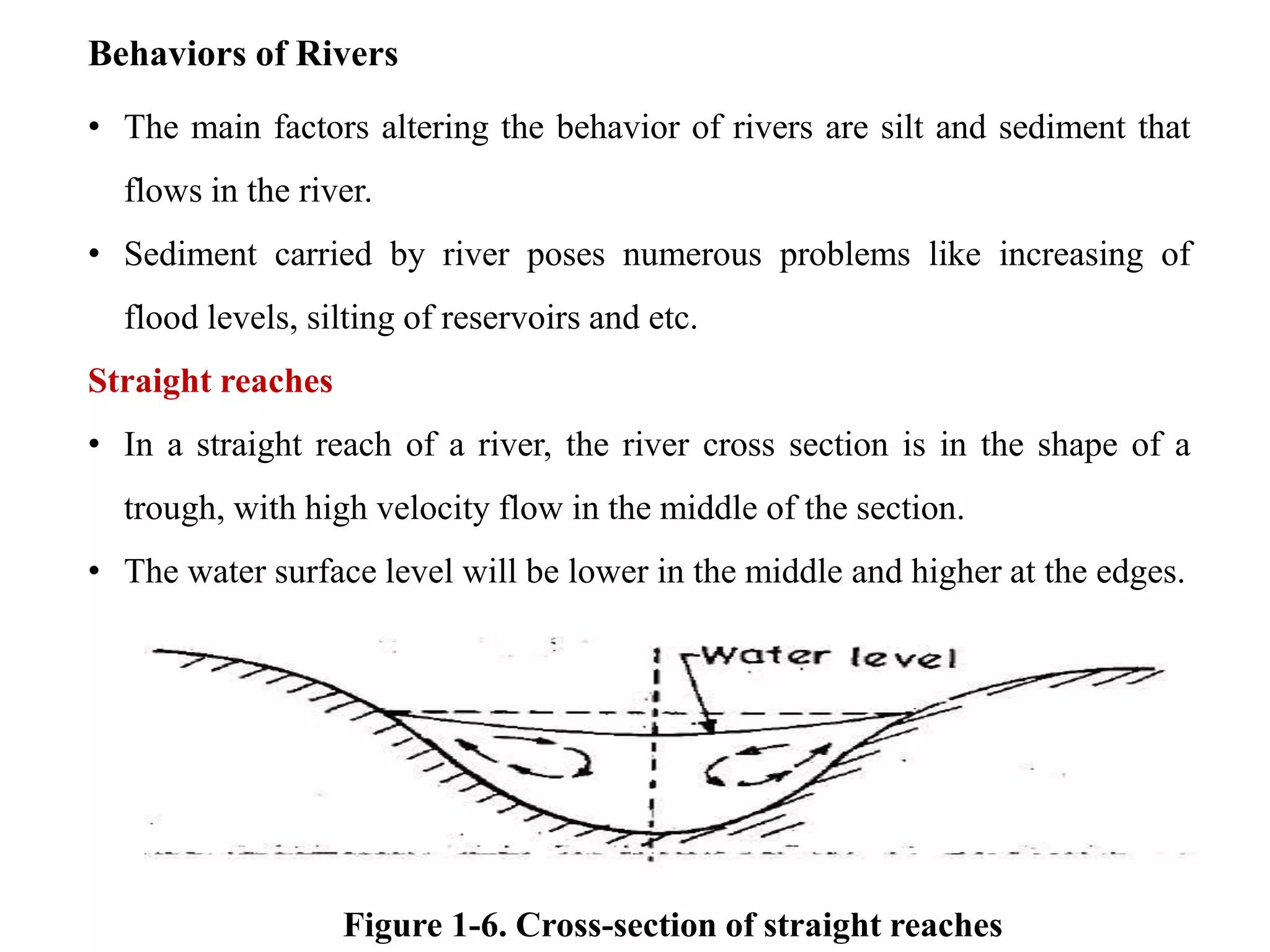
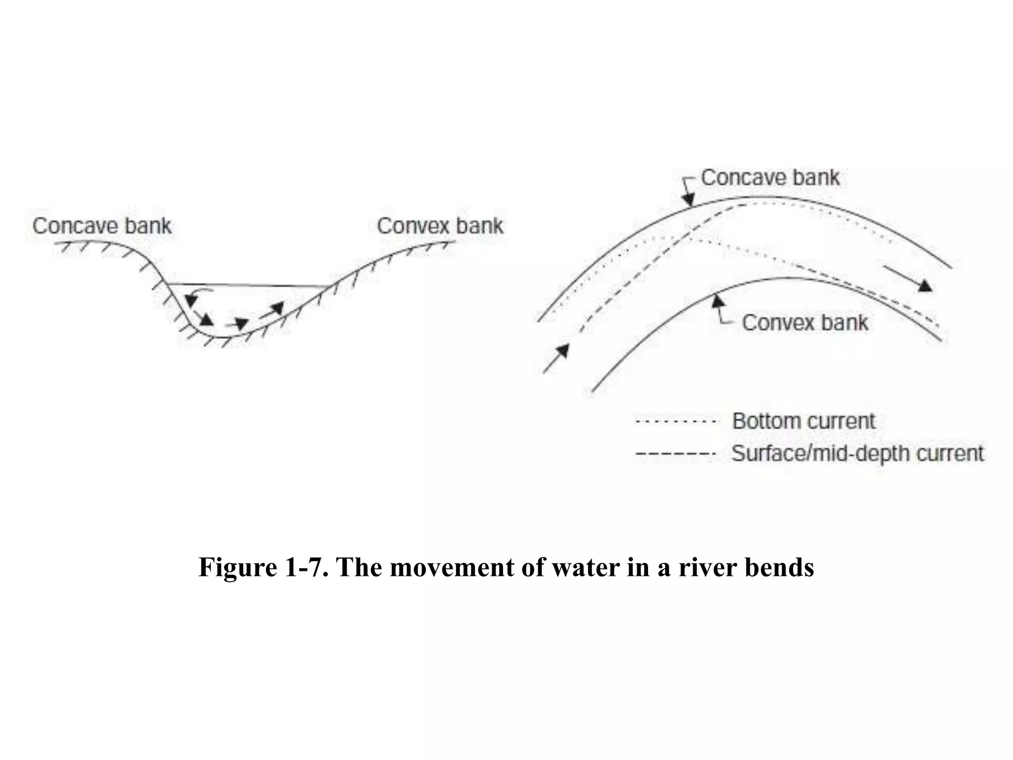
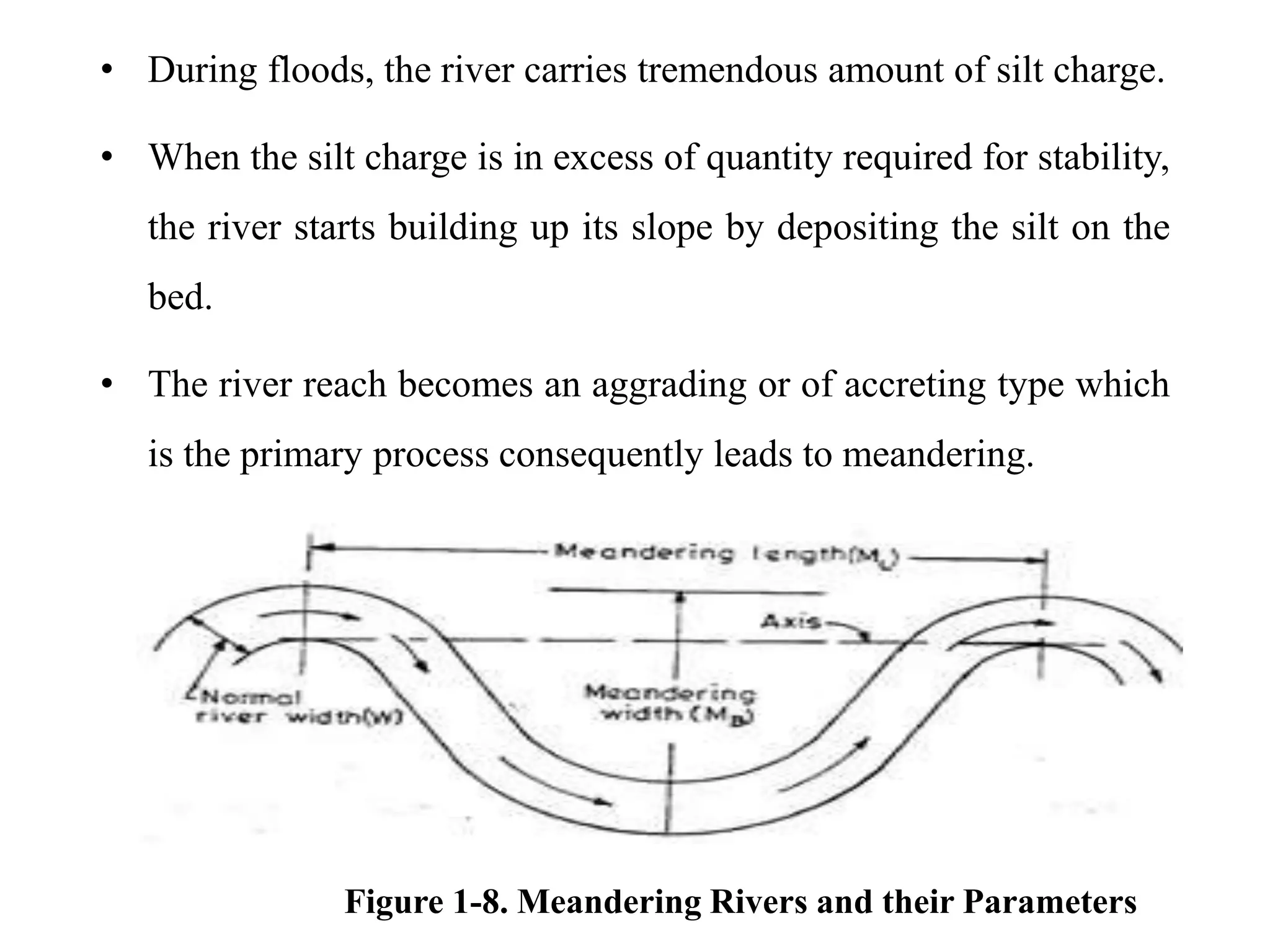
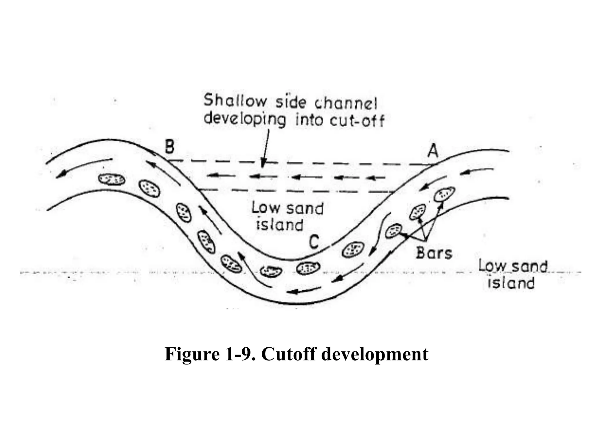
- River channels and morphology vary based on location in a watershed and sediment characteristics. Meandering develops through erosion on concave banks and deposition on convex banks.