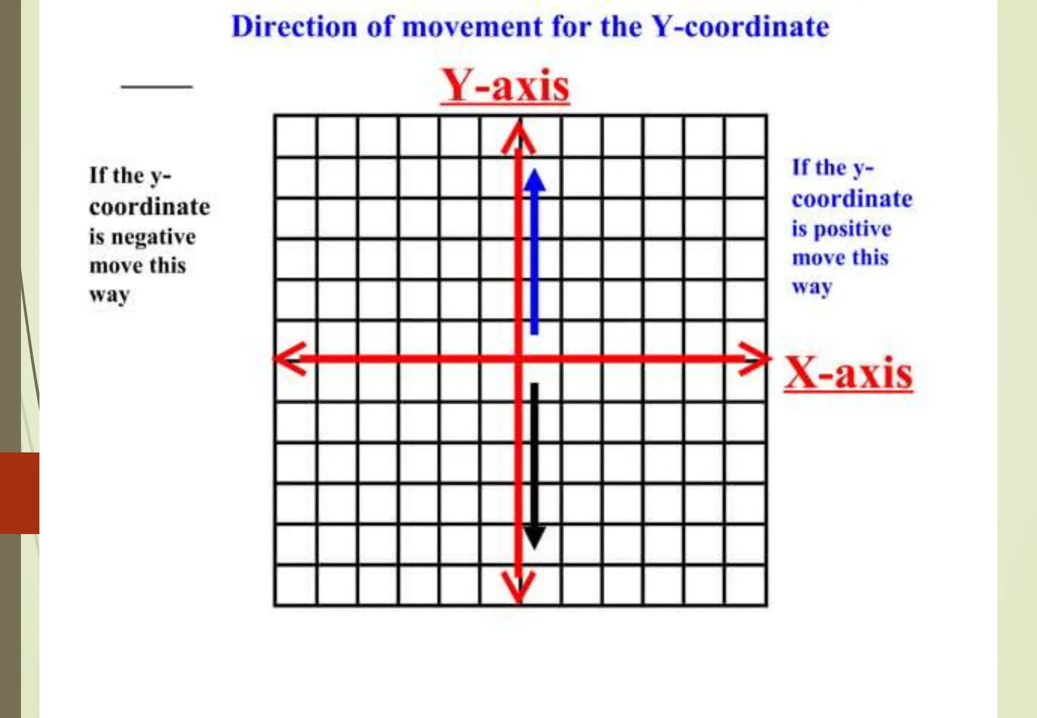
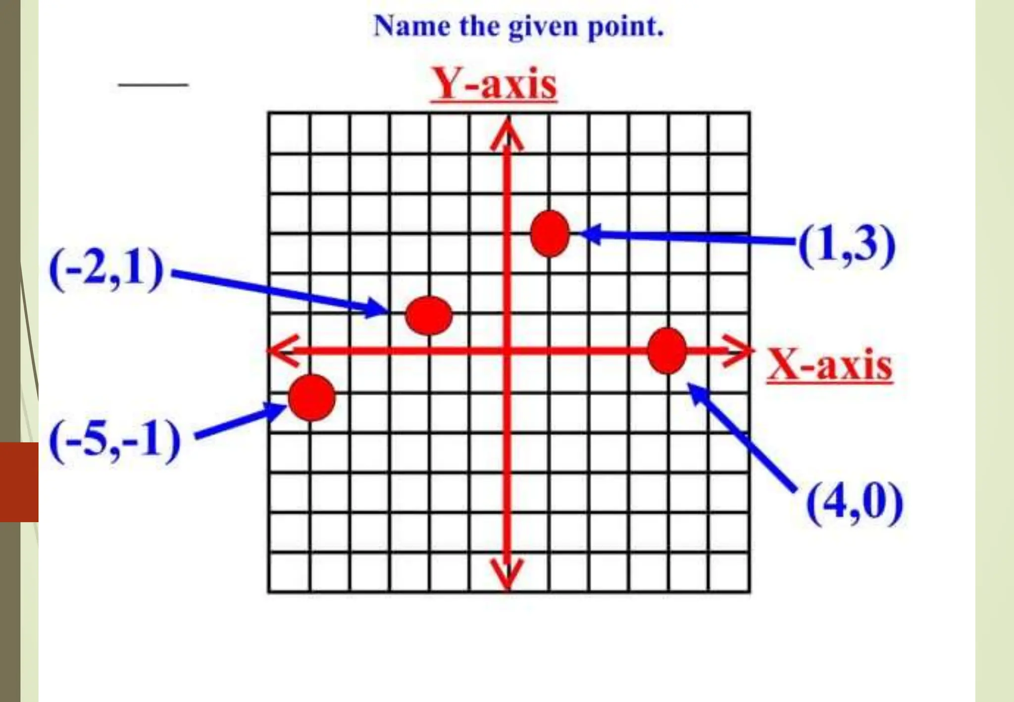
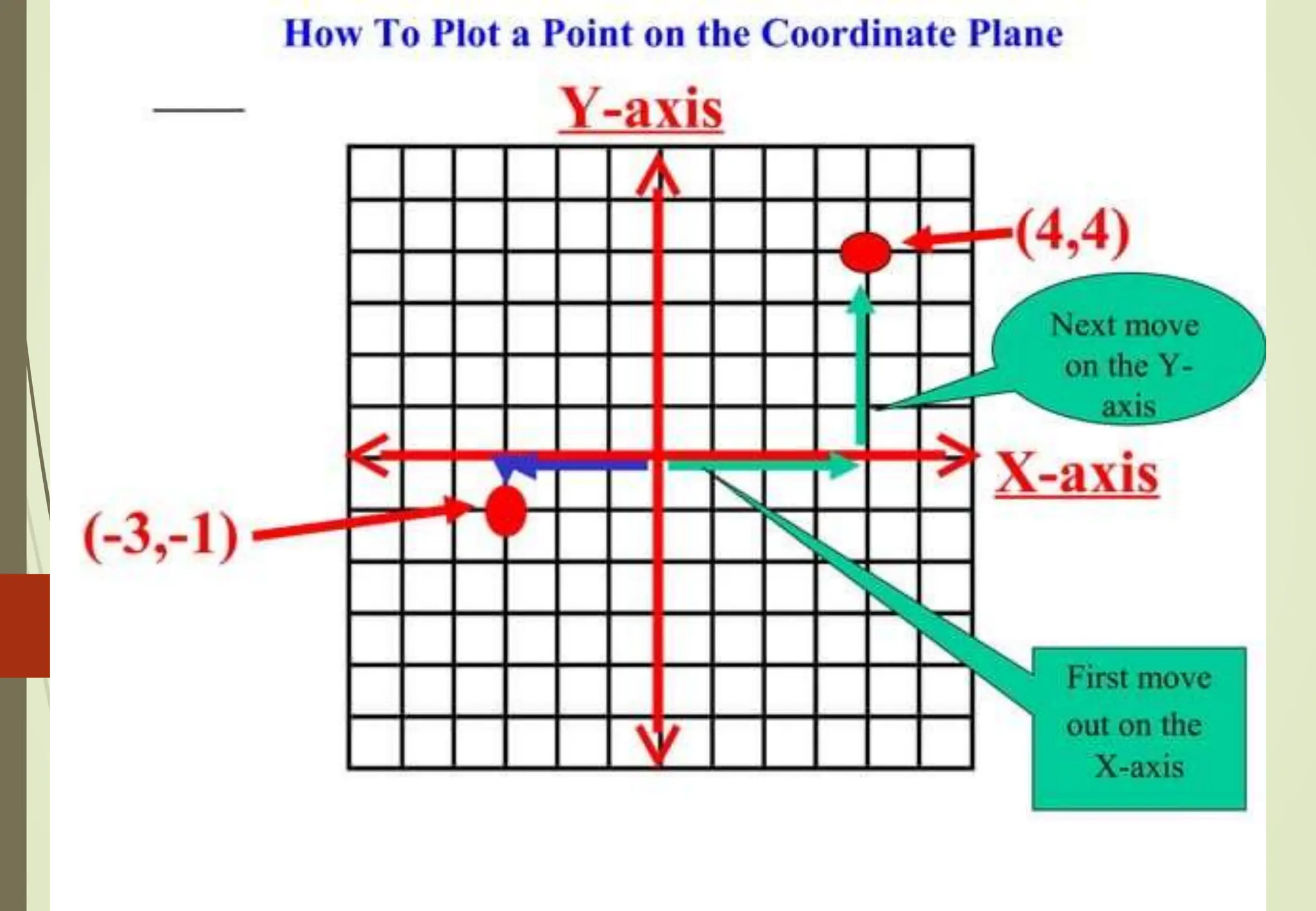
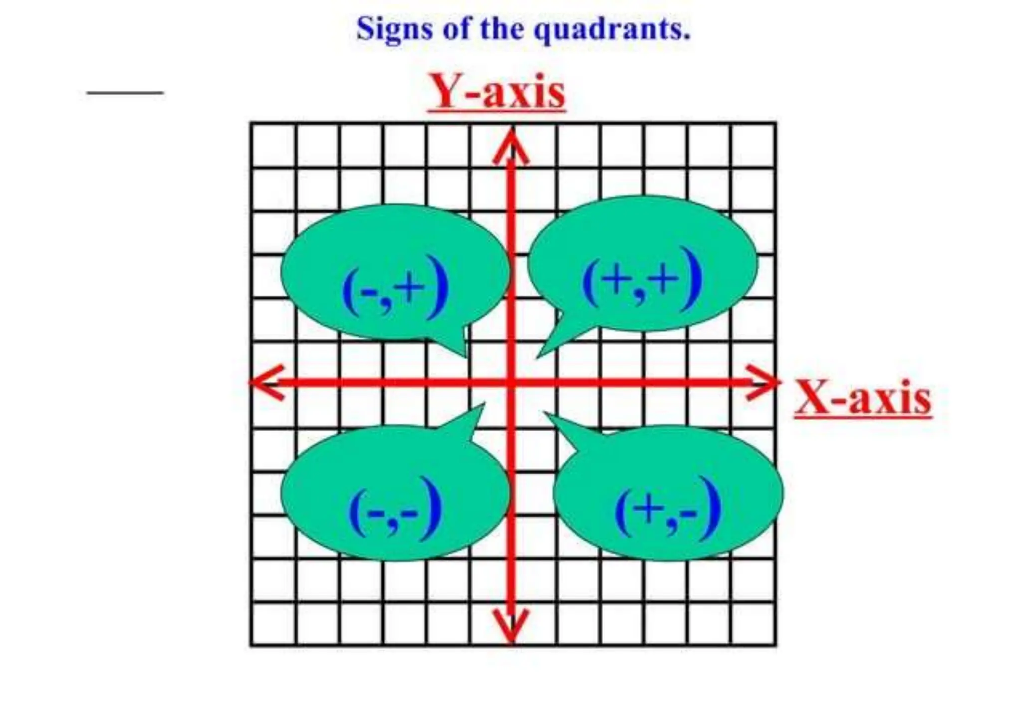
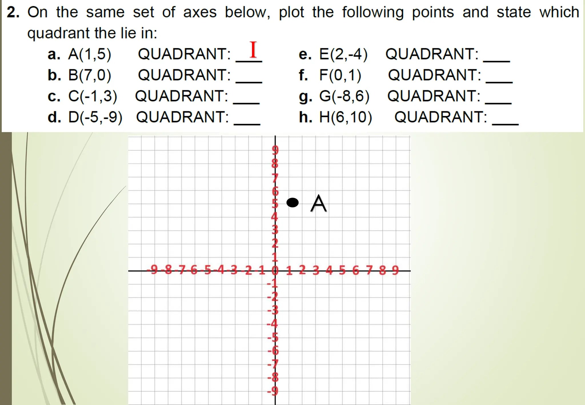
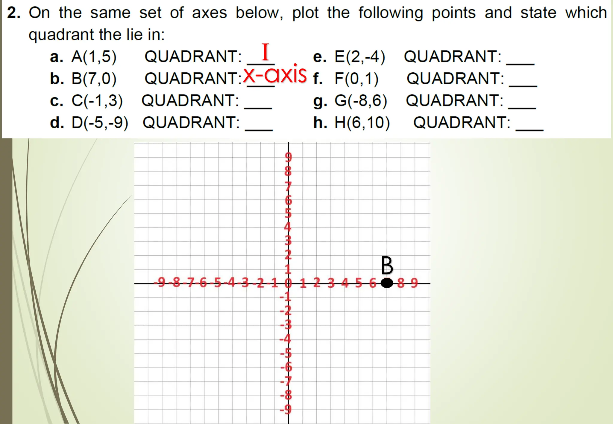
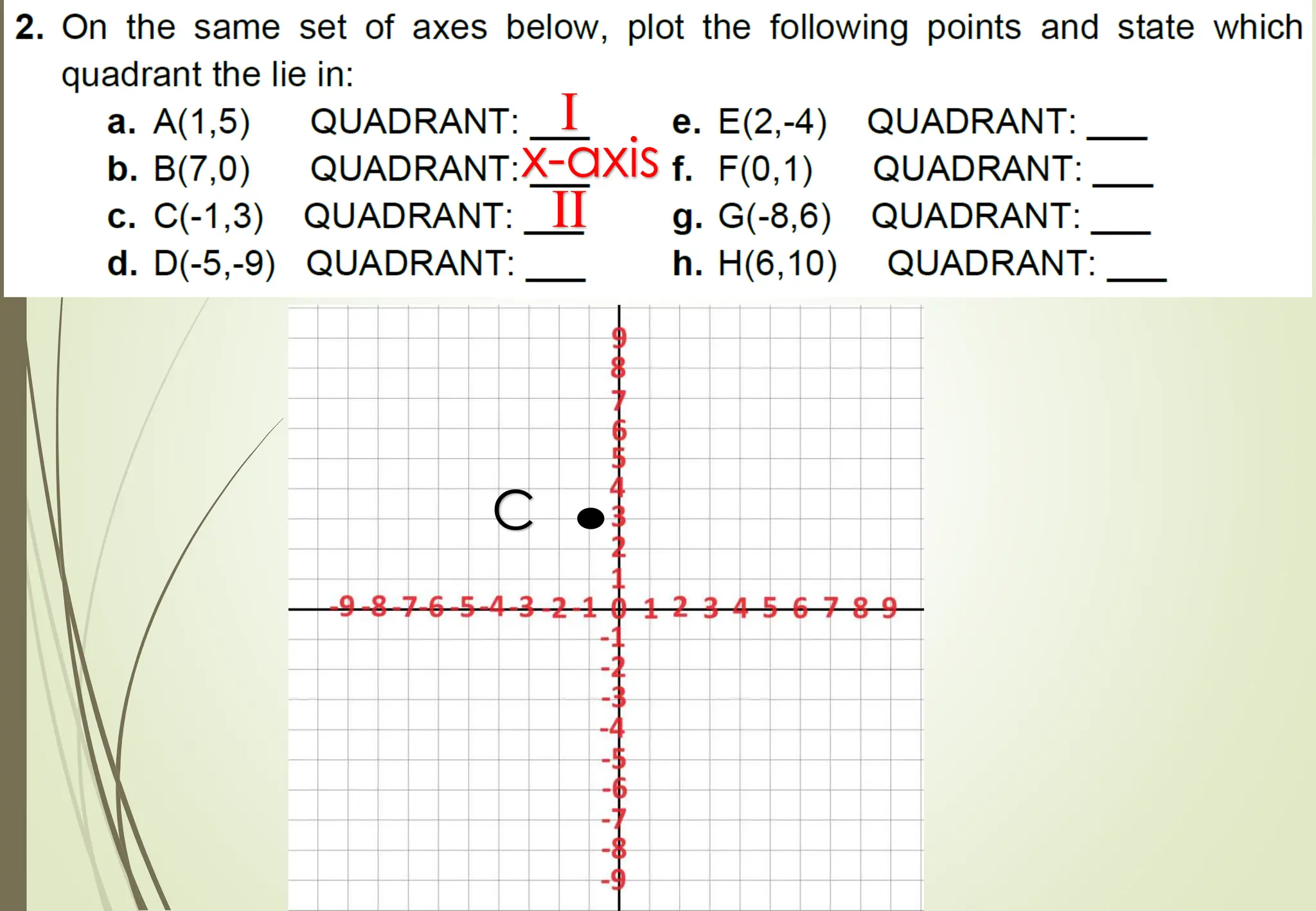
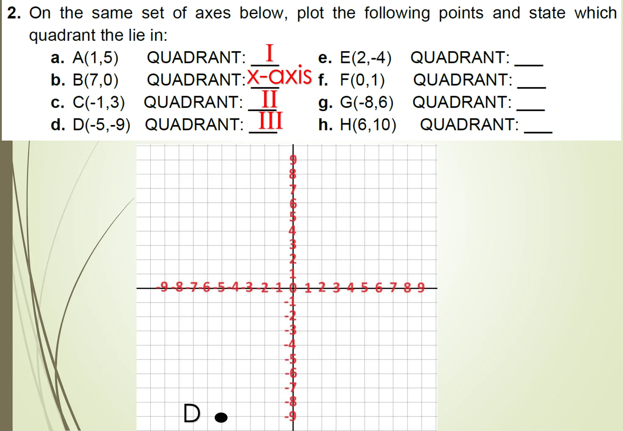
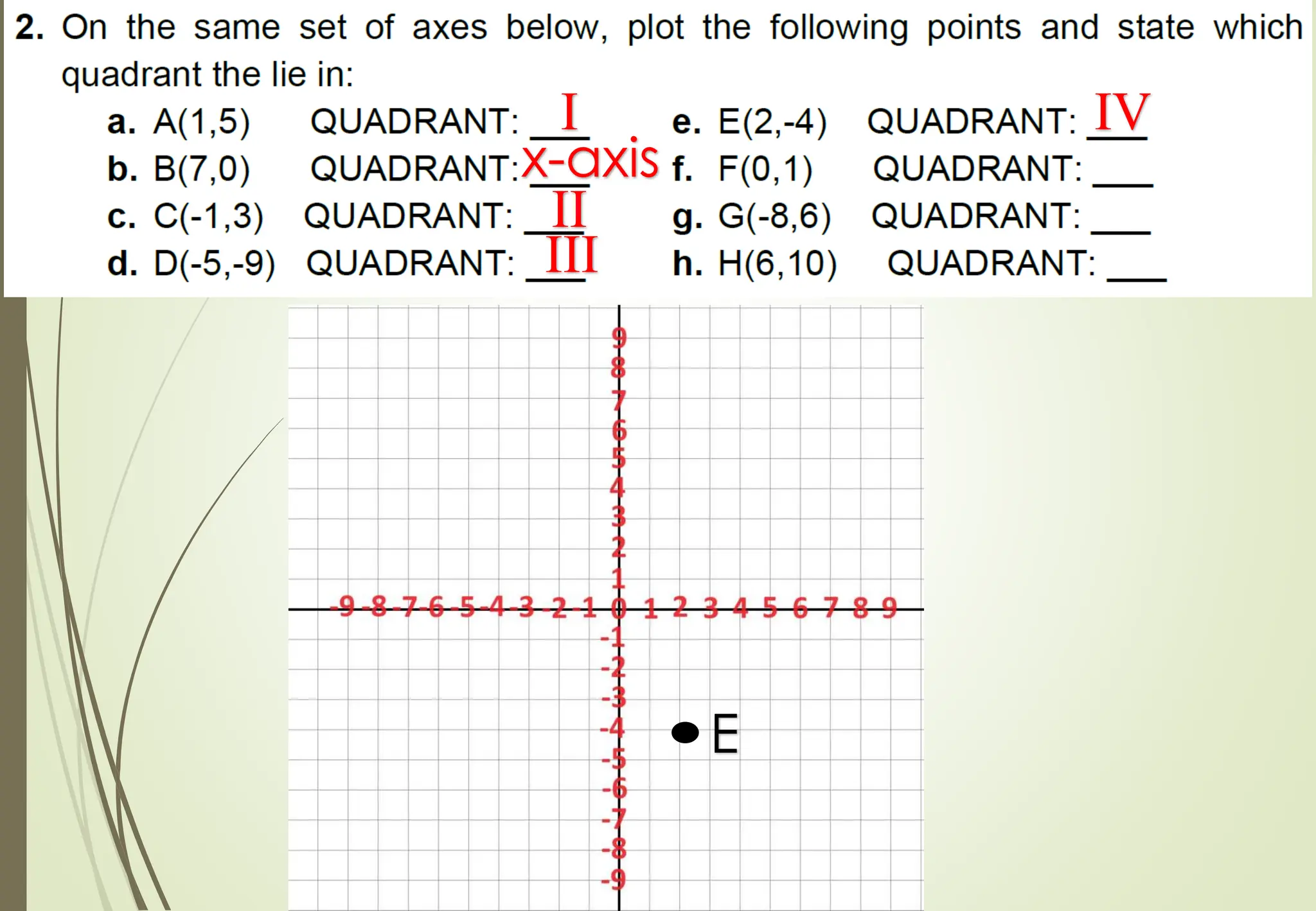
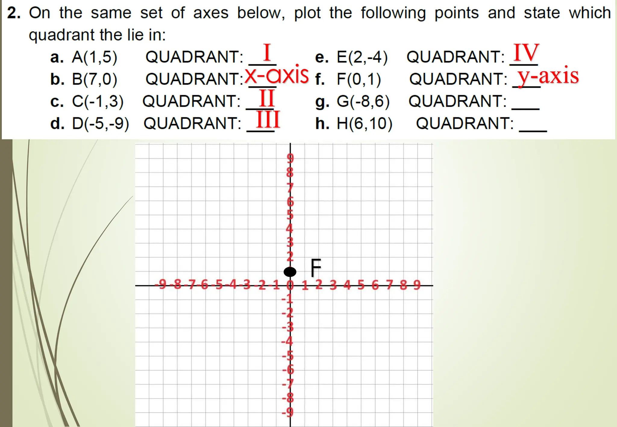
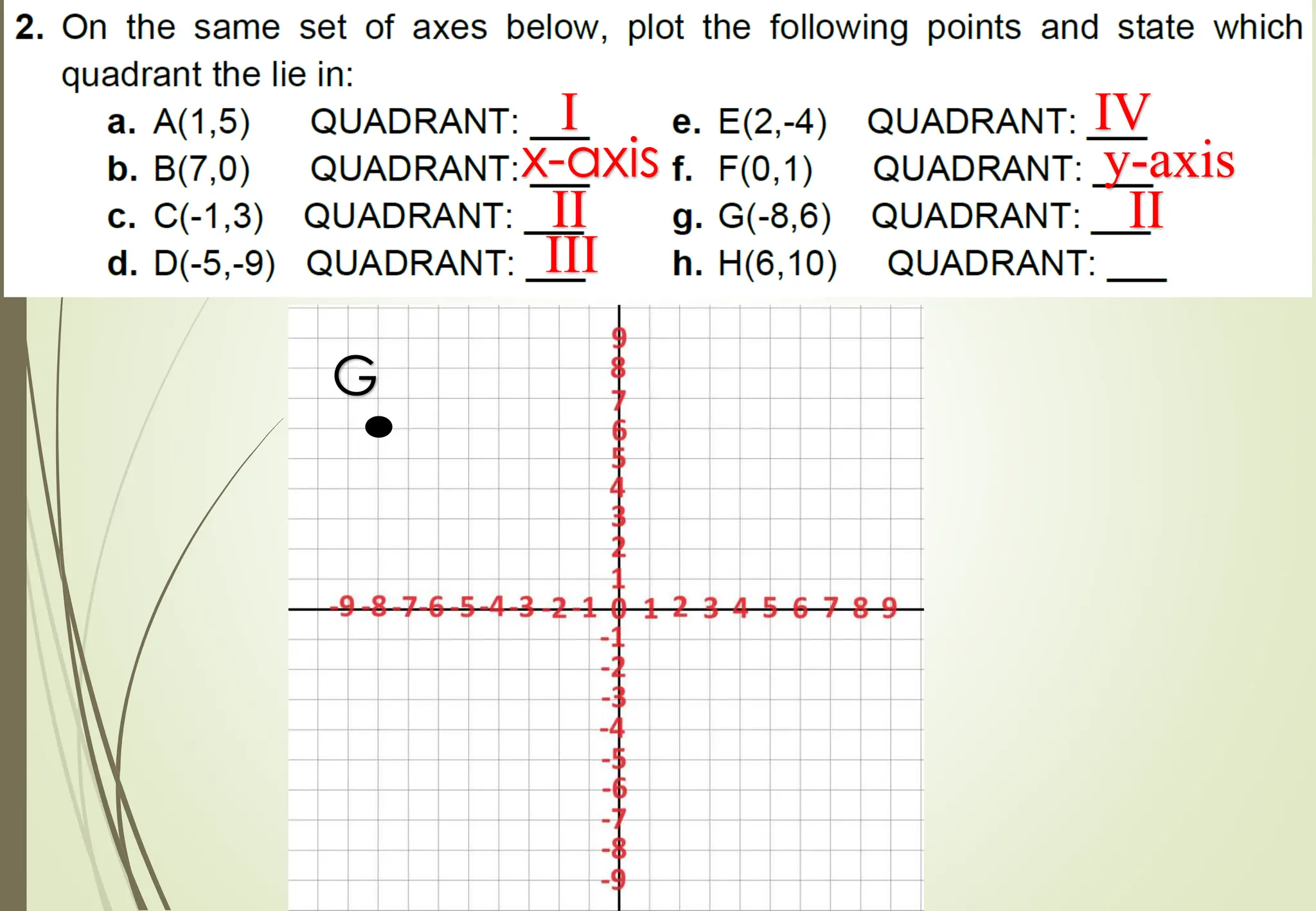
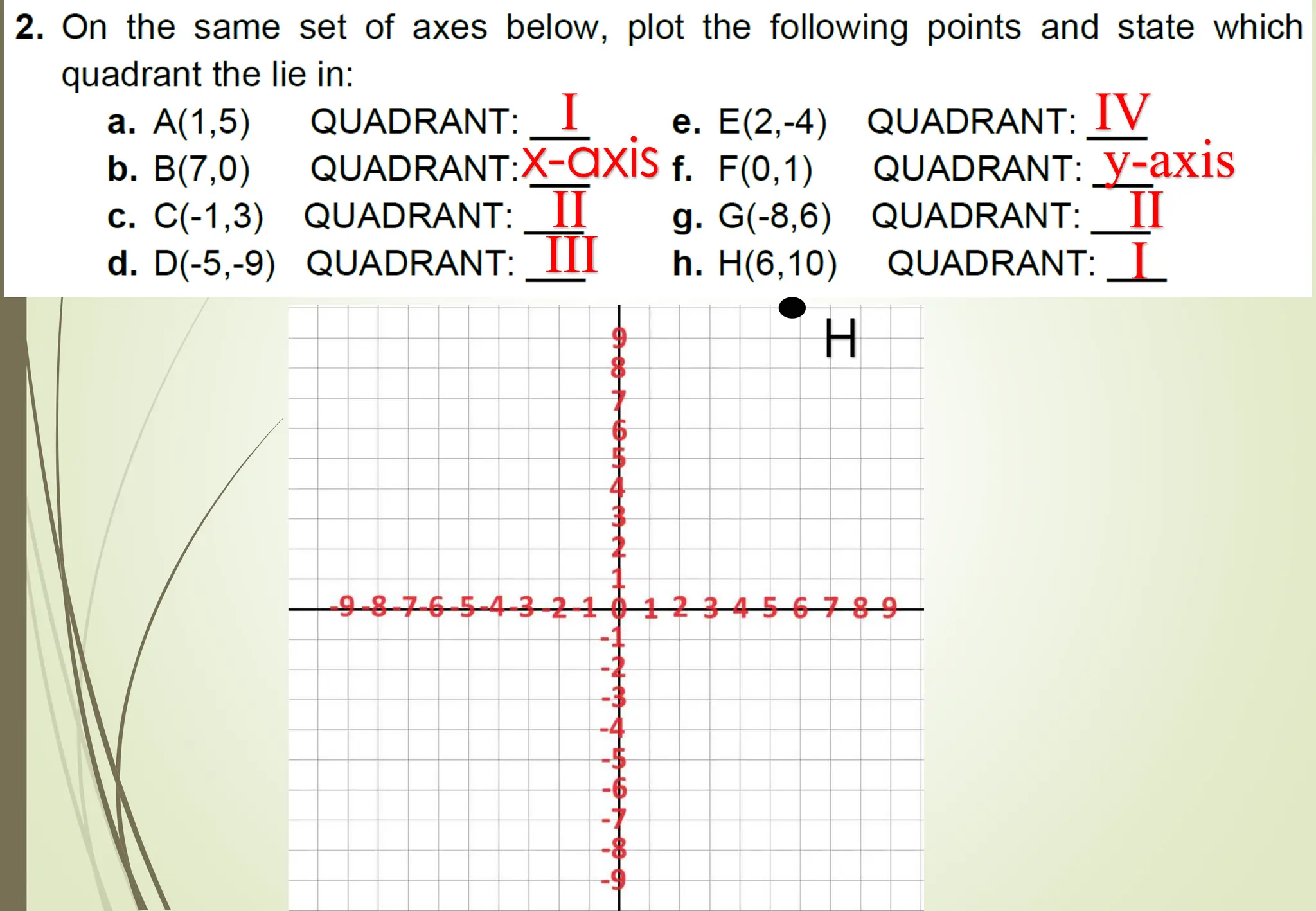
The document explains how to use a coordinate system to precisely locate points on a flat surface. It introduces the x-axis and y-axis, which intersect at the origin point (0,0) and divide the plane into four quadrants. Any point can be specified with an ordered pair of numbers representing its distance from each axis, like (4,2), which would be four units from the y-axis and two units from the x-axis. Several examples are given of plotting and translating points between different locations on the grid.
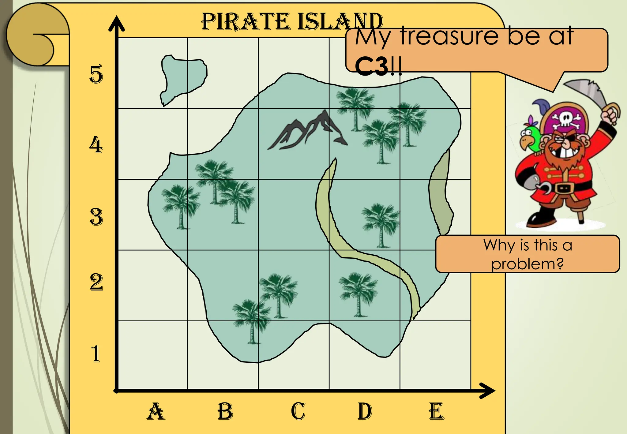
Pirate Island
1
2
3
4
5
A BC D E
My treasure be at
C3!!
He will have to dig up the whole grid
square!
C3 is not accurate enough.
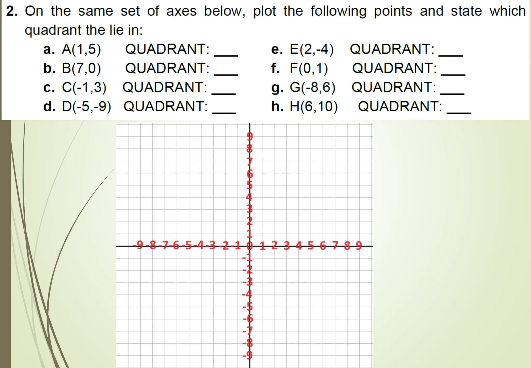
4.
1
2
3
4
5
1 2 34 5
0
0
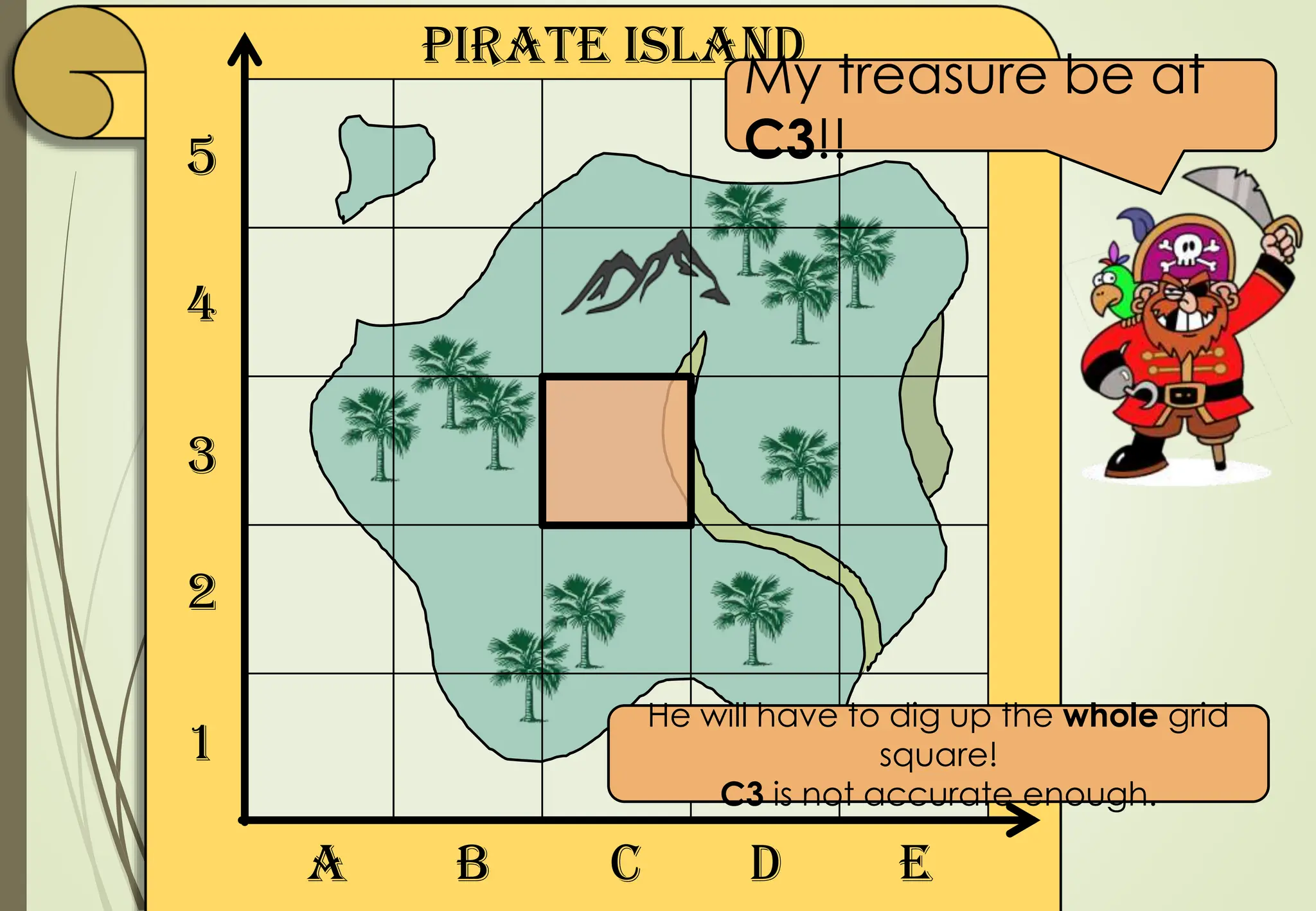
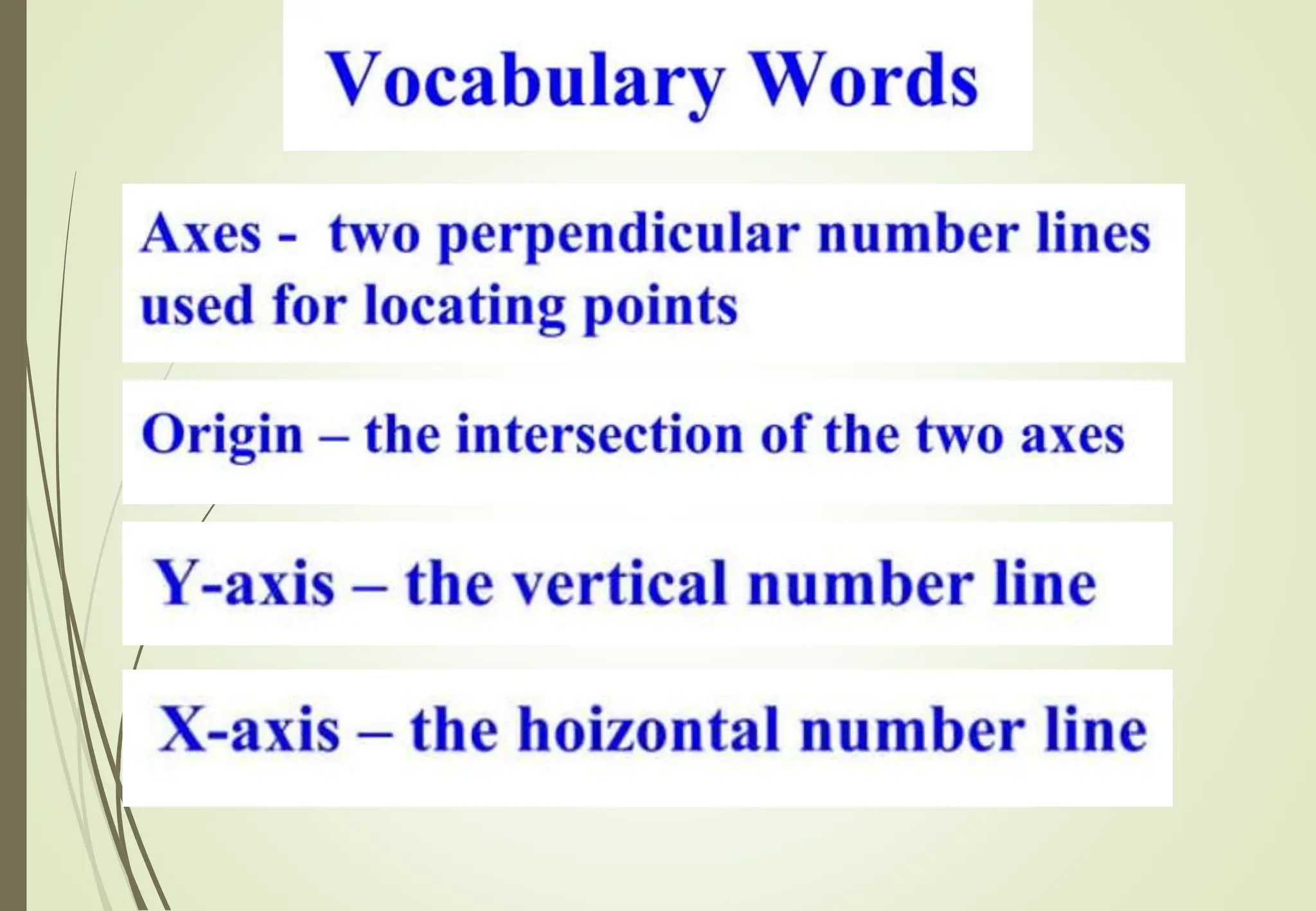
To name points on a flat surface we
use
a pair of coordinates.
A pair of coordinates:
(4,2)
Where is this?
(4,2) means
4 across, 2 up
5.
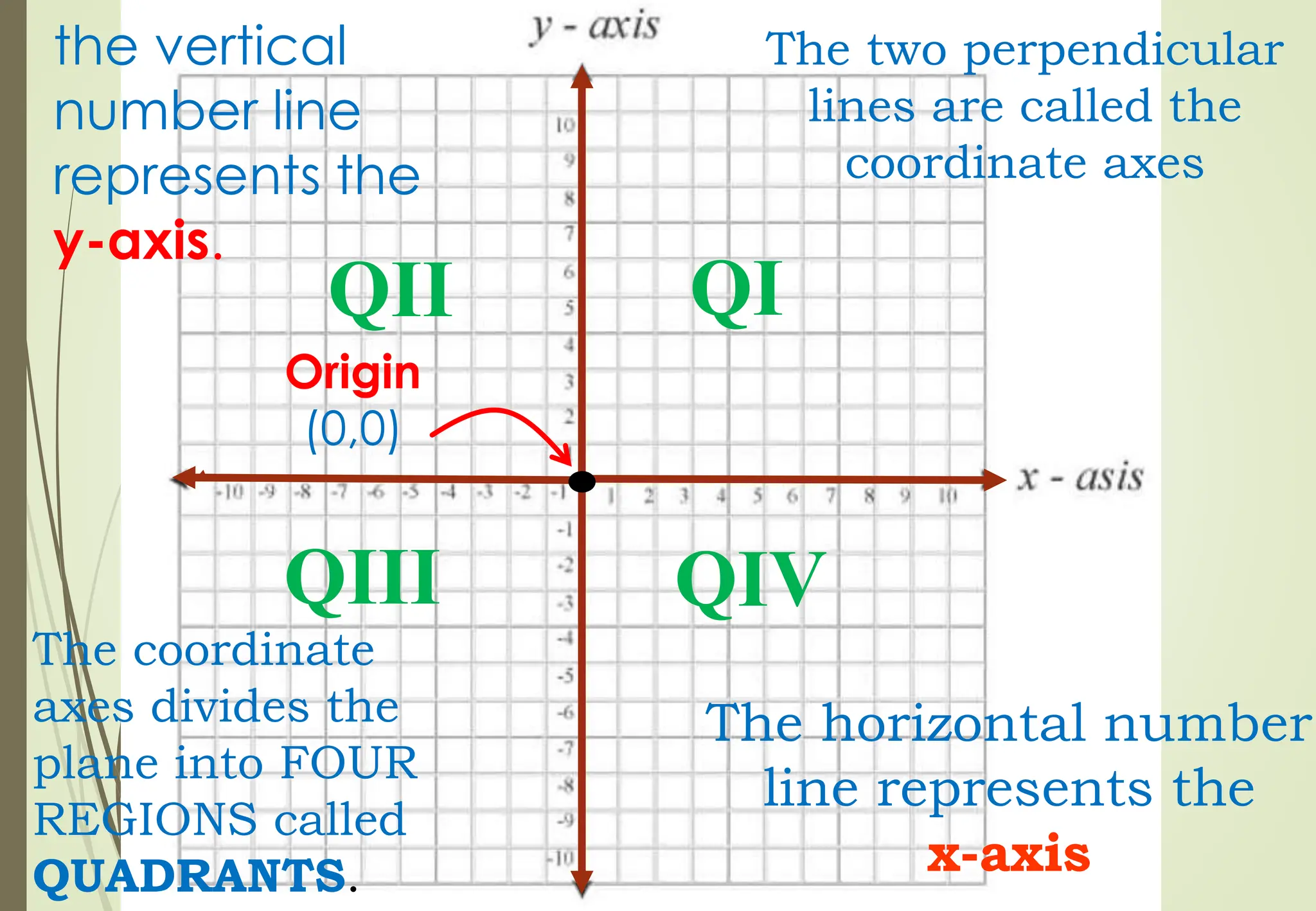
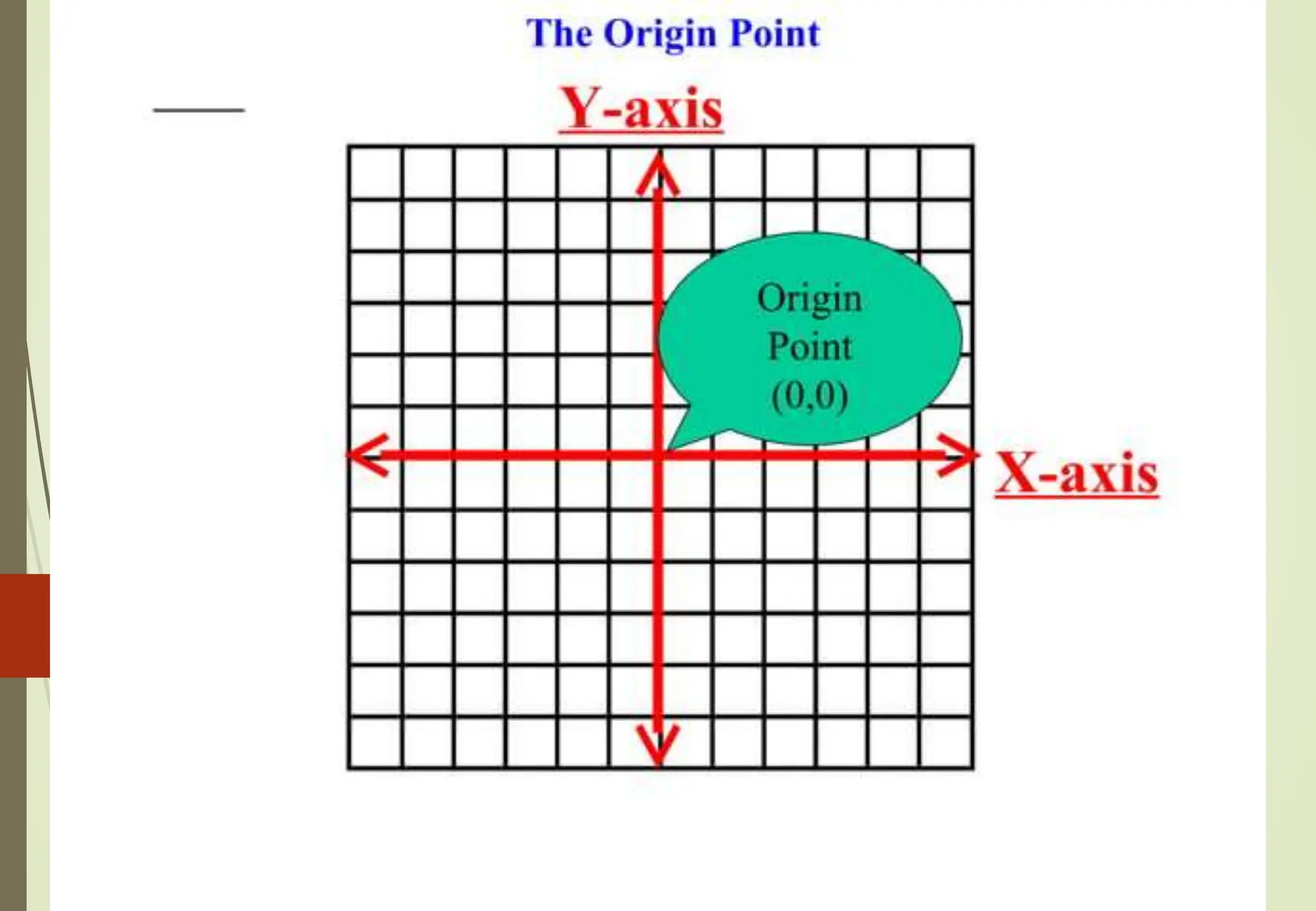
A Rectangular CoordinateSystem or
Cartesian Plane is constructed by drawing
two perpendicular lines wherein the point
of intersection is called origin.
7.
The two perpendicular
linesare called the
coordinate axes
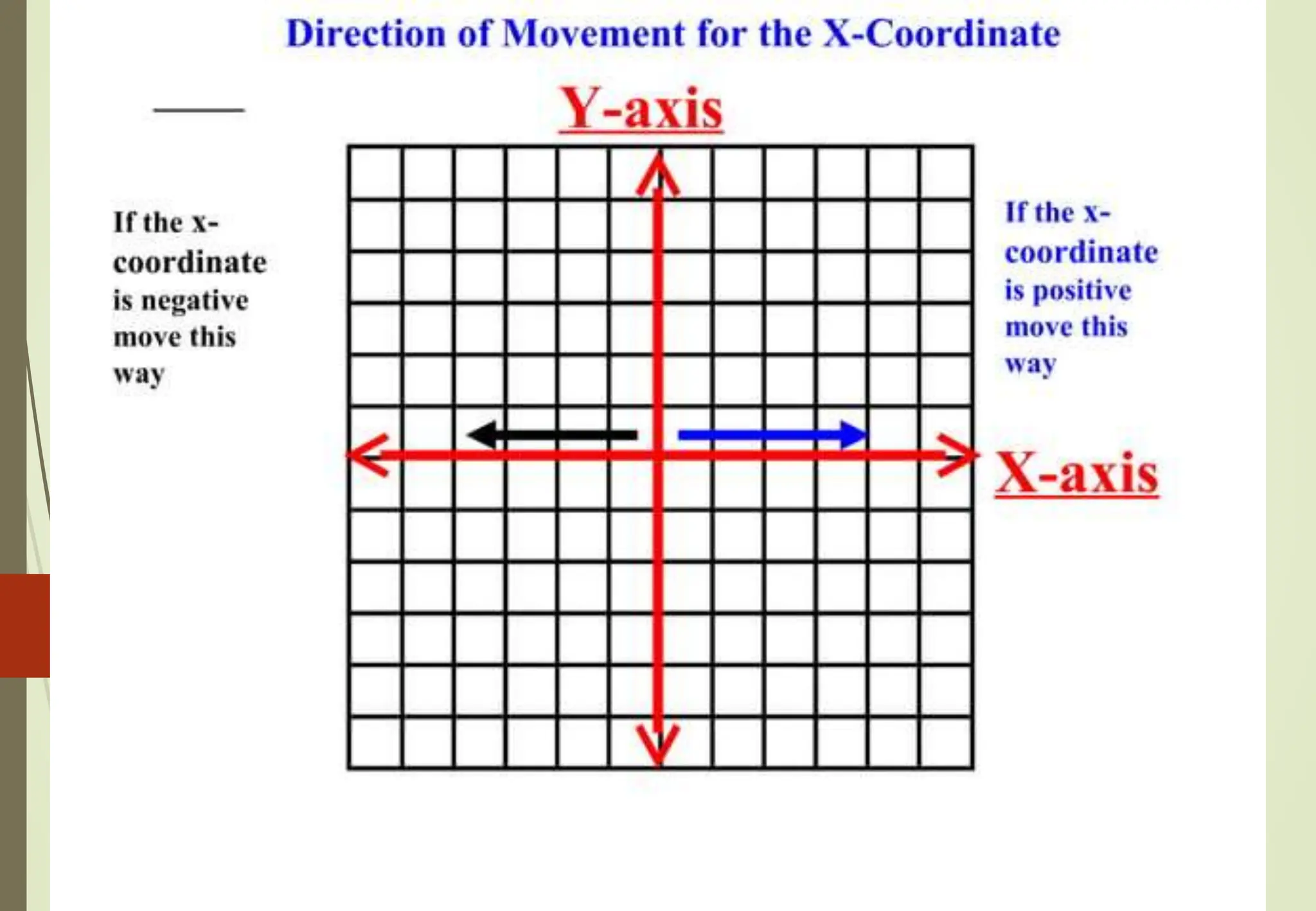
The horizontal number
line represents the
x-axis
the vertical
number line
represents the
y-axis.
Origin
(0,0)
The coordinate
axes divides the
plane into FOUR
REGIONS called
QUADRANTS.
QI
QII
QIII QIV
15.
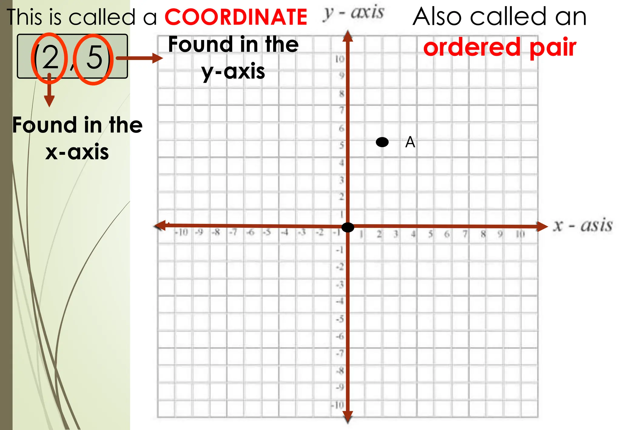
(2 , 5)
Thisis called a COORDINATE
Found in the
x-axis
Found in the
y-axis
Also called an
ordered pair
A
16.
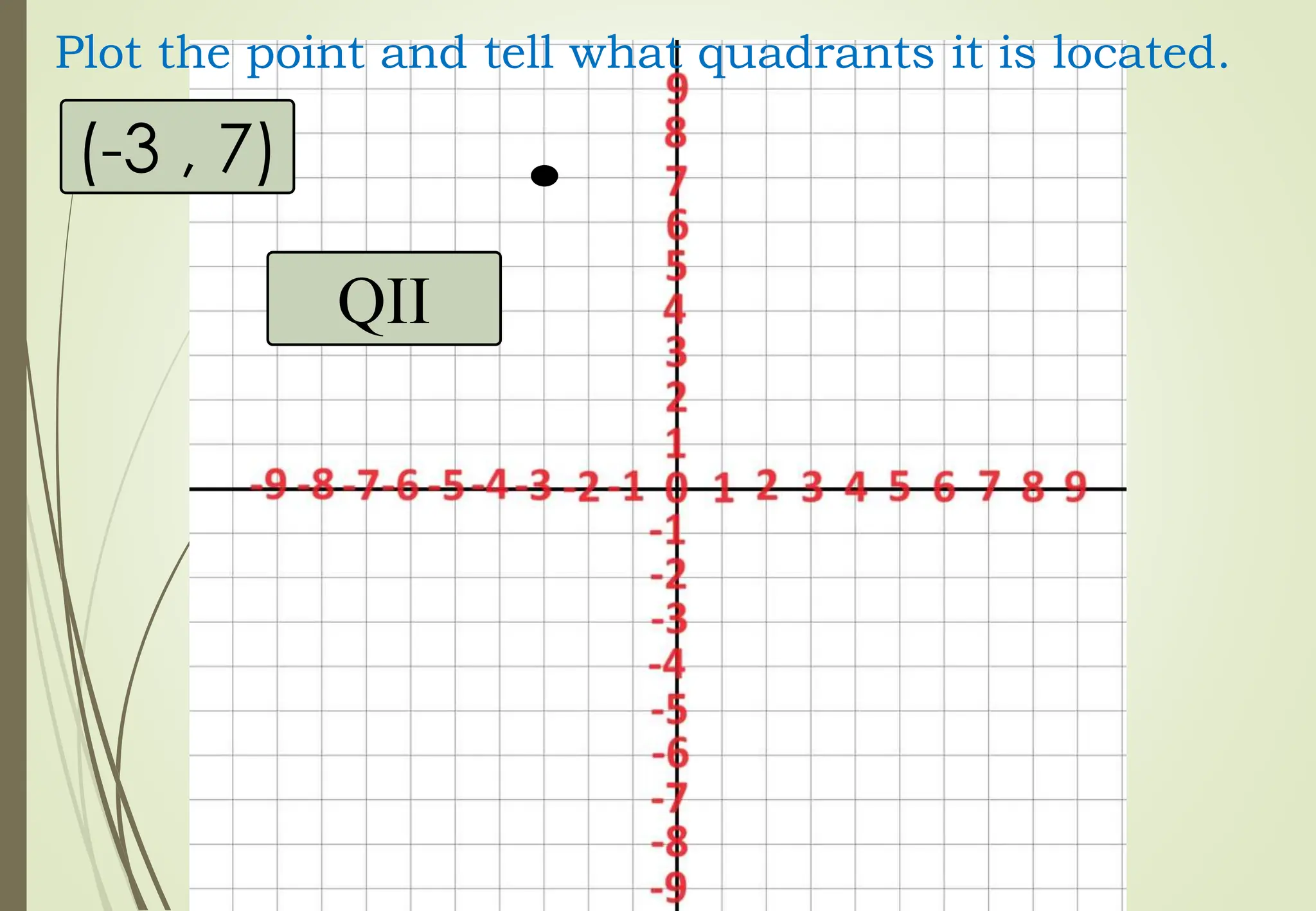
(-3 , 7)
Plotthe point and tell what quadrants it is located.
QII
17.
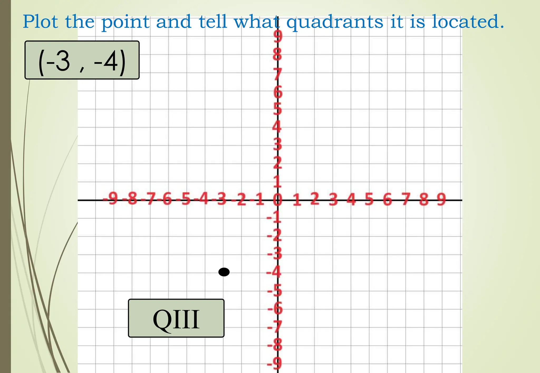
(-3 , -4)
Plotthe point and tell what quadrants it is located.
QIII
18.
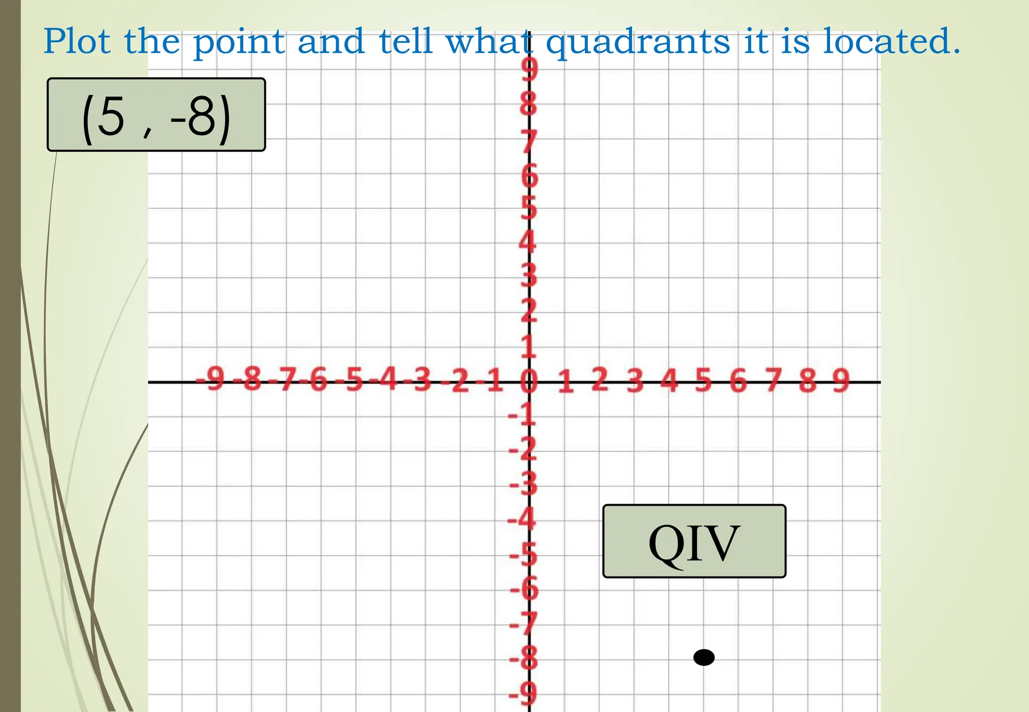
(5 , -8)
Plotthe point and tell what quadrants it is located.
QIV
19.
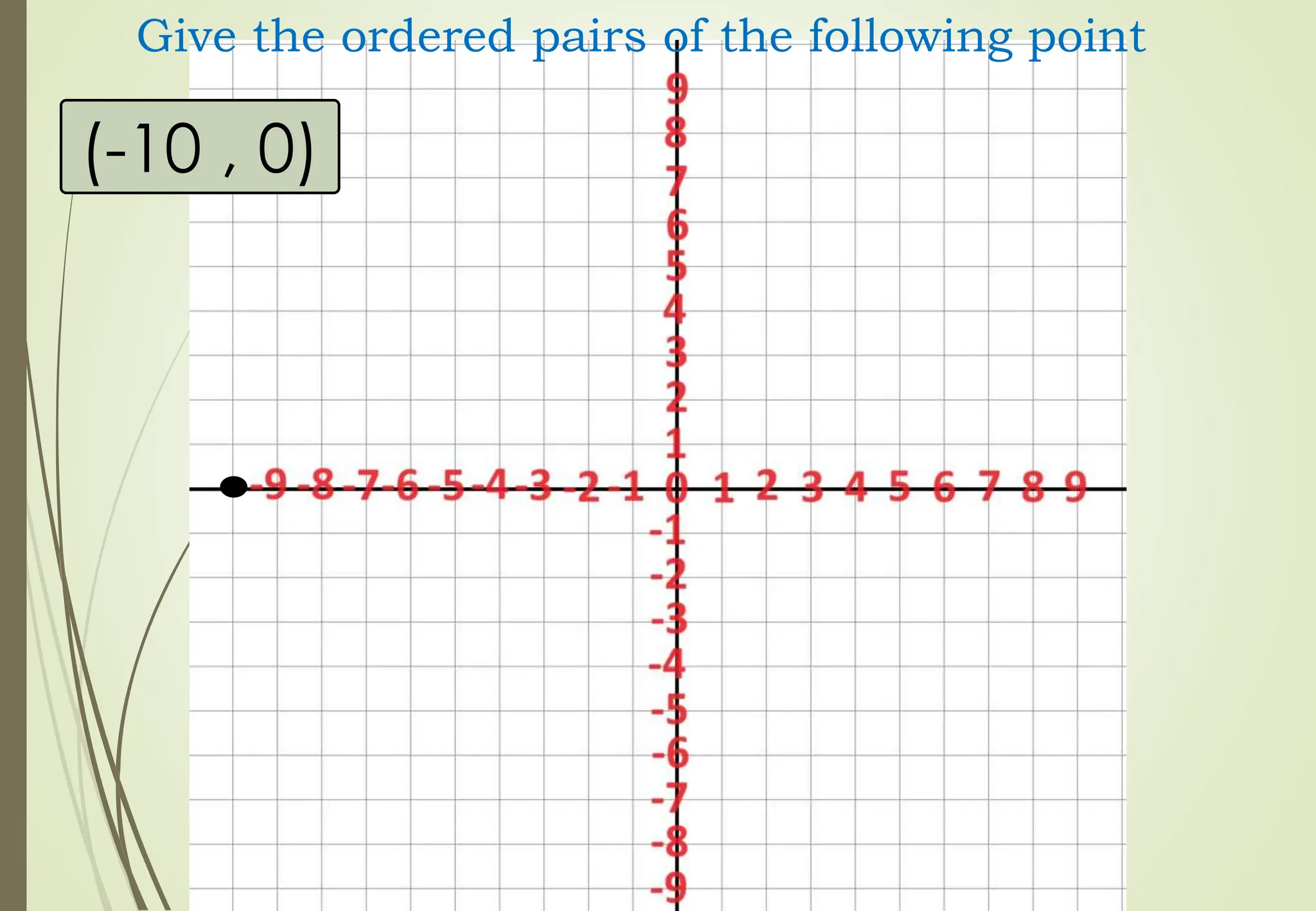
(6 , 0)
Plotthe point and tell what quadrants it is located.
x-axis
20.
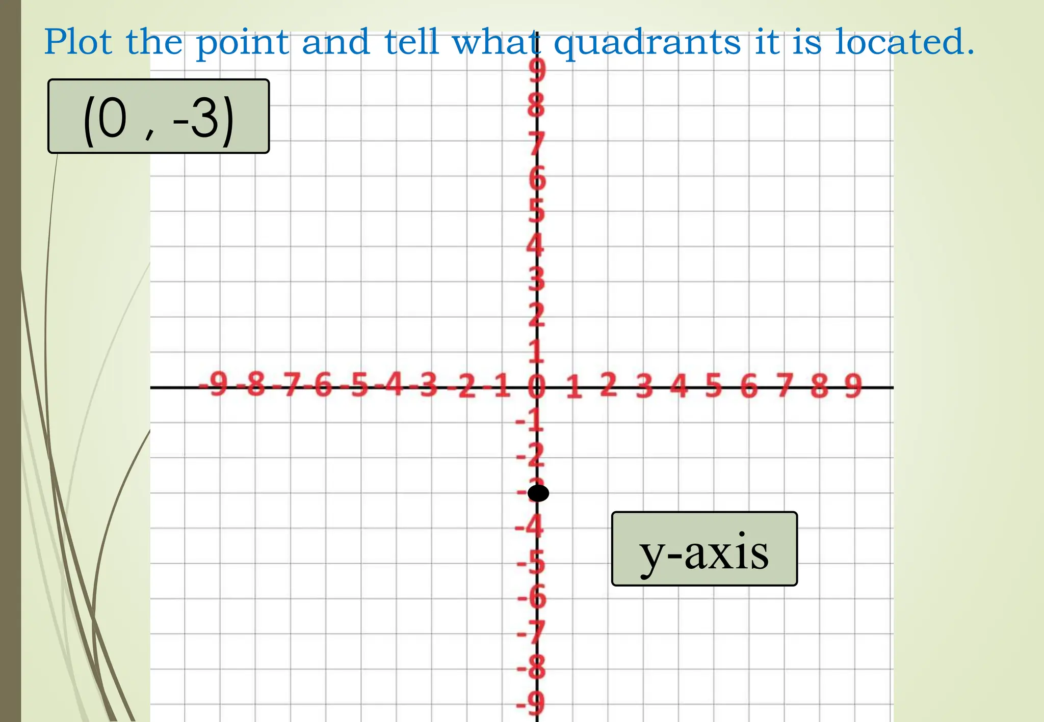
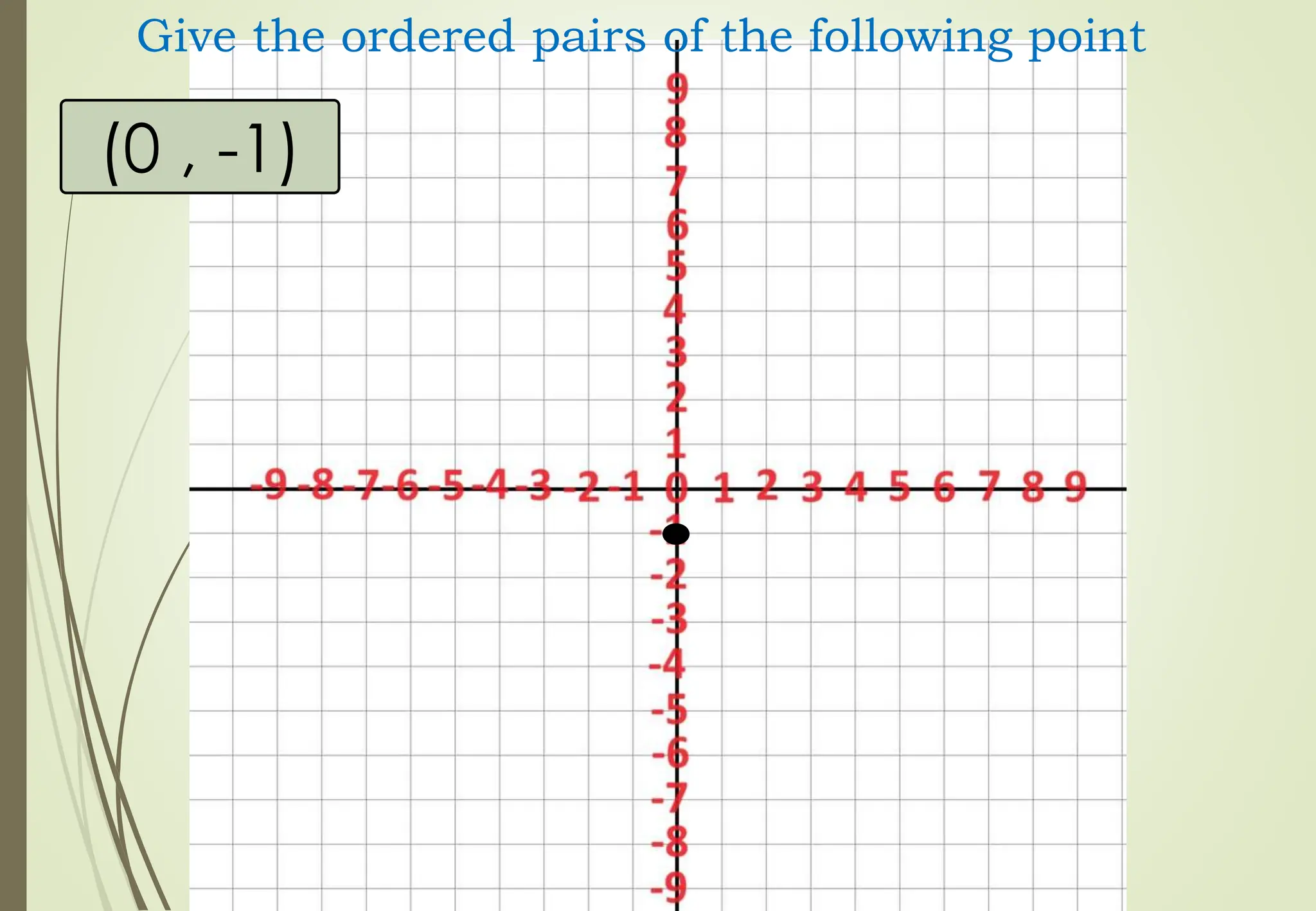
(0 , -3)
Plotthe point and tell what quadrants it is located.
y-axis
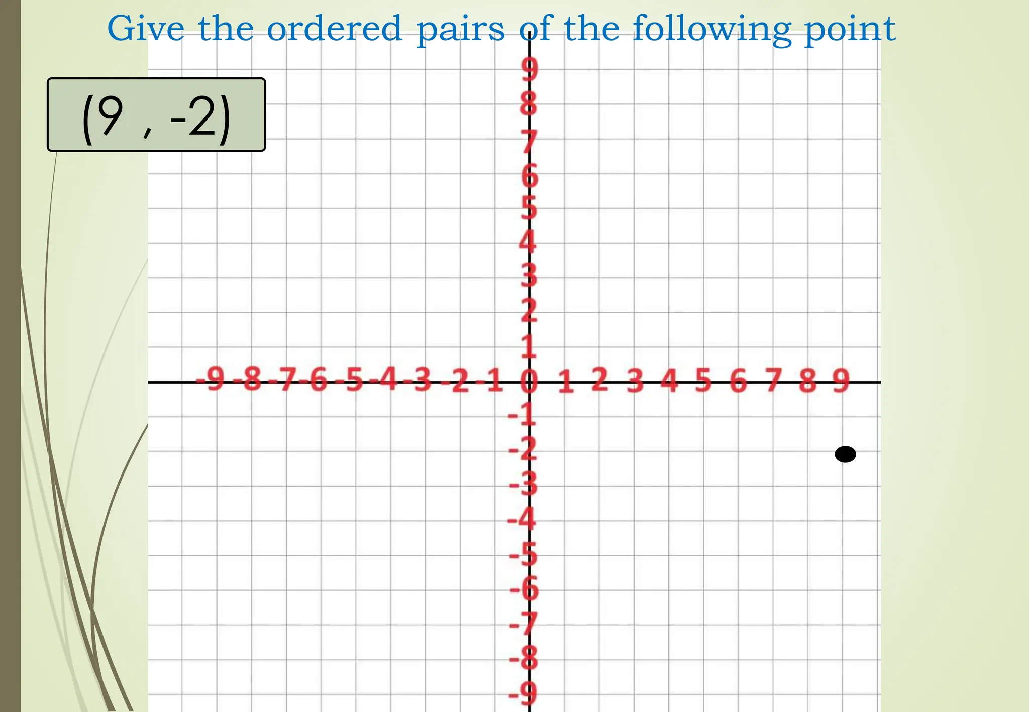
21.
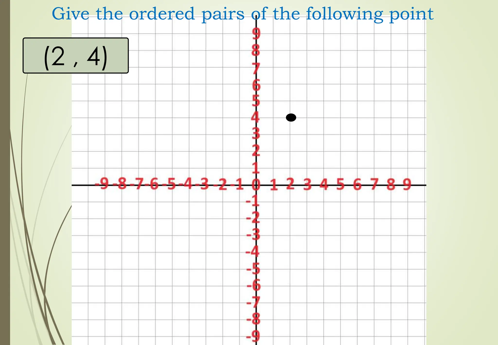
(2 , 4)
Givethe ordered pairs of the following point
22.
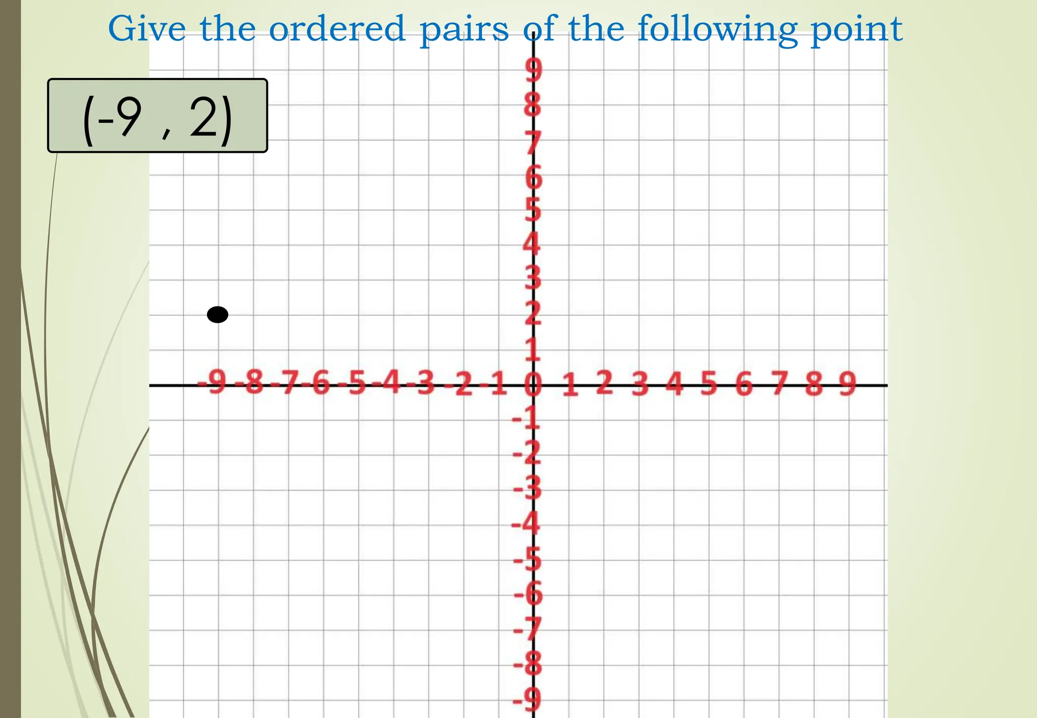
(-9 , 2)
Givethe ordered pairs of the following point
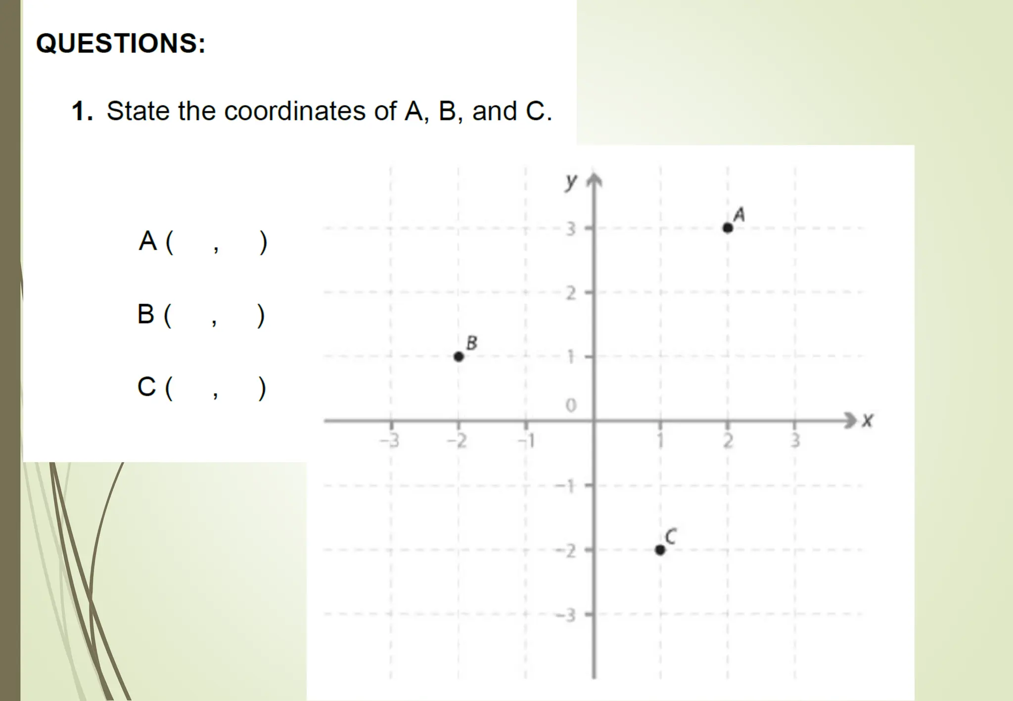
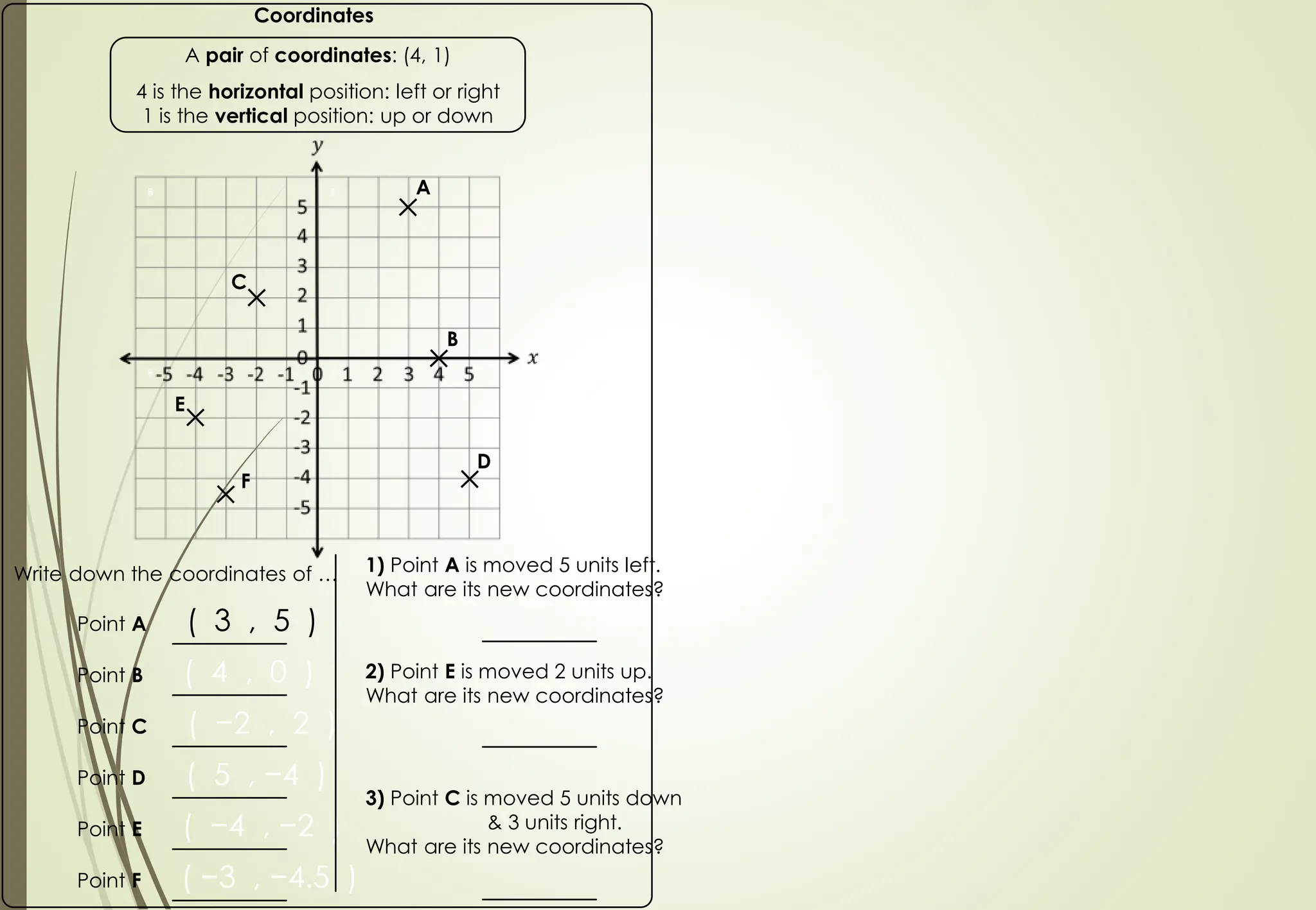
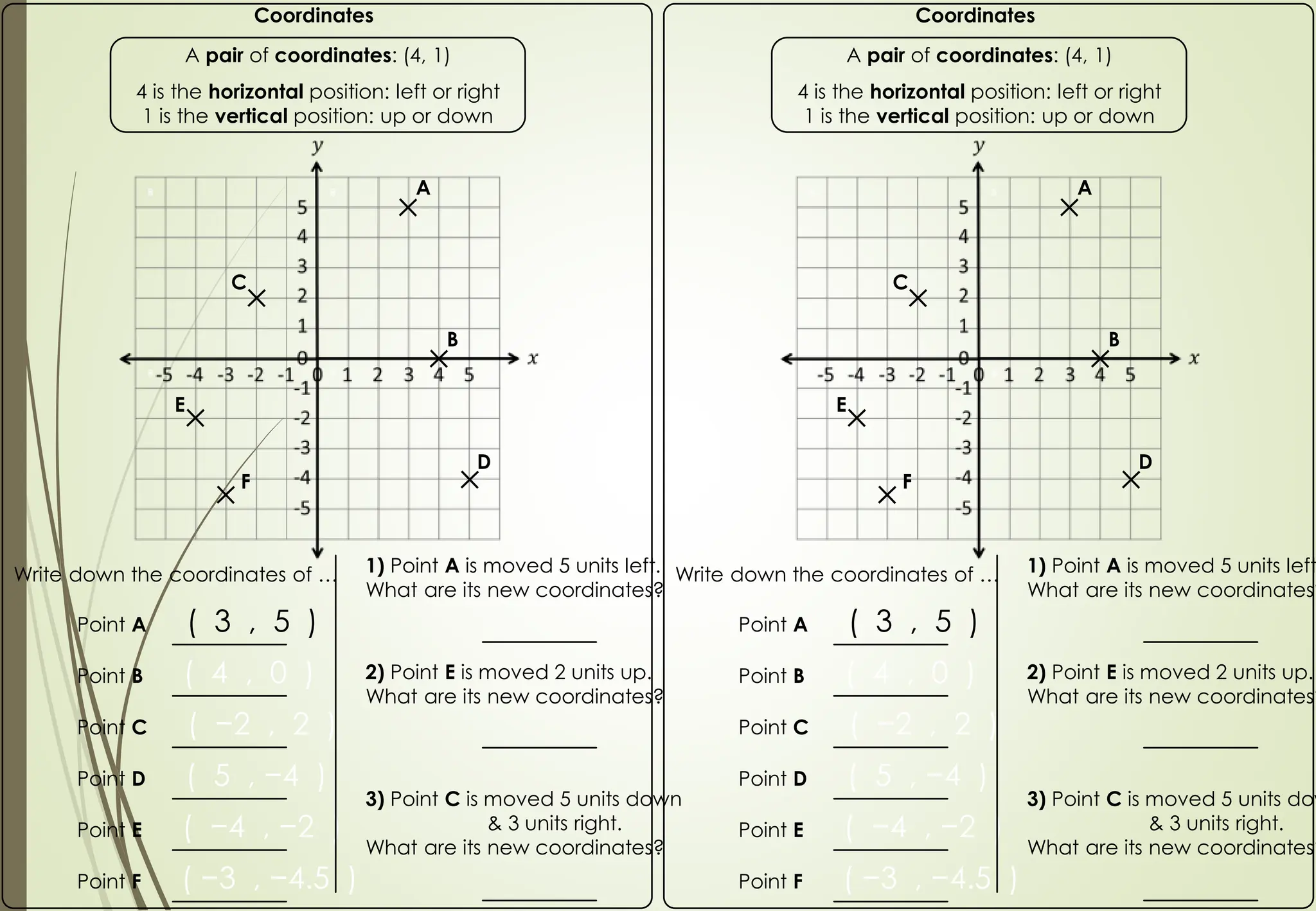
Write down thecoordinates of …
Coordinates
A pair of coordinates: (4, 1)
4 is the horizontal position: left or right
1 is the vertical position: up or down
Point A ( 3 , 5 )
Point B ( 4 , 0 )
Point D ( 5 , −4 )
Point C ( −2 , 2 )
Point E ( −4 , −2 )
Point F ( −3 , −4.5 )
1) Point A is moved 5 units left.
What are its new coordinates?
2) Point E is moved 2 units up.
What are its new coordinates?
3) Point C is moved 5 units down
& 3 units right.
What are its new coordinates?
A
B
C
D
E
F
40.
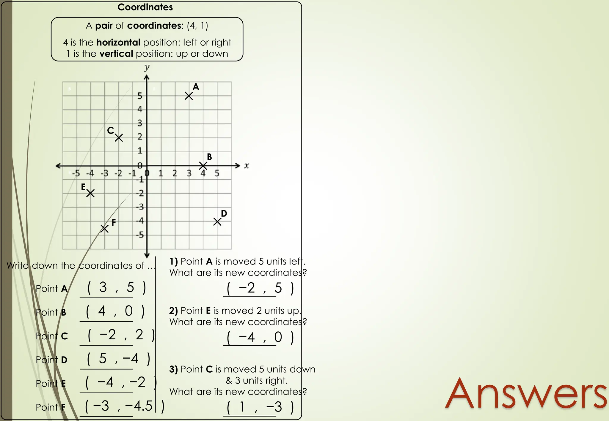
Write down thecoordinates of …
Coordinates
A pair of coordinates: (4, 1)
4 is the horizontal position: left or right
1 is the vertical position: up or down
Point A ( 3 , 5 )
Point B ( 4 , 0 )
Point D ( 5 , −4 )
Point C ( −2 , 2 )
Point E ( −4 , −2 )
Point F ( −3 , −4.5 )
1) Point A is moved 5 units left.
What are its new coordinates?
( −2 , 5 )
2) Point E is moved 2 units up.
What are its new coordinates?
( −4 , 0 )
3) Point C is moved 5 units down
& 3 units right.
What are its new coordinates?
( 1 , −3 )
A
B
C
D
E
F
Answers
41.
Write down thecoordinates of …
Coordinates
A pair of coordinates: (4, 1)
4 is the horizontal position: left or right
1 is the vertical position: up or down
Point A ( 3 , 5 )
Point B ( 4 , 0 )
Point D ( 5 , −4 )
Point C ( −2 , 2 )
Point E ( −4 , −2 )
Point F ( −3 , −4.5 )
1) Point A is moved 5 units left.
What are its new coordinates?
2) Point E is moved 2 units up.
What are its new coordinates?
3) Point C is moved 5 units down
& 3 units right.
What are its new coordinates?
A
B
C
D
E
F
Write down the coordinates of …
Coordinates
A pair of coordinates: (4, 1)
4 is the horizontal position: left or right
1 is the vertical position: up or down
Point A ( 3 , 5 )
Point B ( 4 , 0 )
Point D ( 5 , −4 )
Point C ( −2 , 2 )
Point E ( −4 , −2 )
Point F ( −3 , −4.5 )
1) Point A is moved 5 units left
What are its new coordinates?
2) Point E is moved 2 units up.
What are its new coordinates?
3) Point C is moved 5 units dow
& 3 units right.
What are its new coordinates?
A
B
C
D
E
F