applications of rs and gis in solid waste management
•Download as PPTX, PDF•
37 likes•13,557 views

this presentation will show you how GIS can be used as decision supporting tool for Solid waste management

Recommended
Recommended
More Related Content
What's hot
What's hot (20)
Viewers also liked
Viewers also liked (20)
Similar to applications of rs and gis in solid waste management
Similar to applications of rs and gis in solid waste management (20)
Recently uploaded
Recently uploaded (20)
applications of rs and gis in solid waste management
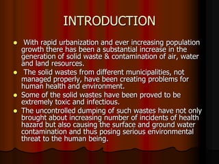
- 1. INTRODUCTION With rapid urbanization and ever increasing population growth there has been a substantial increase in the generation of solid waste & contamination of air, water and land resources. The solid wastes from different municipalities, not managed properly, have been creating problems for human health and environment. Some of the solid wastes have been proved to be extremely toxic and infectious. The uncontrolled dumping of such wastes have not only brought about increasing number of incidents of health hazard but also causing the surface and ground water contamination and thus posing serious environmental threat to the human being.
- 2. The present study would deal with, how Geographical Information System (GIS) and Remote sensing techniques can be used as a decision support tool for planning waste management.
- 3. Source of information The Greater Visakhapatnam Municipal Corporation ward boundary map from Town Planning Department of GVMC. Assessment of the existing solid waste management system in the study area through interview with the employee working with waste management, survey conducted through the questionnaire to the case study area residents, Survey Of India Toposheet of the Study Area Satellite Image The other various information was collected through online source.
- 4. Scope The efficiency of solid waste disposal depends upon selection of proper site and there are several issues that have impacts for site selection. The two main reasons for undertaking the present study are rapid growth in population and urban sprawl leading to an increase in the amount of waste generated. The scope of the work is to use the latest techniques of GIS and Remote Sensing to select a favorable site for solid waste disposal in urban area like Visakhapatnam.
- 5. Objectives To study the existing system of storage, collection, transportation, treatment and disposal of MSW in the Study Area, Visakhapatnam City. Quantitative assessment of solid wastes generated from different sectors in the study area. To create spatial digital database consisting of base map, land use/ land cover, drainage, road network maps with the help of merged product of LISS III & PAN of IRS-1D, SOI toposheets and ground data on ARC/INFO GIS platform. To select a site where the greatest protection of environment is provided using the latest techniques of GIS and Remote Sensing
- 6. Study Area The present study entitled “USE OF GIS IN IDENTIFICATION OF SUITABLE SITE FOR LANDFILL IN VISAKHAPATNAM” was carried out in Visakhapatnam, “the city of destiny”.
- 7. Map showing study area
- 8. LAND USE DETAILS OF VISAKHAPATNAM CITY Land Use Area, Ha Percentage to total Residential 4027.78 53.75 Commercial 99.48 1.34 Industrial 163.40 2.18 Transportation 550.20 7.34 Recreational 582.38 7.77 Water Courses 158.91 2.12 Restricted Area 130.00 1.73 Agricultural 719.85 9.61 Public and Semi-Public 662.50 8.84 Vacant Land 398.72 5.32 Total 7493.20 100.00
- 9. CHART SHOWING LANDUSE DETAILS OF VISAKHAPATNAM CITY Land Use Of Visakhpatnam City Public & SemiVacant Land, 5% Public, 9% Residential Commercial Industrial Agricultural, 10% Transportation Restricted Area, 2% Water Courses, 2% Recreational Residential, 54% Water Courses Restricted Area Recreational, 8% Agricultural Public & Semi-Public Transportation, 7% Industrial , 2% Commercial, 1% Vacant Land
- 10. Contribution of GIS in SWM There are several phases in solid waste management, right from the stage where it is generated till it reaches its final destination or at a stage where it is no more a threat to the environment. It is observed that solid waste management can be bifurcated into mainly two phases. One is the waste management in the area where it is generated and second is the management of waste at dumping
- 11. GIS could help in dealing with several factors simultaneously which needs to be considered while planning waste management. “GIS is a system of computer hardware and software, designed to allow users to collect, manage, analyse and retrieve large volume of spatially referenced data and associated attribute data collected from a variety of sources.”
- 12. Thus, the purpose of this paper is to demonstrate the use of GIS and remote sensing techniques to identify appropriate areas which are suitable for reasonable, convenient, and administratively transparent waste-disposal siting in Visakhapatnam.
- 13. Functional elements Solid waste Managem ent Waste Generation W aste handling, S eperation S torag e Collection Separation P rocessing Tran sfer and tran sport Disposal
- 14. WASTE GENERATION – MATERIAL BALANCE INFLOW STORED MATERIAL (raw material, products, solid waste) OUTFLOW OUT FLOW: Materials, products, Solid wastes, Combustion gases and ashes
- 15. ON-SITE HANDLING Handling of solid waste until they are placed in the containers used for their storage before collection Domestic Solid Waste Commercial and Industrial Solid Waste
- 16. ON-SITE STORAGE a) Types of containers b) Container location c) Public Health & aesthetics d) Collection method ON-SITE PROCESSING a) Recover usable material : Manual sorting b) Reduce the volume : Compaction c) Alter the physical form : Incineration
- 17. Waste storage Providing the system of waste storage on the road side the major activity Primary Waste Storage facilities are made available by GVMC along streets and near commercial complexes. In addition, shopkeepers at a few commercial complexes provide bins for public use. GVMC has about 598 dumper placer container for storage of waste
- 18. DISTRIBUTION OF DUMPER PLACER CONTAINERS BY ZONE ZONE NUMBER 1 DUMPER PLACER CONTAINER 19 2 3 180 4 146 5 55 6 TOTAL 170 28 598
- 20. Collection and transportation Primary collection Secondary collection
- 21. Primary Waste Collection Primary waste collection is the important essential step of solid waste management activity. Primary collection system is necessary to ensure that the waste stored at source is collected regularly and it is not disposed of on the streets, drains, water bodies, etc. The collection of solid waste from the door to door households, shops, and establishment is called primary collection. GVMC has provided Pushcarts (6 tubs), Tricycles to collect the solid waste from the households, commercial establishments etc
- 23. Secondary collection collection of solid waste for the second time, i.e. from community collection points, prior to its transport (often as part of a collection round by larger vehicles) to a transfer station, treatment facility or disposal site.
- 25. WASTE TRANSPORT Transportation of waste stored at waste storage depots at regular intervals is essential. The collection and transportation of waste is practiced on all the days of the year including the public holidays. In GVMC, waste stored in open spaces is either loaded manually or with the help of loaders in trucks. The vehicles involved in the solid waste transportation in Visakhapatnam include dumper placers, tractors, mini vans, tippers (big & small). Dumper placers will carry the bin and unload the waste at the transfer station and will perform on an average of 12 trips per day. Mini tippers transport the waste from the open secondary collection points to transfer stations.
- 26. VEHICLE S AVAILABLE FOR TRANSPORTATION OF MSW IN VISAKHAPATNAM Types of Vehicles Number 1 Dumper Placer Vehicle 43 2 Big Tipper 10 3 Mini Tipper 2 4 Tractors 1 5 Dead Body Van 1 6 Vans 13 S. No Vehicles at Disposal Site 1 JCB 3 2 Bull Dozer 1
- 28. Mini Tipper
- 29. Big Tipper
- 30. TRANSFER STATION Being Visakhapatnam is the big city and waste generation is more and the disposal site is far from the city, transfer station is established to transfer the waste from dumper placers and trucks. The transfer station is located at town road. The collection vehicle like dumper placers, tippers and tractors will pick up the waste from the secondary open collection points and dumper bins and transfer the waste directly in transfer stations. A ramp facility is also provided to facilitate unloading of vehicles or dumper placer containers, directly into large containers at transfer station. Waste is weighed at Weigh Bridge at the entrance gate, a record is being maintained for in time, out time, weight of the solid waste disposing in to the transfer station and vehicle number. The big tipper (20 ton capacity) transport the waste to disposal site located at Kapuluppada which is 25kms away from the city.
- 31. Weigh Bridge
- 33. TRANSFER STATION
- 35. DISPOSAL OF WASTE Currently, the city disposes all of their waste at a Kapuluppada disposal site. This site is operating for the last 5 years with 100 acres. 3 JCB and 1 bulldozer are employed at GVMC for solid waste management, including the operation of the waste disposal site. The existing waste disposal site is a dumpsite with no leachate collection and treatment system and does not meet the current requirements of the MSW 2000 Rules. Open burning of waste, indiscriminate disposal, presence of stray animal & rag pickers at the disposal site and leachate migration into the river are common occurrences.
- 37. COMPOSTING Composting: The controlled biological decomposition of organic matter, such as food and yard wastes, into humus, a soillike material. Composting is nature's way of recycling organic wastes into new soil
- 38. BENEFITS OF COMPOSTING Keeps organic wastes out of landfills. Provides nutrients to the soil. Increases beneficial soil organisms (e.g., worms). Suppresses certain plant diseases. Reduces the need for fertilizers and pesticides. Protects soils from erosion. Assists pollution remediation.
- 42. Composting Beds
- 46. DETAILS OF RECYCLABLES S. N0 Category 1. plastics Waste generation in kg per month 150-180 2. milkcover 250-300 3. cardboard 350 4. Broken glasses 1000 5. Mica papers 1000 6. Waste papers 2500 7. iron 50-60 8. Tube lights 400-500no/month 9. aluminum 1-2 10. Blubs 400-500 no/month
- 47. TOTAL WASTE GENERATED s.no Type of waste Waste Percentage waste generated(tons/day) compostion 1. Domestic house hold waste 464.00 62.87 2. Commercial Establishments waste 36.00 4.87 3. Hotels & Restaurants 16.79 2.27 4. Institutional waste 3.94 054 5. Parks & Gardens 4.50 0.60 6. Street sweeping waste 61.08 8.28 7. Waste from Drains 63.28 8.58 8. Markets 60.00 8.10 9. Temples 2.24 0.30
- 48. 8. 9. 10. 11. 12. 13. Drains Markets Temples Chicken, Mutton, Beef. Fish stalls Slaughter houses Cinema halls Function halls Total Waste 60.00 2.24 8.10 0.30 4.91 0.67 2.40 0.35 0.22 18.60 738 0.04 2.53 100
- 49. SOURCES OF WASTE GENERATION IN VISAKHAPATNAM
- 50. Solid Waste Site Selection Criteria A number of essential factors are considered in locating landfill sites. Such factors include both physical and social environments. The essential factors: Topography, Climate, Surface and Ground Water Hydrology, Geology, Cover material (Land Cover), and Land Uses. Due to data constraints, we used Topography, Surface hydrology, Existing settlements, Sensitive area and Land development (Roads etc.) of the area as guides to site selection.
- 51. Landfill criteria Must not be located within 160 meters of a wetland Must not be located within 160 meters of a sensitive area. Must not be located within 200 meters of an existing waste site. Must not be located within 1000 meters of an existing settlement. Must be located within 300 meters of major road. No landfill should be constructed within critical habitat area. No landfill should be constructed within 3048 m(10,000 ft) of any airport. Not be located on or within 500 m of sites of historic importance.
- 52. WASTE DISPOSAL LAND FILLING Process by which residual solid waste is placed in a landfill LAND FORMING Biological, chemical, and physical processes that occur in the surface of the soil are used to treat the biodegradable industrial wastes DEEP WELL INJECTION Injection of the wastes deep in the ground into permeable rock formation or underground caverns.
- 53. WASTE DISPOSAL- LANDFILL LAND FILLING involves the controlled disposal of solid waste on or in the upper layer of the earth’s mantle. TYPES OF LANDFILLS Sanitary Landfill Engineered Landfill Secured Landfill
- 54. WASTE DISPOSAL- LANDFILL CELL is used to describe the volume of material placed in a landfill during one operating period, usually one day LIFT a complete layer of cells over the active area of the landfill Landfills for Municipal Solid Waste Milled waste Monofills Fills for gas production
- 55. LANDFILLS METHODS Excavated Cell or Trench method Area or Mound method Canyon/Depression method
- 56. Excavated Cell or Trench Method Suitable to areas where: Adequate depth of cover material is available at the site The water table is not near the surface Typical trench: 60 to 300 m x 5 to 20 m x 1 m; SS: 1.5 to 2:1
- 57. Trench landfill
- 58. Area Method Suitable to areas where: The terrain is hard to excavate High ground water table Haul the cover material from other borrow pits nearby Leachate control system is necessary
- 59. Mound landfill
- 60. Canyon or Depression Method Suitability: When canyons, dry borrow pits, quarries, mine pits or holes, natural depressions are available Cost of surface drainage Availability and haul distances of the cover material
- 62. LANDFILLS- DESIGN Land requirement Types of wastes handled Evaluation of seepage potential Drainage and seepage control facilities Leachate management plan Gas collection system Solid waste filling plan Development of operation plan Equipment requirements
- 63. Methodology The figure demonstrates the methodology adopted for the use of GIS in identification of landfill in the study area. The flow of the model indicates the different steps carried in the methodology.
- 65. STUDY AREA
- 66. STUDY AREA
- 67. BUFFERS
- 68. Major Roads
- 69. Major Roads (300 m Buffer)
- 71. Endangered Areas
- 72. Endangered Areas (500 m Buffer)
- 73. Sensitive Areas
- 74. Sensitive Areas (160 m Buffer)
- 76. Residential Areas (1000 m Buffer)
- 77. Wet Lands
- 78. Wet Lands (160 m Buffer)
- 79. ALL Buffers
- 80. Proposed & Existing Sites
- 81. Software Used 81 Monday, February 03, 2014
- 82. Software Used 82 Monday, February 03, 2014