Download to read offline

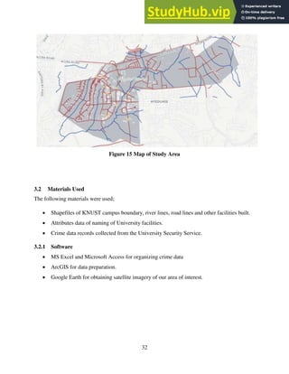
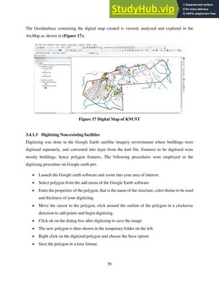

The document presents a project report on developing an updated digital locator map of Kwame Nkrumah University of Science and Technology (KNUST) campus using GIS. The project involved collecting spatial data on campus facilities, creating a geodatabase, digitizing features, geocoding addresses, and performing network and crime analysis. An online map was published using ArcGIS Online and a web application was built using ArcGIS Web AppBuilder to provide an optimized map interface for mobile devices. The updated digital KNUST campus map provides easy navigation and access to information on campus buildings and routes.