
Recommended
More Related Content
What's hot
What's hot (20)
Viewers also liked
Viewers also liked (13)
Similar to WSP N14 Rehabilitation Project Survey
Similar to WSP N14 Rehabilitation Project Survey (20)
WSP N14 Rehabilitation Project Survey
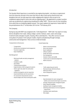
- 1. Bavik Prithiraj Sing 533948 Introduction The Vacation Work Experience is essential for any engineering student , not only as a requirement from the University, but also in the sense that they are able to pick up key characteristics and disciplines that one can only experience while engaging with engineers that are part of an established engineering firm and in-line with an ongoing project . My application to conduct vacation work was accepted by an engineering consulting firm called “WSP”. They are one of a few consulting firms which have an established global network. This report explains the experience I had at WSP for the period between the 2nd of December 2013 to the 7th of February 2014. The Company During my stay with WSP I was assigned to the “Civils Department”. “WSP Civils” has experts in many diverse disciplines from roads, railway, bridges, tunnels, harbours, dams, water and sewage treatment works and pipes to parks, housing, offices and industries. They offer services to cover every phase of a project, from early pre-studies, inquiries and planning through to design, construction and management. These services rendered include: Transportation & Infrastructure · Transportation · Infrastructure development and management · Pavement engineering · Road rehabilitation Risk Management · Web-based health and safety management solutions · Compliance audits · Gap analysis · Training and presentations · Implementation of SHE management systems · Clients' agent role under the construction regulations · Incident investigations and site inspections · Hazard identification and risk assessments · Fire assessment and protection services · Hazard analysis and critical control points audits Coastal Engineering · Marine environmental data · Rivers and estuaries · Beach stabilisation · Offshore facilities · Small craft harbours and marinas · Port development · Seawater intakes and outfalls · Tourism and recreational developments · Marine structures Systems · Traffic engineering and control · Road sign design unlimited software · R&W sign software · Asset management systems Waste Management · Operational plans for waste management facilities and environmental impact assessments · Strategic integrated waste management plans · Waste disposal modelling · Auditing of waste management facilities · Obtaining authorisations in terms of legislative requirements · Hazardous waste classification · Risk analysis
- 2. Bavik Prithiraj Sing 533948 The Project : Gautrans N14 Rehabilitation Project Upon arrival I was given the opportunity to assist with the initial survey of the N14 National Highway Rehabilitation project. Over the years the N14 has been used by commuters between Johannesburg and Pretoria on a daily basis. Since it was completed in the 1960’s and 1970’s the highway has not gone under any major maintenance work. In collaboration with that, the other reason behind this project and the reason why the client “Gautrans” had initiated it is because due to the addition of the infamous “e-toll” system, many motorists have deviated from the normal “e-toll” route and the capacity on the N14 has started to pick up dramatically. There is a tight schedule as per the timeline of this project. The construction should take no longer than 18 months to complete, hence all initial surveying and data capturing needs to be completed as soon as possible to avoid a delay in the project. The detailed expansion of the timeline can be found by referring to Appendix A. Work Completed According to standard WSP Road rehabilitation procedure, we were first assigned to mark of the site in which we were allowed to work on. In this project we were allowed to survey the area from km 0, (which starts in Pretoria), to km 38.5 (which is +/- 15km from Diepsloot). During this time we made markings on the road in increments of 200m and had tagged these markings with geographical way points. This was done for both East and West bound Carriage ways. The reason for us tagging these points is so that we know exactly where each marking is when using programs such as “Google Earth” and “Garmin Basecamp”. The first major component to survey is the existing drainage systems. We had to walk on foot the entire 38.5km stretch and take photos of the; cross culverts, manholes, down chutes, major culverts, kerbs, sub soil drainage and bergs. Along with this we were given a GPS tracking device, which when we got back to the office we should use to geo-tag all the pictures we had taken out, using a program known as “Photomapper”. From this we were able to precisely see where each photo was taken on a map of the area. The normal routine we had followed each day when conducting the drainage survey was as follows; we would go to site each morning till about 13:00, after an hour lunch we would start the data capturing and geo-tagging of the pictures. This included commenting on the state of the various features, what we recommend to be done, the kilometre distance of the feature, and finally we had to identify the length of the problem. The engineer in charge of me (Kyle Nesbitt), told me the importance of this task as it had to be done accurately because he was going to use this information to draw up a bill of quantities (this applied to all components of the road). This task had taken the most time as it involved a lot of walking in dense vegetation cover and most features were hard to get to because of this. Entire spread sheet illustrated in Appendix B.
- 3. Bavik Prithiraj Sing 533948 Once that was completed, we were given the task to conduct a survey on the road signs. Again we took pictures of all the road signs and had geo-tagged them when we got to the office. The data capturing included the following; the kilometre distance, we had to find the date of the sign, the type of sign (this was according to standard regulations), the support type and lastly we had to comment on the condition of the sign. Both East and West bound collected data is illustrated in Appendix C & D respectively. The last site work task we had to complete was the survey on the guard rails. Like the previous two site tasks we were equipped with a camera and a GPS tracking device which we would use to geo-tag the images we had just taken. It was of vital importance that all guard rails are at supreme quality and up to code at all times due to the safety it provides to the road user. To conduct the full assessment of the guard rails we had completed it in two stages. The first stage included the actual N14 road. We drove straight along the N14 and took photos of all guard rails on both east and west carriage ways. The second stage included all on and off ramps of each intersection. During the data capturing part we had to find the following: the start and end kilometre distance of the guardrail, the length of the guard rail, and we had to comment on the condition of the guard rail. When commenting we paid special attention to the stump condition, the actual guardrail condition, whether there were any missing bolts and lastly if there was a sufficient amount of reflective chevrons on the guardrail. The data collected illustrated in Appendix E. In the final weeks of my stay at WSP, I was predominately based at the Bryanston head office, in which all data capturing for the existing drainage system, road signs and guard rails were finalised, and ready to be attached to the head engineers design report. In addition to this, I was given the task to conduct a weather and climate report on the area in which the N14 passes through. This involved rain weather patterns, average temperatures etc. The report can be found in Appendix F. Upon road rehabilitations, WSP protocol dictates that a range of road material tests need to be conducted on the subsurface of the road. The company called in to do this testing is “Roadlab”. They conducted the tests and sent back the results to WSP offices, in which I had to take the raw data and input it into an excel spread sheet whereby the engineer can look at and determine the strength of the road, what is left in the roads lifespan and can determine how much of additional work is needed to this particular stretch of road. The first spreadsheet completed was one for the CBR value (California Bearing Ratio) vs the kilometre distance. The completed spread sheet can be found in Appendix G. The next set of data I needed to extract was the “Profiling data”, which basically is a test conducted to see what type of rock is under the road. These different types of rock are arranged in layers beneath the surface and all contribute to the strength of the road. The spreadsheet illustrated in Appendix H. As per any design report, an appendix with all features needed to be attached. The head engineer assigned me to compile a document with all the major problems found on the road in the sector I had data captured. This included finding the pictures, state why these were extreme cases and give the correct location of it. (Due to the classified nature of this appendix, I could not gain permission to add it into my report) The final task that I was asked to do, was to go on site, and at each intersection I was supposed to measure the width of each lane including the median. This was done to see if there weren’t any
- 4. Bavik Prithiraj Sing 533948 errors made when the lengths were initially taken. Comments Apart from gaining practical knowledge about how to gather information and use the collected data, I had learnt the processes involved, from tender hand in to project hand over. As a result I would like to not only thank WSP for accommodating me, but also a word of appreciation to the School of Civil and Environmental Engineering, for giving us the opportunity to go out of class and gain skills and mind sets that no book could teach us. Personally I feel that I know much more about the course I’m doing and feel motivated to get through to it. What lies ahead in the working environment truly is something that any future civil engineer should be excited for. When speaking to people that have passed the schooling part of their lives and are in the place where you see yourself in couple of years’ time is a true motivation. I appreciate the fact that I was placed in a project from the early stages of it. This experience has made me truly appreciate how important the small details are in a big project like this. I can only wish that I had more time to see this entire project through. Due to the fact that I was involved in a roads project, I was able to notice much more things about the road that users of it just don’t, and as a result I have a new sense of respect towards it. What intrigued me the most was how deep our roads penetrate the ground and the importance of each layer that goes in to making a road capable of handling the intense pressure exerted on it. Due to technological advancements over the years, engineering has become a lot more advanced as well and as a results I have gained experience in using software programs such as; “Basecamp”, “Photomapper”, “Picasa”, “ Google Earth” and “Sketchbook”. All of which were of vital importance to getting the task received complete. As a result I have gained knowledge in using these sort of programmes and can apply to make things easier and more accurate in my third year at Wits. References: · http://intranet.wspgroup.com/en-GB/Africa-Root/Africa/Marketing/Civils/Business-Overview/Services-and-Disciplines/