SlideShare a Scribd company logo
1 of 42
Download to read offline
1
Shanks
Inertial Navigation
&
Global Positioning System
Inertial Navigation
&
Global Positioning System
By Shankar NarayanBy Shankar Narayan
1
Aircraft Navigation
Inertial Navigation
&
Global Positioning System
Inertial Navigation
&
Global Positioning System
Flow of presentation
11 What is Navigation
22 Inertial Navigation System Concepts
33 The Ring Laser Gyro
44 GPS Concepts & Introduction to GPS
55 How GPS Works?
2
29th August 2009
NavigationNavigation
Navigation is the art of guiding oneself to one’s
desired Destination
For Navigation You need to Know your position
at any instant of time!
3Shanks
Shanks
January 23, 2017
Inertial Navigation SystemInertial Navigation System
Presented by
Shankar Narayan
INS conceptsINS concepts
3
January 23, 2017
What is an Inertial Navigation System
(INS)?
• Every object that is free to move in space has six
"degrees of freedom" - or ways it can move.
• There are three linear degrees of freedom (x,y,z) that
specify your position and three rotational degrees of
freedom (theta (pitch), psi (yaw), and phi (roll)) that
specify your attitude.
• If you know these six variables, you know where you are
and which way you're pointed
Inertia – inertness, property by which matter continues in existing state of rest
Or uniform motion, unless acted on by external force
Attitude
• Yaw
• Roll
• Pitch
4
January 23, 2017
•
The six parameters of freedom
A body's actual spatial behavior / movement can be
described with three translatory and three rotary
components.
• : three translatory (x-, y-, z-acceleration) and three rotatory
components (x-, y-, z-angular velocity)
January 23, 2017
Inertial Navigation is accomplished by
integrating the output of a set of sensors
to compute position, velocity, and attitude.
The sensors used are:
1. Gyros
2. Accelerometers.
Inertial NavigationInertial Navigation
5
January 23, 2017
INS
• The present Inertial Navigation uses 'solid state' systems
consists of expensive laser-gyros and integrated sensor
devices (accelerometers) in MEMS technology (Micro
Electro-Mechanical System).
• Inertial navigation systems (INS) are used in civil and
military aviation, cruise missiles, submarines and space
technology.
January 23, 2017
What is inertial Measurement Unit?
• An inertial measurement unit, or IMU, is a "clump" of six
inertial sensors. Three linear accelerometers and three
rate gyros make up our IMU. Usually, an IMU also
contains a computational unit to do the position
calculations based off of the sensors
6
Shanks
January 23, 2017
LASER
GENERAL INFORMATION
January 23, 2017
LASER
• LIGHT
• AMPLIFICATION BY
• STIMULATED
• EMISSION OF
• RADIATION
STIMULATE = EXITE
• LASER IS A COHERENT SOURCE OF LIGHT
• LASER LIGHT IS MORE DIRECTIONAL, MORE MONOCHROMATIC &
HENCE MORE BRIGHT COMPARED WITH OTHER SOURCES OF
LIGHT.
MONOCHROMATIC = SINGLE WAVE LENGTH/COLOR
COHERENT = COSTANT PHASE/CONSISTANT
Spontaneous = occurring without any external cause
7
January 23, 2017
LASER
Shanks
January 23, 2017
RING LASER GYROMETER
8
January 23, 2017
RLG PRINCIPLE
January 23, 2017
LASER GYRO
9
January 23, 2017
RLG Block Triangle
10
January 23, 2017
mirror
mirror mirror
mirror
mirror
mirror
ROLL
HEADING (YAW)
PITCH
11
January 23, 2017
RLG PRINCIPLE
January 23, 2017
ADDING OF LASER BEAMS
PRODUCE FRINGES
12
January 23, 2017
MOTION DETECTION
• WHEN NO MOVEMENT – FRINGE PATTERN IS
FIXED.
• WHEN A MOVEMENT IS DETECTED – THE FRINGE
PATTERN MOVES, DEPENDS UPON THE DIRECTION
OF MOTION OF THE GYRO & IS PROPORTIONAL TO
THE RATE OF ROTATION.
January 23, 2017
LASER IN RLG
• TYPE OF LASER USED IS HELIUM / NEON. HENCE
THE COLOUR IS REDDISH ORANGE.
• FREQUENCY FOR LASER = 1000000000000000
CYCLES PER SECOND.
• THE GLASS TUBE IS MADE OF ‘ZERO DUR’ GERMAN
GLASS INCLUDING THE MIRRORS.
13
Shanks
January 23, 2017
ACCELERO METERSACCELERO METERS
January 23, 2017
The apparatus to measure
acceleration uses the property of
each physical body to persist in a
state of rest on uniform motion.
This property is called inertia and is
characterised by a force F which,
under acceleration g, moves the
mass in the opposite direction to the
acceleration.
AccelerometerAccelerometer
0 1 2
Mass
0 1 2
Mass
Deflection with 1
unit of acceleration
0 1 2
Mass
Deflection with 2
units of acceleration
F = m γ
14
January 23, 2017
The measurement instruments are
called accelerometers and may be
either linear or pendular, this later type
at present being the most widely used.
Under the effect of an acceleration g
of 20 m/s2, the mass moves along
measurement axis. The marked
graduations allowed the value of the
acceleration to be obtained that is 20
m/s2.
20 0 -20
Measurement
axis
γγγγ = 20 m/s²
LINEAR ACCELEROMETER
(principle)
20 0
Measurement
axis
-20
PENDULAR ACCELEROMETER
(principle)
AccelerometerAccelerometer
January 23, 2017
In the case of a pendulum accelerometer,the influence of the earth gravity takes
action as soon as the pendulum leaves its point of equilibrium even if the sensitive
axis is perpendicular to the force of attraction g.
The accelerometer measurement is then erroneous. In order to cancel out this
influence the pendulum must be made to work around its point of equilibrium.
γγγγ = 20 m/s²
0
Sensitive
axis
PENDULAR ACCELEROMETER
g
γγγγ
g
AccelerometerAccelerometer
15
January 23, 2017
AccelerometerAccelerometer
January 23, 2017
• Accelerometer Used Is Pendulum Type Accelerometer.
• Displacement Of The Pendulum Depends On
Acceleration.
• From The Displacement Value Of The Pendulum,
Acceleration Can Be Computed.
AccelerometerAccelerometer
16
January 23, 2017
ACCELEROMETER PRINCIPLE
FLEXIBL
E SHADE
MAGNETIC
DEVICE
DETECTORS
COILS
PENULUM
WITH HINGE
January 23, 2017
ACCELEROMETER OPERATION
With No Motion, Pendulum Is Centered, And The
Capacitor Bridge Is Balanced
When A Motion Is Detected,the Pendulum Is Displaced
And The Bridge Is No Longer Balanced. So A Current Is
Induced Proportional To The Displacement Of The
Pendulum
Pendulum Is Bought Back To Its Null Point By Means Of
A Mechanism Which Generates A Field In Opposition To
The Pendulum Movement.
The Value Of The Current Necessary For The
Mechanism To Keep The Pendulum At Zero Represents
The Measured Acceleration
17
Shanks
GLOBAL POSITIONING SYSTEMGLOBAL POSITIONING SYSTEM
.. In everyday life
Presented by Shankar Narayan
GPSGPSConceptsConcepts
Position of any point on earthPosition of any point on earth
Any location on Earth is described
by three numbers--its latitude
its longitude and its altitude.
If a pilot or a ship's captain
wants to specify position
on a map, these are
the "coordinates" they would use.
Any location on Earth is described
by three numbers--its latitude
its longitude and its altitude.
If a pilot or a ship's captain
wants to specify position
on a map, these are
the "coordinates" they would use.
Position
LatitudeLatitude LongitudeLongitude AltitudeAltitude
Geographical
Coordinates &
Altitude
Geographical
Coordinates &
Altitude
*
18
LatitudeLatitude
• On a globe of the Earth, lines
of latitude are circles of
different size. The longest is
the equator, whose latitude is
zero, while at the poles--at
latitudes 90° north and 90°
south (or -90°) the circles
shrink to a point.
To specify the latitude of some
point P on the surface, draw
the radius OP to that point.
Then the elevation angle of
that point above the equator
is its latitude λ--northern
latitude if north of the equator,
southern (or negative) latitude
if south of it.
LongitudeLongitude
• On the globe, lines of constant
longitude ("meridians") extend
from pole to pole, like the
segment boundaries on a
peeled orange.
• For historical reasons, the
meridian passing the old Royal
Astronomical Observatory in
Greenwich, England, is the
one chosen as zero longitude
19
29th August 2009
Latitude/ Longitude & DirectionsLatitude/ Longitude & Directions
Radius of Earth = 6 378.1 kilometersRadius of Earth = 6 378.1 kilometers
3737ShanksShanks Training & Development Institute, HAL, NasikTraining & Development Institute, HAL, Nasik
*
29th August 2009
latitude
l
o
n
g
i
t
u
d
e
20 degree
73
de
gr
ee
73deg. 54 min 52 sec
ojhar
20 deg. O7 min 22 sec
Shanks
38
20
The Longitude ( Meridian)The Longitude ( Meridian)
• A lines of longitude is also called a meridian, derived from the Latin,
from meri, a variation of "medius" which denotes "middle", and
diem, meaning "day." The word once meant "noon", and times of
the day before noon were known as "ante meridian", while times
after it were "post meridian." Today's abbreviations a.m. and p.m.
come from these terms, and the Sun at noon was said to be
"passing meridian". All points on the same line of longitude
experienced noon (and any other hour) at the same time and were
therefore said to be on the same "meridian line", which became
"meridian" for short.
• Longitudes are measured from zero to 180° east and 180° west
(or -180°), and both 180-degree longitudes share the same line,
in the middle of the Pacific Ocean
Local & Universal TimeLocal & Universal Time
• Local time is actually a measure of the position of the Sun relative
to a locality. At 12 noon local time the Sun passes to the south and
is furthest from the horizon (northern hemisphere). Somewhere
around 6 am it rises, and around 6 pm it sets. Local time is what you
and I use to regulate our lives locally, our work times, meals and
sleep-times.
• universal time (UT), which can be defined (with some slight
imprecision, no concern here) as the local time in Greenwich,
England, at the zero meridian. That is, a single agreed-on clock,
marking time world-wide, not tied to our locality. Astronomers,
astronauts and people dealing with satellite data may need a time
schedule which is the same everywhere, not tied to a locality or time
zone. The Greenwich mean time, the astronomical time at
Greenwich (averaged over the year) is generally used here. It is
sometimes called Universal Time (UT).
21
International Date LineInternational Date Line
• International date line has been established--most of it
following the 180th meridian--where by common
agreement, whenever we cross it the date advances one
day (going west) or goes back one day (going east).
That line passes the Bering Strait between Alaska and
Siberia, which thus have different dates, but for most of
its course it runs in mid-ocean and does not
inconvenience any local time keeping.
What is GPS ?
Global Positioning System
(GPS) is a satellite
Navigation System
which is invented
and Controlled
by the US
Department
of Defense (DOD)
Global Positioning System
(GPS) is a satellite
Navigation System
which is invented
and Controlled
by the US
Department
of Defense (DOD)
22
Global positioning systemGlobal positioning system
• GPS provides specially coded satellite signals.
• These Signals can be processed in a GPS
Receiver.
• The Receiver after processing, outputs highly
accurate - position , velocity, time and altitude
information, to the GPS users around the world.
GPS Uses in Everyday lifeGPS Uses in Everyday life
• Developed for military use( ships, aircrafts..)
• Use in tunnel construction –English # French
• Used in cars, Buses, Trains, to monitor Position
• Help save life- Use in emergency Vehicles
• Moving Map displays in vehicles Guided by GPS
• Used in Surveying, Wildlife management.
• GPS equipped Balloons used to find explore the ozone
layer.
• Explorers use GPS extensively
*
23
GPS Systems of the World
• GLONASS ( Russian) – To be completed by 2010
Global Navigation Satellite System
• NAVSTAR ( American)- Completed
Navigation System by Timing and Ranging
• GALILEO (England) – To be completed by 2020
*
The program was created by the US Department of
defense (DOD) in 1973.
The First GPS satellite, Block I developmental
model was launched in February 1978.
For Global operation of GPS System, a
constellation of 24 satellites (Minimum) is required
Birth of NAVSTAR GPS
*
24
The 24 satellites constellation mile stone was achieved
in June 1993
The system gained fame ‘desert storm’ by providing
unprecedented navigational accuracy for allied air and
ground forces.
Global positioning systemGlobal positioning system
‘The Global Positioning System Fully
Operational, This declaration came from US
Air force on July 17th 1995.
Shanks
The Three
Segments
of GPS
The Three
Segments
of GPS
GPSGPS
4848
25
GPS consists of Three SegmentsGPS consists of Three Segments
Control
segment
Control
segment
consists of a master
control station,
5 monitoring
stations, three ground
antennas & a
Pre launch check
out station
Space
Segment
Space
Segment
consists of 24
satellites
User
Segment
User
Segment
consists of various
GPS receivers
NAVSTAR Global Positioning System
*
Control segmentControl segment
5 monitoring stations which passively track & collect
ranging data from all satellites in view.
A master control station which processes the satellite
ranging data to determine satellite orbits and update
the navigation message for each satellite.
3 ground antennas which transmit the updated
navigation message to each satellite .
A pre launch station which supports the satellite pre-
launch compatibility tests and serves as a fourth
ground antenna when necessary.
26
29th August 2009
Control SegmentControl Segment
The GPS system used is American NAVSTAR ( NAVigation System by
Timing And Ranging) system
1 master control station, 5 monitoring stations, 1 pre launch station,3 ground
antenna
AFB- AIRFORCE BASE
Note :-all the stations are under the control of U S. Territory &
They are all positioned near the equator
Shanks
51
Space segmentSpace segment
• The space segment consists of 24
operational satellites plus 3 spares
27
The Space Segment
Satellite 12 hr. period ..Satellite 12 hr. period ..
24+3
Satellites
24+3
Satellites
Space segment
4 satellite
In each
Orbit
4 satellite
In each
Orbit
Six
Orbits
Six
Orbits
20,200 KM
From
earth
20,200 KM
From
earth
Orbit
inclination
= 55 deg.
Orbit
inclination
= 55 deg.
NAVSTAR System of GPSNAVSTAR System of GPS
hrs
Satellite
makes two
rounds in 24
hrs
*
*
GPS ConstellationGPS Constellation
54
28
GPS OrbitsGPS Orbits
12 Hour Period
ShanksShanks
5555ShanksShanks
*
Satellite Vehicle No. 27Satellite Vehicle No. 27
Sensors
Sensors
Shanks
*
29
-45 deg.lat
+ 45 deg. lat
0 deg. lat
+ 70 deg. lat
- 70 deg. lat
NO SV COVERAGE IN THIS
REGION
NO SV COVERAGE IN THIS
REGION
A satellite vehicle is not
stable in the cone of +/ -
70 deg
Its not possible to apply
correction in this cone.
GPS GIVES ERRORS FOR LAT
> +/- 70 DEG.
GPS GIVES ERRORS FOR LAT
> +/- 70 DEG.
29th August 2009
GPS constellation in operationGPS constellation in operation
COMPLETE COVERAGE WITH A MINIMUM OF 5 SV IN VIEW ALL AROUND THE WORLD
EXCEPT NO COVERAGE AT LAT >+ - 70 Deg.
Shanks
30
User SegmentUser Segment
USER SEGMENTUSER SEGMENT
The user segment consists of receivers
and associated support equipment
Receiver processes signals transmitted by
the satellites and Finds:
1. Its Distance from Satellite
2. And calculates Lat, Long, Altitude
31
Hand held GPS ReceiverHand held GPS Receiver
General Information related to GPSGeneral Information related to GPS
32
CARRIER FREQUENCYCARRIER FREQUENCY
GPS Carrier frequency L1& L2 : 1575.42 MHz and
1277.60 MHz .
These Frequencies are necessary to travel through
ionosphere and troposphere.
SPS – Std. Positioning Service PPS - Precise Positioning Service
SPS has access to codeless L1 signal. (We are SPS users)
PPS user has access to all signals on L1 & L2 and to the
full accuracy of GPS ( only US)
PPS users must have the classified algorithms and the
classified key to remove errors
VELOCITY MEASUREMENTVELOCITY MEASUREMENT
• Velocity is measured using Doppler effect
through software.
• The received frequency appears increased
as the satellite comes towards the
receiver
• Decreases as it recedes from the user.
33
EPHEMERISEPHEMERIS
• In a receiver complete check of ephemeris and
storage normally takes 12.5 min to 25 min Max
• The predictions of current satellite positions
transmitted to the user in the data message.
(Orbital data of a satellite vehicle.)
•Ephemeris last for one week
ALMANACALMANAC
• A data file that contains orbit information on all
satellites, clock corrections, and atmospheric
delay parameters.
• It is transmitted by each GPS satellite in order to
facilitate rapid satellite vehicle data acquisition by
GPS receivers.
34
GPS -NOTEGPS -NOTE
• Velocity of satellite is approximately 30 km /sec.
• Clock frequency is 100mhz.
• Lat/long calculation is done at the speed of 1 hz.
How GPS Works?How GPS Works?
35
Position in Space/ on EarthPosition in Space/ on Earth
Shanks
Position in Space/ on EarthPosition in Space/ on Earth
36
Aircraft Position determinationAircraft Position determination
Aircraft position in space is found by computing
a/cs distance from 4 satellites
Also all those 4 satellites position from the earth
centre is known.
By knowing above two parameters a/cs position
from earth centre is computed.
From the earth model WGS- 84, comparing the
above results , latitude. Longitude and altitude
can be found.
*
29th August 2009
TriangulationTriangulation
TRIANGULATE - MEASURING AND MAP OUT BY DIVIDING IT INTO TRIANGLES
Radius of Earth = 6 378.1 kilometersRadius of Earth = 6 378.1 kilometers
37
Result of TriangulationResult of Triangulation
Shanks
Earth
Result of TriangulationResult of Triangulation
Shanks
Earth
38
LATITUDE / LONGITUDE & ALTITUDELATITUDE / LONGITUDE & ALTITUDE
Shanks*
Shanks
Triangulation
Summary
Triangulation
Summary
GPS
7676
39
29th August 2009 7777ShanksShanks
29th August 2009 7878ShanksShanks
40
29th August 2009 7979
29th August 2009 80Shanks
41
29th August 2009
TWO MEASUREMENTS PUT US
SOMEWHERE IN THIS CIRCLE
TWO MEASUREMENTS PUT US
SOMEWHERE IN THIS CIRCLE
ONE OF THESE TWO
POINTS IS THE
ACCURATE LOCATION
A THIRD SATELLITE
PUTS US AT EITHER OF
TWO POINTS
Shanks
SummarySummary
• Thus with the information from four satellites, the Position of the GPS
receiver user is fixed in space or on earth with respect to satellites.
• Triangulation of the above results gives the position with respect to the
centre of earth.
• The altitude of the GPS receiver user is obtained by Subtracting the
radius of earth from the earth centre distance.
• The triangulation result when superimposed on the WGS – 84
software model, gives the latitude & Longitude of the GPS user.
• Thus the GPS user will know his position accurately with respect to
earth. In terms of latitude, Longitude & Altitude.
42
January 23, 2017
Thank YouThank You
Shankar11122@gmail.com
9405183808
www.shankarnarayan.co.in

More Related Content

What's hot

Gps presentation
Gps presentationGps presentation
Gps presentationpavimalpani
 
Handheld GPS Training for Municipal Use
Handheld GPS Training for Municipal UseHandheld GPS Training for Municipal Use
Handheld GPS Training for Municipal UseRaine
 
How does GPS work, what is geocaching?
How does GPS work, what is geocaching?How does GPS work, what is geocaching?
How does GPS work, what is geocaching?Martin Tirol
 
GPS Receiver ICS2014
GPS Receiver ICS2014GPS Receiver ICS2014
GPS Receiver ICS2014Mazhar Abbas
 
Gps methodology cut
Gps methodology cutGps methodology cut
Gps methodology cutAtique Ahmed
 
GPS in remote sensing,P K MANI
GPS in remote sensing,P K MANIGPS in remote sensing,P K MANI
GPS in remote sensing,P K MANIP.K. Mani
 
Gps in remote sensing, pk mani
Gps in remote sensing, pk maniGps in remote sensing, pk mani
Gps in remote sensing, pk maniP.K. Mani
 
Standards and guidelines for land surveying using gps ver 2.1.3
Standards and guidelines for land surveying using gps ver 2.1.3Standards and guidelines for land surveying using gps ver 2.1.3
Standards and guidelines for land surveying using gps ver 2.1.3engr jafar
 
Introduction to navstar gps
Introduction to navstar gpsIntroduction to navstar gps
Introduction to navstar gpsDocumentStory
 

What's hot (20)

Gps presentation
Gps presentationGps presentation
Gps presentation
 
Handheld GPS Training for Municipal Use
Handheld GPS Training for Municipal UseHandheld GPS Training for Municipal Use
Handheld GPS Training for Municipal Use
 
Gps
GpsGps
Gps
 
How does GPS work, what is geocaching?
How does GPS work, what is geocaching?How does GPS work, what is geocaching?
How does GPS work, what is geocaching?
 
Gps navigation
Gps navigationGps navigation
Gps navigation
 
Global Positioning system (Gps)
Global Positioning system (Gps)Global Positioning system (Gps)
Global Positioning system (Gps)
 
GPS Receiver ICS2014
GPS Receiver ICS2014GPS Receiver ICS2014
GPS Receiver ICS2014
 
Gps
GpsGps
Gps
 
GPS ppt.
GPS ppt. GPS ppt.
GPS ppt.
 
Gps methodology cut
Gps methodology cutGps methodology cut
Gps methodology cut
 
GPS in remote sensing,P K MANI
GPS in remote sensing,P K MANIGPS in remote sensing,P K MANI
GPS in remote sensing,P K MANI
 
GPS
GPSGPS
GPS
 
Gps in remote sensing, pk mani
Gps in remote sensing, pk maniGps in remote sensing, pk mani
Gps in remote sensing, pk mani
 
Standards and guidelines for land surveying using gps ver 2.1.3
Standards and guidelines for land surveying using gps ver 2.1.3Standards and guidelines for land surveying using gps ver 2.1.3
Standards and guidelines for land surveying using gps ver 2.1.3
 
GPS
GPSGPS
GPS
 
Gps surveying
Gps surveyingGps surveying
Gps surveying
 
How gps works
How gps worksHow gps works
How gps works
 
Introduction to navstar gps
Introduction to navstar gpsIntroduction to navstar gps
Introduction to navstar gps
 
Gps
GpsGps
Gps
 
GLOBAL POSITIONING SYSTEM
GLOBAL POSITIONING SYSTEMGLOBAL POSITIONING SYSTEM
GLOBAL POSITIONING SYSTEM
 

Similar to Aircraft Navigation- INS / GPS

Build Your Own VR Display Course - SIGGRAPH 2017: Part 3
Build Your Own VR Display Course - SIGGRAPH 2017: Part 3Build Your Own VR Display Course - SIGGRAPH 2017: Part 3
Build Your Own VR Display Course - SIGGRAPH 2017: Part 3StanfordComputationalImaging
 
Intro to basic navigation lrg
Intro to basic navigation lrgIntro to basic navigation lrg
Intro to basic navigation lrgLance Grindley
 
Longitude and latitude revision copy2
Longitude and latitude revision   copy2Longitude and latitude revision   copy2
Longitude and latitude revision copy2ssuser6edc69
 
CE(PC)403 Surveying & Geomatics
CE(PC)403 Surveying & GeomaticsCE(PC)403 Surveying & Geomatics
CE(PC)403 Surveying & GeomaticsBIKIMALLIK1
 
Latitude and longitude for Demo.pptx
Latitude and longitude for Demo.pptxLatitude and longitude for Demo.pptx
Latitude and longitude for Demo.pptxcvv
 
Satellite science
Satellite scienceSatellite science
Satellite scienceVishwas N
 
INTRODUCTION TO REMOTE SENSING
 INTRODUCTION TO REMOTE SENSING INTRODUCTION TO REMOTE SENSING
INTRODUCTION TO REMOTE SENSINGGhassan Hadi
 
Types of maps, long, lat, satellites, time zones
Types of maps, long, lat, satellites, time zonesTypes of maps, long, lat, satellites, time zones
Types of maps, long, lat, satellites, time zonesBantay's Earth Science!
 
Lec_4_Key Propertires of Spatial Data
Lec_4_Key Propertires of Spatial DataLec_4_Key Propertires of Spatial Data
Lec_4_Key Propertires of Spatial DataAtiqa khan
 
Latitudes and longitudes and india size and location
Latitudes and longitudes and india   size and locationLatitudes and longitudes and india   size and location
Latitudes and longitudes and india size and locationRajesh Kumar
 
SENSORS for attitude determination in Satellites
SENSORS for attitude determination in SatellitesSENSORS for attitude determination in Satellites
SENSORS for attitude determination in SatellitesChaitanya Shukla
 

Similar to Aircraft Navigation- INS / GPS (20)

Build Your Own VR Display Course - SIGGRAPH 2017: Part 3
Build Your Own VR Display Course - SIGGRAPH 2017: Part 3Build Your Own VR Display Course - SIGGRAPH 2017: Part 3
Build Your Own VR Display Course - SIGGRAPH 2017: Part 3
 
Lab two 2012 fall
Lab two 2012 fallLab two 2012 fall
Lab two 2012 fall
 
Intro to basic navigation lrg
Intro to basic navigation lrgIntro to basic navigation lrg
Intro to basic navigation lrg
 
74784234 gyro-compass
74784234 gyro-compass74784234 gyro-compass
74784234 gyro-compass
 
Lab two
Lab twoLab two
Lab two
 
Longitude and latitude revision copy2
Longitude and latitude revision   copy2Longitude and latitude revision   copy2
Longitude and latitude revision copy2
 
CE(PC)403 Surveying & Geomatics
CE(PC)403 Surveying & GeomaticsCE(PC)403 Surveying & Geomatics
CE(PC)403 Surveying & Geomatics
 
Earth science slides one shot
Earth science slides one shotEarth science slides one shot
Earth science slides one shot
 
Latitude and longitude for Demo.pptx
Latitude and longitude for Demo.pptxLatitude and longitude for Demo.pptx
Latitude and longitude for Demo.pptx
 
Pr 1
Pr 1Pr 1
Pr 1
 
Satellite science
Satellite scienceSatellite science
Satellite science
 
Lab two 2011
Lab two 2011Lab two 2011
Lab two 2011
 
INTRODUCTION TO REMOTE SENSING
 INTRODUCTION TO REMOTE SENSING INTRODUCTION TO REMOTE SENSING
INTRODUCTION TO REMOTE SENSING
 
Fundamental Of Geodesy
Fundamental Of GeodesyFundamental Of Geodesy
Fundamental Of Geodesy
 
Types of maps, long, lat, satellites, time zones
Types of maps, long, lat, satellites, time zonesTypes of maps, long, lat, satellites, time zones
Types of maps, long, lat, satellites, time zones
 
Lec_4_Key Propertires of Spatial Data
Lec_4_Key Propertires of Spatial DataLec_4_Key Propertires of Spatial Data
Lec_4_Key Propertires of Spatial Data
 
Latitudes and longitudes and india size and location
Latitudes and longitudes and india   size and locationLatitudes and longitudes and india   size and location
Latitudes and longitudes and india size and location
 
Gyro
GyroGyro
Gyro
 
Unit1 160131210057
Unit1 160131210057Unit1 160131210057
Unit1 160131210057
 
SENSORS for attitude determination in Satellites
SENSORS for attitude determination in SatellitesSENSORS for attitude determination in Satellites
SENSORS for attitude determination in Satellites
 

Recently uploaded

High Profile Call Girls Nagpur Meera Call 7001035870 Meet With Nagpur Escorts
High Profile Call Girls Nagpur Meera Call 7001035870 Meet With Nagpur EscortsHigh Profile Call Girls Nagpur Meera Call 7001035870 Meet With Nagpur Escorts
High Profile Call Girls Nagpur Meera Call 7001035870 Meet With Nagpur EscortsCall Girls in Nagpur High Profile
 
Java Programming :Event Handling(Types of Events)
Java Programming :Event Handling(Types of Events)Java Programming :Event Handling(Types of Events)
Java Programming :Event Handling(Types of Events)simmis5
 
APPLICATIONS-AC/DC DRIVES-OPERATING CHARACTERISTICS
APPLICATIONS-AC/DC DRIVES-OPERATING CHARACTERISTICSAPPLICATIONS-AC/DC DRIVES-OPERATING CHARACTERISTICS
APPLICATIONS-AC/DC DRIVES-OPERATING CHARACTERISTICSKurinjimalarL3
 
UNIT-II FMM-Flow Through Circular Conduits
UNIT-II FMM-Flow Through Circular ConduitsUNIT-II FMM-Flow Through Circular Conduits
UNIT-II FMM-Flow Through Circular Conduitsrknatarajan
 
CCS335 _ Neural Networks and Deep Learning Laboratory_Lab Complete Record
CCS335 _ Neural Networks and Deep Learning Laboratory_Lab Complete RecordCCS335 _ Neural Networks and Deep Learning Laboratory_Lab Complete Record
CCS335 _ Neural Networks and Deep Learning Laboratory_Lab Complete RecordAsst.prof M.Gokilavani
 
247267395-1-Symmetric-and-distributed-shared-memory-architectures-ppt (1).ppt
247267395-1-Symmetric-and-distributed-shared-memory-architectures-ppt (1).ppt247267395-1-Symmetric-and-distributed-shared-memory-architectures-ppt (1).ppt
247267395-1-Symmetric-and-distributed-shared-memory-architectures-ppt (1).pptssuser5c9d4b1
 
High Profile Call Girls Nagpur Isha Call 7001035870 Meet With Nagpur Escorts
High Profile Call Girls Nagpur Isha Call 7001035870 Meet With Nagpur EscortsHigh Profile Call Girls Nagpur Isha Call 7001035870 Meet With Nagpur Escorts
High Profile Call Girls Nagpur Isha Call 7001035870 Meet With Nagpur Escortsranjana rawat
 
result management system report for college project
result management system report for college projectresult management system report for college project
result management system report for college projectTonystark477637
 
Sheet Pile Wall Design and Construction: A Practical Guide for Civil Engineer...
Sheet Pile Wall Design and Construction: A Practical Guide for Civil Engineer...Sheet Pile Wall Design and Construction: A Practical Guide for Civil Engineer...
Sheet Pile Wall Design and Construction: A Practical Guide for Civil Engineer...Dr.Costas Sachpazis
 
Extrusion Processes and Their Limitations
Extrusion Processes and Their LimitationsExtrusion Processes and Their Limitations
Extrusion Processes and Their Limitations120cr0395
 
AKTU Computer Networks notes --- Unit 3.pdf
AKTU Computer Networks notes ---  Unit 3.pdfAKTU Computer Networks notes ---  Unit 3.pdf
AKTU Computer Networks notes --- Unit 3.pdfankushspencer015
 
OSVC_Meta-Data based Simulation Automation to overcome Verification Challenge...
OSVC_Meta-Data based Simulation Automation to overcome Verification Challenge...OSVC_Meta-Data based Simulation Automation to overcome Verification Challenge...
OSVC_Meta-Data based Simulation Automation to overcome Verification Challenge...Soham Mondal
 
MANUFACTURING PROCESS-II UNIT-5 NC MACHINE TOOLS
MANUFACTURING PROCESS-II UNIT-5 NC MACHINE TOOLSMANUFACTURING PROCESS-II UNIT-5 NC MACHINE TOOLS
MANUFACTURING PROCESS-II UNIT-5 NC MACHINE TOOLSSIVASHANKAR N
 
The Most Attractive Pune Call Girls Manchar 8250192130 Will You Miss This Cha...
The Most Attractive Pune Call Girls Manchar 8250192130 Will You Miss This Cha...The Most Attractive Pune Call Girls Manchar 8250192130 Will You Miss This Cha...
The Most Attractive Pune Call Girls Manchar 8250192130 Will You Miss This Cha...ranjana rawat
 
UNIT - IV - Air Compressors and its Performance
UNIT - IV - Air Compressors and its PerformanceUNIT - IV - Air Compressors and its Performance
UNIT - IV - Air Compressors and its Performancesivaprakash250
 
College Call Girls Nashik Nehal 7001305949 Independent Escort Service Nashik
College Call Girls Nashik Nehal 7001305949 Independent Escort Service NashikCollege Call Girls Nashik Nehal 7001305949 Independent Escort Service Nashik
College Call Girls Nashik Nehal 7001305949 Independent Escort Service NashikCall Girls in Nagpur High Profile
 
Software Development Life Cycle By Team Orange (Dept. of Pharmacy)
Software Development Life Cycle By  Team Orange (Dept. of Pharmacy)Software Development Life Cycle By  Team Orange (Dept. of Pharmacy)
Software Development Life Cycle By Team Orange (Dept. of Pharmacy)Suman Mia
 
Microscopic Analysis of Ceramic Materials.pptx
Microscopic Analysis of Ceramic Materials.pptxMicroscopic Analysis of Ceramic Materials.pptx
Microscopic Analysis of Ceramic Materials.pptxpurnimasatapathy1234
 

Recently uploaded (20)

High Profile Call Girls Nagpur Meera Call 7001035870 Meet With Nagpur Escorts
High Profile Call Girls Nagpur Meera Call 7001035870 Meet With Nagpur EscortsHigh Profile Call Girls Nagpur Meera Call 7001035870 Meet With Nagpur Escorts
High Profile Call Girls Nagpur Meera Call 7001035870 Meet With Nagpur Escorts
 
Java Programming :Event Handling(Types of Events)
Java Programming :Event Handling(Types of Events)Java Programming :Event Handling(Types of Events)
Java Programming :Event Handling(Types of Events)
 
APPLICATIONS-AC/DC DRIVES-OPERATING CHARACTERISTICS
APPLICATIONS-AC/DC DRIVES-OPERATING CHARACTERISTICSAPPLICATIONS-AC/DC DRIVES-OPERATING CHARACTERISTICS
APPLICATIONS-AC/DC DRIVES-OPERATING CHARACTERISTICS
 
UNIT-II FMM-Flow Through Circular Conduits
UNIT-II FMM-Flow Through Circular ConduitsUNIT-II FMM-Flow Through Circular Conduits
UNIT-II FMM-Flow Through Circular Conduits
 
CCS335 _ Neural Networks and Deep Learning Laboratory_Lab Complete Record
CCS335 _ Neural Networks and Deep Learning Laboratory_Lab Complete RecordCCS335 _ Neural Networks and Deep Learning Laboratory_Lab Complete Record
CCS335 _ Neural Networks and Deep Learning Laboratory_Lab Complete Record
 
247267395-1-Symmetric-and-distributed-shared-memory-architectures-ppt (1).ppt
247267395-1-Symmetric-and-distributed-shared-memory-architectures-ppt (1).ppt247267395-1-Symmetric-and-distributed-shared-memory-architectures-ppt (1).ppt
247267395-1-Symmetric-and-distributed-shared-memory-architectures-ppt (1).ppt
 
High Profile Call Girls Nagpur Isha Call 7001035870 Meet With Nagpur Escorts
High Profile Call Girls Nagpur Isha Call 7001035870 Meet With Nagpur EscortsHigh Profile Call Girls Nagpur Isha Call 7001035870 Meet With Nagpur Escorts
High Profile Call Girls Nagpur Isha Call 7001035870 Meet With Nagpur Escorts
 
Water Industry Process Automation & Control Monthly - April 2024
Water Industry Process Automation & Control Monthly - April 2024Water Industry Process Automation & Control Monthly - April 2024
Water Industry Process Automation & Control Monthly - April 2024
 
result management system report for college project
result management system report for college projectresult management system report for college project
result management system report for college project
 
Sheet Pile Wall Design and Construction: A Practical Guide for Civil Engineer...
Sheet Pile Wall Design and Construction: A Practical Guide for Civil Engineer...Sheet Pile Wall Design and Construction: A Practical Guide for Civil Engineer...
Sheet Pile Wall Design and Construction: A Practical Guide for Civil Engineer...
 
Extrusion Processes and Their Limitations
Extrusion Processes and Their LimitationsExtrusion Processes and Their Limitations
Extrusion Processes and Their Limitations
 
AKTU Computer Networks notes --- Unit 3.pdf
AKTU Computer Networks notes ---  Unit 3.pdfAKTU Computer Networks notes ---  Unit 3.pdf
AKTU Computer Networks notes --- Unit 3.pdf
 
OSVC_Meta-Data based Simulation Automation to overcome Verification Challenge...
OSVC_Meta-Data based Simulation Automation to overcome Verification Challenge...OSVC_Meta-Data based Simulation Automation to overcome Verification Challenge...
OSVC_Meta-Data based Simulation Automation to overcome Verification Challenge...
 
MANUFACTURING PROCESS-II UNIT-5 NC MACHINE TOOLS
MANUFACTURING PROCESS-II UNIT-5 NC MACHINE TOOLSMANUFACTURING PROCESS-II UNIT-5 NC MACHINE TOOLS
MANUFACTURING PROCESS-II UNIT-5 NC MACHINE TOOLS
 
Roadmap to Membership of RICS - Pathways and Routes
Roadmap to Membership of RICS - Pathways and RoutesRoadmap to Membership of RICS - Pathways and Routes
Roadmap to Membership of RICS - Pathways and Routes
 
The Most Attractive Pune Call Girls Manchar 8250192130 Will You Miss This Cha...
The Most Attractive Pune Call Girls Manchar 8250192130 Will You Miss This Cha...The Most Attractive Pune Call Girls Manchar 8250192130 Will You Miss This Cha...
The Most Attractive Pune Call Girls Manchar 8250192130 Will You Miss This Cha...
 
UNIT - IV - Air Compressors and its Performance
UNIT - IV - Air Compressors and its PerformanceUNIT - IV - Air Compressors and its Performance
UNIT - IV - Air Compressors and its Performance
 
College Call Girls Nashik Nehal 7001305949 Independent Escort Service Nashik
College Call Girls Nashik Nehal 7001305949 Independent Escort Service NashikCollege Call Girls Nashik Nehal 7001305949 Independent Escort Service Nashik
College Call Girls Nashik Nehal 7001305949 Independent Escort Service Nashik
 
Software Development Life Cycle By Team Orange (Dept. of Pharmacy)
Software Development Life Cycle By  Team Orange (Dept. of Pharmacy)Software Development Life Cycle By  Team Orange (Dept. of Pharmacy)
Software Development Life Cycle By Team Orange (Dept. of Pharmacy)
 
Microscopic Analysis of Ceramic Materials.pptx
Microscopic Analysis of Ceramic Materials.pptxMicroscopic Analysis of Ceramic Materials.pptx
Microscopic Analysis of Ceramic Materials.pptx
 

Aircraft Navigation- INS / GPS

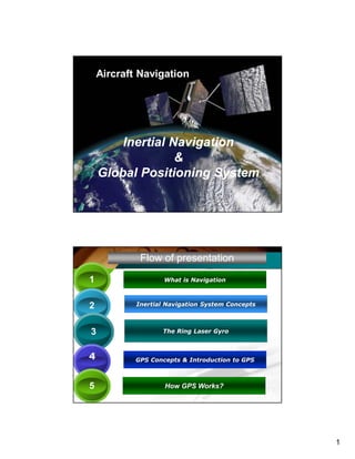
  • 1. 1 Shanks Inertial Navigation & Global Positioning System Inertial Navigation & Global Positioning System By Shankar NarayanBy Shankar Narayan 1 Aircraft Navigation Inertial Navigation & Global Positioning System Inertial Navigation & Global Positioning System Flow of presentation 11 What is Navigation 22 Inertial Navigation System Concepts 33 The Ring Laser Gyro 44 GPS Concepts & Introduction to GPS 55 How GPS Works?
  • 2. 2 29th August 2009 NavigationNavigation Navigation is the art of guiding oneself to one’s desired Destination For Navigation You need to Know your position at any instant of time! 3Shanks Shanks January 23, 2017 Inertial Navigation SystemInertial Navigation System Presented by Shankar Narayan INS conceptsINS concepts
  • 3. 3 January 23, 2017 What is an Inertial Navigation System (INS)? • Every object that is free to move in space has six "degrees of freedom" - or ways it can move. • There are three linear degrees of freedom (x,y,z) that specify your position and three rotational degrees of freedom (theta (pitch), psi (yaw), and phi (roll)) that specify your attitude. • If you know these six variables, you know where you are and which way you're pointed Inertia – inertness, property by which matter continues in existing state of rest Or uniform motion, unless acted on by external force Attitude • Yaw • Roll • Pitch
  • 4. 4 January 23, 2017 • The six parameters of freedom A body's actual spatial behavior / movement can be described with three translatory and three rotary components. • : three translatory (x-, y-, z-acceleration) and three rotatory components (x-, y-, z-angular velocity) January 23, 2017 Inertial Navigation is accomplished by integrating the output of a set of sensors to compute position, velocity, and attitude. The sensors used are: 1. Gyros 2. Accelerometers. Inertial NavigationInertial Navigation
  • 5. 5 January 23, 2017 INS • The present Inertial Navigation uses 'solid state' systems consists of expensive laser-gyros and integrated sensor devices (accelerometers) in MEMS technology (Micro Electro-Mechanical System). • Inertial navigation systems (INS) are used in civil and military aviation, cruise missiles, submarines and space technology. January 23, 2017 What is inertial Measurement Unit? • An inertial measurement unit, or IMU, is a "clump" of six inertial sensors. Three linear accelerometers and three rate gyros make up our IMU. Usually, an IMU also contains a computational unit to do the position calculations based off of the sensors
  • 6. 6 Shanks January 23, 2017 LASER GENERAL INFORMATION January 23, 2017 LASER • LIGHT • AMPLIFICATION BY • STIMULATED • EMISSION OF • RADIATION STIMULATE = EXITE • LASER IS A COHERENT SOURCE OF LIGHT • LASER LIGHT IS MORE DIRECTIONAL, MORE MONOCHROMATIC & HENCE MORE BRIGHT COMPARED WITH OTHER SOURCES OF LIGHT. MONOCHROMATIC = SINGLE WAVE LENGTH/COLOR COHERENT = COSTANT PHASE/CONSISTANT Spontaneous = occurring without any external cause
  • 7. 7 January 23, 2017 LASER Shanks January 23, 2017 RING LASER GYROMETER
  • 8. 8 January 23, 2017 RLG PRINCIPLE January 23, 2017 LASER GYRO
  • 9. 9 January 23, 2017 RLG Block Triangle
  • 10. 10 January 23, 2017 mirror mirror mirror mirror mirror mirror ROLL HEADING (YAW) PITCH
  • 11. 11 January 23, 2017 RLG PRINCIPLE January 23, 2017 ADDING OF LASER BEAMS PRODUCE FRINGES
  • 12. 12 January 23, 2017 MOTION DETECTION • WHEN NO MOVEMENT – FRINGE PATTERN IS FIXED. • WHEN A MOVEMENT IS DETECTED – THE FRINGE PATTERN MOVES, DEPENDS UPON THE DIRECTION OF MOTION OF THE GYRO & IS PROPORTIONAL TO THE RATE OF ROTATION. January 23, 2017 LASER IN RLG • TYPE OF LASER USED IS HELIUM / NEON. HENCE THE COLOUR IS REDDISH ORANGE. • FREQUENCY FOR LASER = 1000000000000000 CYCLES PER SECOND. • THE GLASS TUBE IS MADE OF ‘ZERO DUR’ GERMAN GLASS INCLUDING THE MIRRORS.
  • 13. 13 Shanks January 23, 2017 ACCELERO METERSACCELERO METERS January 23, 2017 The apparatus to measure acceleration uses the property of each physical body to persist in a state of rest on uniform motion. This property is called inertia and is characterised by a force F which, under acceleration g, moves the mass in the opposite direction to the acceleration. AccelerometerAccelerometer 0 1 2 Mass 0 1 2 Mass Deflection with 1 unit of acceleration 0 1 2 Mass Deflection with 2 units of acceleration F = m γ
  • 14. 14 January 23, 2017 The measurement instruments are called accelerometers and may be either linear or pendular, this later type at present being the most widely used. Under the effect of an acceleration g of 20 m/s2, the mass moves along measurement axis. The marked graduations allowed the value of the acceleration to be obtained that is 20 m/s2. 20 0 -20 Measurement axis γγγγ = 20 m/s² LINEAR ACCELEROMETER (principle) 20 0 Measurement axis -20 PENDULAR ACCELEROMETER (principle) AccelerometerAccelerometer January 23, 2017 In the case of a pendulum accelerometer,the influence of the earth gravity takes action as soon as the pendulum leaves its point of equilibrium even if the sensitive axis is perpendicular to the force of attraction g. The accelerometer measurement is then erroneous. In order to cancel out this influence the pendulum must be made to work around its point of equilibrium. γγγγ = 20 m/s² 0 Sensitive axis PENDULAR ACCELEROMETER g γγγγ g AccelerometerAccelerometer
  • 15. 15 January 23, 2017 AccelerometerAccelerometer January 23, 2017 • Accelerometer Used Is Pendulum Type Accelerometer. • Displacement Of The Pendulum Depends On Acceleration. • From The Displacement Value Of The Pendulum, Acceleration Can Be Computed. AccelerometerAccelerometer
  • 16. 16 January 23, 2017 ACCELEROMETER PRINCIPLE FLEXIBL E SHADE MAGNETIC DEVICE DETECTORS COILS PENULUM WITH HINGE January 23, 2017 ACCELEROMETER OPERATION With No Motion, Pendulum Is Centered, And The Capacitor Bridge Is Balanced When A Motion Is Detected,the Pendulum Is Displaced And The Bridge Is No Longer Balanced. So A Current Is Induced Proportional To The Displacement Of The Pendulum Pendulum Is Bought Back To Its Null Point By Means Of A Mechanism Which Generates A Field In Opposition To The Pendulum Movement. The Value Of The Current Necessary For The Mechanism To Keep The Pendulum At Zero Represents The Measured Acceleration
  • 17. 17 Shanks GLOBAL POSITIONING SYSTEMGLOBAL POSITIONING SYSTEM .. In everyday life Presented by Shankar Narayan GPSGPSConceptsConcepts Position of any point on earthPosition of any point on earth Any location on Earth is described by three numbers--its latitude its longitude and its altitude. If a pilot or a ship's captain wants to specify position on a map, these are the "coordinates" they would use. Any location on Earth is described by three numbers--its latitude its longitude and its altitude. If a pilot or a ship's captain wants to specify position on a map, these are the "coordinates" they would use. Position LatitudeLatitude LongitudeLongitude AltitudeAltitude Geographical Coordinates & Altitude Geographical Coordinates & Altitude *
  • 18. 18 LatitudeLatitude • On a globe of the Earth, lines of latitude are circles of different size. The longest is the equator, whose latitude is zero, while at the poles--at latitudes 90° north and 90° south (or -90°) the circles shrink to a point. To specify the latitude of some point P on the surface, draw the radius OP to that point. Then the elevation angle of that point above the equator is its latitude λ--northern latitude if north of the equator, southern (or negative) latitude if south of it. LongitudeLongitude • On the globe, lines of constant longitude ("meridians") extend from pole to pole, like the segment boundaries on a peeled orange. • For historical reasons, the meridian passing the old Royal Astronomical Observatory in Greenwich, England, is the one chosen as zero longitude
  • 19. 19 29th August 2009 Latitude/ Longitude & DirectionsLatitude/ Longitude & Directions Radius of Earth = 6 378.1 kilometersRadius of Earth = 6 378.1 kilometers 3737ShanksShanks Training & Development Institute, HAL, NasikTraining & Development Institute, HAL, Nasik * 29th August 2009 latitude l o n g i t u d e 20 degree 73 de gr ee 73deg. 54 min 52 sec ojhar 20 deg. O7 min 22 sec Shanks 38
  • 20. 20 The Longitude ( Meridian)The Longitude ( Meridian) • A lines of longitude is also called a meridian, derived from the Latin, from meri, a variation of "medius" which denotes "middle", and diem, meaning "day." The word once meant "noon", and times of the day before noon were known as "ante meridian", while times after it were "post meridian." Today's abbreviations a.m. and p.m. come from these terms, and the Sun at noon was said to be "passing meridian". All points on the same line of longitude experienced noon (and any other hour) at the same time and were therefore said to be on the same "meridian line", which became "meridian" for short. • Longitudes are measured from zero to 180° east and 180° west (or -180°), and both 180-degree longitudes share the same line, in the middle of the Pacific Ocean Local & Universal TimeLocal & Universal Time • Local time is actually a measure of the position of the Sun relative to a locality. At 12 noon local time the Sun passes to the south and is furthest from the horizon (northern hemisphere). Somewhere around 6 am it rises, and around 6 pm it sets. Local time is what you and I use to regulate our lives locally, our work times, meals and sleep-times. • universal time (UT), which can be defined (with some slight imprecision, no concern here) as the local time in Greenwich, England, at the zero meridian. That is, a single agreed-on clock, marking time world-wide, not tied to our locality. Astronomers, astronauts and people dealing with satellite data may need a time schedule which is the same everywhere, not tied to a locality or time zone. The Greenwich mean time, the astronomical time at Greenwich (averaged over the year) is generally used here. It is sometimes called Universal Time (UT).
  • 21. 21 International Date LineInternational Date Line • International date line has been established--most of it following the 180th meridian--where by common agreement, whenever we cross it the date advances one day (going west) or goes back one day (going east). That line passes the Bering Strait between Alaska and Siberia, which thus have different dates, but for most of its course it runs in mid-ocean and does not inconvenience any local time keeping. What is GPS ? Global Positioning System (GPS) is a satellite Navigation System which is invented and Controlled by the US Department of Defense (DOD) Global Positioning System (GPS) is a satellite Navigation System which is invented and Controlled by the US Department of Defense (DOD)
  • 22. 22 Global positioning systemGlobal positioning system • GPS provides specially coded satellite signals. • These Signals can be processed in a GPS Receiver. • The Receiver after processing, outputs highly accurate - position , velocity, time and altitude information, to the GPS users around the world. GPS Uses in Everyday lifeGPS Uses in Everyday life • Developed for military use( ships, aircrafts..) • Use in tunnel construction –English # French • Used in cars, Buses, Trains, to monitor Position • Help save life- Use in emergency Vehicles • Moving Map displays in vehicles Guided by GPS • Used in Surveying, Wildlife management. • GPS equipped Balloons used to find explore the ozone layer. • Explorers use GPS extensively *
  • 23. 23 GPS Systems of the World • GLONASS ( Russian) – To be completed by 2010 Global Navigation Satellite System • NAVSTAR ( American)- Completed Navigation System by Timing and Ranging • GALILEO (England) – To be completed by 2020 * The program was created by the US Department of defense (DOD) in 1973. The First GPS satellite, Block I developmental model was launched in February 1978. For Global operation of GPS System, a constellation of 24 satellites (Minimum) is required Birth of NAVSTAR GPS *
  • 24. 24 The 24 satellites constellation mile stone was achieved in June 1993 The system gained fame ‘desert storm’ by providing unprecedented navigational accuracy for allied air and ground forces. Global positioning systemGlobal positioning system ‘The Global Positioning System Fully Operational, This declaration came from US Air force on July 17th 1995. Shanks The Three Segments of GPS The Three Segments of GPS GPSGPS 4848
  • 25. 25 GPS consists of Three SegmentsGPS consists of Three Segments Control segment Control segment consists of a master control station, 5 monitoring stations, three ground antennas & a Pre launch check out station Space Segment Space Segment consists of 24 satellites User Segment User Segment consists of various GPS receivers NAVSTAR Global Positioning System * Control segmentControl segment 5 monitoring stations which passively track & collect ranging data from all satellites in view. A master control station which processes the satellite ranging data to determine satellite orbits and update the navigation message for each satellite. 3 ground antennas which transmit the updated navigation message to each satellite . A pre launch station which supports the satellite pre- launch compatibility tests and serves as a fourth ground antenna when necessary.
  • 26. 26 29th August 2009 Control SegmentControl Segment The GPS system used is American NAVSTAR ( NAVigation System by Timing And Ranging) system 1 master control station, 5 monitoring stations, 1 pre launch station,3 ground antenna AFB- AIRFORCE BASE Note :-all the stations are under the control of U S. Territory & They are all positioned near the equator Shanks 51 Space segmentSpace segment • The space segment consists of 24 operational satellites plus 3 spares
  • 27. 27 The Space Segment Satellite 12 hr. period ..Satellite 12 hr. period .. 24+3 Satellites 24+3 Satellites Space segment 4 satellite In each Orbit 4 satellite In each Orbit Six Orbits Six Orbits 20,200 KM From earth 20,200 KM From earth Orbit inclination = 55 deg. Orbit inclination = 55 deg. NAVSTAR System of GPSNAVSTAR System of GPS hrs Satellite makes two rounds in 24 hrs * * GPS ConstellationGPS Constellation 54
  • 28. 28 GPS OrbitsGPS Orbits 12 Hour Period ShanksShanks 5555ShanksShanks * Satellite Vehicle No. 27Satellite Vehicle No. 27 Sensors Sensors Shanks *
  • 29. 29 -45 deg.lat + 45 deg. lat 0 deg. lat + 70 deg. lat - 70 deg. lat NO SV COVERAGE IN THIS REGION NO SV COVERAGE IN THIS REGION A satellite vehicle is not stable in the cone of +/ - 70 deg Its not possible to apply correction in this cone. GPS GIVES ERRORS FOR LAT > +/- 70 DEG. GPS GIVES ERRORS FOR LAT > +/- 70 DEG. 29th August 2009 GPS constellation in operationGPS constellation in operation COMPLETE COVERAGE WITH A MINIMUM OF 5 SV IN VIEW ALL AROUND THE WORLD EXCEPT NO COVERAGE AT LAT >+ - 70 Deg. Shanks
  • 30. 30 User SegmentUser Segment USER SEGMENTUSER SEGMENT The user segment consists of receivers and associated support equipment Receiver processes signals transmitted by the satellites and Finds: 1. Its Distance from Satellite 2. And calculates Lat, Long, Altitude
  • 31. 31 Hand held GPS ReceiverHand held GPS Receiver General Information related to GPSGeneral Information related to GPS
  • 32. 32 CARRIER FREQUENCYCARRIER FREQUENCY GPS Carrier frequency L1& L2 : 1575.42 MHz and 1277.60 MHz . These Frequencies are necessary to travel through ionosphere and troposphere. SPS – Std. Positioning Service PPS - Precise Positioning Service SPS has access to codeless L1 signal. (We are SPS users) PPS user has access to all signals on L1 & L2 and to the full accuracy of GPS ( only US) PPS users must have the classified algorithms and the classified key to remove errors VELOCITY MEASUREMENTVELOCITY MEASUREMENT • Velocity is measured using Doppler effect through software. • The received frequency appears increased as the satellite comes towards the receiver • Decreases as it recedes from the user.
  • 33. 33 EPHEMERISEPHEMERIS • In a receiver complete check of ephemeris and storage normally takes 12.5 min to 25 min Max • The predictions of current satellite positions transmitted to the user in the data message. (Orbital data of a satellite vehicle.) •Ephemeris last for one week ALMANACALMANAC • A data file that contains orbit information on all satellites, clock corrections, and atmospheric delay parameters. • It is transmitted by each GPS satellite in order to facilitate rapid satellite vehicle data acquisition by GPS receivers.
  • 34. 34 GPS -NOTEGPS -NOTE • Velocity of satellite is approximately 30 km /sec. • Clock frequency is 100mhz. • Lat/long calculation is done at the speed of 1 hz. How GPS Works?How GPS Works?
  • 35. 35 Position in Space/ on EarthPosition in Space/ on Earth Shanks Position in Space/ on EarthPosition in Space/ on Earth
  • 36. 36 Aircraft Position determinationAircraft Position determination Aircraft position in space is found by computing a/cs distance from 4 satellites Also all those 4 satellites position from the earth centre is known. By knowing above two parameters a/cs position from earth centre is computed. From the earth model WGS- 84, comparing the above results , latitude. Longitude and altitude can be found. * 29th August 2009 TriangulationTriangulation TRIANGULATE - MEASURING AND MAP OUT BY DIVIDING IT INTO TRIANGLES Radius of Earth = 6 378.1 kilometersRadius of Earth = 6 378.1 kilometers
  • 37. 37 Result of TriangulationResult of Triangulation Shanks Earth Result of TriangulationResult of Triangulation Shanks Earth
  • 38. 38 LATITUDE / LONGITUDE & ALTITUDELATITUDE / LONGITUDE & ALTITUDE Shanks* Shanks Triangulation Summary Triangulation Summary GPS 7676
  • 39. 39 29th August 2009 7777ShanksShanks 29th August 2009 7878ShanksShanks
  • 40. 40 29th August 2009 7979 29th August 2009 80Shanks
  • 41. 41 29th August 2009 TWO MEASUREMENTS PUT US SOMEWHERE IN THIS CIRCLE TWO MEASUREMENTS PUT US SOMEWHERE IN THIS CIRCLE ONE OF THESE TWO POINTS IS THE ACCURATE LOCATION A THIRD SATELLITE PUTS US AT EITHER OF TWO POINTS Shanks SummarySummary • Thus with the information from four satellites, the Position of the GPS receiver user is fixed in space or on earth with respect to satellites. • Triangulation of the above results gives the position with respect to the centre of earth. • The altitude of the GPS receiver user is obtained by Subtracting the radius of earth from the earth centre distance. • The triangulation result when superimposed on the WGS – 84 software model, gives the latitude & Longitude of the GPS user. • Thus the GPS user will know his position accurately with respect to earth. In terms of latitude, Longitude & Altitude.
  • 42. 42 January 23, 2017 Thank YouThank You Shankar11122@gmail.com 9405183808 www.shankarnarayan.co.in