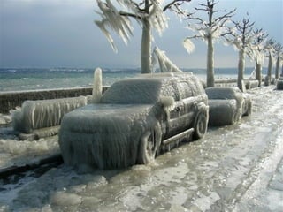
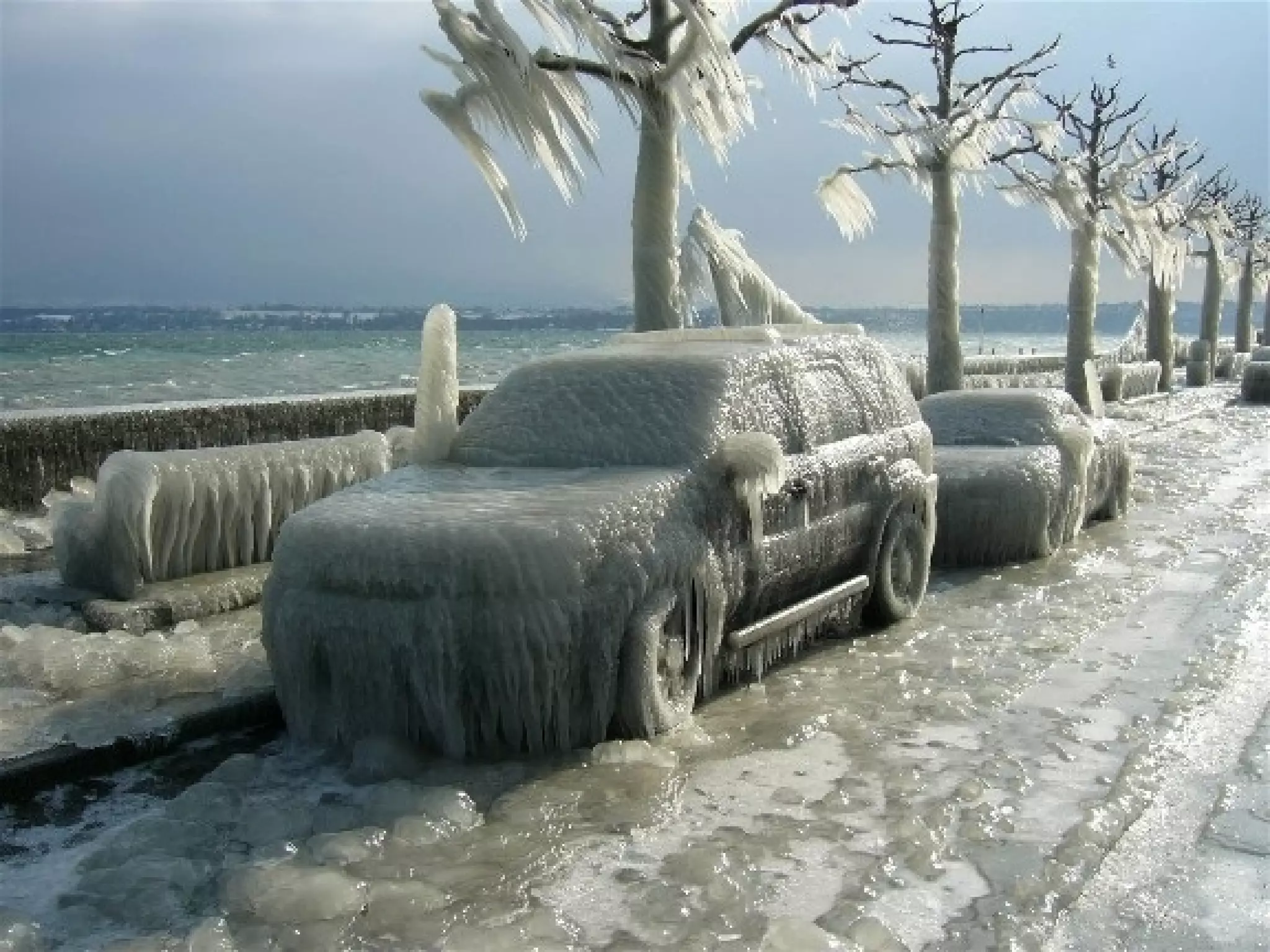
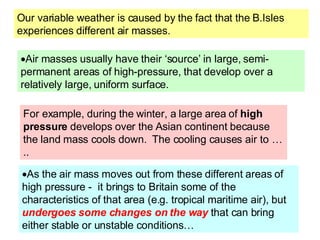
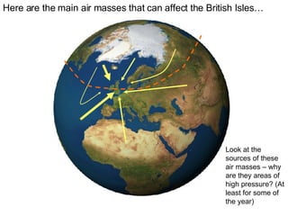
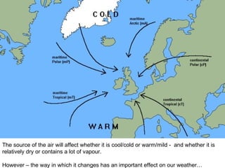
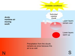
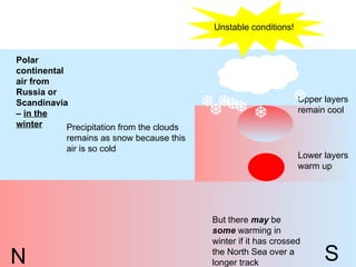
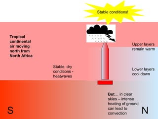
Our variable weather is caused by the fact that the B.Isles experiences different air masses. Air masses usually have their ‘source’ in large, semi-permanent areas of high-pressure, that develop over a relatively large, uniform surface.  As the air mass moves out from these different areas of high pressure -  it brings to Britain some of the characteristics of that area (e.g. tropical maritime air), but  undergoes some changes on the way  that can bring either stable or unstable conditions…  For example, during the winter, a large area of  high pressure  develops over the Asian continent because the land mass cools down.  The cooling causes air to …..
Here are the main air masses that can affect the British Isles… Look at the sources of these air masses – why are they areas of high pressure? (At least for some of the year)
The source of the air will affect whether it is cool/cold or warm/mild -  and whether it is relatively dry or contains a lot of vapour. However – the way in which it changes has an important effect on our weather…
Individual cumulus clouds NW SE Polar maritime air moving south from Canadian Arctic / Greenland Lower layers warm up Upper layers remain cool ‘ Unstable conditions!
Tropical maritime air moving north from the Azores or even the Caribbean Lower layers cool down Upper layers remain warm Stable conditions! Fog in coastal areas! SW NE Vapour condenses
However this warm stable air may be forced to rise over hills – until it reaches its dew point – creating ‘hill fog’ This warm air can hold a lot of vapour –because it is warm and has passed over water. It has the  potential  to become unstable if initially forced to rise. There could be rain in mountain areas
Individual cumulus clouds N S Arctic  maritime air moving south Lower layers warm up Upper layers remain cool ‘ Unstable conditions!        Precipitation from the clouds remains as snow because this air is so cold
N S Polar continental air from Russia or Scandinavia –  in the winter Lower layers warm up Upper layers remain cool Unstable conditions!        Precipitation from the clouds remains as snow because this air is so cold But there  may  be  some  warming in winter if it has crossed the North Sea over a longer track
Tropical continental air moving north from North Africa Lower layers cool down Upper layers remain warm Stable conditions! S N Stable, dry conditions - heatwaves But … in clear skies – intense heating of ground can lead to convection

Air masses made easy for AS

  • 1.
  • 2.
    Our variable weatheris caused by the fact that the B.Isles experiences different air masses. Air masses usually have their ‘source’ in large, semi-permanent areas of high-pressure, that develop over a relatively large, uniform surface. As the air mass moves out from these different areas of high pressure - it brings to Britain some of the characteristics of that area (e.g. tropical maritime air), but undergoes some changes on the way that can bring either stable or unstable conditions… For example, during the winter, a large area of high pressure develops over the Asian continent because the land mass cools down. The cooling causes air to …..
  • 3.
    Here are themain air masses that can affect the British Isles… Look at the sources of these air masses – why are they areas of high pressure? (At least for some of the year)
  • 4.
    The source ofthe air will affect whether it is cool/cold or warm/mild - and whether it is relatively dry or contains a lot of vapour. However – the way in which it changes has an important effect on our weather…
  • 5.
    Individual cumulus cloudsNW SE Polar maritime air moving south from Canadian Arctic / Greenland Lower layers warm up Upper layers remain cool ‘ Unstable conditions!
  • 6.
    Tropical maritime airmoving north from the Azores or even the Caribbean Lower layers cool down Upper layers remain warm Stable conditions! Fog in coastal areas! SW NE Vapour condenses
  • 7.
    However this warmstable air may be forced to rise over hills – until it reaches its dew point – creating ‘hill fog’ This warm air can hold a lot of vapour –because it is warm and has passed over water. It has the potential to become unstable if initially forced to rise. There could be rain in mountain areas
  • 8.
    Individual cumulus cloudsN S Arctic maritime air moving south Lower layers warm up Upper layers remain cool ‘ Unstable conditions!        Precipitation from the clouds remains as snow because this air is so cold
  • 9.
    N S Polarcontinental air from Russia or Scandinavia – in the winter Lower layers warm up Upper layers remain cool Unstable conditions!        Precipitation from the clouds remains as snow because this air is so cold But there may be some warming in winter if it has crossed the North Sea over a longer track
  • 10.
    Tropical continental airmoving north from North Africa Lower layers cool down Upper layers remain warm Stable conditions! S N Stable, dry conditions - heatwaves But … in clear skies – intense heating of ground can lead to convection