This document summarizes procedural methods for terrain modelling. It discusses generating height maps, erosion simulation, vegetation distribution, road networks, and urban environments like buildings procedurally. Current research focuses on integrated frameworks that generate more detailed and realistic virtual worlds in a controllable, intuitive manner. Procedural modelling is active area of research and aims to automate terrain creation to reduce time and costs compared to manual 3D modelling.
Geovisualisation of flows: New approaches to map an interdependent worldBenjamin Hennig
Postgraduate Presentation by Benjamin D Hennig at the Department of Geography, University of Sheffield, 26th May 2009 - more at http://www.viewsoftheworld.net/?p=2777
Slides from a presentation by Benjamin Hennig at the ESRI International User Conference in San Diego, 15 July 2009. See more at http://www.viewsoftheworld.net/?p=654
Presentation by Benjamin David Hennig for the 46th Annual Meeting of the Society of Cartographers, Manchester/UK, 9th September 2010. Read more at http://www.viewsoftheworld.net/?p=832
From geovisualisation to neocartography: Maps in a digital worldBenjamin Hennig
Presentation by Benjamin D. Hennig at the first Neocartography Commission session is set to start directly after the Society of Cartographers conference, and will be held from 3-45pm to 7-15pm at University College London on Wednesday 5th September. More at http://www.viewsoftheworld.net/?p=2566
iPad Atlas is very easy and economiy system for high school geography education.
The author tried field test at Sendai,the Tsunami dangered area with local teachers.
This presentation is did at Association of Japanese Geography education,in August 25.
Maps are everywhere—on the Internet, in our car, and even on our mobile phone. Moreover, maps of the twenty-first century are not just paper diagrams folded like an accordion. Maps today are colorful, searchable, interactive, and shared. This transformation of the static map into dynamic and interactive multimedia reflects the integration of technological innovation and vast amounts of geographic data. The key technology behind this integration, and subsequently the maps of the twenty-first century, is geographic information systems or GIS.
Visualising large spatial databases and Building bespoke geodemographicsDr Muhammad Adnan
This presentation outlines my work at the Local Futures and the PhD research. I have been working on a combined project between Local Futures and UCL and the presentation starts by giving an introduction of the project. My PhD investigated the creation of Real-time bespoke geodemographics, and this presentation presents the work i did during the PhD journey.
This PPT gives a brief description about Geomatics, the disciplines and techniques constituting Geomatics, Geographic Information System or GIS, GIS data (Spatial Data and Non- Spatial Data), GIS data models, GIS application in Petroleum Exploration, Coordinate System, Geodetic Datum and ArcGIS.
This is presentation is intended for middle school students. It provides a short introduction to GIS and how to use GIS in the real-world.
ArcGIS Explorer is the software used to demonstrate concepts.
45 minutes + 15 minutes demo
Download ArcGIS Explorer here...
http://www.esri.com/software/arcgis/explorer/
Gis Geographical Information System FundamentalsUroosa Samman
Gis, Geographical Information System Fundamentals. This presentation includes a complete detail of GIS and GIS Softwares. It will help students of GIS and Environmental Science.
We propose a concept to help data analysts to quickly assess parameters and results of cluster algorithms. The presentation and interaction on a flexible display makes it possible to grasp the function- ing of algorithms and focus on the data itself. Two interaction concepts are presented, which demonstrate the strength of elastic displays: a layer concept that allows the recognition of differences between various parameter settings of cluster algorithms, and a Zoomable User Interface, which encourages the in-depth analysis of clusters.
Presented at the 46th Society of Cartographers Summer School in Manchester on September 10 2010. The abstract for the talk was as follows: "OpenStreetMap is coming of age, but as it starts to be used more in the mainstream, the age-old questions of quality and completeness are coming to the fore. A range of data sources have been used to build up the map in the UK, from GPS traces to aerial imagery, historic mapping, NaPTAN and the OS Open Data release, each with their own benefits and limitations. This talk looks at a number of studies and tools developed to quantify, compare and address accuracy and coverage of the project in the UK, in an attempt to answer the key questions - is it complete yet and just how good is it?"
FOCUS K3D - Foster the Comprehension and Use of Knowledge intensive 3D media
Newsletter 4 (February 2010), download at
http://www.focusk3d.eu/downloads
FOCUS K3D is a Coordination Action (CA) of the European Union's 7th Framework Programme which aims at promoting the adoption of best-practices for the use of semantics in 3D content modelling and processing. This flyer gives an overview of the whole project.
You can download this document at
http://www.focusk3d.eu/downloads
FOCUS K3D is a Coordination Action (CA)which aims at promoting the adoption of best-practices for the use of semantics in 3D content modelling and processing. This slide set gives an overview of the Application Working Group (AWG) CAD/CAE and Virtual Product Modelling.
You can download these slides at
http://www.focusk3d.eu/downloads
FOCUS K3D is a Coordination Action (CA) of the European Union's 7th Framework Programme which aims at promoting the adoption of best-practices for the use of semantics in 3D content modelling and processing. This slide set gives an overview of the whole project.
You can download these slides at
http://www.focusk3d.eu/downloads
Securing your Kubernetes cluster_ a step-by-step guide to success !KatiaHIMEUR1
Today, after several years of existence, an extremely active community and an ultra-dynamic ecosystem, Kubernetes has established itself as the de facto standard in container orchestration. Thanks to a wide range of managed services, it has never been so easy to set up a ready-to-use Kubernetes cluster.
However, this ease of use means that the subject of security in Kubernetes is often left for later, or even neglected. This exposes companies to significant risks.
In this talk, I'll show you step-by-step how to secure your Kubernetes cluster for greater peace of mind and reliability.
The Art of the Pitch: WordPress Relationships and SalesLaura Byrne
Clients don’t know what they don’t know. What web solutions are right for them? How does WordPress come into the picture? How do you make sure you understand scope and timeline? What do you do if sometime changes?
All these questions and more will be explored as we talk about matching clients’ needs with what your agency offers without pulling teeth or pulling your hair out. Practical tips, and strategies for successful relationship building that leads to closing the deal.
GDG Cloud Southlake #33: Boule & Rebala: Effective AppSec in SDLC using Deplo...James Anderson
Effective Application Security in Software Delivery lifecycle using Deployment Firewall and DBOM
The modern software delivery process (or the CI/CD process) includes many tools, distributed teams, open-source code, and cloud platforms. Constant focus on speed to release software to market, along with the traditional slow and manual security checks has caused gaps in continuous security as an important piece in the software supply chain. Today organizations feel more susceptible to external and internal cyber threats due to the vast attack surface in their applications supply chain and the lack of end-to-end governance and risk management.
The software team must secure its software delivery process to avoid vulnerability and security breaches. This needs to be achieved with existing tool chains and without extensive rework of the delivery processes. This talk will present strategies and techniques for providing visibility into the true risk of the existing vulnerabilities, preventing the introduction of security issues in the software, resolving vulnerabilities in production environments quickly, and capturing the deployment bill of materials (DBOM).
Speakers:
Bob Boule
Robert Boule is a technology enthusiast with PASSION for technology and making things work along with a knack for helping others understand how things work. He comes with around 20 years of solution engineering experience in application security, software continuous delivery, and SaaS platforms. He is known for his dynamic presentations in CI/CD and application security integrated in software delivery lifecycle.
Gopinath Rebala
Gopinath Rebala is the CTO of OpsMx, where he has overall responsibility for the machine learning and data processing architectures for Secure Software Delivery. Gopi also has a strong connection with our customers, leading design and architecture for strategic implementations. Gopi is a frequent speaker and well-known leader in continuous delivery and integrating security into software delivery.
UiPath Test Automation using UiPath Test Suite series, part 4DianaGray10
Welcome to UiPath Test Automation using UiPath Test Suite series part 4. In this session, we will cover Test Manager overview along with SAP heatmap.
The UiPath Test Manager overview with SAP heatmap webinar offers a concise yet comprehensive exploration of the role of a Test Manager within SAP environments, coupled with the utilization of heatmaps for effective testing strategies.
Participants will gain insights into the responsibilities, challenges, and best practices associated with test management in SAP projects. Additionally, the webinar delves into the significance of heatmaps as a visual aid for identifying testing priorities, areas of risk, and resource allocation within SAP landscapes. Through this session, attendees can expect to enhance their understanding of test management principles while learning practical approaches to optimize testing processes in SAP environments using heatmap visualization techniques
What will you get from this session?
1. Insights into SAP testing best practices
2. Heatmap utilization for testing
3. Optimization of testing processes
4. Demo
Topics covered:
Execution from the test manager
Orchestrator execution result
Defect reporting
SAP heatmap example with demo
Speaker:
Deepak Rai, Automation Practice Lead, Boundaryless Group and UiPath MVP
JMeter webinar - integration with InfluxDB and GrafanaRTTS
Watch this recorded webinar about real-time monitoring of application performance. See how to integrate Apache JMeter, the open-source leader in performance testing, with InfluxDB, the open-source time-series database, and Grafana, the open-source analytics and visualization application.
In this webinar, we will review the benefits of leveraging InfluxDB and Grafana when executing load tests and demonstrate how these tools are used to visualize performance metrics.
Length: 30 minutes
Session Overview
-------------------------------------------
During this webinar, we will cover the following topics while demonstrating the integrations of JMeter, InfluxDB and Grafana:
- What out-of-the-box solutions are available for real-time monitoring JMeter tests?
- What are the benefits of integrating InfluxDB and Grafana into the load testing stack?
- Which features are provided by Grafana?
- Demonstration of InfluxDB and Grafana using a practice web application
To view the webinar recording, go to:
https://www.rttsweb.com/jmeter-integration-webinar
Encryption in Microsoft 365 - ExpertsLive Netherlands 2024Albert Hoitingh
In this session I delve into the encryption technology used in Microsoft 365 and Microsoft Purview. Including the concepts of Customer Key and Double Key Encryption.
Slack (or Teams) Automation for Bonterra Impact Management (fka Social Soluti...Jeffrey Haguewood
Sidekick Solutions uses Bonterra Impact Management (fka Social Solutions Apricot) and automation solutions to integrate data for business workflows.
We believe integration and automation are essential to user experience and the promise of efficient work through technology. Automation is the critical ingredient to realizing that full vision. We develop integration products and services for Bonterra Case Management software to support the deployment of automations for a variety of use cases.
This video focuses on the notifications, alerts, and approval requests using Slack for Bonterra Impact Management. The solutions covered in this webinar can also be deployed for Microsoft Teams.
Interested in deploying notification automations for Bonterra Impact Management? Contact us at sales@sidekicksolutionsllc.com to discuss next steps.
Key Trends Shaping the Future of Infrastructure.pdfCheryl Hung
Keynote at DIGIT West Expo, Glasgow on 29 May 2024.
Cheryl Hung, ochery.com
Sr Director, Infrastructure Ecosystem, Arm.
The key trends across hardware, cloud and open-source; exploring how these areas are likely to mature and develop over the short and long-term, and then considering how organisations can position themselves to adapt and thrive.
Elevating Tactical DDD Patterns Through Object CalisthenicsDorra BARTAGUIZ
After immersing yourself in the blue book and its red counterpart, attending DDD-focused conferences, and applying tactical patterns, you're left with a crucial question: How do I ensure my design is effective? Tactical patterns within Domain-Driven Design (DDD) serve as guiding principles for creating clear and manageable domain models. However, achieving success with these patterns requires additional guidance. Interestingly, we've observed that a set of constraints initially designed for training purposes remarkably aligns with effective pattern implementation, offering a more ‘mechanical’ approach. Let's explore together how Object Calisthenics can elevate the design of your tactical DDD patterns, offering concrete help for those venturing into DDD for the first time!
Essentials of Automations: Optimizing FME Workflows with ParametersSafe Software
Are you looking to streamline your workflows and boost your projects’ efficiency? Do you find yourself searching for ways to add flexibility and control over your FME workflows? If so, you’re in the right place.
Join us for an insightful dive into the world of FME parameters, a critical element in optimizing workflow efficiency. This webinar marks the beginning of our three-part “Essentials of Automation” series. This first webinar is designed to equip you with the knowledge and skills to utilize parameters effectively: enhancing the flexibility, maintainability, and user control of your FME projects.
Here’s what you’ll gain:
- Essentials of FME Parameters: Understand the pivotal role of parameters, including Reader/Writer, Transformer, User, and FME Flow categories. Discover how they are the key to unlocking automation and optimization within your workflows.
- Practical Applications in FME Form: Delve into key user parameter types including choice, connections, and file URLs. Allow users to control how a workflow runs, making your workflows more reusable. Learn to import values and deliver the best user experience for your workflows while enhancing accuracy.
- Optimization Strategies in FME Flow: Explore the creation and strategic deployment of parameters in FME Flow, including the use of deployment and geometry parameters, to maximize workflow efficiency.
- Pro Tips for Success: Gain insights on parameterizing connections and leveraging new features like Conditional Visibility for clarity and simplicity.
We’ll wrap up with a glimpse into future webinars, followed by a Q&A session to address your specific questions surrounding this topic.
Don’t miss this opportunity to elevate your FME expertise and drive your projects to new heights of efficiency.
De-mystifying Zero to One: Design Informed Techniques for Greenfield Innovati...
3AMIGAS - Paper3: RM Smelik
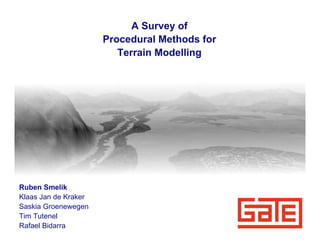
1. A Survey of
Procedural Methods for
Terrain Modelling
Ruben Smelik
Klaas Jan de Kraker
Saskia Groenewegen
Tim Tutenel
Rafael Bidarra
2. Motivation for Automated Terrain Modelling
• Game worlds are increasing in size, detail and visual realism
• Manual design requires effort, time, 3D modelling skills, money, etc.
Wolfenstein 3D (id, 1992) Crysis (Crytek, 2007)
2 Amsterdam,Tuesday, June 16 2009
3. Procedural content generation
• Content generation procedures based on rules, random numbers, etc.
• Also know as data amplification algorithms:
• Few parameters => large amount of content
• Common techniques:
• Fractals
• Rewriting systems
• Simulations
• Advantages:
• Saves effort / time / money
• Variation through randomness
• Storage
3 Amsterdam,Tuesday, June 16 2009
4. Current limitations
• Too random, user has no real control over outcome
• Trial and error
• In-depth knowledge and experimentation required
• Unintuitive parameters, e.g. “persistence”
• Methods have not (yet) been integrated properly
4 Amsterdam,Tuesday, June 16 2009
5. Topics in Procedural Terrain Modelling
1. Earth (height-maps, eroded landscapes)
2. Water (oceans, rivers and lakes)
3. Vegetation (plant models, distribution)
4. Road (networks)
5. Urban (buildings, facades)
5 Amsterdam,Tuesday, June 16 2009
6. Earth - Height-map Generation
• Subdivision
Miller, G. S. P. (1986)
The Definition and Rendering of Terrain Maps.
• Fractal Brownian Motion (using Perlin Noise)
Musgrave, F. K. (1993)
6 Methods for Realistic Landscape Imaging. Amsterdam,Tuesday, June 16 2009
7. Earth - Erosion Simulation
• Thermal erosion
Benes, B. and Forsbach, R. (2001)
Layered Data Representation for Visual Simulation of
Terrain Erosion.
• Fluvial erosion
Anh, N. H., Sourin, A., and Aswani, P.
(2007)
Physically based Hydraulic Erosion
Simulation on Graphics Processing Unit.
7 Amsterdam,Tuesday, June 16 2009
9. Water - Rivers, Oceans and Lakes
Belhadj, F. and Audibert, P. (2005)
Modeling Landscapes with Ridges and Rivers: Bottom Up Approach.
9 Amsterdam,Tuesday, June 16 2009
10. Vegetation - Plant Models
• L-Systems (symbolic rewriting grammar)
Měch, R., Prusinkiewicz, P. (1994).
Visual models of plants interacting with their environment.
10 Amsterdam,Tuesday, June 16 2009
11. Vegetation - Distribution Simulation
Realistic distribution of plants
based on an ecosystem model
Deussen, O., Hanrahan, P., Lintermann, B., Měch, R., Pharr, M., and Prusinkiewicz, P. (1998).
Realistic Modeling and Rendering of Plant Ecosystems.
11 Amsterdam,Tuesday, June 16 2009
13. Road - Network Patterns
Sun, J., Yu, X., Baciu, G., and Green, M. (2002).
Template-based Generation of Road Networks for Virtual City Modeling.
13 Amsterdam,Tuesday, June 16 2009
14. Road - Network Generation
• L-Systems with validity checks, slope constraints and population-
oriented rules
Parish, Y. I. H. and Müller, P. (2001).
Procedural Modeling of Cities.
14 Amsterdam,Tuesday, June 16 2009
15. Urban - Building Grammars
• Split and Shape grammars
Müller, P., Wonka, P., Haegler, S., Ulmer, A., and Gool, L. V. (2006)
Wonka, P., Wimmer, M., Sillion, F., and Ribarsky, W. (2003)
Procedural Modeling of Buildings.
Instant Architecture.
15 Amsterdam,Tuesday, June 16 2009
16. Urban - Commercial Tools
“Random” roads and city
Virtual Pompei
16 CityEngine (Procedural, inc.) Amsterdam,Tuesday, June 16 2009
19. Conclusions
• Procedural modelling is an active research area with many
developments
• Focus shifts from height-map generation to urban environments
• Research directions:
• Performance
• GPU programming
• More detailed urban environments
• E.g. building interiors
• Integrated frameworks with intuitive controls
19 Amsterdam,Tuesday, June 16 2009