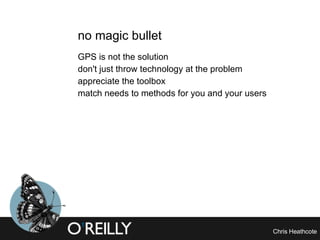
35 ways to find your location Chris Heathcote Product experience manager Orange SA O’Reilly Emerging Technology Conference February 9-12, 2004
why am I here? in 10 years' time,  there will be no concept of lost There will come an age in the far-off years  When Ocean shall unloose the bonds of things,  When the whole broad earth shall be revealed Seneca
where have we come from? the stars, the sun reading nature - birds, vegetation, wind direction, ocean swells (Polynesians) follow a path or coast the compass the almanac the astrolabe the sextant accurate clocks the map local knowledge (bushcraft)
no magic bullet GPS is not the solution don't just throw technology at the problem appreciate the toolbox match needs to methods for you and your users
measures accuracy  availability reliability / trust output useful to humans output useful to computers  requirements for conversion (extra enablers needed)  acquire or refine?
good enough what is good enough for your users? how much benefit will they get? what will it cost them?  - time, money, frustration most current consumer applications - 20-50m
0. assume: The Earth EARTH PIC accuracy: ~510 square Megametres availability: until we conquer space requirements: belief in a spherical Earth best for: acquiring
the time  (light, dark, timezones)  mainly relative position of people "It's 3 pm here” "It's 7 am here” easiest to use when moving long distances  (these days) accuracy: 1000 miles (E-W) n/a (N-S) availability: clocks requirements: UTC best for: seafaring, conf calls
2-7. cultural clues which cell phone operators available? which wi-fi providers? phonebox operators? phone number syntax? newspapers available? language being spoken? accuracy: 1000 - 100,000 miles availability: civilisations requirements: up-to-date list of providers/information best for: acquiring
8. ask someone POLICEMAN PIC accuracy: 10 metres ........ availability: civilisations requirements: someone who knows where they are, social interaction, a common language best for: refining
9. use a map maps tell stories have to have a map that tells your story high cognitive load - getting orientation or locating on a map accuracy: 10 metres - 1 mile availability: from any good bookstore (good for civilisations) requirements: geolocated mapping best for: refining
mobile phone location mainly available through network operators methods often made invisible to the user and the requester just different accuracy
10. cell ID  network reports which cell you are using not always connected to nearest cell can appear to move as you roam from cell to cell Timing Advance http://sitefinder.radio.gov.uk accuracy: 50 metres - 2 miles availability: cell coverage requirements: network hooks best for: acquiring
11. cell ID (local lookup) extract cell ID from phone radio stack can be used for context (home, work) cell IDs reported may not correspond to available data proprietary information needed for real geopositioning (or lots of collaborative mapping) out-of-date / inaccurate data a problem accuracy: 50 metres -5 miles availability: wherever there's coverage requirements: cell ID to lat/long data best for: acquiring
12. angle of arrival (AOA) detects angle of phone to transmitter network could then use more than one transmitter to position resolution not always precise  - can be 45 degrees accuracy: 50 metres - 200 metres availability: coverage requirements: AOA network best for: acquiring
13. time difference of arrival (TDOA)  times signal from handset to cell transmitters http://www.trueposition.com accuracy: 30 metres - 50 metres availability: wherever there's coverage (and can find several transmitters) requirements: network hooks, TDOA-enabled network best for: acquiring
14. observed time difference (OTD) phone times differences  between receiving signals phone passes data to  network for analysis accuracy: 25 - 250 metres availability: coverage requirements: OTD handsets/network best for: acquiring
15. assisted GPS assistance information produced by cell network Simple GPS receiver built into phone handset combines with information from one or more GPS satellites needs AGPS enabled network needs more hardware and software in phone accuracy: 10 metres - 50 metres availability: wherever there's coverage (and clear view of one  GPS satellite) requirements: network hooks, AGPS-enabled network, AGPS-enabled phone best for: acquiring
geolocation technology
16. GPS pretty good accuracy - at a cost Selective Availability can appear to move as satellites appear and disappear other systems - GLONASS, LORAN-C, Galileo
GPS contd. needs more technology (though cost is coming down) eats battery needs clear line of sight to 3 or more satellites - cannot be used in a building, let alone in your pocket slow (for first fix) accuracy: 10 metres - 75 metres availability: clear view of three GPS satellites - four for elevation requirements: a GPS receiver (and a few dozen satellites) best for: acquiring
17. WAAS and other GPS enhancements  improve accuracy using other satellites, or fixed radio stations (EGNOS in Europe) reports any foreseen errors in GPS, and corrects could be commercialised accuracy: 2 metres - 25 metres availability: clear view of three GPS satellites + other data sources (satellite, radio) requirements: an enhanced GPS receiver (and a few dozen satellites) best for: acquiring
18. differential GPS  two receivers pretty close to each other (~200km) signals have had same atmospheric errors reference receiver is very accurately located transmits errors in location to roving receiver accuracy: 1-3 metres availability: clear view of three GPS satellites at two locations (and communications between) requirements: DGPS receivers best for: acquiring
street furniture
19. post codes / zipcodes lookup list from codes to locations can be very accurate for positioning proprietary data goes out of date  only available when at a computer/phone book accuracy: 10 metres to ... miles availability: not when mobile requirements: postcode database best for: acquiring
20. street names not all countries have street names hard to enter when mobile (picking is best) not unique accuracy: 20 metres to  hundreds of miles availability: pretty good requirements: street address lookup best for: acquiring or refining
20a. street corners / intersections high accuracy in built-up areas great for motorways even provides orientation in US cities (streets and avenues) accuracy: 10 metres to 5-10 miles (motorways/"freeways") availability: pretty good requirements: street address lookup best for: refining
21. street numbers  great - if they're available need street name as well accuracy: 10-100 metres availability: pretty good requirements: street number and address lookup best for: refining
22. business names  databases go out of date hard to enter when mobile multiple locations accuracy: 10 metres availability: good in urban locations requirements: business address lookup best for: refining
23. landmarks and littlemarks user picks what they can see  orientation from large landmarks  (e.g. skyscrapers) maybe from street frontage photos accuracy: < 1 mile - as far as the eye can see availability: ok in urban locations, depends on  rural geography requirements: landmark database and lookup best for: refining
24-26. phone boxes / public transport stops / utility markings  bus stops, fire hydrants, street lamps, traffic lights proprietary data - but open for  collaborative mapping often localised - to council or area,  let alone a city accuracy: 10 metres availability: ok in urban locations requirements: access to database best for: acquisition
27. location street signs dedicated street signs for geolocation a nice idea in principle installed in London by a taxi firm (proprietary) http://www.location-net.co.uk/taxipoint/ accuracy: 10 metres availability: bad requirements: installation of street furniture best for: acquisition
28. geowarchalking  postcode street name street numbers lat/long graffiti spray paint/sticker barcodes accuracy: depends availability: bad requirements: crazy pirate geo-graffiti gangs  (Marc Smith's 2%) best for: acquisition
emerging technology
29. dead reckoning accelerometers, electronic compasses highly accurate reckoning of relative position needs an accurate location (and time source) to start with accuracy: as good as initial lock availability: everywhere requirements: accelerometer and decoding best for: refining
30. wi-fi triangulation needs wi-fi nodes with a location server needs accurate location of nodes ubiquitous wi-fi is an American dream used in art galleries and museums At this conference - http://activecampus2.ucsd.edu/oreilly/   accuracy: 5-20m. availability: bad best for: refining
31. broadcast TV/radio triangulation  needs broadcast reception from three different locations not likely in many areas (planning regulations) accuracy: 50m availability: ok
32. IP lookup  currently uninformative (normally the address of an ISP or reseller) some work to make this more dynamic accuracy: a country, a continent
location advertising
33. encoding of location in access point name / location points wi-fi node advertises location through SSID need a standard to be useful in more than one network of hotspots http://www.orangecone.com/archives/000088.html accuracy: 100m
34. local servers / Rendezvous fixed machines advertise their location through wi-fi need a standard http://www.headmap.org/ accuracy: 100-300m 35. bluetooth   accuracy: 1-100m.
36. RFID RFID card scanned; scanner is geolocated or in reverse - card senses if scanned (and potential lookup) http://www.starhill.us/mappingsensornets.html   accuracy: dead - 50m.
a social future
37. who you are near (inference)  people (and people's things) reveal context  if one of these is geolocated, this could be used by all 38. objects you are near   your device asks others around for more-accurate locations  &quot;phone reports 50m accuracy” &quot;wi-fi connected computer nearby reports 10m accuracy by connected GPS” &quot;bluetooth node reports 5m accuracy with WAAS” either pick what appears to be the most accurate, or aggregate and average the locations
39. the road most traveled recording and aggregation of accurate flows time, speed and quantity of movement maps autogenerate themselves better directions, even see which direction your friends have been or normally go Amsterdam Real Time,  http://www.waag.org
a few messages location finding helps fulfill a basic human need - security technology helps - but no one technology fulfills every need what happens when technology fails? electronic acquisition pays no attention to geography - or the way humans think about their location choose your weapons carefully expect and use more than one method what if you want to be lost?
questions? [email_address] http://anti-mega.com presentation available from: http://undergroundlondon.com/etech_35ways.ppt http://locative.net Geowanking mailing list #geo on irc.oftc.net hope you had a good ETCon! (thanks to Rael and all at O'Reilly)

35 ways to find your location

  • 1.
    35 ways tofind your location Chris Heathcote Product experience manager Orange SA O’Reilly Emerging Technology Conference February 9-12, 2004
  • 2.
    why am Ihere? in 10 years' time, there will be no concept of lost There will come an age in the far-off years When Ocean shall unloose the bonds of things, When the whole broad earth shall be revealed Seneca
  • 3.
    where have wecome from? the stars, the sun reading nature - birds, vegetation, wind direction, ocean swells (Polynesians) follow a path or coast the compass the almanac the astrolabe the sextant accurate clocks the map local knowledge (bushcraft)
  • 4.
    no magic bulletGPS is not the solution don't just throw technology at the problem appreciate the toolbox match needs to methods for you and your users
  • 5.
    measures accuracy availability reliability / trust output useful to humans output useful to computers requirements for conversion (extra enablers needed) acquire or refine?
  • 6.
    good enough whatis good enough for your users? how much benefit will they get? what will it cost them? - time, money, frustration most current consumer applications - 20-50m
  • 7.
    0. assume: TheEarth EARTH PIC accuracy: ~510 square Megametres availability: until we conquer space requirements: belief in a spherical Earth best for: acquiring
  • 8.
    the time (light, dark, timezones) mainly relative position of people &quot;It's 3 pm here” &quot;It's 7 am here” easiest to use when moving long distances (these days) accuracy: 1000 miles (E-W) n/a (N-S) availability: clocks requirements: UTC best for: seafaring, conf calls
  • 9.
    2-7. cultural clueswhich cell phone operators available? which wi-fi providers? phonebox operators? phone number syntax? newspapers available? language being spoken? accuracy: 1000 - 100,000 miles availability: civilisations requirements: up-to-date list of providers/information best for: acquiring
  • 10.
    8. ask someonePOLICEMAN PIC accuracy: 10 metres ........ availability: civilisations requirements: someone who knows where they are, social interaction, a common language best for: refining
  • 11.
    9. use amap maps tell stories have to have a map that tells your story high cognitive load - getting orientation or locating on a map accuracy: 10 metres - 1 mile availability: from any good bookstore (good for civilisations) requirements: geolocated mapping best for: refining
  • 12.
    mobile phone locationmainly available through network operators methods often made invisible to the user and the requester just different accuracy
  • 13.
    10. cell ID network reports which cell you are using not always connected to nearest cell can appear to move as you roam from cell to cell Timing Advance http://sitefinder.radio.gov.uk accuracy: 50 metres - 2 miles availability: cell coverage requirements: network hooks best for: acquiring
  • 14.
    11. cell ID(local lookup) extract cell ID from phone radio stack can be used for context (home, work) cell IDs reported may not correspond to available data proprietary information needed for real geopositioning (or lots of collaborative mapping) out-of-date / inaccurate data a problem accuracy: 50 metres -5 miles availability: wherever there's coverage requirements: cell ID to lat/long data best for: acquiring
  • 15.
    12. angle ofarrival (AOA) detects angle of phone to transmitter network could then use more than one transmitter to position resolution not always precise - can be 45 degrees accuracy: 50 metres - 200 metres availability: coverage requirements: AOA network best for: acquiring
  • 16.
    13. time differenceof arrival (TDOA) times signal from handset to cell transmitters http://www.trueposition.com accuracy: 30 metres - 50 metres availability: wherever there's coverage (and can find several transmitters) requirements: network hooks, TDOA-enabled network best for: acquiring
  • 17.
    14. observed timedifference (OTD) phone times differences between receiving signals phone passes data to network for analysis accuracy: 25 - 250 metres availability: coverage requirements: OTD handsets/network best for: acquiring
  • 18.
    15. assisted GPSassistance information produced by cell network Simple GPS receiver built into phone handset combines with information from one or more GPS satellites needs AGPS enabled network needs more hardware and software in phone accuracy: 10 metres - 50 metres availability: wherever there's coverage (and clear view of one GPS satellite) requirements: network hooks, AGPS-enabled network, AGPS-enabled phone best for: acquiring
  • 19.
  • 20.
    16. GPS prettygood accuracy - at a cost Selective Availability can appear to move as satellites appear and disappear other systems - GLONASS, LORAN-C, Galileo
  • 21.
    GPS contd. needsmore technology (though cost is coming down) eats battery needs clear line of sight to 3 or more satellites - cannot be used in a building, let alone in your pocket slow (for first fix) accuracy: 10 metres - 75 metres availability: clear view of three GPS satellites - four for elevation requirements: a GPS receiver (and a few dozen satellites) best for: acquiring
  • 22.
    17. WAAS andother GPS enhancements improve accuracy using other satellites, or fixed radio stations (EGNOS in Europe) reports any foreseen errors in GPS, and corrects could be commercialised accuracy: 2 metres - 25 metres availability: clear view of three GPS satellites + other data sources (satellite, radio) requirements: an enhanced GPS receiver (and a few dozen satellites) best for: acquiring
  • 23.
    18. differential GPS two receivers pretty close to each other (~200km) signals have had same atmospheric errors reference receiver is very accurately located transmits errors in location to roving receiver accuracy: 1-3 metres availability: clear view of three GPS satellites at two locations (and communications between) requirements: DGPS receivers best for: acquiring
  • 24.
  • 25.
    19. post codes/ zipcodes lookup list from codes to locations can be very accurate for positioning proprietary data goes out of date only available when at a computer/phone book accuracy: 10 metres to ... miles availability: not when mobile requirements: postcode database best for: acquiring
  • 26.
    20. street namesnot all countries have street names hard to enter when mobile (picking is best) not unique accuracy: 20 metres to hundreds of miles availability: pretty good requirements: street address lookup best for: acquiring or refining
  • 27.
    20a. street corners/ intersections high accuracy in built-up areas great for motorways even provides orientation in US cities (streets and avenues) accuracy: 10 metres to 5-10 miles (motorways/&quot;freeways&quot;) availability: pretty good requirements: street address lookup best for: refining
  • 28.
    21. street numbers great - if they're available need street name as well accuracy: 10-100 metres availability: pretty good requirements: street number and address lookup best for: refining
  • 29.
    22. business names databases go out of date hard to enter when mobile multiple locations accuracy: 10 metres availability: good in urban locations requirements: business address lookup best for: refining
  • 30.
    23. landmarks andlittlemarks user picks what they can see orientation from large landmarks (e.g. skyscrapers) maybe from street frontage photos accuracy: < 1 mile - as far as the eye can see availability: ok in urban locations, depends on rural geography requirements: landmark database and lookup best for: refining
  • 31.
    24-26. phone boxes/ public transport stops / utility markings bus stops, fire hydrants, street lamps, traffic lights proprietary data - but open for collaborative mapping often localised - to council or area, let alone a city accuracy: 10 metres availability: ok in urban locations requirements: access to database best for: acquisition
  • 32.
    27. location streetsigns dedicated street signs for geolocation a nice idea in principle installed in London by a taxi firm (proprietary) http://www.location-net.co.uk/taxipoint/ accuracy: 10 metres availability: bad requirements: installation of street furniture best for: acquisition
  • 33.
    28. geowarchalking postcode street name street numbers lat/long graffiti spray paint/sticker barcodes accuracy: depends availability: bad requirements: crazy pirate geo-graffiti gangs (Marc Smith's 2%) best for: acquisition
  • 34.
  • 35.
    29. dead reckoningaccelerometers, electronic compasses highly accurate reckoning of relative position needs an accurate location (and time source) to start with accuracy: as good as initial lock availability: everywhere requirements: accelerometer and decoding best for: refining
  • 36.
    30. wi-fi triangulationneeds wi-fi nodes with a location server needs accurate location of nodes ubiquitous wi-fi is an American dream used in art galleries and museums At this conference - http://activecampus2.ucsd.edu/oreilly/ accuracy: 5-20m. availability: bad best for: refining
  • 37.
    31. broadcast TV/radiotriangulation needs broadcast reception from three different locations not likely in many areas (planning regulations) accuracy: 50m availability: ok
  • 38.
    32. IP lookup currently uninformative (normally the address of an ISP or reseller) some work to make this more dynamic accuracy: a country, a continent
  • 39.
  • 40.
    33. encoding oflocation in access point name / location points wi-fi node advertises location through SSID need a standard to be useful in more than one network of hotspots http://www.orangecone.com/archives/000088.html accuracy: 100m
  • 41.
    34. local servers/ Rendezvous fixed machines advertise their location through wi-fi need a standard http://www.headmap.org/ accuracy: 100-300m 35. bluetooth accuracy: 1-100m.
  • 42.
    36. RFID RFIDcard scanned; scanner is geolocated or in reverse - card senses if scanned (and potential lookup) http://www.starhill.us/mappingsensornets.html accuracy: dead - 50m.
  • 43.
  • 44.
    37. who youare near (inference) people (and people's things) reveal context if one of these is geolocated, this could be used by all 38. objects you are near your device asks others around for more-accurate locations &quot;phone reports 50m accuracy” &quot;wi-fi connected computer nearby reports 10m accuracy by connected GPS” &quot;bluetooth node reports 5m accuracy with WAAS” either pick what appears to be the most accurate, or aggregate and average the locations
  • 45.
    39. the roadmost traveled recording and aggregation of accurate flows time, speed and quantity of movement maps autogenerate themselves better directions, even see which direction your friends have been or normally go Amsterdam Real Time, http://www.waag.org
  • 46.
    a few messageslocation finding helps fulfill a basic human need - security technology helps - but no one technology fulfills every need what happens when technology fails? electronic acquisition pays no attention to geography - or the way humans think about their location choose your weapons carefully expect and use more than one method what if you want to be lost?
  • 47.
    questions? [email_address] http://anti-mega.compresentation available from: http://undergroundlondon.com/etech_35ways.ppt http://locative.net Geowanking mailing list #geo on irc.oftc.net hope you had a good ETCon! (thanks to Rael and all at O'Reilly)