2. Q.What does Location Based Services
(LBS) mean?
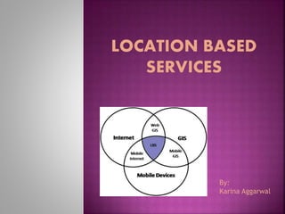
Location based services (LBS) are services
offered through a mobile phone and take into
account the device’s geographical location.
LBS typically provide information or
entertainment. Because LBS are largely
dependent on the mobile user’s location, the
primary objective of the service provider’s
system is to determine where the user is.
For Example,it can point a user to the nearest
restaurant.
An LBS can send an SMS message advertising a
sale at a nearby shopping mall.
3.
4.
5. METHODS
To specify the mobile user's location, one method
involves using the mobile phone network.
For example, the current cell ID can be used for
identifying the base transceiver station (BTS) that
the phone is communicating with. Once that is
determined, the only thing left is to pinpoint the
location of the BTS.
Other systems use GPS satellites. This method
is much more accurate than the one previously
mentioned and are now made easier by some
smartphones that already have built-in GPS
receivers.
6. Another common method is the use of short-
range positioning beacons. Such devices
typically employ WiFi or Bluetooth technologies
and are ideal for indoor LBS applications.
7. The global LBS market is broadly classified on the
basis of technologies, services provided,
applications, end users, regions, and target
audience.
The technologies under LBS market constitute
cell ID, E-OTD, A-GPS, E-GPS, and hybrid
technology.
Among the various technologies, hybrid
technology is emerging and is expected to grow
tremendously in the near future.
The sub segments of applications include
mapping, infotainment and discovery, emergency
support and disaster management, leisure and
social networking, location-based advertising, and
tracking
8. The market research report categorizes the global
Location based services market on the following
basis:
On the basis of Products:
Hardware
Software
Services
On the basis of Services:
Consulting
Managed Services
System Integration
Other Services
On the basis of Technologies:
Cell Identification (Cell-ID)
Enhanced Observed Time Difference (E-OTD)
9. Observed Time Difference Of Arrival (OTDOA)
Assisted GPS (A-GPS)
Enhanced GPS (E-GPS)
Hybrid Technology
On the basis of End Users:
Academia and Education
BFSI
Healthcare
Government and Defense
Retail
Media and Advertisement
Manufacturing
Oil and Gas
Transportation and Logistics
10. It is the process of determining the location of
a point by measuring angles to it from known
points at either end of a fixed baseline, rather
than measuring distances to the point directly
trilateration. The point can then be fixed as
the third point of a triangle with one known
side and two known angles.
11. Denzin (1970) extended the idea of triangulation
beyond its conventional association with research
methods and designs. He distinguished four forms
of triangulation:
Data triangulation, which entails gathering data
through several sampling strategies, so that slices
of data at different times and social situations, as
well as on a variety of people, are gathered.
Investigator triangulation, which refers to the
use of more than one researcher in the field to
gather and interpret data.
Theoretical triangulation, which refers to the
use of more than one theoretical position in
interpreting data.
12. Methodological triangulation, which refers to
the use of more than one method for gathering
data.
Triangulation today is used for many purposes
including
• surveying
• navigation
• metrology
• astrometry
• binocular vision
• Model rocketry and
• gun direction of weapons.
13. Optical 3d measuring systems use this principle
as well in order to determine the spatial
dimensions and the geometry of an item.
Basically, the configuration consists of two
sensors observing the item. One of the sensors is
typically a digital camera device, and the other
one can also be a camera or a light projector.
The projection centers of the sensors and the
considered point on the object’s surface define a
(spatial) triangle.
Within this triangle, the distance between the
sensors is the base b and must be known. By
determining the angles between the projection
rays of the sensors and the basis, the
intersection point, and thus the 3d coordinate, is
calculated from the triangular relations.
15. CGI (Cell Global Identity) is the global identity of the
cell in the whole system. It is composed of four
different parameters:
MCC - Mobile Country Code,
MNC - Mobile Network Code
LAC - Location Area Code,
CI - Cell Identity within the location area.
CGI is sent to the mobile station (MS) as a part of
the system information message (GSM Rec. 04.08).
The combination MCC-MNC-LAC is also known as
the location area identity (LAI).
It is a standard identifier for mobile phones cells,
providing means to geographically locate
connected mobile phones.
16.
17. If a cell phone is connected to a GSM network
then the position of that particular cell phone can
be determined using CGI of the cell which is
covering that cell phone.
There is a series of related technologies that were
developed based on CGI that enhances the
location precision:
Cell Global Identity with Timing Advance
(CGI+TA),
Enhanced CGI (E-CGI),
Cell ID for WCDMA,
Uplink Time Difference Of Arrival (U-TDOA)
Any Time Interrogation (ATI), and
Assisted Global Positioning System (A-GPS)
18. Enhanced Cell ID provides the next-level of accuracy
over Cell ID through the use of Radio Frequency
parameters such as Timing Advance (TA) to estimate a
position within the cell-sector.
In the GSM cellular mobile phone standard, timing
advance value corresponds to a step change in an
approximation of the number of microseconds the
signal from the mobile phone requires to travel to
the base transceiver station (BTS—essentially the cell
tower to which the phone is connected at the time).
Specifically, TA uses time offset information sent
from the BTS to adjust a mobile handset's relative
transmit time to correctly align the time at which its
signal arrives at the BTS. These measurements can be
used to determine the distance from the mobile
device to the BTS further reducing the position error,
as indicated in the following diagram.
19.
20. The Global Positioning System (GPS) is a
space-based satellite navigation system that
provides location and time information
anywhere on or near the earth.
The system provides critical capabilities to
military, civil, and commercial users around
the world.
The United States government created the
system, maintains it, and makes it freely
accessible to anyone with a GPS receiver.
21.
22. The current GPS consists of three major
segments. The U.S. Air Force develops,
maintains, and operates the space and control
segments.
Space segment (SS)::The space segment is
composed of 24 to 32 satellites in medium earth
orbit and also includes the payload adapters to the
boosters required to launch them into orbit.
Control segment (CS)::The control segment is
composed of a master control station (MCS), an
alternate master control station, and a host of
dedicated and shared ground antennas and monitor
stations.
23. User segment (US)::The user segment is
composed of hundreds of thousands of U.S. and
allied military users of the secure GPS Precise
Positioning Service, and tens of millions of civil,
commercial, and scientific users of the Standard
Positioning Service.
APPLICATIONS
Civilian
Communication
Navigation
Military
24.
25. Assisted GPS (A-GPS) is used to speed up start-
up times of GPS-based positioning systems.
GPS may have problems getting a lock when the
signal is weak and in such a case A-GPS would
assist in getting a lock.
This, however, is achieved by the use of an
Assistance Server, so a data connection is
required and charges may apply for the data
transfer.
It enhances the performance of standard GPS in
devices connected to the cellular network. A-GPS
improves the location performance of cell phones
(and other connected devices) in two ways:
26. By obtaining a faster "time to first fix" (TTFF)
By helping position a phone or mobile device