2013 PLSC Track, Hydrographic Surveying and GIS by Carlos Caceres
•
2 likes•4,045 views

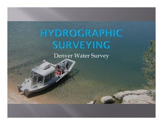
This presentation is to inform the audience about hydrographic surveying done at Denver Water’s reservoirs. In this presentation, I will show how we collect, process, and use the data. I will discuss the software used such as Hypack software, AutoCAD Civil 3D, and most importantly ArcGIS. We are able to map the depths of the reservoirs to determine water volumes that will be used by Water Recourses Analysis Division.

Recommended
More Related Content
What's hot
What's hot (20)
Viewers also liked
Viewers also liked (18)
More from GIS in the Rockies
More from GIS in the Rockies (20)
Recently uploaded
Recently uploaded (20)
2013 PLSC Track, Hydrographic Surveying and GIS by Carlos Caceres
- 2. An active remote sensing system that uses sound waves to estimate depths of water bodies. Single Beam 2. Multibeam 3. Side scan sonar SONAR - SOund Navigation And Ranging 1.
- 3. Who uses this information?
- 5. 2. Multibeam Echo Sounder Odom ES3-1 Mounted Port Side
- 8. 4. Inertial Measurement Unit Ship Motion Control IMU-108 Pitch Roll Heading Heave
- 10. 5. Side Scan Sonar StarFish 450F
- 11. 6. Global Navigation Satellite System (GNSS) Trimble 552 (heading) & 852 (position) Heading Position Base
- 12. • • • Hypack • Survey • Hysweep • C.U.B.E ArcGIS • ArcScene Civil3D
- 14. MBMAX 64 Edit Stage 2