2 Tsolmon
•
3 likes•1,088 views

The document summarizes the activities of the NUM-ITC-UNESCO laboratory for Remote Sensing/GIS at the National University of Mongolia. The laboratory conducts research on environmental monitoring in Mongolia using remote sensing and GIS techniques. Some of its key projects include monitoring pastureland degradation, glaciers, forest fires, drought, and desertification. It also engages in educational activities and international cooperation with universities from countries like the US, UK, Austria, and Japan.
![[object Object],[object Object]](data:image/gif;base64,R0lGODlhAQABAIAAAAAAAP///yH5BAEAAAAALAAAAAABAAEAAAIBRAA7)
Recommended
More Related Content
What's hot
What's hot (20)
Viewers also liked
Viewers also liked (20)
Similar to 2 Tsolmon
Similar to 2 Tsolmon (20)
More from GeoMedeelel
More from GeoMedeelel (20)
Recently uploaded
Recently uploaded (20)
2 Tsolmon
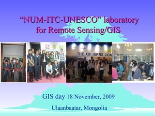
- 1. “ NUM-ITC-UNESCO” laboratory f or Remote Sensing/GIS GIS day 18 November, 2009 Ulaanbaatar, Mongolia
- 4. Remote Sensing Society/GIS Laboratory National University of Mongolia PASTURE LAND DEGRADATION SEVERE WINTER CONDITION (ZUD) GLACIER AIR POLLUTION FORESTRY AND FOREST STEPPE FIRE DROUGHT DESERTIFICATION NUM-ITC-UNESCO Remote Sensing Laboratory Land Cover/Use Change Deforestation
- 9. Research works our laboratory
- 10. Drought index maps, 2000-2003 1988 1990 2000 2001 2002 2003 Non drought Slight drought Severe drought Legends Lake 1982
- 11. Dust and Sand Storm in Northeast Asia Dust from the large expanse of desert across northern China and Mongolia has been subject to much greater study is eastward, out towards the Pacific Ocean.
- 13. 2002.03.18 – 03.21 20 aimag Wind speed > 16m/s: 217 soum > 28m/s: 31 soum Maximum Duration: 68 hours Losses: 3 person 53000 livestock 2.1 billion tugrigs Dust and Sand storm studies using MODIS/TERRA emissive bands
- 14. Band diffrence Pre-processing Satellite data Overlaying layers Meteorological data into GIS Dust storm images Visual Interpretation Dust and Sand Storm a) March.6, 2006 by AVHRR/NOAA b) March.6, 2006 by MODIS/TERRA c)March.9, 2006 by AVHRR/NOAA d )March.9, 2006 by MODIS/TERRA
- 15. Fire Monitoring Steppe and forest fires kill wildlife and also reduce the area of habitat available. Low humidity, a dry climate, and strong winds in the dry season make Mongolia one of the most fire-prone countries in Asia. 1996 1997
- 16. Forest and Steppe Fire Fire Monitoring
- 17. 1996 1999 1998 1997 2000 2002 2004 2005 2001 2003 98.5 percent of forests are classified as high fire risk areas. Fire Monitoring
- 18. Snow/Dzud
- 19. In Mongolia, that word is Zud –a combination of blizzard and bitter cold, preceded by drought. Heavy snow falls caused adverse grazing conditions for livestock SEVERE WINTER CONDITION The ground can become frozen so hard that animals cannot graze and water cannot be easily extracted. Pasture land is used for winter season
- 20. Glaciers MODIS Snow Index Figure 3. Map is showing areas having snow cover during the period June-Aug 2006, i.e. classified by time LANDSAT
- 21. Glacier changes in Western mountain Landsat data GLACIER 1990-09-07 2002-07-14 1992-06-25
- 22. Classification results of Glaciers Mountains Area , ha Changes , % 1990 2002 1 Tsambagarav 112.0 88.1 -21.3 2 Kharkhiraa 70.6 38.5 - 45.5 3 Turgen 93.8 41.6 - 55.6 4 Sutai 24.3 16.2 - 33.3 5 Sair 14.2 8.1 -43.0 6 Munkhkhairkhan 51.2 29.8 41.8 Total 366.1 222.3 - 39.3
- 23. Glacier thickness ALOS/PALSAR data
- 24. Between 1990 and 2005 60,000 ha of forest have been lost; Causes -Incorrect policies -infrastructure support for sustainable logging regimes -Increasing domestic demand for fuel wood and timber - Recent rapid deforestation is primarily due to fire, improper commercial and illegal logging inadequate enforcement of forest rules and regulations - Grazing and browsing of young trees by livestock, and insect infestations Deforest
- 25. Tree Mapping Plot diameter height Stand attributes (NDVI, DBH, height) species Local area Regional Continental The ability of regression models to represent the relationship between biomass and NDVI across local, regional and continental scale Estimation on biomass Forestry
- 26. 0 tonnes/ha 70 tonnes/ha 140 tonnes/ha 210 tonnes/ha 280 tonnes/ha 350tonnes/ha 2003 2004 Change forest biomass of the study area between years 2000 -2004 N52 o , E98 o N48 o , E102 o 2005 2006 2007
- 27. spectral channel number component number Measured satellite sensor response for a pixel in spectral band i Spectral response of mixture component,j,for spectral band i Proportion of mixture component, j ,for a pixel The error term for spectral band i Technique to apply linear mixture models component 3 component 1 1 pixel component 2 Outline of Methodology
- 28. Forest coverage percentage map using NOAA PAL data 1981 1982 1983 1984 1985 1986 1987 1988 1989 1990 1991 1992 1993 1994 1995 1996 1997 1998 1999 2000 200 1
- 29. 1985 1990 1995 2005 2000 20% 40% 60% 80% 100% 0%
- 30. 0 tonnes/ha 60 tonnes/ha 120 tonnes/ha 180 tonnes/ha 240 tonnes/ha 300tonnes/ha VEGETATION NDVI 11-20 August 2006 VEGETATION Forest biomass 11-20 August 2006 Low High N60 o , E80 o N40 o , E120 o Regional area
- 31. Onggi river basin The lenght is 437km, site is 175 square km The Ongi river starts f ro m Khangai Range then acrossed 3 kinds of areas which are Mountain & Wooded area, steering plain area, gobi desert area. Geographical location: 47°10 'N - 44°00'N 101°20'E - 105°00'E Mining
- 32. Approximally 60 thousand people and over one million livestock who one living around Ongi river one getting defective of drink water and pasture because of Ongi river and Ulaan lake’s evaporation. During Mongolia’ s transition to a free market, socio-economic factors such as poverty and profit-seeking mining exploitation of the environment have contributed to its deterioration, and consequently, the loss in regional biodiversity, land degradation and vulnerability.
- 33. Mining activity comprises 55 % of total industrial output Mining commodity gold copper flour spar coal construction material other Mining number 1990 3 1 5 * * 4 2000 127 1 15 * * 2 License number 400 4 58 82 120 52
- 34. Example: Mining activities Big scaled mining in Central part of Mongolia. Need land reclamation.
- 35. Example: Mining activities Hand level mining contributes to land degradation, Increased small to large-scale mining, as well as illicit activity resulting in exploitation of the country’s mineral resources.
- 36. Change of vegetation using MSAVI2 index between years 1998-2006 in the study area 0.175456 0.099066 0.022675 0.251847 0.328237 0.404628 0.481018 0.557409 0.633800 1998 1999 2000 2001 2002 2003 2004 2005 2006
- 37. Introduction Onggi river and Ulaan lake , 1963 year Map of topography М1:10000 0
- 38. LandsatTM Landsat ETM Onggi river&Ulaan lake, Landsat Image TM 1991 ETM 2000
- 39. Mongolian GER simply means "home." GER used by nomads Nomads civilization It is made of a wooden framework covered by large pieces of felt. A decorative cloth covering laid over the felt. Ger districts are characterized by high unemployment and poverty rates and have little or no water, sewer, or waste collection facilities or services contributing to increasing land erosion, and air and water pollution
- 40. Ger area 1990 Ger area 2005 Air pollution in Ulaanbaatar city Ulaanbatar city 1990 Ulaanbatar city 200 5
- 42. Discussion and Conclusion Contribution to plan for the future by making more educated decisions in the ecological issues such as mining, firefighting, forestry and biodiversity Mongolia’s climate change seems to be caused by combination of both human impacts and naturally occurring environmental changes Necessary of modeling of socio-economic factors and land Cover/use change using Remote Sensing/GIS We conclude that environmental issues such as pasture grazing, drought desertification dust storm contribute to land degradation and it will be presumably continue to increase in the future.
- 43. Thank you
Editor's Notes
- Сvvлийн vед ихээхэн яригдах болсон азийн шар тоосны нэг жишээ нь 1998 оны 4-р сарын 19-ны єдєр Монголын говь, цєлийн бvсэд vvсээд 7 хоногын дараа Япон тэнгисийг туулаад Номхон далайг даван Хойд Америкт хvрсэн мэдээ баримт байна.
- In this research, dust and sand storm image was determined as this equations. This approach is based on the split-window method of Aerosol Vapor Index.
- Энэ аргазvйг схемчилэн харуулвал анхдагч боловсруулалт хийсэн мэдээндээ нvдэн тайлал хийж танилцаад температурын ялгаврын индексийг бодуулаад цаг уурын станцын мэдээг ГМС-д оруулж дээрх 2 мэдээгээ давхцуулан шороон шуурганы зураглал хийнэ.
- Socioeconomic analysis of land degradation. Land degradation- water deficient- Migration-to urban areas, It causes urban plan problems in Mongolia. Many herders come to UB and contribute poverty and unemployed population.