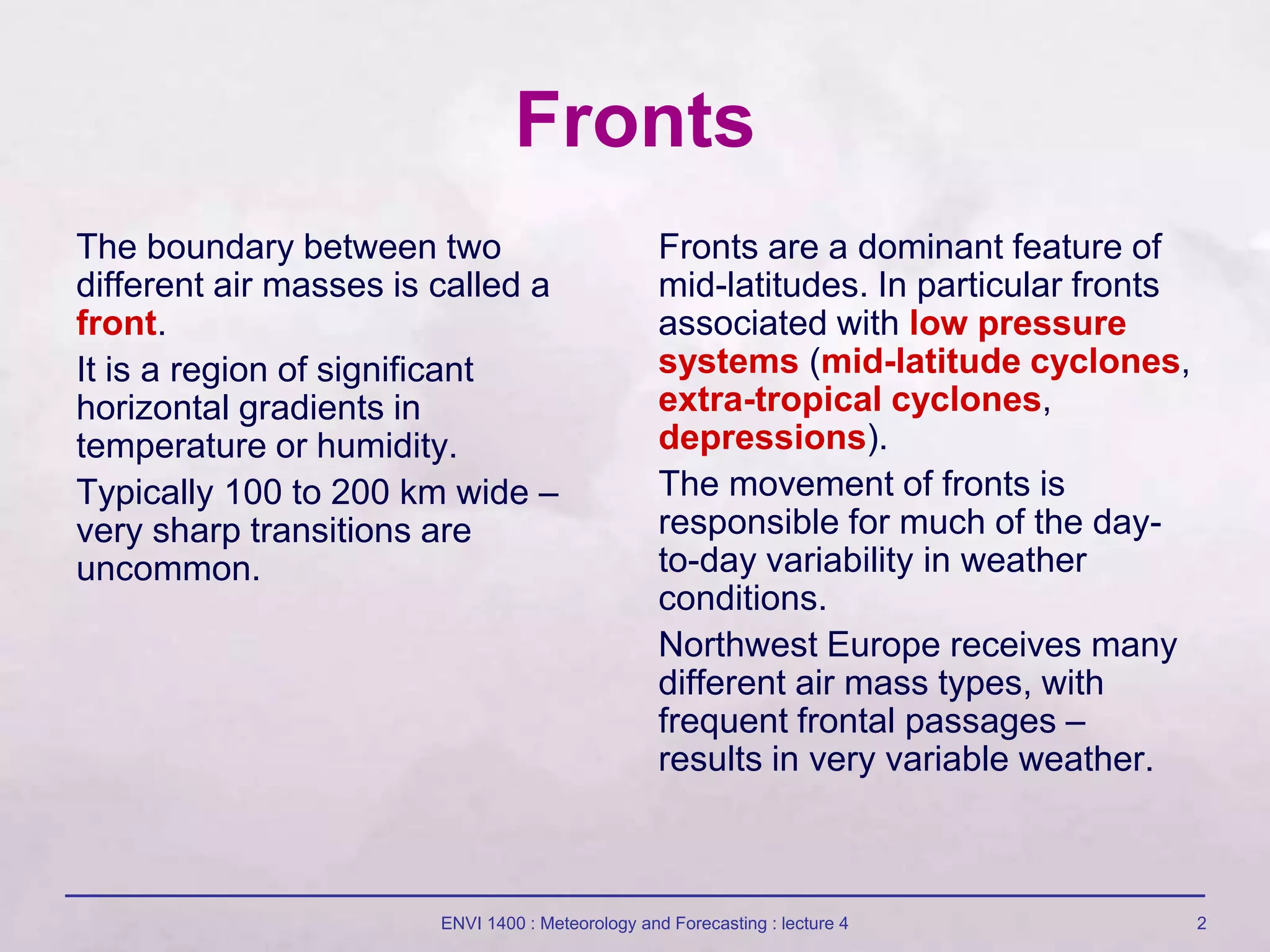
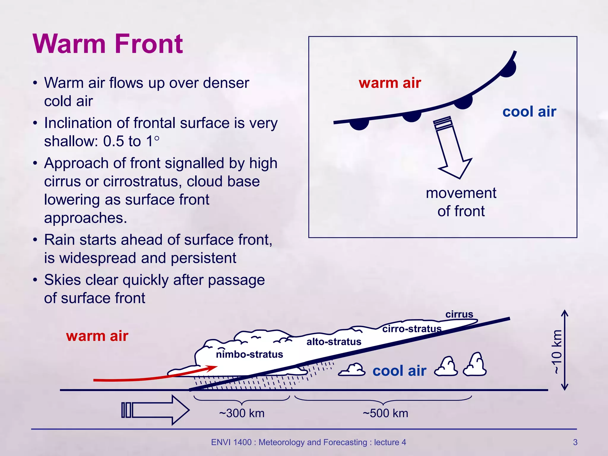
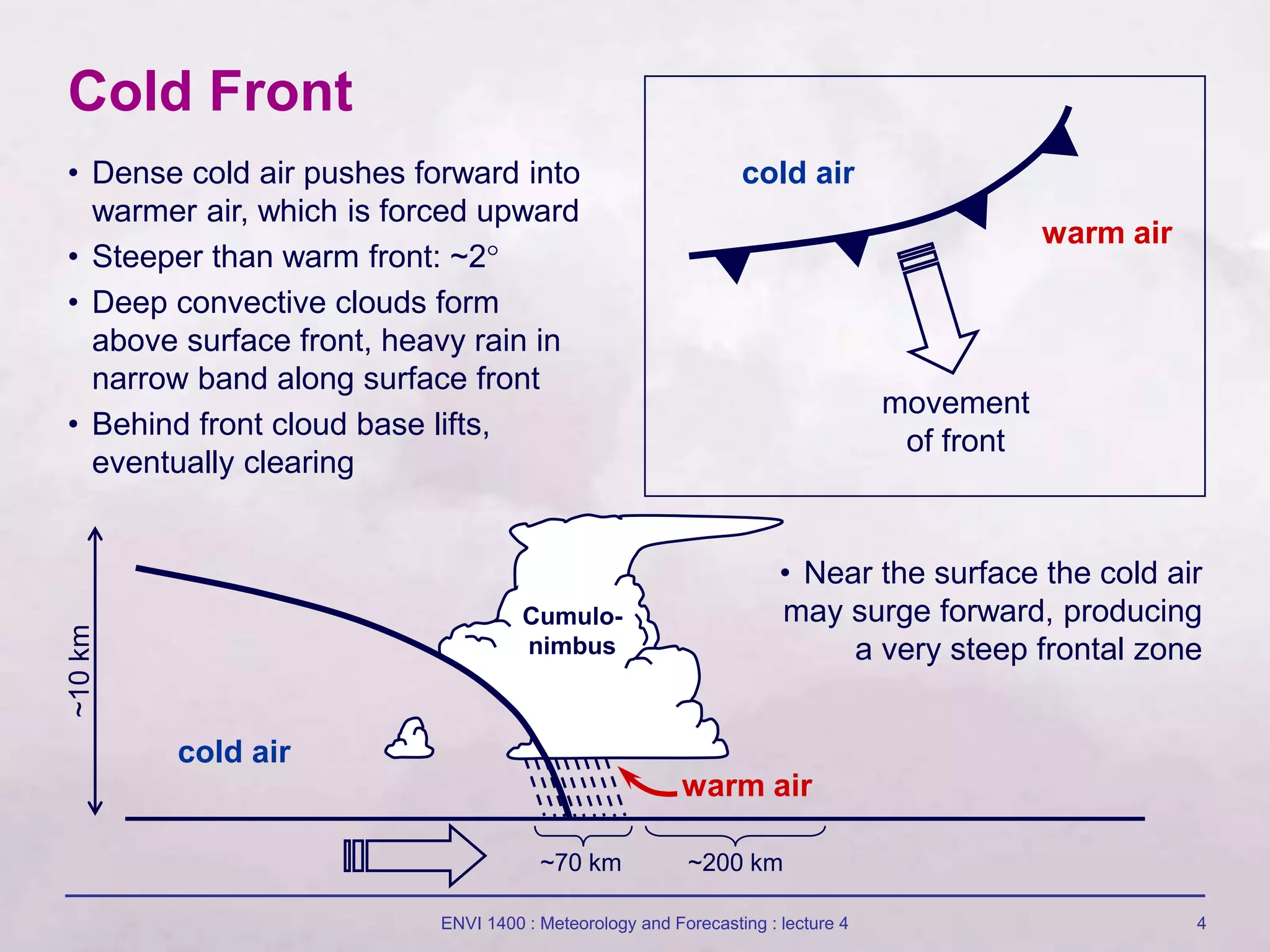
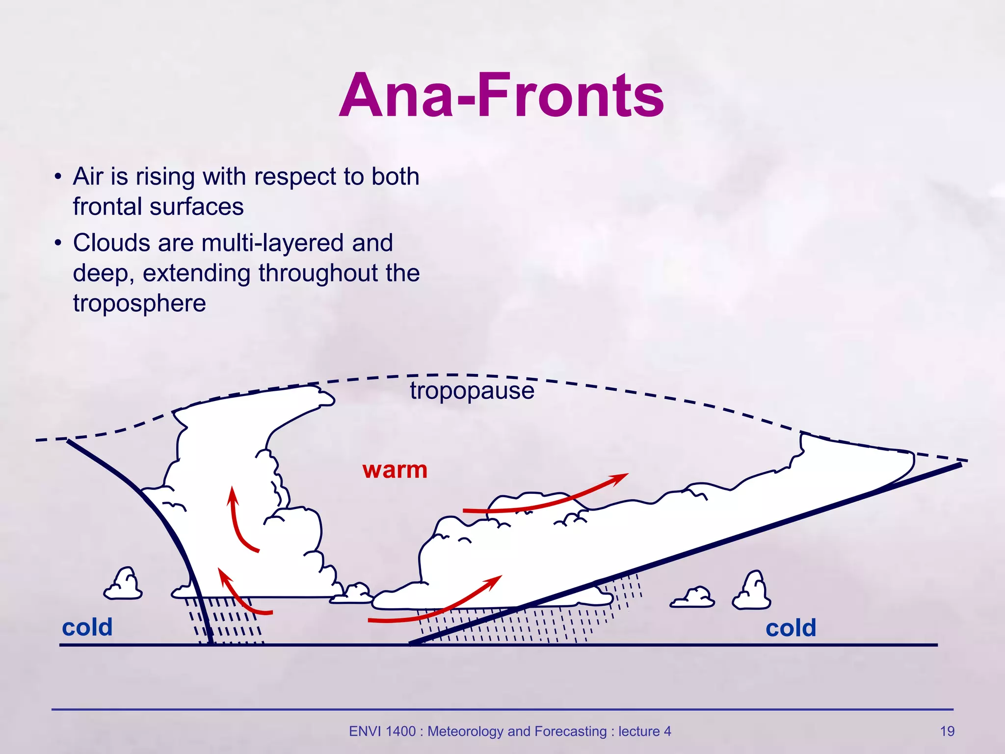
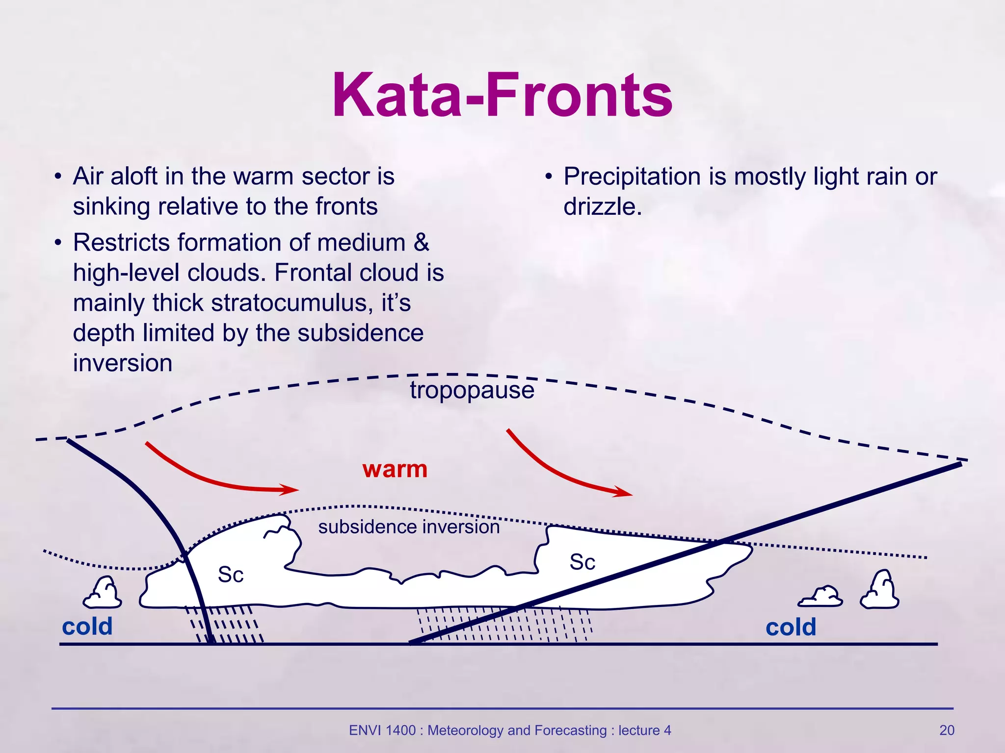
1) The document discusses fronts and mid-latitude cyclones, including the formation and characteristics of warm fronts, cold fronts, stationary fronts, and occluded fronts.
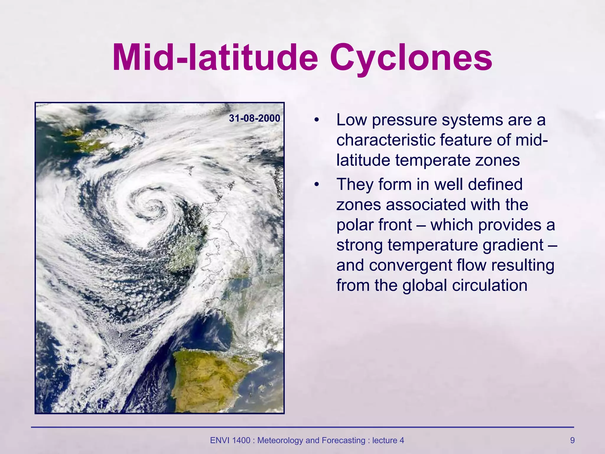
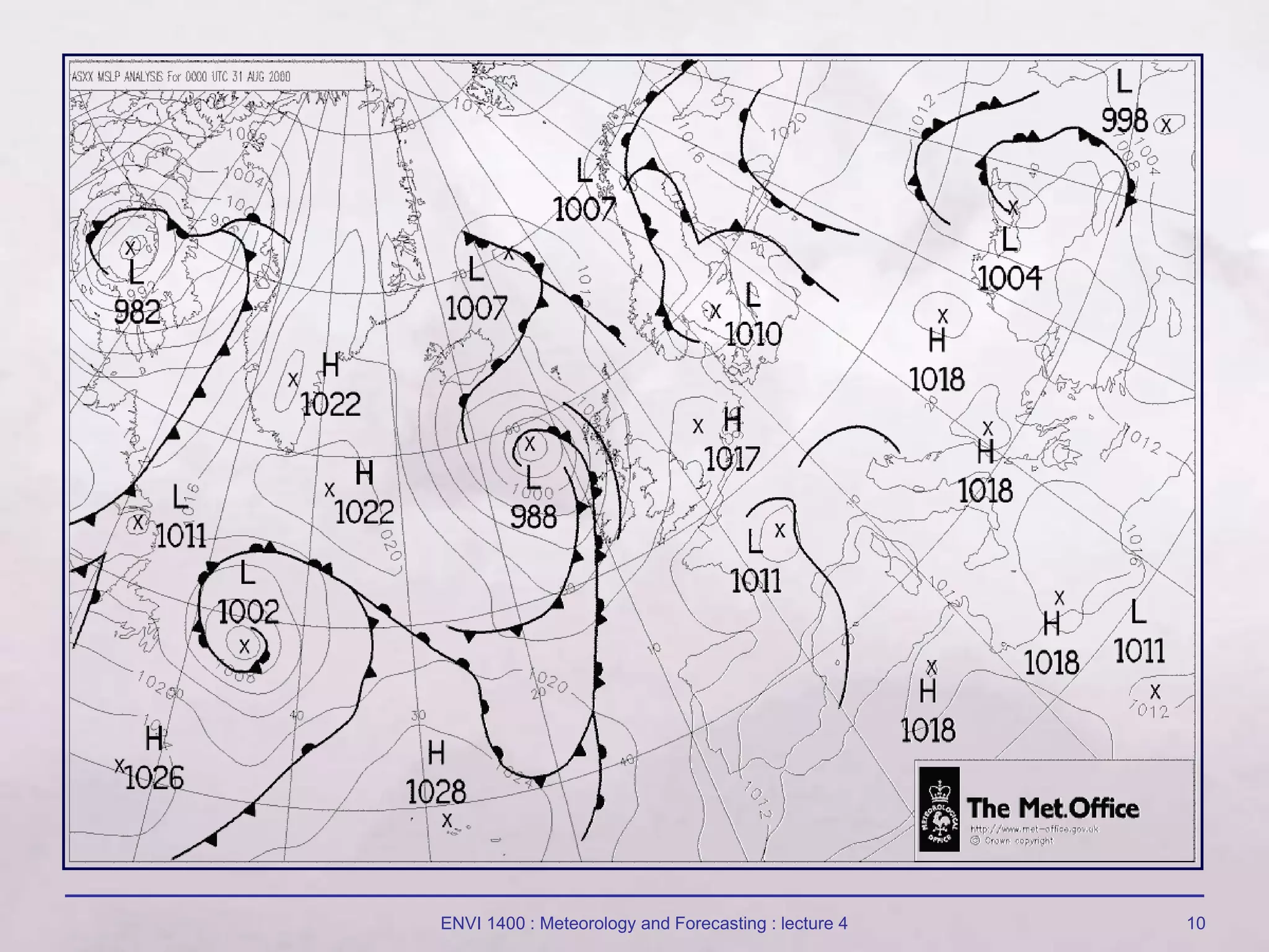
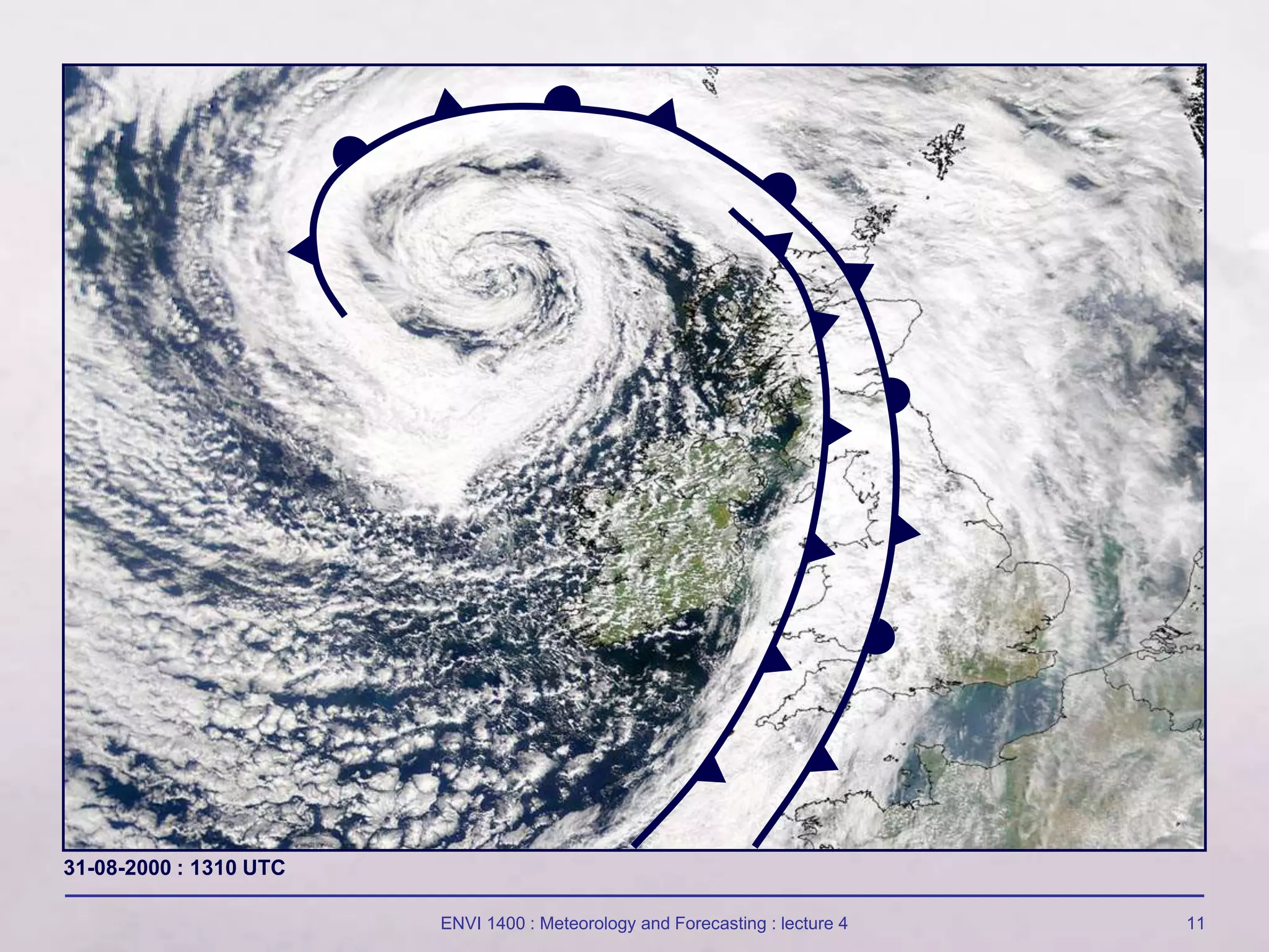
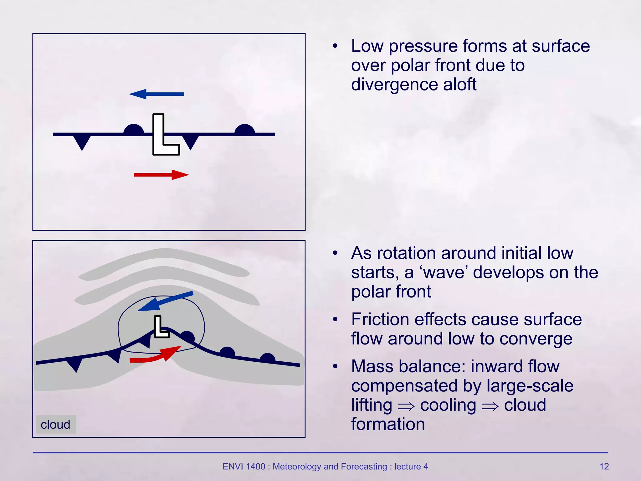
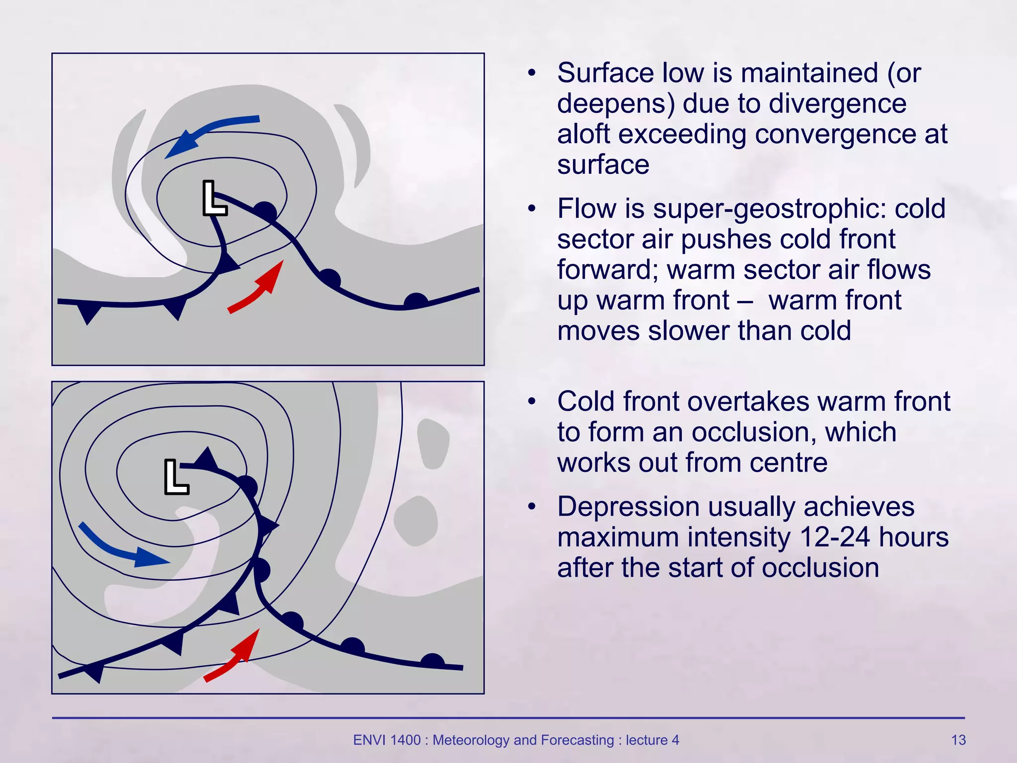
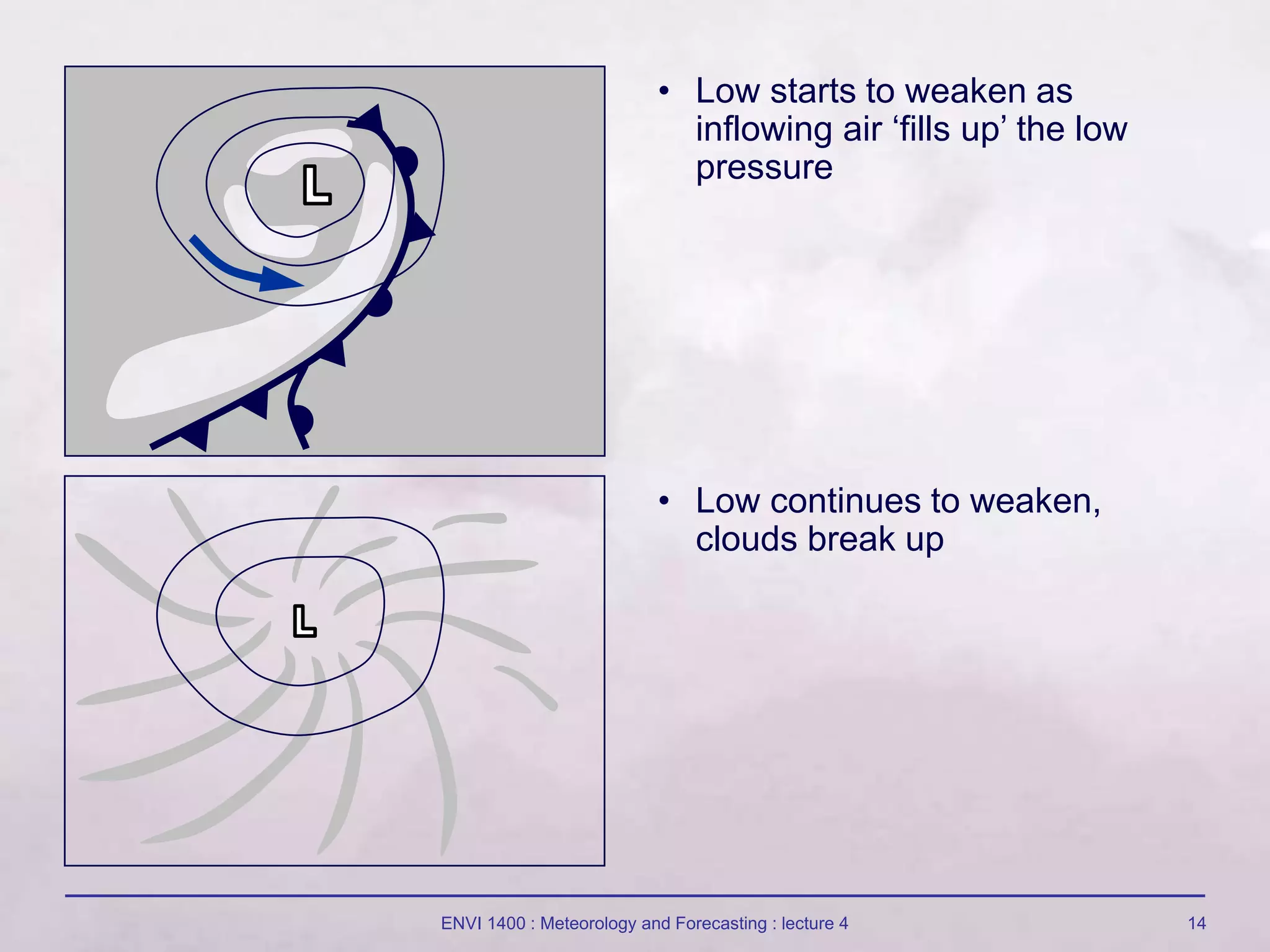
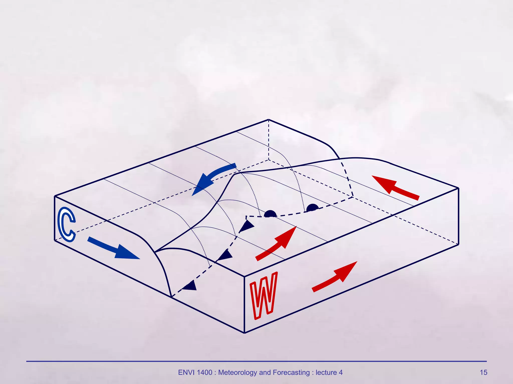
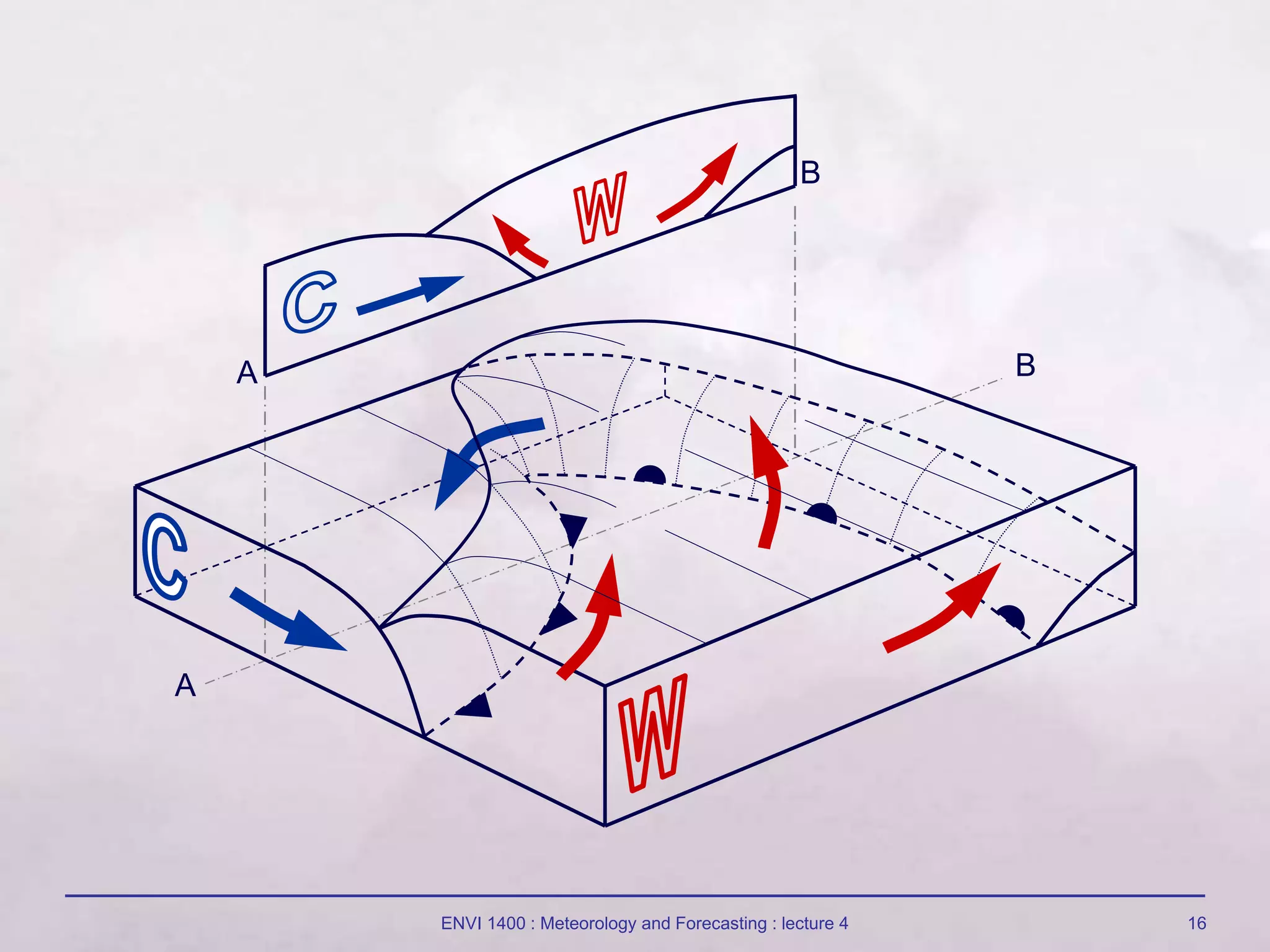
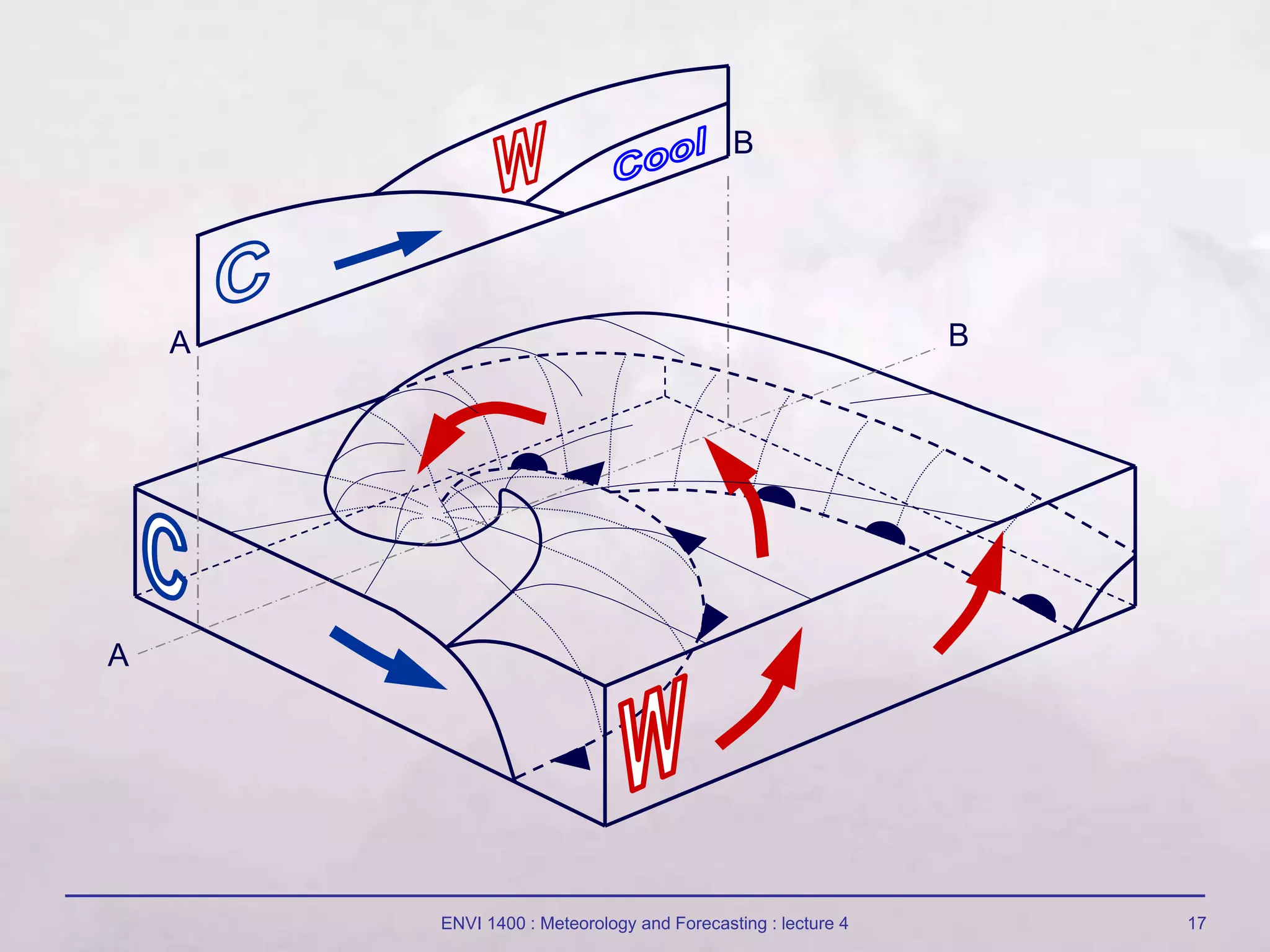
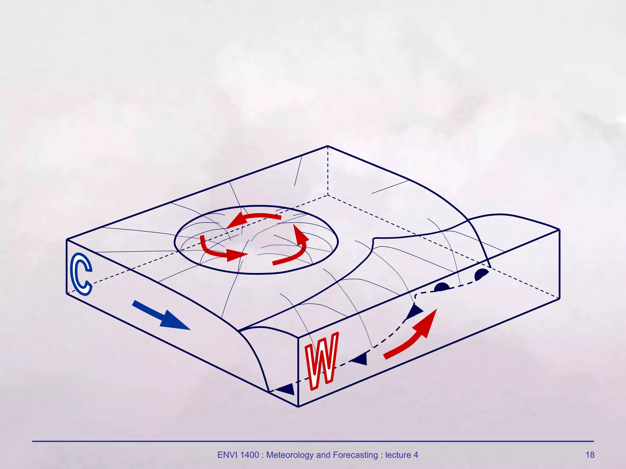
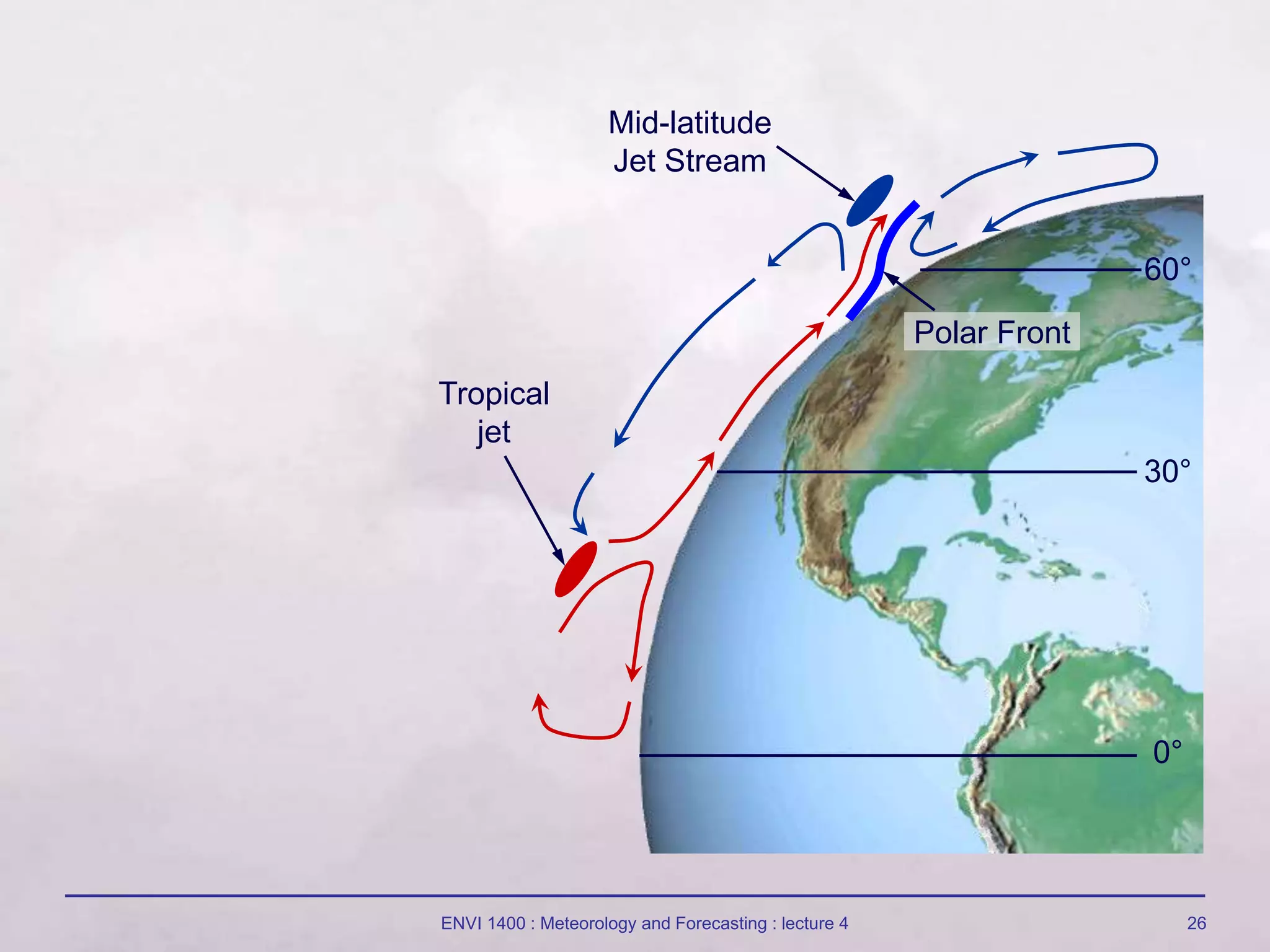
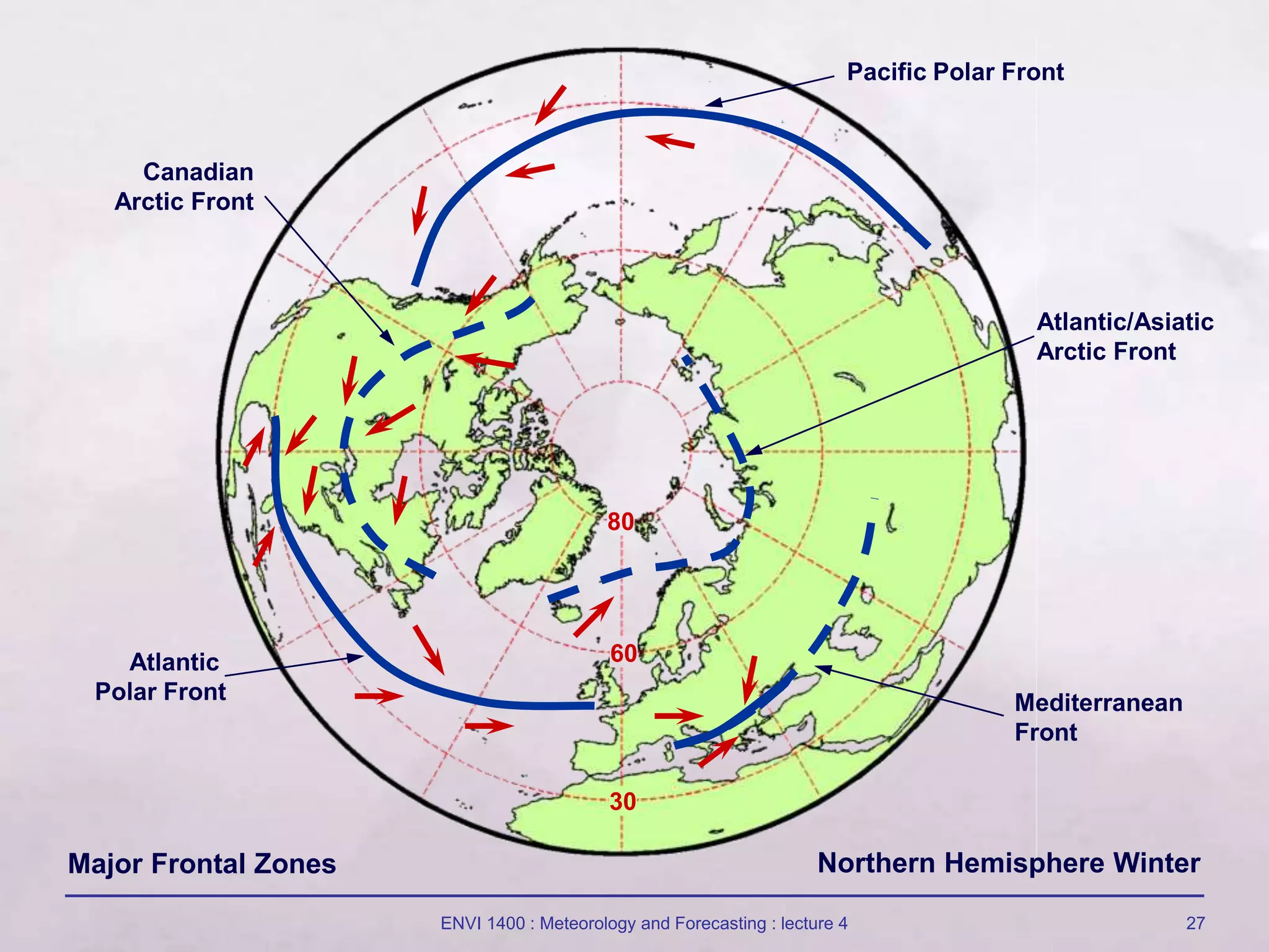
2) Mid-latitude cyclones form in zones along the polar front where there are strong temperature gradients and converging winds. They develop through the formation and movement of different air mass fronts.
3) The movement and interaction of fronts within mid-latitude cyclones is responsible for much of the day-to-day variability in weather conditions in mid-latitude regions like Northwest Europe.