Focus Events of the 1960s
•Download as PPTX, PDF•
1 like•71 views

This 45-minute presentation focuses on two natural disaster events that occurred in the 1960s that changed how we approach responding to disastrous incidents in the United States: The Great Alaska Earthquake of 1964 & Hurricane Betsy in 1965.

Recommended
More Related Content
What's hot
What's hot (19)
Similar to Focus Events of the 1960s
Similar to Focus Events of the 1960s (20)
More from Abdur-Raheem As-Siddiq
More from Abdur-Raheem As-Siddiq (7)
Recently uploaded
Recently uploaded (20)
Focus Events of the 1960s
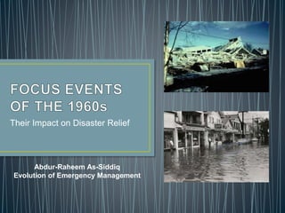
- 1. Their Impact on Disaster Relief Abdur-Raheem As-Siddiq Evolution of Emergency Management
- 2. • The period between 1950 – 1978 was a formative period in the history of the United States Disaster Response and relief efforts • This period ushered in numerous new legislation that built upon one another • Policy Makers addressed Civil Defense readiness, hazard reduction and recovery, identifying different types of threats, as well as technological and environmental disasters • Two specific disasters of the 1960s were the foundation of significant changes to federal law: The Alaska Earthquake of 1964, and Hurricane Betsy, 1965. (Rubin, 2012)
- 3. • What caused mobilization? March 27, 1964 @ 5:36 PM – 9.2 magnitude earthquake hit the Prince William Sound The most powerful recorded earthquake in U.S. history (USGS) 250 km wide aftershock zone Aftershocks continued for more than a year. Significant damage covered about 130,000 square kilometers. (AEIC, 2002)
- 4. • What caused mobilization? Many landslides and avalanches Major structural damage in many major cities The damage totaled 300-400 million dollars Deaths totaled 131 (AEIC, 2002) Most deaths were from the tsunami (USGS, 2014) USGS YouTube Video: 1964 Quake: The Great Alaska Earthquake
- 5. • Agenda Setting President Johnson established the Federal Reconstruction and Development Planning Commission A Senator linked the legislative and executive branches of government $23.5M was allocated to help rebuild essential facilities and replace lost tax revenue (Rubin, 2012) Response by state and local authorities, health and welfare workers, and hundreds of volunteers (The Federal File, 2017)
- 6. • Agenda Setting Command Post established in Anchorage with the following priorities: Organizing Rescue teams Evacuation of victims Establishing emergency communication Restoring central utilities Welfare services for the homeless Food, clothes and emergency shelter (The Federal File, 2017)
- 7. • What caused mobilization? Caused $1.2 billion in damage. (Times-Picayune, 2011) It was more than 600 miles from edge to edge The storm surge flooded Miami and Fort Lauderdale The New River swelled over its banks. It packed winds of 135 mph when it hit Florida (Sun-Sentinel)
- 8. • What caused mobilization? 75 people died, primarily in Louisiana. (Sun-Sentinel) Wind gusts increased and were in excess of 160 mph and caused 16 feet storm surges above normal Inundated 4,800 square miles Disrupted transportation, communication, and utilities services Unexpected flooding in Industrial Canal and South of Gentilly Boulevard (Forrest, 1979)
- 9. • Agenda Setting Immediate problem was the evacuation of those stranded by the flood Shelters needed to be erected to provide evacuees with food and medical supplies Restoration of minimum community services (Forrest)
- 10. • New Legislation Loan forgiveness (Rubin, p.93) Disaster Relief Act of 1966 National Flood Insurance Act of 1968 Public Law 91-79 Disaster Relief Act of 1970 The Southeast Hurricane Disaster Relief Act P.L. 89-339 (Rubin, 2012) New Uniform Building Code was adopted (Tolan & Ural, 2014)
- 11. • Notable Changes Development of the National Earthquake Information Center (NEIC) in 1966. Establishment of the National Earthquake Hazards Reduction Program (NEHRP) in 1977 USGS earthquake research now primarily coordinated through the USGS Earthquake Hazards Program (Robertson et al, 2014)
- 12. • Notable Changes There has been an extensive expansion of monitoring stations in Alaska. USGS’ Advanced National Seismic System (USANSS) is now aiming to establish a nationwide network of 7,100 earthquake sensors across the country. Addition of Geo-spatial grid maps (Robertson et al, 2014) In response to Betsy, Congress ordered the Army Corps of Engineers to build a massive flood- protection system for New Orleans. (Times-Picayune, 2011)
- 13. Up until the 1950s, disaster relief and response was mostly reactive. Between 1950 and 1978, the paradigm shifted especially within the federal government. The court of public opinion was also instrumental in this paradigm shift. It led to numerous legislation and programs that greatly enhanced how the federal government and emergency managers prepare for and respond to disasters. The largest earthquake in United States history and the first $1B hurricane ushered in a new era. The legislation from just these two events have laid the foundation for minimizing the aftermath of disasters that strike United States.
- 14. American Museum of Natural History. (2014, December 12). Nature's fury: the next Alaska quake - rehearsing a response. Retrieved from https://www.youtube.com/watch?v=V3y0wAIlC3o Forrest, Thomas r. (1979). Hurricane Betsy, 1965: a selective analysis of organizational response in the New Orleans Area. University of Delaware Disaster Research Center. Newark, DE. Robertson, J., Roland, E., & Haeussler, P. (2014, March 25). The 1964 great Alaska earthquake & tsunami. Retrieved from https://www2.usgs.gov/blogs/features/usgs_top_story/the-1964-great-alaska-earthquake-tsunami/ Rubin, C. (2012). Emergency management: the American experience 1900-2010. Taylor & Francis Group, LLC. New York, NY. The Alaska Earthquake Information Center. (2002, November). The great Alaska earthquake of 1964. Retrieved from http://www.aeic.alaska.edu/quakes/Alaska_1964_earthquake.html The Federal File. (2017, January 1). The face of disaster - the great Alaska earthquake of 1964. Retrieved from https://www.youtube.com/watch?v=7nOUEOnxieU The Sun-Sentinel. (n.d.). 1965 - Hurricane Betsy. Retrieved from http://www.sun-sentinel.com/news/sfl-1965-hurricane- story.html
- 15. The United States Geological Survey. (2014, February 27). 1964 quake: the great Alaska earthquake. Retrieved from https://www.youtube.com/watch?v=lE2j10xyOgI The United States Geological Survey. (2014, January 16). Magnitude 9.2: the 1964 great Alaska earthquake. Retrieved from https://www.youtube.com/watch?v=jvl-4IWjHXo The United States Geological Survey. (n.d.). The great M9.2 Alaska earthquake and tsunami of March 27, 1964. Retrieved from https://earthquake.usgs.gov/earthquakes/events/alaska1964/. Tolon, M. & Ural D.N. (2014, July 21). Lesson learned from the 1964 great Alaska earthquake in disaster management. United States National Conference on Earthquake Engineering. Anchorage, AK.
Editor's Notes
- The policy changes and new legislations eventually led to a single federal agency becoming the primary responsibility for Emergency Management. Public calls and support for an increased federal role was one of the catalysts for the changes in federal law. Public health emergencies, although a concern, were still placed on the back burner and was not considered within the realm of Emergency Management.
- March 27, 1964 @ 5:36 PM – an earthquake registering 9.2 on the Richter Scale hit the Prince William Sound Region of Alaska The earthquake lasted approximately 4.5 minutes and is the most powerful recorded earthquake in U.S. history (USGS) The aftershock zone of this earthquake was about 250 km wide and extended about 800 km from Prince William Sound to the southwestern end of Kodiak Island. (AEC) In the first day there were 11 aftershocks with magnitudes greater than 6.0
- The four minute duration of shaking triggered many landslides and avalanches. Major structural damage occurred in many of the major cities in Alaska. The damage totaled 300-400 million dollars in 1964 dollars. Most deaths were from the tsunami
- President Johnson established the Federal Reconstruction and Development Planning Commission to develop coordinated plans for federal programs which contribute to reconstruction and to economic and resources development President Johnson appointed Clinton P. Anderson from Mexico to be the link between the legislative and executive branches of government for this effort. He facilitated appropriations and other issues that helped along the reconstruction and planning process
- Command Post established in Anchorage by the Civil Defense and coordinated there efforts (civilian, Military, & government)
- The storm became the first billion-dollar hurricane, causing $1.2 billion in damage. It was more than 600 miles from edge to edge with an eye estimated to be 40 miles wide at one point. The storm brought a six-foot storm surge that flooded Miami and Fort Lauderdale and is said to have nearly covered the island of Key Biscayne. The high storm tide backed the New River out of its banks causing it to overflow into downtown Fort Lauderdale a foot deep. It packed winds of 135 mph by the time it slammed into the Louisiana coast several days later.
- Betsy's reign of terror was Sept. 6 to 10, 1965, and 75 people died, primarily in Louisiana. Midnight September 10th, wind gusts were in excess of 160 mph and caused 16 feet storm surges above normal. Inundated 4,800 square miles, killed 81 persons in Louisiana, disrupted transportation, communication, and utilities service throughout the eastern coastal area. Unexpected flooding in Industrial Canal and South of Gentilly Boulevard caught many families off-guard (Forrest)
- The loan forgiveness statute changed the cost share normally applied to the reconstruction of federal-aid highways Disaster Relief Act of 1966 Authorized federal agencies to provide loans below ,market rates with terms as long as 40 years Extended aid to unincorporated communities Public Law 91-79 expanded this statute to: Allow disaster victims to use unoccupied federal housing and local public housing authorities Authorized the president to lease manufactured homes and make food coupon allotments Provide unemployment assistance Provided funding for states and localities for debris removal Expanded eligibility for public assistance Provided authorizing grants for states for the improvement of comprehensive disaster relief plans P.L. 89-339 Provided long-term assistance Required HUD to examine the need for national flood insurance Expanded upon loan forgiveness provisions enacted for Alaska
- The disaster led to the establishment of the National Earthquake Information Center (NEIC) within the U.S. Coast and Geodetic Survey in 1966. In 1977, Congress passed the Earthquake Hazards Reduction Act, which led to the establishment of the National Earthquake Hazards Reduction Program (NEHRP) the following year. USGS earthquake research efforts—which are now primarily coordinated through the USGS Earthquake Hazards Program—were established through NEHRP. (First video)
- The Alaska Earthquake Center currently receives data from more than 400 seismic sites. Another significant advance has been the production of the USGS National Seismic Hazard Maps. USGS seismic hazard maps are used in developing building codes, helping ensure that earthquake-resistant buildings are built in areas at risk from earthquakes. That levee system fell apart 40 years later during Hurricane Katrina.