Mohamed farah and abdikadir hussein urmah, february, 2014, gargooray assessment report, hargeisa, somaliland
•
1 like•100 views

Mohamed Farah Publications

Recommended
Recommended
More Related Content
What's hot
What's hot (20)
Similar to Mohamed farah and abdikadir hussein urmah, february, 2014, gargooray assessment report, hargeisa, somaliland
Similar to Mohamed farah and abdikadir hussein urmah, february, 2014, gargooray assessment report, hargeisa, somaliland (20)
Recently uploaded
Recently uploaded (20)
Mohamed farah and abdikadir hussein urmah, february, 2014, gargooray assessment report, hargeisa, somaliland
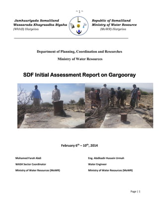
- 1. ~ 1 ~ Page | 1 Jamhuuriyada Somaliland Republic of Somaliland Wasaarada Khayraadka Biyaha Ministry of Water Resource (WkhB) Hargeisa (MoWR)-Hargeisa _______________________________________________________ Department of Planning, Coordination and Researches Ministry of Water Resources SDF Initial Assessment Report on Gargooray February 6th – 10th , 2014 Mohamed Farah Abdi Eng. Abdikadir Hussein Urmah WASH Sector Coordinator Water Engineer Ministry of Water Resources (MoWR) Ministry of Water Resources (MoWR)
- 2. ~ 2 ~ Page | 2 CONTENT 1. ACKNOWLEDGEMENT ....................................................................................................................3 2. EXECUTIVE SUMMARY...................................................................................................................4 3. OBJECTIVES OF STUDY...................................................................................................................4 4. METHODOLOGY ...............................................................................................................................4 5. BACKGROUND ..................................................................................................................................5 6. FINDINGS ON WATER RESOURCES..............................................................................................6 6.1 Sources of Water.................................................................................................................................6 6.2 Functionality and Borehole Data ........................................................................................................7 6.3 Water Demand Analysis......................................................................................................................8 7. RECOMMENDATIONS......................................................................................................................8
- 3. ~ 3 ~ Page | 3 1. ACKNOWLEDGEMENT We would like to express our heart-felt gratitude and our sense of gratefulness to Mr. Hussein Ahmed Abdulle, Minister of Water Resources of the Republic of Somaliland, for his commitment and leadership towards the fulfillment of the Mandate of the Ministry to develop and manage water sector. We are thankful for his guidance to plan and implement SDF water project to respond water needs of Somalilanders. We are appreciating Dr. Abdirizak Jama Nuur, Director General of Ministry of Water Resources (MoWR) for his unreserved support, senior supervision and guidance. I am greatly honored to thank, and to express my gratitude to Anthony Njue, SDF fund manager, for his efforts of realizing the successful implementation of SDF projects. We would like to express our appreciation to the Gargooray communities; elders and youth for their collaboration and facilitating for us to find required information. I would like to specially thank Mr. Abib, head of Gargooray clan, for his enthusiasm and welcoming us to the sites. This assessment trip would not have been possible from the beginning without support and inputs of Esther Lowe, SDF Consultant, in developing the full project proposal. We have special appreciation for Eng. Mohamed Omar Dhanbiil, Awdal regional coordinator of MoWR, for his support and following with us during our days in Awdal region.
- 4. ~ 4 ~ Page | 4 2. EXECUTIVE SUMMARY This initial assessment report explores general water needs in Gargooray agro-pastoral area in Boon district of Awdal region. It investigates functionality of newly drilled borehole in the area and it recommends possible solutions. Also it sums up social and demographic aspects of the community. This initial assessment report contributes to the development of full project proposal of water sector project of MoWR. The assessment was conducted by Ministry of Water Resources (MoWR) in collaboration with Somaliland Development Fund (SDF). The assessment mission was taken between February 6th – 10th , 2014 by Mohamed Farah Abdi, Somaliland WASH Sector Coordinator, and Eng. Abdulkadir Hussein Urmah, water engineer of MoWR. Somaliland Development Fund (SDF) will support MoWR in the implementation of two rural project and two urban water supply development. The two rural water schemes are Hadaaftimo in Sanaag region and Gargooray in Awdal region. The two urban water supply systems will be in Berbera and Burao. The assessment report identified that Gargooray has no water sources while both people and livestock move long distance to water points. The newly drilled borehole in the area is not functioning and it also locates at the peak of a mountain where people and livestock cannot reach. Its required to drill new borehole with water supply system and establish and strengthen water management structure. 3. OBJECTIVES OF STUDY The objective of this study is to do initial assessment on Gargooray water situation to find enough information for the full proposal development of SDF/MoWR. The study has the following specific objectives: 1. To identify water related problems in Gargooray rural community. 2. To report on the functionality and infrastructure of the new drilled borehole. 3. To collect social related information to examine provision of water service satisfies the needs of Gargooray community. 4. To assess and recommend possible solutions for Gargooray water development. 4. METHODOLOGY All information in this assessment report was collected from discussions and direct interviews with the Gargooray community members, clan elders and community leadership members of Boon district. Majority of interviews were focusing on borehole functionality and encountered challenges during dry season, water related problems and demography and social aspects. Direct
- 5. ~ 5 ~ Page | 5 observation and field visits were taken to collect information on water facilities, analyze and identify gaps. 5. BACKGROUND Gargooray locates 50kms North West of Boon district in Awdal region, on Latitude N 10.19’25” .76 and longitude E 43.05’47”.96. Gargooray is not village or town but nomadic land inhabited by agro-pastoral community. The total estimated population in the area is about 3600 persons. The Gargooray community has been suffering from drought impacts and long-persisted water shortage. The Gargooray area was known for agro-pastoralism which depends on the availability of rain. They practice rain-fed farms to find fodder for their livestock and sorghum and wheat for their households. However, due to the poor rains in the past three years, agro-pastoral conditions have considerably worsened in the area. Gargooray gradually changed into drought prone zone of semi- arid climate with temperature ranging between 15 - 32°C. Gargooray is the name of a basin surrounded by mountains with average height of 1500M. It is on semi-arid land where annual rainfall is about 250mm, with the affinity of dry coastal climatic characteristics. Gargooray area consist of various pastoral areas:; Cabdalle, Awrgaba, Qorijab, Xididaale, Dacarbudhuq, Dhabiiley and Carro. The price of water becomes very high about $10 per barrel during the drought season. Many livestock herds are lost every year due to droughts and great number of pastoralists migrate to towns and villages in search of water and aid. Poor sanitation, water borne diseases and diarrhea to some extent are experienced in Gargooray. People and livestock of Gargooray overcrowded in the nearest shallow wells. The closest shallow is 40kms. The community elders said that the living quality of their livestock was greatly harmed by the long distance to travel to the water points. When they walk about 80kms for water; 40km of going to and 40kms of coming from water points. The livestock become underweight as they lost their magnitude of living strong. They collect water from places blocked by steep mountains and huge gullies which are difficult for both people and livestock to travel. Gargooray comes under the administration of Boon district in Awdal region. Boon district has formally appointed mayor and deputy mayor with district executive secretary. The administration of the district is supported by group of traditional leaders and clan elders. Gargooray has one primary school with 300 students of whom 40% of them are girls. The primary school was constructed by community. The community members indicated that they used their camels to fetch water for the construction of the school. There is no health post or MCH in Gargooray. Road is one the greatest challenges affected Gargooray community.
- 6. ~ 6 ~ Page | 6 6. FINDINGS ON WATER RESOURCES 6.1 Sources of Water Water scarcity is the first problem in Gargooray agro-pastoralist community. There are no water points in the Area. The nearest water points are shallow wells in Xaliima Cade (40kms East), Boon district (50kms South), Ceelbaxay shallow well (43 West) and Dhabiiley shallow well (55kms North). The nearest water points (shallow wells) dries up during the dry season because of long time of lack of rains and pressure exerted to them. A 200 liters of water costs $ 10 in drought periods. The situation becomes very desperate as people drink very dirty and stinking remained water at the bottom of the dried up wells and this causes health problems to the children and elders. Most of the households in nomadic settlements spend several hours a day in fetching water. A geophysical assessment was taken in the area in 2007 to know potential water ground aquiver. The assessment was taken by Mr. Bruno Petrucci, Italian geophysical surveyor of African 70 (now Terre Solidali) and he identified specific borehole site (aquiver) to be used for the borehole drilling. A long expected borehole was drilled in the area on February 3, 2012 with the support of Kuwait Fund. Unfortunately, the borehole was drilled in other place rather than the site which was surveyed by Bruno five years before. The table below summarizes the variability: GPS Height Landscape Surveyed Borehole site Latitude N 10.19’25”.76 longitude E 43.05’47”.96 1402m above sea level Bottom of Libaaxley Mountain non-surveyed borehole site Latitude N 10.19’ 53” .06 longitude E 046.05’ 46”.64 1483M above sea level Top of Libaaxley Mountain Both the ministry engineers and community elders confirmed the Gargooray borehole drilling failed. The failure of the borehole was attributed to the misplacement of it in non-surveyed place as result of GPS reading problem. The ministry staffs told that the GPS misled the drillers. The borehole was drilled at the top of a mountain which is 82M above the previously surveyed point that was at the bottom of the mountain. Ministry did not fully supervise and test the borehole in Gargooray. It was not opened and drillers did not handover it to the ministry or to community. Community had good expectation to find borehole first in their life and they become very disappointed this failure. Community members know the exact surveyed site but they were not
- 7. ~ 7 ~ Page | 7 consulted during the time of borehole drilling. Some of the community members participated in the previous geophysical survey as they were co-working with Bruno. The community members did not see water from the borehole and it’s not working properly. On the other hand, the failed borehole was drilled in a where no one can be access to fetch water from it. Both people livestock and people could not reach it as it locates on very steep, gully and at the peak of the mountain. Gargooray community needs another borehole with water supply system. 6.2 Functionality and Borehole Data The Gargooray borehole is completely failure and it has not been used since its drilling date. The borehole was sealed and hammered with heavy bars of iron. On the basis of geological, hydrogeological and geophysical characteristics of land formation and aquiver behaviors, it’s convinced that there is no water in this borehole. We found the following data from the failed borehole: Borehole infrastructure Data Total borehole depth 185M below surface level – Just estimation Static water level No water Diameter 8” GI pipe casing Construction system There is no any construction system because no water source at all Geological formation of the borehole It is outcrop of the Basement Rock 1. Previously Surveyed/Selected Site 2. Current site of the failed borehole
- 8. ~ 8 ~ Page | 8 Aquifer It is basement Rock therefore ,no water Accessibility No one may reach as it locates top of a peak mountain 6.3 Water Demand Analysis According to the estimated population of Gargooray which is 3600 persons who consume minimum water of 15 liters of water per person per day, the daily water requirement of Gargooray will be 54 cum per day. This calculation will be added with water consumption of livestock population which will be about 60 cum per day. There will be an estimated additional 20 cum of water will be required for water security. The total water needs of Gargooray will be estimated about 120 cum per day. 7. RECOMMENDATIONS Gargooray community gets water from far distance shallow wells. There is no water source in the area and the constructed borehole is not functioning now. There is surveyed aquiver in the area. As a result of this initial assessment visit, the following measures are recommended: 1. Ministry of Water Resources should confirm possible uses of the new borehole in the future through making pump test and making water quantity and quality analysis 2. Meet or contact with Bruno, Italian Geophysical Surveyor, to find detailed and correct information about the geophysical survey taken in the area. 3. Establish proper designs with technical drawings, BoQ and specifications on Gargooray water supply. 4. Drill a new borehole with solar water pumping after more investigation on the previous geophysical survey in the area. 5. Construct water supply system with 120 cum elevated water tank, 4 kiosks, 10 animal troughs (4 for goats and sheep, 3 for camels and 3 for cattle) and distribution pipes. 6. Establish water sustainable management committee and train them on water management, operation & maintenance and financial management. 7. Provide necessary facilities for the management and operation and maintenance to the trained community water management committee.