#StandardsGoals for 2024: What’s new for BISAC - Tech Forum 2024
B1031016
1. International Journal of Engineering Research and Development
e-ISSN: 2278-067X, p-ISSN: 2278-800X, www.ijerd.com
Volume 10, Issue 3 (March 2014), PP.10-16
10
Bacteriological and Physico-chemical Analysis of Well Water
from Villages in Edati, Niger State, North-central Nigeria
1
Amadi, A. N., 1
Ameh, I. M., 2
Ezeagu, G. G.,
1
Angwa, E. M. and 1
Omanayin, Y. A.,
1
Department of Geology, Federal University of Technology, Minna, Nigeria
2
University Health Services, Federal University of Technology, Minna, Nigeria
Abstract:- The physico-chemical and bacteriological properties of water from hand-dug wells from villages in
Edati communities was evaluated in this study. The water samples were analyzed in accordance with the
standard procedures for water analysis. The results of the physico-chemical and bacteriological analysis
revealed that all the parameters were below the maximum permissible limit for a safe drinking water
recommended by Nigerian Standard for Drinking Water Quality except iron, manganese, E.coli and total
coliform whose concentration in some locations were higher than the acceptable limit. The high iron and
bacterial coliform may be attributed to the shallow well depth, distance to pit latrine/soakaway, improper well
construction, inadequate of well lining and land use system in the area. The results obtained indicates that the
groundwater quality of Edati fall between the maximum permissible limit of NSDWQ. It is therefore
recommended that provision of hand dug wells and boreholes in this area should not be in proximity with the
pit-latrines, septic and dump sites.
Keywords:- Quality analysis, Well-water, Edati community, Niger State, Nigeria
I. INTRODUCTION
Groundwater offers the most abundant source of water to man. Every aspect of agriculture requires
adequate and timely supply of water to succeed. (Olasehinde, 2010). Groundwater under phreatic condition
occurs in the mantle of weathered rock, alluvium and laterite overlying the hard rock, while within the fissures,
fractures, cracks, joints and lava flow junctions within the hard rock, groundwater is mostly in a semi-confined
state. Compared to the volume of water stored under semi-confined conditions within the body of the hard rock,
the storage in the overlying phreatic aquifer is often much greater. In such cases, the network of fissures and
fractures serves as a permeable conduit feeding this water to the well. The recharge to groundwater takes place
during the rainy season through direct infiltration into the soft mantle overlying the hard rock and also into the
exposed portions of the network of fissures and fractures. Since not every subsurface water is good for human
consumption, investigation of groundwater quality is very essential in providing safe drinking, domestic and
industrial water to the populace. Access to clean water is a human right and a basic requirement for economic
development. The safest kind of water supply is the use of groundwater. Since groundwater normally has a
natural protection against pollution by the covering layers, only minor water treatment is required. Detailed
knowledge on the extent, hydraulic properties, and vulnerability of groundwater reservoirs is necessary to
enable a sustainable use of the resources (Reinhard, 2006).
Study Area Description
Edati is located between longitude 50
381
E to 50
411
E and latitude 90
061
N to 90
091
N on Egbako sheet. A
total surface area of 30km2
was covered. Edati is accessible through a major road, minor road and foot paths.
The area is low lying with more foot paths. It is a sparsely populated settlement with the major occupation of the
dwellers as farmers. Edati is also a part of Bida Formation with majorly sandstone unit and minor siltstone.
Table 1: Showing the Coordinates and Heights above Sea Level
Sample Location Longitudes Latitudes Elevation
Katamba Balogi 70
291
40.9811
100
241
53.1911
268
Goka 70
291
50.6211
100
231
55.8111
254
Majiko 70
291
58.1811
100
251
07.3611
260
Kukpa 70
281
48.3311
100
261
27.8911
205
Ndaba Zumaji 70
281
57.9611
100
241
53.1911
223
Gudu Majiko 70
271
41.6011
100
251
53.6011
230
2. Bacteriological and Chemical Analysis of Well Water from Villages in Edati, Niger State, North-central Nigeria
11
Physiography of the Area
The prevalent climatic condition of Edati is marked by high daily temperature and humidity with
maximum temperatures (37.5 0
C) records in the months of March and minimum temperature in the months of
December and January during harmattan, which occurs during dry season months the annual rainfall is moderate
with rainfall reaching its peak in September. The vegetation consists of broad leaves, Sahel savannah region and
characterized by shrubs, close range trees and close grasses over the area, it is due to rural settlement of the area.
The topography of the area consists of low lying terrains with few gentle hills. The area is typically flat
landscape.
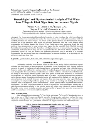
Figure 2: Digital terrain model (DTM) of the study area
A topographical mapping of the area was done using the GPS. Digital Terrain Model (DTM) of the
area was made using Surfer 8.0 software as shown in figure 2. The highland is towards the north central part of
the area.
II. GEOLOGY AND HYDROGEOLOGY OF THE AREA
The geology of Edati falls within the sedimentary basins of Nigeria. The major rock type which shows
it is of the sandstone suit. The rock in the study is mechanically formed sedimentary rock. These rocks have
been formed from the accumulation of materials derived from other rocks which have been cemented together
and the entire area is underlain by cretaceous sandstone. The quantity of groundwater in the study area is by
spaces within the crevices and the inter-connectivity within these crevices. The quality of the groundwater is a
function of the chemistry of the groundwater which is dependent on the amount of solute dissolved in the
Zumagi 70
281
47.5811
100
251
58.4611
208
Gogaa 70
301
33.5211
100
231
51.2811
217
Nuwangi 70
291
18.6811
100
271
11.7511
242
Tsuni 70
311
07.2411
100
251
53.1111
213
3. Bacteriological and Chemical Analysis of Well Water from Villages in Edati, Niger State, North-central Nigeria
12
groundwater and is controlled by the origin of groundwater and the composition of the host rock that stores the
groundwater (Adefila, 1975).
7.465 7.47 7.475 7.48 7.485 7.49 7.495 7.5 7.505 7.51 7.515
10.4
10.405
10.41
10.415
10.42
10.425
10.43
10.435
10.44
10.445
10.45
0 0.01 0.02 0.03 0.04
Figure 3: Map Showing Groundwater Flow Direction of Edati
The direction of flow in Edati area tends towards the Northeastern part which is the highest point of the
area. The table of elevation of the area is shown in table 1 above. The mean value of elevation is 610.60 meter
and it ranges between 597.53 and 642.53 meter above sea level.
III. METHODOLOGY
Geochemical investigation of Water samples were collected in a clean polythene bottles from wells in
Edati randomly which were analyzed in the regional water quality laboratory of Federal Ministry of
Agriculture and Water Resources, Minna to determine the amount of different parameters such as pH, electrical
conductivity (EC), hardness, total dissolved solid (TDS), calcium (Ca2+
), sodium ( Na2+
), magnesium (Mg2+
),
iron (Fe2+
), lead (Pb2+
), potassium(K+
), trace metals, bicarbonate(HCO3
-
), chloride (Cl-
), sulphate (SO4
2-
),
carbonate (CO3
2-
) and nitrate (NO3) for the probable cause of contamination. Before the analysis of the
samples, the physical parameters where determined in the field using standard equipments. The longitude,
latitude and elevation of each location were used to generate the groundwater flow direction and the digital
terrain model of the area.
4. Bacteriological and Chemical Analysis of Well Water from Villages in Edati, Niger State, North-central Nigeria
13
IV. RESULTS AND DISCUSSION
Table 2: Summary of the water analysis
Parameters (mg/l) Minimum Maximum Mean NSDWQ
(2007)
Temp. (0
C) 27.00 29.00 28.00 Ambient
pH 6.45 7.75 6.65 6.50 – 8.50
Cond. (µs/cm) 16.8 347.0 104.01 1000.00
DO 3.40 6.50 5.06 10.00
BOD 0.55 3.40 2.41 6.00
COD 5.60 17.40 11.04 10.00
Total Hardness 7.00 156.00 48.86 500.00
Alkalinity 18.00 360 94.90 250.00
Cl-
14.18 63.81 24.25 250.00
NO3 0.01 0.56 2.19 50.00
TDS 10.92 232.49 69.58 500.00
Na 0.98 170.33 22.30 200.00
K 0.21 19.68 6.67 150.00
Mg 0.33 1.68 0.88 200.00
Mn 0.01 1.01 0.12 0.30
Cu 0.00 0.01 0.01 1.00
Ca 0.61 61.20 11.15 200.00
Fe 0.00 0.50 0.11 0.30
Pb 0.00 0.00 0.00 0.01
CO3
-
9.20 15.72 12.76 100.00
HCO3
-
9.20 15.72 12.76 100.00
SO4
2-
E.coli
T.coliform
3.60
0.00
0.00
7.20
8.00
25.00
5.09
3.50
12.00
200.00
0.00
10.00
Physical Parameters
The ambient temperature ranges from 270
C to 290
C with mean value of 25.330
C from the water
analysis of Edati in Table 2 which indicates that it’s good for drinking purposes. Groundwater with lower
temperatures reveal presence of pollution while those with warm temperatures as above is preferred as healthy
for the environs since the important minerals are dissolved in the process making it rich for human consumption.
The pH value ranges from 6.45 to 7.75 with a mean value of 6.35 which is slightly acidic but can still be
recommended for drinking and domestic purposes since it meets up with the NSDWQ 2007 (6.5 -8.5). The
slight acidity can be due to infiltration of leachates to the subsurface. The maximum conductivity value is 347
(µs/cm) with no complicacies at all. The total hardness falls between 7mg/l and 156 mg/l with a mean value of
48.86 mg/l which is far less below when compared to NSDWQ about 500 and so poses no threat to groundwater
quality of Edati.
Chemical Parameters Cations
Potassium and sodium are alkali ions. Potassium is virtually low when compared to sodium with values
of the samples ranging from 0.21 mg/l -19.68 mg/l with a mean value of 6.67 mg/l while sodium varies from
0.98-170.33 mg/l with a mean value of 22.30 mg/l. The values of sodium and potassium are generally low when
compared with the NSDWQ maximum permissible limits of 150 mg/l for potassium and 200 mg/l for sodium
(NSDWQ, 2007). Calcium and magnesium are alkaline earth metals were determined at close range. Calcium
values ranges from 0.61 mg/l to 61.20 mg/l with an average value of 11.15 mg/l while magnesium concentration
varies from 0.33 mg/l to 1.68 mg/l and a mean value of 0.88 mg/l. These values are far below the recommended
value of 200mg/l for calcium and magnesium respectively (NSDWQ, 2007). Magnesium and calcium metal ions
are responsible for water hardness. Their low concentration implies that the well water within Edati is relatively
soft.
Anions
Bicarbonate and carbonate were determined and analyzed together since the dissolution of carbonate
rock in the ground by water leads to the formation of bicarbonate. The concentration of bicarbonate ranges from
9.2 mg/l to 15.72 mg/l with a mean value of 12.76 mg/l. the values of carbonate also ranges from 9.2 mg/l to
5. Bacteriological and Chemical Analysis of Well Water from Villages in Edati, Niger State, North-central Nigeria
14
15.72 mg/l with a mean value of 12.76 mg/l The value of bicarbonate is by far below the NSDWQ
recommended value of 100mg/l for bicarbonate. But for the carbonate, the values are higher than that of
NSDWQ. This can be attributed to the infiltration of acid rain into the subsurface water within the Edati area.
Figure 4: Correlation of the Mean concentration of Cations versus NSDWQ Values
The values of sulphate lie between 3.6 mg/l to 7.2 mg/l with a mean value of 5.09 mg/l. This falls
below the recommended maximum permissible limit of 200 mg/l (NSDWQ, 2007).The chloride concentration
varies from 14.18 mg/l to 63.81 mg/l with a mean value of 24.25 mg/l. This value is below the NSDWQ
maximum permissible limit of 250mg/l (NSDWQ, 2007).
The concentration of nitrate ranges from 0.01 mg/l to 0.56 mg/l and an average value of 2.19 mg/l. This
value is far below the maximum allowable limit of 50 mg/l (NSDWQ, 2007).
Figure 5: Correlation of the Mean concentration of Anions versus NSDWQ Values
Trace Metals
The concentration of iron varies from -0.0 mg/l to 0.5 mg/l with an average value of 0.11 mg/l. The
values of iron are lower than the NSDWQ maximum permissible limit of 0.3 mg/l which is also good indication
of groundwater pollution free of the area. The concentration of copper varies from -0.00 mg/l to 0.01 mg/l with
a mean value of 0.01 mg/l. These values are far below the NSDWQ maximum permissible limit of 1.0mg/l.
There was no change in the concentration of lead in its 0.00 mg/l. This value shows that Edati area is in
6. Bacteriological and Chemical Analysis of Well Water from Villages in Edati, Niger State, North-central Nigeria
15
conformity with the NSDWQ maximum permissible limit of 0.01mg/l and can be a good zone for groundwater
prospection.
The concentration of Manganese varies from 0.01 mg/l to 1.01mg/l with a mean concentration of 0.12
mg/l. These values do not exceed the standard permissible limit of NSDWQ standard of 0.30 mg/l.
Figure 6: Correlation of Mean concentration of Heavy Metals versus NSDWQ Values.
V. CONCLUSION
The study of groundwater quality in Edati as revealed from the charts deduced in relation to NSDWQ
(2007) shows that it is a viable area to access for subsurface water. The physical and chemical parameters
studied are far below the permissible maximum limit required in NSDWQ making it an area free from
groundwater pollution. But care should be taking to avoid future contamination through citing of boreholes
close to the septic tanks and pit latrines. The use of fertilizers should be minimized to avoid leaching hazardous
chemicals into the subsurface which can be a major problem to groundwater quality in Edati in future.
REFERENCE
[1]. Adefila, S. F., (1975). Decline in pressure head of the middle zone aquifers the Chad basin, parts of
southern Nigeria and northeastern Nigeria. Journal of Mining Geology, 12, (1&2), 23-36.
[2]. Ajibade A.C., (1976). Provisional classification and correlation of the schist belts in northwestern
Nigeria, in Geology of Nigeria, pp 85-90.
[3]. Ajibade A.C., Fitches, W. R. & Wright, J. B., (1979). The Zungeru Mylonites, Nigeria recognition of a
major unit. Rev. deGeol Phy., 21, 350-363.
[4]. Amadi, A. N., Olasehinde, P. I., Yisa, J., Okosun, E. A., Nwankwoala, H. O. & Alkali, Y. B., (2012).
Geostatistical assessment of groundwater quality from coastal aquifers of Eastern Niger Delta, Nigeria.
Geosciences, 2(3), 51–59, doi: 10.5923/j.geo.20120203.03
[5]. Amadi, A. N., (2011a). Quality Assessment of Aba River using Heavy Metal Pollution Index.
American Journal of Environmental Engineering, 1(1), 1-5. doi: 10.5923/j.ajee.20120201.07.
[6]. Amadi, A. N., (2011b). Assessing the Effects of Aladimma Dumpsite on soil and groundwater using
Water Quality Index and Factor Analysis. Australian Journal of Basic and Applied Sciences, 5(11),
763-770.
[7]. Amadi, A. N., Yisa, J., Okoye, N. O. & Okunlola, I. A., (2010). Multivariate statistical evaluation of
the hydrochemical facies in Aba, Southeastern Nigeria. International Journal of Biology and Physical
Sciences, 15(3), 326-337.
[8]. Amadi, A. N. & Olasehinde, P. I., (2010). Application of remote sensing techniques in hydrogeological
mapping of parts of Bosso Area, Minna, North-Central Nigeria. International Journal of Physical
Sciences, 5(9), 1465-1474.
[9]. Amadi, A. N. & Olasehinde, P. I., (2009). Assessment of Groundwater Potential of parts of Owerri,
Southeastern Nigeria. Journal of Science, Education and Technology, 1(2), 177-184.
7. Bacteriological and Chemical Analysis of Well Water from Villages in Edati, Niger State, North-central Nigeria
16
[10]. Amadi, A. N., (2007). Aquifer characterization and groundwater vulnerability around Owerri,
Southeast Nigeria. Unpublished M. Tech. Thesis, Federal University of Technology, Minna.
[11]. Davies, S. & Dawiest, E., (1970). Groundwater Hydrology . John Willey and Sons. Inc. New
[12]. York.
[13]. Jones I. L. A. and Hocket O. R., (1962). Geology of Parts of SW Nigeria. Bulletin 31, Geological
[14]. Survey of Nigeria 87.
NSDWQ, (2007). Nigerian Standard for Drinking Water Quality. Nigerian Industrial Standard, NIS:
554, 1-14.
[15]. Olasehinde P.I (2010). The Groundwaters of Nigeria: A Solution to Sustainable National Water
Needs 17th Inauguaral Lecture, Federal University of Technology, Minna.
[16]. Oyeyemi O, (2003). Effect of polluted water to the community Nigeria Medical Association Bulletin
pg. 46-60.
[17]. U.S Department of the interior: http//ga.water.us; Geological Survey, 2007.
[18]. Kovalevsky, V. S., Kruseman, G. P. & Rushton, K. R. (2004). An international guide for
hydrogeological investigations Ihp-Vi, Series On Groundwater No.3. White, (1987). Hydrology George
Allen Unwind Publication, London pp 104.