Michael Schramm Cuyahoga County Land Bank Datasystems
•Download as PPTX, PDF•
1 like•767 views

Ohio Properties Redevelopment Institute Panel: Using Property Information Systems

Recommended
Recommended
More Related Content
Viewers also liked
Viewers also liked (14)
Similar to Michael Schramm Cuyahoga County Land Bank Datasystems
Similar to Michael Schramm Cuyahoga County Land Bank Datasystems (20)
More from greaterohio
More from greaterohio (13)
Recently uploaded
Recently uploaded (20)
Michael Schramm Cuyahoga County Land Bank Datasystems
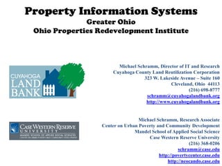
- 1. Property Information Systems Greater Ohio Ohio Properties Redevelopment Institute Michael Schramm, Director of IT and Research Cuyahoga County Land Reutilization Corporation 323 W. Lakeside Avenue – Suite 160 Cleveland, Ohio 44113 (216) 698-8777 schramm@cuyahogalandbank.org http://www.cuyahogalandbank.org Michael Schramm, Research Associate Center on Urban Poverty and Community Development Mandel School of Applied Social Science Case Western Reserve University (216) 368-0206 schramm@case.edu http://povertycenter.case.edu http://neocando.case.edu
- 2. Introduce NEO CANDO/Center on Urban Poverty and Community Development Introduce Cuyahoga County Land Reutilization Corp (CCLRC) Types of property data systems Basics of property information Designers and maintainers of these systems NEO CANDO CCLRC data systems Other data Questions/Discussion w w
- 3. Managed by the Center on Urban Poverty and Community Development at Case Western Reserve University Partnered with and supported by many community partners including the CCLRC Chose to not just write reports, but to put information in the hands of people who could act (Democratizing Information/data driven decisions). Launched 1st version of CANDO in 1992. Established a foundation and expertise for linking data from different sources. 2005 NEO CANDO evolution, has mapping, more flexibility and parcel data NST web application – online Fall 2010 Founding partner in the National Neighborhood Indicators Partnership at the Urban Institute (NNIP) [35 cities with NEO CANDO like qualities) w w
- 4. To facilitate the reclamation, rehabilitation and reutilization of vacant, abandoned, tax-foreclosed or other real property To efficiently hold and manage that real property pending its reclamation, rehabilitation and reutilization To assist governmental entities and other non-profit or for-profit entities in the assembly of that real property and the clearing of title in a coordinated manner To promote economic and housing development of the county or region w w
- 5. The Mission of the Cuyahoga County Land Reutilization Corporation is to strategically acquire properties, return them to productive use, reduce blight, increase property values, support community goals and improve the quality of life for county residents. w w
- 6. What is the Cuyahoga County Land Reutilization Corporation (“CCLRC”)? Non-Profit “Government Purposed” Corporation Under Section115 Quasi Governmental Corporation Incorporated by the County Treasurer Stand-Alone Independent Corporation Governmental Powers (Land Banking) Private Enterprise Transactional Capabilities Transactional Powers buy, sell, lend, borrow, issue bonds, etc. w w
- 7. BANK REO’s DEED IN LIEU HUD GSE’s TAX FORECLOSED PROPERTY TRIAGE RESPONSIBLE PROGRAMS: DEMOLISH FOR MOTHBALL REHABILITATION • SIDE YARD • INFILL HOUSING HOLD FOR RESALE TO • GREEN SPACE STRATEGIC RESPONSIBLE • URBAN GARDENS ASSEMBLY & QUALIFIED ECONOMIC BUYER/REHABBER DEVELOPMENT
- 8. DATA AND DATA MANAGEMENT AT THE PARCEL LEVEL IS ESSENTIAL TO EVERYTHING THE CCLRC DOES
- 9. Systems that allow municipalities/quasi-governmental agencies/counties to do their business at the property level Systems that allow CDCs/nonprofits to track their projects and do project management Systems that integrate existing public data (NEO CANDO/NNIP model) w w
- 10. Data tied to a unique property that has distinct ownership Address (multiple addresses per parcel [multi family]) Parcel/PIN (multiple parcels per address [large building]) Lot/block Owner names should be standardized (Deutsche Bank is spelled at least 100 different ways in Cuyahoga County Auditor data) Maintained by: Municipality (code enforcement, use, zoning, occupancy) County (taxes, deeds and real estate, mortgages, foreclosure notices/sales) [some places municipality also handles county functions] w w
- 11. PRO CON Access/Excel/ArcGIS Inexpensive, quick implementation, Multiple copies of same info, ubiquitous simultaneous editing issues, lack of validation Off the shelf/out of box (a lot of Can be implemented quickly Usually for one purpose, niche code enforcement hard/expensive to customize products) Custom application Customized to specific needs of Need IT staff, competes with other development internally department/organization, small projects, could take time to changes are quick and easy develop Small local software Customized to specific needs of Need to involve developer every developers department/organization time a change is needed, could take time to develop Enterprise solution All data for organization is tracked in Very expensive, multiyear one place (code implementation, different enforcement/garbage collection, departments competing utility billing, etc) Nonprofits, colleges and Good at developing systems that May not be in mission to build universities integrate property data across systems for government operation sources that provide powerful analysis operations
- 12. City and county are really good at putting basic property information online at the parcel level you can look up one parcel, owner or street at a time. you also have to visit multiple sites (auditor, recorder, CCLRC, court, sheriff, city dept of BandH [Building and Housing], etc) New parcel data sources (foreclosure filings are related to a property, but prior to 2005, the subject property was never referenced in the electronic court docket) City and county are really good at putting basic web GIS products that attempt to cut across silos However there is a line dividing data for transparency purposes and data for community analysis purposes w w
- 13. Identify properties that meet specific criteria in a geography (tax delinquent and condemned in a particular CDC target areas) Property “research” [lower case “r”] (trend analysis) Number of condemnations, demolitions, interventions, etc aggregated to target area/neighborhood/county/municipal level Property “Research” [capital “R”] (using data to create more data) “Pathways to Foreclosure report” – Research report combining foreclosure filings, foreclosure deeds, HMDA, mortgage recordings, vacancy data, etc allowed us to then identify those at risk for foreclosure, which then lead to outreach by foreclosure counselors. Most of these data exist in public websites, but none of this is possible without data intermediary w w
- 14. Social and Economic data (pre aggregated for trend analysis) Property data combined with Census, Crime, Public Assistance, etc All data publically accessible Property Data section (individual property data available across silos) Sales, foreclosure, sheriff, characteristics, taxes, market values Most data publically accessible (data on sensitive issues are limited to CDCs/nonprofits/government) [foreclosure filing/sheriff sales] NST database (Neighborhood Stabilization Team) – Specific purposed parcel based application that merges together the last record from every source, allows users to enter their own data Accessible to only trained partners (one example CDC code enforcement partnership) Ad-hoc data requests and research is another way to engage with the data w w
- 15. Email FTP DVD/CD XML Stream Screen Scraping These all occur at various intervals, but most data are updated weekly w w
- 16. • Three main challenges: bureaucratic reluctance, lack of trust, perceived burden on data providers – Government agencies with messy/incomplete/non electronic data – Silos within county and city government w w
- 17. • Champions within government are a good thing – Vacant and Abandoned Property Action Council (VAPAC) [city, county, suburbs, cdc, foundations] • Need to provide valid reason to provide data and bring credibility (more than data for the sake of data) • Scale of foreclosure crisis has encouraged sharing of information w w
- 25. Lower case “r”
- 26. Median Percent of Value Remaining After Sheriff's Sale, by Year of Sheriff's Sale 90.00% 80.00% Capital “R” 70.00% Median Percent Value Remaining 60.00% 50.00% 40.00% 30.00% 20.00% 10.00% 0.00% 2004 2005 2006 2007 2008 2009 Year Cuyahoga County City of Cleveland Suburbs East Side of Cleveland West Side of Cleveland Prepared by: Center on Urban Poverty and Community Development, Mandel School of Applied Social Sciences, Case Western Reserve University. Source: NEO CANDO (http://neocando.case.edu), Tabulation of Cuyahoga County Auditor Data.
- 27. Percentage of all REO properties sold at extremely distressed prices of $10,000 or less, Cuyahoga County, 2004-2009 90.00% 80.00% 70.00% Capital “R” 60.00% Percent of Properties 50.00% 40.00% 30.00% 20.00% 10.00% 0.00% 2004 2005 2006 2007 2008 2009 Year East Inner Suburb East Side of Cleveland Outer Suburb West Inner Suburb West Side of Cleveland City of Cleveland Cuyahoga County Prepared by: Center on Urban Poverty and Community Development, Mandel School of Applied Social Sciences, Case Western Reserve University. Source: NEO CANDO (http://neocando.case.edu), Tabulation of Cuyahoga County Auditor Data.
- 28. CDCs are eyes and ears on the ground for City Dept of BandH Funded by block grant dollars CDCs systematically inspect parts of their ward on a 3 year schedule (Concentrated inspection area - CIA) CDC first tries to get volunteer compliance on routine items (gutters, junk cars, pealing paint) through letter/outreach [good cop] Routine complaints that come to City Dept of BandH complaint center are assigned to CDC through email Non compliance leads to inspection from Dept of BandH [bad cop] Gives more time for Dept of BandH to deal with condemnations and serious issues Built in feedback loop (CDCs can refer complaint to Dept of BandH and they can now see violation info in NST) w w
- 29. Every parcel is assigned to multiple geographies (cdc service area, target area, nsp2, neighborhood, ward, etc) City code enforcement data is merged (permits, violations, demolitions, complaints, demolition contracts) Data is in the context of other County information (foreclosure, sheriff sale, deeds, mortgages, tax delinquency, CCLRC) Most data area updated weekly CDCs can enter information into web database on inspection, follow up, etc Standardized reporting back to Dept BandH w w
- 30. w w
- 31. w w
- 32. Everything tied to a parcel number Track status Reports Photos Assignments Scheduling and ticklers Auto-document creation Web based (work out in field/transparency) Easily exportable (transparency/analysis) w w
- 33. Internal data system at CCLRC Tied to NEO CANDO Tied to CCLRC financial system (we need to know dollars spent on each property) As internal status change, status changes on public website Property assessments data entry done in field via droid Assign tasks to employees and contractors through system Demo and asbestos abatement contractors can enter scheduling information w w
- 37. Photo management
- 38. Ability to run reports based on filtered criteria
- 39. Report that displays photo from photomangement
- 40. Status changes when internal data change
- 41. Ability to request and assign a property showing for a potential rehabber
- 43. HUD – USPS ADDRESS vacancy counts (www.huduser.org) at the tract level Semaphore Corp – (www.semaphorecorp.com). Address standardizer that also reports on vacancy and nostat. (you have to feed it addresses) HMDA – Loan origination info by tract Listsource/Corelogic – You can purchase merged County data on deeds and recordings w w
- 44. Thanks! Questions and Discussion w w