
![GIS@NIH
Bethesda MD
{ "type": "Point“, "coordinates": [ 77.12, 38.99 ] }
Harsh Prakash 2014](https://image.slidesharecdn.com/gisnih-140919122451-phpapp01/85/GIS-NIH-1-320.jpg)
![GIS@NIH
Bethesda MD
{ "type": "Point“, "coordinates": [ 77.12, 38.99 ] }
Harsh Prakash 2014](https://image.slidesharecdn.com/gisnih-140919122451-phpapp01/75/GIS-NIH-1-2048.jpg)
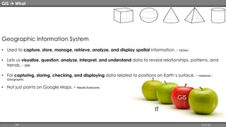
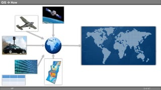
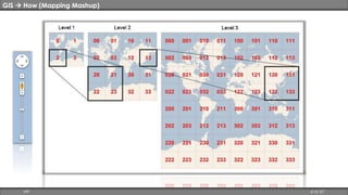
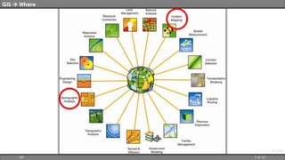

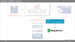
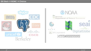
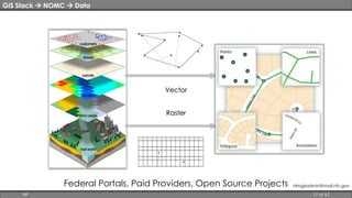
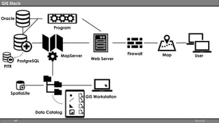
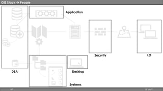
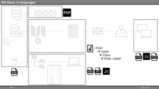
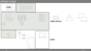
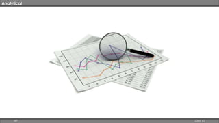
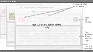
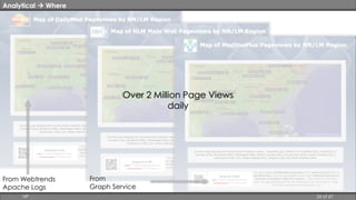
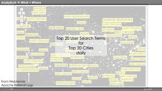
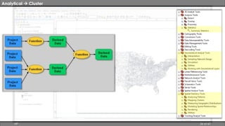
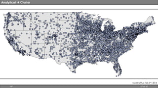
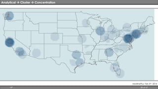
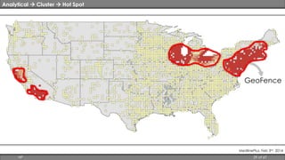
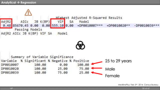

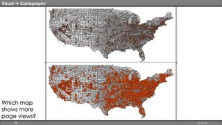
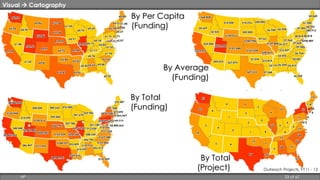
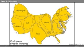
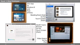

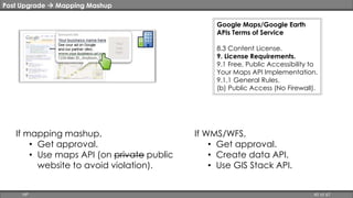
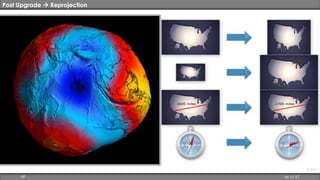
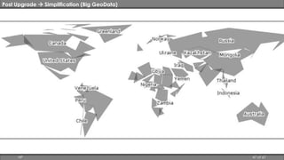
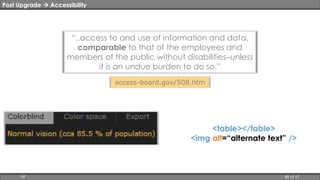
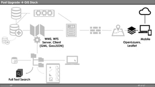
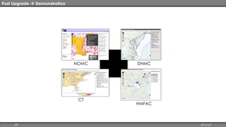
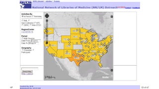
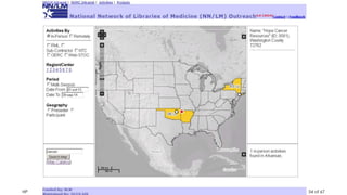
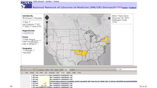
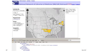
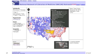
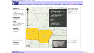
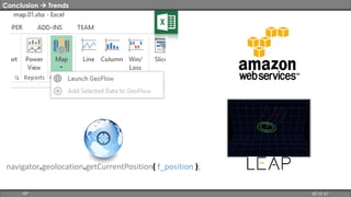
This document provides an overview of geographic information systems (GIS) used at the National Institutes of Health (NIH) in Bethesda, Maryland. It discusses the GIS stack including the National Outreach Mapping Center and its users. It covers analytical uses of GIS including clustering, regression, and visualization techniques. The document concludes with recommendations for trends in GIS and why mapping is important.


