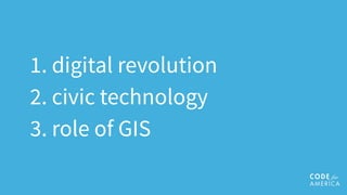
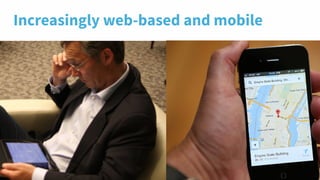
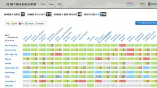
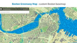
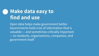
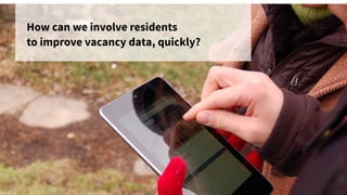
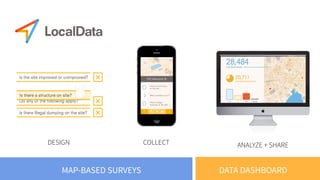
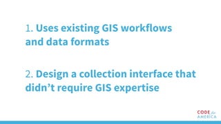
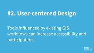
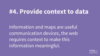
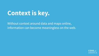
#CalGIS2015
People and Practice:
The changing role of GIS and
civic technology in 2015
Alicia Rouault
Code for America
Urban Planner & Civic Technologist
@arouault | @codeforamerica
We live in an increasingly
digital world.
What role can GIS
professionals play in an
increasingly digital
world?
What can civic
technologists and GIS
experts learn from
each other? 
1. digital revolution
2. civic technology
3. role of GIS
21st century
cities
More data than ever before.
Increasingly web-based and mobile
Citizens expect greater transparency
and better civic engagement.
14
Code for America
governments technologists
Code for America is a
national non-profit
leading the field of
“civic technology”
Photo by Daniel X. O'Neil
User centered design
users should have a voice in
the creation of technologies
Interfaces to government can
be simple, beautiful, and
easy to use.
1. Design for people's needs
2. Make it easy for everyone to participate
3. Focus on what government can do
4. Make data easy to find and use
5. Use data to make and improve decisions
6. Choose the right technology for the job
7. Organize for results
www.codeforamerica.org/governments/principles/
Principles for
21st Century Government
21
How might we make this easy
for the community to help?
Adopt-a helped cities see
what’s possible — from
Boston to Honolulu
Though most CfA
applications have
geospatial components,
very few of our
programmers have ever
used traditional GIS
“How to Lie with Maps”
c. 1996
29
GIS behind the scenes:
apps powered by geospatial
data, that just don’t look like
maps.
transit apps location services
web
mapping
desktop
GIS
overlays browser-
based
analysis
trajectory of GIS technology
historically, GIS has embraced
programming in spatial analysis,
now just begun to use, teach and
build new web-based mapping
tools.
GIS professionals are also great
data stewards who create
something sorely needed in civic
tech today: Metadata
35
36
We make
maps :)
We make
maps, too!
What can we learn
from one another?
Who (and what) is a
civic technologist?
The face of civic technology
Nick Doiron
“Civic Hacker”
aka Nick Mapmeld
@mapmeld
40
Van Gogh Map - powered by MapBox's WebGL API (MoMA)
41
Boston Greenway Map - custom Boston basemap
15,000 Brigade members worldwide
43
44
Massachusetts State Plan
Coordinate System
NAD 83
geoJSON WGS84
47
GeoJson & Github
50
51
52
Open data helps make government better.
Governments hold a lot of information that is
valuable — and sometimes critically important
— to residents, organizations, companies, and
government itself
Make data easy to
find and use
#1. Data Stewardship
Civic technologists showed what’s
possible online, GIS experts made this
work accurate and sustainable.
Civic Tech Story
LocalData: Bridging the
world of civic tech and GIS
Blight in Detroit
Karla Henderson, Director of Buildings and Safety
Karla’s GIS data production problem
Neighborhood-based parallels
How can we involve residents
to improve vacancy data, quickly?
DESIGN COLLECT ANALYZE + SHARE
DATA DASHBOARDMAP-BASED SURVEYS
1. Uses existing GIS workflows
and data formats
2. Design a collection interface that
didn’t require GIS expertise
Existing, official parcel data as a
base map for collection
Officials, academics and data advocates
trained residents on quality data collection
Residents and preservationists
mapped thousands of parcels
Data was easily exported into
existing formats (shapefiles) and
served through an API
And the data was used by the GIS
department to set demolition
priorities
Make it easy for
everyone to participate
Serving everyone means working with, not just for, a true
cross-section of the community. Governments should
proactively collaborate with the community and seek
participation from all residents in decisions that affect
them.
#2. User-centered Design
Tools influenced by existing GIS
workflows can increase accessibility and
participation.
Government Story:
SimpliCity: Simplifying
city data in Asheville
Making SimpliCity has been a lean operation and much
of the time has been spent on usability testing; skills we've
picked up from CfA.”
Jonathan Feldman, CIO, Asheville, North Carolina
“
Governments that use “human-centered design
practices” make it a priority in any project to
conduct research with residents to inform a
better picture of who they are, what they need,
and how they behave.
Designing for people’s needs
#3. Communicate in new
ways
Present information in the language of
the people you serve.
Regional Government Story:
Vital Signs: Making open
data meaningful
Modern technology tools and approaches helps government
build trust with their communities and better address the
challenges they face.
Choose the right
technology for the job
#4. Provide context to data
Information and maps are useful
communication devices, the web
requires context to make this
information meaningful.
Takeaways
Technologists can show
what’s possible.
Civic technologists excel at creating things quickly
and putting them up on the web. They’re not so
good at data stewardship or maintaining agreed
upon geospatial conventions.
GIS professionals
understand how
government works.
The day-to-day insight of working inside government
as a data professional. Special insight into what is
actually needed.
New tools need a louder
GIS perspective.
Though new tools are being created by so!ware
developers outside of the GIS space, there is an
opportunity to become more involved in the
broader civic technology space.
Context is key.
Without context around data and maps online,
information can become meaningless on the web.
Share your spatial
wisdom.
There is a huge opportunity to share what you
know with members outside your community.
so, let’s build a bridge?
Civic technologists are naturally adapted to both
care about public sector problems, use and support
the use of large datasets and also make maps. Get to
know one.
thank you!
@arouault
@codeforamerica
codeforamerica.org/summit

CalGIS 2015: People and Practice, The Changing role of GIS and Civic Technology in 2015