SlideShare a Scribd company logo
1 of 17
Download to read offline
CO-TreeView: the first statewide tree
inventory and management tool
GIS in the Rockies Conference: September 2015
Ian Hanou, Owner/Principal
Presented by:
www.planitgeo.com | info@planitgeo.com 1
http://cotreeview.com/
(based on Tree Plotter v2. software)
 The Colorado Tree
Coalition: coloradotrees.org
 Emerald ash borer
 The silver lining
2www.planitgeo.com | info@planitgeo.com
Agenda
Meet our
Staff
Our
Services
and
Projects
Project
Understand
ing
Project
Approach
Timeline /
Milestones
Questions
Introduction
App Overview
The Basics
Functionality
Questions
Introduction
PG Software Applications Overview
Photo by USDS-APHIS, courtesy of
Wikimedia Commons
Photo by Jeffrey Beall, courtesy of
Wikimedia Commons
 What is CO-TreeView:
benefits summary
COTV Technologies and Requirements
•Web browser-based
• Internet connection required
• No installation or extra software
• Tablets/mobile
•Map-based
• Plot tree points on aerial imagery
• Technologies:
• Open Layers API
• PostgreSQL / PostGIS
• JS libraries (e.g. jqplot)
• Amazon /Apache
• HTML5, CSS, etc.
• Google Maps API (geocoding service)
• Tree Benefits Calculator (web service) / i-Tree
Agenda
Meet our
Staff
Our
Services
and
Projects
Project
Understand
ing
Project
Approach
Timeline /
Milestones
Questions
Introduction
App Overview
The Basics
Functionality
Questions
Introduction
www.planitgeo.com | info@planitgeo.com 4
CO-TreeView Version 1
www.planitgeo.com | info@planitgeo.com 5
Introduction
App Overview
The Basics
Functionality
Questions
App
Overview
CO-TreeView Version 2Agenda
Meet our
Staff
Our
Services
and
Projects
Project
Understand
ing
Project
Approach
Timeline /
Milestones
Questions
Introduction
App Overview
The Basics
Functionality
Questions
App
Overview
www.planitgeo.com | info@planitgeo.com 6
Application Overview
Tools Edit
Data
View
Stats
Add / Move
Tree
LoginInteractive
Legend
Introduction
App Overview
The Basics
Functionality
Questions
App
Overview
www.planitgeo.com | info@planitgeo.com 7
Map Navigation
• Home button zooms to initial extent
• The target will find your mobile GPS enabled device
• Pan with mouse or finger
• Search by address or intersection
Introduction
App Overview
The Basics
Functionality
Questions
The Basics
www.planitgeo.com | info@planitgeo.com 8
www.planitgeo.com | info@planitgeo.com
• Clicking the Add or Plot; select a feature template
• Click (or tap) the map to add new tree point
• The x/y coordinate is auto-populated from the aerial imagery
• Enter attributes into form and attach photos (next slide)
Agenda
Meet our
Staff
Our
Services
and
Projects
Project
Understand
ing
Project
Approach
Timeline /
Milestones
Questions
Introduction
Agenda
Tree Plotter
Basics
Tree Plotter
Functionality
Client
Showcase
Product Levels
Future
Webinars &
Development
Questions &
Tablet Drawing
Introduction
App Overview
The Basics
Functionality
Questions
The Basics
Adding Trees
9
Updated Tools
Turn off the interactive legend
Prompts user to enter login credentials
(Username and Password)
Change passwords, update e-mail addresses
Change base maps from Bing, Google, Esri, etc.
Display data in a variety of symbols and color options
Search for specific addresses or locations
Draw graphics and designs
Label attributes in different styles
Measure distance and surface area
Print maps and adjust titles, scales, and colors
Introduction
App Overview
The Basics
Functionality
Questions
Functionality
www.planitgeo.com | info@planitgeo.com 10
Export your selected data to excel or shapefile
Import existing tree inventory data into the
Imagery Options
11
Bing
ESRI
Streets
MapQuest
Google
• Tree Plotter has multiple imagery base maps to
choose from
• Useful for different situations in the field such
as dense canopy, new development areas, or
navigating streets by name
Introduction
App Overview
The Basics
Functionality
Questions
Functionality
www.planitgeo.com | info@planitgeo.com 11
Change Feature Symbols, Colors, etc.
Change the symbols to a variety of shapes,
colors, and outlines that best represent your
data and base map
Introduction
App Overview
The Basics
Functionality
Questions
Functionality
www.planitgeo.com | info@planitgeo.com 12
Make Awesome Maps of Your Trees
• Printed files are stored in image downloads
• Create labels that stand out against the base
map
• Choose position of legend, scale bar, and title
Introduction
App Overview
The Basics
Functionality
Questions
www.planitgeo.com | info@planitgeo.com
Functionality
13
“Tree Dashboard” Stats
Clicking the Stats button will bring the
following tabs:
• By the Numbers for quick stats by
various fields
• Charts and Graphs: “themes” of
predetermined graphs to view and
download for presentations and
analysis
• Pie chart vs. bar graphs (tables
coming)
Introduction
App Overview
The Basics
Functionality
Questions
Functionality
www.planitgeo.com | info@planitgeo.com 14
Search, Query, Filter
Need to query your data for specific trees?
Open the Advanced Filter interface:
• Filter by Attribute Fields
• Filter by Map
* Tip: apply filter by attributes and map
• Filters Apply to: the map, data table,
exports, and dashboard/stats.
Introduction
App Overview
The Basics
Functionality
Questions
www.planitgeo.com | info@planitgeo.com 15
Functionality
QuestionsIntroduction
App Overview
The Basics
Functionality
Questions
Questions
16
????
Thank you!
Ian Hanou, Owner and Director, Business Development
(303) 503-4846 | IanHanou@PlanItGeo.com
A geospatial analysis, technology
consulting, and planning firm
specializing in urban natural
resource management.
Info@PlanItGeo.com
www.planitgeo.com
17
Angela Poulson, Indep. Contractor, Communications/Forestry
angelapoulson@msn.com
Keith Wood, UCF Coordinator, CO State Forest Service
Keith.Wood@colostate.edu

More Related Content

What's hot

2015 FOSS4G Track: Integrating FOSS4G Into a Government Web-Editing Applicati...
2015 FOSS4G Track: Integrating FOSS4G Into a Government Web-Editing Applicati...2015 FOSS4G Track: Integrating FOSS4G Into a Government Web-Editing Applicati...
2015 FOSS4G Track: Integrating FOSS4G Into a Government Web-Editing Applicati...GIS in the Rockies
 
2015 FOSS4G Track: What is Free and Open Source Software for Geospatial Appli...
2015 FOSS4G Track: What is Free and Open Source Software for Geospatial Appli...2015 FOSS4G Track: What is Free and Open Source Software for Geospatial Appli...
2015 FOSS4G Track: What is Free and Open Source Software for Geospatial Appli...GIS in the Rockies
 
2015 FOSS4G Track: Spatiotemporal Interface Development: Using Web Technologi...
2015 FOSS4G Track: Spatiotemporal Interface Development: Using Web Technologi...2015 FOSS4G Track: Spatiotemporal Interface Development: Using Web Technologi...
2015 FOSS4G Track: Spatiotemporal Interface Development: Using Web Technologi...GIS in the Rockies
 
2015 FOSS4G Track: Analyzing Aspen's Community Forest with Lidar, Object-Base...
2015 FOSS4G Track: Analyzing Aspen's Community Forest with Lidar, Object-Base...2015 FOSS4G Track: Analyzing Aspen's Community Forest with Lidar, Object-Base...
2015 FOSS4G Track: Analyzing Aspen's Community Forest with Lidar, Object-Base...GIS in the Rockies
 
An Overview of Web GIS and Location Based Services
An Overview of Web GIS and Location Based ServicesAn Overview of Web GIS and Location Based Services
An Overview of Web GIS and Location Based Serviceswebmapsolutions
 
Open source web GIS
Open source web GISOpen source web GIS
Open source web GISShweta Ghate
 
OGA - Esri UK Annual Conference 2016
OGA - Esri UK Annual Conference 2016OGA - Esri UK Annual Conference 2016
OGA - Esri UK Annual Conference 2016Esri UK
 
2017 GIS in Development Track: USGS POD Implementation in USGS Cloud to Suppo...
2017 GIS in Development Track: USGS POD Implementation in USGS Cloud to Suppo...2017 GIS in Development Track: USGS POD Implementation in USGS Cloud to Suppo...
2017 GIS in Development Track: USGS POD Implementation in USGS Cloud to Suppo...GIS in the Rockies
 
2015 GIS in Colorado: Going Mobile, Aurora Water Empowers Field Staff with Ta...
2015 GIS in Colorado: Going Mobile, Aurora Water Empowers Field Staff with Ta...2015 GIS in Colorado: Going Mobile, Aurora Water Empowers Field Staff with Ta...
2015 GIS in Colorado: Going Mobile, Aurora Water Empowers Field Staff with Ta...GIS in the Rockies
 
Full planning support system at your fingertips mvopc p&z_120712
Full planning support system at your fingertips mvopc p&z_120712Full planning support system at your fingertips mvopc p&z_120712
Full planning support system at your fingertips mvopc p&z_120712MVRPC
 
SEPA - Esri UK Annual Conference 2016
SEPA - Esri UK Annual Conference 2016SEPA - Esri UK Annual Conference 2016
SEPA - Esri UK Annual Conference 2016Esri UK
 
Network Mapping - Esri UK Annual Conference 2016
Network Mapping - Esri UK Annual Conference 2016Network Mapping - Esri UK Annual Conference 2016
Network Mapping - Esri UK Annual Conference 2016Esri UK
 
Open Source Geospatial Tools: Enabling Decision Makers
Open Source Geospatial Tools: Enabling Decision MakersOpen Source Geospatial Tools: Enabling Decision Makers
Open Source Geospatial Tools: Enabling Decision MakersEcotrust
 
Regionalsurveyresults final 081215
Regionalsurveyresults final 081215Regionalsurveyresults final 081215
Regionalsurveyresults final 081215MVRPC
 
GIS in the Miami Valley Region
GIS in the Miami Valley RegionGIS in the Miami Valley Region
GIS in the Miami Valley RegionMVRPC
 
Ohio gis2012
Ohio gis2012Ohio gis2012
Ohio gis2012MVRPC
 

What's hot (20)

2015 FOSS4G Track: Integrating FOSS4G Into a Government Web-Editing Applicati...
2015 FOSS4G Track: Integrating FOSS4G Into a Government Web-Editing Applicati...2015 FOSS4G Track: Integrating FOSS4G Into a Government Web-Editing Applicati...
2015 FOSS4G Track: Integrating FOSS4G Into a Government Web-Editing Applicati...
 
2015 FOSS4G Track: What is Free and Open Source Software for Geospatial Appli...
2015 FOSS4G Track: What is Free and Open Source Software for Geospatial Appli...2015 FOSS4G Track: What is Free and Open Source Software for Geospatial Appli...
2015 FOSS4G Track: What is Free and Open Source Software for Geospatial Appli...
 
2015 FOSS4G Track: Spatiotemporal Interface Development: Using Web Technologi...
2015 FOSS4G Track: Spatiotemporal Interface Development: Using Web Technologi...2015 FOSS4G Track: Spatiotemporal Interface Development: Using Web Technologi...
2015 FOSS4G Track: Spatiotemporal Interface Development: Using Web Technologi...
 
2015 FOSS4G Track: Analyzing Aspen's Community Forest with Lidar, Object-Base...
2015 FOSS4G Track: Analyzing Aspen's Community Forest with Lidar, Object-Base...2015 FOSS4G Track: Analyzing Aspen's Community Forest with Lidar, Object-Base...
2015 FOSS4G Track: Analyzing Aspen's Community Forest with Lidar, Object-Base...
 
GIS@NIH
GIS@NIHGIS@NIH
GIS@NIH
 
An Overview of Web GIS and Location Based Services
An Overview of Web GIS and Location Based ServicesAn Overview of Web GIS and Location Based Services
An Overview of Web GIS and Location Based Services
 
Meteor
MeteorMeteor
Meteor
 
Overview of geographic information systems (gis)
Overview of geographic information systems (gis)Overview of geographic information systems (gis)
Overview of geographic information systems (gis)
 
Open source web GIS
Open source web GISOpen source web GIS
Open source web GIS
 
OGA - Esri UK Annual Conference 2016
OGA - Esri UK Annual Conference 2016OGA - Esri UK Annual Conference 2016
OGA - Esri UK Annual Conference 2016
 
2017 GIS in Development Track: USGS POD Implementation in USGS Cloud to Suppo...
2017 GIS in Development Track: USGS POD Implementation in USGS Cloud to Suppo...2017 GIS in Development Track: USGS POD Implementation in USGS Cloud to Suppo...
2017 GIS in Development Track: USGS POD Implementation in USGS Cloud to Suppo...
 
2015 GIS in Colorado: Going Mobile, Aurora Water Empowers Field Staff with Ta...
2015 GIS in Colorado: Going Mobile, Aurora Water Empowers Field Staff with Ta...2015 GIS in Colorado: Going Mobile, Aurora Water Empowers Field Staff with Ta...
2015 GIS in Colorado: Going Mobile, Aurora Water Empowers Field Staff with Ta...
 
Full planning support system at your fingertips mvopc p&z_120712
Full planning support system at your fingertips mvopc p&z_120712Full planning support system at your fingertips mvopc p&z_120712
Full planning support system at your fingertips mvopc p&z_120712
 
SEPA - Esri UK Annual Conference 2016
SEPA - Esri UK Annual Conference 2016SEPA - Esri UK Annual Conference 2016
SEPA - Esri UK Annual Conference 2016
 
Network Mapping - Esri UK Annual Conference 2016
Network Mapping - Esri UK Annual Conference 2016Network Mapping - Esri UK Annual Conference 2016
Network Mapping - Esri UK Annual Conference 2016
 
Open Source Geospatial Tools: Enabling Decision Makers
Open Source Geospatial Tools: Enabling Decision MakersOpen Source Geospatial Tools: Enabling Decision Makers
Open Source Geospatial Tools: Enabling Decision Makers
 
Regionalsurveyresults final 081215
Regionalsurveyresults final 081215Regionalsurveyresults final 081215
Regionalsurveyresults final 081215
 
Rolling Climate Change, Transportation & Land Use Planning into One Innovativ...
Rolling Climate Change, Transportation & Land Use Planning into One Innovativ...Rolling Climate Change, Transportation & Land Use Planning into One Innovativ...
Rolling Climate Change, Transportation & Land Use Planning into One Innovativ...
 
GIS in the Miami Valley Region
GIS in the Miami Valley RegionGIS in the Miami Valley Region
GIS in the Miami Valley Region
 
Ohio gis2012
Ohio gis2012Ohio gis2012
Ohio gis2012
 

Similar to 2015 GIS in Colorado: CO-TreeView - The First Statewide Online Urban Tree Inventory Application by Ian Hanou and Angela Poulson

CO-TreeView: The First Statewide Online Urban Tree Inventory Application
CO-TreeView: The First Statewide Online Urban Tree Inventory ApplicationCO-TreeView: The First Statewide Online Urban Tree Inventory Application
CO-TreeView: The First Statewide Online Urban Tree Inventory ApplicationArbor Day Foundation
 
government tree inventory software, work order, and data management case stud...
government tree inventory software, work order, and data management case stud...government tree inventory software, work order, and data management case stud...
government tree inventory software, work order, and data management case stud...TJ Wood
 
Leveraging Google Maps with Business Intellilgence
Leveraging Google Maps with Business IntellilgenceLeveraging Google Maps with Business Intellilgence
Leveraging Google Maps with Business IntellilgenceMISNet - Integeo SE Asia
 
What’s New in Cognos Analytics 11.1.4
What’s New in Cognos Analytics 11.1.4What’s New in Cognos Analytics 11.1.4
What’s New in Cognos Analytics 11.1.4Senturus
 
GWT 2014: Emergency Conference - 02 le soluzioni geospaziali per la gestione ...
GWT 2014: Emergency Conference - 02 le soluzioni geospaziali per la gestione ...GWT 2014: Emergency Conference - 02 le soluzioni geospaziali per la gestione ...
GWT 2014: Emergency Conference - 02 le soluzioni geospaziali per la gestione ...Planetek Italia Srl
 
From Data to Maps to Docs: Turn Days into Minutes with Automated Integration
From Data to Maps to Docs: Turn Days into Minutes with Automated IntegrationFrom Data to Maps to Docs: Turn Days into Minutes with Automated Integration
From Data to Maps to Docs: Turn Days into Minutes with Automated IntegrationSafe Software
 
Strategies for Integrating Utility System Operational Data into ArcGIS Server...
Strategies for Integrating Utility System Operational Data into ArcGIS Server...Strategies for Integrating Utility System Operational Data into ArcGIS Server...
Strategies for Integrating Utility System Operational Data into ArcGIS Server...True North Geographic Technologies
 
Mobile data collection using odk
Mobile data collection using odkMobile data collection using odk
Mobile data collection using odkKARUMBA GATAMA
 
Faster is the New Fast - with Mi Express You can Analyze Location Data Faster
Faster is the New Fast - with Mi Express You can Analyze Location Data FasterFaster is the New Fast - with Mi Express You can Analyze Location Data Faster
Faster is the New Fast - with Mi Express You can Analyze Location Data FasterMISNet - Integeo SE Asia
 
Pollmaps - 2011 Esri UC Presentation
Pollmaps - 2011 Esri UC PresentationPollmaps - 2011 Esri UC Presentation
Pollmaps - 2011 Esri UC PresentationAlex Yule
 
Dotted Eyes - Open Software, Standards and Data
Dotted Eyes - Open Software, Standards and DataDotted Eyes - Open Software, Standards and Data
Dotted Eyes - Open Software, Standards and DataDotted Eyes
 
Concepts and Methods of Embedding Statistical Data into Maps
Concepts and Methods of Embedding Statistical Data into MapsConcepts and Methods of Embedding Statistical Data into Maps
Concepts and Methods of Embedding Statistical Data into MapsMohammad Liton Hossain
 
Usability awareness brown bag
Usability awareness brown bagUsability awareness brown bag
Usability awareness brown bagLawrenceNajjar
 
GWT 2014: Energy Conference - 02 Le soluzioni Geospaziali per il mondo energy
GWT 2014: Energy Conference - 02 Le soluzioni Geospaziali per il mondo energyGWT 2014: Energy Conference - 02 Le soluzioni Geospaziali per il mondo energy
GWT 2014: Energy Conference - 02 Le soluzioni Geospaziali per il mondo energyPlanetek Italia Srl
 
Creating Data Driven Web Apps with BIRT - Michael Williams
Creating Data Driven Web Apps with BIRT - Michael WilliamsCreating Data Driven Web Apps with BIRT - Michael Williams
Creating Data Driven Web Apps with BIRT - Michael Williamsjaxconf
 

Similar to 2015 GIS in Colorado: CO-TreeView - The First Statewide Online Urban Tree Inventory Application by Ian Hanou and Angela Poulson (20)

CO-TreeView: The First Statewide Online Urban Tree Inventory Application
CO-TreeView: The First Statewide Online Urban Tree Inventory ApplicationCO-TreeView: The First Statewide Online Urban Tree Inventory Application
CO-TreeView: The First Statewide Online Urban Tree Inventory Application
 
government tree inventory software, work order, and data management case stud...
government tree inventory software, work order, and data management case stud...government tree inventory software, work order, and data management case stud...
government tree inventory software, work order, and data management case stud...
 
Leveraging Google Maps with Business Intellilgence
Leveraging Google Maps with Business IntellilgenceLeveraging Google Maps with Business Intellilgence
Leveraging Google Maps with Business Intellilgence
 
Geoforum - Digimap Update 2015
Geoforum - Digimap Update 2015Geoforum - Digimap Update 2015
Geoforum - Digimap Update 2015
 
Geospatial Product Watch 2015
Geospatial Product Watch 2015Geospatial Product Watch 2015
Geospatial Product Watch 2015
 
What’s New in Cognos Analytics 11.1.4
What’s New in Cognos Analytics 11.1.4What’s New in Cognos Analytics 11.1.4
What’s New in Cognos Analytics 11.1.4
 
GWT 2014: Emergency Conference - 02 le soluzioni geospaziali per la gestione ...
GWT 2014: Emergency Conference - 02 le soluzioni geospaziali per la gestione ...GWT 2014: Emergency Conference - 02 le soluzioni geospaziali per la gestione ...
GWT 2014: Emergency Conference - 02 le soluzioni geospaziali per la gestione ...
 
srikanthg
srikanthgsrikanthg
srikanthg
 
From Data to Maps to Docs: Turn Days into Minutes with Automated Integration
From Data to Maps to Docs: Turn Days into Minutes with Automated IntegrationFrom Data to Maps to Docs: Turn Days into Minutes with Automated Integration
From Data to Maps to Docs: Turn Days into Minutes with Automated Integration
 
Strategies for Integrating Utility System Operational Data into ArcGIS Server...
Strategies for Integrating Utility System Operational Data into ArcGIS Server...Strategies for Integrating Utility System Operational Data into ArcGIS Server...
Strategies for Integrating Utility System Operational Data into ArcGIS Server...
 
Mobile data collection using odk
Mobile data collection using odkMobile data collection using odk
Mobile data collection using odk
 
Faster is the New Fast - with Mi Express You can Analyze Location Data Faster
Faster is the New Fast - with Mi Express You can Analyze Location Data FasterFaster is the New Fast - with Mi Express You can Analyze Location Data Faster
Faster is the New Fast - with Mi Express You can Analyze Location Data Faster
 
Pollmaps - 2011 Esri UC Presentation
Pollmaps - 2011 Esri UC PresentationPollmaps - 2011 Esri UC Presentation
Pollmaps - 2011 Esri UC Presentation
 
Dotted Eyes - Open Software, Standards and Data
Dotted Eyes - Open Software, Standards and DataDotted Eyes - Open Software, Standards and Data
Dotted Eyes - Open Software, Standards and Data
 
Concepts and Methods of Embedding Statistical Data into Maps
Concepts and Methods of Embedding Statistical Data into MapsConcepts and Methods of Embedding Statistical Data into Maps
Concepts and Methods of Embedding Statistical Data into Maps
 
Usability awareness brown bag
Usability awareness brown bagUsability awareness brown bag
Usability awareness brown bag
 
storytelling-may-12-2022.pptx
storytelling-may-12-2022.pptxstorytelling-may-12-2022.pptx
storytelling-may-12-2022.pptx
 
mapProjectUpdate
mapProjectUpdatemapProjectUpdate
mapProjectUpdate
 
GWT 2014: Energy Conference - 02 Le soluzioni Geospaziali per il mondo energy
GWT 2014: Energy Conference - 02 Le soluzioni Geospaziali per il mondo energyGWT 2014: Energy Conference - 02 Le soluzioni Geospaziali per il mondo energy
GWT 2014: Energy Conference - 02 Le soluzioni Geospaziali per il mondo energy
 
Creating Data Driven Web Apps with BIRT - Michael Williams
Creating Data Driven Web Apps with BIRT - Michael WilliamsCreating Data Driven Web Apps with BIRT - Michael Williams
Creating Data Driven Web Apps with BIRT - Michael Williams
 

More from GIS in the Rockies

GISCO Fall 2018: Bike Network Equity: A GIS and Qualitative Analysis of Ameri...
GISCO Fall 2018: Bike Network Equity: A GIS and Qualitative Analysis of Ameri...GISCO Fall 2018: Bike Network Equity: A GIS and Qualitative Analysis of Ameri...
GISCO Fall 2018: Bike Network Equity: A GIS and Qualitative Analysis of Ameri...GIS in the Rockies
 
GISCO Fall 2018: Colorado 811: Changes and Challenges – Brian Collison
GISCO Fall 2018: Colorado 811: Changes and Challenges – Brian CollisonGISCO Fall 2018: Colorado 811: Changes and Challenges – Brian Collison
GISCO Fall 2018: Colorado 811: Changes and Challenges – Brian CollisonGIS in the Rockies
 
GISCO Fall 2018: Senate Bill 18-167 and GIS – Dave Murray
GISCO Fall 2018: Senate Bill 18-167 and GIS – Dave MurrayGISCO Fall 2018: Senate Bill 18-167 and GIS – Dave Murray
GISCO Fall 2018: Senate Bill 18-167 and GIS – Dave MurrayGIS in the Rockies
 
2018 GIS in the Rockies Workshop: Coordinate Systems and Projections
2018 GIS in the Rockies Workshop: Coordinate Systems and Projections 2018 GIS in the Rockies Workshop: Coordinate Systems and Projections
2018 GIS in the Rockies Workshop: Coordinate Systems and Projections GIS in the Rockies
 
2018 GIS in Emergency Management: Denver Office of Emergency Management Overview
2018 GIS in Emergency Management: Denver Office of Emergency Management Overview2018 GIS in Emergency Management: Denver Office of Emergency Management Overview
2018 GIS in Emergency Management: Denver Office of Emergency Management OverviewGIS in the Rockies
 
2018 GIS in the Rockies Vendor Showcase (Th): The Data Driven Government
2018 GIS in the Rockies Vendor Showcase (Th): The Data Driven Government2018 GIS in the Rockies Vendor Showcase (Th): The Data Driven Government
2018 GIS in the Rockies Vendor Showcase (Th): The Data Driven GovernmentGIS in the Rockies
 
2018 GIS in the Rockies Vendor Showcase (Th): Solving Real World Issues With ...
2018 GIS in the Rockies Vendor Showcase (Th): Solving Real World Issues With ...2018 GIS in the Rockies Vendor Showcase (Th): Solving Real World Issues With ...
2018 GIS in the Rockies Vendor Showcase (Th): Solving Real World Issues With ...GIS in the Rockies
 
2018 GIS in the Rockies Vendor Showcase (Th): ERDAS Imagine What's New and Ti...
2018 GIS in the Rockies Vendor Showcase (Th): ERDAS Imagine What's New and Ti...2018 GIS in the Rockies Vendor Showcase (Th): ERDAS Imagine What's New and Ti...
2018 GIS in the Rockies Vendor Showcase (Th): ERDAS Imagine What's New and Ti...GIS in the Rockies
 
2018 GIS in the Rockies Vendor Showcase (Th): Building High Performance Gover...
2018 GIS in the Rockies Vendor Showcase (Th): Building High Performance Gover...2018 GIS in the Rockies Vendor Showcase (Th): Building High Performance Gover...
2018 GIS in the Rockies Vendor Showcase (Th): Building High Performance Gover...GIS in the Rockies
 
2018 GIS in Recreation: The Making of a Trail
2018 GIS in Recreation: The Making of a Trail2018 GIS in Recreation: The Making of a Trail
2018 GIS in Recreation: The Making of a TrailGIS in the Rockies
 
2018 GIS in Recreation: The Latest Trail Technology Crowdsourcing Maps and Apps
2018 GIS in Recreation: The Latest Trail Technology Crowdsourcing Maps and Apps2018 GIS in Recreation: The Latest Trail Technology Crowdsourcing Maps and Apps
2018 GIS in Recreation: The Latest Trail Technology Crowdsourcing Maps and AppsGIS in the Rockies
 
2018 GIS in the Rockies: Riparian Shrub Assessment of the Mancos River Canyon...
2018 GIS in the Rockies: Riparian Shrub Assessment of the Mancos River Canyon...2018 GIS in the Rockies: Riparian Shrub Assessment of the Mancos River Canyon...
2018 GIS in the Rockies: Riparian Shrub Assessment of the Mancos River Canyon...GIS in the Rockies
 
2018 GIS in Development: Partnerships Lead to Additional Recreational Content...
2018 GIS in Development: Partnerships Lead to Additional Recreational Content...2018 GIS in Development: Partnerships Lead to Additional Recreational Content...
2018 GIS in Development: Partnerships Lead to Additional Recreational Content...GIS in the Rockies
 
2018 GIS in Recreation: Adding Value to Colorado the Beautiful Initiative carr
2018 GIS in Recreation: Adding Value to Colorado the Beautiful Initiative carr2018 GIS in Recreation: Adding Value to Colorado the Beautiful Initiative carr
2018 GIS in Recreation: Adding Value to Colorado the Beautiful Initiative carrGIS in the Rockies
 
2018 GIS in Recreation: A Creek Runs Through It
2018 GIS in Recreation: A Creek Runs Through It2018 GIS in Recreation: A Creek Runs Through It
2018 GIS in Recreation: A Creek Runs Through ItGIS in the Rockies
 
2018 GIS in Recreation: Virtually Touring the National Trails
2018 GIS in Recreation: Virtually Touring the National Trails2018 GIS in Recreation: Virtually Touring the National Trails
2018 GIS in Recreation: Virtually Touring the National TrailsGIS in the Rockies
 
2018 GIS in the Rockies PLSC Track: Turning Towards the Future
2018 GIS in the Rockies PLSC Track: Turning Towards the Future2018 GIS in the Rockies PLSC Track: Turning Towards the Future
2018 GIS in the Rockies PLSC Track: Turning Towards the FutureGIS in the Rockies
 
2018 GIS in the Rockies PLSC: Intro to PLSS
2018 GIS in the Rockies PLSC: Intro to PLSS2018 GIS in the Rockies PLSC: Intro to PLSS
2018 GIS in the Rockies PLSC: Intro to PLSSGIS in the Rockies
 
2018 GIS in the Rockies PLSC Track: Grid to Ground NATRF2022
2018 GIS in the Rockies PLSC Track: Grid to Ground NATRF20222018 GIS in the Rockies PLSC Track: Grid to Ground NATRF2022
2018 GIS in the Rockies PLSC Track: Grid to Ground NATRF2022GIS in the Rockies
 
2018 GIS in Development: USGS and Citizen Science Success and Enhancements fo...
2018 GIS in Development: USGS and Citizen Science Success and Enhancements fo...2018 GIS in Development: USGS and Citizen Science Success and Enhancements fo...
2018 GIS in Development: USGS and Citizen Science Success and Enhancements fo...GIS in the Rockies
 

More from GIS in the Rockies (20)

GISCO Fall 2018: Bike Network Equity: A GIS and Qualitative Analysis of Ameri...
GISCO Fall 2018: Bike Network Equity: A GIS and Qualitative Analysis of Ameri...GISCO Fall 2018: Bike Network Equity: A GIS and Qualitative Analysis of Ameri...
GISCO Fall 2018: Bike Network Equity: A GIS and Qualitative Analysis of Ameri...
 
GISCO Fall 2018: Colorado 811: Changes and Challenges – Brian Collison
GISCO Fall 2018: Colorado 811: Changes and Challenges – Brian CollisonGISCO Fall 2018: Colorado 811: Changes and Challenges – Brian Collison
GISCO Fall 2018: Colorado 811: Changes and Challenges – Brian Collison
 
GISCO Fall 2018: Senate Bill 18-167 and GIS – Dave Murray
GISCO Fall 2018: Senate Bill 18-167 and GIS – Dave MurrayGISCO Fall 2018: Senate Bill 18-167 and GIS – Dave Murray
GISCO Fall 2018: Senate Bill 18-167 and GIS – Dave Murray
 
2018 GIS in the Rockies Workshop: Coordinate Systems and Projections
2018 GIS in the Rockies Workshop: Coordinate Systems and Projections 2018 GIS in the Rockies Workshop: Coordinate Systems and Projections
2018 GIS in the Rockies Workshop: Coordinate Systems and Projections
 
2018 GIS in Emergency Management: Denver Office of Emergency Management Overview
2018 GIS in Emergency Management: Denver Office of Emergency Management Overview2018 GIS in Emergency Management: Denver Office of Emergency Management Overview
2018 GIS in Emergency Management: Denver Office of Emergency Management Overview
 
2018 GIS in the Rockies Vendor Showcase (Th): The Data Driven Government
2018 GIS in the Rockies Vendor Showcase (Th): The Data Driven Government2018 GIS in the Rockies Vendor Showcase (Th): The Data Driven Government
2018 GIS in the Rockies Vendor Showcase (Th): The Data Driven Government
 
2018 GIS in the Rockies Vendor Showcase (Th): Solving Real World Issues With ...
2018 GIS in the Rockies Vendor Showcase (Th): Solving Real World Issues With ...2018 GIS in the Rockies Vendor Showcase (Th): Solving Real World Issues With ...
2018 GIS in the Rockies Vendor Showcase (Th): Solving Real World Issues With ...
 
2018 GIS in the Rockies Vendor Showcase (Th): ERDAS Imagine What's New and Ti...
2018 GIS in the Rockies Vendor Showcase (Th): ERDAS Imagine What's New and Ti...2018 GIS in the Rockies Vendor Showcase (Th): ERDAS Imagine What's New and Ti...
2018 GIS in the Rockies Vendor Showcase (Th): ERDAS Imagine What's New and Ti...
 
2018 GIS in the Rockies Vendor Showcase (Th): Building High Performance Gover...
2018 GIS in the Rockies Vendor Showcase (Th): Building High Performance Gover...2018 GIS in the Rockies Vendor Showcase (Th): Building High Performance Gover...
2018 GIS in the Rockies Vendor Showcase (Th): Building High Performance Gover...
 
2018 GIS in Recreation: The Making of a Trail
2018 GIS in Recreation: The Making of a Trail2018 GIS in Recreation: The Making of a Trail
2018 GIS in Recreation: The Making of a Trail
 
2018 GIS in Recreation: The Latest Trail Technology Crowdsourcing Maps and Apps
2018 GIS in Recreation: The Latest Trail Technology Crowdsourcing Maps and Apps2018 GIS in Recreation: The Latest Trail Technology Crowdsourcing Maps and Apps
2018 GIS in Recreation: The Latest Trail Technology Crowdsourcing Maps and Apps
 
2018 GIS in the Rockies: Riparian Shrub Assessment of the Mancos River Canyon...
2018 GIS in the Rockies: Riparian Shrub Assessment of the Mancos River Canyon...2018 GIS in the Rockies: Riparian Shrub Assessment of the Mancos River Canyon...
2018 GIS in the Rockies: Riparian Shrub Assessment of the Mancos River Canyon...
 
2018 GIS in Development: Partnerships Lead to Additional Recreational Content...
2018 GIS in Development: Partnerships Lead to Additional Recreational Content...2018 GIS in Development: Partnerships Lead to Additional Recreational Content...
2018 GIS in Development: Partnerships Lead to Additional Recreational Content...
 
2018 GIS in Recreation: Adding Value to Colorado the Beautiful Initiative carr
2018 GIS in Recreation: Adding Value to Colorado the Beautiful Initiative carr2018 GIS in Recreation: Adding Value to Colorado the Beautiful Initiative carr
2018 GIS in Recreation: Adding Value to Colorado the Beautiful Initiative carr
 
2018 GIS in Recreation: A Creek Runs Through It
2018 GIS in Recreation: A Creek Runs Through It2018 GIS in Recreation: A Creek Runs Through It
2018 GIS in Recreation: A Creek Runs Through It
 
2018 GIS in Recreation: Virtually Touring the National Trails
2018 GIS in Recreation: Virtually Touring the National Trails2018 GIS in Recreation: Virtually Touring the National Trails
2018 GIS in Recreation: Virtually Touring the National Trails
 
2018 GIS in the Rockies PLSC Track: Turning Towards the Future
2018 GIS in the Rockies PLSC Track: Turning Towards the Future2018 GIS in the Rockies PLSC Track: Turning Towards the Future
2018 GIS in the Rockies PLSC Track: Turning Towards the Future
 
2018 GIS in the Rockies PLSC: Intro to PLSS
2018 GIS in the Rockies PLSC: Intro to PLSS2018 GIS in the Rockies PLSC: Intro to PLSS
2018 GIS in the Rockies PLSC: Intro to PLSS
 
2018 GIS in the Rockies PLSC Track: Grid to Ground NATRF2022
2018 GIS in the Rockies PLSC Track: Grid to Ground NATRF20222018 GIS in the Rockies PLSC Track: Grid to Ground NATRF2022
2018 GIS in the Rockies PLSC Track: Grid to Ground NATRF2022
 
2018 GIS in Development: USGS and Citizen Science Success and Enhancements fo...
2018 GIS in Development: USGS and Citizen Science Success and Enhancements fo...2018 GIS in Development: USGS and Citizen Science Success and Enhancements fo...
2018 GIS in Development: USGS and Citizen Science Success and Enhancements fo...
 

Recently uploaded

My Hashitalk Indonesia April 2024 Presentation
My Hashitalk Indonesia April 2024 PresentationMy Hashitalk Indonesia April 2024 Presentation
My Hashitalk Indonesia April 2024 PresentationRidwan Fadjar
 
"Federated learning: out of reach no matter how close",Oleksandr Lapshyn
"Federated learning: out of reach no matter how close",Oleksandr Lapshyn"Federated learning: out of reach no matter how close",Oleksandr Lapshyn
"Federated learning: out of reach no matter how close",Oleksandr LapshynFwdays
 
Streamlining Python Development: A Guide to a Modern Project Setup
Streamlining Python Development: A Guide to a Modern Project SetupStreamlining Python Development: A Guide to a Modern Project Setup
Streamlining Python Development: A Guide to a Modern Project SetupFlorian Wilhelm
 
Unraveling Multimodality with Large Language Models.pdf
Unraveling Multimodality with Large Language Models.pdfUnraveling Multimodality with Large Language Models.pdf
Unraveling Multimodality with Large Language Models.pdfAlex Barbosa Coqueiro
 
Key Features Of Token Development (1).pptx
Key  Features Of Token  Development (1).pptxKey  Features Of Token  Development (1).pptx
Key Features Of Token Development (1).pptxLBM Solutions
 
Scanning the Internet for External Cloud Exposures via SSL Certs
Scanning the Internet for External Cloud Exposures via SSL CertsScanning the Internet for External Cloud Exposures via SSL Certs
Scanning the Internet for External Cloud Exposures via SSL CertsRizwan Syed
 
SQL Database Design For Developers at php[tek] 2024
SQL Database Design For Developers at php[tek] 2024SQL Database Design For Developers at php[tek] 2024
SQL Database Design For Developers at php[tek] 2024Scott Keck-Warren
 
Pigging Solutions in Pet Food Manufacturing
Pigging Solutions in Pet Food ManufacturingPigging Solutions in Pet Food Manufacturing
Pigging Solutions in Pet Food ManufacturingPigging Solutions
 
costume and set research powerpoint presentation
costume and set research powerpoint presentationcostume and set research powerpoint presentation
costume and set research powerpoint presentationphoebematthew05
 
"LLMs for Python Engineers: Advanced Data Analysis and Semantic Kernel",Oleks...
"LLMs for Python Engineers: Advanced Data Analysis and Semantic Kernel",Oleks..."LLMs for Python Engineers: Advanced Data Analysis and Semantic Kernel",Oleks...
"LLMs for Python Engineers: Advanced Data Analysis and Semantic Kernel",Oleks...Fwdays
 
Tech-Forward - Achieving Business Readiness For Copilot in Microsoft 365
Tech-Forward - Achieving Business Readiness For Copilot in Microsoft 365Tech-Forward - Achieving Business Readiness For Copilot in Microsoft 365
Tech-Forward - Achieving Business Readiness For Copilot in Microsoft 3652toLead Limited
 
Human Factors of XR: Using Human Factors to Design XR Systems
Human Factors of XR: Using Human Factors to Design XR SystemsHuman Factors of XR: Using Human Factors to Design XR Systems
Human Factors of XR: Using Human Factors to Design XR SystemsMark Billinghurst
 
Bun (KitWorks Team Study 노별마루 발표 2024.4.22)
Bun (KitWorks Team Study 노별마루 발표 2024.4.22)Bun (KitWorks Team Study 노별마루 발표 2024.4.22)
Bun (KitWorks Team Study 노별마루 발표 2024.4.22)Wonjun Hwang
 
Science&tech:THE INFORMATION AGE STS.pdf
Science&tech:THE INFORMATION AGE STS.pdfScience&tech:THE INFORMATION AGE STS.pdf
Science&tech:THE INFORMATION AGE STS.pdfjimielynbastida
 
Designing IA for AI - Information Architecture Conference 2024
Designing IA for AI - Information Architecture Conference 2024Designing IA for AI - Information Architecture Conference 2024
Designing IA for AI - Information Architecture Conference 2024Enterprise Knowledge
 
Understanding the Laravel MVC Architecture
Understanding the Laravel MVC ArchitectureUnderstanding the Laravel MVC Architecture
Understanding the Laravel MVC ArchitecturePixlogix Infotech
 
Pigging Solutions Piggable Sweeping Elbows
Pigging Solutions Piggable Sweeping ElbowsPigging Solutions Piggable Sweeping Elbows
Pigging Solutions Piggable Sweeping ElbowsPigging Solutions
 
Kotlin Multiplatform & Compose Multiplatform - Starter kit for pragmatics
Kotlin Multiplatform & Compose Multiplatform - Starter kit for pragmaticsKotlin Multiplatform & Compose Multiplatform - Starter kit for pragmatics
Kotlin Multiplatform & Compose Multiplatform - Starter kit for pragmaticscarlostorres15106
 

Recently uploaded (20)

My Hashitalk Indonesia April 2024 Presentation
My Hashitalk Indonesia April 2024 PresentationMy Hashitalk Indonesia April 2024 Presentation
My Hashitalk Indonesia April 2024 Presentation
 
"Federated learning: out of reach no matter how close",Oleksandr Lapshyn
"Federated learning: out of reach no matter how close",Oleksandr Lapshyn"Federated learning: out of reach no matter how close",Oleksandr Lapshyn
"Federated learning: out of reach no matter how close",Oleksandr Lapshyn
 
Streamlining Python Development: A Guide to a Modern Project Setup
Streamlining Python Development: A Guide to a Modern Project SetupStreamlining Python Development: A Guide to a Modern Project Setup
Streamlining Python Development: A Guide to a Modern Project Setup
 
E-Vehicle_Hacking_by_Parul Sharma_null_owasp.pptx
E-Vehicle_Hacking_by_Parul Sharma_null_owasp.pptxE-Vehicle_Hacking_by_Parul Sharma_null_owasp.pptx
E-Vehicle_Hacking_by_Parul Sharma_null_owasp.pptx
 
Unraveling Multimodality with Large Language Models.pdf
Unraveling Multimodality with Large Language Models.pdfUnraveling Multimodality with Large Language Models.pdf
Unraveling Multimodality with Large Language Models.pdf
 
Key Features Of Token Development (1).pptx
Key  Features Of Token  Development (1).pptxKey  Features Of Token  Development (1).pptx
Key Features Of Token Development (1).pptx
 
Scanning the Internet for External Cloud Exposures via SSL Certs
Scanning the Internet for External Cloud Exposures via SSL CertsScanning the Internet for External Cloud Exposures via SSL Certs
Scanning the Internet for External Cloud Exposures via SSL Certs
 
Hot Sexy call girls in Panjabi Bagh 🔝 9953056974 🔝 Delhi escort Service
Hot Sexy call girls in Panjabi Bagh 🔝 9953056974 🔝 Delhi escort ServiceHot Sexy call girls in Panjabi Bagh 🔝 9953056974 🔝 Delhi escort Service
Hot Sexy call girls in Panjabi Bagh 🔝 9953056974 🔝 Delhi escort Service
 
SQL Database Design For Developers at php[tek] 2024
SQL Database Design For Developers at php[tek] 2024SQL Database Design For Developers at php[tek] 2024
SQL Database Design For Developers at php[tek] 2024
 
Pigging Solutions in Pet Food Manufacturing
Pigging Solutions in Pet Food ManufacturingPigging Solutions in Pet Food Manufacturing
Pigging Solutions in Pet Food Manufacturing
 
costume and set research powerpoint presentation
costume and set research powerpoint presentationcostume and set research powerpoint presentation
costume and set research powerpoint presentation
 
"LLMs for Python Engineers: Advanced Data Analysis and Semantic Kernel",Oleks...
"LLMs for Python Engineers: Advanced Data Analysis and Semantic Kernel",Oleks..."LLMs for Python Engineers: Advanced Data Analysis and Semantic Kernel",Oleks...
"LLMs for Python Engineers: Advanced Data Analysis and Semantic Kernel",Oleks...
 
Tech-Forward - Achieving Business Readiness For Copilot in Microsoft 365
Tech-Forward - Achieving Business Readiness For Copilot in Microsoft 365Tech-Forward - Achieving Business Readiness For Copilot in Microsoft 365
Tech-Forward - Achieving Business Readiness For Copilot in Microsoft 365
 
Human Factors of XR: Using Human Factors to Design XR Systems
Human Factors of XR: Using Human Factors to Design XR SystemsHuman Factors of XR: Using Human Factors to Design XR Systems
Human Factors of XR: Using Human Factors to Design XR Systems
 
Bun (KitWorks Team Study 노별마루 발표 2024.4.22)
Bun (KitWorks Team Study 노별마루 발표 2024.4.22)Bun (KitWorks Team Study 노별마루 발표 2024.4.22)
Bun (KitWorks Team Study 노별마루 발표 2024.4.22)
 
Science&tech:THE INFORMATION AGE STS.pdf
Science&tech:THE INFORMATION AGE STS.pdfScience&tech:THE INFORMATION AGE STS.pdf
Science&tech:THE INFORMATION AGE STS.pdf
 
Designing IA for AI - Information Architecture Conference 2024
Designing IA for AI - Information Architecture Conference 2024Designing IA for AI - Information Architecture Conference 2024
Designing IA for AI - Information Architecture Conference 2024
 
Understanding the Laravel MVC Architecture
Understanding the Laravel MVC ArchitectureUnderstanding the Laravel MVC Architecture
Understanding the Laravel MVC Architecture
 
Pigging Solutions Piggable Sweeping Elbows
Pigging Solutions Piggable Sweeping ElbowsPigging Solutions Piggable Sweeping Elbows
Pigging Solutions Piggable Sweeping Elbows
 
Kotlin Multiplatform & Compose Multiplatform - Starter kit for pragmatics
Kotlin Multiplatform & Compose Multiplatform - Starter kit for pragmaticsKotlin Multiplatform & Compose Multiplatform - Starter kit for pragmatics
Kotlin Multiplatform & Compose Multiplatform - Starter kit for pragmatics
 

2015 GIS in Colorado: CO-TreeView - The First Statewide Online Urban Tree Inventory Application by Ian Hanou and Angela Poulson

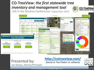
  • 1. CO-TreeView: the first statewide tree inventory and management tool GIS in the Rockies Conference: September 2015 Ian Hanou, Owner/Principal Presented by: www.planitgeo.com | info@planitgeo.com 1 http://cotreeview.com/ (based on Tree Plotter v2. software)
  • 2.  The Colorado Tree Coalition: coloradotrees.org  Emerald ash borer  The silver lining 2www.planitgeo.com | info@planitgeo.com Agenda Meet our Staff Our Services and Projects Project Understand ing Project Approach Timeline / Milestones Questions Introduction App Overview The Basics Functionality Questions Introduction PG Software Applications Overview Photo by USDS-APHIS, courtesy of Wikimedia Commons
  • 3. Photo by Jeffrey Beall, courtesy of Wikimedia Commons  What is CO-TreeView: benefits summary
  • 4. COTV Technologies and Requirements •Web browser-based • Internet connection required • No installation or extra software • Tablets/mobile •Map-based • Plot tree points on aerial imagery • Technologies: • Open Layers API • PostgreSQL / PostGIS • JS libraries (e.g. jqplot) • Amazon /Apache • HTML5, CSS, etc. • Google Maps API (geocoding service) • Tree Benefits Calculator (web service) / i-Tree Agenda Meet our Staff Our Services and Projects Project Understand ing Project Approach Timeline / Milestones Questions Introduction App Overview The Basics Functionality Questions Introduction www.planitgeo.com | info@planitgeo.com 4
  • 5. CO-TreeView Version 1 www.planitgeo.com | info@planitgeo.com 5 Introduction App Overview The Basics Functionality Questions App Overview
  • 6. CO-TreeView Version 2Agenda Meet our Staff Our Services and Projects Project Understand ing Project Approach Timeline / Milestones Questions Introduction App Overview The Basics Functionality Questions App Overview www.planitgeo.com | info@planitgeo.com 6
  • 7. Application Overview Tools Edit Data View Stats Add / Move Tree LoginInteractive Legend Introduction App Overview The Basics Functionality Questions App Overview www.planitgeo.com | info@planitgeo.com 7
  • 8. Map Navigation • Home button zooms to initial extent • The target will find your mobile GPS enabled device • Pan with mouse or finger • Search by address or intersection Introduction App Overview The Basics Functionality Questions The Basics www.planitgeo.com | info@planitgeo.com 8
  • 9. www.planitgeo.com | info@planitgeo.com • Clicking the Add or Plot; select a feature template • Click (or tap) the map to add new tree point • The x/y coordinate is auto-populated from the aerial imagery • Enter attributes into form and attach photos (next slide) Agenda Meet our Staff Our Services and Projects Project Understand ing Project Approach Timeline / Milestones Questions Introduction Agenda Tree Plotter Basics Tree Plotter Functionality Client Showcase Product Levels Future Webinars & Development Questions & Tablet Drawing Introduction App Overview The Basics Functionality Questions The Basics Adding Trees 9
  • 10. Updated Tools Turn off the interactive legend Prompts user to enter login credentials (Username and Password) Change passwords, update e-mail addresses Change base maps from Bing, Google, Esri, etc. Display data in a variety of symbols and color options Search for specific addresses or locations Draw graphics and designs Label attributes in different styles Measure distance and surface area Print maps and adjust titles, scales, and colors Introduction App Overview The Basics Functionality Questions Functionality www.planitgeo.com | info@planitgeo.com 10 Export your selected data to excel or shapefile Import existing tree inventory data into the
  • 11. Imagery Options 11 Bing ESRI Streets MapQuest Google • Tree Plotter has multiple imagery base maps to choose from • Useful for different situations in the field such as dense canopy, new development areas, or navigating streets by name Introduction App Overview The Basics Functionality Questions Functionality www.planitgeo.com | info@planitgeo.com 11
  • 12. Change Feature Symbols, Colors, etc. Change the symbols to a variety of shapes, colors, and outlines that best represent your data and base map Introduction App Overview The Basics Functionality Questions Functionality www.planitgeo.com | info@planitgeo.com 12
  • 13. Make Awesome Maps of Your Trees • Printed files are stored in image downloads • Create labels that stand out against the base map • Choose position of legend, scale bar, and title Introduction App Overview The Basics Functionality Questions www.planitgeo.com | info@planitgeo.com Functionality 13
  • 14. “Tree Dashboard” Stats Clicking the Stats button will bring the following tabs: • By the Numbers for quick stats by various fields • Charts and Graphs: “themes” of predetermined graphs to view and download for presentations and analysis • Pie chart vs. bar graphs (tables coming) Introduction App Overview The Basics Functionality Questions Functionality www.planitgeo.com | info@planitgeo.com 14
  • 15. Search, Query, Filter Need to query your data for specific trees? Open the Advanced Filter interface: • Filter by Attribute Fields • Filter by Map * Tip: apply filter by attributes and map • Filters Apply to: the map, data table, exports, and dashboard/stats. Introduction App Overview The Basics Functionality Questions www.planitgeo.com | info@planitgeo.com 15 Functionality
  • 17. Thank you! Ian Hanou, Owner and Director, Business Development (303) 503-4846 | IanHanou@PlanItGeo.com A geospatial analysis, technology consulting, and planning firm specializing in urban natural resource management. Info@PlanItGeo.com www.planitgeo.com 17 Angela Poulson, Indep. Contractor, Communications/Forestry angelapoulson@msn.com Keith Wood, UCF Coordinator, CO State Forest Service Keith.Wood@colostate.edu