
Recommended
More Related Content
What's hot
What's hot (20)
Viewers also liked
Viewers also liked (20)
Similar to Bauxite mining
Similar to Bauxite mining (20)
Recently uploaded
Recently uploaded (20)
Bauxite mining
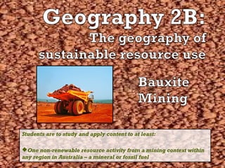
- 1. Students are to study and apply content to at least: One non-renewable resource activity from a mining context within any region in Australia – a mineral or fossil fuel
- 2. BBaauuxxiittee MMiinniinngg iinn tthhee WWoorrlldd • Bauxite is found in 43 countries in the world including Brazil, France, Ghana, Jamaica, Vietnam, West Africa and Australia (among others) • Bauxite is most commonly found along the central tropical (equitorial) belt, where conditions are hot and wet • This is because bauxite is formed by rainfall and leaching, which produces lateritic soils (bauxite is found in laterites) • ALCOA • Worsley
- 3. BBaauuxxiittee MMiinniinngg iinn WWeesstteerrnn AAuussttrraalliiaa ALCOA (Aluminium Company of America) •Alcoa operates three bauxite mine sites within the South-west corner of Western Australia • Huntly • Willowdale • Jarrahdale (closed in 1998) •Alcoa Refineries are located at Pinjarra, Wagerup and Kwinana •Worsley also operates bauxite mines within the area e.g. Mt Saddleback
- 4. BBaauuxxiittee MMiinniinngg Bauxite is found within the caprock layer of the soil profile, 30cm to 2m below the surface of the Jarrah forest. Bauxite is mined through the following series of processes: - Exploration Drilling - Mine Planning - Clearing - Top Soil and Overburden Removal - Secondary Overburden Removal (SOBR) - Backfilling and Drilling - Breaking Caprock - Mining, Crushing and Conveying *We will spend more time looking at the mining process, including INPUTS, THROUGHPUTS and OUTPUTS over the coming weeks*
- 5. WWhheerree iinn tthhee ggrroouunndd ddooeess bbaauuxxiittee ooccccuurr?? In Western Australia bauxite occurs at a depth of approximately 50cm (this depth varies across the scarp) consisting of the caprock* layer and friable** bauxite layer (loose gritty layer beneath the hard caprock) to an average depth of 4-8m. Above the caprock is the soil layer which consists of overburden and topsoil. *a layer of hard impervious rock overlying and often sealing a mineral deposit e.g. coal, bauxite, oil, gas etc **easily crumbled
- 7. LLooccaattiioonn aanndd SSppaattiiaall DDiissttrriibbuuttiioonn • Describe and map the location (site and situation) of both resource activities
- 8. LLooccaattiioonn aanndd SSppaattiiaall DDiissttrriibbuuttiioonn • Describe and map the location (site and situation) of both resource activities • SITE: the actual location of a settlement or activity on earth. Composed of physical characteristics of the landscape specific to the area e.g. landforms, climate, vegetation, water, soil and even wildlife. • SITUATION: the location of a place relative to its surroundings and other features and places. Factors include accessbility to the location (e.g. transport links), location relative to other towns and cities, or features (e.g. 25km South-east of Perth)
- 9. SSIITTEE:: BBaauuxxiittee mmiinniinngg iinn WWAA • South-west corner of Western Australia (SW of WA) is rich in bauxite deposits • Small areas of bauxite occur on the undulating mid-slopes of the Darling Range • Huntly, Willowdale and Mt Saddleback bauxite mines are found within this region • ALCOA and Worsley lease large sections of the Darling Range for bauxite mining • Refineries are found on the flat Swan Coastal Plain
- 10. SSIITTUUAATTIIOONN:: BBaauuxxiittee mmiinniinngg iinn WWAA • Bauxite mining occurs within the Boddington-Pinjarra region of the SW WA • The ALCOA mining lease situated to the east of South West Hwy and South Western Railway between Mundaring in the north and Collie in the south • Huntly mine is situated approximately 80km south-east of Perth, and north of Dwellingup • Willowdale mine is located east of Wagerup, where refinery operations for bauxite extracted from the Willowdale bauxite mine occurs.
- 12. LLooccaattiioonn aanndd SSppaattiiaall DDiissttrriibbuuttiioonn • Explain the physical and cultural factors affecting their location PHYSICAL FACTORS: • This refers to the actual physical features that account for the existence of bauxite and the physical features that make bauxite mining a viable resource activity in the area. • Factors include: Climate, soils, topography and landforms, water availability
- 13. CClliimmaattee • Bauxite is formed under warm, moist climatic conditions in regions that have pronounced wet and dry seasons • Darling range bauxite deposits were built up during past geological ages when the climate was tropical and considerably wetter than it is today • Today, climate of the SW WA, where large deposits of bauxite is found, is Mediterranean with hot, dry summers and cool, wet winters, receiving ~700- 1000ml of rainfall per year.
- 14. SSooiill • Bauxite deposits are found in the largely infertile lateritic soils of the south-west WA region • High rainfall leached the highly soluble minerals out of the soil • Less soluble minerals remained in the soul profile where they accumulated as pebble-like gravels • Upper layers cemented together to form a caprock layer (often referred to as the laterite) • Beneath this caprock is a layer of loose, friable bauxite gravels
- 15. SSooiill • You need to be able to draw and label a diagram of the soil profile where bauxite is found.
- 16. TTooppooggrraapphhyy • Bauxite deposits are found in the gently undulating mid-slopes of the Darling Escarpment on the western edge of the Darling Range • The Darling Escarpment rises from the Swan Coastal Plain to a height of ~300m • Refineries are located on flat stable lands, e.g. Pinjarra on the Coastal plain at the base of the Darling Escarpment. • Bauxite extracted from Huntly mine on the Darling Escarpment is transported downslope on a conveyor belt to Pinjarra refinery on flatter, more stable lands
- 17. TTooppooggrraapphhyy Swan Coastal Plain Darling Range
- 18. LLooccaattiioonn aanndd SSppaattiiaall DDiissttrriibbuuttiioonn • Explain the physical and cultural factors affecting their location CULTURAL FACTORS: • This refers to the cultural features including transport and settlement that have made bauxite a viable resource to mine • Factors include: location to towns and cities, transport links including roads and railways
- 19. CCuullttuurraall FFaaccttoorrss • Bauxite mining occurs in the south-west region of Western Australia, amongst a number of settlements including, Dwellingup, Boddington and Wagerup o This provides good access to employment and labour, making the resource activity viable in the area • Mines are located close to refineries which are located near well-developed settlements and therefore have easy access to well-developed infrastructure E.g. Pinjarra Refinery, Kwinana Refinery etc • Bauxite mining occurs relatively close to the coast, which allows east access to ports including Kwinana, Fremantle and Bunbury for easy export and import of mineral and material • Mines are easily accessible via well-developed transport links. o For example the ALCOA mining land lease is located near or along pre-established road and railways such as South Western HWY and South Western Railway. TIP: you need to be able to draw and label these on a sketch map!
- 20. CCuullttuurraall FFaaccttoorrss • Settlements provide access to local employment e.g. Perth, Pinjarra, Dwellingup and other SW towns • Transport links e.g. South Western Hwy and Railway • Close to ports e.g. Bunbury, Kwinana, Fremantle • Well-developed infrastructure provides relatively cheap access to water, power and gas e.g.
- 22. SSppaattiiaall AAssssoocciiaattiioonn • Describe the associated natural environment i.e. soils, vegetation, climate, wildlife DESCRIBE the associated natural environment – no need to account for the natural environment or discuss the interrelationships. - Use facts and figures - Refer to any available diagrams or graphs - Use SPECIFIC examples
- 23. CClliimmaattee • Mediterranean Climate in the west to Semi-Arid in the east • Hot, Dry Summers • Mild, Wet Winters • 600-1100mm Rainfall to the west (Seasonal) • 400-600mm Rainfall in the east • Average temperature of ~(26) in summer and ~(15) in winter
- 24. VVeeggeettaattiioonn • Bauxite deposits are found within the dry sclerophylous or Jarrah forest which is the predominate vegetation type in the SW region of WA • Dry sclerophyl plants have adapted to the Mediterranean climatic conditions and the infertile soils of the region (xerophytic adaptations e.g. lignotubers, taproot systems, sclerophyllous leaves) • The ALCOA and Worsely bauxite mining lease also extends into the Wandoo woodland (york gum, salmon gum trees) on the eastern edge of the Darling Range
- 25. TTooppooggrraapphhyy aanndd DDrraaiinnaaggee • Bauxite mining is located in the South-west corner of Western Australia in the undulating slopes of the Darling Ranges • The Darling Range is at the western edge of the Great Western Plateau • The topography of this area consists of steeply sided river valleys separated by long round summits • Many small streams dissect the land and flow through the region in westerly direction down the darling escarpment
- 26. SSooiillss • Laterite soils: red, gravelly, infertile • 2 billion years of weathering and leaching of nutrients = infertile soil (little Nitrogen/phosphorus) • Jarrah Forests on gravelly soils with hard caprock (duracrust) of laterite rocks. This weathers into loamy or sandy gravel soils with clay base. • Bauxite is found in the lateritic caprock and in the loose, friable layer underlying the caprock • Swan coast plain where refineries and ports are located are situated on loose, sandy soils of the Swan Coastal Plain
- 28. WWiillddlliiffee • Animal Species are well adapted to low rainfall and long summer drought • Have low water requirements (reptiles and marsupials) • Extract water from food • Feed at dawn and dusk avoid heat (e.g. Kangaroos) • Many nocturnal (e.g. Possums) • Habitat – many nest in local vegetation. (Numbats, hollow logs, Sclerophyllous forest • Food – obtain indirectly or directly from vegetation (Possums eat gum leaves, Numbats eat termites which live off dead wood in Sclerophyllous forest) • Protection – Camouflage, dull grey – green & browns of SW veg results in animals with dull grey/brown fur.
- 29. WWiillddlliiffee Numbat – Small marsupial lives in Sclerophyll forest and woodland. Food from termites from under logs, nests in hollow logs and burrows underground to avoid heat. Western Grey Kangaroo – Widespread, low water requirement, fur helps lose heat and colour good camouflage, feeds at dawn and dusk.
- 30. SSppaattiiaall AAssssoocciiaattiioonn • Describe the cultural environment associated with the resource activity e.g. bauxite and it’s associated refinery and transport network • The cultural landscape of bauxite mining is shaped by the mining process itself. • The cultural landscape exists as a result of the processes that take and the buildings and features that are necessary for this resource activity.
- 31. SAMPLE EXTENDED RESPONSE QUESTION Account for the location of a non-renewable resource activity that you have studied (10 marks) •A good answer will explain how physical and cultural features have affected the location of the non-renewable resource activity
- 35. Note the vehicles of this actively working pod
- 50. CCuullttuurraall LLaannddssccaappee • Open cut mine site o Patchwork – not all forest is mined. o Excavators and blasters used to remove topsoil, overburden and caprock removed. o Front end loaders and haul trucks work on site to remove and carry bauxite to the crusher • Road Network o Network of wide dirt roads connecting mine site, crusher and admin buldings/depot o Water traps prevent runoff into forest (prevent spread of Jarrah dieback) • Crusher o Huge 500+ ton machine, three stories high o Simply a crushing plant reducing bauxite gravels to a finer consistency
- 51. CCuullttuurraall LLaannddssccaappee • Conveyor Belts o Many km’s long (~22km) o Transports bauxite from the mines (crusher) to the refinery o Elevated to allow passage of animals underneath o Covered by a metal roof (protection) • Rehabilitation Sites o Patchwork of rehab sites throughout the Jarrah forest o Noticeably different to natural forest o Parts of the forest were mined and sites rehabilitated at different times • Refineries o Converting bauxite to alumina is an industrial procress which requires a large, flat site o Dominated by industrial buildings and structures e.g. electrical plant, tanks and pipes. o Many railways onsite that connect port to refineries
- 52. CCuullttuurraall LLaannddssccaappee • Port o Bunbury, Kwinana, Wagerup o Consist of land backed wharf, numerous large covered storage facilities to store alumina and special landing facilities • Town sites o Kwinana, Pinjarra, Wagerup, Dwellingup & Bunbury townsite o Suburban/residential buildings o Homesteads o Various urban services (library, shops, schools, petrol stations etc) • Agriculture o Sheep, grazing and cattle o Buffer zones with trees surround Pinjarra & Wagerup refineries
- 53. SAMPLE EXTENDED RESPONSE QUESTION Previous years in-class assessment: DESCRIBE and ACCOUNT for the cultural landscape which has resulted from bauxite mining in the south-west study area(10 marks)
- 54. SSppaattiiaall IInntteerraaccttiioonn • Using a systems model, describe the development and use of both resources – inputs (physical and cultural), throughputs and outputs. SYSTEMS MODEL:
- 55. IINNPPUUTTSS • Anything that is PUT IN to the a system or process to achieve a desired output or outcome. Resources such as people, raw materials, energy, information, finance etc… • Physical (natural) inputs • Cultural (manmade) inputs • Lets look to the mining process:
- 56. PPhhyyssiiccaall IInnppuuttss • There are a number of physical or natural inputs that affect the systems model of this non-renewable activity. These inputs affect the location of bauxite mining and need to be considered or altered to allow for this activity to take place. • Climate (Rainfall and Temperature) • Soils • Flora (Vegetation) • Fauna (Wildlife) • Topography and Drainage
- 57. PPhhyyssiiccaall IInnppuuttss:: CCLLIIMMAATTEE ((RRAAIINNFFAALLLL AANNDD TTEEMMPPEERRAATTUURREE)) • Mediterranean • Hot, dry summer and mild, wet winters • 600-1100mm Rainfall • Average temperature 26 degrees in summer and 15 degrees in winter • Bauxite formed in more tropical conditions when it was much hotter and much wetter
- 58. PPhhyyssiiccaall IInnppuuttss:: SSOOIILL • Red, gravelly laterites • Bauxite occurs in lateritic soils • Formed in tropical conditions due to leaching
- 59. PPhhyyssiiccaall IInnppuuttss:: FFLLOORRAA ((VVEEGGEETTAATTIIOONN)) • Jarrah forest • Wandoo woodlands to the eastern section of the ALCOA and Worsley land lease • Vegetation is cleared to allow for bauxite mining activities to take place
- 60. PPhhyyssiiccaall IInnppuuttss:: TTOOPPOOGGRRAAPPHHYY && DDRRAAIINNAAGGEE • Bauxite mining activity is found in the gently undulating slopes of the darling ranges • Bauxite pods are cut into the slopes (often mid slopes) • Drainage is affected as landscape is totally altered – hydrology is taken into consideration when rehabing the pit. Runoff from gravel roads is diverted.
- 61. CCuullttuurraall IInnppuuttss • CAPITAL • LABOUR • ENTERPRISE • TECHNOLOGY
- 62. CCuullttuurraall IInnppuuttss:: CCAAPPIITTAALL • GIS and digital mapping of the resource location and availability (determines location, depth of bauxite) • Buildings, offices, maintenance sheds/garages • Machinery: crusher, excavator, blasters etc • Vehicles: Dump trucks, front end loaders, utility vehicles etc • Safety equipment: goggles, ear plugs, PPE etc • Misc tools
- 63. CCuullttuurraall IInnppuuttss:: LLAABBOOUURR • Human labour • A LOT of human labour is involved in bauxite mining There is a variety of occupations that all work together to ensure the safe, sustainable (to an extent) and viable operation of this resource activity. • CEO and businessmen, government officials admin and community relations officials, scientists, geologists, geographers, mine planners and GIS developers, hydrologists, environmental protectionist, Miners, heavy duty machinery operators, rehab workers etc…
- 64. CCuullttuurraall IInnppuuttss:: EENNTTEERRPPRRIISSEE ((mmaannaaggeemmeenntt)) • ALCOA and WORSLEY are the two major mining companies that work out of this region • Government and various government organisations have made it possible for these two companies to operate out of this region • Cheap access to water, power and infrastructure • ALCOAa’s operations are overseen by the Mining and Management Program Liaison Group (MMPLG) • Chaired by the Department of Industry and Resources, on behalf of the Minister for State Development, with representatives from the Department of Parks and Wildlife (DoPW), the Department of Water (DoW). • The MMPLG is responsible for reviewing mine plans and associated activities and making recommendations to the Minister for State Development.
- 65. CCuullttuurraall IInnppuuttss:: TTEECCHHNNOOLLOOGGYY • Trucks (measure the weight of the bauxite) • Bayer Process itself • Technology embedded within machinery and processes to produce the product • GIS (Geographical information systems): accurately maps the location and depth of the resource • Other systems that allow machinery to make the work more efficient. For example, systems will alert the machine operator when they are out of the mineral range so that only what is required is being taken from the ground.
- 69. TThhee MMiinniinngg PPrroocceessss • Exploration Drilling • Mine Planning • Clearing • Top Soil and Overburden Removal • Secondary Overburden Removal (SOBR) • Backfilling and Drilling • Breaking Caprock • Mining, Crushing and Conveying • Transport to Refinery (conveyer belt) • Refining • Smelting
- 70. TThhee 44--sstteepp BBaayyeerr PPrroocceessss
- 71. MMiinniinngg
- 72. TTrraannssppoorrtt vviiaa DDuummppttrruucckkss ttoo CCrruusshheerr
- 73. CCrruusshhiinngg
- 74. TTrraannssppoorrtt ttoo RReeffiinneerryy vviiaa CCoonnvveeyyoorr BBeelltt
- 75. RReeffiinniinngg
- 80. OOUUTTPPUUTTSS
- 81. AALLUUMMIINNAA
- 83. SAMPLE EXTENDED RESPONSE QUESTION Semester 2 EXAM 2012: Use a systems model to describe how physical and cultural inputs interact with throughputs to produce the desired outputs of your chosen non-renewable resource activity. A good answer will include a well-drawn systems diagram specific to your chosen resource (9 marks)