SlideShare a Scribd company logo
1 of 19
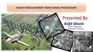
HEIGHT MEASUREMENT FROM AERIAL PHOTOGRAPH
Presented By:
Avijit Ghorai
M.Sc in Geography
Vidyasagar University
1. What is the Aerial Photo?
2. Geometric Types
3. Vertical Aerial Photograph
4. Geometry and components of vertical photograph
5. Height measurement of Aerial Photograph
CONTENT
• Height measurement based on Relief Displacement
• Height measurement based on Shadow length
• Height measurement based on Stereoscopic parallax
What is Aerial Photo?
Aerial photography (or airborne imagery) is the taking of photographs from an
aircraft or other flying object.
Platforms for aerial photography include fixed-
wing aircraft, helicopters, unmanned aerial vehicles (UAVs or
"drones"), balloons, rockets, kites, parachutes,
Aerial photography was the first method of Remote sensing and even used
today in the era of satellite and electronic scanners. Aerial photographs will still
remain the most widely used type of Remote Sensing Data.
1. Vertical aerial photograph:
- camera Tilt <3⁰ from the vertical
2. Low oblique Aerial Photograph:
-inclined about 30° from the vertical
3. High oblique Aerial Photograph:
-camera inclined about 60° from the
vertical
Taking Vertical Aerial Photographs
Most vertical Aerial photographs are taken with frame cameras along flight lines. The line traced on
the ground directly beneath the aircraft during acquisition of photography is called the ‘Nadir line’.
This line connects the image centres of the vertical photographs.
Fig: photographic coverage along a flight strip: a)condition during
exposure, b)resulting photography
Each vertical aerial photograph overlaps the next photograph in the flight line by approximately
60%(referred to as stereoscopic overlap). And the sidelap require 20-40%. This overlap is very
important because it provides at least two and some times three photographic view of each object in
the real world along a flight line.
Fig: Geometry of vertical aerial photo
Source: Elements of Photogrammetry with application in GIS, 4th edition,
2014 McGraw Hill
Fig: components of vertical aerial photo
Source: HTTPs://slideplayer.com/slide/7533210/
Height Measurement of Aerial Photography
Method:1
Displacement is shift in the location of an object
in a photo, which does not change the
perspective characteristics of the photo..
Source:
https://www.google.co.in/search?q=height+measurement+from+relief+displaceme
nt&rlz=1C1GCEA_enIN787IN787&source=lnms&tbm=isch&sa=X&ved=0ahUKEwi0uf-
D1ZHeAhUXEnIKHWotDnUQ_AUIDigB&biw=1536&bih=754#imgrc=sV3kAkvRVSxKo
M:
Causes of Relief Displacement
The amount of relief displacement depends upon:
A. Height of the Object:
When the distance of objects from the nadir point is
remain same. But the object height increased or
decreased.
Higher object is more displaced.
B. The distance of the objects from nadir point
When the distance of object is more from nadir point,
the relief displacement will be more.
C. Focal Length
When the focal length of camera lens is
increased, the
relief displacement will be more. On the
other hand, when
the focal length of camera lens is
decreased, the relief
displacement will be less.
D. Flying height or altitude
If the focal length of the camera lens remain
constant. When the flying height increased, the
relief displacement will be decrease.
E. The height of the object in relation to datum plane
F. Effect of the field of view
Normal angle of view will result in smaller relief
displacement (shift on the photograph of a point because of
its relief (height).
Height Measurement From Relief Displacement
d= Relief Displacement, r= Radial distance from principle
point to top or the displaced object/displaced image point,
h= object height, H= Flying height above the datum, R=
Ground Radial Distance.
h/H = d/r
Or, d=r*h/H
Or, h=d*H/r
Method: 2
Source:
https://www.google.co.in/search?q=Height+Measurement+Based+on+Shadow+Length+of+aerial
+photo&rlz=1C1GCEA_enIN787IN787&tbm=isch&source=lnms&sa=X&ved=0ahUKEwiY-
Ozq25HeAhUYFHIKHZifBl0Q_AUICigB&biw=1396&bih=686&dpr=1.38#imgrc=KwADsqxBzEdJtM:
Formula:
tan e =height(H) / Shadow length(L)
Or, H=L*tan e
The tower on the nearby parking
structure, the shadow length is 20feet
and angle(e) is 30⁰. So the height of
the object is..
h=L*tan e
=20’*tan 30⁰
=11.547feet.
Method: 3
 Parallax is the apparent displacement in the position
of an object.
 Parallax is caused by taking photograph of the
same object but from different point of observation.
Types:
1. Differential Parallax
2. Absolute Parallax Source: http://www.ccrs.nrcan.gc.ca/ccrs/learn/
tutorials/stereosc/chap4/
1. Differential Parallax:
The difference between the
stereoscopic parallax at the top and
base of the object.
D.P=15.2mm. - 13.5mm.
=1.7mm:
2. Absolute Stereoscopic parallax:
Absolute stereoscopic parallax: the
average photo base length = average
distance between PP and CPP
• PP = Principal point = centre of photo
• CPP = Conjugate principal point = adjacent
photo’s PP
Computing height using stereoscopic parallax
where,
h = object height
H = flying height
dP = differential parallax
b = average photo base length(absolute parallax)
h = (H) * dP / (b + dP)
Bibliography
 Jensen, john R. (2004).Remote Sensing Of the Environment.2nd ed. Singapore: Pearson,137-178.
 Lillesand, Thomas M. Kiefer, Ralph W. and Chipman,Jonathan W.(2014).Remote Sensing And Image
Interpretation.6th ed.New Delhi:Wiley,123-145.
 Devi,Sunita,Veena.(2014).Measurement of Relief Displacement from Vertical Photograph. International Journal of
Science, Engineering and Technology Research (IJSETR),3(10).
Thank You

More Related Content

What's hot

What's hot (20)

Historical Development of Photogrammetry
Historical Development of PhotogrammetryHistorical Development of Photogrammetry
Historical Development of Photogrammetry
 
Photogrammetry-part 1
Photogrammetry-part 1Photogrammetry-part 1
Photogrammetry-part 1
 
Stereoscopic Parallax
Stereoscopic ParallaxStereoscopic Parallax
Stereoscopic Parallax
 
Introduction of photogrammetry
Introduction of photogrammetryIntroduction of photogrammetry
Introduction of photogrammetry
 
Digital Elevation Model (DEM)
Digital Elevation Model (DEM)Digital Elevation Model (DEM)
Digital Elevation Model (DEM)
 
Historical Development of Photogrammetry
Historical Development of PhotogrammetryHistorical Development of Photogrammetry
Historical Development of Photogrammetry
 
Digital image processing
Digital image processingDigital image processing
Digital image processing
 
Aerial Photogrammetry
Aerial Photogrammetry Aerial Photogrammetry
Aerial Photogrammetry
 
Optical remote sensing
Optical remote sensingOptical remote sensing
Optical remote sensing
 
Digital photogrammetry
Digital photogrammetryDigital photogrammetry
Digital photogrammetry
 
Photogrammetry 1.
Photogrammetry 1.Photogrammetry 1.
Photogrammetry 1.
 
Types of aerial cameras - photogrammetry
Types of aerial cameras - photogrammetry Types of aerial cameras - photogrammetry
Types of aerial cameras - photogrammetry
 
Types of aerial photographs
Types of aerial photographsTypes of aerial photographs
Types of aerial photographs
 
Aerial photogrammetry ppt 2
Aerial photogrammetry ppt 2Aerial photogrammetry ppt 2
Aerial photogrammetry ppt 2
 
Photogrammetry
PhotogrammetryPhotogrammetry
Photogrammetry
 
Scale of photograph (Aerial Photogrammetry)
Scale of photograph (Aerial Photogrammetry)Scale of photograph (Aerial Photogrammetry)
Scale of photograph (Aerial Photogrammetry)
 
Atmospheric correction
Atmospheric correctionAtmospheric correction
Atmospheric correction
 
Principle of photogrammetry
Principle of photogrammetryPrinciple of photogrammetry
Principle of photogrammetry
 
Aerial photogrammetry ppt 1
Aerial photogrammetry ppt 1Aerial photogrammetry ppt 1
Aerial photogrammetry ppt 1
 
Surveying ii module iii class 1,2
Surveying ii module iii class 1,2Surveying ii module iii class 1,2
Surveying ii module iii class 1,2
 

Similar to Height measurement of aerial photograph

Height measurement of aerial photography
Height measurement of aerial photographyHeight measurement of aerial photography
Height measurement of aerial photographyvidyasagar university
 
Aerial photography-for-aerial-mapping
Aerial photography-for-aerial-mappingAerial photography-for-aerial-mapping
Aerial photography-for-aerial-mappingHigh Exposure
 
AERIAL PHOTOGRAMMETRY.pptx
AERIAL PHOTOGRAMMETRY.pptxAERIAL PHOTOGRAMMETRY.pptx
AERIAL PHOTOGRAMMETRY.pptxDayamoySantra
 
PHOTOGRAMMETRY (REMOTE SENSING & GIS).pptx
PHOTOGRAMMETRY  (REMOTE SENSING & GIS).pptxPHOTOGRAMMETRY  (REMOTE SENSING & GIS).pptx
PHOTOGRAMMETRY (REMOTE SENSING & GIS).pptxBSuresh26
 
photogrammetry.pptx
photogrammetry.pptxphotogrammetry.pptx
photogrammetry.pptxmrunmayee20
 
Introduction on Photogrammetry.pdf
Introduction on Photogrammetry.pdfIntroduction on Photogrammetry.pdf
Introduction on Photogrammetry.pdfBSuresh26
 
Photogyammetry-Notes2.pdf
Photogyammetry-Notes2.pdfPhotogyammetry-Notes2.pdf
Photogyammetry-Notes2.pdfpoola2015
 
Utilizing drone in land development
Utilizing drone  in land developmentUtilizing drone  in land development
Utilizing drone in land developmentKosygin Leishangthem
 
Aerial photography- Concept and Terminologies
Aerial photography- Concept and Terminologies Aerial photography- Concept and Terminologies
Aerial photography- Concept and Terminologies UTTIYACHATTOPADHYAY2
 
Lecture 1-aerial photogrammetry
Lecture 1-aerial photogrammetryLecture 1-aerial photogrammetry
Lecture 1-aerial photogrammetryVidhi Khokhani
 
UAV/Drone survey and its methodology and applications
UAV/Drone survey and its methodology and applicationsUAV/Drone survey and its methodology and applications
UAV/Drone survey and its methodology and applicationsUpendra Oli
 
Photogrammetry_nec.pdf
Photogrammetry_nec.pdfPhotogrammetry_nec.pdf
Photogrammetry_nec.pdfUjjwalSubedi8
 

Similar to Height measurement of aerial photograph (20)

Height measurement of aerial photography
Height measurement of aerial photographyHeight measurement of aerial photography
Height measurement of aerial photography
 
Aerial photography-for-aerial-mapping
Aerial photography-for-aerial-mappingAerial photography-for-aerial-mapping
Aerial photography-for-aerial-mapping
 
AERIAL PHOTOGRAMMETRY.pptx
AERIAL PHOTOGRAMMETRY.pptxAERIAL PHOTOGRAMMETRY.pptx
AERIAL PHOTOGRAMMETRY.pptx
 
Photogrammetry
PhotogrammetryPhotogrammetry
Photogrammetry
 
report
reportreport
report
 
PHOTOGRAMMETRY (REMOTE SENSING & GIS).pptx
PHOTOGRAMMETRY  (REMOTE SENSING & GIS).pptxPHOTOGRAMMETRY  (REMOTE SENSING & GIS).pptx
PHOTOGRAMMETRY (REMOTE SENSING & GIS).pptx
 
photogrammetry.pptx
photogrammetry.pptxphotogrammetry.pptx
photogrammetry.pptx
 
photogrammetry.ppt
photogrammetry.pptphotogrammetry.ppt
photogrammetry.ppt
 
Photogrammetry amir
Photogrammetry amirPhotogrammetry amir
Photogrammetry amir
 
GPS & GIS
GPS & GISGPS & GIS
GPS & GIS
 
Photogrammetry
PhotogrammetryPhotogrammetry
Photogrammetry
 
Introduction on Photogrammetry.pdf
Introduction on Photogrammetry.pdfIntroduction on Photogrammetry.pdf
Introduction on Photogrammetry.pdf
 
DroneSurvey.pdf
DroneSurvey.pdfDroneSurvey.pdf
DroneSurvey.pdf
 
Photogyammetry-Notes2.pdf
Photogyammetry-Notes2.pdfPhotogyammetry-Notes2.pdf
Photogyammetry-Notes2.pdf
 
Utilizing drone in land development
Utilizing drone  in land developmentUtilizing drone  in land development
Utilizing drone in land development
 
Aerial photography- Concept and Terminologies
Aerial photography- Concept and Terminologies Aerial photography- Concept and Terminologies
Aerial photography- Concept and Terminologies
 
Lecture 1-aerial photogrammetry
Lecture 1-aerial photogrammetryLecture 1-aerial photogrammetry
Lecture 1-aerial photogrammetry
 
Aerial Photography.pptx
Aerial Photography.pptxAerial Photography.pptx
Aerial Photography.pptx
 
UAV/Drone survey and its methodology and applications
UAV/Drone survey and its methodology and applicationsUAV/Drone survey and its methodology and applications
UAV/Drone survey and its methodology and applications
 
Photogrammetry_nec.pdf
Photogrammetry_nec.pdfPhotogrammetry_nec.pdf
Photogrammetry_nec.pdf
 

Recently uploaded

BASLIQ CURRENT LOOKBOOK LOOKBOOK(1) (1).pdf
BASLIQ CURRENT LOOKBOOK  LOOKBOOK(1) (1).pdfBASLIQ CURRENT LOOKBOOK  LOOKBOOK(1) (1).pdf
BASLIQ CURRENT LOOKBOOK LOOKBOOK(1) (1).pdfSoniaTolstoy
 
Introduction to ArtificiaI Intelligence in Higher Education
Introduction to ArtificiaI Intelligence in Higher EducationIntroduction to ArtificiaI Intelligence in Higher Education
Introduction to ArtificiaI Intelligence in Higher Educationpboyjonauth
 
Call Girls in Dwarka Mor Delhi Contact Us 9654467111
Call Girls in Dwarka Mor Delhi Contact Us 9654467111Call Girls in Dwarka Mor Delhi Contact Us 9654467111
Call Girls in Dwarka Mor Delhi Contact Us 9654467111Sapana Sha
 
URLs and Routing in the Odoo 17 Website App
URLs and Routing in the Odoo 17 Website AppURLs and Routing in the Odoo 17 Website App
URLs and Routing in the Odoo 17 Website AppCeline George
 
The Most Excellent Way | 1 Corinthians 13
The Most Excellent Way | 1 Corinthians 13The Most Excellent Way | 1 Corinthians 13
The Most Excellent Way | 1 Corinthians 13Steve Thomason
 
Organic Name Reactions for the students and aspirants of Chemistry12th.pptx
Organic Name Reactions  for the students and aspirants of Chemistry12th.pptxOrganic Name Reactions  for the students and aspirants of Chemistry12th.pptx
Organic Name Reactions for the students and aspirants of Chemistry12th.pptxVS Mahajan Coaching Centre
 
Science 7 - LAND and SEA BREEZE and its Characteristics
Science 7 - LAND and SEA BREEZE and its CharacteristicsScience 7 - LAND and SEA BREEZE and its Characteristics
Science 7 - LAND and SEA BREEZE and its CharacteristicsKarinaGenton
 
Incoming and Outgoing Shipments in 1 STEP Using Odoo 17
Incoming and Outgoing Shipments in 1 STEP Using Odoo 17Incoming and Outgoing Shipments in 1 STEP Using Odoo 17
Incoming and Outgoing Shipments in 1 STEP Using Odoo 17Celine George
 
Enzyme, Pharmaceutical Aids, Miscellaneous Last Part of Chapter no 5th.pdf
Enzyme, Pharmaceutical Aids, Miscellaneous Last Part of Chapter no 5th.pdfEnzyme, Pharmaceutical Aids, Miscellaneous Last Part of Chapter no 5th.pdf
Enzyme, Pharmaceutical Aids, Miscellaneous Last Part of Chapter no 5th.pdfSumit Tiwari
 
Introduction to AI in Higher Education_draft.pptx
Introduction to AI in Higher Education_draft.pptxIntroduction to AI in Higher Education_draft.pptx
Introduction to AI in Higher Education_draft.pptxpboyjonauth
 
POINT- BIOCHEMISTRY SEM 2 ENZYMES UNIT 5.pptx
POINT- BIOCHEMISTRY SEM 2 ENZYMES UNIT 5.pptxPOINT- BIOCHEMISTRY SEM 2 ENZYMES UNIT 5.pptx
POINT- BIOCHEMISTRY SEM 2 ENZYMES UNIT 5.pptxSayali Powar
 
Accessible design: Minimum effort, maximum impact
Accessible design: Minimum effort, maximum impactAccessible design: Minimum effort, maximum impact
Accessible design: Minimum effort, maximum impactdawncurless
 
Separation of Lanthanides/ Lanthanides and Actinides
Separation of Lanthanides/ Lanthanides and ActinidesSeparation of Lanthanides/ Lanthanides and Actinides
Separation of Lanthanides/ Lanthanides and ActinidesFatimaKhan178732
 
Crayon Activity Handout For the Crayon A
Crayon Activity Handout For the Crayon ACrayon Activity Handout For the Crayon A
Crayon Activity Handout For the Crayon AUnboundStockton
 
18-04-UA_REPORT_MEDIALITERAСY_INDEX-DM_23-1-final-eng.pdf
18-04-UA_REPORT_MEDIALITERAСY_INDEX-DM_23-1-final-eng.pdf18-04-UA_REPORT_MEDIALITERAСY_INDEX-DM_23-1-final-eng.pdf
18-04-UA_REPORT_MEDIALITERAСY_INDEX-DM_23-1-final-eng.pdfssuser54595a
 
Interactive Powerpoint_How to Master effective communication
Interactive Powerpoint_How to Master effective communicationInteractive Powerpoint_How to Master effective communication
Interactive Powerpoint_How to Master effective communicationnomboosow
 
Sanyam Choudhary Chemistry practical.pdf
Sanyam Choudhary Chemistry practical.pdfSanyam Choudhary Chemistry practical.pdf
Sanyam Choudhary Chemistry practical.pdfsanyamsingh5019
 
Alper Gobel In Media Res Media Component
Alper Gobel In Media Res Media ComponentAlper Gobel In Media Res Media Component
Alper Gobel In Media Res Media ComponentInMediaRes1
 
The basics of sentences session 2pptx copy.pptx
The basics of sentences session 2pptx copy.pptxThe basics of sentences session 2pptx copy.pptx
The basics of sentences session 2pptx copy.pptxheathfieldcps1
 

Recently uploaded (20)

BASLIQ CURRENT LOOKBOOK LOOKBOOK(1) (1).pdf
BASLIQ CURRENT LOOKBOOK  LOOKBOOK(1) (1).pdfBASLIQ CURRENT LOOKBOOK  LOOKBOOK(1) (1).pdf
BASLIQ CURRENT LOOKBOOK LOOKBOOK(1) (1).pdf
 
Introduction to ArtificiaI Intelligence in Higher Education
Introduction to ArtificiaI Intelligence in Higher EducationIntroduction to ArtificiaI Intelligence in Higher Education
Introduction to ArtificiaI Intelligence in Higher Education
 
Call Girls in Dwarka Mor Delhi Contact Us 9654467111
Call Girls in Dwarka Mor Delhi Contact Us 9654467111Call Girls in Dwarka Mor Delhi Contact Us 9654467111
Call Girls in Dwarka Mor Delhi Contact Us 9654467111
 
URLs and Routing in the Odoo 17 Website App
URLs and Routing in the Odoo 17 Website AppURLs and Routing in the Odoo 17 Website App
URLs and Routing in the Odoo 17 Website App
 
The Most Excellent Way | 1 Corinthians 13
The Most Excellent Way | 1 Corinthians 13The Most Excellent Way | 1 Corinthians 13
The Most Excellent Way | 1 Corinthians 13
 
Organic Name Reactions for the students and aspirants of Chemistry12th.pptx
Organic Name Reactions  for the students and aspirants of Chemistry12th.pptxOrganic Name Reactions  for the students and aspirants of Chemistry12th.pptx
Organic Name Reactions for the students and aspirants of Chemistry12th.pptx
 
Science 7 - LAND and SEA BREEZE and its Characteristics
Science 7 - LAND and SEA BREEZE and its CharacteristicsScience 7 - LAND and SEA BREEZE and its Characteristics
Science 7 - LAND and SEA BREEZE and its Characteristics
 
Incoming and Outgoing Shipments in 1 STEP Using Odoo 17
Incoming and Outgoing Shipments in 1 STEP Using Odoo 17Incoming and Outgoing Shipments in 1 STEP Using Odoo 17
Incoming and Outgoing Shipments in 1 STEP Using Odoo 17
 
Enzyme, Pharmaceutical Aids, Miscellaneous Last Part of Chapter no 5th.pdf
Enzyme, Pharmaceutical Aids, Miscellaneous Last Part of Chapter no 5th.pdfEnzyme, Pharmaceutical Aids, Miscellaneous Last Part of Chapter no 5th.pdf
Enzyme, Pharmaceutical Aids, Miscellaneous Last Part of Chapter no 5th.pdf
 
Introduction to AI in Higher Education_draft.pptx
Introduction to AI in Higher Education_draft.pptxIntroduction to AI in Higher Education_draft.pptx
Introduction to AI in Higher Education_draft.pptx
 
POINT- BIOCHEMISTRY SEM 2 ENZYMES UNIT 5.pptx
POINT- BIOCHEMISTRY SEM 2 ENZYMES UNIT 5.pptxPOINT- BIOCHEMISTRY SEM 2 ENZYMES UNIT 5.pptx
POINT- BIOCHEMISTRY SEM 2 ENZYMES UNIT 5.pptx
 
Accessible design: Minimum effort, maximum impact
Accessible design: Minimum effort, maximum impactAccessible design: Minimum effort, maximum impact
Accessible design: Minimum effort, maximum impact
 
Model Call Girl in Tilak Nagar Delhi reach out to us at 🔝9953056974🔝
Model Call Girl in Tilak Nagar Delhi reach out to us at 🔝9953056974🔝Model Call Girl in Tilak Nagar Delhi reach out to us at 🔝9953056974🔝
Model Call Girl in Tilak Nagar Delhi reach out to us at 🔝9953056974🔝
 
Separation of Lanthanides/ Lanthanides and Actinides
Separation of Lanthanides/ Lanthanides and ActinidesSeparation of Lanthanides/ Lanthanides and Actinides
Separation of Lanthanides/ Lanthanides and Actinides
 
Crayon Activity Handout For the Crayon A
Crayon Activity Handout For the Crayon ACrayon Activity Handout For the Crayon A
Crayon Activity Handout For the Crayon A
 
18-04-UA_REPORT_MEDIALITERAСY_INDEX-DM_23-1-final-eng.pdf
18-04-UA_REPORT_MEDIALITERAСY_INDEX-DM_23-1-final-eng.pdf18-04-UA_REPORT_MEDIALITERAСY_INDEX-DM_23-1-final-eng.pdf
18-04-UA_REPORT_MEDIALITERAСY_INDEX-DM_23-1-final-eng.pdf
 
Interactive Powerpoint_How to Master effective communication
Interactive Powerpoint_How to Master effective communicationInteractive Powerpoint_How to Master effective communication
Interactive Powerpoint_How to Master effective communication
 
Sanyam Choudhary Chemistry practical.pdf
Sanyam Choudhary Chemistry practical.pdfSanyam Choudhary Chemistry practical.pdf
Sanyam Choudhary Chemistry practical.pdf
 
Alper Gobel In Media Res Media Component
Alper Gobel In Media Res Media ComponentAlper Gobel In Media Res Media Component
Alper Gobel In Media Res Media Component
 
The basics of sentences session 2pptx copy.pptx
The basics of sentences session 2pptx copy.pptxThe basics of sentences session 2pptx copy.pptx
The basics of sentences session 2pptx copy.pptx
 

Height measurement of aerial photograph

  • 1. HEIGHT MEASUREMENT FROM AERIAL PHOTOGRAPH Presented By: Avijit Ghorai M.Sc in Geography Vidyasagar University
  • 2. 1. What is the Aerial Photo? 2. Geometric Types 3. Vertical Aerial Photograph 4. Geometry and components of vertical photograph 5. Height measurement of Aerial Photograph CONTENT • Height measurement based on Relief Displacement • Height measurement based on Shadow length • Height measurement based on Stereoscopic parallax
  • 3. What is Aerial Photo? Aerial photography (or airborne imagery) is the taking of photographs from an aircraft or other flying object. Platforms for aerial photography include fixed- wing aircraft, helicopters, unmanned aerial vehicles (UAVs or "drones"), balloons, rockets, kites, parachutes, Aerial photography was the first method of Remote sensing and even used today in the era of satellite and electronic scanners. Aerial photographs will still remain the most widely used type of Remote Sensing Data.
  • 4. 1. Vertical aerial photograph: - camera Tilt <3⁰ from the vertical 2. Low oblique Aerial Photograph: -inclined about 30° from the vertical 3. High oblique Aerial Photograph: -camera inclined about 60° from the vertical
  • 5. Taking Vertical Aerial Photographs Most vertical Aerial photographs are taken with frame cameras along flight lines. The line traced on the ground directly beneath the aircraft during acquisition of photography is called the ‘Nadir line’. This line connects the image centres of the vertical photographs. Fig: photographic coverage along a flight strip: a)condition during exposure, b)resulting photography Each vertical aerial photograph overlaps the next photograph in the flight line by approximately 60%(referred to as stereoscopic overlap). And the sidelap require 20-40%. This overlap is very important because it provides at least two and some times three photographic view of each object in the real world along a flight line.
  • 6. Fig: Geometry of vertical aerial photo Source: Elements of Photogrammetry with application in GIS, 4th edition, 2014 McGraw Hill Fig: components of vertical aerial photo Source: HTTPs://slideplayer.com/slide/7533210/
  • 7. Height Measurement of Aerial Photography Method:1 Displacement is shift in the location of an object in a photo, which does not change the perspective characteristics of the photo.. Source: https://www.google.co.in/search?q=height+measurement+from+relief+displaceme nt&rlz=1C1GCEA_enIN787IN787&source=lnms&tbm=isch&sa=X&ved=0ahUKEwi0uf- D1ZHeAhUXEnIKHWotDnUQ_AUIDigB&biw=1536&bih=754#imgrc=sV3kAkvRVSxKo M:
  • 8. Causes of Relief Displacement The amount of relief displacement depends upon: A. Height of the Object: When the distance of objects from the nadir point is remain same. But the object height increased or decreased. Higher object is more displaced.
  • 9. B. The distance of the objects from nadir point When the distance of object is more from nadir point, the relief displacement will be more. C. Focal Length When the focal length of camera lens is increased, the relief displacement will be more. On the other hand, when the focal length of camera lens is decreased, the relief displacement will be less.
  • 10. D. Flying height or altitude If the focal length of the camera lens remain constant. When the flying height increased, the relief displacement will be decrease. E. The height of the object in relation to datum plane
  • 11. F. Effect of the field of view Normal angle of view will result in smaller relief displacement (shift on the photograph of a point because of its relief (height).
  • 12. Height Measurement From Relief Displacement d= Relief Displacement, r= Radial distance from principle point to top or the displaced object/displaced image point, h= object height, H= Flying height above the datum, R= Ground Radial Distance. h/H = d/r Or, d=r*h/H Or, h=d*H/r
  • 13. Method: 2 Source: https://www.google.co.in/search?q=Height+Measurement+Based+on+Shadow+Length+of+aerial +photo&rlz=1C1GCEA_enIN787IN787&tbm=isch&source=lnms&sa=X&ved=0ahUKEwiY- Ozq25HeAhUYFHIKHZifBl0Q_AUICigB&biw=1396&bih=686&dpr=1.38#imgrc=KwADsqxBzEdJtM: Formula: tan e =height(H) / Shadow length(L) Or, H=L*tan e The tower on the nearby parking structure, the shadow length is 20feet and angle(e) is 30⁰. So the height of the object is.. h=L*tan e =20’*tan 30⁰ =11.547feet.
  • 14. Method: 3  Parallax is the apparent displacement in the position of an object.  Parallax is caused by taking photograph of the same object but from different point of observation. Types: 1. Differential Parallax 2. Absolute Parallax Source: http://www.ccrs.nrcan.gc.ca/ccrs/learn/ tutorials/stereosc/chap4/
  • 15. 1. Differential Parallax: The difference between the stereoscopic parallax at the top and base of the object. D.P=15.2mm. - 13.5mm. =1.7mm:
  • 16. 2. Absolute Stereoscopic parallax: Absolute stereoscopic parallax: the average photo base length = average distance between PP and CPP • PP = Principal point = centre of photo • CPP = Conjugate principal point = adjacent photo’s PP
  • 17. Computing height using stereoscopic parallax where, h = object height H = flying height dP = differential parallax b = average photo base length(absolute parallax) h = (H) * dP / (b + dP)
  • 18. Bibliography  Jensen, john R. (2004).Remote Sensing Of the Environment.2nd ed. Singapore: Pearson,137-178.  Lillesand, Thomas M. Kiefer, Ralph W. and Chipman,Jonathan W.(2014).Remote Sensing And Image Interpretation.6th ed.New Delhi:Wiley,123-145.  Devi,Sunita,Veena.(2014).Measurement of Relief Displacement from Vertical Photograph. International Journal of Science, Engineering and Technology Research (IJSETR),3(10).