
Recommended
More Related Content
What's hot
What's hot (20)
Similar to Measuring underwater depths with hydrographic surveying
Similar to Measuring underwater depths with hydrographic surveying (20)
Recently uploaded
Recently uploaded (20)
Measuring underwater depths with hydrographic surveying
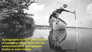
- 1. Hydrographic surveying is branch of surveying which deals with the measurements of hydrographic bodies or water bodies.
- 2. Sounding • Sounding in hydrography are similar to reduced level in topography • Provides necessary data to represent underwater surface conventionally on plan or chart • Defined as depth measured below the water surface of water body.
- 3. Range : • A range or range line is the line along which soundings are made • These are usually fixed perpendicular to the shore line • And parallel to each other Shore signal: • Each range line is marked with two signals • The signals are usually wooden tripods with a white and coloured flag on top
- 4. Equipments Soundings The following equipments are used for measurement of sounding • Sounding boat • Sounding rods or poles • Lead Lines and sounding chains • Sounding Machine • Fathometer
- 5. • It should be stable • Should have sufficient space to accommodate 3 persons • The motor should have adequate control both for low speed and rough waters Sounding boat
- 7. Sounding rods or poles • Usually 25-75 mm in diameter • 3-5 meter long timber rods are used for shallow waters • To facilitate plunging, the rod is weighted with lead at the base • The rod should be light but stiff enough to prevent bending
- 8. Lead lines • It consists of a graduated line or chain to which a lead is attached • Made with cotton or hemp • Under ordinary tension and when wet should not change in length
- 9. Echo Sounding Machine • Also known as fathometer. • Used when depth of water is too much • It measures the depth below the boat on which it is installed • It works on echo property of sound • The sound waves emitted at the surface of water are recorded back after these return from the under water surface 2D =Vt Where, V= velocity of sound waves in water t= time of travel
- 10. Methods of Locating Soundings in Hydrographic Surveying • The soundings are located by the observations made from the boat or from the shore or from both. • There are four methods are there to locate the soundings by: 1. Conning the survey vessel 2. Observations with theodolite or sextant 3. Theodolite angles and EDM distances from the shore 4. Microwave systems
- 11. 1. Sounding by Conning the Survey Vessel • Conning means keeping the boat at known course • This method is suitable for rivers, open sea up to 5 km off shore • The markers are fixed on the shore called as ranges along which vessel or boat is run. • This method is again sub divided into two types as follows. • Location by cross rope • Location by range and time interval
- 12. Location by Cross Rope • A single wire or rope stretched b/w 2 supports A & B on opposite banks • The width is divided into number of segments • And tags are attached at division points • Distances are marked from a reference tag, called 0 tag. • The boat is rowed to a point a1 below the tag no.1 and sounding is taken • Similarly other points are located Suitable in narrow river and narrow lakes and harbours.
- 13. Location by Range and Time Interval • The sounding boat is rowed from the shore near point A and rowed along the range line • After some time the boat attains constant speed from a • A sounding is taken at point a1, and the time of observation is noted • Knowing the speed of boat and time interval distance aa1 is calculated • Likewise, soundings are taken at points a2, a3 etc. • And time of observations are noted • Thus distances of the various sounding points a2, a3, etc. are determined
- 14. 2. Observations with Theodolite or Sextant • Theodolite or sextant is used to measure angles in surveying. • In this method, the sounding is located by measuring angles. • These are the following methods for locating sounding • By range and one angle from the shore • By range and one angle from the boat • By two angles form the shore • By two angles from the boat • By one angle from the shore and one angle from boat • By intersecting angles • By tachometry
- 15. Location by Range and One Angle from the shore
- 16. • There are four range lines AAI, BBI, CCI and DDI. • The theodolite is set up at the station BI for locating points on the range line AAI. • The theodolite is oriented along BIAI. • Let x1 be the perpendicular distances of the point B from A. • The sounding boat is rowed along the line AAI. • The first sounding is taken at a1 and the corresponding angle is measured as α1 Tan α1 = AIa1/x1 AIa1 =x1(Tan α1)
- 17. Continue.. • Like wise, the other points a2,a3 etc. are located on the range line AAI. • Now, the instrument is shifted to the station CI. • The boat is rowed from a3 to point b3. • The horizontal angles of the points b3,b2,b1 from C are measured. • Thus the points are located. • This method is quite accurate and convenient. • It is mostly used in practice.
- 18. By Range and One Angle from the boat • For locating sounding points on the range line AAI, a signal is fixed at point B on the range line BBI. • The sounding boat is rowed along the range line AAI to the sounding point a1 and the angle Aa1B =α1 is measured with nautical sextant mounted on the boat The distance Aa1 is given by, Tan α1=d/Aa1 Aa1= d/Tan α1 Likewise the points a2,a3 etc. are located Now the signal is fixed at point C, the boat is rowed along range line BBI and the sounding points b1,b2,b3 are located.
- 19. Location by Two Angles form the Shore • This method is used when it is not possible to keep the sounding boat on a fixed range line. • The method requires 2 theodolites • The instruments are setup at two known stations A and B on the shore line
- 20. Location by Two Angles form the Shore • When the sounding boat is at P1, whose location is required, horizontal angles at both the instruments measured as α1 and α2. • The time at which the sounding is taken should be noted. • The distance d between A and B is also measured. • The co-ordinates of point P1 may be computed from the relations: • X = d Tan α2/(Tan α1 + Tan α2) • Y= d Tan α1.Tan α2/(Tan α1+ Tan α2)
- 21. Location by two angles from boat • In this method the location of sounding is made by measuring two angles α1and α2 simultaneously with a sextant from the sounding boat at P to 3 prominent signals A, B and C. • The precision is poor when the point P is near the circumference of the circle passing through A, B and C. • If stations A, B and C are on a straight line or if point B is nearer to the boat P than points A and C, the location of P is accurate.
- 22. Location by One Angle from the Shore and One Angle from Boat
- 23. Continue.. • In this method, two points A and B are selected on the shore. • The point A is the instrument station and point B is the shore signal point. • P is the sounding point which is to be located. • When the boat is at P, the angle α is measured with the theodolite at A and angle β is measured at the boat with a nautical sextant. • Knowing the distance d between A and B the position of P can be determined from its coordinates x and y. • X=[ d sin (α + β)/sin β ].cos α • Y=[d sin (α + β)/sin β ].sin α
- 24. Location by Intersecting ranges • Two sets of intersecting ranges are shown one set perpendicular to the shore and the other set inclined to the shore. • To locate the sounding point a1, row the boat to the point where the ranges AAI and CBI intersect. • The signals are fixed at points B, BI,C, CI etc.so that the points of intersection can be located by sighting.
- 26. • The method is very much useful in smooth waters. • Three lines AAI, BBI, and CCI are shown. • The Tacheometer is setup at station AI and oriented along AAI. • A levelling staff is held vertically on the bottom of the sounding boat. • The boatman rows the boat along the range line from shore to a1. • When the boat reaches the point a1, a stadia reading is taken on the staff and a sounding is also taken. • The horizontal distance between the instrument station and the boat is calculated by
- 27. D=(f/I) S+(f + d) S = staff intercept I= stadia interval f= focal length of objective d= distance of vertical axis from optical centre of objective
- 28. 3. Locating Sounding by theodolite and EDM Distances from Shore • In this method, EDM and Theodolite are placed on the shore in fixed positions. • From this set up, the reflector placed on the boat is targeted and point of sounding is located. • This method is more accurate when the water is still. • This is one of the modern methods of fixing sounding vessel.
- 29. 4. Location of Sounding by Microwave Systems • In this method, a device called Tellurometer is used which contains three units’ namely master unit, remote unit and master antenna. • Master unit is fixed to the boat and other two units are located on the shore at two shore stations. • The distances are measured from boat to the shore stations using micro waves produced by tellurometer. • Now from all these known distances the antenna produces the two sets of range information. Tellurometer is useful for distances up to 100km from the shore.