SlideShare a Scribd company logo
1 of 17
Topographical Mapping using GIS
GIS Training : Day 11,12 @IOE, Pulchowk
Presentation Outline
Surface Representation in Arc GIS
TIN, Raster and Terrain Surfaces
Comparison between Surfaces
Analyzing Surfaces:
Slope, Aspect, Hillshade and Curvature
Topographical Mapping
Contouring
Characteristics of Contours
Preparing a topo map: Assignment
Surface representation in ArcGIS
A 3D Surface model is a digital representation of features, either
real or hypothetical, in three-dimensional space.
They are usually derived, or calculated, using specially designed
algorithms that sample point, line, or polygon data and convert it
into a digital 3D surface.
 ArcGIS can create and store three types of surface models: TIN,
Raster, and Terrain dataset.
Contd…
With ArcGIS, there are two approaches for managing your surface
data: geodatabase or file-based.
Choice of the surface is partially your choice but is also limited by
the surface type.
Geodatabases are collections of spatial data native to ArcGIS that
collate several features or raster datasets all in one place.
File-based formats can be ESRI specific (TIN, GRID), open-source and
standardized exchange formats (TIFF, JPEG), or third-party formats
(IMG, PIX).
Triangulated Irregular Network (TIN)
TINs are a form of vector-based digital geographic data constructed by
triangulating a set of vertices (points).
ArcGIS supports the Delaunay triangulation method.
Delaunay triangle criterion ensures that no vertex lies within the
interior of any of the circumcircles of the triangles in the network.
If Delaunay criterion is satisfied everywhere, the minimum interior
angle of all triangles is maximized.
TINs cannot be stored in any of the three types of geodatabases; they
can only be stored in file-based storage solutions.
Raster Surfaces
Raster surface data represents a surface as a grid of equally sized cells
that contain the attribute values for representing the z-value and the
x,y location coordinates.
 Each cell represents a defined square area on the earth's surface and
holds a value that is static across the entire cell.
Elevation models are one such example of raster surface models.
 The fixed point may be a spot height derived from
photogrammetric methods, but interpolation between heights
help form the digital elevation model (DEM).
Terrain Surfaces
Terrain datasets are an efficient way to manage large point-based data
in a geodatabase and produce high-quality, accurate surfaces on the
fly.
A terrain dataset in the geodatabase It doesn't actually store a surface
as a raster or TIN. Rather, it references the original feature classes.
This organization involves the creation of terrain "pyramids" that are
used to quickly retrieve only the data necessary to construct a surface.
Can be stored in a personal, file, or multiuser geodatabase.
Comparison between Surfaces
TIN models are less widely available than raster surface models and
tend to be more time consuming to build and process.
The cost of obtaining good source data can be high, and processing
TINs tends to be less efficient than processing raster data because of
the complex data structure.
TINs are typically used for high-precision modeling of smaller areas,
such as in engineering applications, where they are useful because
they allow calculations of plan metric area, surface area, and volume.
Terrain datasets and related tools offer benefits in the areas of data
management, analysis, and visualization in case of voluminous data .
Analyzing Surfaces
Surface analysis involves several kinds of processing, including
extracting new surfaces from existing surfaces, reclassifying
surfaces, and combining surfaces.
Most common Terrain analysis tools: Slope, Aspect, Hillshade,
and Curvature tools.
Slope ,Aspect, Hillshade and Curvature
The Slope tool calculates the maximum
rate of change from a cell to its
neighbors, which is typically used to
indicate the steepness of terrain.
The Aspect tool calculates the direction
in which the plane fitted to the slope
faces for each cell.
Hillshade shows the intensity of lighting
on a surface given a light source at a
particular location
It can model which parts of a
surface would be shadowed by
other parts.
Curvature (the second derivative of the
surface) calculates the slope of the slope
and finds out whether a given part of a
surface is convex or concave.
Convex parts of surfaces, like ridges,
are generally exposed and drain to
other areas.
Concave parts of surfaces, like
channels, are generally more
sheltered and accept drainage from
other areas.
Topographical Maps
Type of maps in which the configuration of the terrain along with
the horizontal position of the natural and artificial features above
the given terrain is represented.
Topographic maps are also commonly called contour maps or
topo maps.
The various features shown on the map are represented by
conventional signs or symbols. For example, colors can be used to
indicate a classification of roads.
Contouring
General definition:
A Contour line (also isoline, isopleth, or isarithm) of a
function of two variables is a curve along which the function
has a constant value.
It is a cross-section of the three-dimensional graph of the
function f(x, y) parallel to the x, y plane.
In Surveying and mapping , Contours are the imaginary lines that
connects the points of equal elevation.
Contour interval of a contour map is the difference in elevation
between successive contour lines.
Types: Index and Intermediate Contours
Usually every fifth contour line is shown in a heavy, wider line,
so called an index contour
Characteristics of Contours
 The contour are closed curves.
Contour line do not cross to each other.
Important points can be further defined by including a “spot”
elevation.
Contour line cross valley lines at right angles.
Contour line cross ridge line at right angle. The contour line form
U shaped curve.
Ridge contours can be confused with valley contours as they, too, form
'U' shapes - the difference is that the closed end of the 'U' points to
lower ground.
 Depression and hill look the same.
And Many more…
Prepare a Topo Map - Assignment
1. Datasets Location:../day11-12/road_details.csv
2. Manual document -See the pdf: Prepare_map.pdf
Facebook Group:
https://www.facebook.com/groups/316600145217154/
Members Directory:
https://docs.google.com/spreadsheets/d/1VfeITEdcxpDfp4e-
iaKdLoAeOgMNrb8wYBpRkQ689YM/edit?pli=1#gid=0

More Related Content

What's hot

Introduction to GIS systems
Introduction to GIS systemsIntroduction to GIS systems
Introduction to GIS systemsVivek Srivastava
 
Introduction and Application of GIS
Introduction and Application of GISIntroduction and Application of GIS
Introduction and Application of GISSatish Taji
 
Aerial Photogrammetry
Aerial Photogrammetry Aerial Photogrammetry
Aerial Photogrammetry Mujeeb Muji
 
Chap1 introduction to geographic information system (gis)
Chap1 introduction to geographic information system (gis)Chap1 introduction to geographic information system (gis)
Chap1 introduction to geographic information system (gis)Mweemba Hachita
 
Sensors for remote sensing
Sensors for remote sensingSensors for remote sensing
Sensors for remote sensingMohsin Siddique
 
Remote Sensing: Georeferencing
Remote Sensing: GeoreferencingRemote Sensing: Georeferencing
Remote Sensing: GeoreferencingKamlesh Kumar
 
Seminar on gis analysis functions
Seminar on gis analysis functionsSeminar on gis analysis functions
Seminar on gis analysis functionsPramoda Raj
 
WEB GIS AND WEB MAP.pptx
WEB GIS AND WEB MAP.pptxWEB GIS AND WEB MAP.pptx
WEB GIS AND WEB MAP.pptxAsim Pt
 
Spatial analysis and modeling
Spatial analysis and modelingSpatial analysis and modeling
Spatial analysis and modelingTolasa_F
 

What's hot (20)

Introduction to GIS
Introduction to GISIntroduction to GIS
Introduction to GIS
 
Introduction to GIS systems
Introduction to GIS systemsIntroduction to GIS systems
Introduction to GIS systems
 
Introduction and Application of GIS
Introduction and Application of GISIntroduction and Application of GIS
Introduction and Application of GIS
 
Aerial Photogrammetry
Aerial Photogrammetry Aerial Photogrammetry
Aerial Photogrammetry
 
Gis functions
Gis functionsGis functions
Gis functions
 
Topology in GIS
Topology in GISTopology in GIS
Topology in GIS
 
Raster data and Vector data
Raster data and Vector dataRaster data and Vector data
Raster data and Vector data
 
GIS data analysis
GIS data analysisGIS data analysis
GIS data analysis
 
Chap1 introduction to geographic information system (gis)
Chap1 introduction to geographic information system (gis)Chap1 introduction to geographic information system (gis)
Chap1 introduction to geographic information system (gis)
 
DTM
DTMDTM
DTM
 
Functions of GIS
Functions of GISFunctions of GIS
Functions of GIS
 
Relief displacement
Relief displacementRelief displacement
Relief displacement
 
Sensors for remote sensing
Sensors for remote sensingSensors for remote sensing
Sensors for remote sensing
 
Remote Sensing: Georeferencing
Remote Sensing: GeoreferencingRemote Sensing: Georeferencing
Remote Sensing: Georeferencing
 
Seminar on gis analysis functions
Seminar on gis analysis functionsSeminar on gis analysis functions
Seminar on gis analysis functions
 
GIS - lecture-1.ppt
GIS - lecture-1.pptGIS - lecture-1.ppt
GIS - lecture-1.ppt
 
WEB GIS AND WEB MAP.pptx
WEB GIS AND WEB MAP.pptxWEB GIS AND WEB MAP.pptx
WEB GIS AND WEB MAP.pptx
 
Spatial analysis and modeling
Spatial analysis and modelingSpatial analysis and modeling
Spatial analysis and modeling
 
TIN IN GIS
TIN IN GISTIN IN GIS
TIN IN GIS
 
functions of GIS
functions of GISfunctions of GIS
functions of GIS
 

Viewers also liked

Remote Sensing in Digital Model Elevation
Remote Sensing in Digital Model ElevationRemote Sensing in Digital Model Elevation
Remote Sensing in Digital Model ElevationShishir Meshram
 
Digital terrain representations(last)
Digital terrain representations(last)Digital terrain representations(last)
Digital terrain representations(last)Muhammad1212
 
Digital Elevation Models
Digital Elevation ModelsDigital Elevation Models
Digital Elevation ModelsBernd Flmla
 
Digital Elevation Models - WUR - Grontmij
Digital Elevation Models - WUR - GrontmijDigital Elevation Models - WUR - Grontmij
Digital Elevation Models - WUR - GrontmijXander Bakker
 
Initiatives collaboratives sur et avec les territoires - Vue de la métropole...
Initiatives collaboratives sur et avec les territoires - Vue de la métropole...Initiatives collaboratives sur et avec les territoires - Vue de la métropole...
Initiatives collaboratives sur et avec les territoires - Vue de la métropole...Claudine Revol
 
Interferometric and Geodetic Validation of Sentinel-1
Interferometric and Geodetic Validation of Sentinel-1Interferometric and Geodetic Validation of Sentinel-1
Interferometric and Geodetic Validation of Sentinel-1petarmar
 
Huang_presentation.pdf
Huang_presentation.pdfHuang_presentation.pdf
Huang_presentation.pdfgrssieee
 
Image Processing on SAR images
Image Processing on SAR imagesImage Processing on SAR images
Image Processing on SAR imagespankaj kumar
 
IGARSS2011-TDX_Florian_v2.ppt
IGARSS2011-TDX_Florian_v2.pptIGARSS2011-TDX_Florian_v2.ppt
IGARSS2011-TDX_Florian_v2.pptgrssieee
 
ISCE_ISSI_ML_IGARSS2011_v01-rosen.pdf
ISCE_ISSI_ML_IGARSS2011_v01-rosen.pdfISCE_ISSI_ML_IGARSS2011_v01-rosen.pdf
ISCE_ISSI_ML_IGARSS2011_v01-rosen.pdfgrssieee
 
igarss11-singhroy.ppt
igarss11-singhroy.pptigarss11-singhroy.ppt
igarss11-singhroy.pptgrssieee
 
Operational exploitation of the Sentinel-1 mission: implications for geoscience
Operational exploitation of the Sentinel-1 mission: implications for geoscienceOperational exploitation of the Sentinel-1 mission: implications for geoscience
Operational exploitation of the Sentinel-1 mission: implications for geosciencepetarmar
 
Using SAR Intensity and Coherence to Detect A Moorland Wildfire Scar
Using SAR Intensity and Coherence to Detect A Moorland Wildfire ScarUsing SAR Intensity and Coherence to Detect A Moorland Wildfire Scar
Using SAR Intensity and Coherence to Detect A Moorland Wildfire ScarGail Millin-Chalabi
 
Characterizing Landslide Deformation Using InSAR
Characterizing Landslide Deformation Using InSARCharacterizing Landslide Deformation Using InSAR
Characterizing Landslide Deformation Using InSARguest06bc949
 
TH1.L09 - GEODETICALLY ACCURATE INSAR DATA PROCESSOR FOR TIME SERIES ANALYSIS
TH1.L09 - GEODETICALLY ACCURATE INSAR DATA PROCESSOR FOR TIME SERIES ANALYSISTH1.L09 - GEODETICALLY ACCURATE INSAR DATA PROCESSOR FOR TIME SERIES ANALYSIS
TH1.L09 - GEODETICALLY ACCURATE INSAR DATA PROCESSOR FOR TIME SERIES ANALYSISgrssieee
 

Viewers also liked (20)

Remote Sensing in Digital Model Elevation
Remote Sensing in Digital Model ElevationRemote Sensing in Digital Model Elevation
Remote Sensing in Digital Model Elevation
 
Digital terrain model
Digital terrain modelDigital terrain model
Digital terrain model
 
Digital terrain representations(last)
Digital terrain representations(last)Digital terrain representations(last)
Digital terrain representations(last)
 
Digital Elevation Models
Digital Elevation ModelsDigital Elevation Models
Digital Elevation Models
 
Digital Elevation Models - WUR - Grontmij
Digital Elevation Models - WUR - GrontmijDigital Elevation Models - WUR - Grontmij
Digital Elevation Models - WUR - Grontmij
 
Qgis install guide
Qgis install guideQgis install guide
Qgis install guide
 
DTM DEM Generation
DTM DEM GenerationDTM DEM Generation
DTM DEM Generation
 
Enterprising Donegal Business Awards 2010
Enterprising Donegal Business Awards 2010Enterprising Donegal Business Awards 2010
Enterprising Donegal Business Awards 2010
 
Initiatives collaboratives sur et avec les territoires - Vue de la métropole...
Initiatives collaboratives sur et avec les territoires - Vue de la métropole...Initiatives collaboratives sur et avec les territoires - Vue de la métropole...
Initiatives collaboratives sur et avec les territoires - Vue de la métropole...
 
Interferometric and Geodetic Validation of Sentinel-1
Interferometric and Geodetic Validation of Sentinel-1Interferometric and Geodetic Validation of Sentinel-1
Interferometric and Geodetic Validation of Sentinel-1
 
Progetto VULSAR
Progetto VULSARProgetto VULSAR
Progetto VULSAR
 
Huang_presentation.pdf
Huang_presentation.pdfHuang_presentation.pdf
Huang_presentation.pdf
 
Image Processing on SAR images
Image Processing on SAR imagesImage Processing on SAR images
Image Processing on SAR images
 
IGARSS2011-TDX_Florian_v2.ppt
IGARSS2011-TDX_Florian_v2.pptIGARSS2011-TDX_Florian_v2.ppt
IGARSS2011-TDX_Florian_v2.ppt
 
ISCE_ISSI_ML_IGARSS2011_v01-rosen.pdf
ISCE_ISSI_ML_IGARSS2011_v01-rosen.pdfISCE_ISSI_ML_IGARSS2011_v01-rosen.pdf
ISCE_ISSI_ML_IGARSS2011_v01-rosen.pdf
 
igarss11-singhroy.ppt
igarss11-singhroy.pptigarss11-singhroy.ppt
igarss11-singhroy.ppt
 
Operational exploitation of the Sentinel-1 mission: implications for geoscience
Operational exploitation of the Sentinel-1 mission: implications for geoscienceOperational exploitation of the Sentinel-1 mission: implications for geoscience
Operational exploitation of the Sentinel-1 mission: implications for geoscience
 
Using SAR Intensity and Coherence to Detect A Moorland Wildfire Scar
Using SAR Intensity and Coherence to Detect A Moorland Wildfire ScarUsing SAR Intensity and Coherence to Detect A Moorland Wildfire Scar
Using SAR Intensity and Coherence to Detect A Moorland Wildfire Scar
 
Characterizing Landslide Deformation Using InSAR
Characterizing Landslide Deformation Using InSARCharacterizing Landslide Deformation Using InSAR
Characterizing Landslide Deformation Using InSAR
 
TH1.L09 - GEODETICALLY ACCURATE INSAR DATA PROCESSOR FOR TIME SERIES ANALYSIS
TH1.L09 - GEODETICALLY ACCURATE INSAR DATA PROCESSOR FOR TIME SERIES ANALYSISTH1.L09 - GEODETICALLY ACCURATE INSAR DATA PROCESSOR FOR TIME SERIES ANALYSIS
TH1.L09 - GEODETICALLY ACCURATE INSAR DATA PROCESSOR FOR TIME SERIES ANALYSIS
 

Similar to Surface Representations using GIS AND Topographical Mapping

Similar to Surface Representations using GIS AND Topographical Mapping (20)

Terminology and Basic Questions About GIS
Terminology and Basic Questions About GISTerminology and Basic Questions About GIS
Terminology and Basic Questions About GIS
 
Scattered gis handbook
Scattered gis handbookScattered gis handbook
Scattered gis handbook
 
Geographic information system
Geographic information systemGeographic information system
Geographic information system
 
Spatial databases
Spatial databasesSpatial databases
Spatial databases
 
Review on Digital Elevation Model
Review on Digital Elevation ModelReview on Digital Elevation Model
Review on Digital Elevation Model
 
Geographic information system (gis)
Geographic information system (gis)Geographic information system (gis)
Geographic information system (gis)
 
map.ppt
map.pptmap.ppt
map.ppt
 
Assignment vector raster
Assignment vector rasterAssignment vector raster
Assignment vector raster
 
Introduction to gis and arc gis
Introduction to gis and arc gis Introduction to gis and arc gis
Introduction to gis and arc gis
 
3 D Analyst
3 D Analyst3 D Analyst
3 D Analyst
 
Understanding raster
Understanding rasterUnderstanding raster
Understanding raster
 
TYBSC IT PGIS Unit III Chapter I Spatial Referencing and Positioning
TYBSC IT PGIS Unit III Chapter I Spatial Referencing and PositioningTYBSC IT PGIS Unit III Chapter I Spatial Referencing and Positioning
TYBSC IT PGIS Unit III Chapter I Spatial Referencing and Positioning
 
3-1_geo Spatial analysis_spatial_modeling.pptx
3-1_geo Spatial analysis_spatial_modeling.pptx3-1_geo Spatial analysis_spatial_modeling.pptx
3-1_geo Spatial analysis_spatial_modeling.pptx
 
CARTOGRAPHIC_OUTPUT.ppt
CARTOGRAPHIC_OUTPUT.pptCARTOGRAPHIC_OUTPUT.ppt
CARTOGRAPHIC_OUTPUT.ppt
 
GIS_Intro_March_2014
GIS_Intro_March_2014GIS_Intro_March_2014
GIS_Intro_March_2014
 
Cartographic data structures
Cartographic data structuresCartographic data structures
Cartographic data structures
 
Data Display and Cartography-I.pdf
Data Display and Cartography-I.pdfData Display and Cartography-I.pdf
Data Display and Cartography-I.pdf
 
Overview of gis new
Overview of gis newOverview of gis new
Overview of gis new
 
GIS Dictionary
GIS Dictionary GIS Dictionary
GIS Dictionary
 
2-200305220204.pdf
2-200305220204.pdf2-200305220204.pdf
2-200305220204.pdf
 

More from NAXA-Developers

Exploring spatial data in GIS Environment
Exploring spatial data in GIS Environment Exploring spatial data in GIS Environment
Exploring spatial data in GIS Environment NAXA-Developers
 
Exploring Spatial data in GIS Environment
Exploring Spatial data in GIS Environment Exploring Spatial data in GIS Environment
Exploring Spatial data in GIS Environment NAXA-Developers
 
Geographic Phenomena and their Representations
Geographic Phenomena and their RepresentationsGeographic Phenomena and their Representations
Geographic Phenomena and their RepresentationsNAXA-Developers
 
Introduction to MAPS,Coordinate System and Projection System
Introduction to MAPS,Coordinate System and Projection SystemIntroduction to MAPS,Coordinate System and Projection System
Introduction to MAPS,Coordinate System and Projection SystemNAXA-Developers
 
Introduction to GIS and its Applications
Introduction to GIS and its ApplicationsIntroduction to GIS and its Applications
Introduction to GIS and its ApplicationsNAXA-Developers
 

More from NAXA-Developers (6)

Adding data into GIS
Adding  data into GISAdding  data into GIS
Adding data into GIS
 
Exploring spatial data in GIS Environment
Exploring spatial data in GIS Environment Exploring spatial data in GIS Environment
Exploring spatial data in GIS Environment
 
Exploring Spatial data in GIS Environment
Exploring Spatial data in GIS Environment Exploring Spatial data in GIS Environment
Exploring Spatial data in GIS Environment
 
Geographic Phenomena and their Representations
Geographic Phenomena and their RepresentationsGeographic Phenomena and their Representations
Geographic Phenomena and their Representations
 
Introduction to MAPS,Coordinate System and Projection System
Introduction to MAPS,Coordinate System and Projection SystemIntroduction to MAPS,Coordinate System and Projection System
Introduction to MAPS,Coordinate System and Projection System
 
Introduction to GIS and its Applications
Introduction to GIS and its ApplicationsIntroduction to GIS and its Applications
Introduction to GIS and its Applications
 

Recently uploaded

Computer Networks Basics of Network Devices
Computer Networks  Basics of Network DevicesComputer Networks  Basics of Network Devices
Computer Networks Basics of Network DevicesChandrakantDivate1
 
Employee leave management system project.
Employee leave management system project.Employee leave management system project.
Employee leave management system project.Kamal Acharya
 
Tamil Call Girls Bhayandar WhatsApp +91-9930687706, Best Service
Tamil Call Girls Bhayandar WhatsApp +91-9930687706, Best ServiceTamil Call Girls Bhayandar WhatsApp +91-9930687706, Best Service
Tamil Call Girls Bhayandar WhatsApp +91-9930687706, Best Servicemeghakumariji156
 
Thermal Engineering -unit - III & IV.ppt
Thermal Engineering -unit - III & IV.pptThermal Engineering -unit - III & IV.ppt
Thermal Engineering -unit - III & IV.pptDineshKumar4165
 
Thermal Engineering Unit - I & II . ppt
Thermal Engineering  Unit - I & II . pptThermal Engineering  Unit - I & II . ppt
Thermal Engineering Unit - I & II . pptDineshKumar4165
 
DC MACHINE-Motoring and generation, Armature circuit equation
DC MACHINE-Motoring and generation, Armature circuit equationDC MACHINE-Motoring and generation, Armature circuit equation
DC MACHINE-Motoring and generation, Armature circuit equationBhangaleSonal
 
Thermal Engineering-R & A / C - unit - V
Thermal Engineering-R & A / C - unit - VThermal Engineering-R & A / C - unit - V
Thermal Engineering-R & A / C - unit - VDineshKumar4165
 
data_management_and _data_science_cheat_sheet.pdf
data_management_and _data_science_cheat_sheet.pdfdata_management_and _data_science_cheat_sheet.pdf
data_management_and _data_science_cheat_sheet.pdfJiananWang21
 
Introduction to Serverless with AWS Lambda
Introduction to Serverless with AWS LambdaIntroduction to Serverless with AWS Lambda
Introduction to Serverless with AWS LambdaOmar Fathy
 
A CASE STUDY ON CERAMIC INDUSTRY OF BANGLADESH.pptx
A CASE STUDY ON CERAMIC INDUSTRY OF BANGLADESH.pptxA CASE STUDY ON CERAMIC INDUSTRY OF BANGLADESH.pptx
A CASE STUDY ON CERAMIC INDUSTRY OF BANGLADESH.pptxmaisarahman1
 
XXXXXXXXXXXXXXXXXXXXXXXXXXXXXXXXXXXXXXXXXXXXXXXXXXXX
XXXXXXXXXXXXXXXXXXXXXXXXXXXXXXXXXXXXXXXXXXXXXXXXXXXXXXXXXXXXXXXXXXXXXXXXXXXXXXXXXXXXXXXXXXXXXXXXXXXXXXXX
XXXXXXXXXXXXXXXXXXXXXXXXXXXXXXXXXXXXXXXXXXXXXXXXXXXXssuser89054b
 
Design For Accessibility: Getting it right from the start
Design For Accessibility: Getting it right from the startDesign For Accessibility: Getting it right from the start
Design For Accessibility: Getting it right from the startQuintin Balsdon
 
Work-Permit-Receiver-in-Saudi-Aramco.pptx
Work-Permit-Receiver-in-Saudi-Aramco.pptxWork-Permit-Receiver-in-Saudi-Aramco.pptx
Work-Permit-Receiver-in-Saudi-Aramco.pptxJuliansyahHarahap1
 
GEAR TRAIN- BASIC CONCEPTS AND WORKING PRINCIPLE
GEAR TRAIN- BASIC CONCEPTS AND WORKING PRINCIPLEGEAR TRAIN- BASIC CONCEPTS AND WORKING PRINCIPLE
GEAR TRAIN- BASIC CONCEPTS AND WORKING PRINCIPLEselvakumar948
 
kiln thermal load.pptx kiln tgermal load
kiln thermal load.pptx kiln tgermal loadkiln thermal load.pptx kiln tgermal load
kiln thermal load.pptx kiln tgermal loadhamedmustafa094
 
NO1 Top No1 Amil Baba In Azad Kashmir, Kashmir Black Magic Specialist Expert ...
NO1 Top No1 Amil Baba In Azad Kashmir, Kashmir Black Magic Specialist Expert ...NO1 Top No1 Amil Baba In Azad Kashmir, Kashmir Black Magic Specialist Expert ...
NO1 Top No1 Amil Baba In Azad Kashmir, Kashmir Black Magic Specialist Expert ...Amil baba
 
Computer Lecture 01.pptxIntroduction to Computers
Computer Lecture 01.pptxIntroduction to ComputersComputer Lecture 01.pptxIntroduction to Computers
Computer Lecture 01.pptxIntroduction to ComputersMairaAshraf6
 
Block diagram reduction techniques in control systems.ppt
Block diagram reduction techniques in control systems.pptBlock diagram reduction techniques in control systems.ppt
Block diagram reduction techniques in control systems.pptNANDHAKUMARA10
 
HAND TOOLS USED AT ELECTRONICS WORK PRESENTED BY KOUSTAV SARKAR
HAND TOOLS USED AT ELECTRONICS WORK PRESENTED BY KOUSTAV SARKARHAND TOOLS USED AT ELECTRONICS WORK PRESENTED BY KOUSTAV SARKAR
HAND TOOLS USED AT ELECTRONICS WORK PRESENTED BY KOUSTAV SARKARKOUSTAV SARKAR
 

Recently uploaded (20)

Computer Networks Basics of Network Devices
Computer Networks  Basics of Network DevicesComputer Networks  Basics of Network Devices
Computer Networks Basics of Network Devices
 
Employee leave management system project.
Employee leave management system project.Employee leave management system project.
Employee leave management system project.
 
Tamil Call Girls Bhayandar WhatsApp +91-9930687706, Best Service
Tamil Call Girls Bhayandar WhatsApp +91-9930687706, Best ServiceTamil Call Girls Bhayandar WhatsApp +91-9930687706, Best Service
Tamil Call Girls Bhayandar WhatsApp +91-9930687706, Best Service
 
Thermal Engineering -unit - III & IV.ppt
Thermal Engineering -unit - III & IV.pptThermal Engineering -unit - III & IV.ppt
Thermal Engineering -unit - III & IV.ppt
 
Thermal Engineering Unit - I & II . ppt
Thermal Engineering  Unit - I & II . pptThermal Engineering  Unit - I & II . ppt
Thermal Engineering Unit - I & II . ppt
 
DC MACHINE-Motoring and generation, Armature circuit equation
DC MACHINE-Motoring and generation, Armature circuit equationDC MACHINE-Motoring and generation, Armature circuit equation
DC MACHINE-Motoring and generation, Armature circuit equation
 
Thermal Engineering-R & A / C - unit - V
Thermal Engineering-R & A / C - unit - VThermal Engineering-R & A / C - unit - V
Thermal Engineering-R & A / C - unit - V
 
data_management_and _data_science_cheat_sheet.pdf
data_management_and _data_science_cheat_sheet.pdfdata_management_and _data_science_cheat_sheet.pdf
data_management_and _data_science_cheat_sheet.pdf
 
Introduction to Serverless with AWS Lambda
Introduction to Serverless with AWS LambdaIntroduction to Serverless with AWS Lambda
Introduction to Serverless with AWS Lambda
 
A CASE STUDY ON CERAMIC INDUSTRY OF BANGLADESH.pptx
A CASE STUDY ON CERAMIC INDUSTRY OF BANGLADESH.pptxA CASE STUDY ON CERAMIC INDUSTRY OF BANGLADESH.pptx
A CASE STUDY ON CERAMIC INDUSTRY OF BANGLADESH.pptx
 
XXXXXXXXXXXXXXXXXXXXXXXXXXXXXXXXXXXXXXXXXXXXXXXXXXXX
XXXXXXXXXXXXXXXXXXXXXXXXXXXXXXXXXXXXXXXXXXXXXXXXXXXXXXXXXXXXXXXXXXXXXXXXXXXXXXXXXXXXXXXXXXXXXXXXXXXXXXXX
XXXXXXXXXXXXXXXXXXXXXXXXXXXXXXXXXXXXXXXXXXXXXXXXXXXX
 
Design For Accessibility: Getting it right from the start
Design For Accessibility: Getting it right from the startDesign For Accessibility: Getting it right from the start
Design For Accessibility: Getting it right from the start
 
Work-Permit-Receiver-in-Saudi-Aramco.pptx
Work-Permit-Receiver-in-Saudi-Aramco.pptxWork-Permit-Receiver-in-Saudi-Aramco.pptx
Work-Permit-Receiver-in-Saudi-Aramco.pptx
 
GEAR TRAIN- BASIC CONCEPTS AND WORKING PRINCIPLE
GEAR TRAIN- BASIC CONCEPTS AND WORKING PRINCIPLEGEAR TRAIN- BASIC CONCEPTS AND WORKING PRINCIPLE
GEAR TRAIN- BASIC CONCEPTS AND WORKING PRINCIPLE
 
kiln thermal load.pptx kiln tgermal load
kiln thermal load.pptx kiln tgermal loadkiln thermal load.pptx kiln tgermal load
kiln thermal load.pptx kiln tgermal load
 
Integrated Test Rig For HTFE-25 - Neometrix
Integrated Test Rig For HTFE-25 - NeometrixIntegrated Test Rig For HTFE-25 - Neometrix
Integrated Test Rig For HTFE-25 - Neometrix
 
NO1 Top No1 Amil Baba In Azad Kashmir, Kashmir Black Magic Specialist Expert ...
NO1 Top No1 Amil Baba In Azad Kashmir, Kashmir Black Magic Specialist Expert ...NO1 Top No1 Amil Baba In Azad Kashmir, Kashmir Black Magic Specialist Expert ...
NO1 Top No1 Amil Baba In Azad Kashmir, Kashmir Black Magic Specialist Expert ...
 
Computer Lecture 01.pptxIntroduction to Computers
Computer Lecture 01.pptxIntroduction to ComputersComputer Lecture 01.pptxIntroduction to Computers
Computer Lecture 01.pptxIntroduction to Computers
 
Block diagram reduction techniques in control systems.ppt
Block diagram reduction techniques in control systems.pptBlock diagram reduction techniques in control systems.ppt
Block diagram reduction techniques in control systems.ppt
 
HAND TOOLS USED AT ELECTRONICS WORK PRESENTED BY KOUSTAV SARKAR
HAND TOOLS USED AT ELECTRONICS WORK PRESENTED BY KOUSTAV SARKARHAND TOOLS USED AT ELECTRONICS WORK PRESENTED BY KOUSTAV SARKAR
HAND TOOLS USED AT ELECTRONICS WORK PRESENTED BY KOUSTAV SARKAR
 

Surface Representations using GIS AND Topographical Mapping

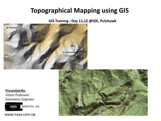
  • 1. Topographical Mapping using GIS GIS Training : Day 11,12 @IOE, Pulchowk
  • 2. Presentation Outline Surface Representation in Arc GIS TIN, Raster and Terrain Surfaces Comparison between Surfaces Analyzing Surfaces: Slope, Aspect, Hillshade and Curvature Topographical Mapping Contouring Characteristics of Contours Preparing a topo map: Assignment
  • 3. Surface representation in ArcGIS A 3D Surface model is a digital representation of features, either real or hypothetical, in three-dimensional space. They are usually derived, or calculated, using specially designed algorithms that sample point, line, or polygon data and convert it into a digital 3D surface.  ArcGIS can create and store three types of surface models: TIN, Raster, and Terrain dataset.
  • 4. Contd… With ArcGIS, there are two approaches for managing your surface data: geodatabase or file-based. Choice of the surface is partially your choice but is also limited by the surface type. Geodatabases are collections of spatial data native to ArcGIS that collate several features or raster datasets all in one place. File-based formats can be ESRI specific (TIN, GRID), open-source and standardized exchange formats (TIFF, JPEG), or third-party formats (IMG, PIX).
  • 5. Triangulated Irregular Network (TIN) TINs are a form of vector-based digital geographic data constructed by triangulating a set of vertices (points). ArcGIS supports the Delaunay triangulation method. Delaunay triangle criterion ensures that no vertex lies within the interior of any of the circumcircles of the triangles in the network. If Delaunay criterion is satisfied everywhere, the minimum interior angle of all triangles is maximized. TINs cannot be stored in any of the three types of geodatabases; they can only be stored in file-based storage solutions.
  • 6. Raster Surfaces Raster surface data represents a surface as a grid of equally sized cells that contain the attribute values for representing the z-value and the x,y location coordinates.  Each cell represents a defined square area on the earth's surface and holds a value that is static across the entire cell. Elevation models are one such example of raster surface models.  The fixed point may be a spot height derived from photogrammetric methods, but interpolation between heights help form the digital elevation model (DEM).
  • 7. Terrain Surfaces Terrain datasets are an efficient way to manage large point-based data in a geodatabase and produce high-quality, accurate surfaces on the fly. A terrain dataset in the geodatabase It doesn't actually store a surface as a raster or TIN. Rather, it references the original feature classes. This organization involves the creation of terrain "pyramids" that are used to quickly retrieve only the data necessary to construct a surface. Can be stored in a personal, file, or multiuser geodatabase.
  • 8. Comparison between Surfaces TIN models are less widely available than raster surface models and tend to be more time consuming to build and process. The cost of obtaining good source data can be high, and processing TINs tends to be less efficient than processing raster data because of the complex data structure. TINs are typically used for high-precision modeling of smaller areas, such as in engineering applications, where they are useful because they allow calculations of plan metric area, surface area, and volume. Terrain datasets and related tools offer benefits in the areas of data management, analysis, and visualization in case of voluminous data .
  • 9. Analyzing Surfaces Surface analysis involves several kinds of processing, including extracting new surfaces from existing surfaces, reclassifying surfaces, and combining surfaces. Most common Terrain analysis tools: Slope, Aspect, Hillshade, and Curvature tools.
  • 10. Slope ,Aspect, Hillshade and Curvature The Slope tool calculates the maximum rate of change from a cell to its neighbors, which is typically used to indicate the steepness of terrain. The Aspect tool calculates the direction in which the plane fitted to the slope faces for each cell.
  • 11. Hillshade shows the intensity of lighting on a surface given a light source at a particular location It can model which parts of a surface would be shadowed by other parts. Curvature (the second derivative of the surface) calculates the slope of the slope and finds out whether a given part of a surface is convex or concave. Convex parts of surfaces, like ridges, are generally exposed and drain to other areas. Concave parts of surfaces, like channels, are generally more sheltered and accept drainage from other areas.
  • 12. Topographical Maps Type of maps in which the configuration of the terrain along with the horizontal position of the natural and artificial features above the given terrain is represented. Topographic maps are also commonly called contour maps or topo maps. The various features shown on the map are represented by conventional signs or symbols. For example, colors can be used to indicate a classification of roads.
  • 13. Contouring General definition: A Contour line (also isoline, isopleth, or isarithm) of a function of two variables is a curve along which the function has a constant value. It is a cross-section of the three-dimensional graph of the function f(x, y) parallel to the x, y plane. In Surveying and mapping , Contours are the imaginary lines that connects the points of equal elevation. Contour interval of a contour map is the difference in elevation between successive contour lines. Types: Index and Intermediate Contours Usually every fifth contour line is shown in a heavy, wider line, so called an index contour
  • 14. Characteristics of Contours  The contour are closed curves. Contour line do not cross to each other. Important points can be further defined by including a “spot” elevation. Contour line cross valley lines at right angles. Contour line cross ridge line at right angle. The contour line form U shaped curve. Ridge contours can be confused with valley contours as they, too, form 'U' shapes - the difference is that the closed end of the 'U' points to lower ground.  Depression and hill look the same. And Many more…
  • 15.
  • 16. Prepare a Topo Map - Assignment 1. Datasets Location:../day11-12/road_details.csv 2. Manual document -See the pdf: Prepare_map.pdf