SlideShare a Scribd company logo
1 of 81
Trading routes used around the 1st century CE centered on the Silk
Road
Chola territories during Rajendra Chola I, c. 1030
Map with the main voyages of the age of discoveries, 1482-1524
Age of Discovery: Overview
 The Portuguese began systematically
exploring the Atlantic coast of Africa from
1418, under the sponsorship of Prince
Henry I
 In 1488 Bartolomeu Dias reached the
Indian Ocean by this route.
 In 1492, racing to find a trade route to
Asia, the Spanish monarchs funded
Christopher Columbus’s plan to sail west
to reach the Indies by crossing the
Atlantic. He landed on an uncharted
continent, then seen by Europeans as a
new world, America.
 To prevent conflict between Portugal and
Spain, a treaty was signed dividing the
world into two regions of exploration,
where each had exclusive rights to claim
newly discovered lands.
 In 1498, a Portuguese expedition
commanded by Vasco da Gama finally
achieved the dream of reaching India by
sailing around Africa, opening up direct
trade with Asia.
 Soon, the Portuguese sailed further
eastward, to the valuable spice islands in
 East and west exploration overlapped in
1522, when Portuguese navigator
Ferdinand Magellan led a Spanish
expedition West, achieving the first
circumnavigation of the world, while
Spanish conquistadors explored inland
Americas, and later, some of the South
Pacific islands.
 Since 1495, the French and English
and, much later, the Dutch entered the
race of exploration after learning of
these exploits, defying the Iberian
monopoly on maritime trade by
searching for new routes, first to the
north, and into the Pacific Ocean around
South America, but eventually by
following the Portuguese around Africa
into the Indian Ocean, discovering
 Australia in 1606,
 New Zealand in 1642, and
 Hawaii in 1778.
 Meanwhile, from the 1580s to the 1640s
Russians explored and conquered
almost the whole of Siberia.
CHRISTOPHER COLUMBUS AND THE SPANISH EMPIRE
Prior to 1492 and Christopher Columbus' voyage to the
Americas, Spain's only possession of any consequence
outside Europe were the Canary Islands.
By the mid-sixteenth century, however, Spain would control
much of the Caribbean, large portions of the Americas and
parts of Africa.
This rapid acquisition of overseas possessions was
accompanied and aided by the establishment and
consolidation of hegemony in Europe through a series of
political marriages.
Instead of waging battles to spread its power and influence,
the prolific Habsburgs preferred to use the bonds of marriage
to link their household to others. This ensured that the
number of threats to Habsburg possessions in Europe would
remain at a minimum and would free Spanish resources to
conquer overseas territory.
Spain politically, socially, and economically dominated her
large empire and, unlike the Portuguese, who were limited to
coastal regions and tenuously held outposts, the Spaniards
were able to penetrate inland and establish much more
permanent settlements.
Portuguese trade routes (blue) since Vasco da Gama's 1498
journey and the Spanish Manila-Acapulco galleons trade routes
(white) established in 1568
Vasco da Gama's passage to
India
A 16th-
century
Portugues
ship used
in the
Indian
Ocean
trade
routes
INS Vikrant circa 1984 carrying a unique complement of Sea Harriers,
Sea Hawks, Allouette & Sea King helicopters and Alize ASW.jpg
INS Mysore on deployment in the Gulf of
Aden to check piracy
Indian Navy Tu-142 and IL-38SD stationed at Arakkonam
Naval Air Station
INS Shivalik the first indigenous stealth
ship of the Indian navy
INS Sindhurakshak (S63), a Sindhughosh
class submarine
Cnceptual Drawing of INSArihant,
India's first ballistic missile nuclear
submarine
INSArihant, India's first ballistic missile
nuclear submarine
 Career (India) Name: INS Arihant
 Builder: Shipbuilding Centre (SBC), Visakhapatnam, India
 Launched: 26 July 2009
 Status: Sea trials
 General characteristics
 Class and type: Arihant-class submarine
 Type: SSBN or SSGN
 Length: 111 m (364 ft)
 Beam: 15 m (49 ft) Draft: 11 m (36 ft)
 Propulsion: PWR using 40% enriched uranium fuel (80 MWe ); one turbine
(47,000 hp/70 MW); one shaft; one 7-bladed, high-skew propeller
 (estimated) Range: unlimited except by food supplies
 Test depth: 300 m (980 ft) (estimated)
 Complement: 95–100 officers and men
 Sensors and processing systems: BEL USHUS
 Armament:
 6 x 533mm torpedoes
12 x K-15 Sagarika SLBM
Shaurya missile (expected)
Air Routes
In India:
Global Air Routes:
LCA Tejas
Indian Navy has shown interest in the Air Force's
Advanced Medium Combat Aircraft
 AAI manages 126 airports, which include 11 international airports, 89 domestic airports
and 26 civil enclaves at Defense airfields.
 All major air-routes over Indian landmass are Radar covered (24 Radar installations at 11
locations) along with VOR (Omnidirectional Radio Range) /DVOR (Doppler VOR)
coverage (72 installations) co-located with Distance Measuring Equipment (71
installations)
 39 runways provided with ILS installations; Night Landing Facilities at 36 airports; and
Automatic Message Switching System at 15 airports.
 Automatic Dependence Surveillance system, using indigenous technology, at Kolkata
and Chennai Air Traffic Control Centers, enabling effective Air Traffic Control over
oceanic areas using satellite communication.
 Use of remote controlled VHF coverage, along with satellite communication links, has
given added strength to our Air Traffic Management System.
 Linking of 80 locations by V-Sat installations vastly enhances Air Traffic Management
and safety of aircraft operations besides enabling administrative and operational control
over our extensive airport network.
Functions of AAI
 Control and management of the Indian airspace extending beyond the territorial
limits of the country, as accepted by ICAO
 Design, Development, Operation and Maintenance of International and Domestic
Airports and Civil Enclaves.
 Construction, Modification and Management of Passenger Terminals
 Development and Management of Cargo Terminals at International and Domestic
airports.
 Provision of Passenger Facilities and Information System at the Passenger
Terminals at airports.
 Expansion and strengthening of operation area viz. Runways, Aprons, Taxiway, etc.
 Provision of visual aids.
 Provision of Communication and Navigational aids viz. ILS, DVOR, DME, Radar,
etc.
Air Navigation Services
In tune with global approach to modernization of Air Navigation infrastructure for
seamless navigation across state and regional boundaries, AAI has plans for
transition to satellite based Communication, Navigation, Surveillance and Air Traffic
Management.
A number of co-operation agreements and Memoranda of Co-operation have been
signed with US Federal Aviation Administration, US Trade and Development Agency,
European Union, Air Services Australia and the French Government, co-operative
projects and studies initiated to gain from their experience.
Through these activities more and more executives of AAI are being exposed to
the latest technology, modern practices and procedures to improve the overall
performance of Airports and Air Navigation Services.
New and improved procedure have been adopted with induction of new
equipments. Some of the major initiatives in this direction are introduction of:
Reduced Vertical Separation Minima (RVSM) in Indian airspace to increase
airspace capacity and reduce congestion in the air and
implementation of GPS and Geo Augmented Navigation GAGAN jointly with
ISRO which, when in operation, would be one of the four such systems in the
world.
Precision Approaches and their Accuracies
Courtesy: Per Enge, Aircraft Landing Systems Based on GPS & GALILEO
Precision Landing Approaches with Local Area Augmentation System
(1 of 2)
 GAGAN is a space-based augmentation system, in contrast with a
wide area augmentation system (WAAS) or local area augmentation
system (LAAS)
 For precise landing approaches, the Local Area Augmentation System
(LAAS) is employed which works in a sequence depicted in the figures
below:
Courtesy: www.faa.gov
Precision Landing Approaches with Local Area Augmentation System (2 of 2)
Aircraft Navigation
Using GAGAN and IRNSS
GPS Augmentation for Civil Aviation
GAGAN: GPS Aided Geostationary Satellite Augmented
Navigation System
Courtesy: www.isro.org
Use OF GAGAN and IRNSS for Position, Velocity,
and Time Determination
 The GPS receivers on the ground stations receive the signals from four or
more GPS satellites.
 The receivers comprehend the navigation data contained in the signals
and send a message to the Master Control Centre (MCC) where the
errors in the GPS signals are calculated.
 A message containing the corrections in the received GPS signals is
generated at the MCC and is sent to the Land Uplink Stations, which
transmit these messages to the geostationary satellites.
 The geostationary satellites broadcast these corrections in order that the
navigating vehicle, equipped with a GPS receiver, receives these
correction messages and corrects the GPS signals accordingly. In this
manner, the navigating vehicle can determine its position, velocity and
time with an increased accuracy.
 The above technique uses the GPS signals. In future, after the
implementation of the IRNSS, the GPS satellite signals would be replaced
by the IRNSS signals.
 An independent regional
navigation system covering
India and an area of about 500
Km around India
 The system will consist of
seven satellites, 3
geostationary and 4
geosynchronous
 The target position accuracy is
of less than 10 m over the
Indian subcontinent and within
20 m over the Indian Ocean
IRNSS Satellites: Three Geostationary and Four
Geosynchronous – A Nice Geometry for Navigation
 Global Navigation
System
 Controlled by the
US Government
 Medium Earth Orbit
Satellites
 Regional
Navigation System
 It will be under full
control of the
Government of
India
 Geosynchronous
Orbit Satellites
IRNSS GPS
Inertial Measurements to Aid GPS Tracking
P = position, V = velocity, A = attitude, T = time,
rho = range, rho_dot = range rate, del_theta = incremental attitude,
del_v = incremental_velocity
Courtesy: Per Enge, Aircraft Landing Systems Based on GPS & GALILEO
Defence Research & Development Organization (DRDO)
Ministry of Defence, Gov’t of India
DRDO is a network of more than 50 laboratories deeply engaged in developing defense
technologies covering various disciplines such as aeronautics, armaments, electronics, combat
vehicles, engineering systems, instrumentation, missiles, advanced computing and simulation,
special materials, naval systems, life sciences, training, information systems and agriculture.
The Organization employs over 5000 scientists and about 25,000 other scientific, technical and
supporting personnel.
Several major projects for the development of missiles, armaments, light combat aircrafts,
radars, electronic warfare systems etc are on hand and significant achievements have been made
in several such technologies.
VISION
Make India prosperous by establishing world class science and
technology base and provide our Defence Services decisive edge by
equipping them with internationally competitive systems and solutions.
MISSION
Design, develop and lead to production state-of-the-art sensors,
weapon systems, platforms and allied equipment for our Defence
Services.
Provide technological solutions to the Services to optimise combat
effectiveness and to promote well-being of the troops.
Develop infrastructure and committed quality manpower and build
strong indigenous technology base.
 AERONAUTICS
 Aeronautical Development Establishment (ADE), Bangalore
 Aerial Delivery Research & Development Establishment (ADRDE), Agra
 Centre for Air Borne Systems (CABS), Bangalore
 Defence Avionics Research Establishment (DARE), Bangalore
 Gas Turbine Research Establishment (GTRE), Bangalore
 Center for Military Airworthiness & Certification (CEMILAC), Bangalore
 MISSILES
 Defence Research & Development Laboratory (DRDL), Hyderabad
 Institute of Systems Studies & Analyses (ISSA), Delhi
 Integrated Test Range (ITR), Balasore
 Research Center Imarat (RCI), Hyderabad
 NAVAL
 Naval Science & Technological Laboratory (NSTL), Vishakapatnam
Technology Clusters
Defence Research and Development Laboratory (DRDL)
Defence Research Complex, Kanchanbagh, Hyderabad
 Formerly directed by A.P.J. Abdul Kalam,
 The main research center for the Integrated Missile Development Program
 DRDL is responsible for the Integrated Guided Missile Program, which
includes five components:
 Prithvi, a surface-to-surface battlefield missile;
 Nag, an anti-tank missile (ATM);
 Akash, a swift, medium-range surface-to-air missile (SAM);
 Trishul, a quick-reaction SAM with a shorter range; and
 Agni, an intermediate range ballistic missile.
Prithvi Agni III Test Flight
DRDO's Prithvi-II, Agni-I, Agni-II, Agni-IIAT, Agni-3 (TD,+,++,SL)
[Image © Arun Vishwakarma]
DRDO's Prithvi-II, Agni-I, Agni-II, Agni-IIAT, Agni-3 (TD,+,++,SL)
[Image © Arun Vishwakarma]
Agni-I
Agni-II Agni-
IIAT
Agni-3 TD Agni-3 A Agni-3 B Agni-3 C Agni-3SL
Length (m) 15 20 20 16.7[0.A] 17[0.A] 17[0.A]
14.6 12
Diameter (m) 1 1 1.2 2 2 2 2
2
Launch Weight
(kg) (Including Payload)
12,000 16,000 27,000 48,300 [0.A] 51,500
(Estimated)
53,100
(Estimated)
44,400
(Estimated)
37,600
(Estimated)
Propellant Solid
(HTPB/AP/AI)
High energy, high density Solid Propellant
(HTPB/AP/AI)
Number of Stages 1 2.5 2.5 2 3 4 3 3
Payload - kg 800 -
1,000
800 -
1,000
300 -
1,000
600 - 1,500[1]
2,490
(conventional)
1,500 600 - 3490 600 - 3490
(8 - 12 RV )
600 - 3490
(8 - 12 RV )
Warhead Strategic nuclear (15 KT to 250 KT), conventional[2] HE-unitary, penetration, sub-munitions, incendiary or fuel air
explosives.
Guidance Strap Down - INS (Inertial
Navigation System), optionally
augmented by GPS terminal
guidance with possible radar scene
correlation.
INS (full Inertial platform)[3], optionally augmented by
GPS/GLONASS/IRNSS, possibly with radar scene correlation.
Range (Payload) 850 km
(1,000kg
)
3,300 km
(1,000kg)
,
4,450 km
(700kg)
4,000 km
(1,500kg
)
5,500 km
(1,500kg) [4]
8,100 Km
(1,500kg)
>18,000
km[4.A]
11,500
km
10,300
(1050kg)
5,200Km
(1,400Kg),
11,600Km
(700kg)
CEP Accuracy 120
meters
40
meters
20
meters
(estimated)
16 meters[4.B]
Launch Platform 8 x 8 Tatra TELAR (Transporter
Erector Launcher)
Rail Mobile Launcher
8 x 8 Tatra TELAR
Rail Mobile Launcher
Submarine
Launcher
Shourya lifts off from the Integrated Test Range
at Balasore, Orrissa, on November 12, 2008
The successful first test of the surface-to-
surface Shourya missile from the Integrated
Test Range at Chandipur-on-sea near
Balasore in Orissa on November 12
Shourya is a hypersonic missile; it can reach a
velocity of Mach 6 even at low altitudes.
On November 12, it reached
a velocity of Mach 5, heating up its surface to
700+ degree Celsius.
The missile performed an
ingenious maneuver of rolling to spread the heat
uniformly on its surface. Its high maneuverability
makes it less vulnerable to present-day anti-missile
defense systems.
Shourya can reach targets 700 km away, carrying both
conventional and nuclear warheads. It is 10 metres long and
74 cm in diameter and weighs 6.2 tonnes. It is a two-stage
missile and both its stages are powered by solid propellants.
Its flight time is 500 seconds to 700 seconds.
Shourya’s Navigation system uses ring-laser gyros and
accelerometers
 In the estimate of V.K. Saraswat, Chief Controller, Missiles and Strategic Systems, DRDO,
Shourya is among the top 10 missiles in the world in its class, with its high-performance
navigation and guidance systems, efficient propulsion systems, state-of-the-art control
technologies and canisterised launch signature – it cannot be easily detected by
satellites – and makes its deployment easy.
 Shourya was ejected from the canister by a gas generator, developed by the High Energy
Materials Research Laboratory (HEMRL), Pune, and the ASL. The gas generator, located
at the bottom of the canister, fires for about a second and a half. It produces high
pressure gas, which expands and ejects the missile from the tube. The missile has six
motors; the first one is the motor in the gas generator.
 The centerpiece of a host of new technologies incorporated in Shourya is its ring-laser
gyroscope and accelerometer. The ring-laser gyroscope, a sophisticated navigation and
guidance system made by the RCI, is highly classified technology. Advanced countries
have denied this technology to India. In Shourya’s flight, it functioned exceptionally well.
 M. Natarajan, Scientific Adviser to the Defense Minister and Director-General of the
DRDO, praised the way the ring-laser gyroscope functioned in Shourya’s flight. “We flew
our own navigation system in this missile. It worked very well. This is an important step
forward for the country in the navigation of missiles, aircraft and spacecraft. No other
country will provide India this navigation system,” he said.
After the flawless launch of the surface-to-surface missile Shourya, the
DRDO is set to fire an interceptor missile.
 Missile technologists of the DRDO are engaged in preparing for the launch of an
interceptor missile.
 The launch, scheduled to take place in the second half of December, will feature two
missiles.
 While the target missile, with a range of 1,500 km, will be fired from a ship in the Bay of
Bengal towards Wheeler Island, located off the Orissa coast, the interceptor missile,
which will be fired from the island, will engage an incoming “enemy missile” in the
terminal phase of its flight at an altitude of 80 km in the exo-atmosphere and decimate it.
 The enemy missile will be a modified version of Dhanush.
 Intense high-technology work at the Defence Research and Development Laboratory
(DRDL), the Advanced Systems Laboratory (ASL), and the Research Centre, Imarat (RCI),
all located on the serene DRDO campus.
 Agni-V will have a range of 5,000 km. It will be launched in 2010.
 The ASL is also preparing for a flight trial of Agni-IIIA in 2009. The missile will be an
advanced version of Agni-II, which has a range of more than 2,500 km.
On November 27 India carried out a successful ballistic
missile interception test.
 The target vehicle was a modified Prithvi SRBM fired in a trajectory meant to
simulate the terminal phase maneuver of a longer range missile.
 The interceptor was fired a minute after the target, and intercepted it an
altitude of 50km.
The interceptor is 10-12 metres long, and has two stages. It uses an active
seeker guidance system in its terminal phase.
India to Test Layered Missile Defense
Ref. Frontier India Strategic and Defence (Dec. 12, 2008)
 India will test layered missile defence in December 2008. This test will
involve 2 Ballastic Missile interceptors intercepting a single modified
Prithvi Missile. The first interception will take place at an altitude of 80
km. The second interception will take place at the altitude of 30 kms.
 The 80 Km or exo-atmospheric interceptor is expected to hit the
incoming missile and
 the 30 Km or the endo-atmospheric interceptor will try to destroy the
largest surviving debris.
 India has so far tested exo-atmospheric and endo-atmospheric
interceptors in stand alone modes.
 On 6th December 2007 DRDO carried out the 2nd launch of a Single
Stage Interceptor Missile against an incoming ballistic missile target of
enemy represented by a modified Prithivi Missile. The Endo-
Atmospheric Interceptor (AAD) intercepted a modified Prithvi Missile at
15 km altitude. On 27 Nov 2006, exo atmospheric test, Prithvi Air
Defence Exercise (PADE), intercepted a modified Prithvi-II Missile at an
altitude of 50 km.
Agni-II Intermediate Range Ballistic Missile displayed at the Republic Day
Parade on New Delhi's Rajpath, January 26, 2004
Agni-3 D2: ASL's A.Chander,
Defense MoS Pallam Raju,
with users
[Source: India Strategic]
.
V.K. Saraswat (left),
Chief Controller,
Research and
Development,
Missile and Strategic
Systems, with the
Shourya team led by
its programme
director
A.K. Chakrabarti
(right) and
P. Venugopalan,
DRDL Director.
In the backdrop
is the missile in a
canister
 Hindustan Aeronautics Limited (HAL) came into existence
on 1st October 1964. The Company was formed by the merger of Hindustan
Aircraft Limited with Aeronautics India Limited and Aircraft Manufacturing
Depot, Kanpur.
 The Company traces its roots to the pioneering efforts of an industrialist with
extraordinary vision, the late Seth Walchand Hirachand, who set up Hindustan
 Aircraft Limited at Bangalore in association with the erstwhile princely State
of Mysore in December 1940.
The Government of India became a shareholder in March 1941 and took over
the Management in 1942.
 Today, HAL has 19 Production Units and 9 Research and Design Centres in 7
locations in India. The Company has an impressive product track record –
 12 types of aircraft manufactured with in-house R & D and 14 types
produced under license.
 over 3550 aircraft
 3600 engines, and
 overhauled over 8150 aircraft and 27300 engines.
 HAL has been successful in numerous R & D programs developed for both
Defence and Civil Aviation sectors.
HAL Products
Chief of Air Staff Air Chief Marshal F.H. Major flew the Advanced Light Helicopter
(ALH) – Dhruv -- powered by the Shakthi engine in Bangalore
Air Chief Marshal F.H. Major, PVSM, AVSM, SC, VM, ADC, Chief of Air Staff
with Shri Ashok K Baweja, Chairman HAL with the weaponised Dhruv
helicopter (ALH) at Helicopter Division of HAL
 HAL has made substantial progress in its current
projects :
 Dhruv, which is Advanced Light Helicopter (ALH)
 Tejas - Light Combat Aircraft (LCA)
 Intermediate Jet Trainer (IJT)
 Various military and civil upgrades.
 HAL has played a significant role in India's space
programs by participating in the manufacture of
structures for Satellite Launch Vehicles like
 PSLV (Polar Satellite Launch Vehicle)
 GSLV (Geo-synchronous Satellite Launch Vehicle)
 IRS (Indian Remote Satellite)
 INSAT (Indian National Satellite)
LIGHT COMBAT AIRCRAFT (LCA) TEST-FLOWN SUCCESSFULLY on 4
January, 2001
 LCA is an advanced technology,
 single seat, single engine,
 supersonic, light-weight,
 all-weather, multi-role,
 air superiority fighter designed for
 air-to-air, air-to-ground and
 air-to-sea combat roles.
 The purpose of flight test program was to validate a number of
advanced technologies incorporated in LCA. These include:
 Unstable configuration,
 quadruplex fly-by-wire digital flight control system,
 integrated avionics with glass cockpit,
 advanced composite materials for primary structure and
 a novel utility systems management system.
Satellite Launch Vehicle – 3 (SLV - 3)
 Project Director: Abdul Kalam
 Weight (t) : 17
 Payload (kg) : 40
 Height(m) : 22
 Orbit : Low - earth orbit
Augmented Satellite launch Vehicle (ASLV)
 ASLV is a five-stage vehicle
employing solid propellant
capable of placing 150 Kg class
satellites in near-circular orbit.
Successfully launched in May
1992 and May 1994, placing
SROSS Scientific Satellites in
orbit.
 Weight (t): 39
 Payload (kg): 150
 Height (m): 23.5
 Orbit :Low - earth orbit
Polar Satellite Launch Vehicle (PSLV)
 Developmental flights completed with successful third
developmental launch in March 1996.
 IRS-1D launched by PSLV-C1 on September 29, 1997.
 Suitable for launching 1,000-1,200 kg class of remote sensing
satellites into polar sun-synchronous orbit.
 IRS-P4 (OCEANSAT) and two piggy back small satellites –
 Korean KITSAT-3 (Korean Institute of Technology) and
 German TUBSAT (Technical University of Berlin)
launched by PSLV-C2 on May 26,1999.
 Technology Experiment Satellite (TES) of ISRO, and
 BIRD (a small satellite mission) of DLR Germany,
 PROBA (Project for Onboard Autonomy) of Belgium –
 into their intended orbits launched by PSLV-C3 on October 22,
2001.
 The 1060 kg KALPANA-1 satellite - into a Geosynchronous
Transfer Orbit (GTO) launched by PSLV-C4 on September 12,
2002.
 RESOURCESAT-1 (IRS-P6) satellite launched by PSLV-C5 on
October 17, 2003.
 CARTOSAT-1 and HAMSAT satellites launched by PSLV-C6 on
Weight (t) : 294
Payload (kg) :
1000-1200
Height (m) : 44.43
Orbit : Polar orbit
INSAT 3A Mission: Launch, Deployment and Establishing
the Geostationary Orbit
Satish Dhawan Space Center (SDSC), SHAR, the Launch Station
for GSLV
Chandrayan’s
Voyage to
Moon
Byalalu
Navigation Systems for Civil Aviation
 Global positioning
 Inertial reference systems,
 ring laser and fiber optic gyro systems, and
 Autonomous Integrity Monitored Extrapolation (AIME®)
technology for commercial aviation.
• LTN-92 Ring Laser Gyro
Inertial Navigation System
The LTN-92 uses three ring laser gyros,
force rebalanced accelerometers, and
three high-speed digital
microprocessors to provide an
advanced technology, all-attitude,
worldwide navigation system
LN-100G Inertial Navigation System with Embedded
GPS
By combining the Zero-lock™ Laser
Gyro, (ZLG™), with the latest
technology, electronics, and GPS,
the LN-100G represents the highest
quality INS/GPS in the world.
 Embedded GPS inertial system
 0.8 nmi/hr free inertial
 Inertial, GPS, and hybrid navigation solutions
 SPS, PPS, all-in-view, and GRAM/SAASM (?) GPS receivers available
 Low power, lightweight
 High MTBF (?)
 Two dual 1553B data bus terminals
 High integrity, endurance tested design
 Validated Ada-based software
 Nondithered RLG (No acoustic noise; no SAR jitter)
 Ease of missionization, >70 applications to date
ISRO Inertial System Unit
ISRO Inertial Systems Unit (IISU)
 Carries out development of inertial sensors and systems for satellites
and launch vehicles covering navigation systems, satellite inertial
systems, bearing and space tribology, and inertial systems integration
and simulation.
 Facilities include precision fabrication, assembly, integration and
testing.
 Achievements include development of inertial systems for ISRO
launch vehicles and satellites, solar array drive assemblies, scanning
mechanisms, etc.
 Currently engaged in development of Inertial Navigation System for
PSLV, GSLV, INSAT and IRS satellites.
Additional Sources
 Visit websites of Northrop Grumman, Honeywell,
Systron Donner,…. for much more details.
 GPSoft toolboxes
 GIPSY from Jet Propulsion Lab, Cal Tech, Pasadena
Three-Axis Motion Simulator for Gyro
Testing and Calibration
Courtesy: Zetatek;
http://www.zetatekindia.com/products_motinsimulators.htm
INS and Nav-Aids for Civil Aviation
 Introduction to Civil Aviation
 Specific references
 Dead reckoning (that is, Inertial Navigation: rate of change
of lat, long; relative bearing, distance on great circle)
 Nav Aids:
 VHF Omni-directional range (VOR),
 DME (distance measuring equipment),
 Tactical Air Navigation (TACAN),
 Instrument Landing System (ILS),
 LORAN-C (Long Range Navigation),
 OMEGA,
 RADAR (Radio detection and ranging)
INS for Civil Aviation
 Fundamental Principals of Inertial Navigation
 1-d, 2-d strapdown navigation, 2-d rotating,
 3-d strapdown navigation system: General Analysis
 Navigation with respect to an inertial frame
 Navigation with respect to a rotating frame, ECEF
 Navigation in Local Geographic Navigation Frame, NED: Vector
equations and scalar equations
 Terrestrial Navigation
 Shape of the Earth: Ref. Ellipsoid, Geoid, WGS, geocentric and geodetic
latitudes; variation of g
 Revised transport rate (rate of change of lat, lon) in geodetic frame
 ECEF coordinates from lat-lon-height
 Geodetic lat-lon-height from the ECEF coordinates using Newton-Raphson
technique (Prob. 4.2-4.3, Rogers)
Course AE 457 - Space Flight Navigation & Guidance
 Navigation:
 Fundamentals of Navigation
 Stellar navigation
 inertial navigation
 radio and radar based navigation systems,
 satellite based navigation systems, global positioning systems
(GPS)
 Performance comparison of various types of navigation systems.
 Guidance:
 Fundamentals of Guidance, intercept geometry and collision
triangle,
 proportional navigation and guidance,
 concept of miss distance and line of sight.
 Augmented proportional navigation and guidance,
 command to LOS guidance and
 beam rider guidance
 Strategic consideration, pulsed guidance and Lambert guidance.
 Concept of Kalman filters, fading memory filters and noise
AE 641 - Introduction to Navigation and Guidance
 Navigation:
 Fundamentals of Navigation,
 Stellar Navigation,
 Inertial Navigation,
 Radio and Radar based Navigation Systems,
 Global Positioning System,
 Other Specialized Navigation Systems,
 A Comparison of the various Navigational Aids,
 Some Case Studies.
 Guidance:
 Fundamentals of guidance,
 Concepts of Intercept Geometry,
 Line of Sight and Collision Triangle,
 Proportional Navigation & Guidance (PNG) and
 Determination of Miss Distance,
 Augmented PNG and its comparison with PNG,
 Command to LOS & Beam Rider Guidance,
 Pulsed and Lambert`s Guidance,
 Tactical Vs. Strategic Considerations in Guidance,
 Impact of Noise on Guidance, Target maneuver and Evasion
References
 P. Zarchan, Tactical and Strategic Missile Guidance, AIAA Education Series, 5th Edition,
2010
 Anderson, E.W., The Principles of Navigation, Hollis & Carter, London,
 Kayton, M., and Fried Navigation : Avionics
 Parkinson, B.E. & Spilker, J.J., Global Positioning System : Theory and Applications;
Vol.1-2, Progress In Aeronautics and Astronautics Series, Vol.163, AIAA
Publication,1996
 Farrell, James L., Integrated Aircraft Navigation, Academic Press, 1976
 Farrell, Jay A., Aided Navigation: GPS with High Rate Sensors, McGraw Hill, 2008
 Titterton, D.H., and Weston, J.L., Strapdown Inertial Navigation Technology, 2nd Ed.,
2004
 Zipfel, P.H., Modeling and Simulation of Aerospace Vehicle Dynamics, AIAA Education
Series, 2000
 Grewal, M.S., Weill, L.R., and Andrews, A.P., Global Positioning Systems, Inertial
Navigation, and Integration, 2nd Ed., 2007
 Grewal, M.S., Kalman Filtering,
 Montenbruck, O., and Gill, E., Satellite Orbits: Models, Methods, Applications, Springer
2000
 Noton, M., Spacecraft Navigation and Guidance, Springer 1998
 Rogers, R.M., Applied Mathematics in Integrated Navigation Systems, 3rd Ed., AIAA
Weight distribution last
semester:
 Assignment 20%
 Midsem: 32%
 Quiz 1: 3%
 Quiz 2: 3%
 Endsem: 42%
 Rules and Guidelines of the Institute:
 Relative weight for in-semester evaluations is typically between 50 and
60 per cent. This will consist of
 one mid-semester test of two hours duration of about 25-30 per cent weight,
 Two quizzes or one quiz and one test
 assignments and viva-voce
 may also include up to a maximum of 10 per cent of the in-semester marks for
active participation in the class and the initiatives shown by the student.
 The semester–end examination’s relative weight would be 40 to 50 per
cent.
It is normally of 3 hours duration and will cover the full syllabus of the
course.
0 10 20 30 40 50 60
0
5
10
15
20
25
30
35
40
45
50
55
60
65
70
AE 308: Control Theory and AE 775: System Modeling Dynamics and Control: Final Grades
AA
AB
BB
BC
CC
CD
DD
av
Final Grades Last Semester

More Related Content

Similar to Lec radar new.ppt

Aeronautical Navigation Systems
Aeronautical Navigation SystemsAeronautical Navigation Systems
Aeronautical Navigation SystemsMichael Bseliss
 
Modern navigational instrument
Modern navigational instrumentModern navigational instrument
Modern navigational instrumentkheersagar
 
Irnss paper presentation
Irnss paper presentationIrnss paper presentation
Irnss paper presentationUtkarsh Gangwar
 
Department of Space, Government of India - Year End Review 2014
Department of Space, Government of India - Year End Review 2014Department of Space, Government of India - Year End Review 2014
Department of Space, Government of India - Year End Review 2014D Murali ☆
 
Evaluation of an Unmanned Airborne System for Monitoring Marine Mammals
Evaluation of an Unmanned Airborne System   for Monitoring Marine MammalsEvaluation of an Unmanned Airborne System   for Monitoring Marine Mammals
Evaluation of an Unmanned Airborne System for Monitoring Marine MammalsAngelo State University
 
Navigation Systems That Changed Aviation
Navigation Systems That Changed AviationNavigation Systems That Changed Aviation
Navigation Systems That Changed AviationGene Bush
 
Intro to RS and GIS by mndp poonia
Intro to RS and GIS by mndp pooniaIntro to RS and GIS by mndp poonia
Intro to RS and GIS by mndp pooniamndp_slide
 
Global positioning system (GPS)
Global positioning system (GPS)Global positioning system (GPS)
Global positioning system (GPS)Henil Shah
 
History of Navigation
History of NavigationHistory of Navigation
History of Navigationgautamanurag
 
History of Navigation
History of NavigationHistory of Navigation
History of Navigationgautamanurag
 
oLRHR5LYJLR1IggX333.pptx
oLRHR5LYJLR1IggX333.pptxoLRHR5LYJLR1IggX333.pptx
oLRHR5LYJLR1IggX333.pptxVishuBaniyan
 

Similar to Lec radar new.ppt (20)

Gps
GpsGps
Gps
 
Aeronautical Navigation Systems
Aeronautical Navigation SystemsAeronautical Navigation Systems
Aeronautical Navigation Systems
 
Modern navigational instrument
Modern navigational instrumentModern navigational instrument
Modern navigational instrument
 
IRNSS paper presentation
IRNSS paper presentationIRNSS paper presentation
IRNSS paper presentation
 
Irnss paper presentation
Irnss paper presentationIrnss paper presentation
Irnss paper presentation
 
Gps
GpsGps
Gps
 
Department of Space, Government of India - Year End Review 2014
Department of Space, Government of India - Year End Review 2014Department of Space, Government of India - Year End Review 2014
Department of Space, Government of India - Year End Review 2014
 
Cours_satellites_Chap1.pdf
Cours_satellites_Chap1.pdfCours_satellites_Chap1.pdf
Cours_satellites_Chap1.pdf
 
Space final
Space finalSpace final
Space final
 
Evaluation of an Unmanned Airborne System for Monitoring Marine Mammals
Evaluation of an Unmanned Airborne System   for Monitoring Marine MammalsEvaluation of an Unmanned Airborne System   for Monitoring Marine Mammals
Evaluation of an Unmanned Airborne System for Monitoring Marine Mammals
 
Navigation Systems That Changed Aviation
Navigation Systems That Changed AviationNavigation Systems That Changed Aviation
Navigation Systems That Changed Aviation
 
Intro to RS and GIS by mndp poonia
Intro to RS and GIS by mndp pooniaIntro to RS and GIS by mndp poonia
Intro to RS and GIS by mndp poonia
 
Global positioning system (GPS)
Global positioning system (GPS)Global positioning system (GPS)
Global positioning system (GPS)
 
History of Navigation
History of NavigationHistory of Navigation
History of Navigation
 
History of Navigation
History of NavigationHistory of Navigation
History of Navigation
 
oLRHR5LYJLR1IggX333.pptx
oLRHR5LYJLR1IggX333.pptxoLRHR5LYJLR1IggX333.pptx
oLRHR5LYJLR1IggX333.pptx
 
Oceansat
OceansatOceansat
Oceansat
 
Gps
GpsGps
Gps
 
Navic
NavicNavic
Navic
 
Navic tanish khilani
Navic tanish khilaniNavic tanish khilani
Navic tanish khilani
 

Recently uploaded

The Liver & Gallbladder (Anatomy & Physiology).pptx
The Liver &  Gallbladder (Anatomy & Physiology).pptxThe Liver &  Gallbladder (Anatomy & Physiology).pptx
The Liver & Gallbladder (Anatomy & Physiology).pptxVishal Singh
 
Improved Approval Flow in Odoo 17 Studio App
Improved Approval Flow in Odoo 17 Studio AppImproved Approval Flow in Odoo 17 Studio App
Improved Approval Flow in Odoo 17 Studio AppCeline George
 
UChicago CMSC 23320 - The Best Commit Messages of 2024
UChicago CMSC 23320 - The Best Commit Messages of 2024UChicago CMSC 23320 - The Best Commit Messages of 2024
UChicago CMSC 23320 - The Best Commit Messages of 2024Borja Sotomayor
 
demyelinated disorder: multiple sclerosis.pptx
demyelinated disorder: multiple sclerosis.pptxdemyelinated disorder: multiple sclerosis.pptx
demyelinated disorder: multiple sclerosis.pptxMohamed Rizk Khodair
 
e-Sealing at EADTU by Kamakshi Rajagopal
e-Sealing at EADTU by Kamakshi Rajagopale-Sealing at EADTU by Kamakshi Rajagopal
e-Sealing at EADTU by Kamakshi RajagopalEADTU
 
Stl Algorithms in C++ jjjjjjjjjjjjjjjjjj
Stl Algorithms in C++ jjjjjjjjjjjjjjjjjjStl Algorithms in C++ jjjjjjjjjjjjjjjjjj
Stl Algorithms in C++ jjjjjjjjjjjjjjjjjjMohammed Sikander
 
Transparency, Recognition and the role of eSealing - Ildiko Mazar and Koen No...
Transparency, Recognition and the role of eSealing - Ildiko Mazar and Koen No...Transparency, Recognition and the role of eSealing - Ildiko Mazar and Koen No...
Transparency, Recognition and the role of eSealing - Ildiko Mazar and Koen No...EADTU
 
BỘ LUYỆN NGHE TIẾNG ANH 8 GLOBAL SUCCESS CẢ NĂM (GỒM 12 UNITS, MỖI UNIT GỒM 3...
BỘ LUYỆN NGHE TIẾNG ANH 8 GLOBAL SUCCESS CẢ NĂM (GỒM 12 UNITS, MỖI UNIT GỒM 3...BỘ LUYỆN NGHE TIẾNG ANH 8 GLOBAL SUCCESS CẢ NĂM (GỒM 12 UNITS, MỖI UNIT GỒM 3...
BỘ LUYỆN NGHE TIẾNG ANH 8 GLOBAL SUCCESS CẢ NĂM (GỒM 12 UNITS, MỖI UNIT GỒM 3...Nguyen Thanh Tu Collection
 
Book Review of Run For Your Life Powerpoint
Book Review of Run For Your Life PowerpointBook Review of Run For Your Life Powerpoint
Book Review of Run For Your Life Powerpoint23600690
 
How to Manage Website in Odoo 17 Studio App.pptx
How to Manage Website in Odoo 17 Studio App.pptxHow to Manage Website in Odoo 17 Studio App.pptx
How to Manage Website in Odoo 17 Studio App.pptxCeline George
 
ANTI PARKISON DRUGS.pptx
ANTI         PARKISON          DRUGS.pptxANTI         PARKISON          DRUGS.pptx
ANTI PARKISON DRUGS.pptxPoojaSen20
 
Major project report on Tata Motors and its marketing strategies
Major project report on Tata Motors and its marketing strategiesMajor project report on Tata Motors and its marketing strategies
Major project report on Tata Motors and its marketing strategiesAmanpreetKaur157993
 
Graduate Outcomes Presentation Slides - English (v3).pptx
Graduate Outcomes Presentation Slides - English (v3).pptxGraduate Outcomes Presentation Slides - English (v3).pptx
Graduate Outcomes Presentation Slides - English (v3).pptxneillewis46
 
TỔNG HỢP HƠN 100 ĐỀ THI THỬ TỐT NGHIỆP THPT TOÁN 2024 - TỪ CÁC TRƯỜNG, TRƯỜNG...
TỔNG HỢP HƠN 100 ĐỀ THI THỬ TỐT NGHIỆP THPT TOÁN 2024 - TỪ CÁC TRƯỜNG, TRƯỜNG...TỔNG HỢP HƠN 100 ĐỀ THI THỬ TỐT NGHIỆP THPT TOÁN 2024 - TỪ CÁC TRƯỜNG, TRƯỜNG...
TỔNG HỢP HƠN 100 ĐỀ THI THỬ TỐT NGHIỆP THPT TOÁN 2024 - TỪ CÁC TRƯỜNG, TRƯỜNG...Nguyen Thanh Tu Collection
 
An Overview of the Odoo 17 Knowledge App
An Overview of the Odoo 17 Knowledge AppAn Overview of the Odoo 17 Knowledge App
An Overview of the Odoo 17 Knowledge AppCeline George
 
ĐỀ THAM KHẢO KÌ THI TUYỂN SINH VÀO LỚP 10 MÔN TIẾNG ANH FORM 50 CÂU TRẮC NGHI...
ĐỀ THAM KHẢO KÌ THI TUYỂN SINH VÀO LỚP 10 MÔN TIẾNG ANH FORM 50 CÂU TRẮC NGHI...ĐỀ THAM KHẢO KÌ THI TUYỂN SINH VÀO LỚP 10 MÔN TIẾNG ANH FORM 50 CÂU TRẮC NGHI...
ĐỀ THAM KHẢO KÌ THI TUYỂN SINH VÀO LỚP 10 MÔN TIẾNG ANH FORM 50 CÂU TRẮC NGHI...Nguyen Thanh Tu Collection
 

Recently uploaded (20)

The Liver & Gallbladder (Anatomy & Physiology).pptx
The Liver &  Gallbladder (Anatomy & Physiology).pptxThe Liver &  Gallbladder (Anatomy & Physiology).pptx
The Liver & Gallbladder (Anatomy & Physiology).pptx
 
Improved Approval Flow in Odoo 17 Studio App
Improved Approval Flow in Odoo 17 Studio AppImproved Approval Flow in Odoo 17 Studio App
Improved Approval Flow in Odoo 17 Studio App
 
UChicago CMSC 23320 - The Best Commit Messages of 2024
UChicago CMSC 23320 - The Best Commit Messages of 2024UChicago CMSC 23320 - The Best Commit Messages of 2024
UChicago CMSC 23320 - The Best Commit Messages of 2024
 
demyelinated disorder: multiple sclerosis.pptx
demyelinated disorder: multiple sclerosis.pptxdemyelinated disorder: multiple sclerosis.pptx
demyelinated disorder: multiple sclerosis.pptx
 
e-Sealing at EADTU by Kamakshi Rajagopal
e-Sealing at EADTU by Kamakshi Rajagopale-Sealing at EADTU by Kamakshi Rajagopal
e-Sealing at EADTU by Kamakshi Rajagopal
 
OS-operating systems- ch05 (CPU Scheduling) ...
OS-operating systems- ch05 (CPU Scheduling) ...OS-operating systems- ch05 (CPU Scheduling) ...
OS-operating systems- ch05 (CPU Scheduling) ...
 
Stl Algorithms in C++ jjjjjjjjjjjjjjjjjj
Stl Algorithms in C++ jjjjjjjjjjjjjjjjjjStl Algorithms in C++ jjjjjjjjjjjjjjjjjj
Stl Algorithms in C++ jjjjjjjjjjjjjjjjjj
 
Transparency, Recognition and the role of eSealing - Ildiko Mazar and Koen No...
Transparency, Recognition and the role of eSealing - Ildiko Mazar and Koen No...Transparency, Recognition and the role of eSealing - Ildiko Mazar and Koen No...
Transparency, Recognition and the role of eSealing - Ildiko Mazar and Koen No...
 
VAMOS CUIDAR DO NOSSO PLANETA! .
VAMOS CUIDAR DO NOSSO PLANETA!                    .VAMOS CUIDAR DO NOSSO PLANETA!                    .
VAMOS CUIDAR DO NOSSO PLANETA! .
 
BỘ LUYỆN NGHE TIẾNG ANH 8 GLOBAL SUCCESS CẢ NĂM (GỒM 12 UNITS, MỖI UNIT GỒM 3...
BỘ LUYỆN NGHE TIẾNG ANH 8 GLOBAL SUCCESS CẢ NĂM (GỒM 12 UNITS, MỖI UNIT GỒM 3...BỘ LUYỆN NGHE TIẾNG ANH 8 GLOBAL SUCCESS CẢ NĂM (GỒM 12 UNITS, MỖI UNIT GỒM 3...
BỘ LUYỆN NGHE TIẾNG ANH 8 GLOBAL SUCCESS CẢ NĂM (GỒM 12 UNITS, MỖI UNIT GỒM 3...
 
Book Review of Run For Your Life Powerpoint
Book Review of Run For Your Life PowerpointBook Review of Run For Your Life Powerpoint
Book Review of Run For Your Life Powerpoint
 
How to Manage Website in Odoo 17 Studio App.pptx
How to Manage Website in Odoo 17 Studio App.pptxHow to Manage Website in Odoo 17 Studio App.pptx
How to Manage Website in Odoo 17 Studio App.pptx
 
ANTI PARKISON DRUGS.pptx
ANTI         PARKISON          DRUGS.pptxANTI         PARKISON          DRUGS.pptx
ANTI PARKISON DRUGS.pptx
 
Major project report on Tata Motors and its marketing strategies
Major project report on Tata Motors and its marketing strategiesMajor project report on Tata Motors and its marketing strategies
Major project report on Tata Motors and its marketing strategies
 
Including Mental Health Support in Project Delivery, 14 May.pdf
Including Mental Health Support in Project Delivery, 14 May.pdfIncluding Mental Health Support in Project Delivery, 14 May.pdf
Including Mental Health Support in Project Delivery, 14 May.pdf
 
Graduate Outcomes Presentation Slides - English (v3).pptx
Graduate Outcomes Presentation Slides - English (v3).pptxGraduate Outcomes Presentation Slides - English (v3).pptx
Graduate Outcomes Presentation Slides - English (v3).pptx
 
Mattingly "AI & Prompt Design: Named Entity Recognition"
Mattingly "AI & Prompt Design: Named Entity Recognition"Mattingly "AI & Prompt Design: Named Entity Recognition"
Mattingly "AI & Prompt Design: Named Entity Recognition"
 
TỔNG HỢP HƠN 100 ĐỀ THI THỬ TỐT NGHIỆP THPT TOÁN 2024 - TỪ CÁC TRƯỜNG, TRƯỜNG...
TỔNG HỢP HƠN 100 ĐỀ THI THỬ TỐT NGHIỆP THPT TOÁN 2024 - TỪ CÁC TRƯỜNG, TRƯỜNG...TỔNG HỢP HƠN 100 ĐỀ THI THỬ TỐT NGHIỆP THPT TOÁN 2024 - TỪ CÁC TRƯỜNG, TRƯỜNG...
TỔNG HỢP HƠN 100 ĐỀ THI THỬ TỐT NGHIỆP THPT TOÁN 2024 - TỪ CÁC TRƯỜNG, TRƯỜNG...
 
An Overview of the Odoo 17 Knowledge App
An Overview of the Odoo 17 Knowledge AppAn Overview of the Odoo 17 Knowledge App
An Overview of the Odoo 17 Knowledge App
 
ĐỀ THAM KHẢO KÌ THI TUYỂN SINH VÀO LỚP 10 MÔN TIẾNG ANH FORM 50 CÂU TRẮC NGHI...
ĐỀ THAM KHẢO KÌ THI TUYỂN SINH VÀO LỚP 10 MÔN TIẾNG ANH FORM 50 CÂU TRẮC NGHI...ĐỀ THAM KHẢO KÌ THI TUYỂN SINH VÀO LỚP 10 MÔN TIẾNG ANH FORM 50 CÂU TRẮC NGHI...
ĐỀ THAM KHẢO KÌ THI TUYỂN SINH VÀO LỚP 10 MÔN TIẾNG ANH FORM 50 CÂU TRẮC NGHI...
 

Lec radar new.ppt

  • 1. Trading routes used around the 1st century CE centered on the Silk Road
  • 2. Chola territories during Rajendra Chola I, c. 1030
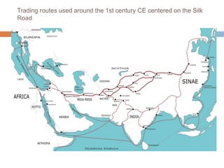
  • 3. Map with the main voyages of the age of discoveries, 1482-1524
  • 4. Age of Discovery: Overview  The Portuguese began systematically exploring the Atlantic coast of Africa from 1418, under the sponsorship of Prince Henry I  In 1488 Bartolomeu Dias reached the Indian Ocean by this route.  In 1492, racing to find a trade route to Asia, the Spanish monarchs funded Christopher Columbus’s plan to sail west to reach the Indies by crossing the Atlantic. He landed on an uncharted continent, then seen by Europeans as a new world, America.  To prevent conflict between Portugal and Spain, a treaty was signed dividing the world into two regions of exploration, where each had exclusive rights to claim newly discovered lands.  In 1498, a Portuguese expedition commanded by Vasco da Gama finally achieved the dream of reaching India by sailing around Africa, opening up direct trade with Asia.  Soon, the Portuguese sailed further eastward, to the valuable spice islands in  East and west exploration overlapped in 1522, when Portuguese navigator Ferdinand Magellan led a Spanish expedition West, achieving the first circumnavigation of the world, while Spanish conquistadors explored inland Americas, and later, some of the South Pacific islands.  Since 1495, the French and English and, much later, the Dutch entered the race of exploration after learning of these exploits, defying the Iberian monopoly on maritime trade by searching for new routes, first to the north, and into the Pacific Ocean around South America, but eventually by following the Portuguese around Africa into the Indian Ocean, discovering  Australia in 1606,  New Zealand in 1642, and  Hawaii in 1778.  Meanwhile, from the 1580s to the 1640s Russians explored and conquered almost the whole of Siberia.
  • 5. CHRISTOPHER COLUMBUS AND THE SPANISH EMPIRE Prior to 1492 and Christopher Columbus' voyage to the Americas, Spain's only possession of any consequence outside Europe were the Canary Islands. By the mid-sixteenth century, however, Spain would control much of the Caribbean, large portions of the Americas and parts of Africa. This rapid acquisition of overseas possessions was accompanied and aided by the establishment and consolidation of hegemony in Europe through a series of political marriages. Instead of waging battles to spread its power and influence, the prolific Habsburgs preferred to use the bonds of marriage to link their household to others. This ensured that the number of threats to Habsburg possessions in Europe would remain at a minimum and would free Spanish resources to conquer overseas territory. Spain politically, socially, and economically dominated her large empire and, unlike the Portuguese, who were limited to coastal regions and tenuously held outposts, the Spaniards were able to penetrate inland and establish much more permanent settlements.
  • 6. Portuguese trade routes (blue) since Vasco da Gama's 1498 journey and the Spanish Manila-Acapulco galleons trade routes (white) established in 1568
  • 7. Vasco da Gama's passage to India A 16th- century Portugues ship used in the Indian Ocean trade routes
  • 8.
  • 9.
  • 10. INS Vikrant circa 1984 carrying a unique complement of Sea Harriers, Sea Hawks, Allouette & Sea King helicopters and Alize ASW.jpg
  • 11. INS Mysore on deployment in the Gulf of Aden to check piracy
  • 12. Indian Navy Tu-142 and IL-38SD stationed at Arakkonam Naval Air Station
  • 13. INS Shivalik the first indigenous stealth ship of the Indian navy
  • 14. INS Sindhurakshak (S63), a Sindhughosh class submarine
  • 15. Cnceptual Drawing of INSArihant, India's first ballistic missile nuclear submarine
  • 16. INSArihant, India's first ballistic missile nuclear submarine  Career (India) Name: INS Arihant  Builder: Shipbuilding Centre (SBC), Visakhapatnam, India  Launched: 26 July 2009  Status: Sea trials  General characteristics  Class and type: Arihant-class submarine  Type: SSBN or SSGN  Length: 111 m (364 ft)  Beam: 15 m (49 ft) Draft: 11 m (36 ft)  Propulsion: PWR using 40% enriched uranium fuel (80 MWe ); one turbine (47,000 hp/70 MW); one shaft; one 7-bladed, high-skew propeller  (estimated) Range: unlimited except by food supplies  Test depth: 300 m (980 ft) (estimated)  Complement: 95–100 officers and men  Sensors and processing systems: BEL USHUS  Armament:  6 x 533mm torpedoes 12 x K-15 Sagarika SLBM Shaurya missile (expected)
  • 20. Indian Navy has shown interest in the Air Force's Advanced Medium Combat Aircraft
  • 21.  AAI manages 126 airports, which include 11 international airports, 89 domestic airports and 26 civil enclaves at Defense airfields.  All major air-routes over Indian landmass are Radar covered (24 Radar installations at 11 locations) along with VOR (Omnidirectional Radio Range) /DVOR (Doppler VOR) coverage (72 installations) co-located with Distance Measuring Equipment (71 installations)  39 runways provided with ILS installations; Night Landing Facilities at 36 airports; and Automatic Message Switching System at 15 airports.  Automatic Dependence Surveillance system, using indigenous technology, at Kolkata and Chennai Air Traffic Control Centers, enabling effective Air Traffic Control over oceanic areas using satellite communication.  Use of remote controlled VHF coverage, along with satellite communication links, has given added strength to our Air Traffic Management System.  Linking of 80 locations by V-Sat installations vastly enhances Air Traffic Management and safety of aircraft operations besides enabling administrative and operational control over our extensive airport network.
  • 22. Functions of AAI  Control and management of the Indian airspace extending beyond the territorial limits of the country, as accepted by ICAO  Design, Development, Operation and Maintenance of International and Domestic Airports and Civil Enclaves.  Construction, Modification and Management of Passenger Terminals  Development and Management of Cargo Terminals at International and Domestic airports.  Provision of Passenger Facilities and Information System at the Passenger Terminals at airports.  Expansion and strengthening of operation area viz. Runways, Aprons, Taxiway, etc.  Provision of visual aids.  Provision of Communication and Navigational aids viz. ILS, DVOR, DME, Radar, etc.
  • 23. Air Navigation Services In tune with global approach to modernization of Air Navigation infrastructure for seamless navigation across state and regional boundaries, AAI has plans for transition to satellite based Communication, Navigation, Surveillance and Air Traffic Management. A number of co-operation agreements and Memoranda of Co-operation have been signed with US Federal Aviation Administration, US Trade and Development Agency, European Union, Air Services Australia and the French Government, co-operative projects and studies initiated to gain from their experience. Through these activities more and more executives of AAI are being exposed to the latest technology, modern practices and procedures to improve the overall performance of Airports and Air Navigation Services. New and improved procedure have been adopted with induction of new equipments. Some of the major initiatives in this direction are introduction of: Reduced Vertical Separation Minima (RVSM) in Indian airspace to increase airspace capacity and reduce congestion in the air and implementation of GPS and Geo Augmented Navigation GAGAN jointly with ISRO which, when in operation, would be one of the four such systems in the world.
  • 24. Precision Approaches and their Accuracies Courtesy: Per Enge, Aircraft Landing Systems Based on GPS & GALILEO
  • 25. Precision Landing Approaches with Local Area Augmentation System (1 of 2)  GAGAN is a space-based augmentation system, in contrast with a wide area augmentation system (WAAS) or local area augmentation system (LAAS)  For precise landing approaches, the Local Area Augmentation System (LAAS) is employed which works in a sequence depicted in the figures below: Courtesy: www.faa.gov
  • 26. Precision Landing Approaches with Local Area Augmentation System (2 of 2)
  • 28. GPS Augmentation for Civil Aviation
  • 29. GAGAN: GPS Aided Geostationary Satellite Augmented Navigation System
  • 31. Use OF GAGAN and IRNSS for Position, Velocity, and Time Determination  The GPS receivers on the ground stations receive the signals from four or more GPS satellites.  The receivers comprehend the navigation data contained in the signals and send a message to the Master Control Centre (MCC) where the errors in the GPS signals are calculated.  A message containing the corrections in the received GPS signals is generated at the MCC and is sent to the Land Uplink Stations, which transmit these messages to the geostationary satellites.  The geostationary satellites broadcast these corrections in order that the navigating vehicle, equipped with a GPS receiver, receives these correction messages and corrects the GPS signals accordingly. In this manner, the navigating vehicle can determine its position, velocity and time with an increased accuracy.  The above technique uses the GPS signals. In future, after the implementation of the IRNSS, the GPS satellite signals would be replaced by the IRNSS signals.
  • 32.  An independent regional navigation system covering India and an area of about 500 Km around India  The system will consist of seven satellites, 3 geostationary and 4 geosynchronous  The target position accuracy is of less than 10 m over the Indian subcontinent and within 20 m over the Indian Ocean
  • 33. IRNSS Satellites: Three Geostationary and Four Geosynchronous – A Nice Geometry for Navigation
  • 34.
  • 35.  Global Navigation System  Controlled by the US Government  Medium Earth Orbit Satellites  Regional Navigation System  It will be under full control of the Government of India  Geosynchronous Orbit Satellites IRNSS GPS
  • 36. Inertial Measurements to Aid GPS Tracking P = position, V = velocity, A = attitude, T = time, rho = range, rho_dot = range rate, del_theta = incremental attitude, del_v = incremental_velocity Courtesy: Per Enge, Aircraft Landing Systems Based on GPS & GALILEO
  • 37. Defence Research & Development Organization (DRDO) Ministry of Defence, Gov’t of India DRDO is a network of more than 50 laboratories deeply engaged in developing defense technologies covering various disciplines such as aeronautics, armaments, electronics, combat vehicles, engineering systems, instrumentation, missiles, advanced computing and simulation, special materials, naval systems, life sciences, training, information systems and agriculture. The Organization employs over 5000 scientists and about 25,000 other scientific, technical and supporting personnel. Several major projects for the development of missiles, armaments, light combat aircrafts, radars, electronic warfare systems etc are on hand and significant achievements have been made in several such technologies.
  • 38. VISION Make India prosperous by establishing world class science and technology base and provide our Defence Services decisive edge by equipping them with internationally competitive systems and solutions. MISSION Design, develop and lead to production state-of-the-art sensors, weapon systems, platforms and allied equipment for our Defence Services. Provide technological solutions to the Services to optimise combat effectiveness and to promote well-being of the troops. Develop infrastructure and committed quality manpower and build strong indigenous technology base.
  • 39.  AERONAUTICS  Aeronautical Development Establishment (ADE), Bangalore  Aerial Delivery Research & Development Establishment (ADRDE), Agra  Centre for Air Borne Systems (CABS), Bangalore  Defence Avionics Research Establishment (DARE), Bangalore  Gas Turbine Research Establishment (GTRE), Bangalore  Center for Military Airworthiness & Certification (CEMILAC), Bangalore  MISSILES  Defence Research & Development Laboratory (DRDL), Hyderabad  Institute of Systems Studies & Analyses (ISSA), Delhi  Integrated Test Range (ITR), Balasore  Research Center Imarat (RCI), Hyderabad  NAVAL  Naval Science & Technological Laboratory (NSTL), Vishakapatnam Technology Clusters
  • 40. Defence Research and Development Laboratory (DRDL) Defence Research Complex, Kanchanbagh, Hyderabad  Formerly directed by A.P.J. Abdul Kalam,  The main research center for the Integrated Missile Development Program  DRDL is responsible for the Integrated Guided Missile Program, which includes five components:  Prithvi, a surface-to-surface battlefield missile;  Nag, an anti-tank missile (ATM);  Akash, a swift, medium-range surface-to-air missile (SAM);  Trishul, a quick-reaction SAM with a shorter range; and  Agni, an intermediate range ballistic missile.
  • 41. Prithvi Agni III Test Flight
  • 42. DRDO's Prithvi-II, Agni-I, Agni-II, Agni-IIAT, Agni-3 (TD,+,++,SL) [Image © Arun Vishwakarma]
  • 43. DRDO's Prithvi-II, Agni-I, Agni-II, Agni-IIAT, Agni-3 (TD,+,++,SL) [Image © Arun Vishwakarma] Agni-I Agni-II Agni- IIAT Agni-3 TD Agni-3 A Agni-3 B Agni-3 C Agni-3SL Length (m) 15 20 20 16.7[0.A] 17[0.A] 17[0.A] 14.6 12 Diameter (m) 1 1 1.2 2 2 2 2 2 Launch Weight (kg) (Including Payload) 12,000 16,000 27,000 48,300 [0.A] 51,500 (Estimated) 53,100 (Estimated) 44,400 (Estimated) 37,600 (Estimated) Propellant Solid (HTPB/AP/AI) High energy, high density Solid Propellant (HTPB/AP/AI) Number of Stages 1 2.5 2.5 2 3 4 3 3 Payload - kg 800 - 1,000 800 - 1,000 300 - 1,000 600 - 1,500[1] 2,490 (conventional) 1,500 600 - 3490 600 - 3490 (8 - 12 RV ) 600 - 3490 (8 - 12 RV ) Warhead Strategic nuclear (15 KT to 250 KT), conventional[2] HE-unitary, penetration, sub-munitions, incendiary or fuel air explosives. Guidance Strap Down - INS (Inertial Navigation System), optionally augmented by GPS terminal guidance with possible radar scene correlation. INS (full Inertial platform)[3], optionally augmented by GPS/GLONASS/IRNSS, possibly with radar scene correlation. Range (Payload) 850 km (1,000kg ) 3,300 km (1,000kg) , 4,450 km (700kg) 4,000 km (1,500kg ) 5,500 km (1,500kg) [4] 8,100 Km (1,500kg) >18,000 km[4.A] 11,500 km 10,300 (1050kg) 5,200Km (1,400Kg), 11,600Km (700kg) CEP Accuracy 120 meters 40 meters 20 meters (estimated) 16 meters[4.B] Launch Platform 8 x 8 Tatra TELAR (Transporter Erector Launcher) Rail Mobile Launcher 8 x 8 Tatra TELAR Rail Mobile Launcher Submarine Launcher
  • 44.
  • 45. Shourya lifts off from the Integrated Test Range at Balasore, Orrissa, on November 12, 2008 The successful first test of the surface-to- surface Shourya missile from the Integrated Test Range at Chandipur-on-sea near Balasore in Orissa on November 12 Shourya is a hypersonic missile; it can reach a velocity of Mach 6 even at low altitudes. On November 12, it reached a velocity of Mach 5, heating up its surface to 700+ degree Celsius. The missile performed an ingenious maneuver of rolling to spread the heat uniformly on its surface. Its high maneuverability makes it less vulnerable to present-day anti-missile defense systems. Shourya can reach targets 700 km away, carrying both conventional and nuclear warheads. It is 10 metres long and 74 cm in diameter and weighs 6.2 tonnes. It is a two-stage missile and both its stages are powered by solid propellants. Its flight time is 500 seconds to 700 seconds.
  • 46. Shourya’s Navigation system uses ring-laser gyros and accelerometers  In the estimate of V.K. Saraswat, Chief Controller, Missiles and Strategic Systems, DRDO, Shourya is among the top 10 missiles in the world in its class, with its high-performance navigation and guidance systems, efficient propulsion systems, state-of-the-art control technologies and canisterised launch signature – it cannot be easily detected by satellites – and makes its deployment easy.  Shourya was ejected from the canister by a gas generator, developed by the High Energy Materials Research Laboratory (HEMRL), Pune, and the ASL. The gas generator, located at the bottom of the canister, fires for about a second and a half. It produces high pressure gas, which expands and ejects the missile from the tube. The missile has six motors; the first one is the motor in the gas generator.  The centerpiece of a host of new technologies incorporated in Shourya is its ring-laser gyroscope and accelerometer. The ring-laser gyroscope, a sophisticated navigation and guidance system made by the RCI, is highly classified technology. Advanced countries have denied this technology to India. In Shourya’s flight, it functioned exceptionally well.  M. Natarajan, Scientific Adviser to the Defense Minister and Director-General of the DRDO, praised the way the ring-laser gyroscope functioned in Shourya’s flight. “We flew our own navigation system in this missile. It worked very well. This is an important step forward for the country in the navigation of missiles, aircraft and spacecraft. No other country will provide India this navigation system,” he said.
  • 47. After the flawless launch of the surface-to-surface missile Shourya, the DRDO is set to fire an interceptor missile.  Missile technologists of the DRDO are engaged in preparing for the launch of an interceptor missile.  The launch, scheduled to take place in the second half of December, will feature two missiles.  While the target missile, with a range of 1,500 km, will be fired from a ship in the Bay of Bengal towards Wheeler Island, located off the Orissa coast, the interceptor missile, which will be fired from the island, will engage an incoming “enemy missile” in the terminal phase of its flight at an altitude of 80 km in the exo-atmosphere and decimate it.  The enemy missile will be a modified version of Dhanush.  Intense high-technology work at the Defence Research and Development Laboratory (DRDL), the Advanced Systems Laboratory (ASL), and the Research Centre, Imarat (RCI), all located on the serene DRDO campus.  Agni-V will have a range of 5,000 km. It will be launched in 2010.  The ASL is also preparing for a flight trial of Agni-IIIA in 2009. The missile will be an advanced version of Agni-II, which has a range of more than 2,500 km.
  • 48. On November 27 India carried out a successful ballistic missile interception test.  The target vehicle was a modified Prithvi SRBM fired in a trajectory meant to simulate the terminal phase maneuver of a longer range missile.  The interceptor was fired a minute after the target, and intercepted it an altitude of 50km. The interceptor is 10-12 metres long, and has two stages. It uses an active seeker guidance system in its terminal phase.
  • 49. India to Test Layered Missile Defense Ref. Frontier India Strategic and Defence (Dec. 12, 2008)  India will test layered missile defence in December 2008. This test will involve 2 Ballastic Missile interceptors intercepting a single modified Prithvi Missile. The first interception will take place at an altitude of 80 km. The second interception will take place at the altitude of 30 kms.  The 80 Km or exo-atmospheric interceptor is expected to hit the incoming missile and  the 30 Km or the endo-atmospheric interceptor will try to destroy the largest surviving debris.  India has so far tested exo-atmospheric and endo-atmospheric interceptors in stand alone modes.  On 6th December 2007 DRDO carried out the 2nd launch of a Single Stage Interceptor Missile against an incoming ballistic missile target of enemy represented by a modified Prithivi Missile. The Endo- Atmospheric Interceptor (AAD) intercepted a modified Prithvi Missile at 15 km altitude. On 27 Nov 2006, exo atmospheric test, Prithvi Air Defence Exercise (PADE), intercepted a modified Prithvi-II Missile at an altitude of 50 km.
  • 50. Agni-II Intermediate Range Ballistic Missile displayed at the Republic Day Parade on New Delhi's Rajpath, January 26, 2004
  • 51.
  • 52. Agni-3 D2: ASL's A.Chander, Defense MoS Pallam Raju, with users [Source: India Strategic]
  • 53. . V.K. Saraswat (left), Chief Controller, Research and Development, Missile and Strategic Systems, with the Shourya team led by its programme director A.K. Chakrabarti (right) and P. Venugopalan, DRDL Director. In the backdrop is the missile in a canister
  • 54.  Hindustan Aeronautics Limited (HAL) came into existence on 1st October 1964. The Company was formed by the merger of Hindustan Aircraft Limited with Aeronautics India Limited and Aircraft Manufacturing Depot, Kanpur.  The Company traces its roots to the pioneering efforts of an industrialist with extraordinary vision, the late Seth Walchand Hirachand, who set up Hindustan  Aircraft Limited at Bangalore in association with the erstwhile princely State of Mysore in December 1940. The Government of India became a shareholder in March 1941 and took over the Management in 1942.  Today, HAL has 19 Production Units and 9 Research and Design Centres in 7 locations in India. The Company has an impressive product track record –  12 types of aircraft manufactured with in-house R & D and 14 types produced under license.  over 3550 aircraft  3600 engines, and  overhauled over 8150 aircraft and 27300 engines.  HAL has been successful in numerous R & D programs developed for both Defence and Civil Aviation sectors.
  • 55.
  • 57. Chief of Air Staff Air Chief Marshal F.H. Major flew the Advanced Light Helicopter (ALH) – Dhruv -- powered by the Shakthi engine in Bangalore Air Chief Marshal F.H. Major, PVSM, AVSM, SC, VM, ADC, Chief of Air Staff with Shri Ashok K Baweja, Chairman HAL with the weaponised Dhruv helicopter (ALH) at Helicopter Division of HAL
  • 58.  HAL has made substantial progress in its current projects :  Dhruv, which is Advanced Light Helicopter (ALH)  Tejas - Light Combat Aircraft (LCA)  Intermediate Jet Trainer (IJT)  Various military and civil upgrades.  HAL has played a significant role in India's space programs by participating in the manufacture of structures for Satellite Launch Vehicles like  PSLV (Polar Satellite Launch Vehicle)  GSLV (Geo-synchronous Satellite Launch Vehicle)  IRS (Indian Remote Satellite)  INSAT (Indian National Satellite)
  • 59. LIGHT COMBAT AIRCRAFT (LCA) TEST-FLOWN SUCCESSFULLY on 4 January, 2001  LCA is an advanced technology,  single seat, single engine,  supersonic, light-weight,  all-weather, multi-role,  air superiority fighter designed for  air-to-air, air-to-ground and  air-to-sea combat roles.  The purpose of flight test program was to validate a number of advanced technologies incorporated in LCA. These include:  Unstable configuration,  quadruplex fly-by-wire digital flight control system,  integrated avionics with glass cockpit,  advanced composite materials for primary structure and  a novel utility systems management system.
  • 60. Satellite Launch Vehicle – 3 (SLV - 3)  Project Director: Abdul Kalam  Weight (t) : 17  Payload (kg) : 40  Height(m) : 22  Orbit : Low - earth orbit
  • 61. Augmented Satellite launch Vehicle (ASLV)  ASLV is a five-stage vehicle employing solid propellant capable of placing 150 Kg class satellites in near-circular orbit. Successfully launched in May 1992 and May 1994, placing SROSS Scientific Satellites in orbit.  Weight (t): 39  Payload (kg): 150  Height (m): 23.5  Orbit :Low - earth orbit
  • 62. Polar Satellite Launch Vehicle (PSLV)  Developmental flights completed with successful third developmental launch in March 1996.  IRS-1D launched by PSLV-C1 on September 29, 1997.  Suitable for launching 1,000-1,200 kg class of remote sensing satellites into polar sun-synchronous orbit.  IRS-P4 (OCEANSAT) and two piggy back small satellites –  Korean KITSAT-3 (Korean Institute of Technology) and  German TUBSAT (Technical University of Berlin) launched by PSLV-C2 on May 26,1999.  Technology Experiment Satellite (TES) of ISRO, and  BIRD (a small satellite mission) of DLR Germany,  PROBA (Project for Onboard Autonomy) of Belgium –  into their intended orbits launched by PSLV-C3 on October 22, 2001.  The 1060 kg KALPANA-1 satellite - into a Geosynchronous Transfer Orbit (GTO) launched by PSLV-C4 on September 12, 2002.  RESOURCESAT-1 (IRS-P6) satellite launched by PSLV-C5 on October 17, 2003.  CARTOSAT-1 and HAMSAT satellites launched by PSLV-C6 on Weight (t) : 294 Payload (kg) : 1000-1200 Height (m) : 44.43 Orbit : Polar orbit
  • 63.
  • 64.
  • 65. INSAT 3A Mission: Launch, Deployment and Establishing the Geostationary Orbit
  • 66. Satish Dhawan Space Center (SDSC), SHAR, the Launch Station for GSLV
  • 69. Navigation Systems for Civil Aviation  Global positioning  Inertial reference systems,  ring laser and fiber optic gyro systems, and  Autonomous Integrity Monitored Extrapolation (AIME®) technology for commercial aviation. • LTN-92 Ring Laser Gyro Inertial Navigation System The LTN-92 uses three ring laser gyros, force rebalanced accelerometers, and three high-speed digital microprocessors to provide an advanced technology, all-attitude, worldwide navigation system
  • 70. LN-100G Inertial Navigation System with Embedded GPS By combining the Zero-lock™ Laser Gyro, (ZLG™), with the latest technology, electronics, and GPS, the LN-100G represents the highest quality INS/GPS in the world.  Embedded GPS inertial system  0.8 nmi/hr free inertial  Inertial, GPS, and hybrid navigation solutions  SPS, PPS, all-in-view, and GRAM/SAASM (?) GPS receivers available  Low power, lightweight  High MTBF (?)  Two dual 1553B data bus terminals  High integrity, endurance tested design  Validated Ada-based software  Nondithered RLG (No acoustic noise; no SAR jitter)  Ease of missionization, >70 applications to date
  • 72. ISRO Inertial Systems Unit (IISU)  Carries out development of inertial sensors and systems for satellites and launch vehicles covering navigation systems, satellite inertial systems, bearing and space tribology, and inertial systems integration and simulation.  Facilities include precision fabrication, assembly, integration and testing.  Achievements include development of inertial systems for ISRO launch vehicles and satellites, solar array drive assemblies, scanning mechanisms, etc.  Currently engaged in development of Inertial Navigation System for PSLV, GSLV, INSAT and IRS satellites.
  • 73. Additional Sources  Visit websites of Northrop Grumman, Honeywell, Systron Donner,…. for much more details.  GPSoft toolboxes  GIPSY from Jet Propulsion Lab, Cal Tech, Pasadena
  • 74. Three-Axis Motion Simulator for Gyro Testing and Calibration Courtesy: Zetatek; http://www.zetatekindia.com/products_motinsimulators.htm
  • 75. INS and Nav-Aids for Civil Aviation  Introduction to Civil Aviation  Specific references  Dead reckoning (that is, Inertial Navigation: rate of change of lat, long; relative bearing, distance on great circle)  Nav Aids:  VHF Omni-directional range (VOR),  DME (distance measuring equipment),  Tactical Air Navigation (TACAN),  Instrument Landing System (ILS),  LORAN-C (Long Range Navigation),  OMEGA,  RADAR (Radio detection and ranging)
  • 76. INS for Civil Aviation  Fundamental Principals of Inertial Navigation  1-d, 2-d strapdown navigation, 2-d rotating,  3-d strapdown navigation system: General Analysis  Navigation with respect to an inertial frame  Navigation with respect to a rotating frame, ECEF  Navigation in Local Geographic Navigation Frame, NED: Vector equations and scalar equations  Terrestrial Navigation  Shape of the Earth: Ref. Ellipsoid, Geoid, WGS, geocentric and geodetic latitudes; variation of g  Revised transport rate (rate of change of lat, lon) in geodetic frame  ECEF coordinates from lat-lon-height  Geodetic lat-lon-height from the ECEF coordinates using Newton-Raphson technique (Prob. 4.2-4.3, Rogers)
  • 77. Course AE 457 - Space Flight Navigation & Guidance  Navigation:  Fundamentals of Navigation  Stellar navigation  inertial navigation  radio and radar based navigation systems,  satellite based navigation systems, global positioning systems (GPS)  Performance comparison of various types of navigation systems.  Guidance:  Fundamentals of Guidance, intercept geometry and collision triangle,  proportional navigation and guidance,  concept of miss distance and line of sight.  Augmented proportional navigation and guidance,  command to LOS guidance and  beam rider guidance  Strategic consideration, pulsed guidance and Lambert guidance.  Concept of Kalman filters, fading memory filters and noise
  • 78. AE 641 - Introduction to Navigation and Guidance  Navigation:  Fundamentals of Navigation,  Stellar Navigation,  Inertial Navigation,  Radio and Radar based Navigation Systems,  Global Positioning System,  Other Specialized Navigation Systems,  A Comparison of the various Navigational Aids,  Some Case Studies.  Guidance:  Fundamentals of guidance,  Concepts of Intercept Geometry,  Line of Sight and Collision Triangle,  Proportional Navigation & Guidance (PNG) and  Determination of Miss Distance,  Augmented PNG and its comparison with PNG,  Command to LOS & Beam Rider Guidance,  Pulsed and Lambert`s Guidance,  Tactical Vs. Strategic Considerations in Guidance,  Impact of Noise on Guidance, Target maneuver and Evasion
  • 79. References  P. Zarchan, Tactical and Strategic Missile Guidance, AIAA Education Series, 5th Edition, 2010  Anderson, E.W., The Principles of Navigation, Hollis & Carter, London,  Kayton, M., and Fried Navigation : Avionics  Parkinson, B.E. & Spilker, J.J., Global Positioning System : Theory and Applications; Vol.1-2, Progress In Aeronautics and Astronautics Series, Vol.163, AIAA Publication,1996  Farrell, James L., Integrated Aircraft Navigation, Academic Press, 1976  Farrell, Jay A., Aided Navigation: GPS with High Rate Sensors, McGraw Hill, 2008  Titterton, D.H., and Weston, J.L., Strapdown Inertial Navigation Technology, 2nd Ed., 2004  Zipfel, P.H., Modeling and Simulation of Aerospace Vehicle Dynamics, AIAA Education Series, 2000  Grewal, M.S., Weill, L.R., and Andrews, A.P., Global Positioning Systems, Inertial Navigation, and Integration, 2nd Ed., 2007  Grewal, M.S., Kalman Filtering,  Montenbruck, O., and Gill, E., Satellite Orbits: Models, Methods, Applications, Springer 2000  Noton, M., Spacecraft Navigation and Guidance, Springer 1998  Rogers, R.M., Applied Mathematics in Integrated Navigation Systems, 3rd Ed., AIAA
  • 80. Weight distribution last semester:  Assignment 20%  Midsem: 32%  Quiz 1: 3%  Quiz 2: 3%  Endsem: 42%  Rules and Guidelines of the Institute:  Relative weight for in-semester evaluations is typically between 50 and 60 per cent. This will consist of  one mid-semester test of two hours duration of about 25-30 per cent weight,  Two quizzes or one quiz and one test  assignments and viva-voce  may also include up to a maximum of 10 per cent of the in-semester marks for active participation in the class and the initiatives shown by the student.  The semester–end examination’s relative weight would be 40 to 50 per cent. It is normally of 3 hours duration and will cover the full syllabus of the course.
  • 81. 0 10 20 30 40 50 60 0 5 10 15 20 25 30 35 40 45 50 55 60 65 70 AE 308: Control Theory and AE 775: System Modeling Dynamics and Control: Final Grades AA AB BB BC CC CD DD av Final Grades Last Semester