[Case study] City of Peoria Municipality: Getting the most impact for GIS technology investments
•
1 like•651 views

Project Type: Operational utility solutions Applications: Provide a graphical, data-rich environment that displays the information utilities need for maximum reliability and efficiency. Customer benefits: • Less time and resources to maintain • Increased accuracy of information • Highly configurable and easily adapted for multiple uses

Recommended
Recommended
More Related Content
What's hot
What's hot (20)
Viewers also liked
Viewers also liked (6)
Similar to [Case study] City of Peoria Municipality: Getting the most impact for GIS technology investments
Similar to [Case study] City of Peoria Municipality: Getting the most impact for GIS technology investments (20)
More from Schneider Electric
More from Schneider Electric (20)
Recently uploaded
Recently uploaded (20)
[Case study] City of Peoria Municipality: Getting the most impact for GIS technology investments
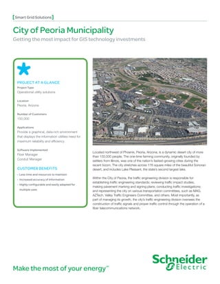
- 1. Smart Grid Solutions City of Peoria Municipality Getting the most impact for GIS technology investments PROJECT AT A GLANCE Project Type Operational utility solutions Location Peoria, Arizona Number of Customers 150,000 Applications Provide a graphical, data-rich environment that displays the information utilities need for maximum reliability and efficiency Software Implemented Located northwest of Phoenix, Peoria, Arizona, is a dynamic desert city of more Fiber Manager than 150,000 people. The one-time farming community, originally founded by Conduit Manager settlers from Illinois, was one of the nation’s fastest-growing cities during the recent boom. The city stretches across 176 square miles of the beautiful Sonoran CUSTOMER BENEFITS desert, and includes Lake Pleasant, the state’s second largest lake. • Less time and resources to maintain • Increased accuracy of information Within the City of Peoria, the traffic engineering division is responsible for: establishing traffic engineering standards; reviewing traffic impact studies; • Highly configurable and easily adapted for making pavement marking and signing plans; conducting traffic investigations; multiple uses and representing the city on various transportation committees, such as MAG, AZTech, Valley Traffic Engineers Committee, and others. Most importantly, as part of managing its growth, the city’s traffic engineering division oversees the construction of traffic signals and proper traffic control through the operation of a fiber telecommunications network. Make the most of your energy SM
- 2. Smart Grid Solutions City of Peoria Municipality “The implementation went smoothly. Working with the Schneider Electric staff was very pleasant. They were always willing to help, and they actually went up and above what they were asked to do to ensure a successful implementation.” Ron Amaya, assistant city traffic engineer A few times during construction, excavation workers Challenges had cut into fiber optic cables, causing disruptions In 2009, the City of Peoria deemed fiber an essential to various communications networks. Consequently, asset, and required accurate documentation of the city had to resplice or reroute data from destroyed its fiber optic network. Tracking of this asset was fiber optic cables to intact cables and networks. requested by the geographic information system (GIS) department, IT department, and the city’s traffic This required checking for alternative routes and the engineering division. At that time, the fiber data was capacity to take on the additional load. “We needed held in various types of CAD drawings, spreadsheets, documentation of everything we were doing out in the word processing documents, and even hand-drawn field in case something was down and we needed to sketches. In addition, any updated information was know what route it had taken to get there,” Amaya based on human memory. To add to its complexity, said. the fiber data was mainly buried underground for weather-related and regulatory reasons. As the city grew, it realized that it needed to do more to improve Solution its operations and system troubleshooting. It also In 2009, to meet these goals, City of Peoria selected wanted a better way to manage information tied to its Schneider Electric’s Fiber Manager. This solution conduits. allowed the city to be able to manage its fiber assets, trace the fiber network and troubleshoot issues more “We had a growing fiber infrastructure and all of our quickly. information was on different types of media, such as drawings and as-builts. We were looking to capture Fiber Manager is an extension of ArcFM Enterprise all of this information and document it in one central GIS, which is based on the Esri ArcGIS® platform. location,” explained Assistant City Traffic Engineer Ron Amaya. ArcFM GIS provides a graphical, data-rich environment that displays the information utilities The city needed an integrated system with need for maximum reliability and efficiency. Developed mapping and database capabilities to identify cable as a complete enterprise solution for an entire information, such as fiber counts, cable types, cable organization, it offers a map-centric, intuitive way to length, length source, conduit size, and usage and model, design, maintain, and manage facility and land splicing details of all fibers. It also required the ability based information. to trace a fiber down through its splice points. Organizations that manage outside plant fiber As part of its expanding telecommunications optic networks need robust tools for mapping needs, the city also wanted a better way to manage related assets, establishing fiber-level connectivity, underground facilities and to track cabling and and building traceable circuits in a network. Fiber conduit capacities. This meant having the ability to Manager is designed to allow editors to quickly and associate underground fiber cables with specific intuitively create, connect, and manage fiber optic ducts in a duct bank, being able to display cross- systems within a GIS. The solution comes with an sections of conduits, and showing the location of the integrated toolset that provides users with editing, fiber cables within it. connectivity, analysis, and reporting capabilities. Fiber Manager can also help accurately locate faults when
- 3. Smart Grid Solutions City of Peoria Municipality they happen by using OTDR traces on the most up-to-date version of the network model. “With Fiber Manager, we now have one big picture instead of numerous By adding Conduit Manager, an extension to the smaller pictures. It has helped us achieve ArcFM GIS Solution, the city was also able to better efficiencies that were not previously manage its underground facilities using sophisticated, possible.” intuitive functions to accurately track where cables Ron Amaya, assistant city traffic engineer are located and placed in conduit. “We have an array of conduits out there. It’s important for us to know where those conduits are, because it could potentially incorporate features such as communication vaults, cause a bottleneck. This tool has helped us know traffic signal and node cabinets, as well as wireless which types of conduits and sizes are out there, and links. This enabled the city to store its fiber network where exactly they are located,” explained Amaya. and conduit information in a single geodatabase for easier viewing and customized reporting. In Conduit Manager is an integrated set of tools addition, Schneider Electric’s Connection Manager and dialogs that add, annotate, and maintain the tool provided the city with a graphical view of underground infrastructure of the telecommunications the connections for splices and ports, improving network system. Schneider Electric Conduit Manager communications and efficiency. provides functionality to define an underground system with duct banks, trenches, conduits, cross- The data model was also configured to include sections, underground cables, and underground devices supporting both optical and electronic access structures. Internals of underground ports — accurately reflecting objects in the real world. structures such as manholes and vaults are also fully All of this was possible due to the flexibility of Fiber supported. Once the underground system is built, Manager. Schneider Electric’s end-to-end solution users can leverage the tracing queries to determine also included data digitization that covered more than duct availability based on various criteria. 54 miles of fiber and over 1,040 devices. The Bottom Line Aside from general fiber tracing capabilities such as With a concerted effort from the traffic engineering OTDR outage tracing and fiber availability tracing, division, IT department, and the GIS department Schneider Electric’s flexible data model was also able within it, together with federal funding administered to support the city’s need to handle loopbacks by by the Arizona DOT, Schneider Electric Fiber Manager tracing through patch locations in order to view the was successfully implemented at the City of Peoria. entire fiber connectivity, end to end. “The implementation went smoothly. Working with “We can see long-term benefits — increased the Schneider Electric staff was very pleasant. They accuracy due to one centralized database and were always willing to help, and they actually went up elimination of hard copies,” said Amaya. “With Fiber and above what they were asked to do to ensure a Manager, we now have one big picture instead of successful implementation,” said Amaya. numerous smaller pictures. It has helped us achieve efficiencies that were not previously possible.” The strength of Fiber Manager’s flexible data model to manage any network out-of-the-box enabled the team to configure the data model and tracing functions to meet specific traffic needs. Apart from the fiber optic cable, conduits, slack loops, and devices, the data model’s flexibility was adapted to
- 4. ©2012 Schneider Electric. All rights reserved. Schneider Electric USA, Inc. 4701 Royal Vista Circle, Fort Collins, CO 80528 Telephone: 1-866-537-1091 Fax: 1-970-223-5577 www.schneider-electric.com/us June 2012