SlideShare a Scribd company logo
1 of 100
Download to read offline
RAINFED AGRICULTURE & WATERSHED
MANAGEMENT
COURSE TITLE:
RAINFED AGRICULTURE AND WATERSHED MANAGEMENT
COURSE NO.: AGRO-235 CREDITS: (1+1) =2
Prepared by:
Prof. Shivaji R. Suryavanshi
Asst. Professor of Agronomy,
Dr. D.Y. Patil College of Agriculture,
Talsande.
1
Prepared by Prof. S. R. Suryavanshi (DYP AC Talsande)
INDEX
THEORY NOTES
COURSE NO. AGRO-235 CREDITS: (1+1) =2
COURSE TITLE: RAINFED AGRICULTURE AND WATERSHED MANAGEMENT
S. N Topic name Page no
1 Introduction 3
2 Classification rainfed area 7
3 Characteristics of dry land agriculture / rainfed area 8
4 History of dryland agriculture and watershed development 9
5 Problems / constrains of rainfed / dryland agriculture 11
6 Agro-climatic zone of India : 15
7 Agro climatic zone of Maharashtra state. 18
8 Types of soils in rainfed area 23
9 Climatic studies of rainfed areas:- 25
10 Techniques of soil and water conservation 29
11 Strip cropping 36
12 Antitranspirants 37
13 Tillage 38
14 Mulching 41
15 Drought and its classification 45
16 Mitigation and crop adaptation to drought or dry growing conditions: 50
17 Effects of drought or moisture stress on the plants: 54
18 Cropping system and cropping pattern 57
19 Water Harvesting 63
20 Management of rainfed crops 67
21 Contingency cropping under different Aberrant weather conditions 77
22 Watershed Management 78
23 Crops planning according to land use capability classification 89
24 Important questions 94
25 Objectives 95
26 Photographs 106
2
Prepared by Prof. S. R. Suryavanshi (DYP AC Talsande)
Teaching Schedule
Lecture Topic Weightage
(%)
1 Rainfed agriculture: Introduction, types, History of rainfed agriculture
and watershed in India
8
2-3 Problems and prospects of rainfed agriculture in India 8
4 Soil and climatic conditions prevalent in rainfed areas 10
5 Soil and water conservation techniques 10
6-7 Drought: types, effect of water deficit on physio- morphological
characteristics of the plants
10
8-9 Crop adaptation and mitigation to drought 8
10-11 Water harvesting: importance, its techniques, Efficient utilization of
water through soil and crop management practices
10
12 Management of crops in rainfed areas 8
13-14 Contingent crop planning for aberrant weather conditions 10
15 Concept, objective, principles and components of watershed
management
10
16 Factors affecting watershed management 8
Total 100
Suggested Readings:
1) Sustainable Development of Dryland Agriculture in India – R. P Singh
2) Dry Farming Technology in India – P. Rangaswamy
3) Dryland resources and Technology – Vol. 8 L.L Somani, K.W. Kaushal
4) Physiological Aspect of Dryland Farming – U.S Gupta
5) Principles of Agronomy S.R. Reddy
6) Dryland Technology – M.L. Jat, S.R. Bhakar, S.K. Shrma , A. K. Kothri
7) Climate, Weather and Crops in India – D. Lenka
3
Prepared by Prof. S. R. Suryavanshi (DYP AC Talsande)
THEORY NOTES
Course No. AGRO-235
Course Title: - Rainfed Agriculture and Watershed Management
INTRODUCTION
Indian agriculture is ‘a gamble in the monsoon’ even today. So, water has been
prioritized to be the most crucial resource for sustainable development of agriculture. The life of
mankind and almost all the flora and fauna on the earth depends on the availability of fresh water
resources. It is an extremely important component of biological systems. The most of the plant
cells and tissues contain 80-90 per cent water by weight. Plant water status influences all the
physiological processes of plants directly or indirectly. Highly variable global distribution of
annual average rainfall of about 1000 mm on the earth surface is responsible for the disparities in
agriculture production and socio-economic conditions. Fifty five per cent or more than one-half
of the total land surfaces of the earth, receives an annual precipitation of less than 500 mm and
must be reclaimed, if at all by dry farming practices. Area with 500-750 mm rainfall, which
accounts for 10 per cent of the total land area, also need dry farming measures for successful
crop production
In India also, distribution of the annual average rainfall of about 1200 mm, is
highly variable, irregular and undependable with wide spread variations among various
meteorological sub-divisions in terms of distribution and amount. The spatial distribution of
rainfall varies from 100mm/annum in Rajasthan to about 11000 mm/annum in Cherrapunji in
Meghalaya. Agriculture uses almost 85 per cent of the total water available in the country. Of the
total geographical and net cultivated area about 92 and 33 million hectares receive less than 750
mm rainfall annually respectively
Table . Distribution of dryland area in different rainfall zones in India.
Mean annual Climate zone Dry land area
rainfall (mm) (million ha)
<500 Arid 10.9
500-750 Dry semi-arid 22.2
750-1000 Wet semi-arid 21.2
1000-1250 Sub-humid 19.6
>1250 Humid 27.7
4
Prepared by Prof. S. R. Suryavanshi (DYP AC Talsande)
Agriculture continues to be mainstay of the Indian economy. It contributes 25 per
cent of the national gross product. In this contribution, rainfed lands in India are important today
and will continue to be so in future. Currently, about 70 per cent of agriculture in India is rainfed.
This area contributes nearly 44 per cent to food production and supports 40 per cent of the
human and 60 per cent of the livestock population. Even if the entire irrigation potential of the
country is used, still about half of the cultivated land will remain rainfed. About 30 per cent of
the country (109 million ha) is drought prone and suffers with critical water shortages. Rainfed
agro-ecosystem covers about 90 million ha of net cultivated area, which is distributed unequally
among different states. In Assam, Gujarat, Himachal Pradesh, Karnataka, Kerala, Madhya
Pradesh, Maharashtra and Rajasthan more than 70 per cent of the net cultivated area is rainfed.
Besides uncertainties in rainwater availability, the swings in the onset, continuity and withdrawal
pattern of monsoon make crop production in rainfed areas a risky proposition. The coefficient of
variation in the monsoon rainfall in areas located in the rainfall zones of < 500 mm, 500 -700
mm, 700-1000 mm and > 1000 mm is in the range of 50-55, 40-50, 30-40 and 20-30 per cent,
respectively.
Water is the most scarce resource in rainfed agriculture. Inefficient use of this
scarce resource leads to inefficiency of all other inputs. In water resource management, the focus
is not merely on development of new water resources but also on efficient utilization of already
developed ones particularly based on indigenous systems. The precipitation reaching the earth
surface may be intercepted by vegetation, may infiltrate into the ground, may flow over land
surface as run -off or may evaporate. Evaporation may occur over the land surface or free water
or from the leaves of the plant through transpiration. Soil acts as a reservoir for the water that
enters the soil. Water in the soil is always in transitory storage. Rainfed areas can be made
productive and profitable by adopting improved technologies for rainwater conservation and
harvesting and commensurate agricultural production technologies. The fundamental problems
of dry farming are:-
5
Prepared by Prof. S. R. Suryavanshi (DYP AC Talsande)
 Storage in the soil of a small annual rainfall;
 Retention of the moisture in the soil until it is needed by the plants;
 Prevention of direct evaporation of soil moisture during the growing season;
 Regulation of the amount of water drawn from the soil by plants;
 Choice of crops capable of growth under moisture stress conditions and
 Crop management for proper utilization of stored soil moisture.
The relation of crops to the prevailing conditions of arid lands offers another group of important
dry farm problems. Some plants are drought resistant and some are drought tolerant. Some attain
maturity in short duration and are suitable for dry farming. Some crops and varieties have deep
root system or waxy layer, which aid in their survival under moisture stress. After the selection
of crops, skill and knowledge are needed in the proper seeding, tillage, nutrient management,
plant population, weed control and mid-season correction for efficient use of conserved
moisture.
Dry lands: Areas which receive an annual rainfall of 750 mm or less and there is no irrigation
facility for raising crops.
Rainfed Agriculture: - Growing or cultivation of crops entirely on rainfall without irrigation
Rainfed Agriculture / Dry land Agriculture: Scientific management of soil and crops under
rainfed condition without irrigation is called dry land agriculture.
Dry land crops: It refers to all such crops which are drought resistant and can complete their life
cycle without irrigation in areas receives an annual rainfall less than 750 mm.
Drought: It is an condition of insufficient moisture supply to the plants under which they fail to
develop and mature properly. If may be caused by soil, atmosphere or both.
Dry farming : In the country with low and precarious rainfall two types agricultures are usually
met, one crop production on aerable farming land other animal husbandry, including
management of grazing areas.
About 100 m.ha (69.5%) of tatal cropped area falls under Rainfed and Dryland
farming. Dry farming areas as per the 9th
plan one those area receiving rainfall less the 750 mm
year and limited irrigation facility is available. Areas which receiving the mean rainfall less than
375 mm per year are considered as absolute arid and desert areas and require special technology
treatment. About 128 district in the country falls under dry framings as defined above. Out of
these, 25 district from the desert land of Rajasthan Sourashtra and rain shadow regions of
Maharashtra and Karnataka belong to very height intensity dry farming areas.
Total Arable land Area- 143.8 m ha (India)
Non- Irrigated 100 mm ha (69.5%) Irrigated 43.8 mm ha (30.5%)
Dry land Rainfed
34.5 m ha (24%) 65.5 m ha (45.5%)
6
Prepared by Prof. S. R. Suryavanshi (DYP AC Talsande)
Area under dry land is likely to a change according to definition and irrigation facilities developed
from time to time. Areas receiving annual rainfall between lees than 750 mm is known as dry farming
tracts zones.
There are about 105 districts under this category but 18 of these districts have good irrigation
facilities. Therefore dry farming tract comprises 87 districts spread over Andrapradesh, Gujart,
Haryana, Punjab, Karnataka, MP, Maharashtra, Rajastan, Tamilnadu and Uttar Pradesh
Even after the utilisation of all our water resources for irrigation, about half of the cultivated
area will remain rainfed. As there is hardly any scope for increasing the area under cultivation, it is
really a colossal task for meeting the future food needs. It is against this background that the role of
dryland agriculture gained importance.
Very often, the words dry farming, dryland famming and rainfed farming are used synonymously
to indicate similar farming situation. Clearly, all the three exclude irrigation.
 Dryland agriculture means cultivation of crop entirely under rainfed conditions.
 In such areas crop production becomes relatively difficult as it mainly depend upon the intensity and
frequency of rainfall.
7
Prepared by Prof. S. R. Suryavanshi (DYP AC Talsande)
CLASSIFICATION OF FARMING BASED ON ANNUAL AVERAGE RAINFALL AND
LENGTH OF GROWING PERIOD
1. Dry farming:- is cultivation of crops in regions with annual rainfall less than 750 mm,
crop failure is most common due to prolonged dry spells during the crop period. These
are arid region with a growing season (period of adequate soil moisture) less than 75
days. Moisture conservation practices are necessary for crop production.
2. Dryland farming:- is cultivation of crops in regions with annual rainfall more than 750
m. Inspite of prolonged dry spells, crop failure is relatively less frequent. These are semi-
arid tracts with a growing period between 75 and 120 days.
3. Rainfed farming:- is crop production in regions with annual rainfall more than 1,150
mm. Crops are not subjected to soil moisture stress during the crop period. Emphasis is
often on disposal of excess water. These are humid regions with growing period more
than 120 days.
In dry farming and dryland farming, emphasis is on soil and water conservation,
sustainable crop yields and limited fertiliser use according to soil moisture availability. In rainfed
agriculture, emphasis is on disposal of excess water, maximum crop yield, high levels of input
and control of water erosion.
Table: Rain dependent farming (Classification based on annual average rainfall and length of
growing period)
Aspects 1. Dry farming 2. Dryland farming 3. Rainfed farming
Annual rainfall < 750 mm 750-1150 mm > 1150 mm
Crop failure Common Less frequent No
Region Arid Semiarid Humid
Growing period < 75 days 75-120 days > 120 days
Moisture conservation Required Necessary + Drainage Disposal of excess water
Emphasis/constrains Soil and water conservation Disposal of excess water
Crop yields Sustainable Maximum
Input use Limited High levels
Wind and water
erosion constraints
Both Water
Cropping System Single Single/ Intercrop Intercrop/ double crop
United Nations Economic and Social Commission for Asia and the Pacific distinguished
dryland agriculture mainly into two categories: dryland and rainfed farming. The
distinguishing features of these two types of farming are given below.
Table : Dry land Vs Rainfed farming.
Constituents Dryland farming Rainfed farming
1. Rainfall (mm) < 750mm >750 mm
2. Moisture Shortage Enough / Sufficient
8
Prepared by Prof. S. R. Suryavanshi (DYP AC Talsande)
3. Growing season <200 days >200 days
4. Growing regions Arid and Semiarid & up lands
of sub humid & humid regions.
Humid and slub humid regions.
5. Cropping system Single crop or
intercropping
Intercropping or double
cropping.
6. Constraints Wind and water erosion Water errosion.
CHARACTERISTICS OF DRY LAND AGRICULTURE / RAINFED AREA
1. Uncertain and limited annual rainfall:- The crops very often suffer from aberrant weather
like delayed onset of monsoon, long gap in rainfall and early stoppage of rains.
2. Extensive climatic hazards: - This area has to face either flood, water logging or drought,
The crops suffer badly from the frost. This way there are extensive climatic hazards leading to
the partial or total crop failure.
3. Undulation soil surface:- Soils in this region get eroded every year due water and wind,
which leaves behind an eroded gulley or rill and it requires leveling but due to poor economy of
the farmers the soil is left as it is and the crops are grown there in. Thus the surface gradually
becomes highly undulating.
4. Extensive agriculture:- The type of agriculture adopted in dry areas always remains
extensive due to lack of irrigation.
5. Relatively larger plot size:- Since there is no irrigation facility, therefore, smaller plots are
not required and farmers use to keep much bigger plot sizes which make it easy to identify as a
rainfed area.
6. Similar types of crops:- In case of dry land agriculture only drought resistant crops can be
grown and almost all the farmers of the region use to grow similar crops. Thus the entire area can
be seen under the same crop having poor growth and development and it can be identified as a
rain fed area.
7. Lower crops yields:- Yields of various crops grown in dry lands are found to be very low as
the farmers being very poor can neither apply full doses of inputs nor the improved seeds of high
yielding varieties.
8. Poor market for the produce:- Since everyone uses to grow the same crops and they become
ready for sale at the same time, they get less price for their produce because of poor demand and
abundant supply rather a glut in the market.
9. Poor farmers economy and cattle health:- The farmers do not get proper return of their
efforts hence their economy remains poor. Due to scarcity of fodder and feed the cattle are not
healthy.
10. Widespread deficiency diseases in human beings:- Surplus of low calory food and short
supply of vegetables, fruits, milk etc. cause deficiency of vitamins and minerals which result into
malnutrition and deficiency diseases in human being.
Why crop failures are common, yields are not static under Rainfed farming because.....
1. Inadequate and uneven distribution of rainfall.
2. Late on set and early cessation of rainfall.
3. Prolonged dry spells during the crop growth period.
4. Low moisture retention capacity of soils.
5. Low fertility of soils, low humidity, higher temperatures, higher wind velocity.
9
Prepared by Prof. S. R. Suryavanshi (DYP AC Talsande)
HISTORY OF DRYLAND AGRICULTURE AND WATERSHED DEVELOPMENT
History of Rainfed Agriculture:-
Over the years, following efforts have been made to transform rainfed farming into more
sustainable and productive systems.
1880-the First Famine Commission was appointed by the then British Empire to suggest ways
and means to off-set the adverse effects of recurring droughts
1920-Scarcity trak development given important by Royal commission on Agriculture.
1923-Establishment and Dry farming Research station at Manjari (Pune)
1933- Dry Farming Research Station at Bijapur and Solapur
1934- Dry Farming Research Station at Hagari and Raichur
1935-Dry Farming Research Station at Rohatak (Panjab)
1942- Bombay land development act passed
1944- Monograph on dry farming in India by Kanitker
1950- Establishment of all India Coordinated Research Project for Dryland Agriculture
(AICRPDA)
1953-Establishment of Central soil conservation Board
1955- Dry farming demonstration centers started
1959- Central Arid Zone Research Institute (CAZRI) was established in at Jodhpur.
1970-All India Coordinated Research Project for Dryland Agriculture (AICRPDA) was initiated
in at 23 centres, selected on agro-climatic basis.
1972-International Crop Research Institute for Semi-arid Tropics (ICRISAT), Hyderabad1976-
Renewed efforts were made by the Government of India in mid-fifties to conserve the
natural resources and optimising their use by establishing eight Soil Conservation Research
Centres at Dehradun, Chandigarh, Udhagamandalam, Bellary, Kota, Vasad, Agra and
Hyderabad, which were put under the control of Central Soil and Water Conservation
Research and Training Institute (CSWCR&TI), Dehradun
1977-KVK, Hayatager
1983-All India Coordinated Research Project on Agro-meteorology was started to strengthen the
location specific weather forecasting.
1983-Starting of 47 maodel watershed under ICAR
1985-Central Research Institute for Dryland Agriculture (CRIDA), Hyderabad
1986 Launching of NWDPRA programme by Government of India in 15 states.
10
Prepared by Prof. S. R. Suryavanshi (DYP AC Talsande)
History Of Watershed Development In India
1962-63 -Centrally Sponsored Scheme of “Soil Conservation Work in the catchments of River
Valley Projects (RVP)” was launched
1973–74- Started Drought Prone Area Programme (DPAP) with an objective of Promote
economic development and mainstreaming of drought prone areas through soil and
moisture conservation measures.
1977–78- Started Desert Development Programme (DDP) with an objective of Minimize adverse
effects of drought and desertification through reforestation.
1980- 81- The Ministry of Agriculture started a scheme of Integrated Watershed Management in
the Catchments of Flood Prone Rivers (FPR).
1980- Several successful experiences of fully treated watersheds, such as Sukhomajri in Haryana
and Ralegaon Siddhi in Western Maharashtra, came to be reported.
1982-83 The Ministry of Agriculture launched a scheme for propagation of water
harvesting/conservation technology in rainfed areas in 19 identified locations.
1990- Concept of integrated watershed development was first institutionalized with the
launching of the National Watershed Development Programme of Rainfed Areas
(NWDPRA) covering 99 districts in 16 states
1992- Indo-German Watershed Development Programme for Rehabilitate micro-watersheds for
the purpose of regeneration of natural resources and sustainable livelihoods, using a
participatory approach by NABARD and the Watershed Organisation Trust (WOTR)
2009- Integrated Watershed Management Programme (IWMP) Consolidated three programs:
IWDP, DPAP, and DPP. Programs adopted a cluster approach focusing on a cluster of
micro-watersheds (1000 ha to 5000 ha scale) by MoRD.
11
Prepared by Prof. S. R. Suryavanshi (DYP AC Talsande)
PROBLEMS / CONSTRAINS OF RAINFED / DRYLAND AGRICULTURE
The low productivity of agriculture in dry farming regions is due to the cumulative effect
of many constraints for crop production. The problems of crop production in dry land agriculture
are mostly with vagaries of monsoon and soil constraints.
The constraints can be broadly grouped in to
A. Climatic constraints
B. Soil constraints
C. Socio economic constraints
D. Technological constraints
E. Crop production problems
A. Climatic constrains :
I) Rainfall
1. Commencement of rains may be quite early or considerably delayed: Normal
onset of monsoon is towards the end of May over Kerala coast and by 15th
July in the
extreme north west part of Rajasthan. There is variability in the dates of onset of the
monsoon from year to year.
2. There may be prolonged ‘breaks’ (Dry spell): There will be break in the monsoon
associated either with weak monsoon current or with the temporary withdrawal of the
monsoon. For breads of more than 2-3 weeks can affect the crop to varying degrees.
Monsoon breaks for 7-10 days may not be serious concem. Breaks of more than 15
days duration especially at critical stages for soil moisture leads to reduction in yield.
Drought due to break in monsoon may adversely affect the crops in shallow soil than
in deep soils.
3. The rains may terminate considerably earlier or persist longer than usual:
Withdrawal of the monsoon begins in the beginning of September in north western
Rajasthan and disappears over Kerala towards the end of October. The date of
withdrawal of the monsoon varies from year to year.
4. Inadequate and uneven distribution of monsoon in space and time: Monsoon may
be excessive in one part of the country and deficient in another, and/or excessive
during one part of the season and deficient during another.
5. Intensity and distribution: Distribution of rainfall is more important than total
rainfall in Dryland agriculture in genetal more than 50% of total rainfall is usually
received in 3 to 5 rainy days. Such intensive rainfall results in substantial loss of
water due to surface runoff. This process also accelerates soil erosion.
6. Late onset of monsoon: Crops cannot be sown in time if on seal of monsoon is
delayed. Delayed sowing leads to poor yield due to reduction in growing period in
such cases.
7. Early withdraw of monsoon: This is more dangerous than late on seal of monsoon.
Rainy season crops will be subjected to terminal stress leading to poor yield.
Similarly post tiny season crops fail due to inadequate available soil moisture
spectrally during reproductive and maturity phases.
8. Seasonal variation: 80 % rainfall received in June to September (Kharif season)
while 20% rainfall received in remaining eight month.
( Vagaries of monsoon: According to average annual rainfall, the country can be divided
into three distinct zones low (less than 750mm), medium (750-1150 mm) and high (more
than 1150 mm) rainfall zones. Areas which receive less than 1150 mm rainfall
characterized arid and semiarid are problematic in crop production. Rainfall variation
12
Prepared by Prof. S. R. Suryavanshi (DYP AC Talsande)
intensity and distribution late onset early withdraw of monsoon and prolonged dry spell
during crop growing period are main features influencing crop production in dry regions.
Rainfall variation: The annual rainfall varies greatly from year to year to crop failures
due to uncertain rains are more frequent in the regions with lesser rainfall. The tremendous
variation in rainfall is mainly due to geographical position of these tracts with reference to
surrounding seas and the configuration of land surface. Other local factors like river lakes,
forest also contribute to determine annual rainfall. )
II) Wind velocity: - Wind velocity is generally high during July and August. If wind
velocity exceeds 18 - 20 km./hr. Such period coincided with dry spell. Hence
Evapotranspiration is at high degree. If velocity is low the lowest evaporation rates
are observed during November and December. High winds are experienced in
association with cyclones, depressions and dust storms. High winds cause mechanical
damage to crops like lodging and bread king. Light winds blowing from colder parts
bring about a drop in temperature Warm and dry winds causes greater losses through
evaporation and result in water stress.
III) Bright sunshine hours: - Bright sunshine is usually experienced during months of
Jan. and Feb. At Solapur it is about 8 to 9 hours. During April and May the sky is
usually have with more dust particles, lowest bright sunshine is noticed during Aug.
(4 to 5 hours). This indicates the cloudy weather but no rainfall. Sunshine is not
limiting factor in anywhere in India. During monsoon there is not a lack of sunshine
but excessive rain is responsible for occasion set back to plant growth. However,
continuous cloudiness during flowering is injuring to all plants. It also creates
conditions favorable to the multiplication of pests and diseases. High humidity and
warm temperature are conducive to most plant diseases.
IV) Humidity: - Humidity is high during July and Sept. During Feb. to May it is low.
During dry spell, less relative humidity is noticed. Evaporation demands are also
accelerated with high temperature and low humidity.
V) Temperature: - Maximum temperature exceeds 410
C during late April and early
May. Minimum temp. is noticed during December. Lowest weekly minimum
temperature is about 14 to 150
C. Generally climate is semi and with mild winter and
hot summer. Crop like wheat and gram requiring longer cool period hence do poor
while prolonged cold weather however, Jowar suffers considerably. The air
temperature is a decisive factor in plant growth. In India, high temperature are also of
special importance as they may have damaging effect on crop during the period of
water stress in arid and semi arid regions. Evaporation demands and also associated
with high temperature and low humidity, which puts further limitation on crop
growth.
B. Soil constraints (Soils of Rainfed region): Alluvial soils occupy the largest area in
Dryland agriculture. The problems of crop production are not so acute in these soils. The
major problems are encountered in vertisols, alfisols and related soils. Black (vertsols) red
(alfisols) and associated soils are mostly distributed in central and south India. The coastal
areas have alfisols, laterite and lateritic soils. The different soil constraints for crop
production are
1. Inadequate soil moisture availability: The moisture holding capacity of soils in dry
regions is low due to shallow depth especially in alfisols (red soils), low rainfall and low
organic matter content.
13
Prepared by Prof. S. R. Suryavanshi (DYP AC Talsande)
2. Poor organic matter content: The organic matter content in most of the soils under
dryland conditions is very low (< 1 %) due to high temperature and low addition of organic
manures. Poor organic matter content adversely affects soil physical properties related to
moisture storage.
3. Poor soil fertility: Due to low accumulation of organic matter and loss of fertile top soil
by soil erosion the dry land soils are poor in fertility status. Most of the dry land soils are
deficient in nitrogen and zinc.
4. Soil deterioration due to erosion (wind, water): In India nearly 175 m.ha of land is
subjected to different land degradations, among them the soil erosion is very predominant.
The erosion causes loss of top fertile soil leaving poor sub soil for crop cultivation.
5. Soil crust problem: In case of red soils, the formation of hard surface soil layers hinders
the emergence of seedlings which ultimately affect the plant population. Crusting of soil
surface after rainfall reduces infiltration and storage of rainfall, due to high run off.
6. Presence of hard layers and deep cracks: Presence of hard layers (pans) in soil and
deep cracks affect the crop production especially in case of black soils.
C. Socio-economic constraints:
 Small land holding and high population pressure
 Frequent failure of crop and unstable production
 Low cropping intensity and low income
 Unemployment for most of the period of year.
 Lack of capital and financial aids
 Traditional attitude of farmers
D. Technological constraints:
 Lack of suitable genotypes giving high and stable yields under Rainfed condition.
 Problem in designing suitable cropping systems.
 High input based technology is risky.
 Limited use of fertilizers, poor response of bio-fertilizers and poor availability of
organic manures.
 Limited scope of use of residual moisture and nutrients
 Problem in soil moisture conservation and timely utilization by crop.
 Limited scope for land improvement.
 Water harvesting and recycling are high investment preposition.
E. Crop production problems:-
-Unfavorable crop growth environment
-Severe limitation on the choice of crops
-Low crop intensity
14
Prepared by Prof. S. R. Suryavanshi (DYP AC Talsande)
15
Prepared by Prof. S. R. Suryavanshi (DYP AC Talsande)
AGRO-CLIMATIC ZONES
Several attempts have been made in our country to classify the Agro-climatic zones.
More often climate and ecology have been used as synonymous.
Climate is the statistical collective of the weather conditions of specified area
during a specified interval time, usually several decades. While Ecology is the relationship
between organisms and their environment, including relationship with other organisms.
Environment, therefore, is the total of all surroundings and natural conditions that affect the
existence of living organism on earth, including air, water, soil, minerals, climate and organisms
themselves. Thus climate and ecology are not interchangeable.
Definition : An agro-climatic zone is a land unit in terms of major climate and growing period
which is climatically suitable for certain range of crops and cultivars.
An ecological region is characterized by distinct ecological response to macro climate as
expressed in vegetation and reflected in soils, fauna and aquatic systems. Therefore an agro-
ecological region is the land unit on the earth’s surface covered out of agro-climatic region when
it is supper imposed on land form and kinds of soils and soil conditions that act as modifiers of
climate and length of growing period.
Delineation of climatically homogenous regions has been an important attempt of agro-
climatic analysis that received extensive attention since the 19th
century. However, several
approaches have been made in the past to delineate the land area into climatic regions for the
purpose of the agricultural planning. These earlier approaches have major limitations of non-
uniform application of the criteria used.
The planning commission, as result of mid-term appraisal of planning targets of VII plan
(1985-1990), divided the country into 15 broad agro-climatic zones based on physiographic and
climate i.e. based on homogeneity in rainfall, temperature, topography, cropping and farming
systems and water resources. The emphasis was on the development of resources and their
optimum utilization in sustainable manner within the frame work of resource constraints and
potentials of each regions. These zones were further divided into 120 sub zones under National
Agricultural Research Project (NARP).
AGRO-CLIMATIC ZONE OF INDIA:
1) Western Himalayan Region : This region comprises, Jammu-Kashmir, Himachal Pradesh
and U.P. Hills. Shallow skeletal soils of cold region, mountain meadow and hilly brown soils are
predominant. Soils are generally silty loams and prone to erosion hazards. Lands or region have
steep slopes in undulating terrain. The productivity of this region is lower than the all India level.
2) Eastern Himalayan Region : This comprises Sikkim and Darjeeling hills, Arunachal
Pradesh, Megahalaya, Nagaland, Manipur, Tripura, Mizoram, Assam and Jalpaiguri and
Coochbehar districts of West Bengal. The rainfall is high with thick forest cover. Shifting
cultivation is practiced. High rainfall causes severe erosion and degradation of soil. This region
is having a high potential for agriculture, forestry and horticulture.
16
Prepared by Prof. S. R. Suryavanshi (DYP AC Talsande)
3) Lower Genetic Plains Region : This zone consists of West Bengal lower Genetic plains
region. Alluvial soils and are prone to floods. Rice cultivation is predominant.
4) Middle Gangetic Plains Region : This region comprises 12 districts of eastern U.P. and 27
districts of Bihar plains. About 61 % of area fall under rainfed farming and cropping intensity is
142 %. Rice productivity is the lowest in this zone.
5) Upper Gangetic Plains Region : The zone consists of 32 districts of North U.P. Problem
soils is about 9 lakh ha. Irrigation by canal & tube wells with good ground water. Cropping
intensity is 144 % productivity of Rice & Wheat is fairly high.
6) Trans-Gangetic Plains Regions : Punjab, Haryana, Union Territories of Delhi and
Chandigarh and Sri Ganganagar in Rajasthan constitute this region. The major characteristics of
this area are highest net sown area, irrigated area and cropping intensity and also high ground
water utilization.
7) Eastern plateau and Hill Regions : The zone consists of eastern parts of M.P., southern part
of West Bengal and most of inland Orissa. The soils are shallow to medium in depth. The
topography is undulating with a slope of 1-10 %. Irrigation through tanks and tube wells.
8) Central Plateau and Hill Regions : This region comprises of MP (46 districts), U.P. and
Rajesthan. About 75 % of the area comes under rainfed. Land topography is highly variable and
about 30 % land is not available for cultivation.
9) Western Plateau and Hill Region : This zone consists of the major part of Maharashtra,
parts of MP and one district in Rajasthan. Average Rainfall is 904 mm. Irrigated area is 12 %
only, with canal being main source. Sorghum and cotton are the predominant crops in this area.
10) Southern Plateau and Hill Region : This is a typical semi-arid zone comprising 35 districts
of Andhra Pradesh, Karnataka & T.N. about 80 % of the area falls under rainfed farming and
hence cropping intensity is low (111 %).
11) East Coast Plains and Hill Region : This zone comprises of east coast of T.N., Andhra
Pradesh & Orissa. Soil is deep, loamy, coastal and deltaic alluvial type. Irrigation through canal
and tanks. About 70 % land comes under rainfed farming.
12) West Coast Plains and Hill Region : The zone consists of west coast of T.N., Kerala,
Karanataka, M.S. & Goa. Soils are shallow and medium, loamy, red and larteritic. Rice, tapioca,
coconut and millets are the important crops.
13) Gujarat Plains and Hill Region : This zones comes under arid climate and covers 19
districts in Gujrant. About 78 % of area falls under rainfed with low rainfall. This is an important
zone of oil seed production.
14) Western Dry Region : This region is characterized by hot sandy desert spread in 9 districts
of Rajasthan. Rainfall is erratic with high evaporative demand and vegetation is scanty. Drought
and famine are very common features. Rainfall is only 400 mm. Temperature in winter is 0o
C
while in summer it is 45o
C. The ground water is deep and often brackish.
15) Island Region : Island territories of Andaman, Nicobar and Lakshadweep come under this
region. Soils are medium to deep, red loamy & sandy. Annual rainfall is 3000 mm spend over 8-
9 months. It is largely a forest zone with undulating land.
17
Prepared by Prof. S. R. Suryavanshi (DYP AC Talsande)
AGROCLIMATIC ZONE OF MAHARASHTRA STATE
Different agroclimatic zones of Maharashtra state with head office as given below
Zone Head office
1) South Konkan costal zone Vengurla
2) North Konkan costal zone Karjat
3) Western Ghat zone Igatpuri
4) Sub-mountain zone Kolhapur
5) Western Maharashtra plain zone Pune
6) Western Maharashtra scarcity zone Solapur
7) Central Maharashtra plateau zone Aurangabad
8) Central vidarbha zone Yevatmal
9) Eastern vidarbha zone Shindewai
The Maharashtra has large size and varied topography. The rainfall in the state varies
from 50 cm in the Western Maharashtra scarcity zone to 400 to 500 cm in Ghat zones.
Temperature though does not very much limiting factor for crop production like solar radiations.
Soils also very from laterites in coastal regions, red and light brown in the hilly areas to heavy
block clayey sols of varying depths in the plateaus. Taking into consideration the total annual
rainfall pattern, the topography, soil characteristics and cropping patterns, the Maharashtra State
has been divided into 9 broad agro climatic zones.
18
Prepared by Prof. S. R. Suryavanshi (DYP AC Talsande)
1) South Konkan Coastal Zone : South Konkan Coastal Zone comprises districts of Ratnagiri
and Sindhudurg. The Zone lies between 150
13’ to 180
500
N latitude and 720
450
and 740
50’ E
longitudes, with long and narrow strip of land measuring 260 km in length and width ranging
between 50-60 km. The zone has an undulating topography with hills and rocky plains
alternating.
Climate : The zone is characterized by warm and humid monsoon climate. May is the hottest
month. About 97% of the rainfall is received during June to September from South West
Monsoon. The average annual Rainfall is 3105 mm in about 101 rainy days.
Soils : Lateritic soil is the predominant type of soil observed in this zone. While along the sea
coast, in a narrow belt, coastal saline and coastal alluvial soils occur. The intense leaching due
to high rainfall has removed the bases from the soil profile giving it a distinctly acidic reaction
(pH 5.5 to 6.5) .
Crops and cropping patterns : Paddy is the major cereal crop and Ragi (nagli) is the second
important crop of the zone. Vari a minor millet is grown on hill slopes on low fertile soil during
kharif. Oil seed crops like niger, Sesamum are also grown in kharif on limited areas. With
introduction of irrigation, the area under Rabi groundnut, Sorghum and redgram is likely to
increase. Due to typical soil and climate, the zone is ideally suited for horticultural crops viz,
Mango, Coconut, Arecanut, Cashewnut, Jackfruit, Banana, Pineapple etc.
2) North Konkan Coastal Zone : This zone comprising districts of Thane and Raigad. The
zone lies between 170
52’ and 200
20’ N latitude and 700
70’ and 730
48’ E longitude. The north
south length of the zone is about 260 km with width of about 140 km in Thane district and 50 km
in Raigadh district.
Climate : The zone is characterized by warm and humid climate. The average rainfall is 2607
mm in 87 rainy days. The maximum rainfall (41%) received in July.
Soils : The predominant soils found in the Thane and northern part of Raigad districts are non
lateritic coarse and shallow. The soils are neutral to acidic in reaction. Medium black soils
occur in patches in the northern part of the zone. Southern part of Raigad has lateritic soils.
These soils are acidic in nature. (pH 5.5 to 6.5)
Crops and cropping patterns : Paddy is the major crop accounting for 64%of the area under
cultivation. Ragi and Vari are also important crops. Major fruit crops are banana and chicku in
Thane and Mango in Raigad district. 32% of the area is under forest.
3) Western Ghat Zone : It includes hilly and high lying terrains around the Ghats of Amboli,
Phonda and Amba in Kolhapur district, Koyna and Mahabaleshwar in Satara district, Lonawala
and Khandala in Pune district, Kalsoobai hills in Akola taluka of Ahmednagar and Igatpuri and
Trimbakeshwar in Nasik district.
Climate : Rainfall at high lying terrains ranges between 3000 to 6000 mm and the area is
mainly covered by deciduous to semi deciduous forests (22 to 25 %).
Soils : The soils are mostly forest land and warkas (Light lateritic and reddish brown) with
distinctly acidic and poor in fertility.
Crops and cropping patterns : The principal crops grown are paddy, ragi (nagli), vari Kodra,
Kharif sorghum, groundnut, niger, gram etc. The sugarcane is grown as cash crop.
The horticulture is the priority need of the zone. The area is well suited for rainfed fruits
like mango, cashewnut, Jackfruit, Kavanda, jamun etc.
4) Sub-mountane Zone : This zone is located on the eastern slopes of sahyadri ranges. It
includes surgana, peth and Nasik talukas of Nasik district, Rajgurunagar, Maval, Mulshi, Velha
and Bhor talukas of Pune district, Javali, Patan and Karad talukas of Satara district, Shahuwadi,
Panhala, Karvir, Kagal, Bhudargad, Ajara, Gadhinglaj talukas of Kolhapur district and Shirala
taluka of Sangali district.
19
Prepared by Prof. S. R. Suryavanshi (DYP AC Talsande)
Climate : The annual rainfall of the zone ranges between 1700 to 2500 mm which is received
mostly through South West monsoon. The climate is characterized by relatively hot summer,
humid rainy season and moderately cold winters.
Soils : The soils are reddish brown to black tending towards lateritic nature with varying depths
and textures. They are generally acidic (pH 6 to 7).
Crop and cropping patterns : The cropping pattern is mainly dominated by Kharif cereals
like paddy, sorghum, pearl millet, maize, ragi followed by groundnut and sugarcane. During
Rabi sorghum, wheat, gram and lab-lab (wal) are the important crops.
Potato, chillies, tomato, brinjal etc. are the important vegetable crops being grown in the
area, Guava, mango, banana and cashew nut are the important fruit crops.
5) Western Maharashtra Plain Zone : This zone includes areas in western tahsils of Dhule,
Ahmednagar and Sangali and Central tahsils of Nasik, Pune, Satara and Kolhapur districts.
Climate : This zone has well distributed rainfall ranging from 700 to 1250 mm. The maximum
rainfall is received from South-West monsoon from June to October. The period of water
availability ranges from 120 to 150 days.
Soils : The topography, in general, is plain in the zone. The soils are predominantly greyish
black with varying texture and depth ranging from 0.25 to 1.00 metre. The medium deep soils
are dark brown in colour. The soils are clay loam in texture and moderately alkaline with pH
ranging from 7.4 to 8.4. The clay percentage around 40.
Crop and cropping patterns : The principal crops are kharif and rabi sorghum, groundnut,
pearl millet, wheat, sugarcane, green gram, black gram, red gram, gram, ragi (nagali) etc.
6) Western Maharashtra Scarcity Zone : This region includes Solapur, Ahmednagar parts of
Satara, Sangali, Pune, Kolhapur, Dhule, Jalgaon and Nasik districts and parts of Aurangabad,
Jalna, Bid and Osmanabad districts.
Climate : This area suffers from twin problems of low productivity and high instability as a
result of inadequate and erratic rainfall. The annual rainfall is less than 750 mm which receives
in about 45 rainy days. Two peaks in rainfall are observed, first during June/July and second
during September, resulting in bimodal pattern of rainfall distribution. Besides, the dry spells of
varying durations extending from 2 to 10 weeks at a stretch are experienced during July and
August. The water availability periods varies from 60 to 140 days. Because of high temperature
and high wind velocity, the PE value is more than 1800 mm resulting in a deficit of more than
60% in general.
Soils : The soils are vertisol with base saturated. They have montmorilonite type clay, which
swells when wet and Shrink on drying producing deep cracks. They are low in nitrogen, low to
medium in phosphate and usually rich in potash. The shallow soils (depth less than 22.5 cm)
constitute 30% medium deep soils (between 22.5 to 90 cm) 45% and deep soils (above 90 cm)
25%. Shallow soils are suited for kharif cropping and deep soils for rabi cropping.
Crops and Cropping patterns : Kharif crops like pearl millet, sorghum, pulses, groundnut,
sunflower are taken on shallow soils. The proportion of kharif cropping is about 25 to 30%,
leaving a large proportion of area to rabi cropping. Sorghum, Safflower, gram, sunflodwer etc,
are taken during Rabi season. The short duration pulses followed by rabi sorghum/safflower
cropping system is remunerative on deep vertisols during better rainfall years. The Agro-
forestry, Agro-horticultural and dry land horticultural systems are gaining importance during
recent year.
7) Central Maharashtra Plateau Zone : This zone comparises of parts of Aurangabad, Jalna,
Bhir and Osmanabad districts, major parts of Parbhani and Nanded districts, Complete Latur
district. This zone includes entire Buldhana and Akola districts excluding southern parts of
Washim and Mangrul pir talukas, whole of Amravati, excluding eastern part of Chandrapur, and
20
Prepared by Prof. S. R. Suryavanshi (DYP AC Talsande)
morshi talkukas, Darwha and Pusad talukas of Yeotmal district, whole Eastern part of Jalgaon
district, Shirpur taluka of Dhule, south Solapur and akkalkot talukas of Solapur district.
Climate : The average rainfall is 700-900 mm with 35 to 65 rainy days. In monsoon (June-
September) , more than 75% of rainfall is received in all the district of this assured rainfall zone.
Soils : Soils are derived from Deccan trap and range from black to red colours. The soils are
vertisols, entisols and inceptions. The pH ranges from 7 to 7.5.
Crops and Cropping Patterns : The sorghum is the predominant crop of the region. The the
next important crop is cotton. The oilseeds (groundnut, sunflower etc.) and pulses (green gram,
black gram, red gram, gram) contributes very little area. In plain area of Parbhani, Nanded, Jalna
and Aurangabad, Kharif cum rabi cropping pattern is prevalent. Under irrigation, Kharif
Sorghum-wheat and cotton summer groundnut are the important cropping systems.
8) Central Vidharbha Zone : This zone includes entire Wardha district, major part of Nagpur
and yeotmal districts, two talukas of Western Chandrapur district, parts of Aurangabad,
Parbhani, Jalna and Nanded districts. This is one of the large Agro-climatic zones of the state.
Climate : The average annual rainfall ranges between 950 to 1250 mm which received in about
59 rainy days. July is the wettest month.
Soils : Soils of the zone are derived from basalt rocks, black in colour and have varying depths.
These soils are medium to heavy in texture, fairly high in clay content, alkaline in reaction, high
lime reserves with high base saturation of the exchange complex. Vertisols swells after wetting
and shrinks after drying producing deep and wide cracks.
Crops and cropping patterns : The cropping patterns involves cotton, kharif sorghum (30-
40%), Red gram, wheat, pulses and oilseeds, paddy and rabi sorghum are also included in the
rotation.
9) Eastern Vidarbha Zone : This zone includes entire Bhandara and Gad-Chiroli districts,
eastern part of Chandrapur district and Umred tahsil of Nagpur district.
Climate : This zone receives average annual rainfall of 1250 to 1700 mm in 60-70 days. July is
the wettest month.
Soils : Soils are chiefly derived from mixed parent rocks like granite, geneses and schists. They
are yellowish brown to red in colour and are having pH in the range of 6 to 7. Some areas in the
south and west have medium black soils.
Crops and cropping patterns : Paddy is the predominant crop the zone in Bhandara district
during kharif, followed by pulses like lathyrus and gram in rabi. In Bramhpuri, Gad-chiroli and
Sironcha taluks of Chandrapur district, paddy although is predominant crop is associated with
rabi sorghum and pulses and oilseeds during rabi season. In Umred taluka of Nagpur district
almost six crops including rabi sorghum, wheat, kharif sorghum, chillies, paddy and linseed
together form the major crop pattern with greater area under rabi crops.
21
Prepared by Prof. S. R. Suryavanshi (DYP AC Talsande)
22
Prepared by Prof. S. R. Suryavanshi (DYP AC Talsande)
TYPES OF SOILS IN RAINFED AREA
1. Alfisols: Alfisols are, by and large, light textured soils which have low moisture holding
capacity but high water intake. The rain water falling in such areas gets soaked up and
saturates the profile. The soil water percolation is more and therefore, is lost for crop use.
Owing to faster intake of water in the profile the surface runoff is limited and soil loss from
erosion is low (3.05 t/ha/year). Soil crusting is a common problem in low rainfall areas.
These are commonly referred to as red soils. The problems relation to crop production are
(Geographical Area 20% Rainfall range 750-2000mm)
 Poor crop stand due to crusting and rapid drying of surface.
 Poor crop growth due to unreliable moisture supply low moisture storage capacity
due to shallow depth and dry spell during crop season.
 Low soil fertility due to low organic matter poor nutrient status particularly with
respect of N.P.S and ca and compact sub soil layer (agrillic fiorson) and alnd
degradation from soil erosion and crusting.
2. Vertisols: (Black soil) Vertisoles have high clay content and high moisture retention
capacity. Owing to its swelling and shrinking characteristics, permeability is low and hence
the rate of infiltration of water is minimum. This causes more surface and high soil loss
from the top layer owing to surface erosion. It is estimated that 68.5 tones/ha per year soil is
lost from vertisoles. Due to high clay content it develops cracks during Rabi season at
flowering stage of crops. These soils commonly called as black soils with high clay content
(30-70%). Important constraints for crop production are: (Geographical area 22%, Rainfall
range 500-1500 mm)
-Narrowing of soil moisture content for tillage
-Tendancy to waterlogged and poor traffic ability.
-Low fertility due to low N and available P and
-Land degradation form soil erosion and salt accumulation.
3. Inceptisols and Entisols (Alluvial soils): Entisols are generally loamy sand or sandy loam.
Depth in these soils is not a constraint. These soils have very low clay content and hold water
up to 200 mm per meter of soil profile. Its nutrient holding capacity is poor. In low rainfall
areas monsoon cropping is practiced and in high rainfall areas double cropping is possible.
These are commonly termed as alluvial soils. (Geographical area 21%)
 Low water holding capacity
 Low nutrient status
 Management for crop production is relatively easy compared to red and black
soils.
 Land degradation is due to soil erosion.
4. Submontane: soils are medium in texture and depth is medium to deep as well as moderate
in clay content. Moisture retention capacity is high (300 mm/m. profile). These soils are poor
in nitrogen but medium in other nutrients. Phosphorous may be limiting in high production
system. Due to high rainfall double cropping is possible in these soils.
5. Sierozemic (Aridisoles) are extremely light soils, effectively depth being influenced by
the CaCo3 concentration in soil profile. Its moisture holding capacity is low (150 mm
water./m). Sierozemic soils are low in nitrogen and sometimes inadequate in
phosphorous. Subsoil salinity is common. These soils are mostly monsoon cropped,
except in deep sandy loams where post-monsoon cropping is also possible. Crusting is
very frequent.
23
Prepared by Prof. S. R. Suryavanshi (DYP AC Talsande)
6. Laterite soils:- These soil occurs in Hills of Karnataka, Kerala, M.P., Eastern ghat of
Orissa, Maharashtra, West Bengal, T.N., and Assam. Due to high rainfall it washes out
the bases causing soil become acidic having pH 5.0 to 6.0. Soils are well drained having
less water holding capacity of soils. Laterites have three varieties such as rice soil,
warkas soils and garden soils. The soils are poor in Nitrogen, Occasionally P2O5 but
K2O deficient.
7. Forest and Hill soils: These soils occur in hilly and forest area having high rainfall
areas.
8. Saline alkali soils: These soils mostly Occurs in coastal areas Maharashtra such as
parts of Ratnagiri, Raigad, Thane and Palghar district. Soils content larger amount of
salts due to locally Known as kharlands.
24
Prepared by Prof. S. R. Suryavanshi (DYP AC Talsande)
CLIMATIC STUDIES OF RAINFED AREAS
Weather is a important factor which either directly or indirectly influences the crops. The
principal weather elements which exert a strong effect on crop growth and yield are
precipitation, temperature, winds, solar radiation, dew, fog and frosts.
1. Precipitation:- Rainfall has following main characteristics
Uncertain and erratic
Rains are generally insufficient or inadequate in arid and semi-arid regions
Intensity and distribution are uneven
Frequent dry spells and breaks.
Uncertain rains result in crop failures. Generally, yields are determined by the amount of
precipitation above the basic minimum required to enable the crop to achieve maturity. Though,
rainfall has major influence on yield of crops. Rainfall may also be in excess of the optimum and
thereby cause reduced yields which may appear paradoxical to semi-arid climates.
2. Temperature:
-Temperature variation greatly affects the physiological and biological process of plants.
-Low temperature increases nutrient deficiencies due to low water uptake.
-At low temperature water is tightly bound to the soil and is difficult to absorb by the plant.
-High temperature causes loss of chlorophyll which result in chlorosis or yellowing of leaves.
- High temperature cause excessive transpiration which result in leaf scorch.
3. Humidity:
- In dry land region relative humidity always less 20-30% at mid-day, While in humid region it
60-70%.
- Low relative humidity increases transpiration rate and crop water requirement.
- When relative humidity is high, pollen may not be dispersed from the anthers.
- The incidence of insect pest and disease is high under high humidity condition.
- Very high or very low relative humidity is not conductive for high grain yield.
4. Winds:
- Wind increases transpiration and evaporation.
- Causes lodging of herbaceous plant.
- Causes soil erosion.
- Heavy winds accompanied by rainfall cause uprooting of crops.
- Hot dry wind affects photosynthesis.
- Winds with low temperature may produce chilling injury to the plant.
5. Solar radiation:
- The arid regions are characterized by predominantly clear sky during both day and night,
permitting a large amount of solar energy to reach the earth.
- Solar energy provides two essential needs of plants. Light needed for photosynthesis and for
many other functions of the plant. Thermal conditions required for the normal physiological
function of plant.
- However, radiation also increases evapotranspiration.
6. Dew:-
- It provides a very small proportion of the water requirements of normally transpiring plants, but
may be of some importance to plants under water stress.
7. Fog:-
- It affects plant growth through the high air-humidity, through wetting the aerial parts of plants
and through humidification of the soil surface.
8. Frosts:-
25
Prepared by Prof. S. R. Suryavanshi (DYP AC Talsande)
- In warm regions, occasional and exceptional frost may do considerable damage because the
crops grown in such regions are usually very susceptible to low temperatures.
Breakthrough to Enhance Crop Production in Dry lands:
The break through leading to a new order of yield in crop production in dry
regions will most likely come from the long term team efforts of breeders agronomists and
physiologist involved directly in experiments evaluation and decision making at every step
of process.
Studies in AICRPDA and ICRISAT have come out with new recommendations to boost
up the yields in dry land areas.
 Offseason and contour tillage in light texture red soils and optirnised minimum tillage in
verticals.
 Early sowing to fully utilize the moisture availability period and make use of
mineralized nutrients.
 Crop residue incorporation to improve moisture retention and nutrient status of soil.
 Crop and varietal selection based on moisture availability period.
 Contingent crop planning to meet vagaries of weather.
 Moderate use to fertilizers.
 Use of organic matter, bio-fertilizers and soil mulches to avoid rapid evaporation of soil
moisture.
 Adoption of optimum plant population timely weed control and need base plant protection
measures.
 In situ soil moisture conservation, water harvesting and recycling.
 Adoption of location specific intercropping and multiple cropping
 Adoption of suitable agro forestry and agrohorti systems.
Dry farming areas : Dry farming areas (as per the IV five year plan) are those areas receiving
an annual rainfall ranging from 375 to 1125 mm and very limited irrigation facilities. Areas
which receive less than 375 mm of average rainfall are considered as absolutely arid or desert
areas, which require special treatment. As many as 128 districts in the country falls under
category of dry farming areas as defined above. Out of these 25 dists from the states of
Rajasthan, Sourashtra and rainshado region of Maharashtra and Karnataka belong to very high
intensity dryfarming areas (i.e. rainfall ranges from 375 to 750 mm and irrigated area belong
10% of the cropped area.)
The major physiographic regions observed in India namely
i) Mountain region
ii) Indogangatic alluvial plains
iii) Peninsular or Deccan plateau &
iv) Coastal plains.
Rainfall distribution is based on:
1. Weekly or monthly rainfall will give distribution of rainfall in weeks during a crop season.
2. Wet and dry spells - A wet spell is a number of continuous days of rainfall. A dry spell is a
number of continuous rainless days.
3. Rainy days: If the rainfall received is more than 2.5 mm on any day. This particular day is
called rainy day.
4. Periodicity of rainfall.
26
Prepared by Prof. S. R. Suryavanshi (DYP AC Talsande)
5. Onset of monsoon.
6. Recurrence of rainfall events.
7. Dependability of rainfall
8. Coefficient of variation. If C.V. is more variation in rainfall is more and vice - a - versa.
9. Length of the growing season (LGS): If LGS is less a short duration crop should be selected.
L.G.S. depends on duration of rainy season and moisture retention.
Rainfall being a single most important factor for success of crops in the dry farming
areas. It is generally known that India receives its annual rainfall by the particular phenomenon
called monsoon which consists of series of cyclones those arise in the Indian Ocean. These travel
in the North East direction and enter the peninsular India along the Western coast. These
cyclones occur from June to Sept. is known as south West monsoon. This is followed by second
third and fourth rainy season during periods from Oct. to Nov., Dec. To Feb. and March to May
respectively. South West Monsoon is the most important as it covers major parts of India and
brings bulk of the total annual rainfall.
The North East of Returning monsoon: By the end of Sept. South West Monsoon ceases
to penetrate North West India but continues a full month longer in Bengal. On account of south
East North easterly winds being to flow on the Eastern coast. Some times some of these cyclones
penetrate In land and give supplementary rainfall to dry region of the plateau of the peninsular
India. This is known as returning monsoon.
Precipitation And Its Factors: Precipitation is reaching of atmospheric humidity either as rain
or snow to the ground. OR Precipitation can be defined as earth word falling of water drops of
ice particles that have formed by rapid condensation in the atmosphere and are too large to
remain suspended in the atmosphere.
Factors influencing precipitation:-
1. Only blowing of winds coming even over the sea is not enough to produce precipitation.
2. Horizontal movement is not conductive to precipitation.
3. The rain bearing clouds, hills, mountains, slanting slopes of the river ralleys lake dynamic
cooling of the clouds.
4. Water vapour in atmosphere and moat conditions which promote greater precipitation.
5. Regiour covered with thick forest contributes more water vapour by transportation and thus
provide favorable condition for preciption.
6. The prevalence of dry winds, higher temperature absence of barriers and cutting of monsoon
currents these are unfavorable for precipitation.
7. Long & short breaks in the monsoon caused due to prevalence of dry winds slowing over land
or desert plains from North East.
8. On the other hand geographical position, physical configuration and meteorological conditions
are responsible for precipitation.
Type Of Rainfall In Dry Areas
1. First type rainfall: Rainfall receives from south west Monsoon. Rainfall receives up to 60%
in the first three months viz. June - July - August - Rontak Jodhpur Jalgaon.
2. Second type rainfall: Rainfall receives from south - West Monsoon (40 to 55%) and
supplemented with North East Monsoon (40 to 50%) Pune. Wai A Nagar Raichur - Maximum
rainfall receives in July & Sept.
3. Third type rainfall: Rainfall receives from North East Monsoon (60%) Solapur Bijapur a
Karnataka.
27
Prepared by Prof. S. R. Suryavanshi (DYP AC Talsande)
4. Four type rainfall: Rainfall receives uniformly (Well distributed) from Both Monsoon
currents, places of rainfall - Chennai. Total rainfall received in 5 to 6 months.
Decennial rainfall: The mean total rainfall received during past 10 years:
Winds coming over land surface from the North - East are dry and cold and man cause of breaks
in the monsoon or they tend to decrease the rainful of a tract by diluting the moisture laden
masses of the atmosphere. Indian be divided into three zones of the basis of rainfall.
A) Heavy rainfall zone: above 1250 mm.
B) Moderate rainfall zone: 750 to 1250 mm.
C) Low rainfall zone: Less than 750 mm annual rainfall.
The average rainfall of Solapur varies from 500 to 720 mm and had bimodal distribution.
The first peak is usually experienced during June and Second during Sept. Rainfall during Sept.
is more assured and is in the rage of 150 to 200 mm. Even though Monsoon sets in by the end of
June, July and August are characterized by dry spells of varying duration (2 to 8 weeks at
stretch) and frequencies 1 to 5. Usually dry speels of more that 4 weeks duration or 3 dry spells
of 2 week duration result in failure off Kharif crops. Such occasions are observed twice in fire
years. Usually high wind velocity (18 to 20 km / hr)
At Solapur under dry land areas year to year fluctuations are so much that there is no
guarantee of a fixed quantity of rainfall. Generally rainfall starts in late June to early July. There
is depression during late July to early August. Again there is good amount of rainfall in last Aug.
and Sept. The rainfall totally recedes by mid October. This is the usual pattern of rainfall in
draught prone areas. The probability of rainfall is more than half the normal is fairly good. (P =
0.58) during September.
28
Prepared by Prof. S. R. Suryavanshi (DYP AC Talsande)
TECHNIQUES OF SOIL AND WATER CONSERVATION
Soil and water conservation methods aim at encouraging water to infiltrate into
the soil, reduce its velocity and check run off losses. The loss of soil and water under natural
vegetation is the lowest. But lands must be cultivated and grown with crops to produce food.
This can be done without much harm to the soil if proper soil and water conservation methods
are followed. Such methods aim at encouraging water to infiltrate into the soil, reduce its
velocity and check run off losses.
Annual rainfall in several parts of drylands is sufficient for one or more crops per
year. Erratic and high intensity storms leads to runoff and erosion. The effective rainfall may be
65 per cm or sometimes less than 50 per cent. Hence, soil management practices have to be
tailored to store and conserve as much rainfall as possible by reducing the runoff and increasing
storage capacity of soil profile. A number of simple technologies have been developed to prevent
or reduce water losses and to increase water intake.
A. Agronomical /cultural practices :
1. Strip cropping
2. Tillage
3. Fallowing
4. Mulching
5. Use of antitranspirants
6. Crop rotation
7. Contour cultivation
8. Cover management
9. Planting of grasses for stabilizing bunds
10. Planting of trees and afforestation
11. Selection of suitable cropping and alternate land use systems
12. Micro-watersheds
B. Mechanical practices :
1 Contour bunding
2 Graded bunding or channel terraces
3 Compartmental bunding:
4 Bench terracing
5 Puetorican type bench terracing
6 Conservation bench terracing (CBT):
7 Broad base terracing
8 Zing terracing
9 Broad bed furrow system
10 Trenching (CCT)
11 Gully and nalla control
12 Control of stream and river banks
13 Dead furrow
14 Sub soiling
A) Agronomical practices:
1. Strip cropping: This consist of growing erosion permitting crop and erosion resisting
crops in alternate strips. The erosion permitting crops are cotton, jowar, bajra etc., which
are grown in rows and which allow the runoff water to flow freely within the row. The
erosion resisting crops are mostly legume like groundnut, matki, soybean, which spread
and cover the soil and do not allow runoff water carry much soil with it.. The soil which
flows from the strip growing erosion permitting crops is caught by the alternating strips of
29
Prepared by Prof. S. R. Suryavanshi (DYP AC Talsande)
erosion resisting crops. This practice was adopted where slope is < 2 % and erosion
problems are not severe.
2. Tillage: - The surface soil should be kept open for the entry of water through the soil
surface. Offseason shallow tillage aids in increasing rain water infiltration besides
decreasing weed problems. Deep tillage once in 2 to 3 years has been extremely beneficial
in shallow red soils of Anantapur (AP). Contour cultivation is effective in reducing soil and
water loss. On red soils, crusting is a serious constraint to seedling emergence and soil and
water conservation. Shallow tillage during initial stage of crop with intercultivation
implements will be effective in breaking up the crust and improving infiltration.
Unfortunately, all the tillage practices that increase entry of water also tend to increase
evaporation losses from surface soil. This is the major component of storage inefficiency in
soils with high water holding capacity.
3. Fallowing:- Traditional dryland cropping systems of deep vertisols involve leaving the
land fallow during rainy season and raise crops only during postrainy season on profile
stored soil moisture. The main intention of fallowing is to provide sufficient moisture for
the main postrainy season crop. The monsoon rains, even in drought years, usually exceeds
the storage capacity of root zone soil depth. This system probably provides some level of
stability in the traditional system, though in years of well distributed rainfall, the chance of
harvesting a good crop is lost. Probably poor drainage, tillage problems (workability of
soil) and weed control have forced the farmer to adopt postrainy season cropping. Since
the soil has to be kept weed free during rainy season. & problem of erosion and runoff
increases considerably.
4. Mulching : A mulch natural or artificially applied layer of plant residues or other materials
on the surface of the soil with the object of moisture conservation, temperature control,
prevention of surface compaction, reduction of run off and erosion, Improvement in soil
structure and weed control.
5. Use of antitrasparant :- Approximately 99% of the water taken up by plant roots is
transpired to the atmosphere through stomatal pores in the leaves. Use of antitranspirant
reduces the transpiration loses and reduces the loss of water from plant.
6. Crop rotation: Continues growing of jowar or bajra crop causes more erosion, but if
followed by a legume crops, which cover the soil, it causes less erosion and maintain soil
fertility.
7. Contour cultivation: Tillage operation viz., Ploughing, harrowing, sowing and
intercultural should be done across the slop of land. This help more infiltration of water,
less run off and erosion and give higher crop yield.
8. Cover management: This practice ensure continuous cover on the soil surface through
cultivation of close growing and erosion resisting crops, grasses and shrubs to reduce
erosion and improve water conservation. Among the field crops, legumes and forage crops
provide better cover for interception of kinetic energy of rain drops and interruption of run-
off. Near ness of the canopy to land surface and extent of cover determine the effectiveness
of the crop. Mixed cropping systems of low-canopy legumes with widely spaced crops is a
most suitable option, which provides a better and continuous cover to ground, protection
against beating action of rain drops and ensure at least one crop under adverse climatic
conditions, particularly in semi-arid and hilly regions against complete failure of the crops.
The cover crops such as greengram, blackgram, groundnut, soybean, sunnhemp and
dhaincha restore soil fertility, control weeds, conserve rainwater, reduce energy and costs,
besides reducing soil erosion and improving soil morphological characters. Intercropping
of low canopy legumes such as groundnut, greengram, blackgram, soybean and cowpea in
30
Prepared by Prof. S. R. Suryavanshi (DYP AC Talsande)
wider inter-row spaces of crops like maize, sorghum, cotton, castor and pigeonpea provide
sufficient cover on the ground, thereby reduce erosion hazards apart from biological
insurance to increase productivity of rainfed arable lands.
9. Planting of grasses for stabilizing bunds : Grasses should be grown on bunds which are
not suitable for cultivation, both for checking erosion and providing pasture for cattle.
10. Planting of trees and afforestation: Forest conserve soil and water quite effectively. They
not only obstruct the floe of water, but the falling leaves provide organic matter which
increase the water holding capacity of the soil. If tree planted is done in the planned
manner in open areas, it will serve as good wind break and if done along the banks of
stream and river, it will regulate their flow.
11. Selection of suitable cropping and alternate land use systems: Cropping sequence and
crop rotation have considerable bearing on production and conservation. Based on the
availability of rainfall, soil type, length of growing season and land topography, cropping
systems and alternate land use systems recommended for different agro-climatic conditions
have to be exploited for effective conservation of rain water and its utilization. Agro-
forestry has become an important technology for resource poor small farmers especially
under dry land conditions. Alley cropping is another approach for effective use of limited
resources. Putting the land under grasses as per land capability classification and efficient
management of existing grazing land may contribute significantly towards efficient
utilization of limited natural resources.
12. Micro-watersheds: Land configurations have been developed in which run-off water from
un-cropped area or parts of the field is concentrated in strips or adjoining plots in which
crops are planted. The crops are sown in the narrow strips or in the inter-plot between wide
strips, which are treated to act as miniature watershed for the cropped areas.
The catchment areas compacted and designed to create slope to increase run-off to the
cropped areas. The relative width of water shedding strips and of the crop producing strips
depend upon the amount of expected annual precipitation. The usual ratios vary from 2:1 to
4:1. Ground covers of plastic films, rubber and metal sheeting materials and waterproofing and
stabilizing soil surfaces by spraying with low cost materials can be used to increase the run-off
from the catchment area.
B) Mechanical practices :
The above measures control erosion by good management practices. Mechanical methods
are adopted to supliment the agronomical practices & when land slope is > 2 %. Bunding,
terracing, gully or nala control, and construction of tanks and bandharas are mechanical
measures requiring engineering techniques and structures. They reduce run off and impound
water for longer time to help infiltration into the soil. Their construction and design will
depend upon rainfall, soil slope and such other factors. These measures are costly but if
properly maintained will improve the land over a long period of time.
Mechanical or engineering measures are needed on agricultural lands to supplement
agronomical practices when slope becomes steeper or velocity of the run-off and discharge
become high. These measures help in dissipating energy of flowing water by reducing its
velocity with permissible limits, increasing the time of concentration to conserve more run-off
water into the soil and minimizing soil erosion by reducing length and/or degree of slope. On
agricultural land, land configuration measures include contour bunding, graded bunding, bench
terracing, conservation bench terracing, conservation ditching, grassed waterways and graded
trenching.
1. Contour bunding: Bunding is the most effective and widely practiced field measure for
controlling run-off and reducing soil erosion. Contour bunding is defined as series of
31
Prepared by Prof. S. R. Suryavanshi (DYP AC Talsande)
mechanical barriers across the land slope on contour line. Each contour bund acts as a barrier
to the flow of water. Thus, the water flow is restricted and there is possibility of impounding
water which infiltrate overtime in the soil profile. This type of bunding is recommended for
rolling lands with the slope of less than 6 % and flat land with scanty or erratic rainfall. In
soil of very shallow depth (< 7.5 cm) contour bunding is not suitable. The design of
contour bund involves spacing of bunds, its cross section, which vary with slope, rainfall,
soil texture and depth of soil profile. Surplusing arrangements for contour bunds are
necessary in high rainfall areas to drain-off excess run-off water safely out of land without
causing erosion. Effective in arid and semi arid areas.
2. Graded bunding: Graded bunds consist of small bunds constructed with a slope of 0.3 to 0.5
% in order to dispose of excess water through the graded channels which lead to naturally
depressed area of the land. These are recommended for area more than 600 mm rainfall
having highly impermeable soils. The purpose of graded bunding is to make run-off water to
trickle rather than to rush out. Graded bunding is restricted to 6 % slope and in specific cases
it may be extended to a slope of 10 %. The height of bund should be at least 45cm and top
width may vary with height of the bund. Grassed water ways are necessary to prevent soil
erosion downstream and failure of the bunds.
3. Compartmental bunding: This method is one of the cheapest rain water conservation
techniques, suitable for rainfed vertisols having slope of less than 1%. The compartmental
bunds are formed in a field with a size of 40m2
with dimensions of 8 m x 5m. The longest
bund is usually formed across the slope while shorter bund along the slope. By this method
the entire field is divided into small sections, which helps in storing the initial rainfall and
permitting increased infiltration rate. This method ensures rational moisture distribution as
well as optimum moisture for better germination of seeds.
4. Bench terracing: A terrace is a ridge or embankment of earth constructed across the slope to
control run-off and minimize soil erosion. This is one of the most widely adopted mechanical
measures of soil moisture conservation suitable for hilly areas with a slope of 6-33%. Bench
terracing consist of step like fields or benches constructed along contours by cut and fill
method to reduce length as well as degree of slope for either impounding rain water for
cultivation or channeling it for safe disposal. In addition, it helps in promoting uniform
distribution of soil moisture, irrigation water and controlling soil erosion and there by
increasing productivity of land. Depending upon the soil, climate, topography and crop
requirements, bench terraces may be of table top or level type, outwardly sloping or inwardly
sloping with mild longitudinal grades for run-off disposal. Cultivation is carried out on the
leveled field.
-BT sloping inwrd- high rainfall area (> 750 mm/annum)
-BT sloping inward- low rainfall area (< 750 mm/annum) with permeable soil of medium
depth
5. Puetorican type bench terracing: Puetorican or natural type bench terrace comprises laying
an earthen bund (30 to 40 cm height) or a vegetative barrier of 1.0 m width along the contour
at 1.0 m vertical interval. The space between barriers is cultivated which results in the
formation of terraces through induced deposition of soil along the barriers in about 4 to 5
years. This fairly less costly practice than bench terracing on slopes up to 7-12% and costs 64
to 76% of the conventional cost of bench terracing. The vegetative barriers should be
established by staggered planting of 2 to 3 lines of grasses across the slope at appropriate
vertical interval. The grass species should be selected as per the agro-climatic condition of
the area, their adaptability and preference of farmers. The recommended grass barriers are
Guinea grass, Napier, Bhabar, Vetiver, Munj and Guatemala.
32
Prepared by Prof. S. R. Suryavanshi (DYP AC Talsande)
6. Conservation bench terracing (CBT): The conservation bench terracing has been applied
successfully to mildly sloping lands in arid, semi-arid and sub-humid regions for erosion
control, water conservation and improvement of crop productivity. The CBT system consists
of terrace ridge to impound run-off on a level bench and a donor watershed, which is left in
its natural slope and produces run-off that spreads on the level bench. It is suitable for low
rainfall condition, for taking assured crop on run-off recipient area. The ratio of run-off
donor to run-off recipient area may vary from 1 : 1 to 3 : 1.
7. Broad base terracing: Broad bed terraces are constructed in deep black soils with high clay
content where deep cracks are developed in summer. A terrace is a combination of ridge and
channel across the slope on a controlled grade. These terraces have wide base and low height
of ridge and usually formed with machinery.
8. Zing terracing: Zing terracing is adopted in lands with 3 to 10%slopes. Zing terraces are
constructed in medium to deep soils in moderate to high rainfall areas. The length of the field
is divided into donar area and receiving area in the ratio of 2:1. The donar area is not leveled
where lower receiving area is leveled. Zing terracing is adopted to cut down the length of
slope, to harvest runoff from upper area for the benefit of crops grown in lower side and to
ensure adequate drainage during periods of heavy downpours.
9. Trenching: Contour trenches are made in non agricultural and for providing adequate
moisture to grow trees and grasses. Contour trenches are suited to grow dry land fruit crops.
Trenches are usually 60 x 45cm in size. The spacing varies from 10 to 30m. The trenches are
not continuous, but broken at interval of 60m. Rain water is held in these trenches for some
time and facilitates growth of vegetation.
10. Broad bed furrow system: It is one of the most efficient land management practices
recommended by ICRISAT for insitu moisture conservation. It controls runoff and erosion
and facilitates infiltration of water into soil. It consists of broad raised beds with furrows of
30cm wide and 15 cm deep on either side of each bed. The width of bed is 120 cm from the
centre of one furrow to the adjacent furrow.
11. Gully or nala control: Gully or nala control is very essential to prevent its extension and
further destruction of cultivated lands and grasslands. The sloping sides are planted with
grass and trees. Suitable temporary and permanent structures such as check dams, overflow
dams, drop structures are also provided. Small gullies can be stabilized by converting them
into paddy fields.
12. Control of stream and river banks: Vulnerable sharp bends nalas by the sides of the rods
and river bends near village sites cause considerable damage to property. These should be
protected by providing spurs, jetties, rivets and retaining walls. Adjoining areas should be
stabilized under permanent vegetation. Spurs are constructed at an angle to reduce the
velocity of water and there by enabling the flood water to flow away but deposit coarse sand
which will cause obstruction to successive water currents from cutting into the bank and thus
straightening their course.
13. Dead furrow: Instead of bunds, furrows are made across the slope to trap run-off and eroded
soil. Water in the furrows slowly infiltrates in the soil profile.
In situ moisture conservation:- In the past, emphasis was given to contour bunding as a
potential tool for soil and water conservation which was never widely adopted by dryland
farmers due to :
- Substantial yield reduction in the pit near the bund due to removal of surface soil during
construction of bund. Even when the advantage was there, it was only marginal
- Quantity of water held by the soil did not increase due to water trapped near the bund
33
Prepared by Prof. S. R. Suryavanshi (DYP AC Talsande)
- Delay in cultural operations and crop damage due to stagnant water above the bund
considerably reduced the yield
- Increase in yield due to the effect of bunding could not compensate for the yield reduction due
to area removed (5-10%) by bunds and soil excavation.
Bunding may be the last line of defence and the land between bunds should be treated
culturally for effective moisture conservation. Appropriate land configurations like broad beds
and furrows, inter-row and inter-plot water harvesting system etc. hold great promise for in situ
water harvesting systems.
The in situ moisture conservation methods area as below
1. Broad Bed and Furrow (BBF)
2. Compartment Bund
3. Dead furrow
4. Opening ridges and furrows
5. Tie-ridging
6. Bedding system
7. Inter-row water harvesting
8. Inter-plot water harvesting
9. Scoop on land surface
10. Subsurface moisture barrier
STRIP CROPPING
It consists of growing of erosion permitting and erosion resisting crops in alternate strips along
with the contours. It is an important agronomic means to asset the soil erosion-in-situ. It helps in
display the entry of rain drop and obstructs the runoff. The practice is only for kharif season
cropping. It can be adopted upto 40 cm depth of soil, undulating terraces upto 3% slope.
Erosion resisting crops:
These are the crops those which spread and cover the soil and do not allow runoff water
to carry much soil with it. The soil, which flows from strips growing erosion permitting crops is
caught by the alternating strips of erosion resisting (soil) crop. e.g. Groundnut, kidney bean,
horse gram, mung, udid, stylo, soybean, which spread and cover to soil and do not allow runoff
water.
Erosion permitting crops:
The erosion permitting (soil depleting) crops when grown in rows, allow the run off
water to flow freely with the rows e.g. cotton, sorghum, pearl millet, red gram etc.
Some grasses are planted because their canopy and profuse root system tightly binds the
soil against erosion, increase water infiltration and improved physical characteristics (structure
and texture) suitable for cultivation.
Types of strip cropping:
i) Contour strip cropping: The strips of crops are arranged on contour at right angle to the
natural slope of land. Usually strips are cropped in a definite rotational sequence. This is the
most effective form of strip cropping.
ii) Field strip cropping: It is followed in areas too undulating or irregular topography of the
direction of erosive force. Field strip cropping, consists of strips of uniform width, control of
erosion by water, the strips run across general slope, but approximately on contour.
iii) Wind strip cropping: Narrow and parallel strips of erosion permitting and erosion resisting
crops are arranged crosswise to the direction of wind. Alternate arrangement of erosion
susceptible and erosion resistant crops in regular narrow strips.
34
Prepared by Prof. S. R. Suryavanshi (DYP AC Talsande)
iv) Buffer strip cropping: In this method , the strips of grasses or legumes are grown between
contour strips crops in rotation. Buffer strip cropping provides protection to the land from
soil erosion.
v) Parmanent or temporary buffer strip cropping : The strips are established particularly in
steep or highly eroded slopes in the field. The strips are generally planted with perennial
legumes, grasses or shrubs on permanent or temporary basis.
ANTITRANSPIRANTS
Antitranspirants are the materials/chemicals which applied to the transpiring plant
surfaces with aim to reducing water loss from the plant. Approximately 99% of the water taken
up by plant roots is transpired to the atmosphere through stomatal pores in the leaves.
Types of antitranspirants:
1) Stomatal Closing :Most of the transpiration occurs through stomata on the leaf surface. Some
fungicides like phenyl mercuric acetate (PMA) and herbicides like atrazine in low concentration
serve as antitranspirants by inducing stomatal closing. These might reduce the photosynthesis
simultaneously. PMA was found to decrease transpiration to greater degree than photosynthesis
in number of plants.
2) Film forming : Plastic and waxy material which form a thin film as external physical barrier
on the leaf surface. However, a film which effectively retards transpiration, it increases the
turgidity of the leaves and stomatal guard cells. The success of these chemicals are limited, since
they also reduce the photosynthesis. The desirable characters of film forming antitranspirants are
1) They should form a thin layer 2) They should be more resistant to the passage of water vapour
than carbon dioxide 3) The film should maintain continuity e.g. Silicones, Mobileaf,
Hexadeconol.
3) Reflectant:These are white materials which form a coating on the leaves and increase the leaf
reflectance (albedo), by reflecting the radiation. They reduce leaf temperature and vapour
pressure gradient from leaf to atmosphere and reduce transpiration. Application of 5% Kaoline
spary reduces transpiration losses. E.g. diatomaceous earth product (Celite), hydrated lime,
calcium carbonate, magnesium, zinc sulphate, kaoline etc.
4) Growth retardants:These chemicals reduce shoot growth and increase root growth and thus
enable the plants to resist drought. They may also induce stomatal closure e.g. Cycocel (CCC).
Antitranspirants are also useful for reducing transplantation' shock of nursery plants
(Horticultural plants). Antitranspirants generally reduce photosynthesis. Therefore, their use is
limited to save the crop from the depth under sever moisture stress.
Good features of antitranspirants:
Non toxicity
Non permanent damage to stomata mechanism
Specific effects on guard cells and not to other cells.
Effects on stomata should persist atleast for one week.
Chemical or material should be cheap and readily available.
Role of antitranspirants in annual field crops:In general field crops are highly dependent on
current photosynthesis for growth and yield. Therefore, it is unlikely that currently available
antitranpirant would increase yield of an annual crop unless the crop suffers stressed from
inadequate water and/or a very high evaporative demand, particularly during a moisture sensitive
stage of development.
Fuahring (1973) sprayed stomata inhibiting or film forming anti-transpirants on Sorghum
under limited irrigation conditions, he found that grain yield increased 5 to 17 %. The application
of antitranspirants just before the boot stage was more effective than later sprays.
Carbon dioxide is an effective antitranspirants. A little rise in CO2 concentration from
the natural o.o3% to 0.05% induces partial closure of stomata. Its higher concentration cannot be
used which results in complete closure of stomata affecting adversely the photosynthesis and
respiration. However, usage of CO2 has one advantage that it inhibits photorespiration But CO2
usage cannot be economical and is practically feasible only in experimental glass house.
35
Prepared by Prof. S. R. Suryavanshi (DYP AC Talsande)
TILLAGE:
Tillage may be defined as the practice of modifying the state of soil in order to
provide conditions favorable for plant growth. Tillage can also been defined as the mechanical
manipulation of soil with certain implement or tools to provide a suitable environment for seed
germination root growth, weed control, soil erosion control and moisture conservation.
Aims and objectives of tillage in rainfed farming:
1. Erosion control: - contour tillage contour cultivation tillage across the slope.
2. Weed control: - check weed growth & avoid moisture competition.
3. Management of crop residues: - Mixing of trash and decomposition of crop residues
retention of trash on top layers to reduce erosion.
4. Improvement of tilth: - minimize the resistance to root penetration, improve soil texture &
structure etc.
5. Improvement of soil aeration: - For good growth of crop.
6. Providing food seed - soil contact.
7. Preparing fine surface for seeding operation.
8. Incorporation of manures, fertilizers and agro chemicals (weedicide & soil amendments)
into the soil.
9. . Insect control.
10. Temperature control for seed germination.
Minimum tillage or no tillage (zero tillage) concept in rainfed farming
In the recent past, minimum tillage concept come into existence for reducing
time, labour and machine operations as well as conserving moisture and reducing erosion. The
modern technology of herbicides & insecticides made it possible to achieve some tillage
requirements without using implements. Any tillage practice in dry lands which does not return
more than its cost by increasing yield and improving soil conditions should be eliminated. Soil
need to be worked only enough to assure optimum crop production and weed control.
Minimum Tillage- It aims of reducing tillage operations to the minimum necessary for a
reasonably good seed bed, favorable edapic environment for growth of crop. Advantage over
zero tillage is improve soil physical condition due to higher water infiltration into subsoil, lesser
resistance to root growth, less surface run-off. In all these primary tillage is as usual. However,
secondary tillage is replaced by direct sowing in which the seed is covered with the equipment
used for sowing. Minimum tillage is a method aimed at reducing tillage to the minimum
necessary for ensuring a good seed bed rapid germination satisfactory stand and favorable
growing condition.
Minimum tillage made practicable and economical because of:
1. Development of good equipments for combined tillage & sowing operations.
2. Enormous progress in chemical weed control which has reduced unnecessary many other
tillage operations.
3. Minimum tillage frequently gives as good as or even better yields than conventional tillage
methods.
Advantages of minimum tillage:-
1. Increases organic carbon.
2. Improves soil structure
3. Increases hydraulic conductivity of soil.
36
Prepared by Prof. S. R. Suryavanshi (DYP AC Talsande)
4. Increases infiltration of soil.
5. Reduce soil compaction.
More advantages in coarse & medium soils than heavy soils.
Disadvantage of minimum tillage:-
1. Seed growth / intensity is increased
2. Less decomposition of organic manures & release of nitrogen
3. Less germination of crop seeds.
Minimum tillage can be practiced by different Methods:-
A) Ploughing planting: - In this method only a single trip over field is required. The tractor
pulls a plough & planter simultaneously. The seed row is centered on the furrow slice. The area
between the rows remains ploughed & weeds do not germinate easily.
This involves in less cost in seed - bed preparation and yields remain some to that of
conventional tillage. The disadvantage in this method is that planting is slowed down & sowing
is delayed beyond the optimum time.
B) Till planting :- (Special Till planter):- It prepares seed - bed & sows two rows in one
operation. The seed - bed is prepared by an implement equipped with a narrow & deep
penetrating sweep a wider & shallower sweep and selection of rotary her. The strip between the
rows neither is nor disturbed.
C) Wheel track planting: - The field is ploughed as usual. The seedbed a prepared by wheels
of the factor. The soil between rows remain rough & loose & absorb better moisture reduces
runoff. Weeds seeds he dormant in loose soil until rainfall.
Save 40% villager cost ploughing + planting of seed shout be done at one time to avoid drying
of upper soil surface.
Zero tillage: It refers to tillage systems in which soil disturbances is reduced to sowing generals
and traffic only and where weed control must be achieved by a genital nears. It can be
considered as a extreme form of minimum tillage. Primary tillage it commonly avoided and
secondary tillage restricted to Seedbed preparation in the row zone only. It is also known as no
till. Zero tilled soil are homogenous in structure with high population of earthworms. Organic
matter content increases due to less mineralization. Control of weeds is the main problem in
zero tillage. Zero tillage a widely used in humid areas. Erosion losses and polities are
minimized by zero tillage. Zero tillage will be useful concept where than.
i. Soils are subject to wind and water erosion
ii. Timing of tillage operation too difficult.
iii. Conventional tillage do not yield more.
iv. Requirement of energy and labour too high.
Concept of Minimum Tillage is Useful In Rainfed Farming
How the concept of minimum tillage or zero tillage is useful in Rainfed farming:
1. It has been pressed hearing the experimental findings that the conventional tillage practices
do not give higher yields over the maximum tillage practices in dry lands & hence the minimum
tillage concept is useful in reducing additional cost on unnecessary tillage practices. The
practice of harrowing alone may serve the purpose of seedbed preparation.
2. Frequent tillage operations results in loosening the top soil layer frequently which is
subjected to more soil erosion due to intense rains. The research findings in dry lands have
indicated that the frequent tillage operations lead to higher soil erosion as compared to untilled
or less tilled soils. Hence the minimum tillage concept is useful in dryland framing in reducing
soil erosion.
37
Prepared by Prof. S. R. Suryavanshi (DYP AC Talsande)
3. The crop residues left over the soil surface acts as a much and helps in minimizing the
evaporation losses. These crop residues also reduce the runoff losses, thus help in soil and water
conservation in dry land.
4. The organic or crop residues get incorporated in top soil layers in subsequent period and
increase the organic matter content of soils increase the infiltration rate of water reduce the bulk
density increase the soil aggregation reduce the compaction of top soil layer thus increasing the
productivity in dry lands.
5. Frequent tillage operations in dry lands also leads to formation of hard pans in heavy soils
when worked under wet conditions & hence frequent tillage operations be avoided in heavy
soils of dry lands.
6. The fine textured heavy soils of dryland posses the self cracking habit extending to the depth
of one meter and thus serves the purpose of ploughing. Hence such soils should not be
ploughed every year. The research findings have indicated that such soils can be ploughed
once in three years.
7. The problem of weed control can be avoided by using the effective herbicides for various
field crops in dryland. Thus, the tillage operations required for weeds control can be reduced
under dryland conditions.
8. The concept of zero tillage is not applicable in any kind of Agricultural system including
dryfarming at this stage since sufficient research information need to be generated for its
successful application.
MULCHING
Spreading of crop residue in rows of the crop within 15 days after sowing
Mulching is a practice of covering the soil surface with organic materials such as straw,
grass, stones, plastics etc. to reduce evaporation, to keep down weeds and also to moderate
diurnal soil temperature. As the surface water infiltrate into the soil, colloidal soil particle are
filtered out in the surface layer. This process impedes water flow into and through soil pores
leading to surface scaling and soil compaction. Hence, reduced infiltration increase surface
runoff. A modification of traditional mulching called vertical mulching has been developed for
heavy soils where infiltration is a problem. Trenches are dug at 5-10 m intervals depending on
slope at sizes of 30 x 60 cm across slope on grade. They are filled with stalk materials which
keep the cracks open and allow better water intake.
Mulches play the important role in dryland areas. Because erratic and uneven
distribution of rainfall, their by soil moisture may not be improved, run-off potential is also
more. Effectiveness of mulch is more visible in low rainfall area than normal rainfall .
Benefits of mulches as- reduce evaporation losses.
- Conserve moisture
- Increase infiltration
- Increase organic matter content
- Increase water holding capacity of soil
- Moderate soil temperature
- reduce weed problems.
Use of Mulches: The practice of applying mulches to soils is possibly as old as agriculture itself
(Jacks et al 1955). Ancient Romans placed stones on the soil surface to conserve water and the
Chinese used pebbles from stream beds for similar purpose. These practices were suitable to
areas where hand labour was readily available; but become impractical when mechanized
agriculture was introduced. The current trend under mechanized agriculture was introduced. The
RAINFED AGRICULTURE & WATERSHED MANAGEMENT

More Related Content

What's hot

Dry land agriculture
Dry land agricultureDry land agriculture
Dry land agricultureAnkush Singh
 
Multi tier cropping system
Multi tier cropping systemMulti tier cropping system
Multi tier cropping systemMohit Dhukia
 
Practical on Weed Identification of Kharif Crops by Dr.G.S.Tomar
Practical on Weed Identification of Kharif Crops by Dr.G.S.TomarPractical on Weed Identification of Kharif Crops by Dr.G.S.Tomar
Practical on Weed Identification of Kharif Crops by Dr.G.S.TomarDrgajendrasinghtomar
 
Crop response production function
Crop response production functionCrop response production function
Crop response production functionAnkush Singh
 
System of rice Intensification (SRI)
System of rice Intensification (SRI)System of rice Intensification (SRI)
System of rice Intensification (SRI)Suraj Poudel
 
Protected Cultivation of Vegetable crops
Protected Cultivation of Vegetable cropsProtected Cultivation of Vegetable crops
Protected Cultivation of Vegetable cropsMD SALMAN ANJUM
 
Crop Modeling - Types of crop growth models in agriculture
Crop Modeling - Types of crop growth models in agricultureCrop Modeling - Types of crop growth models in agriculture
Crop Modeling - Types of crop growth models in agricultureSREENIVASAREDDY KADAPA
 
scope &; importance of fruit and plantation crop in india.docx
scope &; importance of fruit and plantation crop in india.docxscope &; importance of fruit and plantation crop in india.docx
scope &; importance of fruit and plantation crop in india.docxRakesh Pattnaik
 
Crop diversification for Sustainable Agriculture
Crop diversification for Sustainable AgricultureCrop diversification for Sustainable Agriculture
Crop diversification for Sustainable AgricultureGuru6005
 
IRRIGATION SYSTEMS IN GREENHOUSE
IRRIGATION SYSTEMS IN GREENHOUSEIRRIGATION SYSTEMS IN GREENHOUSE
IRRIGATION SYSTEMS IN GREENHOUSEpramodrai30
 
DRYLAND AGRICULTURE - CURRENT STATUS AND CHALLENGES
DRYLAND AGRICULTURE - CURRENT STATUS AND CHALLENGESDRYLAND AGRICULTURE - CURRENT STATUS AND CHALLENGES
DRYLAND AGRICULTURE - CURRENT STATUS AND CHALLENGESAshokh Aravind S
 
Protected Cultivation and Secondary Agriculture (Introduction)
Protected Cultivation and Secondary Agriculture (Introduction)Protected Cultivation and Secondary Agriculture (Introduction)
Protected Cultivation and Secondary Agriculture (Introduction)pramodrai30
 

What's hot (20)

Dry land agriculture
Dry land agricultureDry land agriculture
Dry land agriculture
 
Soil and moisture conservation techniques
Soil and moisture conservation techniquesSoil and moisture conservation techniques
Soil and moisture conservation techniques
 
Multi tier cropping system
Multi tier cropping systemMulti tier cropping system
Multi tier cropping system
 
Practical on Weed Identification of Kharif Crops by Dr.G.S.Tomar
Practical on Weed Identification of Kharif Crops by Dr.G.S.TomarPractical on Weed Identification of Kharif Crops by Dr.G.S.Tomar
Practical on Weed Identification of Kharif Crops by Dr.G.S.Tomar
 
Crop response production function
Crop response production functionCrop response production function
Crop response production function
 
System of rice Intensification (SRI)
System of rice Intensification (SRI)System of rice Intensification (SRI)
System of rice Intensification (SRI)
 
Protected Cultivation of Vegetable crops
Protected Cultivation of Vegetable cropsProtected Cultivation of Vegetable crops
Protected Cultivation of Vegetable crops
 
Crop Modeling - Types of crop growth models in agriculture
Crop Modeling - Types of crop growth models in agricultureCrop Modeling - Types of crop growth models in agriculture
Crop Modeling - Types of crop growth models in agriculture
 
Dry farming
Dry farmingDry farming
Dry farming
 
cropping system
cropping systemcropping system
cropping system
 
scope &; importance of fruit and plantation crop in india.docx
scope &; importance of fruit and plantation crop in india.docxscope &; importance of fruit and plantation crop in india.docx
scope &; importance of fruit and plantation crop in india.docx
 
Distribution of wasteland and problem soils
Distribution of wasteland and problem soils Distribution of wasteland and problem soils
Distribution of wasteland and problem soils
 
Crop diversification for Sustainable Agriculture
Crop diversification for Sustainable AgricultureCrop diversification for Sustainable Agriculture
Crop diversification for Sustainable Agriculture
 
Weed indices ppt lodha
Weed indices ppt lodha Weed indices ppt lodha
Weed indices ppt lodha
 
IRRIGATION SYSTEMS IN GREENHOUSE
IRRIGATION SYSTEMS IN GREENHOUSEIRRIGATION SYSTEMS IN GREENHOUSE
IRRIGATION SYSTEMS IN GREENHOUSE
 
DRYLAND FARMING
DRYLAND FARMING DRYLAND FARMING
DRYLAND FARMING
 
Plant Ideotype Concept
Plant Ideotype ConceptPlant Ideotype Concept
Plant Ideotype Concept
 
DRYLAND AGRICULTURE - CURRENT STATUS AND CHALLENGES
DRYLAND AGRICULTURE - CURRENT STATUS AND CHALLENGESDRYLAND AGRICULTURE - CURRENT STATUS AND CHALLENGES
DRYLAND AGRICULTURE - CURRENT STATUS AND CHALLENGES
 
Protected Cultivation and Secondary Agriculture (Introduction)
Protected Cultivation and Secondary Agriculture (Introduction)Protected Cultivation and Secondary Agriculture (Introduction)
Protected Cultivation and Secondary Agriculture (Introduction)
 
Tools for evaluation of cropping systems
Tools for evaluation of cropping systemsTools for evaluation of cropping systems
Tools for evaluation of cropping systems
 

Similar to RAINFED AGRICULTURE & WATERSHED MANAGEMENT

dryland farming problems and solutions
dryland farming problems and solutionsdryland farming problems and solutions
dryland farming problems and solutionsNavdeepchandrakar
 
Crop Production in Dry Land Area.pptx
Crop Production in Dry Land Area.pptxCrop Production in Dry Land Area.pptx
Crop Production in Dry Land Area.pptxAdityaNarwal1
 
11. potential of rained agriculture sharma et al
11. potential of rained agriculture   sharma et al11. potential of rained agriculture   sharma et al
11. potential of rained agriculture sharma et alChirag Gautam
 
Future prospects and problems in dryland agriculture
Future prospects and problems in dryland agricultureFuture prospects and problems in dryland agriculture
Future prospects and problems in dryland agricultureAbhimanyu Tomar
 
Development of cropping system for watershed areas
Development of cropping system for watershed areasDevelopment of cropping system for watershed areas
Development of cropping system for watershed areasparamjeet singh kanwar
 
Efficient crops and cropping systems in dry land agriculture
Efficient crops and cropping systems in dry land agricultureEfficient crops and cropping systems in dry land agriculture
Efficient crops and cropping systems in dry land agricultureSurendra Parvataneni
 
Deva AGR 201 PPT SEMI-DRY CULTIVATION IN TAMIL NADU_093912.ppsx
Deva AGR 201 PPT SEMI-DRY CULTIVATION IN TAMIL NADU_093912.ppsxDeva AGR 201 PPT SEMI-DRY CULTIVATION IN TAMIL NADU_093912.ppsx
Deva AGR 201 PPT SEMI-DRY CULTIVATION IN TAMIL NADU_093912.ppsxJDevaVaithyanathan
 
Natural resources management in dryland agriculture and importance of water m...
Natural resources management in dryland agriculture and importance of water m...Natural resources management in dryland agriculture and importance of water m...
Natural resources management in dryland agriculture and importance of water m...Rajeev Tiwari
 
Effect of partial rootzone drying technique on growth performance of sorghum
Effect of partial rootzone drying technique on growth performance of sorghumEffect of partial rootzone drying technique on growth performance of sorghum
Effect of partial rootzone drying technique on growth performance of sorghumAlexander Decker
 
Potential of Medicinal and Aromatic Plants Cultivation in Jharkhand (Experien...
Potential of Medicinal and Aromatic Plants Cultivation in Jharkhand (Experien...Potential of Medicinal and Aromatic Plants Cultivation in Jharkhand (Experien...
Potential of Medicinal and Aromatic Plants Cultivation in Jharkhand (Experien...MalothSuresh2
 
DRY-FARMING.pptx
DRY-FARMING.pptxDRY-FARMING.pptx
DRY-FARMING.pptxRVIMALRAJ
 
Effect of partial rootzone drying technique on yield and yield components of ...
Effect of partial rootzone drying technique on yield and yield components of ...Effect of partial rootzone drying technique on yield and yield components of ...
Effect of partial rootzone drying technique on yield and yield components of ...Alexander Decker
 
Soil moisture conservation for drought management in bd
Soil moisture conservation for drought management in bdSoil moisture conservation for drought management in bd
Soil moisture conservation for drought management in bdDr. Md. Altaf Hossain
 

Similar to RAINFED AGRICULTURE & WATERSHED MANAGEMENT (20)

Agronomy rawm
Agronomy rawmAgronomy rawm
Agronomy rawm
 
dryland farming problems and solutions
dryland farming problems and solutionsdryland farming problems and solutions
dryland farming problems and solutions
 
Crop Production in Dry Land Area.pptx
Crop Production in Dry Land Area.pptxCrop Production in Dry Land Area.pptx
Crop Production in Dry Land Area.pptx
 
11. potential of rained agriculture sharma et al
11. potential of rained agriculture   sharma et al11. potential of rained agriculture   sharma et al
11. potential of rained agriculture sharma et al
 
Future prospects and problems in dryland agriculture
Future prospects and problems in dryland agricultureFuture prospects and problems in dryland agriculture
Future prospects and problems in dryland agriculture
 
Development of cropping system for watershed areas
Development of cropping system for watershed areasDevelopment of cropping system for watershed areas
Development of cropping system for watershed areas
 
AGL509
AGL509AGL509
AGL509
 
Agl509
Agl509Agl509
Agl509
 
Efficient crops and cropping systems in dry land agriculture
Efficient crops and cropping systems in dry land agricultureEfficient crops and cropping systems in dry land agriculture
Efficient crops and cropping systems in dry land agriculture
 
Deva AGR 201 PPT SEMI-DRY CULTIVATION IN TAMIL NADU_093912.ppsx
Deva AGR 201 PPT SEMI-DRY CULTIVATION IN TAMIL NADU_093912.ppsxDeva AGR 201 PPT SEMI-DRY CULTIVATION IN TAMIL NADU_093912.ppsx
Deva AGR 201 PPT SEMI-DRY CULTIVATION IN TAMIL NADU_093912.ppsx
 
Natural resources management in dryland agriculture and importance of water m...
Natural resources management in dryland agriculture and importance of water m...Natural resources management in dryland agriculture and importance of water m...
Natural resources management in dryland agriculture and importance of water m...
 
Effect of partial rootzone drying technique on growth performance of sorghum
Effect of partial rootzone drying technique on growth performance of sorghumEffect of partial rootzone drying technique on growth performance of sorghum
Effect of partial rootzone drying technique on growth performance of sorghum
 
Potential of Medicinal and Aromatic Plants Cultivation in Jharkhand (Experien...
Potential of Medicinal and Aromatic Plants Cultivation in Jharkhand (Experien...Potential of Medicinal and Aromatic Plants Cultivation in Jharkhand (Experien...
Potential of Medicinal and Aromatic Plants Cultivation in Jharkhand (Experien...
 
Agro climatic zones
Agro climatic zonesAgro climatic zones
Agro climatic zones
 
DRY-FARMING.pptx
DRY-FARMING.pptxDRY-FARMING.pptx
DRY-FARMING.pptx
 
Dryland farming
Dryland farmingDryland farming
Dryland farming
 
Effect of partial rootzone drying technique on yield and yield components of ...
Effect of partial rootzone drying technique on yield and yield components of ...Effect of partial rootzone drying technique on yield and yield components of ...
Effect of partial rootzone drying technique on yield and yield components of ...
 
ugc journal
ugc journalugc journal
ugc journal
 
aridity and drought
aridity and droughtaridity and drought
aridity and drought
 
Soil moisture conservation for drought management in bd
Soil moisture conservation for drought management in bdSoil moisture conservation for drought management in bd
Soil moisture conservation for drought management in bd
 

More from SHIVAJI SURYAVANSHI

Principles of Organic Farming theory notes (AGRO-248)
Principles of Organic Farming theory notes (AGRO-248)Principles of Organic Farming theory notes (AGRO-248)
Principles of Organic Farming theory notes (AGRO-248)SHIVAJI SURYAVANSHI
 
Objectives on Farming System & Sustainable Agriculture
Objectives on Farming System & Sustainable AgricultureObjectives on Farming System & Sustainable Agriculture
Objectives on Farming System & Sustainable AgricultureSHIVAJI SURYAVANSHI
 
Objectives on Fundamentals of Agronomy-II
Objectives on Fundamentals of Agronomy-IIObjectives on Fundamentals of Agronomy-II
Objectives on Fundamentals of Agronomy-IISHIVAJI SURYAVANSHI
 
Objectives on Geoinformatics and Nanotechnology and Precision Farming
Objectives on Geoinformatics and Nanotechnology and Precision FarmingObjectives on Geoinformatics and Nanotechnology and Precision Farming
Objectives on Geoinformatics and Nanotechnology and Precision FarmingSHIVAJI SURYAVANSHI
 
WOMEN IN AGRICULTURE: MULTIFACETED ROLES AND TASKS, WORK STRESS FACTORS, NUTR...
WOMEN IN AGRICULTURE: MULTIFACETED ROLES AND TASKS, WORK STRESS FACTORS, NUTR...WOMEN IN AGRICULTURE: MULTIFACETED ROLES AND TASKS, WORK STRESS FACTORS, NUTR...
WOMEN IN AGRICULTURE: MULTIFACETED ROLES AND TASKS, WORK STRESS FACTORS, NUTR...SHIVAJI SURYAVANSHI
 
ROLE OF WOMEN IN HOUSEHOLD DECISION MAKING, DRUDGERY REDUCTION FOR FARM WOMEN...
ROLE OF WOMEN IN HOUSEHOLD DECISION MAKING, DRUDGERY REDUCTION FOR FARM WOMEN...ROLE OF WOMEN IN HOUSEHOLD DECISION MAKING, DRUDGERY REDUCTION FOR FARM WOMEN...
ROLE OF WOMEN IN HOUSEHOLD DECISION MAKING, DRUDGERY REDUCTION FOR FARM WOMEN...SHIVAJI SURYAVANSHI
 
FACTORS AFFECTING CROP PRODUCTION
FACTORS AFFECTING CROP PRODUCTIONFACTORS AFFECTING CROP PRODUCTION
FACTORS AFFECTING CROP PRODUCTIONSHIVAJI SURYAVANSHI
 
HISTORY OF AGRICULTURAL DEVELOPMENT IN ANCIENT INDIA, AGRICULTURE IN CIVILIZA...
HISTORY OF AGRICULTURAL DEVELOPMENT IN ANCIENT INDIA, AGRICULTURE IN CIVILIZA...HISTORY OF AGRICULTURAL DEVELOPMENT IN ANCIENT INDIA, AGRICULTURE IN CIVILIZA...
HISTORY OF AGRICULTURAL DEVELOPMENT IN ANCIENT INDIA, AGRICULTURE IN CIVILIZA...SHIVAJI SURYAVANSHI
 
AGRICULTURE, ITS HISTORY & SCOPE IN INDIA AND MAHARASHTRA
AGRICULTURE, ITS HISTORY & SCOPE IN INDIA AND MAHARASHTRAAGRICULTURE, ITS HISTORY & SCOPE IN INDIA AND MAHARASHTRA
AGRICULTURE, ITS HISTORY & SCOPE IN INDIA AND MAHARASHTRASHIVAJI SURYAVANSHI
 
SCOPE OF AGRICULTURE IN INDIA AND MAHARASHTRA
SCOPE OF AGRICULTURE IN INDIA AND MAHARASHTRASCOPE OF AGRICULTURE IN INDIA AND MAHARASHTRA
SCOPE OF AGRICULTURE IN INDIA AND MAHARASHTRASHIVAJI SURYAVANSHI
 
AGRICULTURE, ITS HISTORY & SCOPE IN INDIA AND MAHARASHTRA
AGRICULTURE, ITS HISTORY & SCOPE IN INDIA AND MAHARASHTRAAGRICULTURE, ITS HISTORY & SCOPE IN INDIA AND MAHARASHTRA
AGRICULTURE, ITS HISTORY & SCOPE IN INDIA AND MAHARASHTRASHIVAJI SURYAVANSHI
 
CROP PRODUCTION AND FACTORS AFFECTING IT
CROP PRODUCTION AND FACTORS AFFECTING ITCROP PRODUCTION AND FACTORS AFFECTING IT
CROP PRODUCTION AND FACTORS AFFECTING ITSHIVAJI SURYAVANSHI
 
Classification of soil water &amp; soil moisture characteristics curve
Classification of soil water &amp; soil moisture characteristics curveClassification of soil water &amp; soil moisture characteristics curve
Classification of soil water &amp; soil moisture characteristics curveSHIVAJI SURYAVANSHI
 
Integrated disease management of cucurbitacious crops
Integrated disease management of cucurbitacious cropsIntegrated disease management of cucurbitacious crops
Integrated disease management of cucurbitacious cropsSHIVAJI SURYAVANSHI
 

More from SHIVAJI SURYAVANSHI (20)

Horticultural crops information
Horticultural crops informationHorticultural crops information
Horticultural crops information
 
Principles of Organic Farming theory notes (AGRO-248)
Principles of Organic Farming theory notes (AGRO-248)Principles of Organic Farming theory notes (AGRO-248)
Principles of Organic Farming theory notes (AGRO-248)
 
Objectives on Farming System & Sustainable Agriculture
Objectives on Farming System & Sustainable AgricultureObjectives on Farming System & Sustainable Agriculture
Objectives on Farming System & Sustainable Agriculture
 
Objectives on Fundamentals of Agronomy-II
Objectives on Fundamentals of Agronomy-IIObjectives on Fundamentals of Agronomy-II
Objectives on Fundamentals of Agronomy-II
 
Objectives on Geoinformatics and Nanotechnology and Precision Farming
Objectives on Geoinformatics and Nanotechnology and Precision FarmingObjectives on Geoinformatics and Nanotechnology and Precision Farming
Objectives on Geoinformatics and Nanotechnology and Precision Farming
 
WOMEN IN AGRICULTURE: MULTIFACETED ROLES AND TASKS, WORK STRESS FACTORS, NUTR...
WOMEN IN AGRICULTURE: MULTIFACETED ROLES AND TASKS, WORK STRESS FACTORS, NUTR...WOMEN IN AGRICULTURE: MULTIFACETED ROLES AND TASKS, WORK STRESS FACTORS, NUTR...
WOMEN IN AGRICULTURE: MULTIFACETED ROLES AND TASKS, WORK STRESS FACTORS, NUTR...
 
ROLE OF WOMEN IN HOUSEHOLD DECISION MAKING, DRUDGERY REDUCTION FOR FARM WOMEN...
ROLE OF WOMEN IN HOUSEHOLD DECISION MAKING, DRUDGERY REDUCTION FOR FARM WOMEN...ROLE OF WOMEN IN HOUSEHOLD DECISION MAKING, DRUDGERY REDUCTION FOR FARM WOMEN...
ROLE OF WOMEN IN HOUSEHOLD DECISION MAKING, DRUDGERY REDUCTION FOR FARM WOMEN...
 
FACTORS AFFECTING CROP PRODUCTION
FACTORS AFFECTING CROP PRODUCTIONFACTORS AFFECTING CROP PRODUCTION
FACTORS AFFECTING CROP PRODUCTION
 
HISTORY OF AGRICULTURAL DEVELOPMENT IN ANCIENT INDIA, AGRICULTURE IN CIVILIZA...
HISTORY OF AGRICULTURAL DEVELOPMENT IN ANCIENT INDIA, AGRICULTURE IN CIVILIZA...HISTORY OF AGRICULTURAL DEVELOPMENT IN ANCIENT INDIA, AGRICULTURE IN CIVILIZA...
HISTORY OF AGRICULTURAL DEVELOPMENT IN ANCIENT INDIA, AGRICULTURE IN CIVILIZA...
 
AGRICULTURE, ITS HISTORY & SCOPE IN INDIA AND MAHARASHTRA
AGRICULTURE, ITS HISTORY & SCOPE IN INDIA AND MAHARASHTRAAGRICULTURE, ITS HISTORY & SCOPE IN INDIA AND MAHARASHTRA
AGRICULTURE, ITS HISTORY & SCOPE IN INDIA AND MAHARASHTRA
 
SCOPE OF AGRICULTURE IN INDIA AND MAHARASHTRA
SCOPE OF AGRICULTURE IN INDIA AND MAHARASHTRASCOPE OF AGRICULTURE IN INDIA AND MAHARASHTRA
SCOPE OF AGRICULTURE IN INDIA AND MAHARASHTRA
 
AGRICULTURE, ITS HISTORY & SCOPE IN INDIA AND MAHARASHTRA
AGRICULTURE, ITS HISTORY & SCOPE IN INDIA AND MAHARASHTRAAGRICULTURE, ITS HISTORY & SCOPE IN INDIA AND MAHARASHTRA
AGRICULTURE, ITS HISTORY & SCOPE IN INDIA AND MAHARASHTRA
 
CROP PRODUCTION AND FACTORS AFFECTING IT
CROP PRODUCTION AND FACTORS AFFECTING ITCROP PRODUCTION AND FACTORS AFFECTING IT
CROP PRODUCTION AND FACTORS AFFECTING IT
 
Movement of soil water
Movement of soil waterMovement of soil water
Movement of soil water
 
Classification of soil water &amp; soil moisture characteristics curve
Classification of soil water &amp; soil moisture characteristics curveClassification of soil water &amp; soil moisture characteristics curve
Classification of soil water &amp; soil moisture characteristics curve
 
Soil water plant relationship
Soil water plant relationshipSoil water plant relationship
Soil water plant relationship
 
Irrigation
Irrigation Irrigation
Irrigation
 
Classification of soil water
Classification of soil waterClassification of soil water
Classification of soil water
 
Integrated disease management of cucurbitacious crops
Integrated disease management of cucurbitacious cropsIntegrated disease management of cucurbitacious crops
Integrated disease management of cucurbitacious crops
 
Fym
FymFym
Fym
 

Recently uploaded

INTRODUCTION TO CATHOLIC CHRISTOLOGY.pptx
INTRODUCTION TO CATHOLIC CHRISTOLOGY.pptxINTRODUCTION TO CATHOLIC CHRISTOLOGY.pptx
INTRODUCTION TO CATHOLIC CHRISTOLOGY.pptxHumphrey A Beña
 
call girls in Kamla Market (DELHI) 🔝 >༒9953330565🔝 genuine Escort Service 🔝✔️✔️
call girls in Kamla Market (DELHI) 🔝 >༒9953330565🔝 genuine Escort Service 🔝✔️✔️call girls in Kamla Market (DELHI) 🔝 >༒9953330565🔝 genuine Escort Service 🔝✔️✔️
call girls in Kamla Market (DELHI) 🔝 >༒9953330565🔝 genuine Escort Service 🔝✔️✔️9953056974 Low Rate Call Girls In Saket, Delhi NCR
 
USPS® Forced Meter Migration - How to Know if Your Postage Meter Will Soon be...
USPS® Forced Meter Migration - How to Know if Your Postage Meter Will Soon be...USPS® Forced Meter Migration - How to Know if Your Postage Meter Will Soon be...
USPS® Forced Meter Migration - How to Know if Your Postage Meter Will Soon be...Postal Advocate Inc.
 
Difference Between Search & Browse Methods in Odoo 17
Difference Between Search & Browse Methods in Odoo 17Difference Between Search & Browse Methods in Odoo 17
Difference Between Search & Browse Methods in Odoo 17Celine George
 
How to Add Barcode on PDF Report in Odoo 17
How to Add Barcode on PDF Report in Odoo 17How to Add Barcode on PDF Report in Odoo 17
How to Add Barcode on PDF Report in Odoo 17Celine George
 
ECONOMIC CONTEXT - PAPER 1 Q3: NEWSPAPERS.pptx
ECONOMIC CONTEXT - PAPER 1 Q3: NEWSPAPERS.pptxECONOMIC CONTEXT - PAPER 1 Q3: NEWSPAPERS.pptx
ECONOMIC CONTEXT - PAPER 1 Q3: NEWSPAPERS.pptxiammrhaywood
 
Q4 English4 Week3 PPT Melcnmg-based.pptx
Q4 English4 Week3 PPT Melcnmg-based.pptxQ4 English4 Week3 PPT Melcnmg-based.pptx
Q4 English4 Week3 PPT Melcnmg-based.pptxnelietumpap1
 
Visit to a blind student's school🧑‍🦯🧑‍🦯(community medicine)
Visit to a blind student's school🧑‍🦯🧑‍🦯(community medicine)Visit to a blind student's school🧑‍🦯🧑‍🦯(community medicine)
Visit to a blind student's school🧑‍🦯🧑‍🦯(community medicine)lakshayb543
 
Grade 9 Q4-MELC1-Active and Passive Voice.pptx
Grade 9 Q4-MELC1-Active and Passive Voice.pptxGrade 9 Q4-MELC1-Active and Passive Voice.pptx
Grade 9 Q4-MELC1-Active and Passive Voice.pptxChelloAnnAsuncion2
 
HỌC TỐT TIẾNG ANH 11 THEO CHƯƠNG TRÌNH GLOBAL SUCCESS ĐÁP ÁN CHI TIẾT - CẢ NĂ...
HỌC TỐT TIẾNG ANH 11 THEO CHƯƠNG TRÌNH GLOBAL SUCCESS ĐÁP ÁN CHI TIẾT - CẢ NĂ...HỌC TỐT TIẾNG ANH 11 THEO CHƯƠNG TRÌNH GLOBAL SUCCESS ĐÁP ÁN CHI TIẾT - CẢ NĂ...
HỌC TỐT TIẾNG ANH 11 THEO CHƯƠNG TRÌNH GLOBAL SUCCESS ĐÁP ÁN CHI TIẾT - CẢ NĂ...Nguyen Thanh Tu Collection
 
Field Attribute Index Feature in Odoo 17
Field Attribute Index Feature in Odoo 17Field Attribute Index Feature in Odoo 17
Field Attribute Index Feature in Odoo 17Celine George
 
Gas measurement O2,Co2,& ph) 04/2024.pptx
Gas measurement O2,Co2,& ph) 04/2024.pptxGas measurement O2,Co2,& ph) 04/2024.pptx
Gas measurement O2,Co2,& ph) 04/2024.pptxDr.Ibrahim Hassaan
 
Incoming and Outgoing Shipments in 3 STEPS Using Odoo 17
Incoming and Outgoing Shipments in 3 STEPS Using Odoo 17Incoming and Outgoing Shipments in 3 STEPS Using Odoo 17
Incoming and Outgoing Shipments in 3 STEPS Using Odoo 17Celine George
 
ENGLISH6-Q4-W3.pptxqurter our high choom
ENGLISH6-Q4-W3.pptxqurter our high choomENGLISH6-Q4-W3.pptxqurter our high choom
ENGLISH6-Q4-W3.pptxqurter our high choomnelietumpap1
 
Full Stack Web Development Course for Beginners
Full Stack Web Development Course  for BeginnersFull Stack Web Development Course  for Beginners
Full Stack Web Development Course for BeginnersSabitha Banu
 
Barangay Council for the Protection of Children (BCPC) Orientation.pptx
Barangay Council for the Protection of Children (BCPC) Orientation.pptxBarangay Council for the Protection of Children (BCPC) Orientation.pptx
Barangay Council for the Protection of Children (BCPC) Orientation.pptxCarlos105
 
DATA STRUCTURE AND ALGORITHM for beginners
DATA STRUCTURE AND ALGORITHM for beginnersDATA STRUCTURE AND ALGORITHM for beginners
DATA STRUCTURE AND ALGORITHM for beginnersSabitha Banu
 

Recently uploaded (20)

INTRODUCTION TO CATHOLIC CHRISTOLOGY.pptx
INTRODUCTION TO CATHOLIC CHRISTOLOGY.pptxINTRODUCTION TO CATHOLIC CHRISTOLOGY.pptx
INTRODUCTION TO CATHOLIC CHRISTOLOGY.pptx
 
call girls in Kamla Market (DELHI) 🔝 >༒9953330565🔝 genuine Escort Service 🔝✔️✔️
call girls in Kamla Market (DELHI) 🔝 >༒9953330565🔝 genuine Escort Service 🔝✔️✔️call girls in Kamla Market (DELHI) 🔝 >༒9953330565🔝 genuine Escort Service 🔝✔️✔️
call girls in Kamla Market (DELHI) 🔝 >༒9953330565🔝 genuine Escort Service 🔝✔️✔️
 
YOUVE GOT EMAIL_FINALS_EL_DORADO_2024.pptx
YOUVE GOT EMAIL_FINALS_EL_DORADO_2024.pptxYOUVE GOT EMAIL_FINALS_EL_DORADO_2024.pptx
YOUVE GOT EMAIL_FINALS_EL_DORADO_2024.pptx
 
USPS® Forced Meter Migration - How to Know if Your Postage Meter Will Soon be...
USPS® Forced Meter Migration - How to Know if Your Postage Meter Will Soon be...USPS® Forced Meter Migration - How to Know if Your Postage Meter Will Soon be...
USPS® Forced Meter Migration - How to Know if Your Postage Meter Will Soon be...
 
Difference Between Search & Browse Methods in Odoo 17
Difference Between Search & Browse Methods in Odoo 17Difference Between Search & Browse Methods in Odoo 17
Difference Between Search & Browse Methods in Odoo 17
 
How to Add Barcode on PDF Report in Odoo 17
How to Add Barcode on PDF Report in Odoo 17How to Add Barcode on PDF Report in Odoo 17
How to Add Barcode on PDF Report in Odoo 17
 
ECONOMIC CONTEXT - PAPER 1 Q3: NEWSPAPERS.pptx
ECONOMIC CONTEXT - PAPER 1 Q3: NEWSPAPERS.pptxECONOMIC CONTEXT - PAPER 1 Q3: NEWSPAPERS.pptx
ECONOMIC CONTEXT - PAPER 1 Q3: NEWSPAPERS.pptx
 
Q4 English4 Week3 PPT Melcnmg-based.pptx
Q4 English4 Week3 PPT Melcnmg-based.pptxQ4 English4 Week3 PPT Melcnmg-based.pptx
Q4 English4 Week3 PPT Melcnmg-based.pptx
 
Visit to a blind student's school🧑‍🦯🧑‍🦯(community medicine)
Visit to a blind student's school🧑‍🦯🧑‍🦯(community medicine)Visit to a blind student's school🧑‍🦯🧑‍🦯(community medicine)
Visit to a blind student's school🧑‍🦯🧑‍🦯(community medicine)
 
Grade 9 Q4-MELC1-Active and Passive Voice.pptx
Grade 9 Q4-MELC1-Active and Passive Voice.pptxGrade 9 Q4-MELC1-Active and Passive Voice.pptx
Grade 9 Q4-MELC1-Active and Passive Voice.pptx
 
LEFT_ON_C'N_ PRELIMS_EL_DORADO_2024.pptx
LEFT_ON_C'N_ PRELIMS_EL_DORADO_2024.pptxLEFT_ON_C'N_ PRELIMS_EL_DORADO_2024.pptx
LEFT_ON_C'N_ PRELIMS_EL_DORADO_2024.pptx
 
HỌC TỐT TIẾNG ANH 11 THEO CHƯƠNG TRÌNH GLOBAL SUCCESS ĐÁP ÁN CHI TIẾT - CẢ NĂ...
HỌC TỐT TIẾNG ANH 11 THEO CHƯƠNG TRÌNH GLOBAL SUCCESS ĐÁP ÁN CHI TIẾT - CẢ NĂ...HỌC TỐT TIẾNG ANH 11 THEO CHƯƠNG TRÌNH GLOBAL SUCCESS ĐÁP ÁN CHI TIẾT - CẢ NĂ...
HỌC TỐT TIẾNG ANH 11 THEO CHƯƠNG TRÌNH GLOBAL SUCCESS ĐÁP ÁN CHI TIẾT - CẢ NĂ...
 
Field Attribute Index Feature in Odoo 17
Field Attribute Index Feature in Odoo 17Field Attribute Index Feature in Odoo 17
Field Attribute Index Feature in Odoo 17
 
Gas measurement O2,Co2,& ph) 04/2024.pptx
Gas measurement O2,Co2,& ph) 04/2024.pptxGas measurement O2,Co2,& ph) 04/2024.pptx
Gas measurement O2,Co2,& ph) 04/2024.pptx
 
Incoming and Outgoing Shipments in 3 STEPS Using Odoo 17
Incoming and Outgoing Shipments in 3 STEPS Using Odoo 17Incoming and Outgoing Shipments in 3 STEPS Using Odoo 17
Incoming and Outgoing Shipments in 3 STEPS Using Odoo 17
 
OS-operating systems- ch04 (Threads) ...
OS-operating systems- ch04 (Threads) ...OS-operating systems- ch04 (Threads) ...
OS-operating systems- ch04 (Threads) ...
 
ENGLISH6-Q4-W3.pptxqurter our high choom
ENGLISH6-Q4-W3.pptxqurter our high choomENGLISH6-Q4-W3.pptxqurter our high choom
ENGLISH6-Q4-W3.pptxqurter our high choom
 
Full Stack Web Development Course for Beginners
Full Stack Web Development Course  for BeginnersFull Stack Web Development Course  for Beginners
Full Stack Web Development Course for Beginners
 
Barangay Council for the Protection of Children (BCPC) Orientation.pptx
Barangay Council for the Protection of Children (BCPC) Orientation.pptxBarangay Council for the Protection of Children (BCPC) Orientation.pptx
Barangay Council for the Protection of Children (BCPC) Orientation.pptx
 
DATA STRUCTURE AND ALGORITHM for beginners
DATA STRUCTURE AND ALGORITHM for beginnersDATA STRUCTURE AND ALGORITHM for beginners
DATA STRUCTURE AND ALGORITHM for beginners
 

RAINFED AGRICULTURE & WATERSHED MANAGEMENT

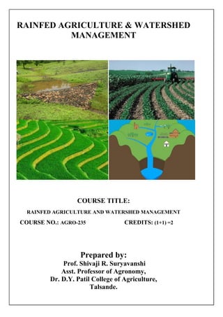
  • 1. RAINFED AGRICULTURE & WATERSHED MANAGEMENT COURSE TITLE: RAINFED AGRICULTURE AND WATERSHED MANAGEMENT COURSE NO.: AGRO-235 CREDITS: (1+1) =2 Prepared by: Prof. Shivaji R. Suryavanshi Asst. Professor of Agronomy, Dr. D.Y. Patil College of Agriculture, Talsande.
  • 2. 1 Prepared by Prof. S. R. Suryavanshi (DYP AC Talsande) INDEX THEORY NOTES COURSE NO. AGRO-235 CREDITS: (1+1) =2 COURSE TITLE: RAINFED AGRICULTURE AND WATERSHED MANAGEMENT S. N Topic name Page no 1 Introduction 3 2 Classification rainfed area 7 3 Characteristics of dry land agriculture / rainfed area 8 4 History of dryland agriculture and watershed development 9 5 Problems / constrains of rainfed / dryland agriculture 11 6 Agro-climatic zone of India : 15 7 Agro climatic zone of Maharashtra state. 18 8 Types of soils in rainfed area 23 9 Climatic studies of rainfed areas:- 25 10 Techniques of soil and water conservation 29 11 Strip cropping 36 12 Antitranspirants 37 13 Tillage 38 14 Mulching 41 15 Drought and its classification 45 16 Mitigation and crop adaptation to drought or dry growing conditions: 50 17 Effects of drought or moisture stress on the plants: 54 18 Cropping system and cropping pattern 57 19 Water Harvesting 63 20 Management of rainfed crops 67 21 Contingency cropping under different Aberrant weather conditions 77 22 Watershed Management 78 23 Crops planning according to land use capability classification 89 24 Important questions 94 25 Objectives 95 26 Photographs 106
  • 3. 2 Prepared by Prof. S. R. Suryavanshi (DYP AC Talsande) Teaching Schedule Lecture Topic Weightage (%) 1 Rainfed agriculture: Introduction, types, History of rainfed agriculture and watershed in India 8 2-3 Problems and prospects of rainfed agriculture in India 8 4 Soil and climatic conditions prevalent in rainfed areas 10 5 Soil and water conservation techniques 10 6-7 Drought: types, effect of water deficit on physio- morphological characteristics of the plants 10 8-9 Crop adaptation and mitigation to drought 8 10-11 Water harvesting: importance, its techniques, Efficient utilization of water through soil and crop management practices 10 12 Management of crops in rainfed areas 8 13-14 Contingent crop planning for aberrant weather conditions 10 15 Concept, objective, principles and components of watershed management 10 16 Factors affecting watershed management 8 Total 100 Suggested Readings: 1) Sustainable Development of Dryland Agriculture in India – R. P Singh 2) Dry Farming Technology in India – P. Rangaswamy 3) Dryland resources and Technology – Vol. 8 L.L Somani, K.W. Kaushal 4) Physiological Aspect of Dryland Farming – U.S Gupta 5) Principles of Agronomy S.R. Reddy 6) Dryland Technology – M.L. Jat, S.R. Bhakar, S.K. Shrma , A. K. Kothri 7) Climate, Weather and Crops in India – D. Lenka
  • 4. 3 Prepared by Prof. S. R. Suryavanshi (DYP AC Talsande) THEORY NOTES Course No. AGRO-235 Course Title: - Rainfed Agriculture and Watershed Management INTRODUCTION Indian agriculture is ‘a gamble in the monsoon’ even today. So, water has been prioritized to be the most crucial resource for sustainable development of agriculture. The life of mankind and almost all the flora and fauna on the earth depends on the availability of fresh water resources. It is an extremely important component of biological systems. The most of the plant cells and tissues contain 80-90 per cent water by weight. Plant water status influences all the physiological processes of plants directly or indirectly. Highly variable global distribution of annual average rainfall of about 1000 mm on the earth surface is responsible for the disparities in agriculture production and socio-economic conditions. Fifty five per cent or more than one-half of the total land surfaces of the earth, receives an annual precipitation of less than 500 mm and must be reclaimed, if at all by dry farming practices. Area with 500-750 mm rainfall, which accounts for 10 per cent of the total land area, also need dry farming measures for successful crop production In India also, distribution of the annual average rainfall of about 1200 mm, is highly variable, irregular and undependable with wide spread variations among various meteorological sub-divisions in terms of distribution and amount. The spatial distribution of rainfall varies from 100mm/annum in Rajasthan to about 11000 mm/annum in Cherrapunji in Meghalaya. Agriculture uses almost 85 per cent of the total water available in the country. Of the total geographical and net cultivated area about 92 and 33 million hectares receive less than 750 mm rainfall annually respectively Table . Distribution of dryland area in different rainfall zones in India. Mean annual Climate zone Dry land area rainfall (mm) (million ha) <500 Arid 10.9 500-750 Dry semi-arid 22.2 750-1000 Wet semi-arid 21.2 1000-1250 Sub-humid 19.6 >1250 Humid 27.7
  • 5. 4 Prepared by Prof. S. R. Suryavanshi (DYP AC Talsande) Agriculture continues to be mainstay of the Indian economy. It contributes 25 per cent of the national gross product. In this contribution, rainfed lands in India are important today and will continue to be so in future. Currently, about 70 per cent of agriculture in India is rainfed. This area contributes nearly 44 per cent to food production and supports 40 per cent of the human and 60 per cent of the livestock population. Even if the entire irrigation potential of the country is used, still about half of the cultivated land will remain rainfed. About 30 per cent of the country (109 million ha) is drought prone and suffers with critical water shortages. Rainfed agro-ecosystem covers about 90 million ha of net cultivated area, which is distributed unequally among different states. In Assam, Gujarat, Himachal Pradesh, Karnataka, Kerala, Madhya Pradesh, Maharashtra and Rajasthan more than 70 per cent of the net cultivated area is rainfed. Besides uncertainties in rainwater availability, the swings in the onset, continuity and withdrawal pattern of monsoon make crop production in rainfed areas a risky proposition. The coefficient of variation in the monsoon rainfall in areas located in the rainfall zones of < 500 mm, 500 -700 mm, 700-1000 mm and > 1000 mm is in the range of 50-55, 40-50, 30-40 and 20-30 per cent, respectively. Water is the most scarce resource in rainfed agriculture. Inefficient use of this scarce resource leads to inefficiency of all other inputs. In water resource management, the focus is not merely on development of new water resources but also on efficient utilization of already developed ones particularly based on indigenous systems. The precipitation reaching the earth surface may be intercepted by vegetation, may infiltrate into the ground, may flow over land surface as run -off or may evaporate. Evaporation may occur over the land surface or free water or from the leaves of the plant through transpiration. Soil acts as a reservoir for the water that enters the soil. Water in the soil is always in transitory storage. Rainfed areas can be made productive and profitable by adopting improved technologies for rainwater conservation and harvesting and commensurate agricultural production technologies. The fundamental problems of dry farming are:-
  • 6. 5 Prepared by Prof. S. R. Suryavanshi (DYP AC Talsande)  Storage in the soil of a small annual rainfall;  Retention of the moisture in the soil until it is needed by the plants;  Prevention of direct evaporation of soil moisture during the growing season;  Regulation of the amount of water drawn from the soil by plants;  Choice of crops capable of growth under moisture stress conditions and  Crop management for proper utilization of stored soil moisture. The relation of crops to the prevailing conditions of arid lands offers another group of important dry farm problems. Some plants are drought resistant and some are drought tolerant. Some attain maturity in short duration and are suitable for dry farming. Some crops and varieties have deep root system or waxy layer, which aid in their survival under moisture stress. After the selection of crops, skill and knowledge are needed in the proper seeding, tillage, nutrient management, plant population, weed control and mid-season correction for efficient use of conserved moisture. Dry lands: Areas which receive an annual rainfall of 750 mm or less and there is no irrigation facility for raising crops. Rainfed Agriculture: - Growing or cultivation of crops entirely on rainfall without irrigation Rainfed Agriculture / Dry land Agriculture: Scientific management of soil and crops under rainfed condition without irrigation is called dry land agriculture. Dry land crops: It refers to all such crops which are drought resistant and can complete their life cycle without irrigation in areas receives an annual rainfall less than 750 mm. Drought: It is an condition of insufficient moisture supply to the plants under which they fail to develop and mature properly. If may be caused by soil, atmosphere or both. Dry farming : In the country with low and precarious rainfall two types agricultures are usually met, one crop production on aerable farming land other animal husbandry, including management of grazing areas. About 100 m.ha (69.5%) of tatal cropped area falls under Rainfed and Dryland farming. Dry farming areas as per the 9th plan one those area receiving rainfall less the 750 mm year and limited irrigation facility is available. Areas which receiving the mean rainfall less than 375 mm per year are considered as absolute arid and desert areas and require special technology treatment. About 128 district in the country falls under dry framings as defined above. Out of these, 25 district from the desert land of Rajasthan Sourashtra and rain shadow regions of Maharashtra and Karnataka belong to very height intensity dry farming areas. Total Arable land Area- 143.8 m ha (India) Non- Irrigated 100 mm ha (69.5%) Irrigated 43.8 mm ha (30.5%) Dry land Rainfed 34.5 m ha (24%) 65.5 m ha (45.5%)
  • 7. 6 Prepared by Prof. S. R. Suryavanshi (DYP AC Talsande) Area under dry land is likely to a change according to definition and irrigation facilities developed from time to time. Areas receiving annual rainfall between lees than 750 mm is known as dry farming tracts zones. There are about 105 districts under this category but 18 of these districts have good irrigation facilities. Therefore dry farming tract comprises 87 districts spread over Andrapradesh, Gujart, Haryana, Punjab, Karnataka, MP, Maharashtra, Rajastan, Tamilnadu and Uttar Pradesh Even after the utilisation of all our water resources for irrigation, about half of the cultivated area will remain rainfed. As there is hardly any scope for increasing the area under cultivation, it is really a colossal task for meeting the future food needs. It is against this background that the role of dryland agriculture gained importance. Very often, the words dry farming, dryland famming and rainfed farming are used synonymously to indicate similar farming situation. Clearly, all the three exclude irrigation.  Dryland agriculture means cultivation of crop entirely under rainfed conditions.  In such areas crop production becomes relatively difficult as it mainly depend upon the intensity and frequency of rainfall.
  • 8. 7 Prepared by Prof. S. R. Suryavanshi (DYP AC Talsande) CLASSIFICATION OF FARMING BASED ON ANNUAL AVERAGE RAINFALL AND LENGTH OF GROWING PERIOD 1. Dry farming:- is cultivation of crops in regions with annual rainfall less than 750 mm, crop failure is most common due to prolonged dry spells during the crop period. These are arid region with a growing season (period of adequate soil moisture) less than 75 days. Moisture conservation practices are necessary for crop production. 2. Dryland farming:- is cultivation of crops in regions with annual rainfall more than 750 m. Inspite of prolonged dry spells, crop failure is relatively less frequent. These are semi- arid tracts with a growing period between 75 and 120 days. 3. Rainfed farming:- is crop production in regions with annual rainfall more than 1,150 mm. Crops are not subjected to soil moisture stress during the crop period. Emphasis is often on disposal of excess water. These are humid regions with growing period more than 120 days. In dry farming and dryland farming, emphasis is on soil and water conservation, sustainable crop yields and limited fertiliser use according to soil moisture availability. In rainfed agriculture, emphasis is on disposal of excess water, maximum crop yield, high levels of input and control of water erosion. Table: Rain dependent farming (Classification based on annual average rainfall and length of growing period) Aspects 1. Dry farming 2. Dryland farming 3. Rainfed farming Annual rainfall < 750 mm 750-1150 mm > 1150 mm Crop failure Common Less frequent No Region Arid Semiarid Humid Growing period < 75 days 75-120 days > 120 days Moisture conservation Required Necessary + Drainage Disposal of excess water Emphasis/constrains Soil and water conservation Disposal of excess water Crop yields Sustainable Maximum Input use Limited High levels Wind and water erosion constraints Both Water Cropping System Single Single/ Intercrop Intercrop/ double crop United Nations Economic and Social Commission for Asia and the Pacific distinguished dryland agriculture mainly into two categories: dryland and rainfed farming. The distinguishing features of these two types of farming are given below. Table : Dry land Vs Rainfed farming. Constituents Dryland farming Rainfed farming 1. Rainfall (mm) < 750mm >750 mm 2. Moisture Shortage Enough / Sufficient
  • 9. 8 Prepared by Prof. S. R. Suryavanshi (DYP AC Talsande) 3. Growing season <200 days >200 days 4. Growing regions Arid and Semiarid & up lands of sub humid & humid regions. Humid and slub humid regions. 5. Cropping system Single crop or intercropping Intercropping or double cropping. 6. Constraints Wind and water erosion Water errosion. CHARACTERISTICS OF DRY LAND AGRICULTURE / RAINFED AREA 1. Uncertain and limited annual rainfall:- The crops very often suffer from aberrant weather like delayed onset of monsoon, long gap in rainfall and early stoppage of rains. 2. Extensive climatic hazards: - This area has to face either flood, water logging or drought, The crops suffer badly from the frost. This way there are extensive climatic hazards leading to the partial or total crop failure. 3. Undulation soil surface:- Soils in this region get eroded every year due water and wind, which leaves behind an eroded gulley or rill and it requires leveling but due to poor economy of the farmers the soil is left as it is and the crops are grown there in. Thus the surface gradually becomes highly undulating. 4. Extensive agriculture:- The type of agriculture adopted in dry areas always remains extensive due to lack of irrigation. 5. Relatively larger plot size:- Since there is no irrigation facility, therefore, smaller plots are not required and farmers use to keep much bigger plot sizes which make it easy to identify as a rainfed area. 6. Similar types of crops:- In case of dry land agriculture only drought resistant crops can be grown and almost all the farmers of the region use to grow similar crops. Thus the entire area can be seen under the same crop having poor growth and development and it can be identified as a rain fed area. 7. Lower crops yields:- Yields of various crops grown in dry lands are found to be very low as the farmers being very poor can neither apply full doses of inputs nor the improved seeds of high yielding varieties. 8. Poor market for the produce:- Since everyone uses to grow the same crops and they become ready for sale at the same time, they get less price for their produce because of poor demand and abundant supply rather a glut in the market. 9. Poor farmers economy and cattle health:- The farmers do not get proper return of their efforts hence their economy remains poor. Due to scarcity of fodder and feed the cattle are not healthy. 10. Widespread deficiency diseases in human beings:- Surplus of low calory food and short supply of vegetables, fruits, milk etc. cause deficiency of vitamins and minerals which result into malnutrition and deficiency diseases in human being. Why crop failures are common, yields are not static under Rainfed farming because..... 1. Inadequate and uneven distribution of rainfall. 2. Late on set and early cessation of rainfall. 3. Prolonged dry spells during the crop growth period. 4. Low moisture retention capacity of soils. 5. Low fertility of soils, low humidity, higher temperatures, higher wind velocity.
  • 10. 9 Prepared by Prof. S. R. Suryavanshi (DYP AC Talsande) HISTORY OF DRYLAND AGRICULTURE AND WATERSHED DEVELOPMENT History of Rainfed Agriculture:- Over the years, following efforts have been made to transform rainfed farming into more sustainable and productive systems. 1880-the First Famine Commission was appointed by the then British Empire to suggest ways and means to off-set the adverse effects of recurring droughts 1920-Scarcity trak development given important by Royal commission on Agriculture. 1923-Establishment and Dry farming Research station at Manjari (Pune) 1933- Dry Farming Research Station at Bijapur and Solapur 1934- Dry Farming Research Station at Hagari and Raichur 1935-Dry Farming Research Station at Rohatak (Panjab) 1942- Bombay land development act passed 1944- Monograph on dry farming in India by Kanitker 1950- Establishment of all India Coordinated Research Project for Dryland Agriculture (AICRPDA) 1953-Establishment of Central soil conservation Board 1955- Dry farming demonstration centers started 1959- Central Arid Zone Research Institute (CAZRI) was established in at Jodhpur. 1970-All India Coordinated Research Project for Dryland Agriculture (AICRPDA) was initiated in at 23 centres, selected on agro-climatic basis. 1972-International Crop Research Institute for Semi-arid Tropics (ICRISAT), Hyderabad1976- Renewed efforts were made by the Government of India in mid-fifties to conserve the natural resources and optimising their use by establishing eight Soil Conservation Research Centres at Dehradun, Chandigarh, Udhagamandalam, Bellary, Kota, Vasad, Agra and Hyderabad, which were put under the control of Central Soil and Water Conservation Research and Training Institute (CSWCR&TI), Dehradun 1977-KVK, Hayatager 1983-All India Coordinated Research Project on Agro-meteorology was started to strengthen the location specific weather forecasting. 1983-Starting of 47 maodel watershed under ICAR 1985-Central Research Institute for Dryland Agriculture (CRIDA), Hyderabad 1986 Launching of NWDPRA programme by Government of India in 15 states.
  • 11. 10 Prepared by Prof. S. R. Suryavanshi (DYP AC Talsande) History Of Watershed Development In India 1962-63 -Centrally Sponsored Scheme of “Soil Conservation Work in the catchments of River Valley Projects (RVP)” was launched 1973–74- Started Drought Prone Area Programme (DPAP) with an objective of Promote economic development and mainstreaming of drought prone areas through soil and moisture conservation measures. 1977–78- Started Desert Development Programme (DDP) with an objective of Minimize adverse effects of drought and desertification through reforestation. 1980- 81- The Ministry of Agriculture started a scheme of Integrated Watershed Management in the Catchments of Flood Prone Rivers (FPR). 1980- Several successful experiences of fully treated watersheds, such as Sukhomajri in Haryana and Ralegaon Siddhi in Western Maharashtra, came to be reported. 1982-83 The Ministry of Agriculture launched a scheme for propagation of water harvesting/conservation technology in rainfed areas in 19 identified locations. 1990- Concept of integrated watershed development was first institutionalized with the launching of the National Watershed Development Programme of Rainfed Areas (NWDPRA) covering 99 districts in 16 states 1992- Indo-German Watershed Development Programme for Rehabilitate micro-watersheds for the purpose of regeneration of natural resources and sustainable livelihoods, using a participatory approach by NABARD and the Watershed Organisation Trust (WOTR) 2009- Integrated Watershed Management Programme (IWMP) Consolidated three programs: IWDP, DPAP, and DPP. Programs adopted a cluster approach focusing on a cluster of micro-watersheds (1000 ha to 5000 ha scale) by MoRD.
  • 12. 11 Prepared by Prof. S. R. Suryavanshi (DYP AC Talsande) PROBLEMS / CONSTRAINS OF RAINFED / DRYLAND AGRICULTURE The low productivity of agriculture in dry farming regions is due to the cumulative effect of many constraints for crop production. The problems of crop production in dry land agriculture are mostly with vagaries of monsoon and soil constraints. The constraints can be broadly grouped in to A. Climatic constraints B. Soil constraints C. Socio economic constraints D. Technological constraints E. Crop production problems A. Climatic constrains : I) Rainfall 1. Commencement of rains may be quite early or considerably delayed: Normal onset of monsoon is towards the end of May over Kerala coast and by 15th July in the extreme north west part of Rajasthan. There is variability in the dates of onset of the monsoon from year to year. 2. There may be prolonged ‘breaks’ (Dry spell): There will be break in the monsoon associated either with weak monsoon current or with the temporary withdrawal of the monsoon. For breads of more than 2-3 weeks can affect the crop to varying degrees. Monsoon breaks for 7-10 days may not be serious concem. Breaks of more than 15 days duration especially at critical stages for soil moisture leads to reduction in yield. Drought due to break in monsoon may adversely affect the crops in shallow soil than in deep soils. 3. The rains may terminate considerably earlier or persist longer than usual: Withdrawal of the monsoon begins in the beginning of September in north western Rajasthan and disappears over Kerala towards the end of October. The date of withdrawal of the monsoon varies from year to year. 4. Inadequate and uneven distribution of monsoon in space and time: Monsoon may be excessive in one part of the country and deficient in another, and/or excessive during one part of the season and deficient during another. 5. Intensity and distribution: Distribution of rainfall is more important than total rainfall in Dryland agriculture in genetal more than 50% of total rainfall is usually received in 3 to 5 rainy days. Such intensive rainfall results in substantial loss of water due to surface runoff. This process also accelerates soil erosion. 6. Late onset of monsoon: Crops cannot be sown in time if on seal of monsoon is delayed. Delayed sowing leads to poor yield due to reduction in growing period in such cases. 7. Early withdraw of monsoon: This is more dangerous than late on seal of monsoon. Rainy season crops will be subjected to terminal stress leading to poor yield. Similarly post tiny season crops fail due to inadequate available soil moisture spectrally during reproductive and maturity phases. 8. Seasonal variation: 80 % rainfall received in June to September (Kharif season) while 20% rainfall received in remaining eight month. ( Vagaries of monsoon: According to average annual rainfall, the country can be divided into three distinct zones low (less than 750mm), medium (750-1150 mm) and high (more than 1150 mm) rainfall zones. Areas which receive less than 1150 mm rainfall characterized arid and semiarid are problematic in crop production. Rainfall variation
  • 13. 12 Prepared by Prof. S. R. Suryavanshi (DYP AC Talsande) intensity and distribution late onset early withdraw of monsoon and prolonged dry spell during crop growing period are main features influencing crop production in dry regions. Rainfall variation: The annual rainfall varies greatly from year to year to crop failures due to uncertain rains are more frequent in the regions with lesser rainfall. The tremendous variation in rainfall is mainly due to geographical position of these tracts with reference to surrounding seas and the configuration of land surface. Other local factors like river lakes, forest also contribute to determine annual rainfall. ) II) Wind velocity: - Wind velocity is generally high during July and August. If wind velocity exceeds 18 - 20 km./hr. Such period coincided with dry spell. Hence Evapotranspiration is at high degree. If velocity is low the lowest evaporation rates are observed during November and December. High winds are experienced in association with cyclones, depressions and dust storms. High winds cause mechanical damage to crops like lodging and bread king. Light winds blowing from colder parts bring about a drop in temperature Warm and dry winds causes greater losses through evaporation and result in water stress. III) Bright sunshine hours: - Bright sunshine is usually experienced during months of Jan. and Feb. At Solapur it is about 8 to 9 hours. During April and May the sky is usually have with more dust particles, lowest bright sunshine is noticed during Aug. (4 to 5 hours). This indicates the cloudy weather but no rainfall. Sunshine is not limiting factor in anywhere in India. During monsoon there is not a lack of sunshine but excessive rain is responsible for occasion set back to plant growth. However, continuous cloudiness during flowering is injuring to all plants. It also creates conditions favorable to the multiplication of pests and diseases. High humidity and warm temperature are conducive to most plant diseases. IV) Humidity: - Humidity is high during July and Sept. During Feb. to May it is low. During dry spell, less relative humidity is noticed. Evaporation demands are also accelerated with high temperature and low humidity. V) Temperature: - Maximum temperature exceeds 410 C during late April and early May. Minimum temp. is noticed during December. Lowest weekly minimum temperature is about 14 to 150 C. Generally climate is semi and with mild winter and hot summer. Crop like wheat and gram requiring longer cool period hence do poor while prolonged cold weather however, Jowar suffers considerably. The air temperature is a decisive factor in plant growth. In India, high temperature are also of special importance as they may have damaging effect on crop during the period of water stress in arid and semi arid regions. Evaporation demands and also associated with high temperature and low humidity, which puts further limitation on crop growth. B. Soil constraints (Soils of Rainfed region): Alluvial soils occupy the largest area in Dryland agriculture. The problems of crop production are not so acute in these soils. The major problems are encountered in vertisols, alfisols and related soils. Black (vertsols) red (alfisols) and associated soils are mostly distributed in central and south India. The coastal areas have alfisols, laterite and lateritic soils. The different soil constraints for crop production are 1. Inadequate soil moisture availability: The moisture holding capacity of soils in dry regions is low due to shallow depth especially in alfisols (red soils), low rainfall and low organic matter content.
  • 14. 13 Prepared by Prof. S. R. Suryavanshi (DYP AC Talsande) 2. Poor organic matter content: The organic matter content in most of the soils under dryland conditions is very low (< 1 %) due to high temperature and low addition of organic manures. Poor organic matter content adversely affects soil physical properties related to moisture storage. 3. Poor soil fertility: Due to low accumulation of organic matter and loss of fertile top soil by soil erosion the dry land soils are poor in fertility status. Most of the dry land soils are deficient in nitrogen and zinc. 4. Soil deterioration due to erosion (wind, water): In India nearly 175 m.ha of land is subjected to different land degradations, among them the soil erosion is very predominant. The erosion causes loss of top fertile soil leaving poor sub soil for crop cultivation. 5. Soil crust problem: In case of red soils, the formation of hard surface soil layers hinders the emergence of seedlings which ultimately affect the plant population. Crusting of soil surface after rainfall reduces infiltration and storage of rainfall, due to high run off. 6. Presence of hard layers and deep cracks: Presence of hard layers (pans) in soil and deep cracks affect the crop production especially in case of black soils. C. Socio-economic constraints:  Small land holding and high population pressure  Frequent failure of crop and unstable production  Low cropping intensity and low income  Unemployment for most of the period of year.  Lack of capital and financial aids  Traditional attitude of farmers D. Technological constraints:  Lack of suitable genotypes giving high and stable yields under Rainfed condition.  Problem in designing suitable cropping systems.  High input based technology is risky.  Limited use of fertilizers, poor response of bio-fertilizers and poor availability of organic manures.  Limited scope of use of residual moisture and nutrients  Problem in soil moisture conservation and timely utilization by crop.  Limited scope for land improvement.  Water harvesting and recycling are high investment preposition. E. Crop production problems:- -Unfavorable crop growth environment -Severe limitation on the choice of crops -Low crop intensity
  • 15. 14 Prepared by Prof. S. R. Suryavanshi (DYP AC Talsande)
  • 16. 15 Prepared by Prof. S. R. Suryavanshi (DYP AC Talsande) AGRO-CLIMATIC ZONES Several attempts have been made in our country to classify the Agro-climatic zones. More often climate and ecology have been used as synonymous. Climate is the statistical collective of the weather conditions of specified area during a specified interval time, usually several decades. While Ecology is the relationship between organisms and their environment, including relationship with other organisms. Environment, therefore, is the total of all surroundings and natural conditions that affect the existence of living organism on earth, including air, water, soil, minerals, climate and organisms themselves. Thus climate and ecology are not interchangeable. Definition : An agro-climatic zone is a land unit in terms of major climate and growing period which is climatically suitable for certain range of crops and cultivars. An ecological region is characterized by distinct ecological response to macro climate as expressed in vegetation and reflected in soils, fauna and aquatic systems. Therefore an agro- ecological region is the land unit on the earth’s surface covered out of agro-climatic region when it is supper imposed on land form and kinds of soils and soil conditions that act as modifiers of climate and length of growing period. Delineation of climatically homogenous regions has been an important attempt of agro- climatic analysis that received extensive attention since the 19th century. However, several approaches have been made in the past to delineate the land area into climatic regions for the purpose of the agricultural planning. These earlier approaches have major limitations of non- uniform application of the criteria used. The planning commission, as result of mid-term appraisal of planning targets of VII plan (1985-1990), divided the country into 15 broad agro-climatic zones based on physiographic and climate i.e. based on homogeneity in rainfall, temperature, topography, cropping and farming systems and water resources. The emphasis was on the development of resources and their optimum utilization in sustainable manner within the frame work of resource constraints and potentials of each regions. These zones were further divided into 120 sub zones under National Agricultural Research Project (NARP). AGRO-CLIMATIC ZONE OF INDIA: 1) Western Himalayan Region : This region comprises, Jammu-Kashmir, Himachal Pradesh and U.P. Hills. Shallow skeletal soils of cold region, mountain meadow and hilly brown soils are predominant. Soils are generally silty loams and prone to erosion hazards. Lands or region have steep slopes in undulating terrain. The productivity of this region is lower than the all India level. 2) Eastern Himalayan Region : This comprises Sikkim and Darjeeling hills, Arunachal Pradesh, Megahalaya, Nagaland, Manipur, Tripura, Mizoram, Assam and Jalpaiguri and Coochbehar districts of West Bengal. The rainfall is high with thick forest cover. Shifting cultivation is practiced. High rainfall causes severe erosion and degradation of soil. This region is having a high potential for agriculture, forestry and horticulture.
  • 17. 16 Prepared by Prof. S. R. Suryavanshi (DYP AC Talsande) 3) Lower Genetic Plains Region : This zone consists of West Bengal lower Genetic plains region. Alluvial soils and are prone to floods. Rice cultivation is predominant. 4) Middle Gangetic Plains Region : This region comprises 12 districts of eastern U.P. and 27 districts of Bihar plains. About 61 % of area fall under rainfed farming and cropping intensity is 142 %. Rice productivity is the lowest in this zone. 5) Upper Gangetic Plains Region : The zone consists of 32 districts of North U.P. Problem soils is about 9 lakh ha. Irrigation by canal & tube wells with good ground water. Cropping intensity is 144 % productivity of Rice & Wheat is fairly high. 6) Trans-Gangetic Plains Regions : Punjab, Haryana, Union Territories of Delhi and Chandigarh and Sri Ganganagar in Rajasthan constitute this region. The major characteristics of this area are highest net sown area, irrigated area and cropping intensity and also high ground water utilization. 7) Eastern plateau and Hill Regions : The zone consists of eastern parts of M.P., southern part of West Bengal and most of inland Orissa. The soils are shallow to medium in depth. The topography is undulating with a slope of 1-10 %. Irrigation through tanks and tube wells. 8) Central Plateau and Hill Regions : This region comprises of MP (46 districts), U.P. and Rajesthan. About 75 % of the area comes under rainfed. Land topography is highly variable and about 30 % land is not available for cultivation. 9) Western Plateau and Hill Region : This zone consists of the major part of Maharashtra, parts of MP and one district in Rajasthan. Average Rainfall is 904 mm. Irrigated area is 12 % only, with canal being main source. Sorghum and cotton are the predominant crops in this area. 10) Southern Plateau and Hill Region : This is a typical semi-arid zone comprising 35 districts of Andhra Pradesh, Karnataka & T.N. about 80 % of the area falls under rainfed farming and hence cropping intensity is low (111 %). 11) East Coast Plains and Hill Region : This zone comprises of east coast of T.N., Andhra Pradesh & Orissa. Soil is deep, loamy, coastal and deltaic alluvial type. Irrigation through canal and tanks. About 70 % land comes under rainfed farming. 12) West Coast Plains and Hill Region : The zone consists of west coast of T.N., Kerala, Karanataka, M.S. & Goa. Soils are shallow and medium, loamy, red and larteritic. Rice, tapioca, coconut and millets are the important crops. 13) Gujarat Plains and Hill Region : This zones comes under arid climate and covers 19 districts in Gujrant. About 78 % of area falls under rainfed with low rainfall. This is an important zone of oil seed production. 14) Western Dry Region : This region is characterized by hot sandy desert spread in 9 districts of Rajasthan. Rainfall is erratic with high evaporative demand and vegetation is scanty. Drought and famine are very common features. Rainfall is only 400 mm. Temperature in winter is 0o C while in summer it is 45o C. The ground water is deep and often brackish. 15) Island Region : Island territories of Andaman, Nicobar and Lakshadweep come under this region. Soils are medium to deep, red loamy & sandy. Annual rainfall is 3000 mm spend over 8- 9 months. It is largely a forest zone with undulating land.
  • 18. 17 Prepared by Prof. S. R. Suryavanshi (DYP AC Talsande) AGROCLIMATIC ZONE OF MAHARASHTRA STATE Different agroclimatic zones of Maharashtra state with head office as given below Zone Head office 1) South Konkan costal zone Vengurla 2) North Konkan costal zone Karjat 3) Western Ghat zone Igatpuri 4) Sub-mountain zone Kolhapur 5) Western Maharashtra plain zone Pune 6) Western Maharashtra scarcity zone Solapur 7) Central Maharashtra plateau zone Aurangabad 8) Central vidarbha zone Yevatmal 9) Eastern vidarbha zone Shindewai The Maharashtra has large size and varied topography. The rainfall in the state varies from 50 cm in the Western Maharashtra scarcity zone to 400 to 500 cm in Ghat zones. Temperature though does not very much limiting factor for crop production like solar radiations. Soils also very from laterites in coastal regions, red and light brown in the hilly areas to heavy block clayey sols of varying depths in the plateaus. Taking into consideration the total annual rainfall pattern, the topography, soil characteristics and cropping patterns, the Maharashtra State has been divided into 9 broad agro climatic zones.
  • 19. 18 Prepared by Prof. S. R. Suryavanshi (DYP AC Talsande) 1) South Konkan Coastal Zone : South Konkan Coastal Zone comprises districts of Ratnagiri and Sindhudurg. The Zone lies between 150 13’ to 180 500 N latitude and 720 450 and 740 50’ E longitudes, with long and narrow strip of land measuring 260 km in length and width ranging between 50-60 km. The zone has an undulating topography with hills and rocky plains alternating. Climate : The zone is characterized by warm and humid monsoon climate. May is the hottest month. About 97% of the rainfall is received during June to September from South West Monsoon. The average annual Rainfall is 3105 mm in about 101 rainy days. Soils : Lateritic soil is the predominant type of soil observed in this zone. While along the sea coast, in a narrow belt, coastal saline and coastal alluvial soils occur. The intense leaching due to high rainfall has removed the bases from the soil profile giving it a distinctly acidic reaction (pH 5.5 to 6.5) . Crops and cropping patterns : Paddy is the major cereal crop and Ragi (nagli) is the second important crop of the zone. Vari a minor millet is grown on hill slopes on low fertile soil during kharif. Oil seed crops like niger, Sesamum are also grown in kharif on limited areas. With introduction of irrigation, the area under Rabi groundnut, Sorghum and redgram is likely to increase. Due to typical soil and climate, the zone is ideally suited for horticultural crops viz, Mango, Coconut, Arecanut, Cashewnut, Jackfruit, Banana, Pineapple etc. 2) North Konkan Coastal Zone : This zone comprising districts of Thane and Raigad. The zone lies between 170 52’ and 200 20’ N latitude and 700 70’ and 730 48’ E longitude. The north south length of the zone is about 260 km with width of about 140 km in Thane district and 50 km in Raigadh district. Climate : The zone is characterized by warm and humid climate. The average rainfall is 2607 mm in 87 rainy days. The maximum rainfall (41%) received in July. Soils : The predominant soils found in the Thane and northern part of Raigad districts are non lateritic coarse and shallow. The soils are neutral to acidic in reaction. Medium black soils occur in patches in the northern part of the zone. Southern part of Raigad has lateritic soils. These soils are acidic in nature. (pH 5.5 to 6.5) Crops and cropping patterns : Paddy is the major crop accounting for 64%of the area under cultivation. Ragi and Vari are also important crops. Major fruit crops are banana and chicku in Thane and Mango in Raigad district. 32% of the area is under forest. 3) Western Ghat Zone : It includes hilly and high lying terrains around the Ghats of Amboli, Phonda and Amba in Kolhapur district, Koyna and Mahabaleshwar in Satara district, Lonawala and Khandala in Pune district, Kalsoobai hills in Akola taluka of Ahmednagar and Igatpuri and Trimbakeshwar in Nasik district. Climate : Rainfall at high lying terrains ranges between 3000 to 6000 mm and the area is mainly covered by deciduous to semi deciduous forests (22 to 25 %). Soils : The soils are mostly forest land and warkas (Light lateritic and reddish brown) with distinctly acidic and poor in fertility. Crops and cropping patterns : The principal crops grown are paddy, ragi (nagli), vari Kodra, Kharif sorghum, groundnut, niger, gram etc. The sugarcane is grown as cash crop. The horticulture is the priority need of the zone. The area is well suited for rainfed fruits like mango, cashewnut, Jackfruit, Kavanda, jamun etc. 4) Sub-mountane Zone : This zone is located on the eastern slopes of sahyadri ranges. It includes surgana, peth and Nasik talukas of Nasik district, Rajgurunagar, Maval, Mulshi, Velha and Bhor talukas of Pune district, Javali, Patan and Karad talukas of Satara district, Shahuwadi, Panhala, Karvir, Kagal, Bhudargad, Ajara, Gadhinglaj talukas of Kolhapur district and Shirala taluka of Sangali district.
  • 20. 19 Prepared by Prof. S. R. Suryavanshi (DYP AC Talsande) Climate : The annual rainfall of the zone ranges between 1700 to 2500 mm which is received mostly through South West monsoon. The climate is characterized by relatively hot summer, humid rainy season and moderately cold winters. Soils : The soils are reddish brown to black tending towards lateritic nature with varying depths and textures. They are generally acidic (pH 6 to 7). Crop and cropping patterns : The cropping pattern is mainly dominated by Kharif cereals like paddy, sorghum, pearl millet, maize, ragi followed by groundnut and sugarcane. During Rabi sorghum, wheat, gram and lab-lab (wal) are the important crops. Potato, chillies, tomato, brinjal etc. are the important vegetable crops being grown in the area, Guava, mango, banana and cashew nut are the important fruit crops. 5) Western Maharashtra Plain Zone : This zone includes areas in western tahsils of Dhule, Ahmednagar and Sangali and Central tahsils of Nasik, Pune, Satara and Kolhapur districts. Climate : This zone has well distributed rainfall ranging from 700 to 1250 mm. The maximum rainfall is received from South-West monsoon from June to October. The period of water availability ranges from 120 to 150 days. Soils : The topography, in general, is plain in the zone. The soils are predominantly greyish black with varying texture and depth ranging from 0.25 to 1.00 metre. The medium deep soils are dark brown in colour. The soils are clay loam in texture and moderately alkaline with pH ranging from 7.4 to 8.4. The clay percentage around 40. Crop and cropping patterns : The principal crops are kharif and rabi sorghum, groundnut, pearl millet, wheat, sugarcane, green gram, black gram, red gram, gram, ragi (nagali) etc. 6) Western Maharashtra Scarcity Zone : This region includes Solapur, Ahmednagar parts of Satara, Sangali, Pune, Kolhapur, Dhule, Jalgaon and Nasik districts and parts of Aurangabad, Jalna, Bid and Osmanabad districts. Climate : This area suffers from twin problems of low productivity and high instability as a result of inadequate and erratic rainfall. The annual rainfall is less than 750 mm which receives in about 45 rainy days. Two peaks in rainfall are observed, first during June/July and second during September, resulting in bimodal pattern of rainfall distribution. Besides, the dry spells of varying durations extending from 2 to 10 weeks at a stretch are experienced during July and August. The water availability periods varies from 60 to 140 days. Because of high temperature and high wind velocity, the PE value is more than 1800 mm resulting in a deficit of more than 60% in general. Soils : The soils are vertisol with base saturated. They have montmorilonite type clay, which swells when wet and Shrink on drying producing deep cracks. They are low in nitrogen, low to medium in phosphate and usually rich in potash. The shallow soils (depth less than 22.5 cm) constitute 30% medium deep soils (between 22.5 to 90 cm) 45% and deep soils (above 90 cm) 25%. Shallow soils are suited for kharif cropping and deep soils for rabi cropping. Crops and Cropping patterns : Kharif crops like pearl millet, sorghum, pulses, groundnut, sunflower are taken on shallow soils. The proportion of kharif cropping is about 25 to 30%, leaving a large proportion of area to rabi cropping. Sorghum, Safflower, gram, sunflodwer etc, are taken during Rabi season. The short duration pulses followed by rabi sorghum/safflower cropping system is remunerative on deep vertisols during better rainfall years. The Agro- forestry, Agro-horticultural and dry land horticultural systems are gaining importance during recent year. 7) Central Maharashtra Plateau Zone : This zone comparises of parts of Aurangabad, Jalna, Bhir and Osmanabad districts, major parts of Parbhani and Nanded districts, Complete Latur district. This zone includes entire Buldhana and Akola districts excluding southern parts of Washim and Mangrul pir talukas, whole of Amravati, excluding eastern part of Chandrapur, and
  • 21. 20 Prepared by Prof. S. R. Suryavanshi (DYP AC Talsande) morshi talkukas, Darwha and Pusad talukas of Yeotmal district, whole Eastern part of Jalgaon district, Shirpur taluka of Dhule, south Solapur and akkalkot talukas of Solapur district. Climate : The average rainfall is 700-900 mm with 35 to 65 rainy days. In monsoon (June- September) , more than 75% of rainfall is received in all the district of this assured rainfall zone. Soils : Soils are derived from Deccan trap and range from black to red colours. The soils are vertisols, entisols and inceptions. The pH ranges from 7 to 7.5. Crops and Cropping Patterns : The sorghum is the predominant crop of the region. The the next important crop is cotton. The oilseeds (groundnut, sunflower etc.) and pulses (green gram, black gram, red gram, gram) contributes very little area. In plain area of Parbhani, Nanded, Jalna and Aurangabad, Kharif cum rabi cropping pattern is prevalent. Under irrigation, Kharif Sorghum-wheat and cotton summer groundnut are the important cropping systems. 8) Central Vidharbha Zone : This zone includes entire Wardha district, major part of Nagpur and yeotmal districts, two talukas of Western Chandrapur district, parts of Aurangabad, Parbhani, Jalna and Nanded districts. This is one of the large Agro-climatic zones of the state. Climate : The average annual rainfall ranges between 950 to 1250 mm which received in about 59 rainy days. July is the wettest month. Soils : Soils of the zone are derived from basalt rocks, black in colour and have varying depths. These soils are medium to heavy in texture, fairly high in clay content, alkaline in reaction, high lime reserves with high base saturation of the exchange complex. Vertisols swells after wetting and shrinks after drying producing deep and wide cracks. Crops and cropping patterns : The cropping patterns involves cotton, kharif sorghum (30- 40%), Red gram, wheat, pulses and oilseeds, paddy and rabi sorghum are also included in the rotation. 9) Eastern Vidarbha Zone : This zone includes entire Bhandara and Gad-Chiroli districts, eastern part of Chandrapur district and Umred tahsil of Nagpur district. Climate : This zone receives average annual rainfall of 1250 to 1700 mm in 60-70 days. July is the wettest month. Soils : Soils are chiefly derived from mixed parent rocks like granite, geneses and schists. They are yellowish brown to red in colour and are having pH in the range of 6 to 7. Some areas in the south and west have medium black soils. Crops and cropping patterns : Paddy is the predominant crop the zone in Bhandara district during kharif, followed by pulses like lathyrus and gram in rabi. In Bramhpuri, Gad-chiroli and Sironcha taluks of Chandrapur district, paddy although is predominant crop is associated with rabi sorghum and pulses and oilseeds during rabi season. In Umred taluka of Nagpur district almost six crops including rabi sorghum, wheat, kharif sorghum, chillies, paddy and linseed together form the major crop pattern with greater area under rabi crops.
  • 22. 21 Prepared by Prof. S. R. Suryavanshi (DYP AC Talsande)
  • 23. 22 Prepared by Prof. S. R. Suryavanshi (DYP AC Talsande) TYPES OF SOILS IN RAINFED AREA 1. Alfisols: Alfisols are, by and large, light textured soils which have low moisture holding capacity but high water intake. The rain water falling in such areas gets soaked up and saturates the profile. The soil water percolation is more and therefore, is lost for crop use. Owing to faster intake of water in the profile the surface runoff is limited and soil loss from erosion is low (3.05 t/ha/year). Soil crusting is a common problem in low rainfall areas. These are commonly referred to as red soils. The problems relation to crop production are (Geographical Area 20% Rainfall range 750-2000mm)  Poor crop stand due to crusting and rapid drying of surface.  Poor crop growth due to unreliable moisture supply low moisture storage capacity due to shallow depth and dry spell during crop season.  Low soil fertility due to low organic matter poor nutrient status particularly with respect of N.P.S and ca and compact sub soil layer (agrillic fiorson) and alnd degradation from soil erosion and crusting. 2. Vertisols: (Black soil) Vertisoles have high clay content and high moisture retention capacity. Owing to its swelling and shrinking characteristics, permeability is low and hence the rate of infiltration of water is minimum. This causes more surface and high soil loss from the top layer owing to surface erosion. It is estimated that 68.5 tones/ha per year soil is lost from vertisoles. Due to high clay content it develops cracks during Rabi season at flowering stage of crops. These soils commonly called as black soils with high clay content (30-70%). Important constraints for crop production are: (Geographical area 22%, Rainfall range 500-1500 mm) -Narrowing of soil moisture content for tillage -Tendancy to waterlogged and poor traffic ability. -Low fertility due to low N and available P and -Land degradation form soil erosion and salt accumulation. 3. Inceptisols and Entisols (Alluvial soils): Entisols are generally loamy sand or sandy loam. Depth in these soils is not a constraint. These soils have very low clay content and hold water up to 200 mm per meter of soil profile. Its nutrient holding capacity is poor. In low rainfall areas monsoon cropping is practiced and in high rainfall areas double cropping is possible. These are commonly termed as alluvial soils. (Geographical area 21%)  Low water holding capacity  Low nutrient status  Management for crop production is relatively easy compared to red and black soils.  Land degradation is due to soil erosion. 4. Submontane: soils are medium in texture and depth is medium to deep as well as moderate in clay content. Moisture retention capacity is high (300 mm/m. profile). These soils are poor in nitrogen but medium in other nutrients. Phosphorous may be limiting in high production system. Due to high rainfall double cropping is possible in these soils. 5. Sierozemic (Aridisoles) are extremely light soils, effectively depth being influenced by the CaCo3 concentration in soil profile. Its moisture holding capacity is low (150 mm water./m). Sierozemic soils are low in nitrogen and sometimes inadequate in phosphorous. Subsoil salinity is common. These soils are mostly monsoon cropped, except in deep sandy loams where post-monsoon cropping is also possible. Crusting is very frequent.
  • 24. 23 Prepared by Prof. S. R. Suryavanshi (DYP AC Talsande) 6. Laterite soils:- These soil occurs in Hills of Karnataka, Kerala, M.P., Eastern ghat of Orissa, Maharashtra, West Bengal, T.N., and Assam. Due to high rainfall it washes out the bases causing soil become acidic having pH 5.0 to 6.0. Soils are well drained having less water holding capacity of soils. Laterites have three varieties such as rice soil, warkas soils and garden soils. The soils are poor in Nitrogen, Occasionally P2O5 but K2O deficient. 7. Forest and Hill soils: These soils occur in hilly and forest area having high rainfall areas. 8. Saline alkali soils: These soils mostly Occurs in coastal areas Maharashtra such as parts of Ratnagiri, Raigad, Thane and Palghar district. Soils content larger amount of salts due to locally Known as kharlands.
  • 25. 24 Prepared by Prof. S. R. Suryavanshi (DYP AC Talsande) CLIMATIC STUDIES OF RAINFED AREAS Weather is a important factor which either directly or indirectly influences the crops. The principal weather elements which exert a strong effect on crop growth and yield are precipitation, temperature, winds, solar radiation, dew, fog and frosts. 1. Precipitation:- Rainfall has following main characteristics Uncertain and erratic Rains are generally insufficient or inadequate in arid and semi-arid regions Intensity and distribution are uneven Frequent dry spells and breaks. Uncertain rains result in crop failures. Generally, yields are determined by the amount of precipitation above the basic minimum required to enable the crop to achieve maturity. Though, rainfall has major influence on yield of crops. Rainfall may also be in excess of the optimum and thereby cause reduced yields which may appear paradoxical to semi-arid climates. 2. Temperature: -Temperature variation greatly affects the physiological and biological process of plants. -Low temperature increases nutrient deficiencies due to low water uptake. -At low temperature water is tightly bound to the soil and is difficult to absorb by the plant. -High temperature causes loss of chlorophyll which result in chlorosis or yellowing of leaves. - High temperature cause excessive transpiration which result in leaf scorch. 3. Humidity: - In dry land region relative humidity always less 20-30% at mid-day, While in humid region it 60-70%. - Low relative humidity increases transpiration rate and crop water requirement. - When relative humidity is high, pollen may not be dispersed from the anthers. - The incidence of insect pest and disease is high under high humidity condition. - Very high or very low relative humidity is not conductive for high grain yield. 4. Winds: - Wind increases transpiration and evaporation. - Causes lodging of herbaceous plant. - Causes soil erosion. - Heavy winds accompanied by rainfall cause uprooting of crops. - Hot dry wind affects photosynthesis. - Winds with low temperature may produce chilling injury to the plant. 5. Solar radiation: - The arid regions are characterized by predominantly clear sky during both day and night, permitting a large amount of solar energy to reach the earth. - Solar energy provides two essential needs of plants. Light needed for photosynthesis and for many other functions of the plant. Thermal conditions required for the normal physiological function of plant. - However, radiation also increases evapotranspiration. 6. Dew:- - It provides a very small proportion of the water requirements of normally transpiring plants, but may be of some importance to plants under water stress. 7. Fog:- - It affects plant growth through the high air-humidity, through wetting the aerial parts of plants and through humidification of the soil surface. 8. Frosts:-
  • 26. 25 Prepared by Prof. S. R. Suryavanshi (DYP AC Talsande) - In warm regions, occasional and exceptional frost may do considerable damage because the crops grown in such regions are usually very susceptible to low temperatures. Breakthrough to Enhance Crop Production in Dry lands: The break through leading to a new order of yield in crop production in dry regions will most likely come from the long term team efforts of breeders agronomists and physiologist involved directly in experiments evaluation and decision making at every step of process. Studies in AICRPDA and ICRISAT have come out with new recommendations to boost up the yields in dry land areas.  Offseason and contour tillage in light texture red soils and optirnised minimum tillage in verticals.  Early sowing to fully utilize the moisture availability period and make use of mineralized nutrients.  Crop residue incorporation to improve moisture retention and nutrient status of soil.  Crop and varietal selection based on moisture availability period.  Contingent crop planning to meet vagaries of weather.  Moderate use to fertilizers.  Use of organic matter, bio-fertilizers and soil mulches to avoid rapid evaporation of soil moisture.  Adoption of optimum plant population timely weed control and need base plant protection measures.  In situ soil moisture conservation, water harvesting and recycling.  Adoption of location specific intercropping and multiple cropping  Adoption of suitable agro forestry and agrohorti systems. Dry farming areas : Dry farming areas (as per the IV five year plan) are those areas receiving an annual rainfall ranging from 375 to 1125 mm and very limited irrigation facilities. Areas which receive less than 375 mm of average rainfall are considered as absolutely arid or desert areas, which require special treatment. As many as 128 districts in the country falls under category of dry farming areas as defined above. Out of these 25 dists from the states of Rajasthan, Sourashtra and rainshado region of Maharashtra and Karnataka belong to very high intensity dryfarming areas (i.e. rainfall ranges from 375 to 750 mm and irrigated area belong 10% of the cropped area.) The major physiographic regions observed in India namely i) Mountain region ii) Indogangatic alluvial plains iii) Peninsular or Deccan plateau & iv) Coastal plains. Rainfall distribution is based on: 1. Weekly or monthly rainfall will give distribution of rainfall in weeks during a crop season. 2. Wet and dry spells - A wet spell is a number of continuous days of rainfall. A dry spell is a number of continuous rainless days. 3. Rainy days: If the rainfall received is more than 2.5 mm on any day. This particular day is called rainy day. 4. Periodicity of rainfall.
  • 27. 26 Prepared by Prof. S. R. Suryavanshi (DYP AC Talsande) 5. Onset of monsoon. 6. Recurrence of rainfall events. 7. Dependability of rainfall 8. Coefficient of variation. If C.V. is more variation in rainfall is more and vice - a - versa. 9. Length of the growing season (LGS): If LGS is less a short duration crop should be selected. L.G.S. depends on duration of rainy season and moisture retention. Rainfall being a single most important factor for success of crops in the dry farming areas. It is generally known that India receives its annual rainfall by the particular phenomenon called monsoon which consists of series of cyclones those arise in the Indian Ocean. These travel in the North East direction and enter the peninsular India along the Western coast. These cyclones occur from June to Sept. is known as south West monsoon. This is followed by second third and fourth rainy season during periods from Oct. to Nov., Dec. To Feb. and March to May respectively. South West Monsoon is the most important as it covers major parts of India and brings bulk of the total annual rainfall. The North East of Returning monsoon: By the end of Sept. South West Monsoon ceases to penetrate North West India but continues a full month longer in Bengal. On account of south East North easterly winds being to flow on the Eastern coast. Some times some of these cyclones penetrate In land and give supplementary rainfall to dry region of the plateau of the peninsular India. This is known as returning monsoon. Precipitation And Its Factors: Precipitation is reaching of atmospheric humidity either as rain or snow to the ground. OR Precipitation can be defined as earth word falling of water drops of ice particles that have formed by rapid condensation in the atmosphere and are too large to remain suspended in the atmosphere. Factors influencing precipitation:- 1. Only blowing of winds coming even over the sea is not enough to produce precipitation. 2. Horizontal movement is not conductive to precipitation. 3. The rain bearing clouds, hills, mountains, slanting slopes of the river ralleys lake dynamic cooling of the clouds. 4. Water vapour in atmosphere and moat conditions which promote greater precipitation. 5. Regiour covered with thick forest contributes more water vapour by transportation and thus provide favorable condition for preciption. 6. The prevalence of dry winds, higher temperature absence of barriers and cutting of monsoon currents these are unfavorable for precipitation. 7. Long & short breaks in the monsoon caused due to prevalence of dry winds slowing over land or desert plains from North East. 8. On the other hand geographical position, physical configuration and meteorological conditions are responsible for precipitation. Type Of Rainfall In Dry Areas 1. First type rainfall: Rainfall receives from south west Monsoon. Rainfall receives up to 60% in the first three months viz. June - July - August - Rontak Jodhpur Jalgaon. 2. Second type rainfall: Rainfall receives from south - West Monsoon (40 to 55%) and supplemented with North East Monsoon (40 to 50%) Pune. Wai A Nagar Raichur - Maximum rainfall receives in July & Sept. 3. Third type rainfall: Rainfall receives from North East Monsoon (60%) Solapur Bijapur a Karnataka.
  • 28. 27 Prepared by Prof. S. R. Suryavanshi (DYP AC Talsande) 4. Four type rainfall: Rainfall receives uniformly (Well distributed) from Both Monsoon currents, places of rainfall - Chennai. Total rainfall received in 5 to 6 months. Decennial rainfall: The mean total rainfall received during past 10 years: Winds coming over land surface from the North - East are dry and cold and man cause of breaks in the monsoon or they tend to decrease the rainful of a tract by diluting the moisture laden masses of the atmosphere. Indian be divided into three zones of the basis of rainfall. A) Heavy rainfall zone: above 1250 mm. B) Moderate rainfall zone: 750 to 1250 mm. C) Low rainfall zone: Less than 750 mm annual rainfall. The average rainfall of Solapur varies from 500 to 720 mm and had bimodal distribution. The first peak is usually experienced during June and Second during Sept. Rainfall during Sept. is more assured and is in the rage of 150 to 200 mm. Even though Monsoon sets in by the end of June, July and August are characterized by dry spells of varying duration (2 to 8 weeks at stretch) and frequencies 1 to 5. Usually dry speels of more that 4 weeks duration or 3 dry spells of 2 week duration result in failure off Kharif crops. Such occasions are observed twice in fire years. Usually high wind velocity (18 to 20 km / hr) At Solapur under dry land areas year to year fluctuations are so much that there is no guarantee of a fixed quantity of rainfall. Generally rainfall starts in late June to early July. There is depression during late July to early August. Again there is good amount of rainfall in last Aug. and Sept. The rainfall totally recedes by mid October. This is the usual pattern of rainfall in draught prone areas. The probability of rainfall is more than half the normal is fairly good. (P = 0.58) during September.
  • 29. 28 Prepared by Prof. S. R. Suryavanshi (DYP AC Talsande) TECHNIQUES OF SOIL AND WATER CONSERVATION Soil and water conservation methods aim at encouraging water to infiltrate into the soil, reduce its velocity and check run off losses. The loss of soil and water under natural vegetation is the lowest. But lands must be cultivated and grown with crops to produce food. This can be done without much harm to the soil if proper soil and water conservation methods are followed. Such methods aim at encouraging water to infiltrate into the soil, reduce its velocity and check run off losses. Annual rainfall in several parts of drylands is sufficient for one or more crops per year. Erratic and high intensity storms leads to runoff and erosion. The effective rainfall may be 65 per cm or sometimes less than 50 per cent. Hence, soil management practices have to be tailored to store and conserve as much rainfall as possible by reducing the runoff and increasing storage capacity of soil profile. A number of simple technologies have been developed to prevent or reduce water losses and to increase water intake. A. Agronomical /cultural practices : 1. Strip cropping 2. Tillage 3. Fallowing 4. Mulching 5. Use of antitranspirants 6. Crop rotation 7. Contour cultivation 8. Cover management 9. Planting of grasses for stabilizing bunds 10. Planting of trees and afforestation 11. Selection of suitable cropping and alternate land use systems 12. Micro-watersheds B. Mechanical practices : 1 Contour bunding 2 Graded bunding or channel terraces 3 Compartmental bunding: 4 Bench terracing 5 Puetorican type bench terracing 6 Conservation bench terracing (CBT): 7 Broad base terracing 8 Zing terracing 9 Broad bed furrow system 10 Trenching (CCT) 11 Gully and nalla control 12 Control of stream and river banks 13 Dead furrow 14 Sub soiling A) Agronomical practices: 1. Strip cropping: This consist of growing erosion permitting crop and erosion resisting crops in alternate strips. The erosion permitting crops are cotton, jowar, bajra etc., which are grown in rows and which allow the runoff water to flow freely within the row. The erosion resisting crops are mostly legume like groundnut, matki, soybean, which spread and cover the soil and do not allow runoff water carry much soil with it.. The soil which flows from the strip growing erosion permitting crops is caught by the alternating strips of
  • 30. 29 Prepared by Prof. S. R. Suryavanshi (DYP AC Talsande) erosion resisting crops. This practice was adopted where slope is < 2 % and erosion problems are not severe. 2. Tillage: - The surface soil should be kept open for the entry of water through the soil surface. Offseason shallow tillage aids in increasing rain water infiltration besides decreasing weed problems. Deep tillage once in 2 to 3 years has been extremely beneficial in shallow red soils of Anantapur (AP). Contour cultivation is effective in reducing soil and water loss. On red soils, crusting is a serious constraint to seedling emergence and soil and water conservation. Shallow tillage during initial stage of crop with intercultivation implements will be effective in breaking up the crust and improving infiltration. Unfortunately, all the tillage practices that increase entry of water also tend to increase evaporation losses from surface soil. This is the major component of storage inefficiency in soils with high water holding capacity. 3. Fallowing:- Traditional dryland cropping systems of deep vertisols involve leaving the land fallow during rainy season and raise crops only during postrainy season on profile stored soil moisture. The main intention of fallowing is to provide sufficient moisture for the main postrainy season crop. The monsoon rains, even in drought years, usually exceeds the storage capacity of root zone soil depth. This system probably provides some level of stability in the traditional system, though in years of well distributed rainfall, the chance of harvesting a good crop is lost. Probably poor drainage, tillage problems (workability of soil) and weed control have forced the farmer to adopt postrainy season cropping. Since the soil has to be kept weed free during rainy season. & problem of erosion and runoff increases considerably. 4. Mulching : A mulch natural or artificially applied layer of plant residues or other materials on the surface of the soil with the object of moisture conservation, temperature control, prevention of surface compaction, reduction of run off and erosion, Improvement in soil structure and weed control. 5. Use of antitrasparant :- Approximately 99% of the water taken up by plant roots is transpired to the atmosphere through stomatal pores in the leaves. Use of antitranspirant reduces the transpiration loses and reduces the loss of water from plant. 6. Crop rotation: Continues growing of jowar or bajra crop causes more erosion, but if followed by a legume crops, which cover the soil, it causes less erosion and maintain soil fertility. 7. Contour cultivation: Tillage operation viz., Ploughing, harrowing, sowing and intercultural should be done across the slop of land. This help more infiltration of water, less run off and erosion and give higher crop yield. 8. Cover management: This practice ensure continuous cover on the soil surface through cultivation of close growing and erosion resisting crops, grasses and shrubs to reduce erosion and improve water conservation. Among the field crops, legumes and forage crops provide better cover for interception of kinetic energy of rain drops and interruption of run- off. Near ness of the canopy to land surface and extent of cover determine the effectiveness of the crop. Mixed cropping systems of low-canopy legumes with widely spaced crops is a most suitable option, which provides a better and continuous cover to ground, protection against beating action of rain drops and ensure at least one crop under adverse climatic conditions, particularly in semi-arid and hilly regions against complete failure of the crops. The cover crops such as greengram, blackgram, groundnut, soybean, sunnhemp and dhaincha restore soil fertility, control weeds, conserve rainwater, reduce energy and costs, besides reducing soil erosion and improving soil morphological characters. Intercropping of low canopy legumes such as groundnut, greengram, blackgram, soybean and cowpea in
  • 31. 30 Prepared by Prof. S. R. Suryavanshi (DYP AC Talsande) wider inter-row spaces of crops like maize, sorghum, cotton, castor and pigeonpea provide sufficient cover on the ground, thereby reduce erosion hazards apart from biological insurance to increase productivity of rainfed arable lands. 9. Planting of grasses for stabilizing bunds : Grasses should be grown on bunds which are not suitable for cultivation, both for checking erosion and providing pasture for cattle. 10. Planting of trees and afforestation: Forest conserve soil and water quite effectively. They not only obstruct the floe of water, but the falling leaves provide organic matter which increase the water holding capacity of the soil. If tree planted is done in the planned manner in open areas, it will serve as good wind break and if done along the banks of stream and river, it will regulate their flow. 11. Selection of suitable cropping and alternate land use systems: Cropping sequence and crop rotation have considerable bearing on production and conservation. Based on the availability of rainfall, soil type, length of growing season and land topography, cropping systems and alternate land use systems recommended for different agro-climatic conditions have to be exploited for effective conservation of rain water and its utilization. Agro- forestry has become an important technology for resource poor small farmers especially under dry land conditions. Alley cropping is another approach for effective use of limited resources. Putting the land under grasses as per land capability classification and efficient management of existing grazing land may contribute significantly towards efficient utilization of limited natural resources. 12. Micro-watersheds: Land configurations have been developed in which run-off water from un-cropped area or parts of the field is concentrated in strips or adjoining plots in which crops are planted. The crops are sown in the narrow strips or in the inter-plot between wide strips, which are treated to act as miniature watershed for the cropped areas. The catchment areas compacted and designed to create slope to increase run-off to the cropped areas. The relative width of water shedding strips and of the crop producing strips depend upon the amount of expected annual precipitation. The usual ratios vary from 2:1 to 4:1. Ground covers of plastic films, rubber and metal sheeting materials and waterproofing and stabilizing soil surfaces by spraying with low cost materials can be used to increase the run-off from the catchment area. B) Mechanical practices : The above measures control erosion by good management practices. Mechanical methods are adopted to supliment the agronomical practices & when land slope is > 2 %. Bunding, terracing, gully or nala control, and construction of tanks and bandharas are mechanical measures requiring engineering techniques and structures. They reduce run off and impound water for longer time to help infiltration into the soil. Their construction and design will depend upon rainfall, soil slope and such other factors. These measures are costly but if properly maintained will improve the land over a long period of time. Mechanical or engineering measures are needed on agricultural lands to supplement agronomical practices when slope becomes steeper or velocity of the run-off and discharge become high. These measures help in dissipating energy of flowing water by reducing its velocity with permissible limits, increasing the time of concentration to conserve more run-off water into the soil and minimizing soil erosion by reducing length and/or degree of slope. On agricultural land, land configuration measures include contour bunding, graded bunding, bench terracing, conservation bench terracing, conservation ditching, grassed waterways and graded trenching. 1. Contour bunding: Bunding is the most effective and widely practiced field measure for controlling run-off and reducing soil erosion. Contour bunding is defined as series of
  • 32. 31 Prepared by Prof. S. R. Suryavanshi (DYP AC Talsande) mechanical barriers across the land slope on contour line. Each contour bund acts as a barrier to the flow of water. Thus, the water flow is restricted and there is possibility of impounding water which infiltrate overtime in the soil profile. This type of bunding is recommended for rolling lands with the slope of less than 6 % and flat land with scanty or erratic rainfall. In soil of very shallow depth (< 7.5 cm) contour bunding is not suitable. The design of contour bund involves spacing of bunds, its cross section, which vary with slope, rainfall, soil texture and depth of soil profile. Surplusing arrangements for contour bunds are necessary in high rainfall areas to drain-off excess run-off water safely out of land without causing erosion. Effective in arid and semi arid areas. 2. Graded bunding: Graded bunds consist of small bunds constructed with a slope of 0.3 to 0.5 % in order to dispose of excess water through the graded channels which lead to naturally depressed area of the land. These are recommended for area more than 600 mm rainfall having highly impermeable soils. The purpose of graded bunding is to make run-off water to trickle rather than to rush out. Graded bunding is restricted to 6 % slope and in specific cases it may be extended to a slope of 10 %. The height of bund should be at least 45cm and top width may vary with height of the bund. Grassed water ways are necessary to prevent soil erosion downstream and failure of the bunds. 3. Compartmental bunding: This method is one of the cheapest rain water conservation techniques, suitable for rainfed vertisols having slope of less than 1%. The compartmental bunds are formed in a field with a size of 40m2 with dimensions of 8 m x 5m. The longest bund is usually formed across the slope while shorter bund along the slope. By this method the entire field is divided into small sections, which helps in storing the initial rainfall and permitting increased infiltration rate. This method ensures rational moisture distribution as well as optimum moisture for better germination of seeds. 4. Bench terracing: A terrace is a ridge or embankment of earth constructed across the slope to control run-off and minimize soil erosion. This is one of the most widely adopted mechanical measures of soil moisture conservation suitable for hilly areas with a slope of 6-33%. Bench terracing consist of step like fields or benches constructed along contours by cut and fill method to reduce length as well as degree of slope for either impounding rain water for cultivation or channeling it for safe disposal. In addition, it helps in promoting uniform distribution of soil moisture, irrigation water and controlling soil erosion and there by increasing productivity of land. Depending upon the soil, climate, topography and crop requirements, bench terraces may be of table top or level type, outwardly sloping or inwardly sloping with mild longitudinal grades for run-off disposal. Cultivation is carried out on the leveled field. -BT sloping inwrd- high rainfall area (> 750 mm/annum) -BT sloping inward- low rainfall area (< 750 mm/annum) with permeable soil of medium depth 5. Puetorican type bench terracing: Puetorican or natural type bench terrace comprises laying an earthen bund (30 to 40 cm height) or a vegetative barrier of 1.0 m width along the contour at 1.0 m vertical interval. The space between barriers is cultivated which results in the formation of terraces through induced deposition of soil along the barriers in about 4 to 5 years. This fairly less costly practice than bench terracing on slopes up to 7-12% and costs 64 to 76% of the conventional cost of bench terracing. The vegetative barriers should be established by staggered planting of 2 to 3 lines of grasses across the slope at appropriate vertical interval. The grass species should be selected as per the agro-climatic condition of the area, their adaptability and preference of farmers. The recommended grass barriers are Guinea grass, Napier, Bhabar, Vetiver, Munj and Guatemala.
  • 33. 32 Prepared by Prof. S. R. Suryavanshi (DYP AC Talsande) 6. Conservation bench terracing (CBT): The conservation bench terracing has been applied successfully to mildly sloping lands in arid, semi-arid and sub-humid regions for erosion control, water conservation and improvement of crop productivity. The CBT system consists of terrace ridge to impound run-off on a level bench and a donor watershed, which is left in its natural slope and produces run-off that spreads on the level bench. It is suitable for low rainfall condition, for taking assured crop on run-off recipient area. The ratio of run-off donor to run-off recipient area may vary from 1 : 1 to 3 : 1. 7. Broad base terracing: Broad bed terraces are constructed in deep black soils with high clay content where deep cracks are developed in summer. A terrace is a combination of ridge and channel across the slope on a controlled grade. These terraces have wide base and low height of ridge and usually formed with machinery. 8. Zing terracing: Zing terracing is adopted in lands with 3 to 10%slopes. Zing terraces are constructed in medium to deep soils in moderate to high rainfall areas. The length of the field is divided into donar area and receiving area in the ratio of 2:1. The donar area is not leveled where lower receiving area is leveled. Zing terracing is adopted to cut down the length of slope, to harvest runoff from upper area for the benefit of crops grown in lower side and to ensure adequate drainage during periods of heavy downpours. 9. Trenching: Contour trenches are made in non agricultural and for providing adequate moisture to grow trees and grasses. Contour trenches are suited to grow dry land fruit crops. Trenches are usually 60 x 45cm in size. The spacing varies from 10 to 30m. The trenches are not continuous, but broken at interval of 60m. Rain water is held in these trenches for some time and facilitates growth of vegetation. 10. Broad bed furrow system: It is one of the most efficient land management practices recommended by ICRISAT for insitu moisture conservation. It controls runoff and erosion and facilitates infiltration of water into soil. It consists of broad raised beds with furrows of 30cm wide and 15 cm deep on either side of each bed. The width of bed is 120 cm from the centre of one furrow to the adjacent furrow. 11. Gully or nala control: Gully or nala control is very essential to prevent its extension and further destruction of cultivated lands and grasslands. The sloping sides are planted with grass and trees. Suitable temporary and permanent structures such as check dams, overflow dams, drop structures are also provided. Small gullies can be stabilized by converting them into paddy fields. 12. Control of stream and river banks: Vulnerable sharp bends nalas by the sides of the rods and river bends near village sites cause considerable damage to property. These should be protected by providing spurs, jetties, rivets and retaining walls. Adjoining areas should be stabilized under permanent vegetation. Spurs are constructed at an angle to reduce the velocity of water and there by enabling the flood water to flow away but deposit coarse sand which will cause obstruction to successive water currents from cutting into the bank and thus straightening their course. 13. Dead furrow: Instead of bunds, furrows are made across the slope to trap run-off and eroded soil. Water in the furrows slowly infiltrates in the soil profile. In situ moisture conservation:- In the past, emphasis was given to contour bunding as a potential tool for soil and water conservation which was never widely adopted by dryland farmers due to : - Substantial yield reduction in the pit near the bund due to removal of surface soil during construction of bund. Even when the advantage was there, it was only marginal - Quantity of water held by the soil did not increase due to water trapped near the bund
  • 34. 33 Prepared by Prof. S. R. Suryavanshi (DYP AC Talsande) - Delay in cultural operations and crop damage due to stagnant water above the bund considerably reduced the yield - Increase in yield due to the effect of bunding could not compensate for the yield reduction due to area removed (5-10%) by bunds and soil excavation. Bunding may be the last line of defence and the land between bunds should be treated culturally for effective moisture conservation. Appropriate land configurations like broad beds and furrows, inter-row and inter-plot water harvesting system etc. hold great promise for in situ water harvesting systems. The in situ moisture conservation methods area as below 1. Broad Bed and Furrow (BBF) 2. Compartment Bund 3. Dead furrow 4. Opening ridges and furrows 5. Tie-ridging 6. Bedding system 7. Inter-row water harvesting 8. Inter-plot water harvesting 9. Scoop on land surface 10. Subsurface moisture barrier STRIP CROPPING It consists of growing of erosion permitting and erosion resisting crops in alternate strips along with the contours. It is an important agronomic means to asset the soil erosion-in-situ. It helps in display the entry of rain drop and obstructs the runoff. The practice is only for kharif season cropping. It can be adopted upto 40 cm depth of soil, undulating terraces upto 3% slope. Erosion resisting crops: These are the crops those which spread and cover the soil and do not allow runoff water to carry much soil with it. The soil, which flows from strips growing erosion permitting crops is caught by the alternating strips of erosion resisting (soil) crop. e.g. Groundnut, kidney bean, horse gram, mung, udid, stylo, soybean, which spread and cover to soil and do not allow runoff water. Erosion permitting crops: The erosion permitting (soil depleting) crops when grown in rows, allow the run off water to flow freely with the rows e.g. cotton, sorghum, pearl millet, red gram etc. Some grasses are planted because their canopy and profuse root system tightly binds the soil against erosion, increase water infiltration and improved physical characteristics (structure and texture) suitable for cultivation. Types of strip cropping: i) Contour strip cropping: The strips of crops are arranged on contour at right angle to the natural slope of land. Usually strips are cropped in a definite rotational sequence. This is the most effective form of strip cropping. ii) Field strip cropping: It is followed in areas too undulating or irregular topography of the direction of erosive force. Field strip cropping, consists of strips of uniform width, control of erosion by water, the strips run across general slope, but approximately on contour. iii) Wind strip cropping: Narrow and parallel strips of erosion permitting and erosion resisting crops are arranged crosswise to the direction of wind. Alternate arrangement of erosion susceptible and erosion resistant crops in regular narrow strips.
  • 35. 34 Prepared by Prof. S. R. Suryavanshi (DYP AC Talsande) iv) Buffer strip cropping: In this method , the strips of grasses or legumes are grown between contour strips crops in rotation. Buffer strip cropping provides protection to the land from soil erosion. v) Parmanent or temporary buffer strip cropping : The strips are established particularly in steep or highly eroded slopes in the field. The strips are generally planted with perennial legumes, grasses or shrubs on permanent or temporary basis. ANTITRANSPIRANTS Antitranspirants are the materials/chemicals which applied to the transpiring plant surfaces with aim to reducing water loss from the plant. Approximately 99% of the water taken up by plant roots is transpired to the atmosphere through stomatal pores in the leaves. Types of antitranspirants: 1) Stomatal Closing :Most of the transpiration occurs through stomata on the leaf surface. Some fungicides like phenyl mercuric acetate (PMA) and herbicides like atrazine in low concentration serve as antitranspirants by inducing stomatal closing. These might reduce the photosynthesis simultaneously. PMA was found to decrease transpiration to greater degree than photosynthesis in number of plants. 2) Film forming : Plastic and waxy material which form a thin film as external physical barrier on the leaf surface. However, a film which effectively retards transpiration, it increases the turgidity of the leaves and stomatal guard cells. The success of these chemicals are limited, since they also reduce the photosynthesis. The desirable characters of film forming antitranspirants are 1) They should form a thin layer 2) They should be more resistant to the passage of water vapour than carbon dioxide 3) The film should maintain continuity e.g. Silicones, Mobileaf, Hexadeconol. 3) Reflectant:These are white materials which form a coating on the leaves and increase the leaf reflectance (albedo), by reflecting the radiation. They reduce leaf temperature and vapour pressure gradient from leaf to atmosphere and reduce transpiration. Application of 5% Kaoline spary reduces transpiration losses. E.g. diatomaceous earth product (Celite), hydrated lime, calcium carbonate, magnesium, zinc sulphate, kaoline etc. 4) Growth retardants:These chemicals reduce shoot growth and increase root growth and thus enable the plants to resist drought. They may also induce stomatal closure e.g. Cycocel (CCC). Antitranspirants are also useful for reducing transplantation' shock of nursery plants (Horticultural plants). Antitranspirants generally reduce photosynthesis. Therefore, their use is limited to save the crop from the depth under sever moisture stress. Good features of antitranspirants: Non toxicity Non permanent damage to stomata mechanism Specific effects on guard cells and not to other cells. Effects on stomata should persist atleast for one week. Chemical or material should be cheap and readily available. Role of antitranspirants in annual field crops:In general field crops are highly dependent on current photosynthesis for growth and yield. Therefore, it is unlikely that currently available antitranpirant would increase yield of an annual crop unless the crop suffers stressed from inadequate water and/or a very high evaporative demand, particularly during a moisture sensitive stage of development. Fuahring (1973) sprayed stomata inhibiting or film forming anti-transpirants on Sorghum under limited irrigation conditions, he found that grain yield increased 5 to 17 %. The application of antitranspirants just before the boot stage was more effective than later sprays. Carbon dioxide is an effective antitranspirants. A little rise in CO2 concentration from the natural o.o3% to 0.05% induces partial closure of stomata. Its higher concentration cannot be used which results in complete closure of stomata affecting adversely the photosynthesis and respiration. However, usage of CO2 has one advantage that it inhibits photorespiration But CO2 usage cannot be economical and is practically feasible only in experimental glass house.
  • 36. 35 Prepared by Prof. S. R. Suryavanshi (DYP AC Talsande) TILLAGE: Tillage may be defined as the practice of modifying the state of soil in order to provide conditions favorable for plant growth. Tillage can also been defined as the mechanical manipulation of soil with certain implement or tools to provide a suitable environment for seed germination root growth, weed control, soil erosion control and moisture conservation. Aims and objectives of tillage in rainfed farming: 1. Erosion control: - contour tillage contour cultivation tillage across the slope. 2. Weed control: - check weed growth & avoid moisture competition. 3. Management of crop residues: - Mixing of trash and decomposition of crop residues retention of trash on top layers to reduce erosion. 4. Improvement of tilth: - minimize the resistance to root penetration, improve soil texture & structure etc. 5. Improvement of soil aeration: - For good growth of crop. 6. Providing food seed - soil contact. 7. Preparing fine surface for seeding operation. 8. Incorporation of manures, fertilizers and agro chemicals (weedicide & soil amendments) into the soil. 9. . Insect control. 10. Temperature control for seed germination. Minimum tillage or no tillage (zero tillage) concept in rainfed farming In the recent past, minimum tillage concept come into existence for reducing time, labour and machine operations as well as conserving moisture and reducing erosion. The modern technology of herbicides & insecticides made it possible to achieve some tillage requirements without using implements. Any tillage practice in dry lands which does not return more than its cost by increasing yield and improving soil conditions should be eliminated. Soil need to be worked only enough to assure optimum crop production and weed control. Minimum Tillage- It aims of reducing tillage operations to the minimum necessary for a reasonably good seed bed, favorable edapic environment for growth of crop. Advantage over zero tillage is improve soil physical condition due to higher water infiltration into subsoil, lesser resistance to root growth, less surface run-off. In all these primary tillage is as usual. However, secondary tillage is replaced by direct sowing in which the seed is covered with the equipment used for sowing. Minimum tillage is a method aimed at reducing tillage to the minimum necessary for ensuring a good seed bed rapid germination satisfactory stand and favorable growing condition. Minimum tillage made practicable and economical because of: 1. Development of good equipments for combined tillage & sowing operations. 2. Enormous progress in chemical weed control which has reduced unnecessary many other tillage operations. 3. Minimum tillage frequently gives as good as or even better yields than conventional tillage methods. Advantages of minimum tillage:- 1. Increases organic carbon. 2. Improves soil structure 3. Increases hydraulic conductivity of soil.
  • 37. 36 Prepared by Prof. S. R. Suryavanshi (DYP AC Talsande) 4. Increases infiltration of soil. 5. Reduce soil compaction. More advantages in coarse & medium soils than heavy soils. Disadvantage of minimum tillage:- 1. Seed growth / intensity is increased 2. Less decomposition of organic manures & release of nitrogen 3. Less germination of crop seeds. Minimum tillage can be practiced by different Methods:- A) Ploughing planting: - In this method only a single trip over field is required. The tractor pulls a plough & planter simultaneously. The seed row is centered on the furrow slice. The area between the rows remains ploughed & weeds do not germinate easily. This involves in less cost in seed - bed preparation and yields remain some to that of conventional tillage. The disadvantage in this method is that planting is slowed down & sowing is delayed beyond the optimum time. B) Till planting :- (Special Till planter):- It prepares seed - bed & sows two rows in one operation. The seed - bed is prepared by an implement equipped with a narrow & deep penetrating sweep a wider & shallower sweep and selection of rotary her. The strip between the rows neither is nor disturbed. C) Wheel track planting: - The field is ploughed as usual. The seedbed a prepared by wheels of the factor. The soil between rows remain rough & loose & absorb better moisture reduces runoff. Weeds seeds he dormant in loose soil until rainfall. Save 40% villager cost ploughing + planting of seed shout be done at one time to avoid drying of upper soil surface. Zero tillage: It refers to tillage systems in which soil disturbances is reduced to sowing generals and traffic only and where weed control must be achieved by a genital nears. It can be considered as a extreme form of minimum tillage. Primary tillage it commonly avoided and secondary tillage restricted to Seedbed preparation in the row zone only. It is also known as no till. Zero tilled soil are homogenous in structure with high population of earthworms. Organic matter content increases due to less mineralization. Control of weeds is the main problem in zero tillage. Zero tillage a widely used in humid areas. Erosion losses and polities are minimized by zero tillage. Zero tillage will be useful concept where than. i. Soils are subject to wind and water erosion ii. Timing of tillage operation too difficult. iii. Conventional tillage do not yield more. iv. Requirement of energy and labour too high. Concept of Minimum Tillage is Useful In Rainfed Farming How the concept of minimum tillage or zero tillage is useful in Rainfed farming: 1. It has been pressed hearing the experimental findings that the conventional tillage practices do not give higher yields over the maximum tillage practices in dry lands & hence the minimum tillage concept is useful in reducing additional cost on unnecessary tillage practices. The practice of harrowing alone may serve the purpose of seedbed preparation. 2. Frequent tillage operations results in loosening the top soil layer frequently which is subjected to more soil erosion due to intense rains. The research findings in dry lands have indicated that the frequent tillage operations lead to higher soil erosion as compared to untilled or less tilled soils. Hence the minimum tillage concept is useful in dryland framing in reducing soil erosion.
  • 38. 37 Prepared by Prof. S. R. Suryavanshi (DYP AC Talsande) 3. The crop residues left over the soil surface acts as a much and helps in minimizing the evaporation losses. These crop residues also reduce the runoff losses, thus help in soil and water conservation in dry land. 4. The organic or crop residues get incorporated in top soil layers in subsequent period and increase the organic matter content of soils increase the infiltration rate of water reduce the bulk density increase the soil aggregation reduce the compaction of top soil layer thus increasing the productivity in dry lands. 5. Frequent tillage operations in dry lands also leads to formation of hard pans in heavy soils when worked under wet conditions & hence frequent tillage operations be avoided in heavy soils of dry lands. 6. The fine textured heavy soils of dryland posses the self cracking habit extending to the depth of one meter and thus serves the purpose of ploughing. Hence such soils should not be ploughed every year. The research findings have indicated that such soils can be ploughed once in three years. 7. The problem of weed control can be avoided by using the effective herbicides for various field crops in dryland. Thus, the tillage operations required for weeds control can be reduced under dryland conditions. 8. The concept of zero tillage is not applicable in any kind of Agricultural system including dryfarming at this stage since sufficient research information need to be generated for its successful application. MULCHING Spreading of crop residue in rows of the crop within 15 days after sowing Mulching is a practice of covering the soil surface with organic materials such as straw, grass, stones, plastics etc. to reduce evaporation, to keep down weeds and also to moderate diurnal soil temperature. As the surface water infiltrate into the soil, colloidal soil particle are filtered out in the surface layer. This process impedes water flow into and through soil pores leading to surface scaling and soil compaction. Hence, reduced infiltration increase surface runoff. A modification of traditional mulching called vertical mulching has been developed for heavy soils where infiltration is a problem. Trenches are dug at 5-10 m intervals depending on slope at sizes of 30 x 60 cm across slope on grade. They are filled with stalk materials which keep the cracks open and allow better water intake. Mulches play the important role in dryland areas. Because erratic and uneven distribution of rainfall, their by soil moisture may not be improved, run-off potential is also more. Effectiveness of mulch is more visible in low rainfall area than normal rainfall . Benefits of mulches as- reduce evaporation losses. - Conserve moisture - Increase infiltration - Increase organic matter content - Increase water holding capacity of soil - Moderate soil temperature - reduce weed problems. Use of Mulches: The practice of applying mulches to soils is possibly as old as agriculture itself (Jacks et al 1955). Ancient Romans placed stones on the soil surface to conserve water and the Chinese used pebbles from stream beds for similar purpose. These practices were suitable to areas where hand labour was readily available; but become impractical when mechanized agriculture was introduced. The current trend under mechanized agriculture was introduced. The