SlideShare a Scribd company logo
1 of 6
Download to read offline

Please Get In Touch Today on 01625 260446
Get a Quote


Topographical Survey UK (or Europe)
Whether a site is subject to a change of use or is planned for development, a high quality Topographical Survey and an up to
date plan represents an essential basis for assessment, planning and subsequent design works.  This plan and its derivatives will
most likely be an integral part of the whole development project life-cycle and must therefore be of an appropriate accuracy and
detail.
If our client does not have a detailed specification we can provide a Topographic Survey template and we encourage our client’s
involvement in the further definition of the survey specification. This may be simply a check-list approach to the level of survey
detail or a more detailed specification such as in  the RICS Specification Guidelines standard.
Topographic Surveying
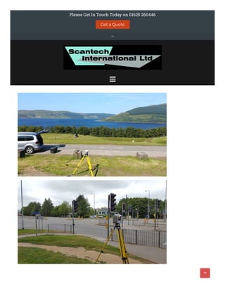
Our Topographical Surveyor will utilise the "best" or most appropriate equipment for the area to be surveyed and this can
include :
Laser scanning for areas where building elevations may be required or where access to the highway would require tra ic
management
Total Stations  to coordinate the scan data and to survey features not captured by the scanner such as manhole covers
hidden by vegetation
GPS to orientate the Survey to OS coordinates
Safety on Site
As Topographic Land Surveyors the safety of our surveyors is paramount and when the topographical survey includes roads the
use of our laser scanners o en eliminates the requirement for tra ic management and road closures as we can o en work on
the pavement. The laser scanner can pick up features that are in the road and avoids the situation o en seen where a surveyor
will try and pick up for example manhole covers in a road by "dodging the tra ic" - never admitted to but o en seen.
Presentation of Data
The presentation of data from topographic surveying and mapping will vary from 2D paper plots through to 3D digital models.
 Prior to any start on site we will agree the deliverable format with the customer to ensure that it is compatible to their so ware
applications and o en we will send trial CAD data through to ensure compatibility. We are also available free of charge (within
reason) to discuss any problems our clients may have with importing the data into their systems
3D digital terrain models are generated within our Autodesk  so ware from which sectional information and complex volumetric
(cut and fill) models can be generated.  As this so ware calculates volumes automatically using a single, intelligent model, it is
both extremely fast and accurate. This model creates relationships between objects so that design changes update without
further intervention.  In other words, a change to one part of the design can propagate throughout an entire project.
TOPOGRAPHICAL SURVEYS

Our Quality Management System covers all aspects of the data acquisition, data processing, management and presentation
process.  A registry of drawing reference and revisions forms the basis of our quality system and all stages of the survey and
deliverable works are independently checked by senior management.
Please Contact us to see how we could help you
GET A QUOTE
ABOUT US
topographical examples
FOLLOW US ON SOCIAL MEDIA FOR
PROMOTIONS, NEWS & EXCITING PROJECTS 
     
CONTACT US
01625 260446
keith.mccrory@scantech-international.com


ScanTech International Ltd is a limited Company registered in England and Wales with Company No. 4370185 and VAT No
784028320 and does not accept legal responsibility for the contents of this Website. The viewer is responsible for verifying its
authenticity before acting on the contents. Registered O ice : Hillside, 2 Murrayfield, Prestbury, Cheshire SK10 4BZ
Sitemap
Home
Sectors
Railway Surveys
Railway Gauging
Tunnel Condition Evaluation and Monitoring
BIM Surveys
Process Plant Surveys
Highway Surveys
Heritage
Drone Surveying
Train Model
Land Surveys
Point Cloud Survey
Services
3D Laser Scanning services
BIM Modelling
Topographical Surveys
Setting-out

Proudly powered by WordPress | Theme: Sydney by aThemes.
Measured Building Surveys
Asset Management and 3D Laser Scanning
Elevation Survey
Engineering Surveys
Case Studies
CS – Harringworth Viaduct
CS – Manchester Victoria Station
CS – Twickenham Stadium
CS – Kings College London
CS – Lordhope
CS – Waste Water Treatment Works
My blog
Contact Us

Topographical Survey UK & Topographical Survey in Europe

More Related Content

Similar to Topographical Survey UK & Topographical Survey in Europe

AABSyS Information Technology Private Limited - A GIS, CAD and Software Company
AABSyS Information Technology Private Limited - A GIS, CAD and Software CompanyAABSyS Information Technology Private Limited - A GIS, CAD and Software Company
AABSyS Information Technology Private Limited - A GIS, CAD and Software Companywebaabsys
 
OSL BIMevoke statement
OSL BIMevoke statementOSL BIMevoke statement
OSL BIMevoke statementOSL Rail Ltd
 
Coastway SCAN to BIM Presentation may 25th cita
Coastway SCAN to BIM Presentation may 25th citaCoastway SCAN to BIM Presentation may 25th cita
Coastway SCAN to BIM Presentation may 25th citaCoastway
 
Coastway SCAN to BIM Presentation may 25th cita
Coastway SCAN to BIM Presentation may 25th citaCoastway SCAN to BIM Presentation may 25th cita
Coastway SCAN to BIM Presentation may 25th citaCoastway
 
Geospatial services
Geospatial servicesGeospatial services
Geospatial servicesSai S
 
Revolutionize Your Projects with Falcon Survey's 3D Laser Scanning Survey Ser...
Revolutionize Your Projects with Falcon Survey's 3D Laser Scanning Survey Ser...Revolutionize Your Projects with Falcon Survey's 3D Laser Scanning Survey Ser...
Revolutionize Your Projects with Falcon Survey's 3D Laser Scanning Survey Ser...falconsurveyme
 
Laser Scanning SOQ.PDF
Laser Scanning SOQ.PDFLaser Scanning SOQ.PDF
Laser Scanning SOQ.PDFVenugopal Raju
 
MAPS GEOSYSTEM PROFILE 2015
MAPS GEOSYSTEM PROFILE 2015MAPS GEOSYSTEM PROFILE 2015
MAPS GEOSYSTEM PROFILE 2015SURAJ CHOUDHARY
 
3D Laser Scanning – All You Should Know About
3D Laser Scanning – All You Should Know About3D Laser Scanning – All You Should Know About
3D Laser Scanning – All You Should Know AboutKevinSmith511452
 
SJ Geomatics Brochure
SJ Geomatics BrochureSJ Geomatics Brochure
SJ Geomatics BrochureSteve Jones
 
\'Monitoring Services\' CPD Presentation
\'Monitoring Services\' CPD Presentation\'Monitoring Services\' CPD Presentation
\'Monitoring Services\' CPD Presentationianedwardjohnson
 
Six D India Technical Detail
Six D India Technical DetailSix D India Technical Detail
Six D India Technical DetailSangiba Sangiba
 
LesterFranks-CompanyProfile-2015-Web
LesterFranks-CompanyProfile-2015-WebLesterFranks-CompanyProfile-2015-Web
LesterFranks-CompanyProfile-2015-WebJustin Legg
 

Similar to Topographical Survey UK & Topographical Survey in Europe (20)

EN_3DLS_Oil_Gas_Offshore
EN_3DLS_Oil_Gas_OffshoreEN_3DLS_Oil_Gas_Offshore
EN_3DLS_Oil_Gas_Offshore
 
AABSyS Information Technology Private Limited - A GIS, CAD and Software Company
AABSyS Information Technology Private Limited - A GIS, CAD and Software CompanyAABSyS Information Technology Private Limited - A GIS, CAD and Software Company
AABSyS Information Technology Private Limited - A GIS, CAD and Software Company
 
OSL BIMevoke statement
OSL BIMevoke statementOSL BIMevoke statement
OSL BIMevoke statement
 
3D Laser Scaning FPSO Mystras
3D Laser Scaning FPSO Mystras3D Laser Scaning FPSO Mystras
3D Laser Scaning FPSO Mystras
 
3D Laser Scaning FPSO Mystras
3D Laser Scaning FPSO Mystras3D Laser Scaning FPSO Mystras
3D Laser Scaning FPSO Mystras
 
Coastway SCAN to BIM Presentation may 25th cita
Coastway SCAN to BIM Presentation may 25th citaCoastway SCAN to BIM Presentation may 25th cita
Coastway SCAN to BIM Presentation may 25th cita
 
Coastway SCAN to BIM Presentation may 25th cita
Coastway SCAN to BIM Presentation may 25th citaCoastway SCAN to BIM Presentation may 25th cita
Coastway SCAN to BIM Presentation may 25th cita
 
Geospatial services
Geospatial servicesGeospatial services
Geospatial services
 
3D Laser Scanning FPSO Mystras
3D Laser Scanning FPSO Mystras3D Laser Scanning FPSO Mystras
3D Laser Scanning FPSO Mystras
 
Revolutionize Your Projects with Falcon Survey's 3D Laser Scanning Survey Ser...
Revolutionize Your Projects with Falcon Survey's 3D Laser Scanning Survey Ser...Revolutionize Your Projects with Falcon Survey's 3D Laser Scanning Survey Ser...
Revolutionize Your Projects with Falcon Survey's 3D Laser Scanning Survey Ser...
 
Laser Scanning SOQ.PDF
Laser Scanning SOQ.PDFLaser Scanning SOQ.PDF
Laser Scanning SOQ.PDF
 
Building Technology
Building TechnologyBuilding Technology
Building Technology
 
MAPS GEOSYSTEM PROFILE 2015
MAPS GEOSYSTEM PROFILE 2015MAPS GEOSYSTEM PROFILE 2015
MAPS GEOSYSTEM PROFILE 2015
 
3D Laser Scanning – All You Should Know About
3D Laser Scanning – All You Should Know About3D Laser Scanning – All You Should Know About
3D Laser Scanning – All You Should Know About
 
SJ Geomatics Brochure
SJ Geomatics BrochureSJ Geomatics Brochure
SJ Geomatics Brochure
 
\'Monitoring Services\' CPD Presentation
\'Monitoring Services\' CPD Presentation\'Monitoring Services\' CPD Presentation
\'Monitoring Services\' CPD Presentation
 
Six D India Technical Detail
Six D India Technical DetailSix D India Technical Detail
Six D India Technical Detail
 
R&d tools for marine, process & energy
R&d tools  for marine, process & energyR&d tools  for marine, process & energy
R&d tools for marine, process & energy
 
LesterFranks-CompanyProfile-2015-Web
LesterFranks-CompanyProfile-2015-WebLesterFranks-CompanyProfile-2015-Web
LesterFranks-CompanyProfile-2015-Web
 
Who we are
Who we areWho we are
Who we are
 

Recently uploaded

Leverage Zilliz Serverless - Up to 50X Saving for Your Vector Storage Cost
Leverage Zilliz Serverless - Up to 50X Saving for Your Vector Storage CostLeverage Zilliz Serverless - Up to 50X Saving for Your Vector Storage Cost
Leverage Zilliz Serverless - Up to 50X Saving for Your Vector Storage CostZilliz
 
The Future of Software Development - Devin AI Innovative Approach.pdf
The Future of Software Development - Devin AI Innovative Approach.pdfThe Future of Software Development - Devin AI Innovative Approach.pdf
The Future of Software Development - Devin AI Innovative Approach.pdfSeasiaInfotech2
 
Kotlin Multiplatform & Compose Multiplatform - Starter kit for pragmatics
Kotlin Multiplatform & Compose Multiplatform - Starter kit for pragmaticsKotlin Multiplatform & Compose Multiplatform - Starter kit for pragmatics
Kotlin Multiplatform & Compose Multiplatform - Starter kit for pragmaticscarlostorres15106
 
Story boards and shot lists for my a level piece
Story boards and shot lists for my a level pieceStory boards and shot lists for my a level piece
Story boards and shot lists for my a level piececharlottematthew16
 
Artificial intelligence in cctv survelliance.pptx
Artificial intelligence in cctv survelliance.pptxArtificial intelligence in cctv survelliance.pptx
Artificial intelligence in cctv survelliance.pptxhariprasad279825
 
"Federated learning: out of reach no matter how close",Oleksandr Lapshyn
"Federated learning: out of reach no matter how close",Oleksandr Lapshyn"Federated learning: out of reach no matter how close",Oleksandr Lapshyn
"Federated learning: out of reach no matter how close",Oleksandr LapshynFwdays
 
Vector Databases 101 - An introduction to the world of Vector Databases
Vector Databases 101 - An introduction to the world of Vector DatabasesVector Databases 101 - An introduction to the world of Vector Databases
Vector Databases 101 - An introduction to the world of Vector DatabasesZilliz
 
AI as an Interface for Commercial Buildings
AI as an Interface for Commercial BuildingsAI as an Interface for Commercial Buildings
AI as an Interface for Commercial BuildingsMemoori
 
SIP trunking in Janus @ Kamailio World 2024
SIP trunking in Janus @ Kamailio World 2024SIP trunking in Janus @ Kamailio World 2024
SIP trunking in Janus @ Kamailio World 2024Lorenzo Miniero
 
Install Stable Diffusion in windows machine
Install Stable Diffusion in windows machineInstall Stable Diffusion in windows machine
Install Stable Diffusion in windows machinePadma Pradeep
 
Powerpoint exploring the locations used in television show Time Clash
Powerpoint exploring the locations used in television show Time ClashPowerpoint exploring the locations used in television show Time Clash
Powerpoint exploring the locations used in television show Time Clashcharlottematthew16
 
DevoxxFR 2024 Reproducible Builds with Apache Maven
DevoxxFR 2024 Reproducible Builds with Apache MavenDevoxxFR 2024 Reproducible Builds with Apache Maven
DevoxxFR 2024 Reproducible Builds with Apache MavenHervé Boutemy
 
SAP Build Work Zone - Overview L2-L3.pptx
SAP Build Work Zone - Overview L2-L3.pptxSAP Build Work Zone - Overview L2-L3.pptx
SAP Build Work Zone - Overview L2-L3.pptxNavinnSomaal
 
Dev Dives: Streamline document processing with UiPath Studio Web
Dev Dives: Streamline document processing with UiPath Studio WebDev Dives: Streamline document processing with UiPath Studio Web
Dev Dives: Streamline document processing with UiPath Studio WebUiPathCommunity
 
WordPress Websites for Engineers: Elevate Your Brand
WordPress Websites for Engineers: Elevate Your BrandWordPress Websites for Engineers: Elevate Your Brand
WordPress Websites for Engineers: Elevate Your Brandgvaughan
 
DevEX - reference for building teams, processes, and platforms
DevEX - reference for building teams, processes, and platformsDevEX - reference for building teams, processes, and platforms
DevEX - reference for building teams, processes, and platformsSergiu Bodiu
 
Unleash Your Potential - Namagunga Girls Coding Club
Unleash Your Potential - Namagunga Girls Coding ClubUnleash Your Potential - Namagunga Girls Coding Club
Unleash Your Potential - Namagunga Girls Coding ClubKalema Edgar
 
"LLMs for Python Engineers: Advanced Data Analysis and Semantic Kernel",Oleks...
"LLMs for Python Engineers: Advanced Data Analysis and Semantic Kernel",Oleks..."LLMs for Python Engineers: Advanced Data Analysis and Semantic Kernel",Oleks...
"LLMs for Python Engineers: Advanced Data Analysis and Semantic Kernel",Oleks...Fwdays
 
Unraveling Multimodality with Large Language Models.pdf
Unraveling Multimodality with Large Language Models.pdfUnraveling Multimodality with Large Language Models.pdf
Unraveling Multimodality with Large Language Models.pdfAlex Barbosa Coqueiro
 
New from BookNet Canada for 2024: BNC CataList - Tech Forum 2024
New from BookNet Canada for 2024: BNC CataList - Tech Forum 2024New from BookNet Canada for 2024: BNC CataList - Tech Forum 2024
New from BookNet Canada for 2024: BNC CataList - Tech Forum 2024BookNet Canada
 

Recently uploaded (20)

Leverage Zilliz Serverless - Up to 50X Saving for Your Vector Storage Cost
Leverage Zilliz Serverless - Up to 50X Saving for Your Vector Storage CostLeverage Zilliz Serverless - Up to 50X Saving for Your Vector Storage Cost
Leverage Zilliz Serverless - Up to 50X Saving for Your Vector Storage Cost
 
The Future of Software Development - Devin AI Innovative Approach.pdf
The Future of Software Development - Devin AI Innovative Approach.pdfThe Future of Software Development - Devin AI Innovative Approach.pdf
The Future of Software Development - Devin AI Innovative Approach.pdf
 
Kotlin Multiplatform & Compose Multiplatform - Starter kit for pragmatics
Kotlin Multiplatform & Compose Multiplatform - Starter kit for pragmaticsKotlin Multiplatform & Compose Multiplatform - Starter kit for pragmatics
Kotlin Multiplatform & Compose Multiplatform - Starter kit for pragmatics
 
Story boards and shot lists for my a level piece
Story boards and shot lists for my a level pieceStory boards and shot lists for my a level piece
Story boards and shot lists for my a level piece
 
Artificial intelligence in cctv survelliance.pptx
Artificial intelligence in cctv survelliance.pptxArtificial intelligence in cctv survelliance.pptx
Artificial intelligence in cctv survelliance.pptx
 
"Federated learning: out of reach no matter how close",Oleksandr Lapshyn
"Federated learning: out of reach no matter how close",Oleksandr Lapshyn"Federated learning: out of reach no matter how close",Oleksandr Lapshyn
"Federated learning: out of reach no matter how close",Oleksandr Lapshyn
 
Vector Databases 101 - An introduction to the world of Vector Databases
Vector Databases 101 - An introduction to the world of Vector DatabasesVector Databases 101 - An introduction to the world of Vector Databases
Vector Databases 101 - An introduction to the world of Vector Databases
 
AI as an Interface for Commercial Buildings
AI as an Interface for Commercial BuildingsAI as an Interface for Commercial Buildings
AI as an Interface for Commercial Buildings
 
SIP trunking in Janus @ Kamailio World 2024
SIP trunking in Janus @ Kamailio World 2024SIP trunking in Janus @ Kamailio World 2024
SIP trunking in Janus @ Kamailio World 2024
 
Install Stable Diffusion in windows machine
Install Stable Diffusion in windows machineInstall Stable Diffusion in windows machine
Install Stable Diffusion in windows machine
 
Powerpoint exploring the locations used in television show Time Clash
Powerpoint exploring the locations used in television show Time ClashPowerpoint exploring the locations used in television show Time Clash
Powerpoint exploring the locations used in television show Time Clash
 
DevoxxFR 2024 Reproducible Builds with Apache Maven
DevoxxFR 2024 Reproducible Builds with Apache MavenDevoxxFR 2024 Reproducible Builds with Apache Maven
DevoxxFR 2024 Reproducible Builds with Apache Maven
 
SAP Build Work Zone - Overview L2-L3.pptx
SAP Build Work Zone - Overview L2-L3.pptxSAP Build Work Zone - Overview L2-L3.pptx
SAP Build Work Zone - Overview L2-L3.pptx
 
Dev Dives: Streamline document processing with UiPath Studio Web
Dev Dives: Streamline document processing with UiPath Studio WebDev Dives: Streamline document processing with UiPath Studio Web
Dev Dives: Streamline document processing with UiPath Studio Web
 
WordPress Websites for Engineers: Elevate Your Brand
WordPress Websites for Engineers: Elevate Your BrandWordPress Websites for Engineers: Elevate Your Brand
WordPress Websites for Engineers: Elevate Your Brand
 
DevEX - reference for building teams, processes, and platforms
DevEX - reference for building teams, processes, and platformsDevEX - reference for building teams, processes, and platforms
DevEX - reference for building teams, processes, and platforms
 
Unleash Your Potential - Namagunga Girls Coding Club
Unleash Your Potential - Namagunga Girls Coding ClubUnleash Your Potential - Namagunga Girls Coding Club
Unleash Your Potential - Namagunga Girls Coding Club
 
"LLMs for Python Engineers: Advanced Data Analysis and Semantic Kernel",Oleks...
"LLMs for Python Engineers: Advanced Data Analysis and Semantic Kernel",Oleks..."LLMs for Python Engineers: Advanced Data Analysis and Semantic Kernel",Oleks...
"LLMs for Python Engineers: Advanced Data Analysis and Semantic Kernel",Oleks...
 
Unraveling Multimodality with Large Language Models.pdf
Unraveling Multimodality with Large Language Models.pdfUnraveling Multimodality with Large Language Models.pdf
Unraveling Multimodality with Large Language Models.pdf
 
New from BookNet Canada for 2024: BNC CataList - Tech Forum 2024
New from BookNet Canada for 2024: BNC CataList - Tech Forum 2024New from BookNet Canada for 2024: BNC CataList - Tech Forum 2024
New from BookNet Canada for 2024: BNC CataList - Tech Forum 2024
 

Topographical Survey UK & Topographical Survey in Europe

  • 1.  Please Get In Touch Today on 01625 260446 Get a Quote  
  • 2. Topographical Survey UK (or Europe) Whether a site is subject to a change of use or is planned for development, a high quality Topographical Survey and an up to date plan represents an essential basis for assessment, planning and subsequent design works.  This plan and its derivatives will most likely be an integral part of the whole development project life-cycle and must therefore be of an appropriate accuracy and detail. If our client does not have a detailed specification we can provide a Topographic Survey template and we encourage our client’s involvement in the further definition of the survey specification. This may be simply a check-list approach to the level of survey detail or a more detailed specification such as in  the RICS Specification Guidelines standard. Topographic Surveying Our Topographical Surveyor will utilise the "best" or most appropriate equipment for the area to be surveyed and this can include : Laser scanning for areas where building elevations may be required or where access to the highway would require tra ic management Total Stations  to coordinate the scan data and to survey features not captured by the scanner such as manhole covers hidden by vegetation GPS to orientate the Survey to OS coordinates Safety on Site As Topographic Land Surveyors the safety of our surveyors is paramount and when the topographical survey includes roads the use of our laser scanners o en eliminates the requirement for tra ic management and road closures as we can o en work on the pavement. The laser scanner can pick up features that are in the road and avoids the situation o en seen where a surveyor will try and pick up for example manhole covers in a road by "dodging the tra ic" - never admitted to but o en seen. Presentation of Data The presentation of data from topographic surveying and mapping will vary from 2D paper plots through to 3D digital models.  Prior to any start on site we will agree the deliverable format with the customer to ensure that it is compatible to their so ware applications and o en we will send trial CAD data through to ensure compatibility. We are also available free of charge (within reason) to discuss any problems our clients may have with importing the data into their systems 3D digital terrain models are generated within our Autodesk  so ware from which sectional information and complex volumetric (cut and fill) models can be generated.  As this so ware calculates volumes automatically using a single, intelligent model, it is both extremely fast and accurate. This model creates relationships between objects so that design changes update without further intervention.  In other words, a change to one part of the design can propagate throughout an entire project. TOPOGRAPHICAL SURVEYS 
  • 3. Our Quality Management System covers all aspects of the data acquisition, data processing, management and presentation process.  A registry of drawing reference and revisions forms the basis of our quality system and all stages of the survey and deliverable works are independently checked by senior management. Please Contact us to see how we could help you GET A QUOTE ABOUT US topographical examples FOLLOW US ON SOCIAL MEDIA FOR PROMOTIONS, NEWS & EXCITING PROJECTS 
  • 4.       CONTACT US 01625 260446 keith.mccrory@scantech-international.com   ScanTech International Ltd is a limited Company registered in England and Wales with Company No. 4370185 and VAT No 784028320 and does not accept legal responsibility for the contents of this Website. The viewer is responsible for verifying its authenticity before acting on the contents. Registered O ice : Hillside, 2 Murrayfield, Prestbury, Cheshire SK10 4BZ Sitemap Home Sectors Railway Surveys Railway Gauging Tunnel Condition Evaluation and Monitoring BIM Surveys Process Plant Surveys Highway Surveys Heritage Drone Surveying Train Model Land Surveys Point Cloud Survey Services 3D Laser Scanning services BIM Modelling Topographical Surveys Setting-out 
  • 5. Proudly powered by WordPress | Theme: Sydney by aThemes. Measured Building Surveys Asset Management and 3D Laser Scanning Elevation Survey Engineering Surveys Case Studies CS – Harringworth Viaduct CS – Manchester Victoria Station CS – Twickenham Stadium CS – Kings College London CS – Lordhope CS – Waste Water Treatment Works My blog Contact Us 