Mangrove conservation planning using remote sensing
•Download as PPTX, PDF•
5 likes•492 views

This document discusses using remote sensing for mangrove conservation planning. It provides examples of using Landsat satellite imagery to analyze mangrove area and density changes over time in locations like the Philippines and India. Remote sensing techniques like NDVI analysis and image classification are used to measure and monitor mangrove degradation. The document concludes that while remote sensing provides a qualitative assessment, the quality depends on access, time, and funds, and understanding mangroves is key to conserving them.

Recommended
Recommended
More Related Content
What's hot
What's hot (20)
Similar to Mangrove conservation planning using remote sensing
Similar to Mangrove conservation planning using remote sensing (20)
Recently uploaded
Recently uploaded (20)
Mangrove conservation planning using remote sensing
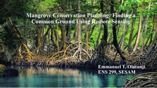
- 1. Mangrove Conservation Planning: Finding a Common Ground Using Remote Sensing Emmanuel T. Olatunji ENS 299, SESAM
- 2. Global Distribution of Mangroves
- 5. Google image
- 6. Comparison of areal estimates of mangrove forest for the Philippines. Dates indicate year of estimate. (Long and Giri 2011) Philippines Mangrove Status
- 7. Conservation
- 8. What is conservation? “Man living in harmony with nature”- Leopold T. Enders and J. Anderson theory of conservation Local communities' interest in forest conservation depends at least to some degree on how much they are still part of the ecosystem and how much their management of resources directly affects their own survival. David C. Korten theory of conservation- A learning process approach
- 9. What option do we have REMOTE SENSING
- 10. What is Remote Sensing? Magic.piktochat.com Acquisition of information about an object or Phenomena without making physical contact. And WHY?
- 12. Common Applicable Data Acquisition Technique Earth Observation Satellite • These thematic mappers take images in multiple wavelengths of electro-magnetic radiation • TMs generated can be used to prospect for minerals, detect or monitor land usage, detect invasive vegetation, deforestation, and examine the health of indigenous plants and crops, including entire farming regions or forests.
- 13. Different Scenarios Using Remote Sensing for Conservation Planning
- 14. Degradation of Mangrove by using Landsat 5 TM and Landsat 8 OLI image Mempawah Regency, West Kalimantan Province year 1989-2014 Khairuddin et al (2016) Objective: Analyze the area and density of the distribution of mangrove in the Mempawah Regency of West Kalimantan Province using NDVI analysis
- 15. Image processing Overlay and display of image Methodology Landsat 5 TM 1989 and Landsat 8 OLI 2014 image
- 16. Landsat Mangrove Area Mangrove density Preprocessing Composite: RGB:453 (Landsat 5) RGB:564 (Landsat 8) Histogram Visual interpretation (On screen digitization) NDVI Subset image Data processing flow chart
- 17. Calculating the Normalized Difference vegetation index 1) NDVI = (Band 5-band 4) / (band 5+Band 4) 2) NIR = Near Infrared (Band 4 on Landsat 5 and Landsat Band 5 to 8) 3) Red = Red (Band 3 on Landsat 5 and Landsat Band 4 to 8) Indonesian National Standard (SNI) 2011
- 18. Determining mangrove canopy density using NDVI. The value of the NDVI classes in reclassification into 3 classes, high, medium and low. KL = (xt-xr)/k Where: KL = class interval, xt = maximum value xr = minimum value k = number of classes This algorithm is applied to the satellite images, to highlight aspects of the density of vegetation or other aspects relating to density, like biomass, Leaf Area Index (LAI), the concentration of chlorophyll.
- 19. Landsat 5 TM 1989 and Landsat 8 OLI image
- 20. Changes in mangrove area and density in the Mempawah Regency
- 21. Conservation of Mangroves in Orissa: Role of Remote Sensing and GIS Pattanaik et al 2010 Objective: Assessment of mangrove forest and its change dynamics in Orissa over 30 years using multi-temporal satellite data.
- 22. METHODOLOGY • Survey of India topo-sheet of 1:50,000 scale and forest management maps were used as reference data • Data sets were co-registered to UTM projection and WGS 84 using ground control points (GCP) • Ground truth collection with the help of false color composite (FCC) hard copy prints, topo- sheets, Global Positioning System (GPS) and magnetic compass • The different tonal variation representing the different classes were marked and rectified on the classified map • The 2 images were overlaid to find the net change in mangrove and other land use
- 23. Mangrove and other land-use categories (ha) in Bhitarkanika mangroves from 1973 to 2004
- 24. Land use land cover categories in Balasore mangroves from 1973 to 2004
- 25. Land use land cover categories in Mahanadi delta mangroves from 1973 to 2004
- 26. Conclusion Most application of the use of Remote sensing are Qualitative. Quality of the result depends of the availability of access to the site, time and funds
- 27. “In the end, we will conserve only what we love, we will love only what we understand, and we will understand only what we are taught.” -Baba Dioum, a Senegalese conservationist
- 28. Gevana D., Garcia K., Malabrigo P., (November 2013) Philippines’ mangrove ecosystem: Status, Threats, and Conservation Kihairuddin B., Yulianda F., Kusmana C., Yonvitner (2016) Degradation mangrove by using landsat 5 TM and Landsat 8 OLI image in mempawah regency, wet kalimanta province year, 1989-2014 Purnamasayangsukasih R. P., Norizah K., Adnan I. A. M., Shamsudin I. (2016) A review of uses of satellite imagery in monitoring mangrove forests Santos L. C. M., Bitencourt D. M., (2016) Remote sensing in the study of Brazilian Mangroves: review, gaps in the knowledge, new perspectives and contributions of management. Journal of integrated coastal zone management Satyanarayana B., Thierry B., Seen Lo D., Raman A. V., Muthusankar G. (November 2001)Remote sensing in mangrove research – Relationship between vegetation indices and dendrometric parameters: A case for coring, East coast of India. National University of Singapore Sudhakar C. R. (January 2010)Conservation of Mangrove in Orissa: Role of Remote sensing and GIS References
Editor's Notes
- Indigenous to Tropics and subtropics countries with 73 species 15.2 million hectares estimated cover 0.4% of total forest Distributed among 123 countries and terrains
- Reliable and timely information on the nature Extent, spatial distribution pattern Temporal behavior of mangrove forests are not available. Are rereq to restoration and management
- Change detection visualization Measurement Facilitates better understand of trends in change Mangrove Sudden change identification Prediction of expected future development Serve as guide to planning and management of mangrove
- Acquisition of information about an object or Phenomina without making physical contact
- Analysis is called Interpretation Hybrid Combination of Visual interpretation for delineation objects & digital analysis for interpretation
- Result: deforested of mangrove area of 250.88 Ha, 174.14 Ha, reforested 565.18 Ha unchanged
- Differences blw the 2 reviewed studies?