SlideShare a Scribd company logo
1 of 82
Chapter Two
The Humid Geomorphic
Environment
GEE-421: GEOMORPHOLOGY-II
Presented by
Md. Nazir Hossain
Lecturer
Geography and Environment
Shahjalal University of Science & Technology
Sylhet-3114, Bangladesh
nazirswapon@gmail.com
Running Water and Streams
Running/flowing water is the result of net
precipitation = {Total precipitation (input) –
Evapotranspiration (output or loss) +
Infiltration}
Running Water
Running Water: Run-off, water flowing on the
surface of earth
Sources of Running Water
 Major sources: rain water & ice caps
 Minor sources: ground water, surface water
Classification of Run-off:
1. Immediate run-off: rain water
2. Delayed run-off: ice, glaciers, water fall, lake etc.
Stream & River
Stream: A stream is a body of water with a current, confined
within a bed and stream banks.
River:
 It is a channelized natural flow of water
 A large natural channel of water; a natural stream of water that
flows through land and empties into a body of water such as an
ocean or lake.
 A river is a natural watercourse usually freshwater, flowing
towards an ocean, a lake, a sea, or another river.
Stream is a small flowing water where as river is a collection of many
streams. A river is larger, deep, longer and wider where as a stream is a thin
shallow.
Terms
Source: origin of stream
Mouth: end at sea/lake
Estuary: wide mouth
Confluence: meeting point of two/more rivers
Doab: middle area of two rivers
River basin: an area of land drained by a river and its
tributaries
Water divide/shed
Origin and Evolution of Streams
Factors of river origin
Availability of sufficient water
Slope of land
Presence of soft rock
Type of climate
Classification of Streams/Rivers
1. Perennial stream : year round
2. Intermittent stream: seasonal
A perennial stream or perennial river is a stream or river
(channel) that has continuous flow in parts of its stream
bed all year round during years of normal rainfall.
An intermittent or seasonal stream is one that only flows
for part of the year.
Classification of Streams/Rivers (Cont…)
Davisian classification…
1. Youthful river: a river with a steep gradient that has very
few tributaries and flows quickly. Its channels erode deeper
rather than wider.
2. Mature river: A river with a gradient that is less steep than
those of youthful rivers and flows more slowly. A mature
river is fed by many tributaries and has more discharge than
a youthful river. Its channels erode wider rather than deeper.
3. Old river: a river with a low gradient and low erosive
energy. Old rivers are characterized by flood plains.
Stages of river
1. Upper/mountain stages
2. Middle/plain stages
3. Low/deltaic stages
Drainage system
A drainage system is the pattern formed by the
streams, rivers, and lakes in a particular drainage
basin.
They are governed by the topography of the land,
whether a particular region is dominated by hard or
soft rocks, and the gradient of the land.
Drainage Patterns
1. Dendritic drainage pattern
2. Parallel drainage pattern
3. Trellis drainage pattern
4. Rectangular drainage pattern
5. Radial drainage pattern
6. Deranged drainage pattern
1. Dendritic drainage pattern
Dendritic drainage systems are the most
common form of drainage system.
In a dendritic system, there are many
contributing streams, which are then joined
together into the tributaries of the main river.
They develop where the river channel
follows the slope of the terrain.
Dendritic systems form in V-shaped valleys;
as a result, the rock types must be
impervious and non-porous.
2. Parallel drainage pattern
A parallel drainage system is a
pattern of rivers caused by steep
slopes with some relief.
Because of the steep slopes, the
streams are swift and straight, with
very few tributaries, and all flow in
the same direction.
Parallel drainage patterns form
where there is a pronounced slope
to the surface.
3. Trellis drainage pattern
The geometry of a trellis drainage
system is similar to that of a
common garden trellis used to
grow vines.
Trellis drainage is characteristic of
folded mountains, such as the
Appalachian Mountains in North
America.
4. Rectangular drainage pattern
Rectangular drainage develops on
rocks that are of approximately
uniform resistance to erosion, but
which have two directions of
jointing at approximately right
angles.
The joints are usually less resistant
to erosion than the bulk rock and
streams eventually develop along
the joints.
5. Radial drainage pattern
In a radial drainage system, the
streams radiate outwards from a
central high point.
Volcanoes usually display excellent
radial drainage.
Other geological features on which
radial drainage commonly develops
are domes and laccoliths.
On these features the drainage may
exhibit a combination of radial
patterns.
6. Deranged drainage pattern
A deranged drainage system is a drainage system in
drainage basins where there is no coherent pattern to the
rivers and lakes.
It happens in areas where there has been much geological
disruption.
Channel Patterns
Major three types are…
1. Straight
 which are found in the most
tectonically active areas.
 This is more of a hypothetical end-
member, and are not often found in
nature.
 Straight-type channels can be found
at alluvial fans.
2. Braided rivers
which form in (tectonically
active) areas that have a larger
sedimentary load than the
discharge of the river.
Channel Patterns
Channel Patterns
3. Meandering rivers,
which form a sinuous path in
a usually low-gradient plain
toward the end of a fluvial
system.
Process of Valley Development
Valley development depends on
Erosional power of main river and their tributaries
Structure and soil type of the area
Stages of river
 Upper/mountain stage
 Middle/Plain stage
 Lower/deltaic stage
River/Stream Processes
Erosional processes of a river conducted by
i. Hydraulic action
ii. Corrosion: erosion by small particles
iii. Attrition: the wearing away of river bed
iv. Solution
Erosional Landform Features
1. V-shaped valley
2. Gorge & Canyon
3. Rapid & Cascade
4. Waterfall
5. Pot hole
6. Meanders
7. River terraces
Erosional Landform features (Cont…)
1. V-shaped valley
 A river valley is usually V-shaped. The exact shape depends on
the characteristics of the stream flowing through it.
 V-Shaped valleys are found in the upper course of the river and
are a result of both erosion by the river and weathering.
 Rivers with steep gradients, as in mountain ranges, produce steep
walls and a bottom. Shallower slopes may produce broader and
gentler valleys.
2. Gorge & Canyon
The word “canyon” is widely used in the United
States, and the term “gorge” is widely used in
Europe.
A canyon is a deep valley having steep sides, and a
gorge is a deep ravine with a river flowing through
it or a ravine without the river.
Canyons have been formed through long periods of
time and frequent erosion from a plateau level.
Gorges are mainly formed because of the flow of
water or lava. Like canyons, the walls of gorges are
also made of sandstone and granite.
Grand Canyon in Arizona and Kali Gandaki in the
Himalayas in Nepal.
Erosional Landform features (Cont…)
3. Rapid & Cascade
Rapids are sections of a river where the river bed has a relatively steep
gradient, causing an increase in water velocity and turbulence.
Cascades is a small waterfall or a series of small waterfalls over steep rocks.
Rapids are hydrological features between a run (a smoothly flowing part of a
stream) and a cascade.
Rapids are characterised by the river becoming shallower with some rocks
exposed above the flow surface.
Rapid Cascade
Erosional landform features (Cont…)
4. Waterfall
 A waterfall is a place where water flows over a vertical drop in
the course of a stream or river.
 Waterfalls also occur where meltwater drops over the edge of a
ice shelf.
 Waterfalls are commonly formed when a river is young.
 Water passes over hard rock and erodes the softer rock below
Erosional Landform features (Cont…)
5. Pot hole
Potholes are cylindrical holes drilled into the bed of a river that
vary in depth & diameter from a few centimetres to several
metres.
They’re found in the upper course of a river where it has enough
potential energy to erode vertically.
It is also a circular hole in the bed of a river produced by
abrasion
Erosional Landform features (Cont…)
6. Meanders:
 A meander, in general, is a bend in a sinuous
watercourse or river.
 A meander forms when moving water in a stream
erodes the outer banks and widens its valley, and the
inner part of the river has less energy and deposits silt.
Erosional landform features (Cont…)
6. Measurement of Meanders:
The sinuosity of a river is a measurement of how much a river
varies from a straight line.
It’s a ratio between the channel length and displacement (straight
line distance) between two points in the river’s course:
Sinuosity Index = Channel Length / Displacement
A sinuosity of 1 (SI=1)
means that the channel is
perfectly straight.
A sinuosity greater than
1 (SI > 1) means that the
river meanders.
Erosional landform features (Cont…)
7. River terraces
 a terrace is a step-like landform.
 terrace consists of a flat or gently sloping
geomorphic surface, called a tread, that is typically
bounded one side by a steeper ascending slop.
River Transportation
Rivers transport material in four ways:
1. Solution - minerals are dissolved in the water and
carried along in solution. This typically occurs in areas
where the underlying bedrock is limestone.
2. Suspension - fine light material is carried along in the
water.
3. Saltation - small pebbles and stones are bounced
along the river bed.
4. Traction - large boulders and rocks are rolled along
the river bed.
Stream Load
 Stream load is a geologic term referring to the
solid matter carried by a stream.
 Erosion and bed shear stress continually remove
mineral material from the bed and banks of the
stream channel, adding this material to the regular
flow of water.
Sedimentation: Types of stream load
Stream load is broken into three types (Ritter, 2006).
1. Dissolved load: Dissolved matter is invisible, and is
transported in the form of chemical ions. All streams carry
some type of dissolved load.
2. Suspended load: Suspended load is composed of fine
sediment particles suspended and transported through the
stream. These materials are too large to be dissolved, but
too small to lie on the bed of the stream
3. Bed load: Bed load rolls slowly along the floor of the
stream.
Sedimentation: Types of stream load (Cont…)
Depositional Landform Features
1. Alluvial fan and cone
2. Bajada/Alluvial slope
3. Piedmont Alluvial plain
4. Incised meander
5. Floodplain
6. Horse-shoe/Ox-bow Lake
7. Sandbars
8. Natural levees
9. Back slope & Back swamp
10. Delta
Depositional Landform Features (Cont…)
1. Alluvial fan and cone
 Alluvial fan and cone: An alluvial
fan is a fan- or cone- shaped deposit
of sediment crossed and built up by
streams.
 Alluvial cone: An alluvial fan with
steep slopes
Depositional Landform Features (Cont…)
2. Bajada/Alluvial slope
 Bajada (Spanish “slope”) also spelled Bahada, broad slope of
debris spread along the lower slopes of mountains by
descending streams, usually found in arid or semiarid climates;
the term was adopted because of its use in the U.S. Southwest.
 A surface of alluvium which slopes down from mountainsides
and merges with the plain or broad valley floor.
Depositional Landform Features (Cont…)
3. Piedmont Alluvial plain
An alluvial plain is a largely flat landform created by the
deposition of sediment over a long period of time by one or
more rivers coming from highland regions, from which
alluvial soil forms.
Depositional Landform Features (Cont…)
4. Incised meander
a river meander which has been cut abnormally
deeply into the landscape because uplift of the land
has led to renewed downward erosion by the river.
Depositional Landform Features (Cont…)
5. Flood plain
 An area of low-lying ground adjacent to a river, formed
mainly of river sediments and subject to flooding
 A floodplain or flood plain is an area of land adjacent to a
stream or river that stretches from the banks of its channel
to the base of the enclosing valley walls and experiences
flooding during periods of high discharge.
Depositional Landform Features (Cont…)
6. Horse-shoe/Ox-bow Lake
 An oxbow lake is a U-shaped body of water that
forms when a wide meander from the main stem of a
river is cut off, creating a free-standing body of
water.
 This landform is so named for its distinctive curved
shape, resembling the bow pin of an oxbow.
Depositional Landform Features (Cont…)
7. Sandbars
 A sandbar or gravel bar, is a characteristically linear
landform completely within or extending into a body
of water.
 It is typically composed of sand, silt, and/or small
pebbles.
Depositional Landform Features (Cont…)
8. Natural levees
 A natural levee (or dyke), embankment, flood bank or stop
bank is an elongated naturally occurring ridge or wall,
which regulates water levels.
 It is usually earthen and often parallel to the course of a
river in its floodplain or along low-lying coastlines.
Depositional Landform Features (Cont…)
8. Natural levees
Depositional Landform Features (Cont…)
9. Back slope & Back Swamp/Marshes
 Back slope is the back part of a natural levee.
 Back swamp is the section of a floodplain where
deposits of fine silts and clays settle after a flood.
Back swamps usually lie behind a stream's natural
levees.
Back slope
Depositional Landform Features (Cont…)
10. Delta
 A river delta is a landform that forms at the mouth of a
river, where the river flows into an ocean, sea, estuary,
lake, or reservoir.
 Deltas form from deposition of sediment carried by a
river as the flow leaves its mouth.
World well-known deltas
Delta Types
Classification according to the shape of river delta
1. Arcuate type delta
2. Birds foot delta
3. Estuarine delta
4. Cuspate delta
5. Fan shaped delta
Delta Types (Cont…)
Arcuate type: like delta or bah (ব) in Bangla
 Arcuate deltas are triangular in
shape, like the Nile River's delta.
 This shape, resembling the Greek
alphabet's fourth letter, gave
deltas their name.
 Arcuate deltas usually have
smooth coastlines because of the
wave action and how they are
formed.
Delta Types (Cont…)
Birds foot Delta
 Bird-foot deltas have long finger-like projections that
reach out to the sea, like the Mississippi River's delta.
 The bird-foot delta is named for its long thin shape,
much like a bird's toe.
 These deltas might have broad, shallow shelves.
Delta Types (Cont…)
Estuarine Delta
Estuarine deltas form when a river flows into a large
estuary that will fill with sediment, as is the case
with France's Seine River.
Delta Types (Cont…)
Cuspate delta: when river elongated to sea
 Cuspate deltas extend to the sea as a V shape with long
curving sides, like the Tiber River's delta (Italy).
 The cuspate delta tends to form when one river or stream
empties into a flat coastline where it encounters a direct hit
from waves. This action forms its tooth-like shape.
Delta Types (Cont…)
Fan shaped delta: like alluvial fan
Flood
When the high flow of water overtops the natural or artificial
banks of a stream and inundates the adjacent areas is called flood.
In Bangladesh, the definition of flood appears differently. During
the rainy season when the water flow exceeds the holding capacity
of rivers, canals, beels, haors, low-lying areas it inundates the
whole area causing damage to crops, homesteads, roads and other
properties is known as flood.
Flood Prone Countries of the World
China
Bangladesh
India,
Indonesia,
Vietnam,
Cambodia,
Philippines,
Myanmar,
Brazil,
Netherlands,
Pakistan,
Eastern African countries
Flood in Bangladesh
Flood is common phenomena in Bangladesh.
Each year about 26,000 km2, (around 18%) of the country is
flooded.
During severe floods the affected area may exceed 75% of the
country, as was seen in 1998. This volume was 95% of the
total annual inflow.
The floods have caused devastation in Bangladesh throughout
history, especially during the years 1955, 1966, 1987, 1988
and 1998.
The 2007 and 2010 also affected a large portion of
Bangladesh.
Flooded area of Bangladesh in different year
Source: FFWC, 2009
Types of Floods
1. Monsoon flood: It is a seasonal flood, increases slowly
and decreases slowly, inundates vast areas and causes
huge losses to life and property.
2. Flash Flood: The flood is rapid characteristics. Water
increases and decreases suddenly, generally happen in the
valleys of the hilly areas.
3. Tidal flood: Storm surge flood is a coastal phenomenon
forced by cyclones hitting the coastline. Duration of this
flood is short; height is generally 3m to 6m but very
catastrophic in characteristics.
Floods
Monsoon flood
Flash Flood
Tidal flood
In general classification
Riverine flooding
Rain-fed flooding
Coastal flooding
Urban flooding: A few days to weeks
Types of floods (Cont…)
Flood Prone Area of Bangladesh
Causes of Flooding
 Physical causes of floods
 Low lying flat topography
 Being drainage outlet
 Excessive rainfall during monsoon
 Snow-melting in the Himalayas
 River siltation/landslides
 Synchronization of major river peaks and influences of one
river on the other
 Tidal and wind effects on slowing down the river outflow
(backwater effect)
 Being floodplain
Features of the Bangladesh Delta
The Brahmaputra, Ganges and Meghna basins
Causes of Flooding (Cont…)
 Human induced Causes of the Floods
 Increasing population pressure, unplanned settlements &
urbanization
 Construction of barrages and protective works
 Deforestation in the upper riverine countries.
 Infrastructure development without adequate drainage facilities.
 Lack of financial capital means.
 Poorly maintained embankments (levees) leak & collapse in times
of high discharge.
 Urbanization of the flood plain has increased magnitude &
frequency of floods.
 The building of dams in India
Common Consequences of Flooding
1. Economy
 Economic loss, e.g. house, crops, livestock,
 Reconstruction and rehabilitation cost
2. Environment
 Traffic: damages of roads, collapse of bridges or traffic
congestion,
 Damaging the farmland
3. Human lives
4. Diseases, e.g. fever, pneumonic plague, dermatopathia,
dysentery, common cold, break bone fever
5. Effect on food production
6. Livestock and Poultry
Common Consequences of Flooding
Common Consequences of Flooding (Cont…)
In terms of duration of effects…
1. Short-term Consequences: losses of lives, damages of
crops, property, livestock etc.
2. Long-term Consequences: famine due to damages of
food grain, environmental degradation, e.g. due to salinity
intrusion, river bank erosion, others.
Deadliest floods due to flood in the world
Death toll (Lac) Event Location Date
25–37 1931 China floods China 1931
9–20 1887 Yellow River (Huang He) flood China 1887
5–7 1938 Yellow River (Huang He) flood China 1938
2.3
Banqiao Dam failure, result of
Typhoon Nina
China 1975
2.3 Indian Ocean tsunami Indonesia 2004
1.45 1935 Yangtze river flood China 1935
1+ St. Felix's Flood, storm surge Netherlands 1530
1 Hanoi and Red River Delta flood
North
Vietnam
1971
1 1911 Yangtze river flood China 1911
Source: Myaux, J A et al., 1997
Positive effects of flooding
• Normal flood fertile agricultural land
• This deposition of silt also creates land upon which people
can live- for example the Ganges delta.
• Clean the environment by washing away the garbage, dust
and non-disposal materials.
• Increase waterway/navigation
Flood Management
A systematic and well-organized programme is
necessary against flood disaster.
Measures that can be adopted for flood damage
mitigation can be classified into two categories.
1. Structural measures
2. Non-structural measures
Structural Measures
Structural measures aim at protecting an area up to
certain level of flooding. It can be divided into five
categories:
i. Storage reservoir or basins to control overflow.
ii. Levees and floodwalls to confine floodwaters.
iii. Improvement of channel capacity.
iv. Flood diversion through bypasses.
Structural Measures
Examples of structural Measures:
• Embankments & Dykes
• Flood drainage & pumping system
• Flood control gates
• Flood proofing
• Channel improvement etc.
• Construction of flood shelters
Flood
control
measures
Embankments of Bangladesh Source: LGED, 2006
Non-structural Measures
Non-structural measures are aimed at reduction of loss due to flood
by administrative measures. Some of the non-structural measures
are:
Examples of Non-structural Measures
• Awareness building
• Early warning
• Legal framework
• Training & Education
• Incentives
• Relief and rehabilitation
• Legal framework
• Flood zonation & land management
Relief operation
Next Lecture
Third Chapter
81
Thanks To All
82

More Related Content

What's hot

River Channel Processes & Landforms
River Channel Processes & LandformsRiver Channel Processes & Landforms
River Channel Processes & LandformsMalia Damit
 
Hill slope erosion
Hill slope erosionHill slope erosion
Hill slope erosionManjit Das
 
Hydrology and Fluvial Geo morphology for CAMBRIDGE AS level
Hydrology and Fluvial Geo morphology for CAMBRIDGE AS level Hydrology and Fluvial Geo morphology for CAMBRIDGE AS level
Hydrology and Fluvial Geo morphology for CAMBRIDGE AS level Yonas Gemeda
 
Aeolian processes and landforms
Aeolian processes and landformsAeolian processes and landforms
Aeolian processes and landformsPramoda Raj
 
Fluvial depositional landform geomorphology
Fluvial depositional  landform geomorphologyFluvial depositional  landform geomorphology
Fluvial depositional landform geomorphologyShivam Jain
 
Erosional and depositional landforms
Erosional and depositional landformsErosional and depositional landforms
Erosional and depositional landformsMd. Saiful Islam
 
River Landform
River LandformRiver Landform
River Landformaikyatha
 
Geomorophology presentation
Geomorophology presentationGeomorophology presentation
Geomorophology presentationNigatu G-medhin
 
Drainage pattern and their significance
Drainage pattern and their significanceDrainage pattern and their significance
Drainage pattern and their significanceAvinashAvi110
 
Drainage pattern & morphometric analyses of drainage basins
Drainage pattern & morphometric analyses of drainage basinsDrainage pattern & morphometric analyses of drainage basins
Drainage pattern & morphometric analyses of drainage basinsUjjavalPatel16
 
Hydraulic geometry of a river
Hydraulic geometry of a riverHydraulic geometry of a river
Hydraulic geometry of a riverLalit Thakare
 
aeolian landforms
 aeolian landforms aeolian landforms
aeolian landformsPramoda Raj
 
Karst topography
Karst topographyKarst topography
Karst topographyShivam Jain
 
Fundmetal concepts of geomorphology
Fundmetal concepts of geomorphologyFundmetal concepts of geomorphology
Fundmetal concepts of geomorphologyNikhil Sherekar
 

What's hot (20)

Fluvial processes and landforms
Fluvial processes and landformsFluvial processes and landforms
Fluvial processes and landforms
 
River Channel Processes & Landforms
River Channel Processes & LandformsRiver Channel Processes & Landforms
River Channel Processes & Landforms
 
Hill slope erosion
Hill slope erosionHill slope erosion
Hill slope erosion
 
Hydrology and Fluvial Geo morphology for CAMBRIDGE AS level
Hydrology and Fluvial Geo morphology for CAMBRIDGE AS level Hydrology and Fluvial Geo morphology for CAMBRIDGE AS level
Hydrology and Fluvial Geo morphology for CAMBRIDGE AS level
 
Aeolian processes and landforms
Aeolian processes and landformsAeolian processes and landforms
Aeolian processes and landforms
 
Fluvial depositional landform geomorphology
Fluvial depositional  landform geomorphologyFluvial depositional  landform geomorphology
Fluvial depositional landform geomorphology
 
Erosional and depositional landforms
Erosional and depositional landformsErosional and depositional landforms
Erosional and depositional landforms
 
River Landform
River LandformRiver Landform
River Landform
 
Geomorophology presentation
Geomorophology presentationGeomorophology presentation
Geomorophology presentation
 
Drainage Basins
Drainage BasinsDrainage Basins
Drainage Basins
 
Groundwater
GroundwaterGroundwater
Groundwater
 
Drainage pattern and their significance
Drainage pattern and their significanceDrainage pattern and their significance
Drainage pattern and their significance
 
Drainage pattern & morphometric analyses of drainage basins
Drainage pattern & morphometric analyses of drainage basinsDrainage pattern & morphometric analyses of drainage basins
Drainage pattern & morphometric analyses of drainage basins
 
Hydraulic geometry of a river
Hydraulic geometry of a riverHydraulic geometry of a river
Hydraulic geometry of a river
 
Coastal processes and landforms
Coastal processes and landformsCoastal processes and landforms
Coastal processes and landforms
 
River Profiles
River ProfilesRiver Profiles
River Profiles
 
aeolian landforms
 aeolian landforms aeolian landforms
aeolian landforms
 
Karst topography
Karst topographyKarst topography
Karst topography
 
Fundmetal concepts of geomorphology
Fundmetal concepts of geomorphologyFundmetal concepts of geomorphology
Fundmetal concepts of geomorphology
 
concepts of Geomorphology by Thornbury
concepts of Geomorphology by Thornbury concepts of Geomorphology by Thornbury
concepts of Geomorphology by Thornbury
 

Viewers also liked

Remote sensing and image interpretation
Remote sensing and image interpretationRemote sensing and image interpretation
Remote sensing and image interpretationMd. Nazir Hossain
 
Balancing chemical equations concepts
Balancing chemical equations conceptsBalancing chemical equations concepts
Balancing chemical equations conceptshocuzboguz
 
Endogenic influences on geomorphic landscapes
Endogenic influences on geomorphic landscapesEndogenic influences on geomorphic landscapes
Endogenic influences on geomorphic landscapesEsha Aabi
 
earth movements Endogenic forces
 earth movements Endogenic forces earth movements Endogenic forces
earth movements Endogenic forcesMandeep Kaur
 
Balancing chemical equation
Balancing chemical equationBalancing chemical equation
Balancing chemical equationsuryacad
 
Introduction to geomorphology
Introduction to geomorphologyIntroduction to geomorphology
Introduction to geomorphologyMd. Nazir Hossain
 
Structural Geology and Geomorphology through Remote Sensing
Structural Geology and Geomorphology through Remote SensingStructural Geology and Geomorphology through Remote Sensing
Structural Geology and Geomorphology through Remote SensingUzair Khan
 
Application of Basic Remote Sensing in Geology
Application of Basic Remote Sensing in GeologyApplication of Basic Remote Sensing in Geology
Application of Basic Remote Sensing in GeologyUzair Khan
 
Geomorphology applications
Geomorphology applicationsGeomorphology applications
Geomorphology applicationsvyshalik
 
Geomorphic Processes
Geomorphic ProcessesGeomorphic Processes
Geomorphic Processeslrabbetts
 
Endogenic processes - The Process Within
Endogenic processes - The Process WithinEndogenic processes - The Process Within
Endogenic processes - The Process WithinRichie Jake Generale
 
Chemical equations & reactions
Chemical equations & reactionsChemical equations & reactions
Chemical equations & reactionsBibhuti Bhushan
 
Geomorphology Topic 1 (Part 1) - Basic Concepts
Geomorphology Topic 1 (Part 1) - Basic ConceptsGeomorphology Topic 1 (Part 1) - Basic Concepts
Geomorphology Topic 1 (Part 1) - Basic ConceptsWilliam W. Little
 
Chemical reaction types_grade_10
Chemical reaction types_grade_10Chemical reaction types_grade_10
Chemical reaction types_grade_10suryacad
 
Chapter18 wind erosion and deposition
Chapter18 wind erosion and depositionChapter18 wind erosion and deposition
Chapter18 wind erosion and depositionashtonx
 

Viewers also liked (20)

Erosion and deposition
Erosion and depositionErosion and deposition
Erosion and deposition
 
Remote sensing and image interpretation
Remote sensing and image interpretationRemote sensing and image interpretation
Remote sensing and image interpretation
 
Balancing chemical equations concepts
Balancing chemical equations conceptsBalancing chemical equations concepts
Balancing chemical equations concepts
 
Geomorphic process
Geomorphic processGeomorphic process
Geomorphic process
 
Plate tectonics
Plate tectonicsPlate tectonics
Plate tectonics
 
Endogenic influences on geomorphic landscapes
Endogenic influences on geomorphic landscapesEndogenic influences on geomorphic landscapes
Endogenic influences on geomorphic landscapes
 
earth movements Endogenic forces
 earth movements Endogenic forces earth movements Endogenic forces
earth movements Endogenic forces
 
Balancing chemical equation
Balancing chemical equationBalancing chemical equation
Balancing chemical equation
 
Introduction to geomorphology
Introduction to geomorphologyIntroduction to geomorphology
Introduction to geomorphology
 
Wind erosion
Wind erosionWind erosion
Wind erosion
 
Structural Geology and Geomorphology through Remote Sensing
Structural Geology and Geomorphology through Remote SensingStructural Geology and Geomorphology through Remote Sensing
Structural Geology and Geomorphology through Remote Sensing
 
Wind Erosion
Wind ErosionWind Erosion
Wind Erosion
 
Application of Basic Remote Sensing in Geology
Application of Basic Remote Sensing in GeologyApplication of Basic Remote Sensing in Geology
Application of Basic Remote Sensing in Geology
 
Geomorphology applications
Geomorphology applicationsGeomorphology applications
Geomorphology applications
 
Geomorphic Processes
Geomorphic ProcessesGeomorphic Processes
Geomorphic Processes
 
Endogenic processes - The Process Within
Endogenic processes - The Process WithinEndogenic processes - The Process Within
Endogenic processes - The Process Within
 
Chemical equations & reactions
Chemical equations & reactionsChemical equations & reactions
Chemical equations & reactions
 
Geomorphology Topic 1 (Part 1) - Basic Concepts
Geomorphology Topic 1 (Part 1) - Basic ConceptsGeomorphology Topic 1 (Part 1) - Basic Concepts
Geomorphology Topic 1 (Part 1) - Basic Concepts
 
Chemical reaction types_grade_10
Chemical reaction types_grade_10Chemical reaction types_grade_10
Chemical reaction types_grade_10
 
Chapter18 wind erosion and deposition
Chapter18 wind erosion and depositionChapter18 wind erosion and deposition
Chapter18 wind erosion and deposition
 

Similar to Humid geomorphic environment

Fluvial Process And Related Land Forms
Fluvial Process And Related Land Forms Fluvial Process And Related Land Forms
Fluvial Process And Related Land Forms sileshi
 
Grade 12 notes (Geomorphology) .pdf
Grade 12 notes (Geomorphology) .pdfGrade 12 notes (Geomorphology) .pdf
Grade 12 notes (Geomorphology) .pdfBRYAN SHINGANGE
 
River and landforms by rivers
River and landforms by riversRiver and landforms by rivers
River and landforms by riversAnasZafar8
 
Sec 3 Rivers
Sec 3 RiversSec 3 Rivers
Sec 3 RiversRon Tan
 
CH-1 Introduction to River Hydraulics.pdf
CH-1 Introduction to River Hydraulics.pdfCH-1 Introduction to River Hydraulics.pdf
CH-1 Introduction to River Hydraulics.pdfDanielSolomon58
 
River Changes And Landforms
River Changes And LandformsRiver Changes And Landforms
River Changes And Landformswhiskeyhj
 
River erosion
River erosionRiver erosion
River erosionVasu Goel
 
Running water as an agent of Erosion
Running water as an agent of ErosionRunning water as an agent of Erosion
Running water as an agent of ErosionRakesh S
 
River Development.ppt
River Development.pptRiver Development.ppt
River Development.pptManamnoBeza1
 
Rivers presentation
Rivers presentationRivers presentation
Rivers presentationZahid Rao
 
Fluvial/River Processes
Fluvial/River Processes Fluvial/River Processes
Fluvial/River Processes Noel Hogan
 
Geological action of river and wind.ppt
Geological action of river and wind.pptGeological action of river and wind.ppt
Geological action of river and wind.pptVENUPRASAD ANNAJIGOWDA
 

Similar to Humid geomorphic environment (20)

Fluvial Process And Related Land Forms
Fluvial Process And Related Land Forms Fluvial Process And Related Land Forms
Fluvial Process And Related Land Forms
 
Grade 12 notes (Geomorphology) .pdf
Grade 12 notes (Geomorphology) .pdfGrade 12 notes (Geomorphology) .pdf
Grade 12 notes (Geomorphology) .pdf
 
River
RiverRiver
River
 
Hydrology
HydrologyHydrology
Hydrology
 
River and landforms by rivers
River and landforms by riversRiver and landforms by rivers
River and landforms by rivers
 
River
RiverRiver
River
 
Sec 3 Rivers
Sec 3 RiversSec 3 Rivers
Sec 3 Rivers
 
CH-1 Introduction to River Hydraulics.pdf
CH-1 Introduction to River Hydraulics.pdfCH-1 Introduction to River Hydraulics.pdf
CH-1 Introduction to River Hydraulics.pdf
 
Uses of Rivers
Uses of Rivers Uses of Rivers
Uses of Rivers
 
River Changes And Landforms
River Changes And LandformsRiver Changes And Landforms
River Changes And Landforms
 
River erosion
River erosionRiver erosion
River erosion
 
Revise Rivers
Revise RiversRevise Rivers
Revise Rivers
 
River Erosion and its Associated fetures
River Erosion and its Associated feturesRiver Erosion and its Associated fetures
River Erosion and its Associated fetures
 
introduction.ppt
introduction.pptintroduction.ppt
introduction.ppt
 
Running water as an agent of Erosion
Running water as an agent of ErosionRunning water as an agent of Erosion
Running water as an agent of Erosion
 
Unit6_RIVERS.ppt
Unit6_RIVERS.pptUnit6_RIVERS.ppt
Unit6_RIVERS.ppt
 
River Development.ppt
River Development.pptRiver Development.ppt
River Development.ppt
 
Rivers presentation
Rivers presentationRivers presentation
Rivers presentation
 
Fluvial/River Processes
Fluvial/River Processes Fluvial/River Processes
Fluvial/River Processes
 
Geological action of river and wind.ppt
Geological action of river and wind.pptGeological action of river and wind.ppt
Geological action of river and wind.ppt
 

Recently uploaded

Along the Lakefront, "Menacing Unknown"s
Along the Lakefront, "Menacing Unknown"sAlong the Lakefront, "Menacing Unknown"s
Along the Lakefront, "Menacing Unknown"syalehistoricalreview
 
9873940964 Full Enjoy 24/7 Call Girls Near Shangri La’s Eros Hotel, New Delhi
9873940964 Full Enjoy 24/7 Call Girls Near Shangri La’s Eros Hotel, New Delhi9873940964 Full Enjoy 24/7 Call Girls Near Shangri La’s Eros Hotel, New Delhi
9873940964 Full Enjoy 24/7 Call Girls Near Shangri La’s Eros Hotel, New Delhidelih Escorts
 
Delivering nature-based solution outcomes by addressing policy, institutiona...
Delivering nature-based solution outcomes by addressing  policy, institutiona...Delivering nature-based solution outcomes by addressing  policy, institutiona...
Delivering nature-based solution outcomes by addressing policy, institutiona...CIFOR-ICRAF
 
Abu Dhabi Sea Beach Visitor Community pp
Abu Dhabi Sea Beach Visitor Community ppAbu Dhabi Sea Beach Visitor Community pp
Abu Dhabi Sea Beach Visitor Community pp202215407
 
885MTAMount DMU University Bachelor's Diploma in Education
885MTAMount DMU University Bachelor's Diploma in Education885MTAMount DMU University Bachelor's Diploma in Education
885MTAMount DMU University Bachelor's Diploma in Educationz xss
 
Call {Girls Delhi} Very Low rateVaishali 9711199012 DownLoad PDF
Call {Girls Delhi} Very Low rateVaishali 9711199012 DownLoad PDFCall {Girls Delhi} Very Low rateVaishali 9711199012 DownLoad PDF
Call {Girls Delhi} Very Low rateVaishali 9711199012 DownLoad PDFMs Riya
 
办理(Victoria毕业证书)维多利亚大学毕业证成绩单原版一比一
办理(Victoria毕业证书)维多利亚大学毕业证成绩单原版一比一办理(Victoria毕业证书)维多利亚大学毕业证成绩单原版一比一
办理(Victoria毕业证书)维多利亚大学毕业证成绩单原版一比一z xss
 
Environmental and Social Impact Assessment
Environmental and Social Impact AssessmentEnvironmental and Social Impact Assessment
Environmental and Social Impact AssessmentTesfahunTesema
 
Unit 1 - introduction to environmental studies.pdf
Unit 1 - introduction to environmental studies.pdfUnit 1 - introduction to environmental studies.pdf
Unit 1 - introduction to environmental studies.pdfRajjnish1
 
Spiders by Slidesgo - an introduction to arachnids
Spiders by Slidesgo - an introduction to arachnidsSpiders by Slidesgo - an introduction to arachnids
Spiders by Slidesgo - an introduction to arachnidsprasan26
 
AI and Ecology - The H4rmony Project.pptx
AI and Ecology - The H4rmony Project.pptxAI and Ecology - The H4rmony Project.pptx
AI and Ecology - The H4rmony Project.pptxNeoV2
 
原版1:1复刻塔夫斯大学毕业证Tufts毕业证留信学历认证
原版1:1复刻塔夫斯大学毕业证Tufts毕业证留信学历认证原版1:1复刻塔夫斯大学毕业证Tufts毕业证留信学历认证
原版1:1复刻塔夫斯大学毕业证Tufts毕业证留信学历认证jdkhjh
 
Poly-film-Prefab cover agricultural greenhouse-polyhouse structure.pptx
Poly-film-Prefab cover agricultural greenhouse-polyhouse structure.pptxPoly-film-Prefab cover agricultural greenhouse-polyhouse structure.pptx
Poly-film-Prefab cover agricultural greenhouse-polyhouse structure.pptxAgrodome projects LLP
 
See How do animals kill their prey for food
See How do animals kill their prey for foodSee How do animals kill their prey for food
See How do animals kill their prey for fooddrsk203
 
Soil pollution causes effects remedial measures
Soil pollution causes effects remedial measuresSoil pollution causes effects remedial measures
Soil pollution causes effects remedial measuresvasubhanot1234
 
Limnology and Wetland Management 2023 NaRM.pptx
Limnology and Wetland Management 2023 NaRM.pptxLimnology and Wetland Management 2023 NaRM.pptx
Limnology and Wetland Management 2023 NaRM.pptxTesfahunTesema
 
VIP Call Girls Service Bandlaguda Hyderabad Call +91-8250192130
VIP Call Girls Service Bandlaguda Hyderabad Call +91-8250192130VIP Call Girls Service Bandlaguda Hyderabad Call +91-8250192130
VIP Call Girls Service Bandlaguda Hyderabad Call +91-8250192130Suhani Kapoor
 

Recently uploaded (20)

Along the Lakefront, "Menacing Unknown"s
Along the Lakefront, "Menacing Unknown"sAlong the Lakefront, "Menacing Unknown"s
Along the Lakefront, "Menacing Unknown"s
 
9873940964 Full Enjoy 24/7 Call Girls Near Shangri La’s Eros Hotel, New Delhi
9873940964 Full Enjoy 24/7 Call Girls Near Shangri La’s Eros Hotel, New Delhi9873940964 Full Enjoy 24/7 Call Girls Near Shangri La’s Eros Hotel, New Delhi
9873940964 Full Enjoy 24/7 Call Girls Near Shangri La’s Eros Hotel, New Delhi
 
Escort Service Call Girls In Shakti Nagar, 99530°56974 Delhi NCR
Escort Service Call Girls In Shakti Nagar, 99530°56974 Delhi NCREscort Service Call Girls In Shakti Nagar, 99530°56974 Delhi NCR
Escort Service Call Girls In Shakti Nagar, 99530°56974 Delhi NCR
 
Delivering nature-based solution outcomes by addressing policy, institutiona...
Delivering nature-based solution outcomes by addressing  policy, institutiona...Delivering nature-based solution outcomes by addressing  policy, institutiona...
Delivering nature-based solution outcomes by addressing policy, institutiona...
 
Abu Dhabi Sea Beach Visitor Community pp
Abu Dhabi Sea Beach Visitor Community ppAbu Dhabi Sea Beach Visitor Community pp
Abu Dhabi Sea Beach Visitor Community pp
 
885MTAMount DMU University Bachelor's Diploma in Education
885MTAMount DMU University Bachelor's Diploma in Education885MTAMount DMU University Bachelor's Diploma in Education
885MTAMount DMU University Bachelor's Diploma in Education
 
Call {Girls Delhi} Very Low rateVaishali 9711199012 DownLoad PDF
Call {Girls Delhi} Very Low rateVaishali 9711199012 DownLoad PDFCall {Girls Delhi} Very Low rateVaishali 9711199012 DownLoad PDF
Call {Girls Delhi} Very Low rateVaishali 9711199012 DownLoad PDF
 
Call Girls In R.K. Puram 9953056974 Escorts ServiCe In Delhi Ncr
Call Girls In R.K. Puram 9953056974 Escorts ServiCe In Delhi NcrCall Girls In R.K. Puram 9953056974 Escorts ServiCe In Delhi Ncr
Call Girls In R.K. Puram 9953056974 Escorts ServiCe In Delhi Ncr
 
办理(Victoria毕业证书)维多利亚大学毕业证成绩单原版一比一
办理(Victoria毕业证书)维多利亚大学毕业证成绩单原版一比一办理(Victoria毕业证书)维多利亚大学毕业证成绩单原版一比一
办理(Victoria毕业证书)维多利亚大学毕业证成绩单原版一比一
 
Environmental and Social Impact Assessment
Environmental and Social Impact AssessmentEnvironmental and Social Impact Assessment
Environmental and Social Impact Assessment
 
Model Call Girl in Rajiv Chowk Delhi reach out to us at 🔝9953056974🔝
Model Call Girl in Rajiv Chowk Delhi reach out to us at 🔝9953056974🔝Model Call Girl in Rajiv Chowk Delhi reach out to us at 🔝9953056974🔝
Model Call Girl in Rajiv Chowk Delhi reach out to us at 🔝9953056974🔝
 
Unit 1 - introduction to environmental studies.pdf
Unit 1 - introduction to environmental studies.pdfUnit 1 - introduction to environmental studies.pdf
Unit 1 - introduction to environmental studies.pdf
 
Spiders by Slidesgo - an introduction to arachnids
Spiders by Slidesgo - an introduction to arachnidsSpiders by Slidesgo - an introduction to arachnids
Spiders by Slidesgo - an introduction to arachnids
 
AI and Ecology - The H4rmony Project.pptx
AI and Ecology - The H4rmony Project.pptxAI and Ecology - The H4rmony Project.pptx
AI and Ecology - The H4rmony Project.pptx
 
原版1:1复刻塔夫斯大学毕业证Tufts毕业证留信学历认证
原版1:1复刻塔夫斯大学毕业证Tufts毕业证留信学历认证原版1:1复刻塔夫斯大学毕业证Tufts毕业证留信学历认证
原版1:1复刻塔夫斯大学毕业证Tufts毕业证留信学历认证
 
Poly-film-Prefab cover agricultural greenhouse-polyhouse structure.pptx
Poly-film-Prefab cover agricultural greenhouse-polyhouse structure.pptxPoly-film-Prefab cover agricultural greenhouse-polyhouse structure.pptx
Poly-film-Prefab cover agricultural greenhouse-polyhouse structure.pptx
 
See How do animals kill their prey for food
See How do animals kill their prey for foodSee How do animals kill their prey for food
See How do animals kill their prey for food
 
Soil pollution causes effects remedial measures
Soil pollution causes effects remedial measuresSoil pollution causes effects remedial measures
Soil pollution causes effects remedial measures
 
Limnology and Wetland Management 2023 NaRM.pptx
Limnology and Wetland Management 2023 NaRM.pptxLimnology and Wetland Management 2023 NaRM.pptx
Limnology and Wetland Management 2023 NaRM.pptx
 
VIP Call Girls Service Bandlaguda Hyderabad Call +91-8250192130
VIP Call Girls Service Bandlaguda Hyderabad Call +91-8250192130VIP Call Girls Service Bandlaguda Hyderabad Call +91-8250192130
VIP Call Girls Service Bandlaguda Hyderabad Call +91-8250192130
 

Humid geomorphic environment

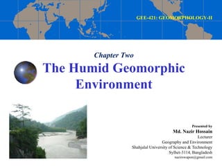
  • 1. Chapter Two The Humid Geomorphic Environment GEE-421: GEOMORPHOLOGY-II Presented by Md. Nazir Hossain Lecturer Geography and Environment Shahjalal University of Science & Technology Sylhet-3114, Bangladesh nazirswapon@gmail.com
  • 2. Running Water and Streams Running/flowing water is the result of net precipitation = {Total precipitation (input) – Evapotranspiration (output or loss) + Infiltration}
  • 3. Running Water Running Water: Run-off, water flowing on the surface of earth Sources of Running Water  Major sources: rain water & ice caps  Minor sources: ground water, surface water Classification of Run-off: 1. Immediate run-off: rain water 2. Delayed run-off: ice, glaciers, water fall, lake etc.
  • 4. Stream & River Stream: A stream is a body of water with a current, confined within a bed and stream banks. River:  It is a channelized natural flow of water  A large natural channel of water; a natural stream of water that flows through land and empties into a body of water such as an ocean or lake.  A river is a natural watercourse usually freshwater, flowing towards an ocean, a lake, a sea, or another river. Stream is a small flowing water where as river is a collection of many streams. A river is larger, deep, longer and wider where as a stream is a thin shallow.
  • 5. Terms Source: origin of stream Mouth: end at sea/lake Estuary: wide mouth Confluence: meeting point of two/more rivers Doab: middle area of two rivers River basin: an area of land drained by a river and its tributaries Water divide/shed
  • 6.
  • 7. Origin and Evolution of Streams Factors of river origin Availability of sufficient water Slope of land Presence of soft rock Type of climate
  • 8. Classification of Streams/Rivers 1. Perennial stream : year round 2. Intermittent stream: seasonal A perennial stream or perennial river is a stream or river (channel) that has continuous flow in parts of its stream bed all year round during years of normal rainfall. An intermittent or seasonal stream is one that only flows for part of the year.
  • 9. Classification of Streams/Rivers (Cont…) Davisian classification… 1. Youthful river: a river with a steep gradient that has very few tributaries and flows quickly. Its channels erode deeper rather than wider. 2. Mature river: A river with a gradient that is less steep than those of youthful rivers and flows more slowly. A mature river is fed by many tributaries and has more discharge than a youthful river. Its channels erode wider rather than deeper. 3. Old river: a river with a low gradient and low erosive energy. Old rivers are characterized by flood plains.
  • 10. Stages of river 1. Upper/mountain stages 2. Middle/plain stages 3. Low/deltaic stages
  • 11. Drainage system A drainage system is the pattern formed by the streams, rivers, and lakes in a particular drainage basin. They are governed by the topography of the land, whether a particular region is dominated by hard or soft rocks, and the gradient of the land.
  • 12. Drainage Patterns 1. Dendritic drainage pattern 2. Parallel drainage pattern 3. Trellis drainage pattern 4. Rectangular drainage pattern 5. Radial drainage pattern 6. Deranged drainage pattern
  • 13. 1. Dendritic drainage pattern Dendritic drainage systems are the most common form of drainage system. In a dendritic system, there are many contributing streams, which are then joined together into the tributaries of the main river. They develop where the river channel follows the slope of the terrain. Dendritic systems form in V-shaped valleys; as a result, the rock types must be impervious and non-porous.
  • 14. 2. Parallel drainage pattern A parallel drainage system is a pattern of rivers caused by steep slopes with some relief. Because of the steep slopes, the streams are swift and straight, with very few tributaries, and all flow in the same direction. Parallel drainage patterns form where there is a pronounced slope to the surface.
  • 15. 3. Trellis drainage pattern The geometry of a trellis drainage system is similar to that of a common garden trellis used to grow vines. Trellis drainage is characteristic of folded mountains, such as the Appalachian Mountains in North America.
  • 16. 4. Rectangular drainage pattern Rectangular drainage develops on rocks that are of approximately uniform resistance to erosion, but which have two directions of jointing at approximately right angles. The joints are usually less resistant to erosion than the bulk rock and streams eventually develop along the joints.
  • 17. 5. Radial drainage pattern In a radial drainage system, the streams radiate outwards from a central high point. Volcanoes usually display excellent radial drainage. Other geological features on which radial drainage commonly develops are domes and laccoliths. On these features the drainage may exhibit a combination of radial patterns.
  • 18. 6. Deranged drainage pattern A deranged drainage system is a drainage system in drainage basins where there is no coherent pattern to the rivers and lakes. It happens in areas where there has been much geological disruption.
  • 19.
  • 20. Channel Patterns Major three types are… 1. Straight  which are found in the most tectonically active areas.  This is more of a hypothetical end- member, and are not often found in nature.  Straight-type channels can be found at alluvial fans.
  • 21. 2. Braided rivers which form in (tectonically active) areas that have a larger sedimentary load than the discharge of the river. Channel Patterns
  • 22. Channel Patterns 3. Meandering rivers, which form a sinuous path in a usually low-gradient plain toward the end of a fluvial system.
  • 23. Process of Valley Development Valley development depends on Erosional power of main river and their tributaries Structure and soil type of the area Stages of river  Upper/mountain stage  Middle/Plain stage  Lower/deltaic stage
  • 24. River/Stream Processes Erosional processes of a river conducted by i. Hydraulic action ii. Corrosion: erosion by small particles iii. Attrition: the wearing away of river bed iv. Solution
  • 25. Erosional Landform Features 1. V-shaped valley 2. Gorge & Canyon 3. Rapid & Cascade 4. Waterfall 5. Pot hole 6. Meanders 7. River terraces
  • 26. Erosional Landform features (Cont…) 1. V-shaped valley  A river valley is usually V-shaped. The exact shape depends on the characteristics of the stream flowing through it.  V-Shaped valleys are found in the upper course of the river and are a result of both erosion by the river and weathering.  Rivers with steep gradients, as in mountain ranges, produce steep walls and a bottom. Shallower slopes may produce broader and gentler valleys.
  • 27. 2. Gorge & Canyon The word “canyon” is widely used in the United States, and the term “gorge” is widely used in Europe. A canyon is a deep valley having steep sides, and a gorge is a deep ravine with a river flowing through it or a ravine without the river. Canyons have been formed through long periods of time and frequent erosion from a plateau level. Gorges are mainly formed because of the flow of water or lava. Like canyons, the walls of gorges are also made of sandstone and granite. Grand Canyon in Arizona and Kali Gandaki in the Himalayas in Nepal. Erosional Landform features (Cont…)
  • 28. Erosional Landform features (Cont…) 3. Rapid & Cascade Rapids are sections of a river where the river bed has a relatively steep gradient, causing an increase in water velocity and turbulence. Cascades is a small waterfall or a series of small waterfalls over steep rocks. Rapids are hydrological features between a run (a smoothly flowing part of a stream) and a cascade. Rapids are characterised by the river becoming shallower with some rocks exposed above the flow surface. Rapid Cascade
  • 29. Erosional landform features (Cont…) 4. Waterfall  A waterfall is a place where water flows over a vertical drop in the course of a stream or river.  Waterfalls also occur where meltwater drops over the edge of a ice shelf.  Waterfalls are commonly formed when a river is young.  Water passes over hard rock and erodes the softer rock below
  • 30. Erosional Landform features (Cont…) 5. Pot hole Potholes are cylindrical holes drilled into the bed of a river that vary in depth & diameter from a few centimetres to several metres. They’re found in the upper course of a river where it has enough potential energy to erode vertically. It is also a circular hole in the bed of a river produced by abrasion
  • 31. Erosional Landform features (Cont…) 6. Meanders:  A meander, in general, is a bend in a sinuous watercourse or river.  A meander forms when moving water in a stream erodes the outer banks and widens its valley, and the inner part of the river has less energy and deposits silt.
  • 32. Erosional landform features (Cont…) 6. Measurement of Meanders: The sinuosity of a river is a measurement of how much a river varies from a straight line. It’s a ratio between the channel length and displacement (straight line distance) between two points in the river’s course: Sinuosity Index = Channel Length / Displacement A sinuosity of 1 (SI=1) means that the channel is perfectly straight. A sinuosity greater than 1 (SI > 1) means that the river meanders.
  • 33. Erosional landform features (Cont…) 7. River terraces  a terrace is a step-like landform.  terrace consists of a flat or gently sloping geomorphic surface, called a tread, that is typically bounded one side by a steeper ascending slop.
  • 34. River Transportation Rivers transport material in four ways: 1. Solution - minerals are dissolved in the water and carried along in solution. This typically occurs in areas where the underlying bedrock is limestone. 2. Suspension - fine light material is carried along in the water. 3. Saltation - small pebbles and stones are bounced along the river bed. 4. Traction - large boulders and rocks are rolled along the river bed.
  • 35.
  • 36. Stream Load  Stream load is a geologic term referring to the solid matter carried by a stream.  Erosion and bed shear stress continually remove mineral material from the bed and banks of the stream channel, adding this material to the regular flow of water.
  • 37. Sedimentation: Types of stream load Stream load is broken into three types (Ritter, 2006). 1. Dissolved load: Dissolved matter is invisible, and is transported in the form of chemical ions. All streams carry some type of dissolved load. 2. Suspended load: Suspended load is composed of fine sediment particles suspended and transported through the stream. These materials are too large to be dissolved, but too small to lie on the bed of the stream 3. Bed load: Bed load rolls slowly along the floor of the stream.
  • 38. Sedimentation: Types of stream load (Cont…)
  • 39. Depositional Landform Features 1. Alluvial fan and cone 2. Bajada/Alluvial slope 3. Piedmont Alluvial plain 4. Incised meander 5. Floodplain 6. Horse-shoe/Ox-bow Lake 7. Sandbars 8. Natural levees 9. Back slope & Back swamp 10. Delta
  • 40. Depositional Landform Features (Cont…) 1. Alluvial fan and cone  Alluvial fan and cone: An alluvial fan is a fan- or cone- shaped deposit of sediment crossed and built up by streams.  Alluvial cone: An alluvial fan with steep slopes
  • 41. Depositional Landform Features (Cont…) 2. Bajada/Alluvial slope  Bajada (Spanish “slope”) also spelled Bahada, broad slope of debris spread along the lower slopes of mountains by descending streams, usually found in arid or semiarid climates; the term was adopted because of its use in the U.S. Southwest.  A surface of alluvium which slopes down from mountainsides and merges with the plain or broad valley floor.
  • 42. Depositional Landform Features (Cont…) 3. Piedmont Alluvial plain An alluvial plain is a largely flat landform created by the deposition of sediment over a long period of time by one or more rivers coming from highland regions, from which alluvial soil forms.
  • 43. Depositional Landform Features (Cont…) 4. Incised meander a river meander which has been cut abnormally deeply into the landscape because uplift of the land has led to renewed downward erosion by the river.
  • 44. Depositional Landform Features (Cont…) 5. Flood plain  An area of low-lying ground adjacent to a river, formed mainly of river sediments and subject to flooding  A floodplain or flood plain is an area of land adjacent to a stream or river that stretches from the banks of its channel to the base of the enclosing valley walls and experiences flooding during periods of high discharge.
  • 45. Depositional Landform Features (Cont…) 6. Horse-shoe/Ox-bow Lake  An oxbow lake is a U-shaped body of water that forms when a wide meander from the main stem of a river is cut off, creating a free-standing body of water.  This landform is so named for its distinctive curved shape, resembling the bow pin of an oxbow.
  • 46. Depositional Landform Features (Cont…) 7. Sandbars  A sandbar or gravel bar, is a characteristically linear landform completely within or extending into a body of water.  It is typically composed of sand, silt, and/or small pebbles.
  • 47. Depositional Landform Features (Cont…) 8. Natural levees  A natural levee (or dyke), embankment, flood bank or stop bank is an elongated naturally occurring ridge or wall, which regulates water levels.  It is usually earthen and often parallel to the course of a river in its floodplain or along low-lying coastlines.
  • 48. Depositional Landform Features (Cont…) 8. Natural levees
  • 49. Depositional Landform Features (Cont…) 9. Back slope & Back Swamp/Marshes  Back slope is the back part of a natural levee.  Back swamp is the section of a floodplain where deposits of fine silts and clays settle after a flood. Back swamps usually lie behind a stream's natural levees. Back slope
  • 50. Depositional Landform Features (Cont…) 10. Delta  A river delta is a landform that forms at the mouth of a river, where the river flows into an ocean, sea, estuary, lake, or reservoir.  Deltas form from deposition of sediment carried by a river as the flow leaves its mouth.
  • 52. Delta Types Classification according to the shape of river delta 1. Arcuate type delta 2. Birds foot delta 3. Estuarine delta 4. Cuspate delta 5. Fan shaped delta
  • 53. Delta Types (Cont…) Arcuate type: like delta or bah (ব) in Bangla  Arcuate deltas are triangular in shape, like the Nile River's delta.  This shape, resembling the Greek alphabet's fourth letter, gave deltas their name.  Arcuate deltas usually have smooth coastlines because of the wave action and how they are formed.
  • 54. Delta Types (Cont…) Birds foot Delta  Bird-foot deltas have long finger-like projections that reach out to the sea, like the Mississippi River's delta.  The bird-foot delta is named for its long thin shape, much like a bird's toe.  These deltas might have broad, shallow shelves.
  • 55. Delta Types (Cont…) Estuarine Delta Estuarine deltas form when a river flows into a large estuary that will fill with sediment, as is the case with France's Seine River.
  • 56. Delta Types (Cont…) Cuspate delta: when river elongated to sea  Cuspate deltas extend to the sea as a V shape with long curving sides, like the Tiber River's delta (Italy).  The cuspate delta tends to form when one river or stream empties into a flat coastline where it encounters a direct hit from waves. This action forms its tooth-like shape.
  • 57. Delta Types (Cont…) Fan shaped delta: like alluvial fan
  • 58. Flood When the high flow of water overtops the natural or artificial banks of a stream and inundates the adjacent areas is called flood. In Bangladesh, the definition of flood appears differently. During the rainy season when the water flow exceeds the holding capacity of rivers, canals, beels, haors, low-lying areas it inundates the whole area causing damage to crops, homesteads, roads and other properties is known as flood.
  • 59. Flood Prone Countries of the World China Bangladesh India, Indonesia, Vietnam, Cambodia, Philippines, Myanmar, Brazil, Netherlands, Pakistan, Eastern African countries
  • 60. Flood in Bangladesh Flood is common phenomena in Bangladesh. Each year about 26,000 km2, (around 18%) of the country is flooded. During severe floods the affected area may exceed 75% of the country, as was seen in 1998. This volume was 95% of the total annual inflow. The floods have caused devastation in Bangladesh throughout history, especially during the years 1955, 1966, 1987, 1988 and 1998. The 2007 and 2010 also affected a large portion of Bangladesh.
  • 61. Flooded area of Bangladesh in different year Source: FFWC, 2009
  • 62. Types of Floods 1. Monsoon flood: It is a seasonal flood, increases slowly and decreases slowly, inundates vast areas and causes huge losses to life and property. 2. Flash Flood: The flood is rapid characteristics. Water increases and decreases suddenly, generally happen in the valleys of the hilly areas. 3. Tidal flood: Storm surge flood is a coastal phenomenon forced by cyclones hitting the coastline. Duration of this flood is short; height is generally 3m to 6m but very catastrophic in characteristics.
  • 64. In general classification Riverine flooding Rain-fed flooding Coastal flooding Urban flooding: A few days to weeks Types of floods (Cont…)
  • 65. Flood Prone Area of Bangladesh
  • 66. Causes of Flooding  Physical causes of floods  Low lying flat topography  Being drainage outlet  Excessive rainfall during monsoon  Snow-melting in the Himalayas  River siltation/landslides  Synchronization of major river peaks and influences of one river on the other  Tidal and wind effects on slowing down the river outflow (backwater effect)  Being floodplain
  • 67. Features of the Bangladesh Delta
  • 68. The Brahmaputra, Ganges and Meghna basins
  • 69. Causes of Flooding (Cont…)  Human induced Causes of the Floods  Increasing population pressure, unplanned settlements & urbanization  Construction of barrages and protective works  Deforestation in the upper riverine countries.  Infrastructure development without adequate drainage facilities.  Lack of financial capital means.  Poorly maintained embankments (levees) leak & collapse in times of high discharge.  Urbanization of the flood plain has increased magnitude & frequency of floods.  The building of dams in India
  • 70. Common Consequences of Flooding 1. Economy  Economic loss, e.g. house, crops, livestock,  Reconstruction and rehabilitation cost 2. Environment  Traffic: damages of roads, collapse of bridges or traffic congestion,  Damaging the farmland 3. Human lives 4. Diseases, e.g. fever, pneumonic plague, dermatopathia, dysentery, common cold, break bone fever 5. Effect on food production 6. Livestock and Poultry
  • 72. Common Consequences of Flooding (Cont…) In terms of duration of effects… 1. Short-term Consequences: losses of lives, damages of crops, property, livestock etc. 2. Long-term Consequences: famine due to damages of food grain, environmental degradation, e.g. due to salinity intrusion, river bank erosion, others.
  • 73. Deadliest floods due to flood in the world Death toll (Lac) Event Location Date 25–37 1931 China floods China 1931 9–20 1887 Yellow River (Huang He) flood China 1887 5–7 1938 Yellow River (Huang He) flood China 1938 2.3 Banqiao Dam failure, result of Typhoon Nina China 1975 2.3 Indian Ocean tsunami Indonesia 2004 1.45 1935 Yangtze river flood China 1935 1+ St. Felix's Flood, storm surge Netherlands 1530 1 Hanoi and Red River Delta flood North Vietnam 1971 1 1911 Yangtze river flood China 1911 Source: Myaux, J A et al., 1997
  • 74. Positive effects of flooding • Normal flood fertile agricultural land • This deposition of silt also creates land upon which people can live- for example the Ganges delta. • Clean the environment by washing away the garbage, dust and non-disposal materials. • Increase waterway/navigation
  • 75. Flood Management A systematic and well-organized programme is necessary against flood disaster. Measures that can be adopted for flood damage mitigation can be classified into two categories. 1. Structural measures 2. Non-structural measures
  • 76. Structural Measures Structural measures aim at protecting an area up to certain level of flooding. It can be divided into five categories: i. Storage reservoir or basins to control overflow. ii. Levees and floodwalls to confine floodwaters. iii. Improvement of channel capacity. iv. Flood diversion through bypasses.
  • 77. Structural Measures Examples of structural Measures: • Embankments & Dykes • Flood drainage & pumping system • Flood control gates • Flood proofing • Channel improvement etc. • Construction of flood shelters
  • 79. Embankments of Bangladesh Source: LGED, 2006
  • 80. Non-structural Measures Non-structural measures are aimed at reduction of loss due to flood by administrative measures. Some of the non-structural measures are: Examples of Non-structural Measures • Awareness building • Early warning • Legal framework • Training & Education • Incentives • Relief and rehabilitation • Legal framework • Flood zonation & land management Relief operation

Editor's Notes

  1. Arcuate: curved: in the shape of an arc or a bow
  2. Arcuate: curved: in the shape of an arc or a bow
  3. Cuspate : outer tooth shape