Introduction to heat waves and Heatwaves in Bangladesh.pptx
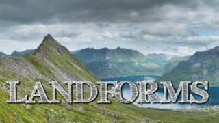
LANDFORMS
1.
2. LandformsWeathering, water, elevation, sinking, and erosion of the soil are constantly shaping the surface of
the Earth. It doesn’t really happen overnight but takes hundreds and thousands of years for us to
notice these changes. These are the natural processes that lead to various formations of the
Landforms. Landforms originate from these geological processes. Let’s understand the processes
that shape the landforms.
External Process
External process means effects caused by the external factors such as rain or wind. Erosion occurs
when material on the surface like soil and rocks which are called sediments are deposited or
dropped off in a different location. These natural processes change the surface of the Earth.
and Deposition are the processes that are occurring externally.
Internal Process
Needless to say, internal processes occur inside the surface of the Earth, beneath the crust. The
internal process, like Volcanic eruption and Plate tectonics, are caused because of the intense
in the Earth’s core that causes molten rock in the mantle layer to move thus creating uneven
movement on the surface. These layers are either uplifting or sinking.
3. A) MOUNTAIN
Any landmass that is higher and steeper than a hill is called a Mountain. A hill
is a landform that extends above the surrounding terrain. Generally,
mountains are higher than 2000 ft. In any other natural elevation like
atmosphere, as you go higher and higher, the temperature drops down and
the climate becomes colder. Habitation becomes harsher. That’s why there is
less habitation in the mountainous areas.
Due to the temperature drop, it is not uncommon for mountains to develop
ice on them. In some mountains, there are permanently frozen rivers of ice
called as glaciers. Because of the steep slopes of the mountains, there is less
land available for proper farming.
4. If the surface is calculated considering the sea base as the scale, there are
mountains even under the sea. Mauna Kea (Hawaii) in the Pacific Ocean is an
example. It is elevated higher than Mt. Everest. Also, a line of mountains is
known as a range. For example, the Himalayas in Asia, the Alps in Europe and
the Andes in South America. These ranges are the storehouses of water.
Many rivers have their origins in these mountains, the glaciers of the
mountains are the source of these rivers.
Mountains are generally untouched by civilisations are thus have the
endangered species of plants and animals. They also inhibit a rich variety of
flora and fauna.
5. 1. Fold Mountain
Fold mountains are created when two tectonic plates collide and
the edges of these plates ‘fold’ because of the enormous push
force between them. Scientists classify the fold mountains into
‘young fold mountains’ are the ‘old fold mountains’ according to
the mountains age.
The young fold mountains are between 10 and 25 million years old
such as the Himalayas in Nepal, the Alps in Europe and the Andes in
South America.
6. 2. Block Mountains
Block mountains occur when large areas are broken and displaced
vertically.These large areas of rock, sometimes stretching across
hundreds of kilometres are created by tectonic and localized stresses
in the Earth’s crust.
The uplifted blocks are termed as horsts.The lowered blocks are called
grabens.They resemble piano keys. The examples of block mountains
are the Rhine valley and theVosges mountain in Europe.
7. 3. Volcanic Mountains
Volcanic mountains are formed by magma rising up from the mantle to
the crust of the earth. The example of volcanic mountains is
Kilimanjaro and Mount Fuji.
8. B) Plateaus
Plateaus are elevated flatlands. It is a flat land which is standing above the
surrounding area. Plateaus may have one or more sides with steep slopes.
Depending upon the plateau their height varies from a few hundred
meters to several thousand meters.
The most familiar plateau in India is the Deccan Plateau and these plateaus
are mainly formed by lava, meaning they are volcanic in origin. The
extension of Deccan Plateau is the Chhotanagpur plateau in India. It’s a
reserve for minerals such as iron ore, manganese and coal. African plateau
is most famous for gold and diamond mining.
9. C) Plains
Plains are the most fertile regions. They are stretches of large land. The
predominant activity is the primary sector in plains which is A surrounding.
These stretches of land are the most suitable for human habitation and
agriculture activities like farming and poultry.
Plains are formed by rivers and their tributaries. The rivers flow down the
mountains and erode them. They deposit sediments along their courses and
in valleys. It is from these deposits that plains are formed. In India, the Indo-
Gangetic plains are the most densely populated regions of the country.
10. 1) Outwash Plain
Also called a sandur, an outwash plain is formed by glaciers.
Such a plain is formed when a glacier deposits sediments at its
terminus. As a glacier moves, it erodes the bedrock and carries
the eroded sediments downstream. These sediments are
deposited by the meltwater of the glacier at the snout. Outwash
plains are a common landform in Iceland. The Skeiðarársandur
in Iceland is the world’s largest outwash plain with an area of
1,300 square km.
2)Till Plain
A till plain is also a plain formed by glacial action. Such plains
are formed by the deposition of glacial till (unsorted glacial
sediment).
11. When a sheet of glacial ice gets detached from the main
glacier and melts in place, the sediments are deposited on
the ground to result in the formation of a till plain. Such plains
can be seen in northern Ohio where they were created by
the Wisconsin glaciation.
3)Lava Field
A lava field can also be referred to as a lava plain. Such a
plain is formed by the accumulation of layers of lava. The
lava plains can stretch for miles and are easily visible from
the air or in satellite images where they appear darker in
color than the surrounding landscape.
12. 4) Lacustrine Plain
Lacustrine plains are formed in areas previously occupied
by lakes. When a lake drains out completely due to factors
like evaporation, natural drainage, etc., the sediments
remain behind on the lakebed to form a plain. Such
lacustrine plains might be highly fertile and support
agriculture or might form a wetland or even a desert
depending on the composition of the sediments. Lacustrine
plains are common in Southern Indiana of the US where
such plains are found in areas formerly occupied by
proglacial lakes. The Kashmir Valley of India is also an
example of a lacustrine plain.
13. 5) Scroll Plain
Scroll plains are formed in areas where a river meanders
across a low gradient. Deposition of sediments at such
locations results in the formation of a plain. Oxbow lakes are
common occurrences in such areas. The Taieri River forms a
spectacular scroll plain near Paerau in New Zealand.
6) Flood Plain
A floodplain refers to a plain that stretches from the banks of a
river or stream to the enclosing valley walls. Floodplains are
usually subjected to flooding when the adjacent water body
overflows. The plains are often fertile and are made of deposits
of silts, sands, levees, etc., deposited by floodwaters.
Floodplains usually support a rich ecosystem.
14. Many densely populated cities are located on these plains.
However, many of the most devastating floods in history have
taken place in floodplains. The Yellow River's floodplains is
one such area that is frequently subjected to deadly floods.
7) Alluvial Plain
Alluvial plains are vast, sweeping stretches of plain land that
are formed by the deposition of sediments called alluvium. An
alluvial plain usually includes floodplains as part of its area but
extends beyond such plains. An alluvial plain represents the
pattern of floodplain shift over geological time. As a river flows
down mountains or hills, it carries sediments resulting from
erosion and transports the sediments to the lower plain
15. As the sediments build up over time, the elevation of the
floodplain increases while the width of the river channel
decreases. Unable to bear the pressure, the river now looks
for an alternative course with a higher channel capacity. Thus,
the river forms a meander and flows through a new channel.
In this way, floodplains continue growing and adding up to
form massive stretches of alluvial plains. The Indo-Gangetic
Plain in India and the Po Valley in Italy are examples of
alluvial plains.
8) Abyssal Plain
A plain located at great depths on the floor of the ocean is
called an abyssal plain. Such plains can be found at depths
ranging between 9,800 ft and 20,000 ft. Abyssal plains
comprise about 50% of the surface of our planet.
16. Abyssal plains comprise about 50% of the surface of our
planet. These regions are some of the world’s least explored
areas as well as the flattest and smoothest ones. The abyssal
plains are massive in size. For example, the Sohm Plain of the
North Atlantic Ocean covers an area of about 900,000 square
km. Such plains are most common in the Atlantic Ocean but
quite rare in the Pacific Ocean.
17. A valley is a type of landform. A valley is a lower part in the land,
between two higher parts which might be hills or mountains. Valleys
often start as a downward fold between two upward folds in the
surface of the Earth, and sometimes as a rift valley. A valley is made
deeper by a stream of water or a river as it flows from the high land
to the lower land, and into a lake or sea. Some valleys are made by
glaciers which are slow-moving rivers of ice. When water or ice make
a valley deeper or wider, this is called erosion. Wind can also make
valleys larger by erosion.
D) Valley
18. Types of valleys
1)Valleys in mountains
Mountains and hills are made when the layers of rock and soil (called
"strata") get folded. Fault block mountains may have rift valleys.
There are valleys in mountain ranges, between the highest parts
which are the "peaks". People who want to travel to the other side of
the mountains usually go by the valleys. A valley that people use to
travel through mountains or hills is called a mountain pass.
19. 2)Valleys in hilly country
In country that has hills, but is not very steep, a river or stream runs
more slowly. It makes a wider valley that often has some large bends
as the river flows around the hills, always following the lowest way.
Water running down from the hillsides often carries soil that spreads
out across the valley, making flat land that is good for growing food
crops and raising cattle and other animals. Many farms are in valleys
that are in hilly land.
20. 3)Valleys in flat country
Some valleys are almost flat, like a large saucer. Valleys of this type
often have a very large river with many "tributaries" (streams that
are like branches) running through them. The tributaries carry water
from the hills or mountains that may be far from the main river.
After heavy rain, lots of water rushes into the main river so that it
rises and floods over the flat floor of the valley. When the flood
waters spread, they drop lots of soil which has washed down from
the hills. The soil that drops on the valley floor makes a flat flood
plain. Valleys of this type are very useful for growing food crops.
21. 4) Valleys made by glaciers
A glacier is like a frozen river. Many countries do not have any
glaciers. A glacier starts in very high mountains where there is snow
and ice all the year. The snow and ice starts to move down a valley
that has been made by a fast-flowing stream. As the ice starts to
slide down the mountainside, it does not flow around the rocks; it
pushes the rocks out of the way. As a glacier moves, it picks up more
ice and gets bigger and bigger. A big glacier cuts through the soil and
softer rock of the valley and piles up the rocks on either side, or
pushes them in front of it. When a big glacier melts, it leaves a valley
of a deep U-shape.
22. E) Glaciers
Glaciers are the perennial ice sheets on the planet. They are huge
masses of ice that slowly move over the land surface, predominant in
high mountains and the cold Polar Regions. The very low
temperatures in the regions are the enabling factor for the buildup
of snow and densification into ice at depths of 15 meters or even
more. Most glaciers have density thickness in the ranges of 91 to
3000 meters. The glaciers include the Greenland Ice Sheet and the
Antarctic Ice Sheet.
23. F) Hills
Hills are raised areas on the surface of the earth with distinctive
summits, but are not as high as mountains. Hills are created as a
result of accumulation of rock debris or sand deposited by wind and
glaciers. They can also be created by faulting when the faults go
slightly upwards. Hills are generally present in low mountain valleys
and plains.
The Black Hills are the most known.
24. G) Deserts
Deserts are the hot and dry areas of the world. They are the arid
and semi-arid lands with little or no vegetation. Deserts constitute
approximately 20% of the earth’s total land cover and are
distinguished by little or no rainfall. The deserts are divided into
four major categories including the Semi-Arid Deserts, the Hot and
Dry Deserts, the Cold Deserts, and the Coastal Deserts.
25. These deserts are located in different areas of the world. Deserts
experience very high temperatures, less cloud cover, low humidity,
low atmospheric pressure, and very little rain, which makes them
have very little vegetation cover. The soil cover is also rocky and
shallow and with very little organic matter and as such, it only
supports a few plants adapted to the conditions.