TUTORIAL RTKLIB
•Download as PPSX, PDF•
0 likes•971 views

1. This document provides a tutorial for using RTKLIB software to perform real-time kinematic (RTK) positioning. 2. It outlines steps to download the RTKLIB package and sample data, load configuration files, specify input data streams for the rover and base stations, start the RTK processing, view the solution on a map, and monitor the RTK status. 3. The tutorial demonstrates using RTKLIB's RTKNAVI and RTKPLOT programs to perform RTK positioning with sample GPS data and obtain an accuracy of centimeters.

Recommended
Recommended
More Related Content
What's hot
What's hot (20)
Similar to TUTORIAL RTKLIB
Similar to TUTORIAL RTKLIB (20)
More from Hamida ID
More from Hamida ID (11)
Recently uploaded
Recently uploaded (20)
TUTORIAL RTKLIB
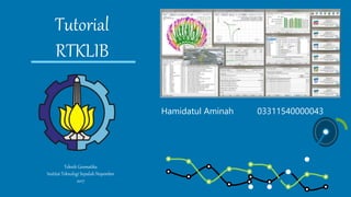
- 1. Tutorial RTKLIB Teknik Geomatika Institut Teknologi Sepuluh Nopember 2017 Hamidatul Aminah 03311540000043
- 2. 1 Download RTKLIB (RTKLIB 2.4.2) package and RTKLIB Sample on www.rtklib.com
- 3. 2 Execute rtknavi.exe in rtklib_2.4.2. You can see RTKNAVI window. Extract to folder Click to Open
- 4. 3 Push “Option…” on RTKNAVI. You can see Options dialog.
- 5. 4 Push “Load” on Options dialog and select rtknavi_rtk.conf to load pre-defined RTK options. Then, push OK ..
- 6. 5 Push upper of RTKNAVI window to set the sistem input stream options. So, You can see the Input Stream dialog.
- 7. 6 Input the file paths for Rover and Base Station. Push […] right of Input File Paths fields Select rtklib_sampleoemv_20090515c.gps for first column. And rtklib_sample0263_20090515c.rtcm3 for second column.
- 8. 7 Check Time and select x1 to set the playback speed and push OK on Input Streams dialog. Then push “Plot…” on RTKNAVI.. You can see RTKPLOT window.
- 9. 8 Excute the Menu “File>Open Map Image…” of RTKPLOT. Select rtklib_samplenarasaki.jpg
- 10. 9 Push Start on RTKNAVI. RTKNAVI Starts playback of the record data. Solution : FIX means ambiguity-resolved RTK solution obtained, which has usually cm-class accuracy.
- 11. 10 The position of RTK solution can be seen on RTKPLOT as a circle and the track is also shown on the window.
- 12. 22% 11 Push button on RTKNAVI window to change the display mode.
- 13. 12 Push button on RTKNAVI to see RTK Monitor, which indicates the detail status RTK positioning.
- 14. 13 After finishing the playback, push Stop on RTKNAVI. Then, Push button on RTKPLOT to disconnect from RTKNAVI
- 15. 14 Excute menu File > Open Solution-2… of RTKPLOT. Select rtklib_sampleubx_20090515.ubx for the second solution data.
- 16. 15 For detail instructions to use RTKNAVI and RTKPLOT in RTKLIB as well as other AP like a RINEX converter RTKCONV, a post-processing software RTKPOST, please refer RTKLIB Manual.
- 17. 16 Please Enjoy your RTK ! Thank you
- 18. Hamidatul Aminah says Thank you for your attention… RTKLIB TUTORIAL DONE! Teknik Geomatika-ITS ||| 2017
Editor's Notes
- This slide contains the editable pieces that were used to build infographic sample Icons – Eye, PC